Canadian Pacific Railway]Biblio.com
133 résultats
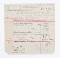
1883108441Montreal 1883. receipt. Invoice to the Canadian Pacific Railway dated 9th May 1883 for hose couplings and oil cups. approximately 21 X 21 CM folded twice. Several tears along folds. Several stamps with signature or initials on front and note in ink on verso signed and dated by F. G. Shaughnessey. Thomas George Shaughnessy 1853-1923 1st Baron Shaughnessy was president of the Canadin Pacific railway from 1899-1918. 1883 unknown
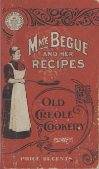
19006878San Francisco; Chicago: Southern Pacific Railroad; Printed by Poole Bros 1900. Duodecimo-size booklet 14.75 x 8.5 cm. 80 pages. Blue and brown ink on pink paper. Two photographic portraits Monsieur and Madame Bégué. Illustrations. List of railway agents. Title from cover. In logo at head of title: Southern Pacific Sunset Route. ~ Evident FIRST EDITION. A souvenir anthology of writings including sixty recipes from two landmark New Orleans restaurants offered for sale to customers traveling the Sunset Route San Francisco–New Orleans by the Southern Pacific Railroad Company. A sampling: Mutton Feet à la Créole Liver à la Bégué Jambalaya of Chicken Codish with White Beans Bisque of Crayfish Creamed Cauliflower Onion Salad Eggplant with Rice and Ham Mayonaise of Celery and Shrimps Pineapple with White Wine. ~ The title displayed on the wrappers is misleading: the atmospheric essays and testimonials – arranged by a literary journalist who contributed to Southern Pacific's promotional magazine Sunset Henry Monroe Mayo 1868-1950 – reveal little regarding the eponymous originator of the recipes or the history of the cuisine that brought her fame. Only pages 47-68 contain recipes by Elizabeth née Elisabetha Kettenring Dutreuil Bégué 1831-1906 the proprietary chef of the beloved restaurant in the Vieux Carré – the second oldest such establishment in New Orleans – located on the Rue de la Levée Decatur Street after 1870 downriver from Jackson Square and across from the French Market. An immigrant from southern Germany she had opened a coffee shop with her husband Louis Dutreuil in 1863. After his death in 1875 she married again and with her second husband Hippolyte Bégué 1842-1917 reopened in the same location with the aim of serving one meal per day – a “second breakfast†beginning at 11:00 a.m. – to accommodate laborers in the meat markets and on the docks who started work at dawn. A fuller history by David Shields is available in his The Culinarians Chicago: University or Chicago Press 2017 pages 270-273. By the mid-1880s trade fairs held in the city were bringing tourists as well and Bégué’s became a destination on its own. Madame Bégué died in 1906. The restaurant continued under management of her daughter but was sold in 1914 to relatives of the family Tujague competitors since 1856 on Decatur Street a few doors away. ~ A shorter tribute with recipes pages 69-74 is accorded another restaurateur presumably Victor Béro d. 1904 an immigrant from Belgium who had presided over Victor's Restaurant since 1873. Mayo appears to confuse the "Monsieur Victor" of his time with the founder and namesake of the establishment Victor Martin 1812-1865; cf. Shields page 136 445. ~ The Sunset Route of the Southern Pacific Company was the southernmost of the transport lines to the West Coast originally contemplated by the series of Pacific Railroad Acts between 1862 and 1866. Of the resulting publicly subsidized corporate consortia that would transform western North America – known collectively as the transcontinental railroads – Southern Pacific was already a mammoth system in 1900 including smaller subsidiaries such as the Texas and New Orleans Railroad and extending across territories that would later become New Mexico and Arizona as well as northwards through Nevada Utah and much of California. The in-house Sunset magazine appears to have been printed close to headquarters in San Francisco but like many publications issued by the transportation industry Mme. Bégué and Her Recipes was printed by Poole Brothers of Chicago who advertised as "railway printers" and also produced tickets brochures and mileage tables. ~ A few pages dog-eared. Very good in publisher's red wrappers decorated in black and white with an image of Madame Chef in kitchen apron. Rare. OCLC locates thirteen copies; Uhler 28; New Orleans Culinary History Group page 13; not in Bitting Brown or Cagle. Southern Pacific Railroad]; [Printed by] Poole Bros unknown
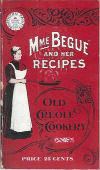
190010228San Francisco; Chicago: Southern Pacific Railroad; Printed by Poole Bros 1900. Duodecimo-size booklet 14.75 x 8.5 cm. 80 pages. Blue and brown ink on pink paper. Two photographic portraits Monsieur and Madame Bégué. Illustrations. List of railway agents. Title from cover. In logo at head of title: Southern Pacific Sunset Route. ~ Evident FIRST EDITION. A souvenir anthology of writings including sixty recipes from two landmark New Orleans restaurants offered for sale to customers traveling the Sunset Route San Francisco–New Orleans by the Southern Pacific Railroad Company. A sampling: Mutton Feet à la Créole Liver à la Bégué Jambalaya of Chicken Codish with White Beans Bisque of Crayfish Creamed Cauliflower Onion Salad Eggplant with Rice and Ham Mayonaise of Celery and Shrimps Pineapple with White Wine. ~ The title displayed on the wrappers is misleading: the atmospheric essays and testimonials – arranged by a literary journalist who contributed to Southern Pacific's promotional magazine Sunset Henry Monroe Mayo 1868-1950 – reveal little regarding the eponymous originator of the recipes or the history of the cuisine that brought her fame. Only pages 47-68 contain recipes by Elizabeth née Elisabetha Kettenring Dutreuil Bégué 1831-1906 the proprietary chef of the beloved restaurant in the Vieux Carré – the second oldest such establishment in New Orleans – located on the Rue de la Levée Decatur Street after 1870 downriver from Jackson Square and across from the French Market. An immigrant from southern Germany she had opened a coffee shop with her husband Louis Dutreuil in 1863. After his death in 1875 she married again and with her second husband Hippolyte Bégué 1842-1917 reopened in the same location with the aim of serving one meal per day – a “second breakfast†beginning at 11:00 a.m. – to accommodate laborers in the meat markets and on the docks who started work at dawn. A fuller history by David Shields is available in his The Culinarians Chicago: University or Chicago Press 2017 pages 270-273. By the mid-1880s trade fairs held in the city were bringing tourists as well and Bégué’s became a destination on its own. Madame Bégué died in 1906. The restaurant continued under management of her daughter but was sold in 1914 to relatives of the family Tujague competitors since 1856 on Decatur Street a few doors away. ~ A shorter tribute with recipes pages 69-74 is accorded another restaurateur presumably Victor Béro d. 1904 an immigrant from Belgium who had presided over Victor's Restaurant since 1873. Mayo appears to confuse the "Monsieur Victor" of his time with the founder and namesake of the establishment Victor Martin 1812-1865; cf. Shields page 136 445. ~ The Sunset Route of the Southern Pacific Company was the southernmost of the transport lines to the West Coast originally contemplated by the series of Pacific Railroad Acts between 1862 and 1866. Of the resulting publicly subsidized corporate consortia that would transform western North America – known collectively as the transcontinental railroads – Southern Pacific was already a mammoth system in 1900 including smaller subsidiaries such as the Texas and New Orleans Railroad and extending across territories that would later become New Mexico and Arizona as well as northwards through Nevada Utah and much of California. The in-house Sunset magazine appears to have been printed close to headquarters in San Francisco but like many publications issued by the transportation industry Mme. Bégué and Her Recipes was printed by Poole Brothers of Chicago who advertised as "railway printers" and also produced tickets brochures and mileage tables. ~ Internally clean and sound; in publisher's red wrappers decorated in black and white with an image of Madame Chef in kitchen apron. Wrappers with some rubbing and two small chips to the spine Near very good. Rare. OCLC locates thirteen copies; Uhler 28; New Orleans Culinary History Group page 13; not in Bitting Brown or Cagle. Southern Pacific Railroad]; [Printed by] Poole Bros unknown
1848DEMO015918IGand / Ghent: Chez Ve Vander Schelden 1848. First Belgian edition. Hardcover. Very Good. Small octavo 589 pages contemporary full green sheep extra gilt aeg scuffed. Inked presentation in 1912 from Rev. Francis J. Harbe: Harbe died in 1913 at age 37 in San Antonio Texas. He may have acquired this when a seminarian at Belgium in 1900. <br/><br/>Howes D286; Graff 3826; Field 1425; Sabin 82266; Smith 9549; Strathern 511:iii. "This edition seems to have been prepared by the author himself. It contains more material than the edition in English "Oregon Missions" the illustrations are different and the three maps are entirely new - Sabin 82265." It has several additional letters and an Appendix pp. 360 - 378. "Origine des Americains." Contains Fr. De Smet's description of his travels through and about the central Columbia River Plateau . he continued . to the Fort Vancouver by way of Fort Colville -- Wagner-Cam-Becker 141.2." Contains 16 plates including the pictorial title-age and 3 folding maps. Chez Ve Vander Schelden hardcover
1848DEMO015778IParis & Lyon: Librairie de Poussielgue-Rusand 1848. First French edition. Hardcover. Very Good. lithographs. 12mo 408 pages quarter red calf marbled boards lacks half-title. Ex libris Francis Reynolds Dickinson. <br/><br/>Howes D286; Graff 3826; Field 1425; Sabin 82266; Smith 9549; Strathern 511:iii "Contains Father Smet's description of his travels through and about the central Columbia River plateau . he continued . to the country of the Assiniboines and arrived at Fort Augusta . He returned to Fort Vancouver by way of Fort Colville -- Wagner- Camp - Becker 141:3." Contains only 8 trimmed of its 13 chromolithographed plates lacking also its illustrated half-title. Librairie de Poussielgue-Rusand hardcover
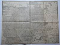
1887009783Chicago: Rand McNally & Co./ Matthews Northrup & Company Engravers & Printers Buffalo NY 1887. Book. Very Good. Single Sheet Folded. 33 3/4" x 27 1/2". Corrected up to Apr. 1 1887 inset at upper left. Single Sheet Folded 33 3/4" x 27 1/2" entire verso contains - "Map showing land grant of the Northern Pacific Railroad Co. in eastern Washington and northern Idaho" with inset map showing "Northern Pacific Railroad System" . Sheet folded to 17 3/8" x 13 3/4" with additional folds making it 8 7/8" x 4 3/4" to fit in a pocket. Recto titled - "Sectional Map Showing the Lands of Northern Pacific Railroad Co. In Eastern Washington and Northern Idaho with Condensed Information Relating to the Northern Pacific Country" - contains printed information on the Pacific Northwest company advertising and a smaller map 10 3/4" x 8 1/2" of "Washington Oregon & Northern Idaho" by Rand McNally. Very Good small tears and a few small holes at creases. RARE OCLC locates three libraries with holdings of this 1887 map - U. of Calif Berkeley U. of Missouri St. Louis and Washington State Library. There was one earlier version corrected up to January 1 1886 one of which most recently seen at an auction in 2007. Rand McNally & Co./ Matthews, Northrup & Company Engravers & Printers , Buffalo, NY unknown
185275869Oregon City: Surveyor General's Office 1852. First edition. 15 3/4 x 26 inches. Printed in various shades of green blue red and black. Some light toning long fold-lines else a very good map of a vastly underpopulated Territory.The map above shows the surveyed portion of the Oregon Territory as of October 21 1852. It was prepared by John B. Preston first surveyor general of Oregon."With the establishment of the Oregon Territory on August 14 1848 all grants of claims of land in the territory were nullified. It was not until the passage of the Donation Land Act on September 27 1850 that new provisions were made for acquiring unclaimed land to be based upon government surveys. John B. Preston was appointed first surveyor general of Oregon where he arrived on April 20 1851. On June 7 1851 Preston drove the “starting stake†for the base surveys of the territory at what is today known as the Willamette Stone. The east-west Willamette Base Line and the north-south Willamette Meridian still define surveying and legal land descriptions in Oregon and Washington state.Preston and his crew were able to carry out their surveying and mapping to the extent depicted on this map in just over one year. Each square of the grid termed a section is one mile on each side and includes 640 acres of land—the maximum acreage allowed for a married couple making a claim under the Donation Land Act; a single man could claim up to 320 acres. Thirty-six sections make up a township.The surveyors took careful note of waterways hills prairies and roads. Some recognizable places are already viable communities such as Salem and Lafayette; other communities of the period—Champoeg Fairfield Cincinnati for example—have vanished as meaningful places. All three of those were river landings that were affected by floods channel changes and the eventual disappearance of river transportation. Notably absent from the map is Mission Bottom or Mission Landing the by-then-abandoned site of the Methodist mission of the 1830s and St. Paul on French Prairie. The roads that are mapped include ancient routes such as the California-Oregon Trail which had sections that paralleled both sides of the valley as well as newer roads established in recent years. The roads converging on Salem from the outlying farming districts for instance reflect its recent importance as a mill town powered by the waters of Mill Creek Surveyor General's Office unknown
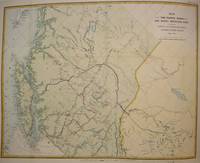
1874M7548Montreal: Canadian Pacific Railway 1874. Very Good; laid down on acid-free tissue paper for long-term preservation. Notes: A very important and early working map of Alberta and British Columbia depicting existing and suggested railways.<br>There is a note written in period ink in the lower margin in reference to a contemporary marking of newly suggested routes in black ink:<br><br>"Note -- The Surveys made since the publication of the Report & Maps of 1874 shew the routes colored full black line and thus broken black line to be the best lines for railway construction that have been found to this date Oct 1875. Mr. Smith".<br><br>"Mr. Smith" is believed to be Donald A. Smith a major partner in the yet-to-be incorporated Canadian Pacific Railway Company in 1881. <br><br>The routes marked out in red as printed depict potential lines crossing the Rockies to the west of Edmonton at Yellowhead Pass. Almost none of the suggested routes depicted on this map were eventually used--CPR dismissed the use of Yellowhead Pass for a pass farther south in order to discourage competition from railway lines south of the border. They chose instead Kicking Horse Pass which is depicted on this map. Size : 608x779 mm 23.94x30.67 Inches Coloring: Hand Colored Category: Maps Railroad; Maps Canada West British Columbia;Maps Canada West Alberta; Canadian Pacific Railway unknown
189837912Chicago: Poole Bros. 1898. 1898. COLORADO. 8 1/2" x 6 1/2" in color pictorial wrappers. 44 pp. illustrations. Information on Manitou Colorado Springs Pikes Peak the Manitou and Pike's Peak Railway side trip to the Grand Canon of the Arkansas various parks the Rocky Mountain Limited etc. Double-page drawing of "The Rocky Mountain Limited" above the floor plan of the train above a line map of the route from Chicago to Denver. Numerous illustrations of scenes along the Great Rock Island Route. Wear and rubbing to corners and spine. A nicely produced booklet. Poole Bros., 1898. unknown
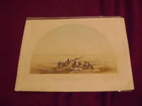
1880233129np.: np. c. 1880. Soft cover. . Near fine very light marginal foxing. 8 1/5" x 11". Hand-tinted lithograph. Very scarce in this condition. np. paperback
189564099Portland OR: Lewis & Dryden Printing Co. 1895. Folio. 10 x 14.75 in. xxiii 1 494 pp. Frontisp. 100s of illusts. photos decorated initials. Original publisher’s brown morocco over beveled boards gilt lettering & decoration on spine paneled in gilt ruling on covers marbled fore-edges & endpapers very slight rubbing slight shelfwear to corners and very slight sunning to spine still a near fine entirely unsophisticated copy. First edition of this invaluable maritime history in the Pacific Northwest with an excellent index and lavishly illustrated and perhaps one of the best copies this cataloguer has ever examined. Wright 1863-1930 as manager of the Portland Merchant’s Exchange had access to a vast store of original documents letters journals and accounts of marine shipping and development on the Columbia River and Pacific Northwest much of which has not survived. With the help of Harriman he later became director of the Port of Portland and later operated the shipyards in Astoria OR. Howes W963. Lewis & Dryden Printing Co., hardcover
189547595Portland OR: Lewis & Dryden Printing Co. 1895. Folio. xxiii 1 494 pp. Frntsp. 100s of illusts. photos decorated initials. Original publisher’s brown morocco over beveled boards gilt lettering & decoration on spine paneled in gilt ruling on covers gilt inner dentelles a.e.g. marbled endpapers minor bumping & wear to corners some rubbing edgewear rebacked with original spine laid back down still a VG copy from the library of Thea Foss 1857-1927 of Foss Launch & Tug Company later Foss Maritime -- who served as the inspiration for the story and Tugboat Annie movie based on her life. First edition of this invaluable maritime history in the Pacific Northwest with an excellent index and lavishly illustrated. Howes W963. Lewis & Dryden Printing Co., hardcover
188914096Buffalo NY: E.H. Hutchinson 1889. First Edition. Softcover. Near fine. 87 pp in original printed wrappers. Mild soiling. The author was an attorney and Principal of the Buffalo Classical School. He traveled to Oregon Washington Alaska primarily Sitka and British Columbia in 1888 reporting back in a series of articles for his local newspaper the Commercial Advertiser. This is their first appearance in book form. Includes interesting letters on indigenous crafts in Alaska the Russian population in the Sitka area and the Sitka mission along with sketches of Portland Astoria and the Puget Sound region. Tourville 658; Wickersham 1987; Not in Smith or Arctic Bibliography. E.H. Hutchinson unknown
1878z015741Liverpool: Panama Railroad Company/ Royal Mail Steam Packet Company/ Pacific Mail Steam Ship Co 1878. Very Good. Letter of transmittal from a Panama Railroad Company/ Royal Mail Steam Packet Company/ Pacific Mail Steam Ship Co. agent to James M. Lincoln of the Pacific Mail Steamship Co. New York. Measures 8 by 10 inches recto only. Very good. Stain and paper repair to top corner letter creased else clean and unmarked. Panama Railroad Company/ Royal Mail Steam Packet Company/ Pacific Mail Steam Ship Co unknown
1888ZB579853Washington: 1888. 88 pp. 3 large folding maps; issued as 50th Congress 1st Session SED 254; concerns indemnity lands in Washington Territory; text browned maps very good slight extraction roughness at left margin self wrappers. - If you are reading this this item is actually physically in our stock and ready for shipment once ordered. We are not bookjackers. Buyer is responsible for any additional duties taxes or fees required by recipient's country. Photos available upon request. Washington: unknown
1894ZB326378Washington: GPO 1894. 37 pp issued as 53d Congress 2d Session HED 194; light extraction roughness at spine now in self wrappers; concerns the company going into receivership. - If you are reading this this item is actually physically in our stock and ready for shipment once ordered. We are not bookjackers. Buyer is responsible for any additional duties taxes or fees required by recipient's country. Washington: GPO, unknown
1894ZB326377Washington: GPO 1894. 11 pp issued as 53d Congress 2d Session HED 203; light extraction roughness at spine now in self wrappers; concerns the company going into receivership. - If you are reading this this item is actually physically in our stock and ready for shipment once ordered. We are not bookjackers. Buyer is responsible for any additional duties taxes or fees required by recipient's country. Washington: GPO, unknown
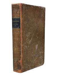
18389126Ithaca NY: Published by the Author 1838. First edition. 8vo xii 13-371pp. Folding map of Oregon Territory at front and one plate here between pgs 208 and 209. Contemporary sheep with black spine label gilt lettering. Rebacked with original spine laid down. Front pastedown stained mild to moderate foxing throughout. Map with single small tear at fold neat tape repair at edge few spots of foxing. A very good example with attractive fragile map. <br /> <br /> First edition in contemporary binding of this popular book which went through at least four editions in the 1840s and contained one of the first widely circulated maps to contain reliable information about the Oregon Territory. Parker's journal details his fur trading expedition in the Rockies in 1835 for part of which he was accompanied by Marcus Whitman. The group arrived in Walla Walla in October 1835 and returned East 2 years later via ship around Cape Horn. A cornerstone Pacific Northwest title. <br /> <br /> Howes P89. Wagner-Camp 70. Washington 89 60. Published by the Author unknown
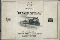
189824652American Medical Association 1898. Wraps. Very good condition. Unrecorded guide to the railway trip and preliminary program for the 1898 American Medical Association meeting in Denver by way of the Wabash Railroad St. Louis to Kansas City and the Chicago Rock Island & Pacific Railway Kansas City to Denver.<br /> <br /> The guide includes description of the train accommodations round trip fare St. Louis to Denver $26.50 special cars the train schedule with illustration of the new Union Station in St. Louis a preliminary program of meeting events and points of interest including the trans Mississippi and International Exposition in Omaha.<br /> <br /> Oblong 8vo 10 x 7" 26pp. Printed pictorial paper wrappers with route of Denver Special at rear wrapper. Front wrapper faintly dusty; bright and clean copy. American Medical Association unknown
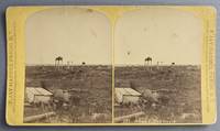
188068192Fargo D.T. Dakota Territory: F. Jay Haynes Official Photographer Northern Pacific Railway 1880. Photograph. Very Good. Stereoview photograph on a yellow Northern Pacific Railway mount 10 cm x 18 cm. Northern Pacific Views backstamp with decorative diamond border lines. Title is negative-etched in white along along the bottom edge of the right image. Both the card and the image is a little bit rubbed and dirty. Image is still clear and sharp. View of the burial ground with several structures visible. Taken at ground level centered and from a middle distance.<br /> <br /> Frank Jay Haynes 1853-1921 was the official photographer for the Northern Pacific Railway and later for Yellowstone National Park. Haynes took many noteworthy photographs at various locations along the Northern Pacific Yellowstone Park Line. Haynes travelled to Yellowstone in 1882 and captured many images of the emerging park. He opened his Log Cabin Studio the following year at Mammoth Hot Springs and continued to photograph the park for many years to come. Haynes' photography is inextricably linked to the public image of the famous national park. F. Jay Haynes, Official Photographer, Northern Pacific Railway unknown
189556659Mount Angel OR: Typis Monasterii S. Benedicti 1895. 8vo. 73 3 pp. Black embossed cloth embossed blind-stamped lettering on front cover minor edgewear rubbing slightly shaken still VG- copy from the library of Edwin Vincent O’Hara 1881-1956 Roman Catholic Priest educator social reformer and author of the Pioneer Catholic History of Oregon. whose manuscript note indicates this copy was acquired after he became the bishop of Great Falls MT in 1923. First edition of this scarce Oregon imprint and one of the earliest publications issued by the Mount Angel Seminary Press. This work publishes in Latin the orders and decrees describing and outlining the work and efforts of the Catholic missionaries and churches in the Oregon Territory and later state. It includes orders decrees and letters concerning missions and churches in Walla Walla Vancouver Island Portland Willamette Valley from and to the Archbishops and Bishops in Oregon Idaho Washington and Vancouver Island. Of particular interest the second Provincial Council was vehemently opposed to Public Schools and that due to the “swearing cursing and Profane expressions . . . of public school children†all good Catholics were “enjoined to preserve the little ones from the poisoned atmosphere of these godless institutions.†The Third Provincial Council was overseen by Archbishop William Gross who was also responsible for urging the Benedictine Monks to establish the Mount Angel Seminary to train Pacific Northwest priests. Typis Monasterii S. Benedicti, hardcover
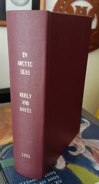
189261686Philadelphia: Rufus C. Hartranft. Good with no dust jacket; Usual library stamps and markings. 1892. First Edition. Hardcover. Rebound in maroon reinforced cloth binding vii 524pp photos illustrations maps. Account of the 1891 Peary expedition to explore the shores of Greenland. ; Ex-Library; 8vo 8" - 9" tall . Rufus C. Hartranft hardcover
18920008437Chicago: Rand McNally 1892. First edition. Hardcover. Very Good. 12mo 226 pages original brown cloth bright gilt rehinged <br/><br/>"Spears favors his readers with an intimate word-picture of Death Valley as it appeared in 1891. . It is noted for its early photographs in almost the same degree as for its textual content. It is conceivable that these may be the first pictures ever published - perhaps ever taken - of the Death Valley region. Maximum importance attaches to them - Edwards ENDURING DESERT p.227." Howes S821; Cowan p.604; Graff 3926; not in Soliday; Paher 1844. With a map of the Borax Fields and 56 photographic illustrations per Contents pages. Rand McNally hardcover
188553538Paris: Imprimé pour Isadore Liseux et ses amis 1885. First edition thus. Near fine. First vernacular translation of these suppressed Latin elegies that include the most explicit poetic expressions of homosexual desire of the Italian Renaissance. The HECATELEGIUM was first published in Florence in 1489 by a poet so notorious for his open homosexuality that Machiavelli named him in a 1501 letter as one of those poets who would have been burned at the stake had they not been protected by powerful cardinals "qui nisi haberent refugium in asylum nunc huius nunc illius Cardinalis combusti iam essent". Massimi's fame during his long life was nearly extinguished over the centuries of suppression and silence that followed which saw a heavily bowdlerized edition of the HECATELEGIUM published in Parma in 1691 and this privately printed edition in French and Latin only in 1885 the first uncensored edition since 1523. Though the Latin of this edition is complete certain obscene Latin words are printed in Greek rather than French in the facing translation still deemed too filthy to be read by anyone without a protective classical education. Undertaken by the shadowy publisher Antoine-Isidore Liseux 1835-1894 it was printed in Liseux's elegant typographical style in a "private" edition of 120 copies. Rare and important. 9.75'' x 6.5''. Later three-quarter cherry-red calf over marbled boards signed "Canape Belz" with matching marbled endpapers. Edition of 120 copies this copy no. 80. Text in French and Latin. xvi 354 2 pages. Minor rubbing to extremities. Old shelf label removed from head of spine. Else bright clean and sound. Imprimé pour Isadore Liseux et ses amis unknown
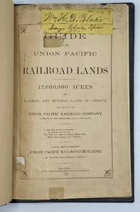
18709707Omaha: Omaha Herald Steam Printing Establishment 1870. First Edition. 44pp. Octavo 23 cm Black buckram with the title gilt stamped on the front board. Original printed salmon wrappers bound in. New endsheets and pastedowns. Manuscript label to head of original cover with paper of a similar color attached to the head of the verso. Small lib. ink stamp with accompanying 'Discard' stamp to title page. Complete with all three maps including the fold-out map 'Map of the Union Pacific Railroad Line in Nebraska' 19.5 cm x 56 cm / 7.5" x 22".<br /> <br /> Land promotional work from the Union Pacific encouraging the settlement of three million acres of U.P. lands that divides the available lands into three groups: agricultural lands the first 350 miles west of the Missouri River grazing lands from the forks of the Platte through the Laramie Plains in Wyoming and mineral lands between the Black Hills and the Wasatch Mountains. <br /> <br /> "No section of the United States furnishes facilities for grazing and stock raising superior to Nebraska and the lands on the line of the Union Pacific Railroad. The rich bottom lands of the valleys of the Platte Elkhorn Loup Fork Papillion Maple Shell Logan and Pebble Creeks Wood River Wahoo and Big Blue are included within these limits and present extensive tracts of the finest meadow land in America." Eberstadt 115: 856 later edition. Graff 4238 later edition. Herd 2351 later edition. Uncommon. Omaha Herald Steam Printing Establishment unknown