2 832 résultats
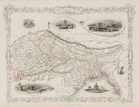
1851200119AG1851. London & New York John Tallis & Company 1851. Original steel engraving / Vintage map. Drawn and engraved by John Rapkin. Partly hand-coloured. Illustrations by A.H. Wray and Engraved by J.H. Kernot. Plate Size: 31.5 cm x 25 cm. Sheet Size: 37.2 cm x 27.2 cm. Vintage 19th century map in very good condition. Beautifully bordered map of northern India from Cambay to Chittagong and Aracan in the Bay of Bengal. The political subdivisions are colourfully included marking out independent Nepal and Bhutan. The regions of Jemer Malwa Allahabade and Assam can also be seen on the map along with the names of many towns and cities The regions rivers including the Ganges are shown and relief is depicted with hachuring. John Tallis 7 November 1817 3 June 1876 was an English cartographic publisher. His company John Tallis and Company published views maps and atlases in London from roughly 1838 to 1851. Tallis set up as a publisher with Frederick Tallis in Cripplegate in 1842; the business moved to Smithfield in 1846 and was dissolved in 1849. From 1851 to 1854 Tallis operated as John Tallis and Company. He started The illustrated news of the world and national portrait gallery of eminent personages in 1858 selling it for £1370 in 1861; it folded in 1863. Wikipedia The most important project John Tallis undertook was the 'Illustrated Atlas' from 1851. The original map we offer here was part of this exceptional Atlas and all the maps it contained are still today considered as the last reminder of an era of lavish map production. Tallis worked the project together with John Rapkin 1815-1876 and it was Rapkin's style and talent that we have to thank for when we marvel at these maps today. What makes these maps so special is the detail of engraved vignettes that surround the map and often show indigenous scenes people in their environment and even more so historical buildings or historical views of towns and cities architecture and landscape. The project of 'The Illustrated Atlas' was designed to be finished just in time for the anxiously awaited "Great Exhibition of the Works of Industry of All Nations" or The Great Exhibition sometimes referred to as the Crystal Palace Exhibition in reference to the temporary structure in which it was held was an international exhibition that took place in Hyde Park London from 1 May to 11 October 1851. It was the first in a series of World's Fairs exhibitions of culture and industry that became popular in the 19th century and it was a much anticipated event. The Great Exhibition was organized by Henry Cole and Prince Albert husband of the reigning monarch Queen Victoria. It was attended by numerous notable figures of the time including Charles Darwin Samuel Colt members of the Orléanist Royal Family and the writers Charlotte Brontë Charles Dickens Lewis Carroll George Eliot and Alfred Tennyson. Music for the opening was under the direction of Sir George Thomas Smart and the continuous music from the exhibited organs for the Queen's procession was "under the superintendence of William Sterndale Bennett". Wikipedia unknown
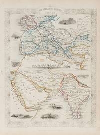
1851200124AG1851. London & New York John Tallis & Company 1851. Original steel engraving / Vintage map. Drawn and engraved by John Rapkin. Partly hand-coloured. Illustrations by H. Warren and Engraved by J. Rogers. Plate Size: 34.5 cm x 34 cm. Sheet Size: 27.2 cm x 37.4 cm. Vintage 19th century map in very good condition. Published in the Illustrated Atlas And Modern History Of The World Geographical Political Commercial & Statistical Edited By R. Montgomery Martin. Beautifully bordered and fascinating double map of the overland route between Britain and India. The upper map shows Europe and the links - both land and sea - running from England through to Alexandria Egypt. The routes are; the 'Mail Steam Packet Route' which runs around Gibraltar through Malta and onto Egypt; the 'Marseilles Overland Route' that runs across France to Marseilles and onto Alexandria via Malta and; the 'German Overland Route' that runs through across Belgium Germany before reaching Trieste and then onto the Mediterranean and then Egypt. The second map shows the differing routes on the next part of the journey - either across the Turkish controlled Middle East and through the Persian Gulf or down the Red Sea and across the Indian Ocean. What the map clearly illustrates is the importance attached to India 'Hindoostan' in the Imperial mind and the need for secure communication and transport links which necessitated control of certain choke points on the link such as Gibraltar Malta Suez etc. John Tallis 7 November 1817 3 June 1876 was an English cartographic publisher. His company John Tallis and Company published views maps and atlases in London from roughly 1838 to 1851. Tallis set up as a publisher with Frederick Tallis in Cripplegate in 1842; the business moved to Smithfield in 1846 and was dissolved in 1849. From 1851 to 1854 Tallis operated as John Tallis and Company. He started The illustrated news of the world and national portrait gallery of eminent personages in 1858 selling it for £1370 in 1861; it folded in 1863. Wikipedia The most important project John Tallis undertook was the 'Illustrated Atlas' from 1851. The original map we offer here was part of this exceptional Atlas and all the maps it contained are still today considered as the last reminder of an era of lavish map production. Tallis worked the project together with John Rapkin 1815-1876 and it was Rapkin's style and talent that we have to thank for when we marvel at these maps today. What makes these maps so special is the detail of engraved vignettes that surround the map and often show indigenous scenes people in their environment and even more so historical buildings or historical views of towns and cities architecture and landscape. The project of 'The Illustrated Atlas' was designed to be finished just in time for the anxiously awaited "Great Exhibition of the Works of Industry of All Nations" or The Great Exhibition sometimes referred to as the Crystal Palace Exhibition in reference to the temporary structure in which it was held was an international exhibition that took place in Hyde Park London from 1 May to 11 October 1851. It was the first in a series of World's Fairs exhibitions of culture and industry that became popular in the 19th century and it was a much-anticipated event. The Great Exhibition was organized by Henry Cole and Prince Albert husband of the reigning monarch Queen Victoria. It was attended by numerous notable figures of the time including Charles Darwin Samuel Colt members of the Orléanist Royal Family and the writers Charlotte Brontë Charles Dickens Lewis Carroll George Eliot and Alfred Tennyson. Music for the opening was under the direction of Sir George Thomas Smart and the continuous music from the exhibited organs for the Queen's procession was "under the superintendence of William Sterndale Bennett". Wikipedia unknown
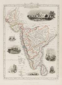
1851200109AG1851. London & New York John Tallis & Company 1851. Original steel engraving / Vintage map. Drawn and engraved by John Rapkin. Partly hand-coloured. Illustrations by A.H. Wray and Engraved by J.H. Kernot. Plate Size: 31.8 cm x 25.5 cm. Sheet Size: 37.2 cm x 27.2 cm. Vintage 19th century map in very good condition. Beautiful map of the southern Indian subcontinent from Sinde at the mouth of the Indus Estuary in the north down through Gujerat Bejapor and Mysore and down into the Carnatic region in the south. Hydrabad and Circars border the Bay of Bengal. Ceylon is also included in the map as are the Laccadive and Maldive islands in the Indian Ocean. Relief is depicting with hachuring. The major cities such as Bombay Sernigapatam and Madras are shown as are the rivers - including the Godavery and Beema rivers. This was an India dominated by the East India Company the British joint-stock company that came to rule large areas of India with its private armies exercising military power and seizing administrative functions. Formed in the early 1600s to compete with the Dutch for trade and commerce in the East the company rose to account for half of the world's trade at one point. Company rule in India lasted until 1858 when following the Indian Rebellion of 1857 the Government of India Act 1858 led to the British Crown's assuming direct control of the Indian subcontinent in the form of the new British Raj. The company was dissolved in 1874 as a result of the East India Stock Dividend Redemption Act passed one year earlier as the Government of India Act had by then rendered it vestigial powerless and obsolete. The official government machinery of British India assumed the East India Company's governmental functions and absorbed its navy and its armies in 1858. Wikipedia John Tallis 7 November 1817 3 June 1876 was an English cartographic publisher. His company John Tallis and Company published views maps and atlases in London from roughly 1838 to 1851. Tallis set up as a publisher with Frederick Tallis in Cripplegate in 1842; the business moved to Smithfield in 1846 and was dissolved in 1849. From 1851 to 1854 Tallis operated as John Tallis and Company. He started The illustrated news of the world and national portrait gallery of eminent personages in 1858 selling it for £1370 in 1861; it folded in 1863. Wikipedia The most important project John Tallis undertook was the 'Illustrated Atlas' from 1851. The original map we offer here was part of this exceptional Atlas and all the maps it contained are still today considered as the last reminder of an era of lavish map production. Tallis worked the project together with John Rapkin 1815-1876 and it was Rapkin's style and talent that we have to thank for when we marvel at these maps today. What makes these maps so special is the detail of engraved vignettes that surround the map and often show indigenous scenes people in their environment and even more so historical buildings or historical views of towns and cities architecture and landscape. The project of 'The Illustrated Atlas' was designed to be finished just in time for the anxiously awaited "Great Exhibition of the Works of Industry of All Nations" or The Great Exhibition sometimes referred to as the Crystal Palace Exhibition in reference to the temporary structure in which it was held was an international exhibition that took place in Hyde Park London from 1 May to 11 October 1851. It was the first in a series of World's Fairs exhibitions of culture and industry that became popular in the 19th century and it was a much anticipated event. The Great Exhibition was organized by Henry Cole and Prince Albert husband of the reigning monarch Queen Victoria. It was attended by numerous notable figures of the time including Charles Darwin Samuel Colt members of the Orléanist Royal Family and the writers Charlotte Brontë Charles Dickens Lewis Carroll George Eliot and Alfred Tennyson. Music for the opening was under the direction of Sir George Thomas Smart and the continuous music from the exhibited organs for the Queen's procession was "under the superintendence of William Sterndale Bennett". Wikipedia unknown
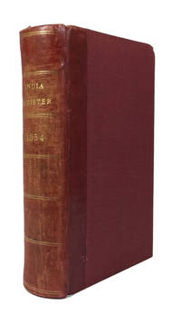
185484658London: Wm. H. Allen & Co 1854. Hardcover. Very Good. index c 145p. plus 6p. advertisements. Rebound in a red 20th century quarterbinding red leather backstrip and red cloth. 17cm. Rear joint tender. Richard F. Burton shows up in the list as does John H. Speke. Wm. H. Allen & Co hardcover
2000Star-9783790812688Springer 2000. Hardcover. New. Springer hardcover
2000Star-9783790812688Springer 2000. Hardcover. New. Springer hardcover
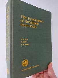
19793313New Delhi: World Health Organisation 1979. 1st Edition. Hardcover. Used - Very Good. Very good condition. Spine binding and cover all fine though corners turning slightly. Contents unmarked and no inscription; title on spine fading slightly but fine on front cover. Overall very good condition. 346 pages. World Health Organisation hardcover
2026x-1032702826Taylor & Francis Ltd 2026. Hardcover. New. 300 pages. 9.68x6.87x9.61 inches. Taylor & Francis Ltd hardcover
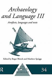
1999x-0415100542Routledge 1999. Hardcover. New. 1st edition. 416 pages. 9.50x6.25x0.75 inches. Routledge hardcover
2026x-1032455497Taylor & Francis Ltd 2026. Hardcover. New. 246 pages. 9.18x6.12x9.45 inches. Taylor & Francis Ltd hardcover
ria9780443332265_inpPaperback / softback. New. New Book; Fast Shipping from UK; Not signed; Not First Edition; N/A paperback
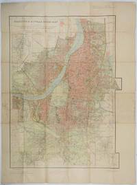
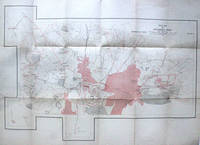
1943202248Survey of India. Third Edition. Third edition revised1943. Large folding colour map 85 x 60 cms; 101 x 75 cms sheet folding into stiff card wrappers 17 x 10.5 cms four inset maps worn with paper abrasions to the wrappers discoloured fold splits neatly repaired on reverse with washi and marginal discolouration small tidemark a little fished one spot affecting the legend at the head of the map neat ink annotations on back cover but overall in good condition. Wonderfully detailed town plan of Calcutta and Howrah showing district and municipal boundaries transportation parks & gardens water features buildings and built-up areas the three inset maps: Index to Districts Municipalities and Municipal Wards; Index to Bus Routes Calcutta and Howrah and to Dalhousie Square and Esplanade. . Survey of India. unknown
1888040755London: Spencer Blackett 1888. xi 388pp 8 bw ills. Or green gilt cloth with title and elephant in gilt. Cloth lightly rubbed at edges front hinge a little tender. A nice clean copy. Originally published in 1881 this undated second edition 1888. Lots of hunting tiger and other military comment social comment and information on the various states. . Second Edition. Hard Cover. Very Good. Illus. by The Author; Burton Miss C.G.M. 8vo. Spencer Blackett Hardcover
2021BN70850Knesebeck 2021. 2021. Pasta fantastica: Spektakuläre Nudeln einfach selber machen. Selbstgemachte Pasta wie in Italien Spektakuläre Nudeln einfach selber machen <br/><br/> Knesebeck hardcover
1999x-0415117615Routledge 1999. Hardcover. New. 1st edition. 431 pages. 9.75x6.75x1.00 inches. Routledge hardcover
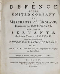
1762239716London: Printed for J. Brotherton in Cornhill; and sold by R. and J. Dodsley in Pall-Mall and T. Waller in Fleet Street 1762. First edition. 4 71 pp. Errata slip tipped to blank verso of second leaf. LACKING folding diagram. 1 vols. 4to. Removed. First two leaves detached. First edition. 4 71 pp. Errata slip tipped to blank verso of second leaf. LACKING folding diagram. 1 vols. 4to. Dunning's brilliant defence of the British East India Company against charges brought by the Dutch marked the beginning of his career as barrister and politician. " . of Dunning's great distinction as a lawyer there is no doubt. The obituary in the Gentleman's Magazine referred not purely conventionally to his 'amazing powers' . Shelburne wrote that 'all parties allowed him to be at the head of the bar . The only doubt was whether he excelled most at equity or common law. There was none as to anybody's coming up to him in either' . " ODNB. Kress 6007; Goldsmith 9776; Higgs 2737; ESTC T97097 Printed for J. Brotherton, in Cornhill; and sold by R. and J. Dodsley, in Pall-Mall, and T. Waller, in Fleet Street unknown
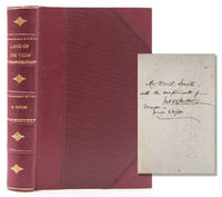
1873316648New York: Nelson & Phillips 1873. Eighth edition. Illus. with a map and 42 illustraions. 557pp. Three quarters crimson morocco and cloth sides. Fine. Eighth edition. Illus. with a map and 42 illustraions. 557pp. Inscribed on ffep"Mr David Smith/ with trhe compliments of/ Jno. W. Butler/ Mexico/ June 22/80. Nelson & Phillips unknown
1828317758London: James Duncan and Thomas Tegg and Son 1828. Folding engraved map 15 engraved views. 4 vols. Small 8vo. Bound in half contemporary morocco and cloth. Very Good. Folding engraved map 15 engraved views. 4 vols. Small 8vo. James Duncan and Thomas Tegg and Son unknown
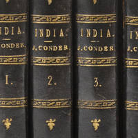
1900316898London: Macmillan and Co 1900. New Edition in One Volume. With 42 Illus. ii 601pp. 8vo. Bound in three quarters mottled brown calf and marbled boards green leather title label. Fine. New Edition in One Volume. With 42 Illus. ii 601pp. 8vo. Macmillan and Co unknown
197575752V.p.: V.p. 1975-1990. Life for women in developing countries. This particular lot deals with the trials and tribulations of Indian women in India and Southeast Asia. Suffice it to say that they are not all singing Halleleujas to their second-class citizen status. 20 are hardbacks in nice jackers and the remainer are in wrappers nice condition. The titles are as follows:SAWNINATAN. M. Village Modernisation and Fertility Behaviour ; A Study in a Block of South Arcot District Tamil Nadu.Annamalai University; Annalamainagar 1986. Phd thesis in cloth.CHAUDRY Rafiqul Huda. Female Status in Bangladesh. Dacca; Bangladesh Institute of Development Studies ca. 1980ISELY Barbara J. & Charles C. Langford. Report on Research on Gender Roles in Rice Farming Systems in Tamil Nadu. Corvallis: Oregon State University 1992AHHSAN Rosie Majid & Shahnaz Huq HUSSEIN & Ben J WALLACE. Role of Women in Agriculture. Centre for Urban Studies: Dhaka 1986.GOUZHU Hua & M.S. Swaminathan. Women in Rice Farming Systems : An Operational and Research Training Program Manila: The International Rice Research Institute 1987.SINHA B.P. Women in Agriculture-A Victim of Drudgery. New Delhi: Indian Agricultural Institute 1988DULYAPACH Poungpit. Thai Women in Agriculture and Rural Development. Bangkok; FAO Regional Office. 1985.KRISHNARAJ Maithreyi. Gender and the Household Domain. Vol. 4 of "Women and the Household in Asia." New Delhi: Sage Pblications 1989. SRINIVAS M. N. Some Reflections on Dowry. Dehli: Oxford University Press 1984.SEN Amartya. On Economic Inequality. New York: W. W. Norton and Co. 1973.SHARMA Kumud. Women in Focus: A Community in Search of Equal Roles. Hyderabad: Sangam Books 1984.MITRA Asok. The Status of Women: Literacy and Employment. ICSSR Programme of Women's Studies II. Bombay: Allied Publishers. 1979.SACHCHIDANANDA & Ramesh P. Sinh. Women's Rights: Myth & Reality. Jaipur: Printwell Publishers 1984.SHARMA Ursula. Women Work and Property in North-West India. London: Tavistock Publicarions 1980.MITRA Asok. Implications of Declining Sex Ratio in India's Population. ICSSR Programme of Women's Studies I. Bombay: Allied Publishers. 1979.NANDA B. R. Indian Women: From Purdah to Modernity. New Delhi; Vikas Publishing House. 1975MEHTA Rama. Divorced Hindu Woman. New Delhi; Vikas Publishing House. 1975RAMA K. G. Women's Welfare in Tamil Nadu. Madras: Sanghan Publishers 1974.SAHAI S. N. Women in Changing Society: A Bibliographical Study. Delhi: Mittal Publications !985. Sahai was the librarian at the University of Jodphur Librarian.BAIG Tara Ali. India's Woman Power. New Delhi: S. Chand & Co. 1976SINGH Andrea Menefee & Anita KELLES-VIITANEN. Invisible Hands: Women in Home-based Production. Women and the Household in Asia -Vol. 1. New Delhi: Sage Publications 1987.THIMMAIAH G. Inequality and Poverty A Case Study of Karnataka. Bombay: Himalaya Publishing House 1983MAZUMDAR Vina. Role of Rural Women in Development: Report of an International Seminar. Bombay: Allied Publisher's 1978.DE SOUZA Alfred. Women in Contemporary India and South Asia. Reprint. New Delhi: Manohar Publications 1980.CHAKI-SIRCAR Manjushri. Feminism in a Traditional Society: Women of the Maniput Valley. New Delhi: Shakti Books 1984.LEBRA. Joyce et. al. editors Women and Work in India: Continuity and Change. New Delhi: Promilla and Co. 1984.JESUDASAN Victor et. al. editors. Non-Formal Education for Rural Women to Promote the Development of the Young Child. New Delhi: Allied Publishers 1981.MUKHOPADHYAY Maitrayee. Silver Shackles: Women and Development in India. Oxford: Oxfam 1984.HIRWAY Indira. Denial of Maternity Benefits to Women Workers in India. New Delhi: Oxford and IBH Publishing 1986/BHUYAN Rabia. Legal Right of Hindu Women in Marriage and Divorce with Legal Rights of Muslim Women in Marriage and Divorce. Bangladesh: Women for Women 1986 V.p. hardcover
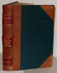
190811098Simla India: Government Monotype Press 1908. Book. Good. Hardcover. Half-leather and dark green cloth. Raised bands on the spine with red leather labels and gilt lettering. The lower label stamped "For Official Use Only." No. 1387 stamped in gilt on the upper leather corner of the front cover. Rubbing wear to the leather slight evidence of powder residue red rot from the some parts of the leather and two of the spine labels show slight peeling from the spine. The cloth has some insect damage along the top edge of the rear cover and the fore-edges. The interior has foxing on the endpapers affecting the bookplate on the front endpaper and on several adjacent pages. The upper corners of about the first hundred pages are creased or bent from having been bumped. 461 pages with six fold-out sketches/maps tipped in and one large fold-out general map rear pocket illustrating this volume. Bookplate of an early British aviator Neville Morris Jenkins affixed on the front pastedown. He is listed as Lt. Neville Morris Jenkins RA one of the pilots receiving an Aviator's Certificate from the Royal Aero Club in 1913. CONTENTS: Chapters I-III are about the Afridi Tribe Chapter IV - Orakzai Tribe Chapter V - The Zaimukht Tribe Chapter Vi - The Turi and Bangash Tribes Chapter VII - Darwesh Khel Wazirs Chapter VIII-IX - Masud Wazirs and Bhittanis and Chapter X - The Dawaris. We also have Volume IV in stock in the original edition. Government Monotype Press Hardcover
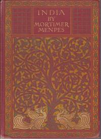
191220853London: A & C Black. 1912. Second Edition. Hardcover. Very Good. Boards with light rubbing to extremities. Slight bumping to one corner. First and last few pages browned. Light foxing to half-title page and very light occasional foxing but not affecting the illustrations. ; Dark red cloth boards with gilt lettering and ornate design in gilt green and orange. Top edge gilt. 75 tissue guarded illustrations from watercolors by the famous artist Mortimer Menpes. 20 Shilling Series. Inman 38 ; 8vo 8" - 9" tall; 216 pages . A & C Black hardcover
1934275256India: Survey of India 1934. Colored offset Lithograph. Sheet maps 22" x 29.5".<br/> <br/> This 1934 pocket map depicts the plan of the Gulbarga Fort and vicinity located in the northern part of the state of Karnataka at the time Hyderabad State in southern India. Beautifully detailed the map notes the fort important roads lakes wells vegetation and a host of other topographic elements.<br> <br> Originally built by Raja Gulchand a feudatory of the Warangal Kakatiyas it was further fortified and enlarged in 1327 by Sultan Al-ud-din Bahmani of Bahmani Sultanate in 1327 and Adil Shah. Various monuments such as mosques palaces tombs and other structures were also built. Most notable of these is the Jami Masjid built on the lines of the Great Mosque of Cordoba in Spain is one of the first mosques in southern India. The fort remained the capital of the Bahmani Kingdom until 1424. Later the fort would be razed by the Vijaynagar Emperor and subsequently rebuilt by Yusuf Adil Shah the founder of the Bujapur Sultanate.<br> <br> This map was published under the authority of Brigadier H. J. Couchman Surveyor General of India. It is in good condition with minor wear along the original folds and some offsetting. The map is lined with silk.<br/> <br/> Survey of India unknown
1826L3 box764 b3v3<p>Platonis et que vel Platonis esse Feruntur vel Platonica Solent Comitari Scripta Graece Omnia ad Codices Manuscriptos Volume 3. Recensuit Variasque Inde Lectiones Diligenter Enotavit Immanuel Bekker. Annotationibus Integris Stephani Heindorfii Heusdii Wyttenbachii Lindavii Boeckhiique. Adjiciuntur Modo Non Integrae Serrani Cornarii Thompsoni Fischeri Gottleberi Astii Butmanni et Stalbaumi Necnon Ex Commentariis Aliorum Curiose Excerpta. 1826 MDCCCXXVI Londini: Excudebat A. J. Valpy A. M. Sumptibus Ricardi Priestley. Blue cloth hardcover 568 pp for Volume 3.</p> A. J. Valpy hardcover
1826L3box764 b3v4<p>Platonis et que vel Platonis esse Feruntur vel Platonica Solent Comitari Scripta Graece Omnia ad Codices Manuscriptos Volume 4. Recensuit Variasque Inde Lectiones Diligenter Enotavit Immanuel Bekker. Annotationibus Integris Stephani Heindorfii Heusdii Wyttenbachii Lindavii Boeckhiique. Adjiciuntur Modo Non Integrae Serrani Cornarii Thompsoni Fischeri Gottleberi Astii Butmanni et Stalbaumi Necnon Ex Commentariis Aliorum Curiose Excerpta. 1826 MDCCCXXVI Londini: Excudebat A. J. Valpy A. M. Sumptibus Ricardi Priestley. Blue cloth hardcover 583 pp for Volume 4.</p> A. J. Valpy hardcover