[EAST INDIA COMPANY].Biblio.com
2 832 résultats
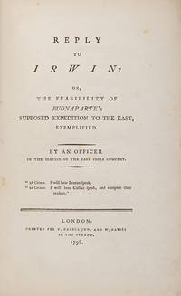
108549London Printed for T. Cadell Jun. and W. Davies 1798. . First and only edition 8vo 22 x 14.5 cm; armorial bookplate of Sir Archibald Grant of Monymoske to front pastedown dated advertisement half title occasional light spotting; morocco back marbled boards title in gilt to spine corners lightly rubbed; 53 1pp. A very good copy.<br /> The anonymous reply by an officer of the East India Company to Eyle Irwin's d.1817 An Enquiry into the Feasibility of the Supposed Expedition of Buonaparte to the East 1798. In his treatise Irwin born in Calcutta to an officer of the Company had downplayed Napoleon's purported ambition to conquer British possessions in Asia following his defeat in the Battle of the Nile. <br /><br />Without wishing to 'damp the universal joy' which had infected the public mood following Nelson's victory at the Nile earlier in the year the anonymous author of the Reply sounds a more cautionary note urging his readers not to allow their current enthusiasm to become reckless jingoism. Diagnosing the issue as an 'aversion to bestow praise on an enemy' the author predicted that an alliance of French and Russian forces could undertake a joint invasion of India a threat which almost came true but for Napoleon's reluctance to expose his already army tired army to defeat. <br /><br />ESTC records copies at only four locations in the British Isles BL Derry and Raphoe Diocesan Library King's College London and the Royal Irish Academy and a further six in North America Kansas Missouri NYPL Rutgers UTS and Virginia.<br /> ESTC T44625. London, Printed for T. Cadell Jun. and W. Davies, 1798. hardcover
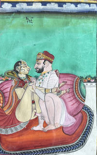
TK0040India: 19th century. Collection from various sources meaning clearly this group includes work from several different artists. Please view added illustrations online under this description. [19th century]. unknown
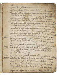
1743ABC_45492Karaikal 1743. Blue mottled stiff paper wrappers. 4to ca. 24 x 18.5 cm. Manuscript written in dark brown ink on beige laid paper. French manuscript written in Karaikal French India since 1739 which gives a detailed explanation of the Indian caste system: the author explains in the beginning of the text that the French people are ill-informed about it. To illustrate the Indian caste system the anonymous author tells lively anecdotes and makes comparisons with French social classes and parallels to biblical stories. The author not only describes the details of the four castes Brahmin Raj Vaisya and Sudra including their hierarchy and advantages the purpose of this social structure and the experience of those who lose their caste. He goes further speculates about the way different cultures criticize each others morals. He argues that all nations criticize each other in some way simply because the habits of cultures differ each with its own good reasons. He also wrote about the extent of superstition in the customs of Indian people for example the beliefs surrounding cows. He concludes that not all their customs are superstitious. The author clearly views Indian cultural practices with a certain gentleness.Somewhat worn at the extremities and spine slightly foxed on the front paste-down and a little dust soiled on the first page. Otherwise in good condition. unknown
1973216268Varanasi.: Cultural Department of the Embassy of the Federal Republic of Germany. 1973. Map plan and black & white illustration. Orange cloth covered boards lettered in gilt. 424pp. 25 x 18cm. Aims to acquaint the Indian reader with the research-work of contemporaneous German scholars and scientists on a wide range of subjects related to the land and people of India. . Cultural Department of the Embassy of the Federal Republic of Germany hardcover
223137New Delhi.: The Tourist Division. Ministry of Transport. Black and white photographic plates 149pp. 13 x 19cm. A little rubbed and browned wrappers from the library of Professor A. L. Basham with his handwritten title on the spine. . The Tourist Division. Ministry of Transport. unknown
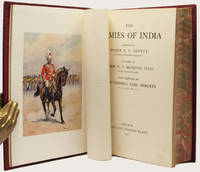
191133748London: Adam and Charles Black 1911. First Edition. With 72 highly impressive tissue captioned colour plates by Major Lovett and 19 smaller line drawings throughout the text. Large 8vo handsomely bound in full cordovan calf the spine with raised bands separating the compartments which are decorated with gilt filleted panels black morocco lettering label gilt the upper cover with an eagle in gilt at the center all edges marbled. xiv 224 pp. A very well preserved and handsome copy the text-block clean and well preserved and with fine plates the binding handsome with slight mellowing to the spine panel and with the gilt decorations all still very bright. FIRST EDITION OF THIS SUPERB WORK ON THE INDIAN REGIMENTS. The author and artist have joined forces to create here a fine review of the armies fielded by the Empire.the history of their battles and their administration. The book is a costume designer's dream-come-true as the very impressive colourplates bring vividly to the life the men the many regimental uniforms and accouterments and the scene of Imperial India. This is also an invaluable work for anyone interested in the colonial armies and military histories at the height of the English Age of Empire.<br> Major General Sir George Fletcher Macmunn 1869-1952 KCB KCSI DSO British General scholar military historian and writer was also one of the founders of the Kipling Society. Major Alfred Crowdy Lovett 1862-1919 was of the Gloucestershire Regiment. The watercolours by Lovett illustrate the full dress and field service dress uniforms of the Indian Army. Adam and Charles Black hardcover
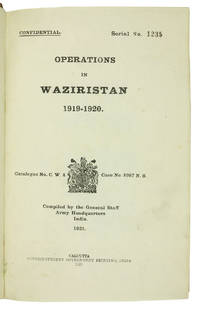
1921ABC_45215Calcutta: Superintendent of Government Printing 1921. Contemporary half calf green cloth sides gold-stamped red spine labels. 8vo. With frontispiece 31 plates 7 maps 3 in pocket on inside of back board and 8 panoramas mostly folding. First edition of the British-Indian armys official account of the 1919-20 Waziristan campaign marked "Confidential" on the title-page. The operations followed unrest that arose in the aftermath of the Third Anglo-Afghan War; they were conducted in the mountainous region of Waziristan now in Pakistan by British and Indian forces against the fiercely independent Waziri and Mahsud tribesmen that inhabited it. Since the 1870s the British government agencies were assiduous in compiling internally published histories of their military frontier operations with the intention of providing a "valuable guide" to such British commanders and policymakers as "might have future dealings with these turbulent neighbours" as the Punjab Government phrased it in 1866.The title-page reports the catalogue number and location of what may be the original report: Catalogue no. C.W. 4 - Case no. 8987 N.S..Serial No. 1235 stamped on the title-page. Occasional light marginal staining. A few edge flaws consistent with army use repaired by a contemporary owner. Otherwise in very good condition.l WorldCat 11497145. Superintendent of Government Printing, hardcover
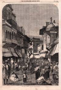
1858184072London.: Illustrated London News. 27 November1858. Engraving on single newspaper leaf 34.3 x 23.7 cms related text verso short sealed marginal tear not affecting the image scant spotting very good condition. Bustling street scene in Agra fifty or so years after it had fallen under the control of the East India Company. The engraving includes fine architectural detail in a city known for its most prized monument the Taj Mahal. . Illustrated London News. unknown
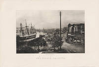
1890217858London. circa1890s. Engraving 11.5 x 18cms image only; 18.2 x 26.5cms sheet including caption a little marginal wear but the image with deep tone in very good condition. Atmospheric photogravure of Kolkata after an original photograph by Francis Frith 1822-1898 one of the most successful English commercial photographers in the 1850s & 1860s. . unknown
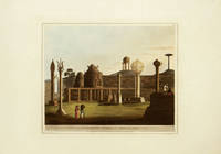
1804204071London.: Edward Orme. Circa1804. Handcoloured aquatint engraving measuring 27.8 x 34cm. Sheet including platemark and generous margins measures 41.8 x 58.8cm. Very slight toning at the platemark but the plate in very bright clean condition. A beautifully executed aquatint from the series 'Picturesque Scenery in the Kingdom of Mysore' by James Hunter first published in 'A Brief History of Ancient and Modern India' by Francis William Blagdon in 1805 the engraving is dated on the plate June 4 1804. This may be from a subsequent edition see Abbey #425. . Edward Orme. unknown
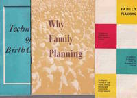
1959223291New Delhi.: Directorate of Advertising & Visual Publicity. 1959 1960. Collection of three items. <br>Two booklets in stapled wrappers: <br>"Why Family Planning": 20pp. 20.5 x 14cm. <br>"Techniques of Birth Control": Black and white illustrations 27pp. 20.7 x 13.2cm. <br>One accordion fold brochure 21.3 x 10.3cm. <br>Good condition. . Directorate of Advertising & Visual Publicity. unknown
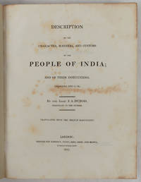
1817223218London.: Longman Hurst Rees Orme and Brown. 1817. xxvii 565pp 2 publisher's advertisements; half calf over marbled boards 27.5 x 22 cms endpapers renewed the title page and prelims spotted scant foxing elsewhere the final ten leaves tide-marked a good sound copy. Detailed account of the social cultural and religious practices of India during the late 18th and early 19th centuries. Abbé Dubois a French Catholic priest and missionary was stationed in India from 1792-1823 and his manuscript was purchased by the East India Company in 1807 publishing this English translation in 1817. . Longman, Hurst, Rees, Orme and Brown. hardcover
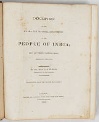
1817223216London.: Longman Hurst Rees Orme and Brown. 1817. xxvii 565pp 2 publisher's advertisments; contemporary diced morocco the boards with an elaborate double-border blind-stamped and gilt-embossed rubbed at the edges re-backed mounting the original gilt-decorated and lettered backstrip 27 x 22 cms marbled fore edges marbled endpapers the title page rather spotted and stained scant foxing elsewhere with the armorial bookplate of J. E. Saunders Finsbury Square and the neat pencilled inscription of a later owner to the initial blank a good copy. Detailed account of the social cultural and religious practices of India during the late 18th and early 19th centuries. Abbé Dubois a French Catholic priest and missionary was stationed in India from 1792-1823 and his manuscript was purchased by the East India Company in 1807 publishing this English translation in 1817. . Longman, Hurst, Rees, Orme and Brown. hardcover
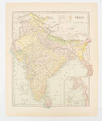
1910174839New York. circa1910. Printed colour map 29 x 25 cm with inset map of the Eastern Part of India colour key reference key to the ruling divisions current and projected railways and telegraphs also shown central fold slight toning; in very good condition. Interesting map shaded by Divisions: the Presidencies of Bengal Madras Bombay Ceylon "Native States under British Protection" and "Independent States" Nepal and Bhutan. . unknown
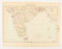
1910174841London. circa1910. Printed colour map on conjoined pages 22.3 x 33.7 railways submarine cables and heights above sea level marked faded but in very good condition. Map showing the ruling divisions by shading borders with Burma and the Andaman and Nicobar Islands also shown. . unknown
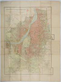
1943202248Survey of India. Third Edition. Third edition revised1943. Large folding colour map 85 x 60 cms; 101 x 75 cms sheet folding into stiff card wrappers 17 x 10.5 cms four inset maps worn with paper abrasions to the wrappers discoloured fold splits neatly repaired on reverse with washi and marginal discolouration small tidemark a little fished one spot affecting the legend at the head of the map neat ink annotations on back cover but overall in good condition. Wonderfully detailed town plan of Calcutta and Howrah showing district and municipal boundaries transportation parks & gardens water features buildings and built-up areas the three inset maps: Index to Districts Municipalities and Municipal Wards; Index to Bus Routes Calcutta and Howrah and to Dalhousie Square and Esplanade. . Survey of India. unknown
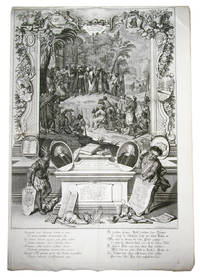
1730ABC_47423Augsburg 1730. 86 x 59 cm. Copperplate engraving. A grand engraving commemorating the achievements of the August Protestant Church in India features various scenes and elements. In the background there are mountains palm trees houses and people including a Chinese person. The foreground shows deciduous and palm trees with a lit grotto holding an idol inscribed with "Brama". In front of the grotto an evangelical missionary preaches to a large congregation of natives while holding a book of music in his left hand and pointing to Brama with his right hand. The missionary wears a turban a priest's cloak and has flappers. The audience under the hill is depicted in interesting groups with some closer to us appearing larger and clearer. At the bottom of the engraving there is an art altar with several books including the "Biblia Malabarica" "Catechism Malabaricus" and the hymnal "Liber Cantion. Malabar." The engraving was made by the German engraver painter draughtsman and art publisher Johann Elias Ridinger 1698-1767. He trained in Ulm and Augsburg under Christoph Resch and Johann Falch and learned engraving from Georg Philipp Rugendas. Ridinger later spent three years in Regensburg where he developed his style through coursing and visits to the riding school. His ornamental works show Rococo stylistic tendencies and he founded his own publishing house in Augsburg. His precise and tasteful drawings were highly regarded and transferred to decoration porcelain and ceramics.With two minor tears one partly repaired the other one not affecting the engraving. Overall in very good condition.l Thienemann Leben und Wirken des unvergleichlichen Thiermalers und Kupferstechers Johann Elias Ridinger 913; Thienemann "Nachträge Zusätze und Berichtigungen C. L. zu : Leben und Wirken des unvergleichlichen Thiermalers und Kupfer stechers Johann Elias Ridinger etc." in Archiv für die zeichnenden Künste 5 1859 pp. 148-149. unknown
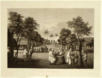
1835196250Paris.: A. Bertrand. 1835. Aquatint 27.1 x 36 cms; 31.6 x 47.2 cms sheet trimmed including platemark margins outside the platemark toned and discoloured edgewear with small chips mark at the foot of the caption split without loss at the lower corner of the platemark the image a fine dark impression in very good condition. Fine view of the market square at Pondicherry showing the well and the prison in the background from the official account of the Laplace voyage in the Favorite 1830-32 by voyage artist François-Edmond Pâris 1806-1893. The important French expedition encompassed India Southeast Asia and the Pacific. . A. Bertrand. unknown
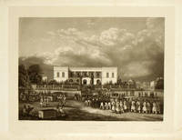
1835196251Paris.: A. Bertrand. 1835. Aquatint 27.1 x 36 cm; 32.3 x 47.2 cm sheet trimmed including platemark margins outside the platemark toned and discoloured with soft crease and small split not affecting the image to an upper corner the image a fine dark impression in very good condition. Beautifully executed view of the Governor's Palace in the Pondicherry showing soldiers and officials trouping out from the official account of the Laplace voyage in the Favorite 1830-32 by voyage artist François-Edmond Pâris 1806-1893. The important French expedition encompassed India Southeast Asia and the Pacific. . A. Bertrand. unknown
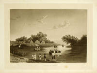
1835198166Paris.: A. Bertrand. 1835. Aquatint 27.1 x 36.3 cms; 32 x 47.6cms sheet trimmed including platemark margins outside the platemark toned and discoloured edge tears one encroaching on the platemark image unaffected small bloom of browning at the foot near caption the image a fine dark impression in very good condition. Tranquil river view by artist and draughtsman Barthelemy Lauvergne 1805-1875 from the official account of the Laplace voyage in the Favorite 1830-32. . A. Bertrand. unknown
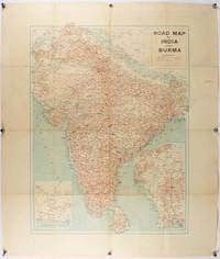
1940211089Bombay.: Joshi & Co. circa1940. Colour lithographic map 66 x 50 cms; 81.x 68.5 cms sheet two inset maps and on the verso a full sheet "Relief Map of India" original folds with fold splits archivally strengthened several city names have been neatly underlined “Agartala” inked in the margin overall in good condition. Scarce Bombay-published map of the pre-Partition Indian sub-continent with two small inset maps one showing roads around Karachi and the other Burma. Through Routes Other Main Roads and Motorable Roads Subject to Weather are marked. The "Relief Map of India" on the verso includes Railway Lines Canals Steamer Routes Rivers Air Routes Navigable Canals and Broadcasting Stations. . Joshi & Co. unknown
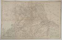
1859189711Calcutta.: Surveyor Generals Office. 1870. Reissue of 1859 edition. Lithographed map 57.2 x 93 cms; 61.1 x 96 cms sheet original folds old paper repairs to the verso and a sealed marginal tear central folds archivally strengthened some toning to the folds and creasing but the map in remarkably good clean condition. Impressive large Calcutta printing from the Survey of India showing Rajasthan Uttar Pradesh and surrounding states with extremely detailed delineation of settlements roads railways rivers and major points of interest the Taj Mahal is highlighted. . Surveyor Generals Office. unknown
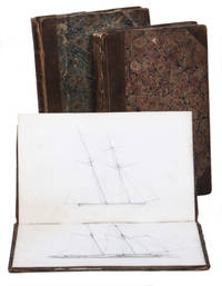
1822ABC_49460Aboard the Winchelsea written and drawn at sea 1822. Contemporary half gold-tooled brown calf marbled paper sides each volume with a different marbled paper the journal volume with marbled endpapers. 8vo. The two sketchbooks contain a total of ca. 100 pages of sketches of ships done in pencil including 1 page containing signal flags in colour. 3 volumes. With: Two sketchbooks with pencil drawings of ships. A neatly-written and illustrated sea journal kept by James Dudman the second mate on board the East India Company's ship Winchelsea during a 1822-23 voyage to India. Launched in 1803 the Winchelsea was already a veteran East Indiaman this being her ninth voyage - she made a total of eleven voyages for the EIC before she was broken up in 1834. On the present voyage commanded by Captain William Adamson she carried 592 people including the 17th and 44th Regiments of Foot and detachments of the King's and EIC's soldiers and a number of women and children. The sea journal volume is accompanied by two additional volumes by Dudman containing pencil sketches of unidentified masted sailing vessels.The Winchelsea's journey from its departure at Blackwall Dock on April 24 1822 to its arrival in Bengal and eventual return to England via St. Helena and The Downs on May 24 1823 reflects the extensive maritime routes integral to British imperial dominance. The ship's role in transporting personnel and cargo exemplifies the strength of the EIC's logistical network sustaining Britain's colonial and economic interests in India. The journal with its careful record-keeping offers an intimate glimpse into the daily operations experiences and extraordinary events encountered by the second mate aboard an East Indiaman during Britain's height of imperial expansion.The journal written in Dudman's beautiful scribe-like handwriting opens with an entry dated 24 April 1822 at Blackwall Dock where the voyage started "bound for Bengal." The next few pages contain a detailed listing of the people on board beginning with the ship's company of 122 men with names followed by the troops on board: "List of a detachment of His Majesty's Troops belonging to the 44th Regt. of Foot on board the Honable. Company's Ship Wincelsea for Bengal" comprising name and rank of 367 men followed by the names of 42 women on board as well as the name and age of 57 children on board including 3 who died at sea plus 4 additional passengers.At Saugur meaning Sagar Island they took on board further passengers duly noted in an additional "List of H.M. 17th Regiment of Foot with the Women and Children accompanying them. Embarked on board the Honble. Company's ship Winchelsea at Saugur New Anchorage for England."Beyond the usual records of position winds weather and other ships Dudman includes interesting notes on unusual occurrences. Perhaps the most fascinating event was recorded on February 10 1823: a major earthquake off the coast of India experienced by the Winchelsea: "At 10 minutes past 1 PM every one on board was greatly alarmed at the singular feel of the ship which was in a violent trembling motion as if the ship was grazing over a rocky shoal and a loud rumbling noise similar to the roll.g! of a Bull quickly along the deck this very singular seuration lasted certainly not less than a minute those below ran on deck to enquire the cause and those below the poop below to ask the same question. I was in the round house at the time when it comen'd. The noise appeared to me as coming along the quarter deck and instantly over the poop the sea was smooth and the day clear. I looked out at the stern windows but saw no appearance of any shoal which I certainly would have done had such existed. The water being very clear and the ship not going more than 2 knots I cannot account for this very singular phenomenon in any other way than its being the shock of an Earthquake".The voyage journal of the Winchelsea during its 1822-23 journey to Bengal provides valuable insight into the maritime operations of the EIC its commercial and colonial reach and the strategic importance of British trade with India in the early 19th century. As a veteran East Indiaman the Winchelsea was part of the vast trading network that connected Britain with the Indian subcontinent transporting soldiers goods and passengers under the auspices of the EIC which functioned as both a commercial enterprise and a colonial governing force.The journal volume contains the typographic book plate of Mr. Jas. Dudman on the front pastedown and a manuscript inscription in ink on the first flyleaf by Lumsden Dudman who was married to Mary Anne Shirreff "Joseph H. Shirreff from L.S. Dudman Xmas 1892" one of the sketchbooks contains a manuscript inventory list in Greek of goods for sale on the first flyleaf and one of the sketchbooks with ownership signature "L: Dudman / Sept. 27 1836" likely Rev. Lumsden S. Dudman perhaps a brother of James Dudman. Some general wear to the leather spines and corners of the boards of the volumes occasionally foxed but overall internally clean. Overall in good condition. unknown
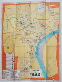
1960178269Circa1960. Folding colour tourist map of Varanasi in Uttar Pradesh province two inset maps of India and a gude map of Sarnath legend and key select Ghats shown railways "western style" and "Indian style" hotels marked in very good condition. 42.9 x 33.1 cm. . unknown
191556328Bangalore: Office of the Director Southern Circle Survey of India P.B. No. 44 1915. 4to. 7.25 x 9.75 in. which holds a 32-panel linen backed colour-printed map which folds out into double atlas folio sized map sized 36.5 x 53 in. Mounted within Navy-blue linen portfolio printed label w/ manuscript annotations on front cover indicating the sheet number minor shelfwear slight rubbing still NF copy. First edition thus of this map of Bangalore prepared under the auspices of the Survey of India Office of the Director in the opening years of World War I. This remarkable topographical map featuring a scale of 1†to 1 mile is based on the surveys first launched by William Lambton in the 19th Century known as the Great Trigonometrical Survey of India led successively by Lambton George Everest Andrew Waugh and James Walker. These fulfilled the premise that geodetic survey was the only option for accurate maps of large areas and much of this work in the survey of India was based upon the base lines in Bangalore originally measured by Warren and the base lines of Kumta by De Penning. These original linen-backed survey maps of India from the early 20th Century have become quite scarce. No copies located in Worldcat; See; Rama Deb Roy The Great Trigonometrical Survey of India in a Historical Perspective Pre-Census Population Studies Unit Indian Journal of History of Science 1986 Vol. 21 1 pp. 22-32. Office of the Director, Southern Circle, Survey of India, P.B. No. 44, unknown