1 044 résultats
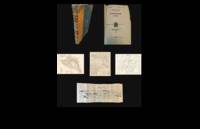
192771713large black and white paper map of Liddar Valley India at scale of 2 inches to a mile Published by The Survey of India Offices unknown
192771714large black and white paper map of Liddar Valley India at scale of 2 inches to a mile Published by The Survey of India Offices unknown
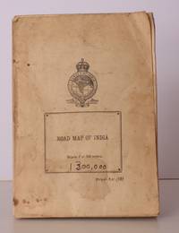
194571942black and white map Scale of 1;1000000 1 millimetre = 1 kilometre heights and depths are in metres and feet contains both english and french text double sided map scaling and formatting is the same on either side handwritten note on map detailing travel information dated 1945 Published by the Survey of India Offices paperback
1921NL-02287<p><strong>Frontier warfare and colonial cartography: 1921 Survey of India "Confidential" atlas documenting the British campaign in Waziristan.</strong></p><p>This highly detailed 1921 confidential British-Indian general staff report produced by the Survey of India documents the Waziristan military operations of 19191920 along the volatile frontier of the Northwest Boundary. The publication includes a frontispiece 31 plates seven maps three of which are pocket-folded and eight folding panoramic illustrations that chronicle both the terrain and troop dispositions. The maps provide tactical clarity on routes native strongholds topographic obstacles and British positions. At the same time the accompanying text analyzes operational strategy lessons learned and the emergent use of air power in tribal warfare.</p><p>Waziristan now in Pakistan had long been viewed by the British as a strategically critical and persistently unstable frontier region inhabited by fiercely autonomous Waziri and Mahsud tribes. The 19191920 campaign followed the Third Anglo-Afghan War during which boundary tensions and local insurrections compelled renewed military intervention. This report presents not just the operational narrative but also the institutional mindset of early 20th-century colonial warfare combining detailed cartography with doctrinal reflection.</p><p>Cartographers:</p><p>The <strong>Survey of India</strong> established in 1767 under Major James Rennell and expanded during British rule served as the paramount cartographic and geodetic agency in India. By 1921 it had become central to mapping the subcontinent for both civil administration and military planning. In this instance the Survey's maps reflect the dual imperative of geographic precision and strategic control making this report an indispensable source for scholars of South Asian military history cartography and colonial frontier dynamics.</p><p>Condition Description</p><p>Good. Some wear on cover. Fold lines and some marginal imperfections on maps views and illustrations.</p> Survey of India
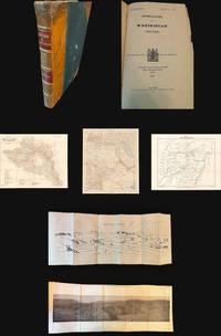
1921NL-02287a<p><strong>Frontier warfare and colonial cartography: 1921 Survey of India "Confidential" atlas documenting the British campaign in Waziristan.</strong></p><p>This highly detailed 1921 confidential British-Indian general staff report produced by the Survey of India documents the Waziristan military operations of 1919–1920 along the volatile frontier of the Northwest Boundary. The publication includes a frontispiece 31 plates seven maps three of which are pocket-folded and eight folding panoramic illustrations that chronicle both the terrain and troop dispositions. The maps provide tactical clarity on routes native strongholds topographic obstacles and British positions. At the same time the accompanying text analyzes operational strategy lessons learned and the emergent use of air power in tribal warfare.</p><p>Waziristan now in Pakistan had long been viewed by the British as a strategically critical and persistently unstable frontier region inhabited by fiercely autonomous Waziri and Mahsud tribes. The 1919–1920 campaign followed the Third Anglo-Afghan War during which boundary tensions and local insurrections compelled renewed military intervention. This report presents not just the operational narrative but also the institutional mindset of early 20th-century colonial warfare combining detailed cartography with doctrinal reflection.</p><p>Cartographers:</p><p>The <strong>Survey of India</strong> established in 1767 under Major James Rennell and expanded during British rule served as the paramount cartographic and geodetic agency in India. By 1921 it had become central to mapping the subcontinent for both civil administration and military planning. In this instance the Survey's maps reflect the dual imperative of geographic precision and strategic control making this report an indispensable source for scholars of South Asian military history cartography and colonial frontier dynamics.</p><p>Condition Description</p><p>Good. Some wear on cover. Fold lines and some marginal imperfections on maps views and illustrations.</p> Survey of India
194642874Survey of India 1946. Folding coloured map on paper measuring 44 x 31 ins approx. 112 x 79 cms folding in 36 panels to 7.5 x 5.25 ins approx. 19 x 13 cms; printed wrapper covers mildly age-soiled but map itself remakably bright and clean a bright copy. A SCARCE SURVIVAL. Survey of India, unknown
1948018911India: Survey of India 1948. Book. VG. No Binding. 3rd Edition. Large folded colored map with minimal wear thus very good plus. . Survey of India unknown
19661094654New York, Putnam, (1966). 4to. 175, (1) S., 103 teils farb. Taf. OLwd m. OUmschl.
1909004431Dehra Dun: Trigonometrical Branch Survey of India 1909. 1st Edition. . Hardcover. Poor. folding index to the degree sheets followed by 43 large folding maps showing the trigonemtrical survey network of norteast India including parts of Bhutan Nepal and Tibet. This is a technical work printed in Dehra Dun by heliozincograph. Half leather black cloth gilt titles to spine much of which has been lost. Maps mounted on tabs and in very good condition boards all but detached. Stamp of the National Physicasl Laboratory on fpd with a pencil note to the effect that the book is one of an edition of 310 unconfirmed Size: 4to - over 9¾" - 12" tall <br/> <br/> Trigonometrical Branch, Survey of India, hardcover
19701093764Genf, Nagel, (1970). Gr.-8vo. 278 S., 1 Bl. m. zahlr. teils farb. Abb. (Archaeologia Mundi). OPpbd.
193163451Hirsau (Württ.). Verlag Die Arche. 1931. Titelblatt, 43 Seiten u. 2 Bll. Roter Original-Leinwand-Einband. (Einband etwas randfleckig). 22x15 cm
19551097626London, Macmillan, 1955. 1 Bl., 200 S. OPp.
191597056München, Kurt Wolff, 1915. 118 (1) S. 23 cm. Privateinband mit farb. marmorierten Papierbezügen, rotem Rücken- u. Deckelschild (mit verschlungenem Monogramm RT).
192176922München, Kurt Wolff, (1921). 2 Bll., 630 S., 1 Bl. (18,5 x 12,5 cm). OHLn.
192176921München, Kurt Wolff, (1921). 4 Bll., 408 S., 2 Bll. (18,5 x 12,5 cm). OHLn.
19521092780Zürich, Stauffacher-Vlg, (1952). 320 S. m. 59 Abb. u. 6 Kartenskizzen. (Globetrotter-Bücher 2). OPpbd.
19671097182Bombay, Orient Longmans, (1967). 12, 694 S. OLwd.
19771093911Delhi, Motilal Banarsidass, (1977). 82 S. OKart.
19651094927Bombay, Asia Publ. House, (1965). 21, (3), 343 S. OLwd.
195253445London George Allen & Unwin Ltd. 1952. Hardcover. Ex-library with the usual ownership markings and withdrawn stamp; covers scuffed and partially sun-faded; pages toned; otherwise very good condition. . Two volume set separately paged. London, George Allen & Unwin Ltd., [ hardcover
19682111902154610086Inoueshoten 1968. Soft Cover. Fine. Size: B5 Inoueshoten paperback