6 résultats
1894POLYNESI008491The Religious Tract Society London. 1894. First edition. Octavo. 383 pages. Frontispiece. Publishers' adverts on rear endpapers.Endpapers a bit spotted. Very good. The Religious Tract Society, London. unknown
18761908210711xbvkAmsterdam, C. G. van der Post, 1876. 32 (14) pages. - Black halfcloth-binding around 1900 with brown-marbled panels and cloth-corners; 4to.(ca. 31 x 23 cm; 0,338 kg.).
18874343ABLondon, Swan Sonnenschein, Lowrey, 1887. 8°. Frontispiz (Karte), XVI, 384 S. und fotogr. Abbildungen auf 10 Tafeln (davon 1 mit Notenbeispielen)., 1
18554619Murray, London 1855. XVI, 333 S. mit gest. Frontispiz, gest. Titelvignette, 11 Tafeln, 2 Abbildungen u. mehreren Notenbeispielen. Grünes Illustr.-Ln. Einband verblichen. Rücken stärker beschädigt. Gelenke locker. Teils etwas stärker stockfleckig.
18512027AG1851. London & New York J & F. Tallis 1851. Original steel engraving / Vintage map. Drawn and engraved by John Rapkin. Partly hand-coloured. Plate Size: 35.7 cm x 25.8 cm. Sheet Size: 37.5 cm x 27.3 cm. Vintage 19th century map in very good condition. John Tallis 7 November 1817 3 June 1876 was an English cartographic publisher. His company John Tallis and Company published views maps and atlases in London from roughly 1838 to 1851. Tallis set up as a publisher with Frederick Tallis in Cripplegate in 1842; the business moved to Smithfield in 1846 and was dissolved in 1849. From 1851 to 1854 Tallis operated as John Tallis and Company. He started The illustrated news of the world and national portrait gallery of eminent personages in 1858 selling it for £1370 in 1861; it folded in 1863. Wikipedia The most important project John Tallis undertook was the 'Illustrated Atlas' from 1851. The original map we offer here was part of this exceptional Atlas and all the maps it contained are still today considered as the last reminder of an era of lavish map production. Tallis worked the project together with John Rapkin 1815-1876 and it was Rapkin's style and talent that we have to thank for when we marvel at these maps today. What makes these maps so special is the detail of engraved vignettes that surround the map and often show indigenous scenes people in their environment and even more so historical buildings or historical views of towns and cities architecture and landscape. The project of 'The Illustrated Atlas' was designed to be finished just in time for the anxiously awaited "Great Exhibition of the Works of Industry of All Nations" or The Great Exhibition sometimes referred to as the Crystal Palace Exhibition in reference to the temporary structure in which it was held was an international exhibition that took place in Hyde Park London from 1 May to 11 October 1851. It was the first in a series of World's Fairs exhibitions of culture and industry that became popular in the 19th century and it was a much anticipated event. The Great Exhibition was organized by Henry Cole and Prince Albert husband of the reigning monarch Queen Victoria. It was attended by numerous notable figures of the time including Charles Darwin Samuel Colt members of the Orléanist Royal Family and the writers Charlotte Brontë Charles Dickens Lewis Carroll George Eliot and Alfred Tennyson. Music for the opening was under the direction of Sir George Thomas Smart and the continuous music from the exhibited organs for the Queen's procession was "under the superintendence of William Sterndale Bennett". Wikipedia unknown
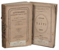
1863ABC_47184Papeete: Imprimerie du Gouvernement 1863. Original publisher's printed wrappers. Small 8vo. With two original photographs in the 1863 edition both reproducing maps one showing the islands Tahiti and Moorea and the other showing archipels which were then under French protectorate. 2 volumes. With: 2 IDEM. Annuaire des établissements français de l'Océanie et du Protectorat des Iles de la Société et dépendances pour l'an 1864 title on the front wrapper: Annuaire de Taïti pour 1864.Papeete Imprimerie du Gouvernement October 1864. Two very rare issues of an administrative annual periodical in the form of an almanac on Tahiti Moorea and other parts of French Polynesia printed in Papeete the capital of French Polynesia and Tahiti. In 1842 the French proclaimed the protectorate over the islands and atolls in the different archipelagos of French Polynesia including Tahiti which is the most populous island. Both issues contain a calendar in addition to the many pages listing various members of the local and colonial government and judiciary. Both issues also contain demographic information about the population and trade including lists showing who has a patent on what tables on the import and export in the port of Papeete but also tables showing the different rates for posting letters from Polynesia through the colonial mail service. Besides this administrative information the yearbooks also contain geographical information on the Society Islands both the Windward Islands or Îles du Vent including Tahiti and Moorea and the Leeward Islands or Îles Sous le Vent among others Bora-Bora and Raiatea the Marquesas Islands and the archipelago of Tuamotu besides some small remarks on others places in Oceania.With the blind-tooled stamp of Carlos Bailly-Balliere C. Bailly Balliere Libreria Estranjera y Nacional Madrid" on both title pages with some contemporary labels mounted on the front wrapper and spine reading "E" and "1"; "C" and "3". Wrappers are a little worn some soiling on the back wrapper of the 1863 issue a light crease in the front wrapper of the 1863 issue book blocks cracked and therefore some leaves are a little or almost loose. The 1863 issue is slightly foxed also on the leaves on which the photographs are mounted but not affecting the maps. Otherwise in good condition. Both annuals are very rare and seldomly offered for sale.l O'Reilly & Reitman 10283 & 10284. Imprimerie du Gouvernement, unknown