1 330 résultats
176pp.+ 2 enfolding tables, 2e éd., bel état
1952T72480Heidelberg, Carl Winter 1952 335pp., 25cm., cloth, bound in cloth, VG, T72480
335pp., 25cm., cloth, bound in cloth, VG, T72480
Light dampstaining to boards. Spine faded. Rear hinge started; A Baedeker clone (but with blue boards). Including maps; 16mo 6" - 7" tall; 224 pages
19701246849Oslo, Universitetsforlaget, (1970). Gr.-8vo. 589 S. (Norsk bibliografisk bibliotek 44). OBroschur (Umschlag u. Schnitt begriffen).
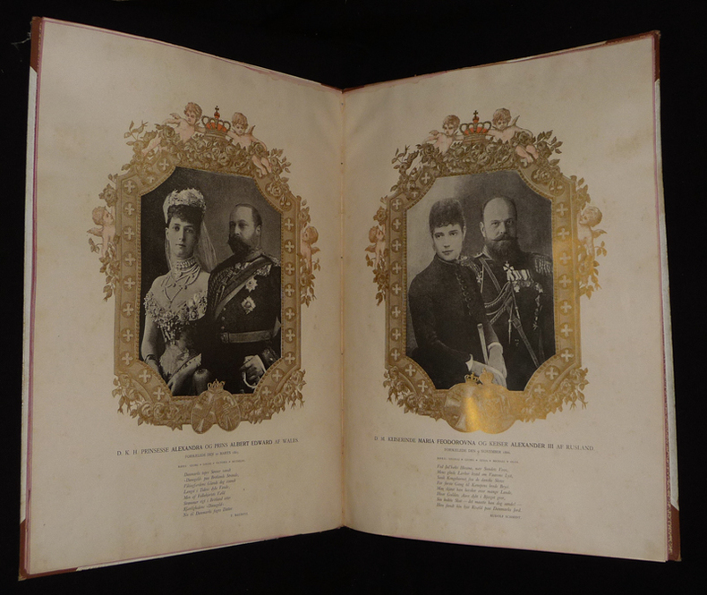
1892ko1329Udgivet af G. Paulis Kunstanstalt Relié 1892 In-folio (29,5 x 41,2 cm), reliure demi-toile à coins, non paginé, texte en danois, illustrations en noir et en couleurs, livre publié à l'occasion du 9e anniversaire de mariage de Christian et Louise du Royaume du Danemark et de Norvège ; ouvrage gondolé suite à des mouillures (visibles sur les plats et certaines pages, coupes frottées, quelques traces sur les plats, en l'état. Livraison a domicile (La Poste) ou en Mondial Relay sur simple demande.
26849AB8°. Orig.-Broschur. bzw. Hefte.
1868AUB-3151Paris, C. Reinwald 1868. Bel exemplaire relié, reliure pleine toile ornée d'éd., in-8 non ébarbé, XXIII + 323 pages avec annexes + planches.
192074272Couverture souple. Broché. 9 x 11 cm. 124 pages. Couverture défraîchie. Manques au dos. Papier bruni.
1857231345Copenhagen: L'Imprimerie de Thiele 1857. First edition. 22 plates. 10 pp. text. 1 vols. Folio. Contemporary boards. Spine perished boards detached. Internally Fine. First edition. 22 plates. 10 pp. text. 1 vols. Folio. L'Imprimerie de Thiele unknown books
1868793251868. SCANDINAVIA NORDISKA TAFLOR: PITTORESKA UTSIGTER FRAN SVERGE NORGE OCH DANMARK. I TRASNITT MED TEXT. TREDJE BANDET. Stockholm: Albert Bonnier 1868. 48 pp. text 72 full page wood engravings. Oblong 4to. green cloth. Good moderate shelfwear and rubbing to cloth. Endpapers tanned at edges closed 1 inch tear to ffep and following page. Bottom corner dampstained 1-3 inches throughout affecting some of the engravings. Volume 3 only of 5. Picturesque places of Sweden Norway and Denmark. unknown books
Esteve-Coll, Elizabeth, DIn Pristine Condition. unknown
Erik van Mingroot and EduNot in perfect condition. unknown
877132397X.Ghardcover. Good. Access codes and supplements are not guaranteed with used items. May be an ex-library book. hardcover
20131-8771320431Unilit 2013. Hardcover. New. 448 pages. Spanish language. 9.40x6.60x1.50 inches. Unilit hardcover
1922HN-6W4L-TXI61922. Hardcover. Very Good. Nickerson 1922. Moderate external wear spine dulled with a little staining. Pages yellowed with an occasional minor blemish. Binding firm. Ownership inscription to half title Griffith G. Jones 1934. hardcover
877132108X.Ghardcover. Good. Access codes and supplements are not guaranteed with used items. May be an ex-library book. hardcover
SONG8772472006Casscom Media 0000-00-00. hardcover. Used: Good. 8.30x0.50x10.90. Buy with confidence. Excellent Customer Service & Return policy. Casscom Media hardcover
1851200100AG1851. London Edinburgh & Dublin J & F. Tallis 1851. Original steel engraving / Vintage map. Drawn and engraved by John Rapkin. Partly hand-coloured. Illustrations by H. Warren and engravings by J.B. Allen. Plate Size: 25 cm x 34 cm. Sheet Size: 27.4 cm x 37.4 cm. Vintage 19th century map in very good condition. Published in the Illustrated Atlas And Modern History Of The World Geographical Political Commercial & Statistical Edited By R. Montgomery Martin. Beautiful and interesting map of Denmark: the Jutland Peninsula and the surrounding islands such as Zealand and Funen in the Baltic and the North Sea. The political subdivisions of Denmark are delineated and the towns and cities including Copenhagen Aarhus and Odense are shown. Off the east coast the Cattegat strait is identified. The southern coast of Sweden is shown as are the German coasts in the lower part of the map Hanover Mecklenburg and Prussia The Danish royal coat-of-arms can be seen in the upper right corner of the map. John Tallis 7 November 1817 3 June 1876 was an English cartographic publisher. His company John Tallis and Company published views maps and atlases in London from roughly 1838 to 1851. Tallis set up as a publisher with Frederick Tallis in Cripplegate in 1842; the business moved to Smithfield in 1846 and was dissolved in 1849. From 1851 to 1854 Tallis operated as John Tallis and Company. He started The illustrated news of the world and national portrait gallery of eminent personages in 1858 selling it for £1370 in 1861; it folded in 1863. Wikipedia The most important project John Tallis undertook was the 'Illustrated Atlas' from 1851. The original map we offer here was part of this exceptional Atlas and all the maps it contained are still today considered as the last reminder of an era of lavish map production. Tallis worked the project together with John Rapkin 1815-1876 and it was Rapkin's style and talent that we have to thank for when we marvel at these maps today. What makes these maps so special is the detail of engraved vignettes that surround the map and often show indigenous scenes people in their environment and even more so historical buildings or historical views of towns and cities architecture and landscape. The project of 'The Illustrated Atlas' was designed to be finished just in time for the anxiously awaited "Great Exhibition of the Works of Industry of All Nations" or The Great Exhibition sometimes referred to as the Crystal Palace Exhibition in reference to the temporary structure in which it was held was an international exhibition that took place in Hyde Park London from 1 May to 11 October 1851. It was the first in a series of World's Fairs exhibitions of culture and industry that became popular in the 19th century and it was a much-anticipated event. The Great Exhibition was organized by Henry Cole and Prince Albert husband of the reigning monarch Queen Victoria. It was attended by numerous notable figures of the time including Charles Darwin Samuel Colt members of the Orléanist Royal Family and the writers Charlotte Brontë Charles Dickens Lewis Carroll George Eliot and Alfred Tennyson. Music for the opening was under the direction of Sir George Thomas Smart and the continuous music from the exhibited organs for the Queen's procession was "under the superintendence of William Sterndale Bennett". Wikipedia unknown
1903921759.Gboard_book. Good. Access codes and supplements are not guaranteed with used items. May be an ex-library book. unknown
1272112519.Gpaperback. Good. Access codes and supplements are not guaranteed with used items. May be an ex-library book. paperback
1272713539.Gpaperback. Good. Access codes and supplements are not guaranteed with used items. May be an ex-library book. paperback
2000mon0004109659Scandinavia / Casscom Media 9/1/2012 12:00:01 AM. board_book. Good. 0.9055 11.2205 8.5827. Scandinavia / Casscom Media unknown
2005Q-8772477989Scandinavia Publishing House 2005-04-15. Hardcover. New. New. In shrink wrap. Looks like an interesting title! Scandinavia Publishing House hardcover
SONG8772477989Scandinavia Publishing House 2017-04-06. hardcover. Used: Good. 10.08x0.51x11.94. Buy with confidence. Excellent Customer Service & Return policy. Scandinavia Publishing House hardcover