Scandinavia Publishing HouseBiblio.com

1 330 résultats
8771320431.Ghardcover. Good. Access codes and supplements are not guaranteed with used items. May be an ex-library book. hardcover
877247470X.Ghardcover. Good. Access codes and supplements are not guaranteed with used items. May be an ex-library book. hardcover
2010Q-8772477547Scandinavia Publishing 2012-01-01. Hardcover. New. New. In shrink wrap. Looks like an interesting title! Scandinavia Publishing hardcover
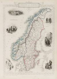
1851200099AG1851. London Edinburgh & Dublin J & F. Tallis 1851. Original steel engraving / Vintage map. Drawn and engraved by John Rapkin. Partly hand-coloured. Illustrations by J. Marchant and engraved by J.H. Kernot. Plate Size: 23.5 cm x 34.5 cm. Sheet Size : 27.4 cm x 37.4 cm. Vintage 19th century map in very good condition. Published in the Illustrated Atlas And Modern History Of The World Geographical Political Commercial & Statistical Edited By R. Montgomery Martin. Beautiful and interesting map of the Sweden and Norway. Denmark the Baltic states and Finland can be seen also. In the Baltic Sea Gotland and Aland islands are included as are the island further north above the Arctic Circle Loffoden Tomsen islands. The political subdivisions are also delineated. Stockholm and Christiania Oslo are identified on the map as are many other towns and cities. Relief is depicted by hachuring. Sweden and Norway or SwedenNorway officially the United Kingdoms of Sweden and Norway or as the United Kingdoms was a personal union of the separate kingdoms of Sweden and Norway under a common monarch and common foreign policy that lasted from 1814 until its peaceful dissolution in 1905. John Tallis 7 November 1817 3 June 1876 was an English cartographic publisher. His company John Tallis and Company published views maps and atlases in London from roughly 1838 to 1851. Tallis set up as a publisher with Frederick Tallis in Cripplegate in 1842; the business moved to Smithfield in 1846 and was dissolved in 1849. From 1851 to 1854 Tallis operated as John Tallis and Company. He started The illustrated news of the world and national portrait gallery of eminent personages in 1858 selling it for £1370 in 1861; it folded in 1863. Wikipedia The most important project John Tallis undertook was the 'Illustrated Atlas' from 1851. The original map we offer here was part of this exceptional Atlas and all the maps it contained are still today considered as the last reminder of an era of lavish map production. Tallis worked the project together with John Rapkin 1815-1876 and it was Rapkin's style and talent that we have to thank for when we marvel at these maps today. What makes these maps so special is the detail of engraved vignettes that surround the map and often show indigenous scenes people in their environment and even more so historical buildings or historical views of towns and cities architecture and landscape. The project of 'The Illustrated Atlas' was designed to be finished just in time for the anxiously awaited "Great Exhibition of the Works of Industry of All Nations" or The Great Exhibition sometimes referred to as the Crystal Palace Exhibition in reference to the temporary structure in which it was held was an international exhibition that took place in Hyde Park London from 1 May to 11 October 1851. It was the first in a series of World's Fairs exhibitions of culture and industry that became popular in the 19th century and it was a much-anticipated event. The Great Exhibition was organized by Henry Cole and Prince Albert husband of the reigning monarch Queen Victoria. It was attended by numerous notable figures of the time including Charles Darwin Samuel Colt members of the Orléanist Royal Family and the writers Charlotte Brontë Charles Dickens Lewis Carroll George Eliot and Alfred Tennyson. Music for the opening was under the direction of Sir George Thomas Smart and the continuous music from the exhibited organs for the Queen's procession was "under the superintendence of William Sterndale Bennett". Wikipedia unknown
8772479752.Gboard_book. Good. Access codes and supplements are not guaranteed with used items. May be an ex-library book. unknown
1982100138655Methuen young books 1982 200 pages 22 098x2 286x16 51cm. 1982. Cartonné jaquette. 200 pages.
1845RO20021093Comptoir des imprimeurs. 1845. In-8. Relié demi-cuir. Etat passable, Couv. convenable, Manque en coiffe de tête, Quelques rousseurs. 430p, quelques traces de mouillures sur les dernières pages, dos relié cuir marron, papier marbré sur les plats, épidermures sur le dos, tache d'encre sur le 1er plat.. . . . Classification Dewey : 948-Scandinavie
prefazione dell'autore 1 23.9x17 cm., 159 pp., illustrazione all'antiporta, 52 ill., legatura in piena tela illustrata, pagine lievemente brunite, copertina quasi staccata peraltro ottimo, in italiano
Carta geografica della Scandinavia, con confini colorati all'epoca, incisa da Giovan Battista Falda che riprese la carta del Sanson. Inserita nell'opera "Mercurio geografico..." edita in Roma da G. Giacomo De Rossi alla fine del '600 con Giorgio Widman che incise le lettere. La carta è ridimensionata al margine della scala graduata che è tutta visibile
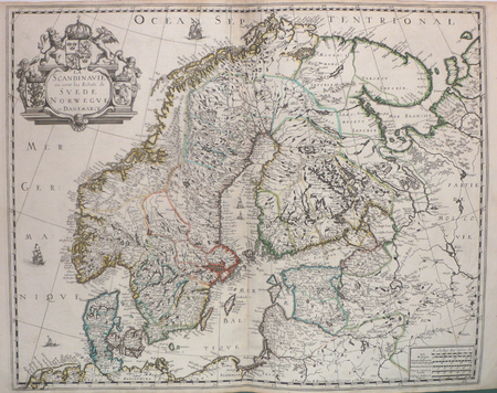
1658LBW0394dParis P. Mariette 1658 421 x 525 mm.
DJ with light rubbing to extremities. DJ pc ; Personal travel experiences all over Scandinavia ; B&W Photographs; 8vo; 156 pages
124471Gingko Press, Berkeley, 2019. 240 S. ; 29 x 21,5 cm ; Pp. ;
2012124910Gingko Press, Berkeley, 2012. 254 S. ; 29 x 21,5 cm ; Pp. ;
Carta geografica della penisola scandinava. Rara edizione stampata a Napoli
1898RO80104240PLON E., NOURRIT & Cie. 1898. In-12. Relié demi-cuir. Etat d'usage, Couv. convenable, Dos fané, Intérieur frais. 304 pages. Frontispice en noir et blanc. Nombreuses planches de phototypies, en noir et blanc. Etiquette de code sur la coiffe en-tête et tampons de bibliothèque sur la page de titre et dans quelques marges.. . . . Classification Dewey : 948-Scandinavie
18985230Paris Plon 1898 In-12 304 pp, 1 carte dépliante des pays scandinaves, 28 phototypies, rousseurs sur le dos et les tranches, léger manque au bas du dos
1979R200109370éditions de la Pibole. 1979. In-4. Relié. Bon état, Couv. convenable, Dos satisfaisant, Intérieur frais. pages. Ex dono sur le deuxième contre plat. BD; illustrations en couleur. Erreur de reliure : sens de lecture inversé.. . . . Classification Dewey : 948-Scandinavie
Stralcio in 4° dall'ebdomadario "Le Tour du Monde", dalla pagina 161 alla pagina 208 e dalla 129 alla 144. Assolutamente inedito, ricchissimo iconograficamente di magnifiche silografie, di non facile reperibilità, senza legatura, in bello stato
1979RO80213867Pohjoinen. 1979. In-4. Relié. Bon état, Couv. convenable, Dos satisfaisant, Intérieur frais. 144 pages. Nombreuses photographies en noir et blanc hors texte. Jaquette légèrement défraichie. Texte en langue finlandaise.. Avec Jaquette. . . Classification Dewey : 948-Scandinavie
1982R100089364Fayard. 1982. In-8. Broché. Etat d'usage, Coins frottés, Dos plié, Intérieur frais. 380 pages - couverture jaunie - quelques planches de photos en noir et blanc - quelques fac similés en noir et blanc hors texte.. . . . Classification Dewey : 948-Scandinavie
192447093ABBerlin. Wasmuth 1924. 4°. XXXVI S., [Tafeln]. Original-Leinwand mit Rücken- und Deckeltitel in Gold. Rücken mit Lichtspur. Leicht wellig. (=Orbis Terrarum). 1
1983R200115407Ministère royal des affaires étrangères du Danemark / DK livres. 1983. In-8. Relié. Bon état, Couv. convenable, Dos satisfaisant, Intérieur frais. 111 pages. Nombreuses illustrations en couleur et noir et blanc, dans et hors texte. Contreplats illustrés de carte en couleur.. . . . Classification Dewey : 948-Scandinavie
Inserita nell'opera "La Geografia di Claudio Tolomeo alessandrino, già tradotta di greco in italiano da M. Giero. Ruscelli: & hora in questa nuoua editione da M. Gio. Malombra ricorretta, & purgata d'infiniti errori: ... Con l'Espositioni del Ruscelli, ... Con una copiosa tauola de' nomi antichi, dichiarati co' nomi moderni: dal Malombra riueduta, & ampliata. Et con un Discorso di M. Gioseppe Moleto, .. "
1929jj3735Stock Le cabinet cosmopolite Broché 1929 "In-8 broché, 235 pp., tirage à 2750 ex., tous numérotés sur alfa satiné, E.O., non coupé, préface de Lucien Maury (directeur de la sous-série scandinave), titre n°32 de la belle collection ""Le Cabinet Cosmopolite"" des éditions Stock ; menus incidents sans aucune gravité (en couverture ou en tranche), bel état. Livraison a domicile (La Poste) ou en Mondial Relay sur simple demande."
Brown, Jules, Paul Karr,In Pristine Condition. unknown