Urbanitzky, Grete vAntiquariat.de

1 592 résultats
1937136702Leipzig: Weise 1937. 94 S. 19,5*13 cm. Halbleinen
697767737Packt Publishing Limited pp. 316 . Papeback. New. Packt Publishing, Limited unknown
198711603Bielefeld: Delius Klasing 1987. 7. überarb. und erw. Auflage Mit vielen Abbildungen, Kartenskizzen und Register, 305 S., 8°, OPb.
1943131811Brünn - München - Wien, Rudolf M. Rohrer Verlag 1943. 119, (1) Seiten, 7 Seiten Tabellen, 7 Kunstdrucktafeln mit 21 Abbildungen und 5 Kartenbeilagen. Originalbroschur. (Teils mit geringeren Gebrauchsspuren). 22x15 cm
2011130729Budapest 2011. 198, (2) pages. With a lot of illustrations, mostly in colour. Illustrated softcover binding. 30x21 cm
1914124386Budapest. Pallas Reszvenytarsasag Nyomdaja. 1914. 402 Seiten. Mit zahlreichen teils farbigen Abbildungen. Roter Leinwand-Einband ohne Titelaufdruck. (Papier teils fleckig). 21x16 cm
1954124376(Budapest). Hungarian Bulletin 1954. 55 Seiten. Privater, roter Leinwand-Einband ohne Titelaufdruck mit eingebundener Originalbroschur. 20x15 cm
188417027Szegedin. Druck u. Verlag von L. Endrenyi & Comp. 1884. (6), 150, (2) Seiten. Halbleder-Einband der Zeit auf 4 Bünden mit Rückentitelvergoldung u. Lederecken. (Einband an den Kanten teils berieben. Papier teils fleckig). 20x13 cm
1993121670Budapest 1993. 67 Seiten. Mit zahlreichen farbigen Abbildungen. Farbig ill. Originalbroschur. (Ein Blatt lose. Leicher Kellergeruch). 29x21 cm
1911139205Tübingen. Verlag von J. C. B. Mohr (Paul Siebeck) 1911. XI, (1), 234 Seiten. Halbleder-Einband der Zeit mit marmorierten Deckeln. (Einband teils berieben. Mehrfach gestempeltes Bibliotheks-Exemplar). 26x18 cm
1985107926Budapest. RTV-Minerva. 1985. 94, (2) Seiten. Mit zahlr. teils faks. Abbildungen. Farbig ill. OKart.-Einband. (Titelblatt im Falz mit kleinem Einriss). 29x21 cm
199469557Budapest. Balassi Kiado. 1994. 311 Seiten. Mit zahlreichen Abbildungen im Text und auf 16 farbigen Tafeln. Farbig ill. Originalbroschur. Sehr gutes Exemplar. 23x16 cm
1994121350Budapest 1994. 265 Seiten. Mit zahlreichen, teils faks. Abbildungen. Ill. Originalbroschur. 25x18 cm
188535591Budapest. Carl Grill. (1885). 239, (95) Seiten. Mit zahlr. teils ganzseitigen Holzschnittansichten, vielen teils ill. Werbeanzeigen u. einem mehrfach gefalteten und farbigen Situationsplan i. Anhang. Ill. Original-Leinwand-Einband. (Einband fleckig. Papier teils etwas fleckig) 17x10 cm
1877146662Stuttgart. Verlag von August Auerbach. 1877. XII, (1), 397, (3) Seiten. Ansprechender Halbleinwand-Einband der Zeit mit marmorierten Deckeln. (Geringe Gebrauchsspuren). 21x13,5 cm
19350323-23Bln. u. Lpz.,de Gruyter 1935. gr.8°. XV,(1),272,(2) S. Vlgsanzeigen. Okart., 2 Bl. mit kl. Eselsohren, gutes Expl.
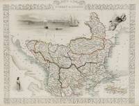
1851200055AG1851. London and New York J & F. Tallis 1851. Original steel engraving / Vintage map. Drawn and engraved by John Rapkin. Partly hand-coloured. Illustrations by H. Warren and engraved by J. Rogers. Plate Size: 32.5 cm x 26 cm. Sheet Size : 37.4 cm x 27.3 cm. Vintage 19th century map in very good condition. Published in the Illustrated Atlas And Modern History Of The World Geographical Political Commercial & Statistical Edited By R. Montgomery Martin. Beautiful and interesting map of South East Europe. Much of the Balkans was then under the control of the Ottoman Turks. The region is delineated into the historic - and future - nations and states including Croatia Herzegovina Bosnia Serbia Albania Macedonia northern Greece Bulgaria Walachia in Romania and Moldova. Russia can be seen extending down into the areas around the Black Sea. Hapsburg-Austria and the heel of the Italian peninsula is shown. Corfu Cyprus and the Greek islands can be seen lying of the archipelago. Gallipoli Sea of Marmara the Bosporus and Constantinople/Istanbul and Asia Minor/Anatolia are shown in the lower right corner. John Tallis 7 November 1817 3 June 1876 was an English cartographic publisher. His company John Tallis and Company published views maps and atlases in London from roughly 1838 to 1851. Tallis set up as a publisher with Frederick Tallis in Cripplegate in 1842; the business moved to Smithfield in 1846 and was dissolved in 1849. From 1851 to 1854 Tallis operated as John Tallis and Company. He started The illustrated news of the world and national portrait gallery of eminent personages in 1858 selling it for £1370 in 1861; it folded in 1863. Wikipedia The most important project John Tallis undertook was the 'Illustrated Atlas' from 1851. The original map we offer here was part of this exceptional Atlas and all the maps it contained are still today considered as the last reminder of an era of lavish map production. Tallis worked the project together with John Rapkin 1815-1876 and it was Rapkin's style and talent that we have to thank for when we marvel at these maps today. What makes these maps so special is the detail of engraved vignettes that surround the map and often show indigenous scenes people in their environment and even more so historical buildings or historical views of towns and cities architecture and landscape. The project of 'The Illustrated Atlas' was designed to be finished just in time for the anxiously awaited "Great Exhibition of the Works of Industry of All Nations" or The Great Exhibition sometimes referred to as the Crystal Palace Exhibition in reference to the temporary structure in which it was held was an international exhibition that took place in Hyde Park London from 1 May to 11 October 1851. It was the first in a series of World's Fairs exhibitions of culture and industry that became popular in the 19th century and it was a much-anticipated event. The Great Exhibition was organized by Henry Cole and Prince Albert husband of the reigning monarch Queen Victoria. It was attended by numerous notable figures of the time including Charles Darwin Samuel Colt members of the Orléanist Royal Family and the writers Charlotte Brontë Charles Dickens Lewis Carroll George Eliot and Alfred Tennyson. Music for the opening was under the direction of Sir George Thomas Smart and the continuous music from the exhibited organs for the Queen's procession was "under the superintendence of William Sterndale Bennett". Wikipedia unknown
Very Good English Modern cloth bdg. Cr. 8vo. (20 x 14 cm). In Turkish. 145, [3] p., musical scores. One of the publications of Communist Bulgarian Turks printed in Sofia. Rare. Vintage cover. Yeni sarkilar. New songs.
18086Paris, Presses Universitaires de France 1977, 240x155mm, 269pages, broché. Bel exemplaire.
191129190Sarajevo, Selbstverlag des B.-H. Instituts für Balkanforschung, 1911. Gr.-8°. Mit 1 farb. Kte. u. 5 Kartenskizzen. 2 Bll., 95 SS. Hldr. d. Zt. (gering beschabt).
19041354-19Sarajewo, Studnicka 1904. 4°. 79 S. Mit zahlr. Abb. Ln. d. Zt. m. Gold- u. Blindpräg. In gutem Zustand. [2 Warenabbildungen]
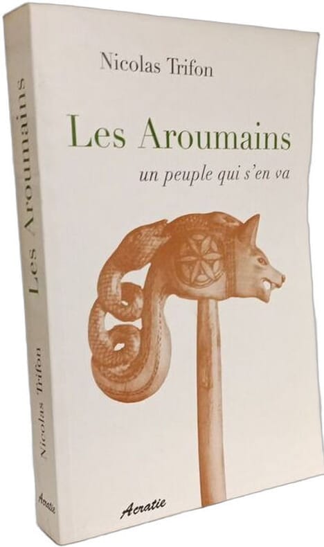
2005100143114Editions Acratie 2005 in8. 2005. Broché.
1945KIBU1935Wien u. Leipzig, Deutscher Vlg. f. Jugend und Volk (1945). 64 S. Mit 14 Schattenrissen, 14 Init. u. farb. Deckelill. v. Herta SLADKY. OBrosch., Umschl. mit kleinen Randrissen. Der seltenste Band der Reihe. Wie stets ohne S.5/6 (Vorwort). Nicht bei Hopster.
1945KIBU0742Wien u. Leipzig, Deutscher Vlg. f. Jugend und Volk (1945). 84 S. Mit 12 Schattenrissen, Init. u. farb. Deckelill. v. Herta SLADKY. OHLn. Geringf. berieb., Text papierbedingt gebräunt.
195631901956 in-8, 372pp., publicités, 1 carte en coul. depliante., br. Beograd 1956,