50 745 résultats
Broch?. 411 pages.
1 15,5x11 cm., legatura cartonata editoriale, pagg.188 (4), in italiano, prima edizione, buone condizioni. Se un luogo della terra ti ha incantato, non tornarci pi?. Non sarebbe mai come quella prima volta. - E se scopri un posto bellissimo e sconosciuto, non dirlo a nessuno.
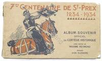
1368347° Centenaire de St.-Prex Svizzera 1234 - 1934 - Album Souvenir officiel du Cortege Historique - Avec notice de Maxime Reymond - Dessins d'Ed. Elzingre - ed. 1934 - Pag. 15 con una tavola illustrata più volte ripiegata più di 2 5 metri - Copertina morbida - Lingua francese. - Buone condizioni. - - unknown
brossura 8 film da leggere, senza annoiarsi, molto facili da leggere, con i brani musicali, che sono indicati ai film. fate pubblicità, se volete vedere i film al cinema 8 film con molta fantasia, come gli 8 film scritti nel primo libro. Una parte dei miei guadagni andrà alla Caritas.
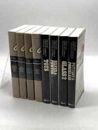
1980HVD-48982-XZ-0New York NY: Knopf. Good in Good dust jacket. 1980s. First Edition; First Printing. Paperback. Pottery & Porcelain; Toys; Silver & Pewter; Glass Volume 2 ; Chairs Tables Sofas & Beds; Quilts Coverlets Rugs & Samplers; Glass Tableware Bowls & Vases; Chests Cupboards Desks & Other Pieces. Light fading to DJ spines. Minor rubbing and creasing to covers. Minor rubbing and smudges to the top exterior edge of textblocks on a few books. Minor wear to DJ edges. Very Good condition otherwise. No other noteworthy defects. No markings. ; - Your satisfaction is our priority. We offer free returns and respond promptly to all inquiries. Your item will be carefully cushioned in bubble wrap and securely boxed. All orders ship on the same or next business day. Buy with confidence. . Knopf paperback
96302aafImprimerie St. Paul, Fribourg, 1957, in-8vo, 72 p. avec un plan de la ville fribourg, brochure originale.
19851001310901985 31 pages in8. 1985. Agrafé. 31 pages.
Legatura editoriale dalla copertina rinforzata, plastificata, illustrata da un progetto grafico di Yekaterina Ratner, ombrata da velli di polvere e segnata da imperfezioni da urti alle punte, ai bordi e alle cuffie e da abrasioni da contatto al piatto e alla cerniera posteriore, l'interno del libro, presenta carte ricche di tabelle, disegni e grafici, immacolate e come nuove, testo in lingua inglese. N. pag. 318. USATO
1985R260108540NATHAN. 1985. In-8. Broché. Etat d'usage, Couv. légèrement passée, Dos satisfaisant, Intérieur frais. Environ 40 pages. Premier plat illustré en couleurs.. . . . Classification Dewey : 53-Guide
Collana Guida Hobby. Brossura con copertina in cartoncino lucido, piatti illustrati, che riporta comuni mende d'uso e conservazione. Macchia più evidente al dorso. Interno integro, pagine ben preservate, naturalmente imbrunite. Numero pagine 843. USATO
1990R160108574SALON DU LIVRE. 14 OCTOBRE 1990. In-12. Broché. Bon état, Couv. convenable, Dos satisfaisant, Intérieur frais. 173 pages illustrées de photos dans le texte.. . . . Classification Dewey : 53-Guide
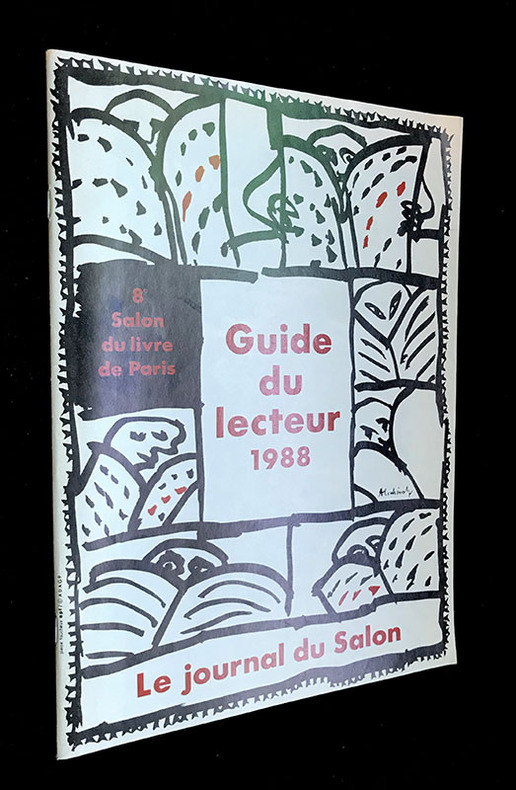
1988qi1950Éditions professionnelles du Livre, Paris dos caré collé 1988 In-4 (21 x 30 cm), dos agrafé, 62 pages, iconographie en noir et en couleurs, bien complet du poster et de l'agenda du Salon du Livre ; coiffes et coins légèrement frottés, plats à peine défraîchis, bel état. Livraison a domicile (La Poste) ou en Mondial Relay sur simple demande.
illustrazioni
11459Paris, Nouvelles Editions de l'Université, 1998, 1 br., couverture illustrée. in-8 de 288 pp., cartes ;
2019500033967BONNETON 2019 17 2x22 8x3 2cm. 2019. Relié.
2014RO80247693Bleu Azur. 2014. In-8. Broché. Bon état, Couv. convenable, Dos satisfaisant, Intérieur frais. 56 pages. Nombreuses photos en couleurs dans le texte.. . . . Classification Dewey : 53-Guide
2001932630New York: HarperCollins, 2001. 184 S. Originalleinen mit Schutzumschlag.
Brossura editoriale con alette, coperta in buono stato, così come le pagine, libro completamente fruibile, volume appartenente alla collana "BUR Varia", presenti figure in nero nel testo, prima edizione nella collana, numero pagine 320; da segnalare: tracce di pregressa umidità al margine inferiore delle ultime pagine USATO
New English Paperback. Pbo. Demy 8vo. (21,5 x 2 cm). In Japanese. 148, [2] p., 1 folding map. Color and b/w ills. [A site on the Unesco World Heritage List: Troia / Wilusa guidebook. General background and a guided tour (including the information panels at the site) prepared by the director of the excavations.] JAPANESE EDITION
Very Good Russian Original dark green cloth bdg. Oblong folio. (28 x 36 cm). Eight languages of the title on the colophon, the text is completely Russian. [6], [ii], 108 p., [36] maps in various sizes, some of folded: (62x47 cm, 52,5x45,5 cm, 49,5x27 cm [x3], 61x47 cm; other maps are 36x28 cm). Four unnumbered leaves with half-title and contents for each section. Two small millimetric cuttings on two text pages. Ex-owner's name is on the title page. Markings on the index. Otherwise a very good and clean copy. Rare complete and the first atlas including a fine collection of 36 attractive chromo-lithograph maps mostly with tissue papers of the Soviet Union, edited by the Central Executive Committee and Enukidze (1877-1937), who was a prominent Georgian "Old Bolshevik". One of 11000 copies. Being published only 10 years after the USSR was established, this is the earliest atlas of the country. It seems to have been published with a wider audience in mind, with a title page in various European languages. The borders of many areas -including not just administrative regions throughout the USSR, but also entire autonomous republics (especially in Central Asia)- were in a state of flux; as such, the borders in this Atlas (including the wax-paper overlays meant to update various maps with changes made between when they were drawn and when the Atlas was published) often don't look anything like the borders they were set at the end of the Soviet Union and have continued on to modern times. Since the boundaries were often ideologically- (sometimes ethnically-, less so economically-) motivated, this offers an interesting insight into the mindset of the administration that was making these changes. Map list: World map, General USSR, USSR in Europe, Asia and USSR, Karelian Autonomous Soviet Socialist Republic, Komi-Zyryan Autonomous Oblast, Avt, Votskaya Oblast, Maryinskaya, Cherepovetsky District, Vologda Oblast, Avt. Chuvashskaya SSR (Chuvashia), Avt. Tatarskaya SSR (Tatarstan), Avt. Bashkirskaya SSR (Bashkiria), ASSR Nemchev Povoljiya, Kalmykia (Kalmykia), Krimskaya SSR (Crimea), Adigeiskaya (Tscherkeskaya) Obl. (Cherkesia), Kabardino-Balkarskaya Avt. Obl. (Kabardino-Balkarian Rep.), Karachayskaya Avt. Obl. & Tscherkesskiy Nation. Okrug (Karachay-Cherkessia), Chechenskaya Avt. Obl. (Chechnya), Ingushetiya, Severo-Osetiya, Avt. Daghestanskaya SSR, Avt. Kazakskaya SSR, Kyrgyzkaya ASSR, Avt. Oiuratskaya Oblast, Burito - Mongolskaya SSR (Kazakhstan), Avt. Yakustkaya SSR (Yakutia), Beloruskaya SSR (Belarus), Ukrainskaya, SSR (Ukraine), Moldavskaya SSR (Moldovia), Zakavkazkaya SSR (Abkhazia), Azerbaijanskaya SSR (Azerbaijan), Arminskaya SSR (Armenia), SSR Gruzii (Georgia), Central Asian SSR (Karakalpakstan, Kyrgyzstan, Turkmenistan, Uzbekistan), Uzbekistan, Turkmenistan. OCLC shows copies in twenty-three libraries worldwide: 7852120, 968755133, and 822577467.
Very Good Arabic In modern full leather bdg. Roy. 8vo. (24 x 17 cm). In Arabic and Modern Turkish. [xv], [1], 186, [2], 158 p. Abû ?ayyân Athîr ad-Dîn al-Gharnâtî, whose full name is Mu?ammad ibn Yûsuf bin 'Alî ibn Yûsuf ibn Hayyân, sometimes called Ibn Hayyan, was a celebrated commentator on the Quran and foremost Arabic grammarian of his era. His magnum opus Tafsir al-Bahr al-Muhit (Explanation of the Ocean) is the most important reference on Qur'anic expressions and the issues of grammar, vocabulary, etymology and the transcriber-copyists of the Holy Qur'an. Quite exceptionally for a linguist of Arabic of his day was his strong interest in non-Arabic languages. He wrote several works of comparative linguistics for Arabic speakers, and gives extensive comparative grammatical analysis and explanation. He was born in Spain in November of 1256 to a family of Berber origins, from the Berber tribe of Nifza. Historians variously cite Gharnati's place of birth as both Jaén and Granada; his appellation "Gharnati" derives from this latter. At the time Jaén was a dependency of Granada, and the appellation conflict may only be apparent. Abu Hayyan adhered to the Zahiri madhhab of Sunni Islam. When asked toward the end of his life about a claim he had switched to the Shafi'i madhhab, or some other school, he responded that, anyone who had known the ?ahiri school could never leave it. He regarded Sufism as heresy, and the metaphysicsts ibn Arabi, Mansur Al-Hallaj, Ibn al-Farid, Ibn Sab'in and Abu al-Hasan al-Shushtari, as especially impious heretics.[5] Abu Hayyan, along with most Muslim scholars of Andalus of the time, saw the appeal of Sufism as a particular threat to secular Muslims. On the Arabic language, Abu Hayyan shared the views of his fellow ?âhirî Andalusian, Ibn Ma?â'. Absolute belief in the divine mover led them to reject the concept of linguistic causality. For them the 'cause' of all things, including language, is attributable solely to God. Thus on theological grounds, he was suspicious of the so-called "eastern grammarian" supporters of 'linguistic causality'. When Abu Hayyan arrived in Egypt the Mamluk Sultan was ruler. Although Abu Hayyan held the Turkic languages of Mamluk Egypt superior to the Kipchak and Turkmen languages with which he was familiar, he also wrote grammars of Amharic, Middle Mongol, the Berber languages and the Turkic. Other Arabic-language linguists of his day had little regard for foreign languages. Abu Hayyan often illuminated Arabic grammatical concepts with quotes from various language. (Wikipedia). Ahmet Caferoglu was a Turkish filologist. He has worked on basic works of Turkish, etymology, Turkish dialects and Anatolian dialects. He was the first language dialect researcher and historian of science with sturdy title in Turkey. OCLC: 150018789 / 977434024 / 906866886 / 917024141 / 576836072 / 924028884.
Fine Turkish, Ottoman (1500-1928) Modern light brown cloth bdg. gilt lettering on the front board. [1], 99 p., 36 numbered maps printed in black and red ink, 5 numbered folded plates. A fine copy. First and only edition of this extremely rare atlas in user guide form including the instructions and descriptions of the routes of vessels by an advisor of the British naval officer and German prince related to the British royal family, Prince Louis Alexander of Battenberg (1854-1921), who was the first Marquess of Milford Haven, commanded the Atlantic Fleet from 1908 to 1910 and became first sea lord in 1912. This book was translated by Nusret, who was a lieutenant in the Ottoman Naval Forces in its period and prepared only for use of Turkish naval officers. The plates include the maneuver plate of an officer named "Martin", who is not able to be recognized. Every map and plate depending on the current position of the ship has its own descriptive text. Özege 12270.; Not in OCLC and Library Hub.
Very Good Turkish, Ottoman (1500-1928) Contemporary red cloth. Roy. 8vo. (24 x 16 cm). In Ottoman script (Old Turkish with Arabic letters). [1], 229, [1] p., many b/w and color ills., 30 chromo-lithographed maps. Wear and fading on spine, some ex-library stamps on the colophon and several blank pages, ownership ink inscription and signature on the first page-overall a good copy. First edition of this rare Ottoman atlas for the primary schools in the late Ottoman Empire, including beautiful 30 chromo-lithographed maps of the Ottoman land according to administrative regions (provinces) and richly illustrated with b/w plates of the cities and provinces in the Middle East. Map list: 1. World map 2. Complete Imperial Ottoman 3. Arabian Peninsula 4. Anatolia 5. Asia Minor 6. Marmara and Black Sea 7. Aegean (The Archipelago) 8. Demography of Anatolia and Syria, Libya, etc 9. Administrative map of Anatolia 10. Map of mines of Anatolia 11. Agricultural map of the Imperial Ottoman 12. Arabian Peninsula 13. Map of the Edirne Vilayat [Adrianople Province of the Ottoman Empire] 14. Map of the Bosphorus 15. Map of the Hüdavendigâr Vilayat [Brusa Province] 16. Maps of Izmit and Biga Sanjaks 17. Map of Aydin Vilayat and Mentese Sanjak 18. Map of the Konya Vilayat 19. Maps of the Adana Vilayat and the Mediterranean Sea 20. Maps of the Erzurum and Ankara Vilayats 21. MAps of Kastamonu Vilayat and Bolu Sanjak 22. Map of the Trebizond Vilayat 23. Maps of the Van and Bitlis Vilayats 24. Maps of the Sivas and Harput Vilayats 25. Maps of the Bagdad and Basrah Vilayats 26. Map of the Mosul Vilayat and Day al-Zor Sanjak 27. Map of the Aleppo Vilayat and Urfa Sanjak 28. Map of the Syria and Beirut Vilayats 29. Map of the Arabia 30. Maps of the Yemen vilayat and Asir Sanjak. This atlas was printed four times for the different classes of the early Turkish / Ottoman schools, during World War 1 (two times in 1916) and the National Struggle (two times in 1921). Geylangil was born in Istanbul in 1887 and studied in Aleppo and Baghdad. Geylangil, who also studied economic geography, taught geography at many schools, including Galatasaray High School. Until his death, he wrote 14 books on geography, most of which were geographical atlases. In 1941, he was among the founding members of the Turkish Geographical Society. Özege 23216.; TBTK 11481.; We couldn't find any copy of this edition worldwide.