BAEDEKER, Karl (Hrsg).Biblio.com

4 586 résultats
1582-05Lpz. Baedeker 1931. kl.-8°. XVIII 8 Bll. 228 S. Mit 8 teils mehrf. gefalt. farb. Karten 8 teils mehrf. gefalt. farb. Plänen u. 13 Grundrissen. OLn. In sehr gutem Zustand. Hinrichsen D 198 - Erste und einzige Ausgabe! Lpz., Baedeker 1931. unknown
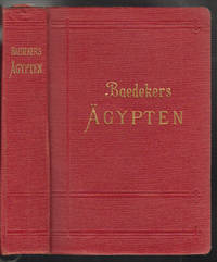
0761-18Lpz. Baedeker 1913. 7. Aufl. kl.-8°. CXC 438 S. Mit 21 teils gefalt. farb. Karten 84 teils gefalt. farb. Plänen u. 55 Abb. OLn. Tit. gestemp. sonst in sehr gutem Zustand. Hinrichsen D 493 - . Lpz., Baedeker 1913. unknown
19047550ALeipzig, Baedeker, 1904. Kl.8°. LXIV, 591 S. Mit 25 Karten, 32 Plänen und 4 Grundrissen. OLn. mit Deckel- und RVg. 2. Auflage.
19137551ALeipzig, Baedeker, 1913. Kl.8°. CXC, 438 S. Mit 21 Karten, 84 Plänen und Grundrissen und 55 Abbildungen. OLn. mit Deckel- u. RVg. 7. Auflage.
190841322ABLeipzig, Karl Baedeker, 1908. 5. Aufl. 8°. CXXVIII, 442 S. Mit 15 Karten, 25 Plänen, 5 Grundrissen, 2 Tafeln u. 1 Panorama von Athen. Originalleinwand. Vergold. Rücken-u. Deckeltitel. Lesebändchen. Etw. ber. u.best. Tls. l. gebr. u. fl., 2 Bll. lose. Insgesamt guter Zustand. 5
189524610ABLeipzig, Baedeker, 1895. X, 492 S. Mit 28 Karten u. 25 Plänen. OLn., 24610A.jpg 24. Aufl.
188839792Lpz., Baedeker, 1888. mit 8 teils gefalt. Karten u. 14 Plänen, Kl.-8°, OLwd. (Rücken unterlegt, Vorsätze erneuert)
19311582-05Lpz., Baedeker 1931. kl.-8°. XVIII, 8 Bll., 228 S. Mit 8 teils mehrf. gefalt. farb. Karten, 8 teils mehrf. gefalt. farb. Plänen u. 13 Grundrissen. OLn. In sehr gutem Zustand.
192348338Karl Baedeker Leipzig 1923. Sm. 8vo. Sixth Edition with double-page map as frontispiece double-page coloured map 9 folding coloured maps 13 folding plans and numerous plans in the text series catalogue on front endpapers and rear endpaper map; original series binding of red grained red cloth upper board framed in blind and lettered in gilt radial corners gilt back marbled edges silk marker a remarkably well-preserved near fine copy. The folding maps and plans are on japon. SCARCE WITH ALL MAPS. Hinrichsen E65. Karl Baedeker, Leipzig, hardcover
19294936753George Allen & Unwin 1929. This is an ex-library book and may have the usual library/used-book markings inside.This book has hardback covers. In fair condition suitable as a study copy. Flexicover. Complete with maps. Please note the Image in this listing is a stock photo and may not match the covers of the actual item500grams ISBN: George Allen & Unwin hardcover
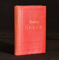
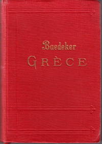
1910890T5Leipzig: Karl Baedeker 1910. Cloth. Very Good. 6.5" by 4.5". Not Stated. A smart copy of this informative travel guide to Greece from Baedeker with folding maps. French language. French. Illustrated with a panorama of Athens seventeen maps thirty-two plans and two plates six of which are folding. With a large map inserted into the rear pocket. Collated complete. A detailed travel guide book to Greece with chapters on Athens Corinth Delphi Livadia Thebes Larissa Aetolia Mykonos Andros Corfu Ithaca Zante and more. Written by Karl Ludwig Johannes Baedeker a German publisher whose company Baedeker set the standard for authoritative guidebooks for tourists. In the original red cloth binding. Externally smart with light shelf wear and bumping to the extremities. Minor fading to the spine and the odd small mark to the boards. Internally firmly bound. Pages are very bright with the odd spot or handling mark. Light age toning to the endpapers. Very Good Karl Baedeker hardcover
19041202090163Leipzig : K. Baedeker ; New York : C. Scribner's Sons 1904. Hardcover. Very Good. 16mo. Red cloth. ciii 660 p. 70 leaves of plates 28 folded : col. maps plans ; 16 cm. Clean unmarked pages. Previous owner's name inscribed in ink to reverse of front cover. Front fold-out map of the Eastern United States included in three pieces with tears and extremely delicate paper. Back fold-out map of the Western United States has a few small tears but still attached and in-tact. All other colored fold-out maps appear in excellent shape without tears or excessive wear. Good binding. Negligible rubbing to cover. Gilt lettering on cover still bright. Numerous maps of various U.S. cities portray the prevalent use of the grid pattern in city planning. Also included is a plan of the Metropolitan Museum of Art Ground and Upper Floors and a map of the Yucatan Peninsula.<br><br>Founded in 1827 Baedeker guides gained popularity during the second half of the 19th century so much so that Baedekering became part of everyday language. They were an invaluable and essential part of "civilized travel" in the fin-de-siecle. Baedeker was known for both its accuracy and attention to detail. Included in each are intricate colored fold-out maps and floor plans. Baedeker's comments and recommendations open a fascinating window into the mores of a world now past. <br><br>An interesting side note: Literary references to Baedeker's abound from E. M. Forester's A Room with a View to Mark Twain's A Tramp Abroad. T.E. Lawrence is reputed to have used Baedeker's guide to Palestine during his Doctoral work in the Levant and prompted his Allied superiors to make facsimile copies during WWI. <br><br>During the Luftwaffe's Vergeltungsangriffe the guides were important enough to be reportedly cited by Gustav Braun von Stumm that "We shall go out and bomb every building in Britain marked with three stars in the Baedeker Guide."3 In the so-called "Baedeker Blitz" of 1942 the English cities of Exeter Bath Norwich York and Canterbury were bombed. Leipzig : K. Baedeker ; New York : C. Scribner's Sons hardcover
19047534ALeipzig, Baedeker, 1904. Kl.8° CXXXIV, 438 S. Mit 1 Panorama von Athen, 11 Karten, 19 Plänen, 5 Grundrissen und 2 Tafeln. 4. Auflage.
191219877ABWien und Leipzig, Hartleben, 1912. VII + 1 + 336 S. OLwd., Einband Zweite Verbesserte und vermehrte auflage Leichte Gbrsp.
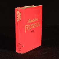
1971980Y3London: George Allen and Unwin Limited 1971. Cloth. Near Fine/Very Good. 6.5" by 4.5". Not Stated . A facsimile printing of this culturally significant Russian handbook from Karl Baedeker. Facsimile of the first English edition. A special edition for the Readers Union Group of Book Clubs. With the original clipped dust wrapper.Illustrated with forty maps and seventy-eight plans thirteen of which are folding. Collated complete. The original English edition of this handbook was made quickly obsolete with reprinting stopped following the war and revolution. The Russia described here was experiencing the most critical two decades of its history but catches the nation still open to western tourists. Covers not only Russia but Poland Finland Persia Manchuria and Peking. These 'Baedeker' handbooks set the standard for authoritative guidebooks for tourists conveniently designed to be carried around in a pocket and available for reference on maps and information regarding routes travel facilities noteworthy sights attractions and museums written by specialists. In the original cloth binding. With the original clipped dust wrapper. Externally excellent with only slight cocking to the spine and minor shelf wear. Dust wrapper is smart with edge wear and a small closed tear to the spine. Translucent film to the wrapper coming away slightly in places. Internally firmly bound with bright and clean pages. Near Fine George Allen and Unwin Limited hardcover
1910996N17Leipzig: Karl Baedeker 1910-1912. Cloth. Very Good Indeed. 6.5" by 4.5". Unknown. Three insightful and informative travel handbooks for exploring Paris Switzerland or Western Scandinavia from a travel publishing authority. Informative and insightful travel handbooks Paris Switzerland and Norway written by German publisher and travel authority Karl Baedeker. All revised editions published between 1910-1912.In the publisher's original red cloth.As well as offering tourists travel routes and handy hotels to stay Baedeker also offers valuable information regarding different areas of towns. - Paris and its Environs with Routes from London to Paris. The seventeenth revised edition. Contains twenty-one folding colour maps and plans as well as four other monochrome folding plans and numerous other colour and monochrome maps and plans. Collated complete. 1910.- Switzerland and the Adjacent Portion of Italy Savoy and Tyrol. The twenty-fourth edition. Contains a colour map frontispiece as well as forty-eight other colour folding maps and plans eight folding panoramas including one in colour and numerous other colour and monochrome maps and plans. Collated complete. 1911.- Norway Sweden and Denmark with Excursions to Iceland and Spitzbergen. The tenth edition. Contains a colour map frontispiece as well as twenty-nine other colour folding maps and plans a folding panorama and numerous other colour and monochrome maps and plans. Collated complete. 1912. In the publisher's original red cloth. Externally smart with minimal marks to boards. Minor bumping to the heads and tails of the spines and to the extremities. Slight fading to spines and rubbing to joints of Paris marginally heavier to Switzerland. End papers are bright and clean in Norway slight browning and age toning to front end papers of Switzerland and Paris. Internally firmly bound. Pages are bright and clean with minor age toning to Switzerland and Paris with marginal crinkling to the rare leaf and folding map extremities of Switzerland. Slight browning to Index and Plans covers inside Paris. Very Good Indeed Karl Baedeker hardcover
1914964T16Leipzig: Karl Baedeker 1914. Cloth. Very Good. 6.5" by 4.5". Not Stated. A smart seventh edition of this practical handbook for travelling in Egypt and Sudan from renowned German publisher Karl Baedeker. Seventh remodeled edition. Illustrated with twenty-two maps and eighty-five plans eleven of which are folding as well as fifty-five vignettes. Collated complete. Baedekers guides often referred to simply as "Baedekers" contain maps and introductions to the country or area information about routes and travel facilities and descriptions of noteworthy buildings sights attractions and museums. These guides written by specialists set the standard for authoritative guidebooks for tourists. This guide provides information on travelled around Egypt and the Sudan with reference to conveyances public safety dialect geographical political and historical notes and more. Written and developed by Karl Ludwig Johannes Baedeker a German publisher descended from a long line of printers booksellers and publishers. In the original full cloth binding. Externally smart with light rubbing and minor bumping to the extremities. Internally firmly bound. Pages are very bright with light scattered spotting and age toning to the extremities. Very Good Karl Baedeker hardcover
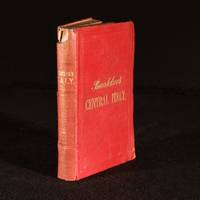
1869977Y46Coblenz : Karl Baedeker 1869. Cloth. Good Only. 6.5" by 4.5". Not Stated . The scarce second edition of this Baedeker travel guide being the second of three 'Italy' volumes. Second edition revised and augmented. In the original red cloth binding. With three maps and eight plans four of which are folding. Collated complete. A scarce early Baedeker handbook being the second of three parts dedicated to exploring Italy this volume providing various routes and excursions around central Italy and Rome as well as practical hints on expenses public safety hotels restaurants climate and art. These 'Baedeker' handbooks from the company of German publisher Karl Baedeker set the standard for authoritative guidebooks for tourists. Lacking the last four pages prior to the rear folding plans. In the original cloth binding. Externally with loss to the head of the spine and a closed split to the middle of the rear joint's cloth. General rubbing and bumping to the extremities. Internally lacking the last four pages prior to the rear folding plans. Pages are generally bright with a large tide mark visible until around p. 120 and fading up until that page. Scattered spots throughout. Small contemporary ownership inscription to the front free endpaper. Good Only Karl Baedeker hardcover
112152Leipzig and Paris Karl Baedeker 1910. 8vo. XVIII XVIIIa-h XIX-CII 468 pp. 27 plates mostly folding large fold. map loose in pocket. Publ. red cloth marbled boards. Owner’s signature of Lars-Olof Skoglund. Hinrichsen F216. First and only French edition of Greece. hardcover
1914163359Leipzig: Karl Baedeker 1914. Seventh remodelled edition. Very nice copy. small octavo. limp red boards cxc 458pp. colour maps & plans index 22 maps 85 plans and 55 vignettes. OwnersÕ bookplate on verso of front end paper o/w a superb crisp copy. All maps in fine order Karl Baedeker hardcover
18795168Leipzig: Verlag Von Karl Baedeker. 1879. Eighteenth Edition. Hardcover. Very Good-. Boards a bit worn and with tears along outer hinge. Front endpaper chipping and detached but present. Hinges gapping. Small tear to front map. Former owner's name on front endpaper. Marginal light dampstains to last few pages; 16mo; 528 pages . Verlag Von Karl Baedeker hardcover
1392Handbuch für Reisende.- XXIV 286 p. 44 p. advert. 23 Karten 16 Plaenen und 2 Panoramen. Leipzig : Baedeker 1921 BAEDEKER K. Keywords Europe Europa Germany Deutschland Austria Travel Guide Voyages Travel Book # 1392 unknown
190925924Leipzig, Paris, K. Baedeker, P. Ollendorff, 1909 [14° éd.], in-16, LXXVIII, 503pp, 20pp. (indicateur et plans de Rome), 19 cartes, 55 plans et 1pl, cartonnage d'éditeur en percaline rouge, dos lisse orné, tranches marbrées, 19 cartes et 55 plans, dessins et vues, et 1 planche reproduisant les armoiries papales depuis 1417. Nouvelle édition, revue et mise à jour. Elle comprend des plans nouveaux de l'île d'Elbe, des environs de Sienne, de Montepulciano, de San Gimignano et d'Urbino. Les plans de Faenza, Forli, Orvieto, Ostie et Volterra sont entièrement refondus. Bon exemplaire. LXXVIII, 503pp., 20pp.
191415517Baedeker, Ollendorff Leipzig, Paris 1914 1 vol. In-12 de XXVI 488 pp. 1 f.n.ch. 60 pp. 1 f.n.ch. (indicateur et plans avec couverture imprimée conservée), pleine percaline rouge éditeur, titre doré sur le premier plat, tranches marbrées.
25924Couverture rigide. Bon/1909. in-16. Leipzig Paris K. Baedeker P. Ollendorff 1909 14° éd. in-16 LXXVIII 503pp 20pp. indicateur et plans de Rome 19 cartes 55 plans et 1pl cartonnage d'éditeur en percaline rouge dos lisse orné tranches marbrées 19 cartes et 55 plans dessins et vues et 1 planche reproduisant les armoiries papales depuis 1417. Nouvelle édition revue et mise à jour. Elle comprend des plans nouveaux de l'île d'Elbe des environs de Sienne de Montepulciano de San Gimignano et d'Urbino. Les plans de Faenza Forli Orvieto Ostie et Volterra sont entièrement refondus. Bon exemplaire. unknown