[La Perouse]Biblio.com

88 résultats
180021185London 1800. Very good overall. Copper engraving of two Tlingit women of the Pacific Northwest. Port des Francais is now known as Lituya Bay in southeast Alaska. The engraving depicts the women at the sea coast seated under trees wearing fur cloaks one viewed in profile each with lip plates or labrets. Engraved by Deeves after a drawing by Prior. From Voyage de La Perouse Autour du Monde. 4to 8x 10" paper; 6 1/4 x 8 1/2" image. unknown
1797558961797. From the Voyages of La Pérouse who set sail from France in 1785 to continue the discoveries of Captain Cook. He was shipwrecked in 1788 but his narrative maps and views survived and were published in 1797. Thirty-eight years later the scattered remains of La Boussole and L'Astrolabe was discovered wrecked on a vicious reef on an atoll in the New Hebrides. Engraved by Le Pagelet. Size: 250 x 180 mm. Fine condition. Some foxing to the lower margin not affecting the image. unknown
1797014743Paris: L'Imprimerie de la Republique 1797. Print measures 40x25.cm. Some light surface wear stain mark on margin. Print in good clean condition. . Near Very Good. Illus. by Godefroy. L'Imprimerie de la Republique unknown
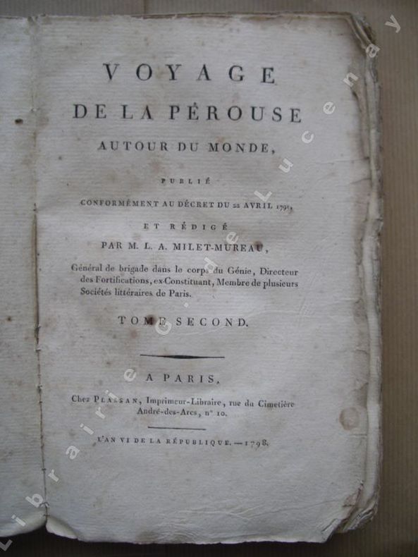
179817370Paris Plassan 1798 - An VI in-8 br. non rogné. T II : (2ff.), 414pp. ;T III : 316pp., (74ff.) ; T IV: (2ff.), 328pp.
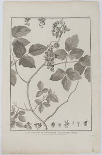
1798175968London. 1798. Engraving on watermarked wove paper 33.3 x 24.9 cm plate mark 42 x 26.6 cm sheet edges a little browned and dusty but a very good dark impression. Fine botanical illustration of the climbing chili prepared for the 'Account of the Voyage of Jean-François Galaup-La Pérouse' 1785-1788 the great but ill-fated French voyage of discovery and exploration. Guillaume Prevost was botanical artist on the ship L'Astrolabe and from a noted family of botanical artists. . unknown
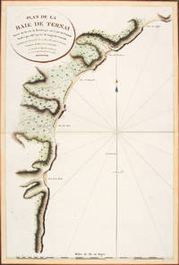
179756364Atlas Du Voyage De La Pérouse. Paris: L'Imprimerie de la Republique. 1797. A crisp clear map of the Bay of Ternai in Tartary. Relief shown by hachures; depths by soundings. From the Voyages of La Pérouse who set sail from France in 1785 to continue the discoveries of Captain Cook. He was shipwrecked in 1788 but his narrative maps and views survived and were published in 1797. Thirty-eight years later the scattered remains of La Boussole and L'Astrolabe was discovered wrecked on a vicious reef on an atoll in the New Hebrides. Copper engraving. Fine condition; slight browning and foxing to wide margins not affecting the image. Hand coloured. Size: 42.5 x 56.5 cm. 16½ x 22 inches unknown
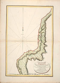
179755865Atlas Du Voyage De La Pérouse. 1797. From the Voyages of La Pérouse who set sail from France in 1785 to continue the discoveries of Captain Cook. He was shipwrecked in 1788 but his narrative maps and views survived and were published in 1797. Uglegorsk Region Russia Full Title: Plan de la Baie d'Estaing. Situee a la cote de l'ouest de Tchoka par 48059'38" de latitude nord et par 14000'42" de longitude orientale prise du mouillage de l'Astrolabe. Cette Baie fut decouverte le 20 juillet 1787 par les Fregates Francaises la Boussole et l'Astrolabe commandees par MM. de La Perouse et de Langle. L. Aubert scripsit. Atlas du Voyage de la Perouse no. 51. Paris: L'Imprimerie de la Republique An V 1797. Engraved by AUBERTL. Size: 255 x 400 mm. Copper engraving. Uncoloured. Very good condition. unknown
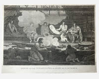
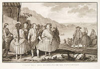
1798003682G. G & J. Robinson. LA PEROUSE Jean Francois; DUCHÉ DE VANCY Jean Baptiste; HEATH James. Dress of the Inhabitants of Baie de Castries. An engraving from the atlas volume of plates of the voyage of Jean-François de Galaup comte de La Pérouse published in London by G. G. & J. Robinson Paternoster Row 1798. Copper-engraving plate no. 54 after a drawing by the Duché de Vancy engraved by Heath with the imprint "Published as the Act directs Nov. 1st 1798". 330x220mm light uniform toning mild marginal soiling a little show-through from the verso but a clean well-defined impression with good margins. Overall very good. Image depicting domestic life costume and material culture of the Indigenous inhabitants of Baie de Castries on the north-west coast of America then described as the eastern coast of "Tartary" in contemporary French and British geographical usage. This plate forms part of the celebrated series of engravings prepared for the posthumous publication of La Pérouse's voyage 1785-1788 documenting the French expedition's survey of the North Pacific including Alaska the Sea of Japan Kamchatka and the northwest coast of America. The draughtsman Jean-Baptiste Claude Duché de Vancy served as official artist to the expedition while Heath was one of the principal London engravers engaged for the English edition of the atlas. The scene records the built environment clothing and domestic practices observed at Baie de Castries during La Pérouse's brief but historically important visit in 1786 shortly before the expedition's disappearance in the South Pacific. . Very Good. Soft cover. 1st Edition. 1st Printing. 1798. G. G & J. Robinson paperback
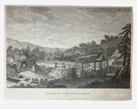
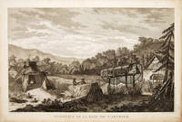
1798003681G. G & J. Robinson. LA PAROUSE John Francis Galaup; DUCHÉ DE VANCY Jean Baptiste; HEATH James: Tombs of Baie de Castries. An engraving from Charts and Plates to La Pérouse's Voyage London: G. G. & J. Robinson 1798. Copper engraving 310 × 230 mm plate on laid paper with good margins; plate mark visible; light overall toning and a few faint spots with a shallow horizontal fold as issued otherwise in very good condition. A view of the tombs at Baie de Castries showing a small settlement with two figures in the foreground and the distinctive raised wooden burial structures. Bais de Castries described in contemporary sources as lying on the eastern coast of Tartary corresponds to the North Pacific explored by La Perouse in 1787 in the region now identified with the northwest coast of America southeast Alaska. The drawing was made by Jean-Baptiste Louis Claude Théodore duc de Vancy one of the official artists attached to the expedition of Jean-François de Galaup comte de La Pérouse whose role was to record landscapes sites and customs encountered during the voyage. La Perouse and his crew wouldn't make it back to Paris with it latterly being discovered that his ship was wrecked at Vanikoro now the Solomon Islands. The plate was engraved in London by James Heath among the leading line engravers of the late eighteenth century and published by G. G. & J. Robinson for the atlas volume Charts and Plates to La Pérouse's Voyage Round the World issued in 1798 as part of the English edition of the expedition's results. . Very Good. Soft cover. 1st Edition. 1st Printing. 1798. G. G & J. Robinson paperback
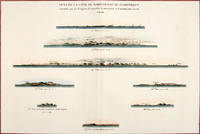
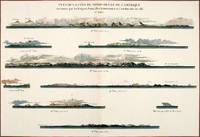
179756369Paris: 1797. Eight profiles showing Mt. la Touche Baie de la Touche present Englefield Bay C. Hector present Cape St. James I. Kerouard Iles Sartine Scott Islands and Cap Blanc. The map is from the Voyages of La Pérouse who set sail from France in 1785 to continue the discoveries of Captain Cook. He was shipwrecked in 1788 but his narrative maps and views survived and were published in 1797. Thirty-eight years later the scattered remains of La Boussole and L'Astrolabe was discovered wrecked on a vicious reef on an atoll in the New Hebrides. Atlas Du Voyage De La Pérouse. Paris: Copper engraving. Very good condition; slight browning along the centrefold and foxing to wide margins a tear to the bottom margin along the centrefold not affecting the image. Hand coloured. Size: 58.5 x 43 cm. unknown
179756368Paris: 1797. Nine profiles showing Mt. Beautems Mt. Crillon Mt.St. Hyacinthe Port Guibert Iles des Espagnols Iles Necker Necker Islands Ile Sn. Carlos Pointe des Brisants present Estevan Point and Baie Clonard Beresford Bay. The map is from the Voyages of La Pérouse who set sail from France in 1785 to continue the discoveries of Captain Cook. He was shipwrecked in 1788 but his narrative maps and views survived and were published in 1797. Thirty-eight years later the scattered remains of La Boussole and L'Astrolabe was discovered wrecked on a vicious reef on an atoll in the New Hebrides. Atlas Du Voyage De La Pérouse. Paris: Copper engraving. Very good condition; slight browning along the centrefold and foxing to wide margins a tear to the bottom margin along the centrefold not affecting the image. Hand coloured. Size: 58.5 x 43 cm. unknown
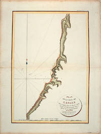
179755866Paris: L'Imprimerie de la Republique.Atlas Du Voyage De La Pérouse. 1797. From the Voyages of La Pérouse who set sail from France in 1785 to continue the discoveries of Captain Cook. He was shipwrecked in 1788 but his narrative maps and views survived and were published in 1797. Tomari Region Russia ; Sakhalin Russia Full Title: Plan de la Baie de Langle. Situee a la partie ouest de l'Ile de Tchoka par 47048'36" de latitude nord et 139057'54" de longitude orientale. L. Aubert scripsit. Atlas du Voyage de la Perouse no. 49. Paris: L'Imprimerie de la Republique An V 1797. Engraved by AUBERTL. Size: 255 x 400 mm. Copper engraving. Hand coloured. Very good condition. unknown
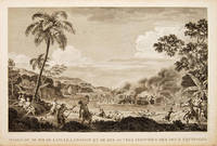
179755648Atlas Du Voyage De La Pérouse. 1797. Scene showing the locals attacking voyagers as they disembark from their boats. From the Voyages of La Pérouse who set sail from France in 1785 to continue the discoveries of Captain Cook. He was shipwrecked in 1788 but his narrative maps and views survived and were published in 1797. Copper engraving. Very good condition. slight browing around edges but not effecting image Uncoloured. Size: 40 x 25.5 cm. 15½ x 10 inches unknown
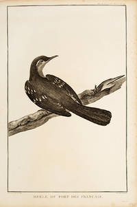
179755672Paris. 1797. Print of an Alaskan Merle Bird. From the Voyages of La Pérouse who set sail from France in 1785 to continue the discoveries of Captain Cook. He was shipwrecked in 1788 but his narrative maps and views survived and were published in 1797. Atlas Du Voyage De La Pérouse. Size: 255 x 400 mm. Copper engraving. Uncoloured. Very good condition. Slight browing around edges but not effecting image. unknown
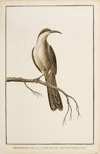
179755673Paris. 1797. Print of a Californian Cape bird. From the Voyages of La Pérouse who set sail from France in 1785 to continue the discoveries of Captain Cook. He was shipwrecked in 1788 but his narrative maps and views survived and were published in 1797. Atlas Du Voyage De La Pérouse Size: 255 x 400 mm. Copper engraving. Uncoloured. Very good condition. Slight browing around edges but not effecting image. unknown
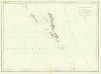
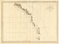
1797151Paris: Imprimerie de la République 1797. First Edition. Folio Leaf. Very Good. Hérault / Bouclet. Elephant Folio. Leaf measures 33.25" x 23.25" while the printed chart is 26.5" x 19.5". Fold at center as issued. Condition is Very Good with very light foxing within the plate and slightly darker foxing in the top right margin. A dampstain the size of a fifty-cent piece at the lower right corner outside the border rule and not affecting print impression. La Pérouse was France's answer to Captain James Cook. Directed by King Louis XVI to explore and chart the Pacific in 1785 La Pérouse set sail from France with the frigates Boussole and Astrolabe . and never returned. After years of speculation and expeditions sent in search of the ships their 1788 shipwrecked-fate in the South Seas was finally ascertained. Prior to disappearing La Pérouse dispatched a courier homeward overland via Russia with his narrative charts and artist-depictions to-date. His achievements were published in 1797 including this chart.<p>This chart covering the coastline from Cape Rond Tillamook Head northward to the Baie de Clonard present-day Queen Charlotte Islands or Haida Gwaii was the only chart of the region other than works by or based on Cook's efforts. Three Spanish voyages and Cook's third voyage had visited the west coast of now-known Vancouver Island before La Pérouse. As depicted in this chart the land mass is not yet known by the place-name "Vancouver" nor is it recognized as an island. LADA-MOCARSKI 52 claims the best charting by La Pérouse is on the Asian side of the Pacific. Indeed it must be noted that La Pérouse like Cook missed both the Columbia River and the Strait of Juan de Fuca. See WAGNER Cartography of the Northwest Coast of America 840. Imprimerie de la République unknown
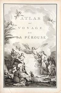
179066877Paris. c.1790. An extremely decorative title page featuring a huge scrolled map assorted angels and winged cherubs together with various seated and standing peoples of the world undoubtedly encountered during the La Perouse voyages. Size: 445 x 295 mm. Copperplate engraving. Good condition. unknown
179756362Paris: 1797. Fine sea chart of the bay and Bio Bio River region with great topographical and hydrological detail. Villages and Fort St. Pierre are depicted. From the Voyages of La Pérouse who set sail from France in 1785 to continue the discoveries of Captain Cook. He was shipwrecked in 1788 but his narrative maps and views survived and were published in 1797. Thirty-eight years later the scattered remains of La Boussole and L'Astrolabe was discovered wrecked on a vicious reef on an atoll in the New Hebrides. Copper engraving. Very good condition; slight browning to the centrefold. Hand coloured. Size: 57 x 42 cm. unknown
1798496London: G & T Robinson 1798. The English edition of a map published to accompany La Perouse' Voyage. G&T Robinson Nov. 1st 1798. Covers from the Gulf of Carpentaria to the Solitaire Islands to the Navigator Islands in the east and to above New Guinea. Charts Maurelle's tracks. G & T Robinson unknown
1797016788Paris: La Perouse 1797. Map. Very good condition. Unbound. First Edition. Folio. A large map beautifully decorated with original outline color. The map is included in the Atlas volume of La Perouse's Voyages but was drawn from Spanish manuscripts as it was thought that it might be a part of the Northwest Passage. The map has an extra vertical crease from mis-folding but is quite clean and has large margins which are lightly soiled here and there. La Perouse Paperback
174052760Atlas du Voyage de la Pérouse. c.1740. A beautiful picture with four people in the foreground and others in the background against a backdrop of the sea. Engraved by Thomas. Atlas du Voyage de la Pérouse. Original copper engraving. Fine condition. Black & white. Size: 39.6 x 26.5 cm. unknown
1797M2909Paris 1797. Very Good; light dampstain on lower margin. Size : 494x677 mm 19.375x26.625 Inches Coloring: Black & White Category: Maps Polar Arctic Regions Alaska Greenland Iceland; unknown
178624580Paris 1786. Other. In excellent condition. 490 by 860mm 19¼ by 33¾ inches. Copper engraving uncolored as published. unknown
178624536Paris 1786. Other. In excellent condition. 495 by 685mm 19 by 27 inches. 495 by 685mm 19 by 27 inches. Copper Engraving uncolored by La Perouse Jean-Francois de Galup published 1786 by Paris. Image size: 495 by 685mm 19 by 27 inches. By Lapérouse among the rarest and most historically important charts of the Northwest Coast ever produced. Jean-François de Galaup Comte de Lapérouse 17411788 was the foremost French navigator and explorer of the late 18th century. Commissioned by Louis XVI to lead a major scientific and commercial expedition to the Pacific he departed Brest in 1785 with two frigates the Boussole and the Astrolabe and spent three years charting the Pacific and North American coasts with extraordinary precision. His charts of the Northwest Coast of North America 1786 were the first scientific surveys of many sections of that coastline and were published posthumously in the celebrated four-volume Voyage de Lapérouse autour du monde 1797. The expedition disappeared without trace near Vanikoro in 1788. Lapérouse's charts are among the most historically important and rarest maps of the Pacific and Northwest Coast ever produced.This antique map of Carte Particuliere de la Còte du Nord-Quest de L Amerique r was published in 1786 by Paris 495 by 685mm 19 by 27 inches. It is printed as a copper engraving uncolored. The map documents the region with careful attention to rivers settlements roads and political boundaries reflecting the geographical knowledge available at the time of publication and offering an invaluable primary source for historians and collectors of North American antique cartography. In excellent condition. 495 by 685mm 19 by 27 inches. unknown
179755668Atlas Du Voyage De La Pérouse. 1797. From the Voyages of La Pérouse who set sail from France in 1785 to continue the discoveries of Captain Cook. He was shipwrecked in 1788 but his narrative maps and views survived and were published in 1797. Size: 400 x 255 mm. Copper engraving. Uncoloured. Very good condition. slight browing around edges not affecting image. unknown