La PerouseBiblio.com
88 résultats
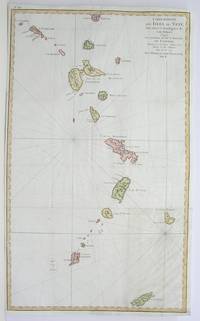
1796M3355Paris 1796. Very Good; lower margin extended. Size : 606x362 mm 23.875x14.25 Inches Coloring: Hand Colored Category: ; Maps West Indies Whole unknown
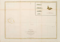
179755873Paris: 1797. From the Voyages of La Pérouse who set sail from France in 1785 to continue the discoveries of Captain Cook. He was shipwrecked in 1788 but his narrative maps and views survived and were published in 1797. Sea chart showing Necker Island a small island in the Pacific Ocean part of the Nortwestern Hawaiian Islands. La Perouse was the first European to visit the island in 1786. Map inset in the right top corner showing profiles of the island from different angles. Atlas Du Voyage De La Pérouse. Size: 680 x 485 mm. Copper engraving. Hand coloured. Very good condition. Faint waterstain to the left vertical fold. Good margins. Watermarks. Folds as issued. unknown
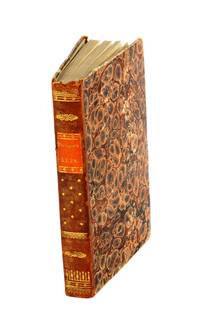
179953594Leipsick No publisher 1799. Contemp. hcalf. Spine gilt and with gilt lettering. XXXVI562 pp. 5 engraved plates and 1 large folded engraved world map: "Mappemonde ou Carte réduite des Parties connues du Globe pour servir au Voyage de la Pérouse." 52 x 425 cm. A few margins of text at beginning and at end stained. The portrait lacks. <br/><br/><em>Sabin 38959. </em> unknown
179953594Leipsick, No publisher, 1799. Contemp. hcalf. Spine gilt and with gilt lettering. XXXVI,562 pp., 5 engraved plates and 1 large folded engraved world map: ""Mappemonde ou Carte réduite des Parties connues du Globe pour servir au Voyage de la Pérouse..."" (52 x 42,5 cm.). A few margins of text at beginning and at end stained. The portrait lacks.
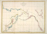
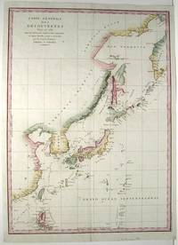
179755870Paris: 1797. A large and imposing sea chart of the North Pacific ocean. From the Voyages of La Pérouse who set sail from France in 1785 to continue the discoveries of Captain Cook. He was shipwrecked in 1788 but his narrative maps and views survived and were published in 1797. Copper engraving. Very good condition. Watermarks. Good margins. Hand coloured. Size: 68.5 x 49.5 cm. unknown
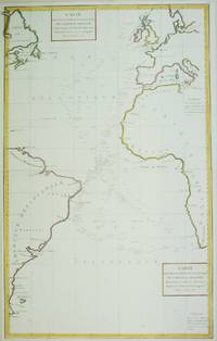
1788M6850Paris 1788. Very Good; laid on acid-free paper for long-term preservation. Notes: This handsome sea chart that indicates magnetic needle readings along various routes through the Atlantic. Size : 850x532 mm 33.46x20.94 Inches Coloring: Hand Colored in Outline Category: Maps Sea Chart; Maps Ocean Atlantic; unknown
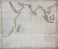
1788M7032Paris 1788. Very Good;. Notes: An 18th century mapping of the Indian Ocean. This handsome sea chart depicts magnetic needle readings along various routes in the ocean from the Cape of Good Hope le Cap des Aiguilles to the South East Asian archipelago. Size : 511x583 mm 20.12x22.95 Inches Coloring: Hand Colored in Outline Category: Maps Sea Chart; Maps Ocean Indian; unknown
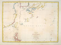
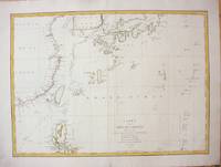
179755879Paris:. 1797. From the Voyages of La Pérouse who set sail from France in 1785 to continue the discoveries of Captain Cook. He was shipwrecked in 1788 but his narrative maps and views survived and were published in 1797. Fine large chart shows the southern coast of China Japan Korea Formosa & the Philippines and the Marianas as well as many small islands in the region. Locates the tracks of the Boussoles the Astrolabe the ships of La Perouse on his voyage from Manila to Kamtschatka. Chart shows very detailed soundings and all known harbours straits and island chains. Engraved by BOUCLET. Atlas Du Voyage De La Pérouse Size: 675 x 490 mm. Copper engraving. Hand coloured. Fine condition. Slight browning to the lower margin. Good margins. unknown
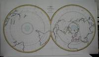
1788M5521Paris 1788. Very Good folding map flattened and folds reinforced laid on acid free canvas for long term preservation. Notes: "Double hemispherical world map with each hemisphere shown on polar projection. Plate probably accompanied: Histoire naturelle generale et particulare / George Louis Leclerc Buffon. Paris 1749-1804. Plate "No. 8" of an 8 sheet map which was probably compiled from the reports of La Perouse’s last voyage in the Pacific and is by Jean-Charles Borda." National Library of Australia Digital Collection map-rm3253 Size : 480x940 mm 18.875x37 Inches Coloring: Hand Colored in Outline Category: ; Maps Polar Antarctic Regions; Maps Polar Arctic Regions unknown
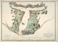
179755881Paris: 1797. From the Voyages of La Pérouse who set sail from France in 1785 to continue the discoveries of Captain Cook. He was shipwrecked in 1788 but his narrative maps and views survived and were published in 1797. Thirty-eight years later the scattered remains of La Boussole and L'Astrolabe was discovered wrecked on a vicious reef on an atoll in the New Hebrides. Attractive sea chart showing the entrance to Port des Français. Engraved by BOUCLET. Atlas Du Voyage De La Pérouse. Size: 680 x 495 mm. Copper engraving. Hand coloured. Fine condition. Good margins. unknown
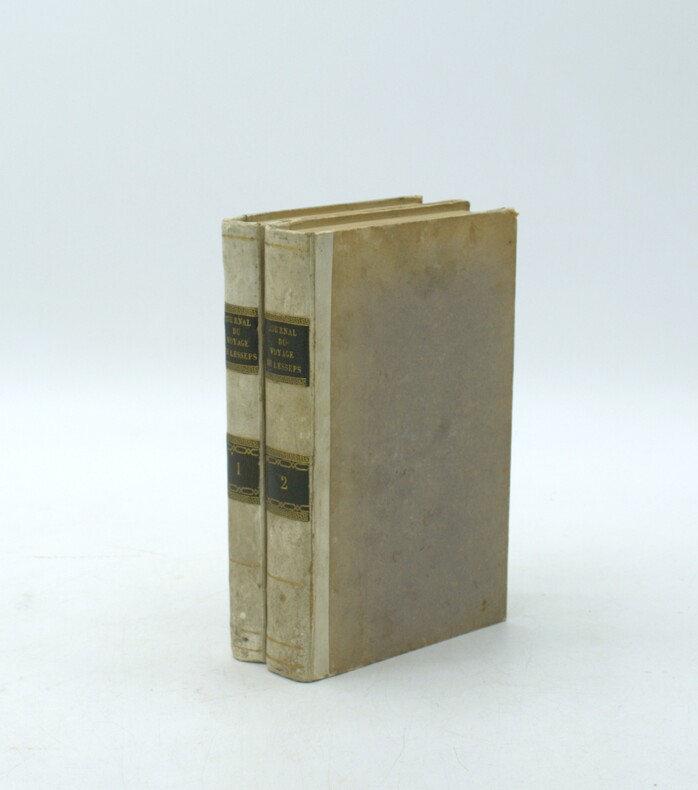
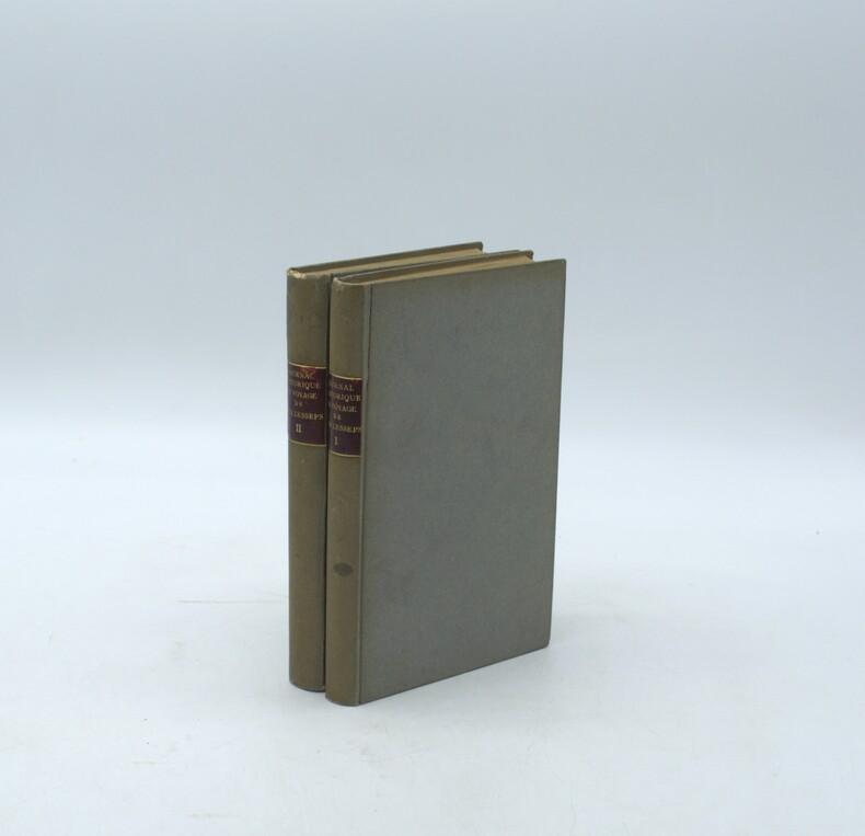
1790PHO-2166Paris, de l’Imprimerie Royale, 1790. 2 volumes in-8° (20 × 12,5 cm), demi veau ivoire, dos lisse avec pièces de titre et tomaison maroquin noir, (6)-VII-1-280 pp. ; 4 ff., 380 pp., VI pp. d’errata. Illustré de deux cartes dépliantes (Kamtschatka ; Route de M. de Lesseps) manque la planche dépliante (Caravane kamtschadale). Petits défauts, coins usés
1787M7397Paris c.1787. Very Good;. Size : 495x680 mm 19.49x26.77 Inches Coloring: Hand Colored in Outline Category: Maps Asia Far East China; Maps Asia Far East Japan & Korea; unknown
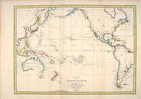
179755869Paris: 1797. A splendid large chart of the Pacific Ocean and of those countries that border it. Only coastal information is given. From the Voyages of La Pérouse who set sail from France in 1785 to continue the discoveries of Captain Cook. He was shipwrecked in 1788 but his narrative maps and views survived and were published in 1797. Copper engraving. Very good condition. Faint waterstain along the left vertical fold. Very slight foxing not affectong the image. Hand coloured. Size: 68.5 x 49.5 cm. unknown
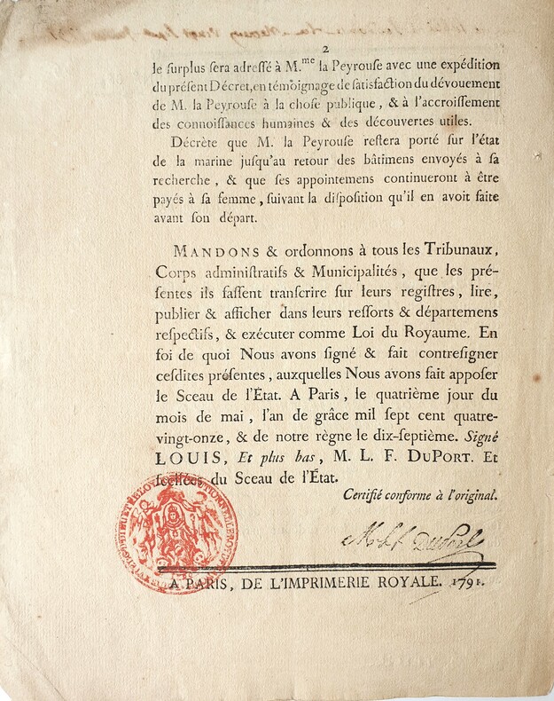
17914196Paris, Imprimerie Royale, 1791. 1791 2 ff. in-folio (244 x 196 mm.) dont 1 blanc. Bandeau gravé surmonté de linscription manuscrite à lencre brune « lu à laudiance du mercredy vingt-sept juillet 1791.» ; tampon officiel rouge et signature à lencre noire in fine. (traces de plis, salissures et défauts dusage). Non relié, conservé tel que paru dans une chemise de papier d'époque.
1797M753Paris 1797. Excellent. Size : 685x495 mm 27x19.5 Inches Coloring: Hand Colored Category: Maps Asia Far East China; Maps Asia Far East Japan & Korea; unknown
1788M6851Paris 1788. Very Good; laid on acid-free canvas for long-term preservation. Notes: This handsome sea chart depicts magnetic needle readings along various routes in the North Pacific ocean.<br> Size : 590x1090 mm 23.23x42.91 Inches Coloring: Hand Colored in Outline Category: Maps Sea Chart; Maps Ocean Pacific; Maps United States West; unknown
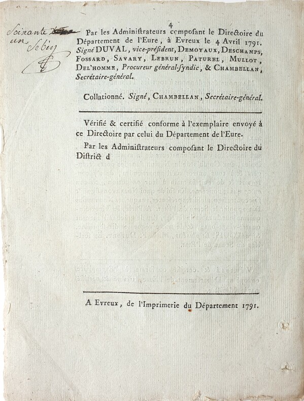
17914212Evreux, Imprimerie du département, 1791. 1791 2 ff. in-folio (244 x 196 mm.) de 4 pp. Imprimées. Bandeau gravé en entéte, note signée à lencre noire en marge de la p. 4. (traces de plis et de trous en marges). Non relié, conservé tel que paru dans une chemise de papier d'époque.
1790PHO-2142Paris, de l’Imprimerie Royale, 1790. 2 volumes in-8° (20 × 13,5 cm), reliés en cartonnage postérieur, dos lisse avec pièces de titre, d’auteur et de tomaison, (6)-VII-1-280 pp. ; 4 ff., 380 pp., VI pp. d’errata. Illustré de deux cartes dépliantes (Kamtschatka ; Route de M. de Lesseps) et d’une planche dépliante (Caravane kamtschadale). Petits défauts, réparations aux faux-titre, titre et 1er feuillet.
17900032791790 A Paris, Chez Letellier, 1789-1790. Deux ouvrages reliés en un volume in-8 (131 X 200) basane fauve, double filet doré en place des nerfs, pièce de titre maroquin ocre, tranches mouchetées en rouge (reliure de l'époque) ; (1) f. blanc, titre, (1) f. d'avis préliminaire, 213 pages ; (1) f. blanc, VIII pages (dont faux-titre et titre), 266 pages, (1) f. blanc. Cernes de mouillures claires à certains feuillets, plus marqués aux premiers feuillets du volume. Manque de papier à l'angle inférieur des feuillets 153/154 et 169/170 de l'ouvrage de Tench, avec perte d'une lettre ("e" final de "espac[e]") au second feuillet. Quelques rares rousseurs. Minimes restaurations à la reliure.
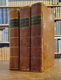
179823577London: John Stockdale 1798. First Stockdale edition. Hardcover. Recently expertly rebacked retaining all original materials some toning to text and plates but a very good copy. 2 volumes contemporary full tan calf by H. Faulkner; 20 cxc 290; viii 442 119 pp 51 engraved plates in the 2 volumes including 3 folding maps in first volume. Printed label at upper corner of verso of front free endpaper: "Bound by H. Faulkner George Court Adelphi." The British Book Trade Directory finds a Henry Faulkner Sr. succeded by Henry Faulkner Jr. at a George Court Adelphi from 1790 to 1825. <br/><br/>Originally published in French in 1797 this is one of two English-language translations published in 1798. This edition preceded earlier in the year by the Johnson edition which had only 41 plates. "The narrative of the enterprising but ill-fated Pérouse is full of interest in all portions but his relations of the peculiarities he observed in the natives of the northwest coast of North America are especially valuable. The mysterious fate of this distinguished navigator has never been satisfactorily cleared up. The above account was transmitted from Botany Bay after leaving this place the expedition was never heard of again" Sabin. In fact recent investigations into the fate of La Perouse have determined that both ships in the expedition were wrecked on the reefs of Vanikoro in the Solomon Islands. Cox I p. 67; Hill 974 observing that "The preface to the Stockdale edition leads one to suppose that the Johnson edition was published slightly earlier; Sabin 38964. John Stockdale hardcover
1798117441Paris: chez Plassan An VI - 1798. In-8 p. mm. 216x136 4 volumi brossura muta coeva dorsi con mancanze pp. 4LXVIII368; 4414; 316148; 4328; con una grande carta geografica più e più volte ripieg. i.e. mappemonde ou carte reduite des parties connues du globe. In Appendice al III volume: Tables de la route de "La Boussole" pendant les années 1785-1786-1787-1788 depuis son départ d'Europe jusqu'à Botany-Bay Tables de la route de "L'Astrolabe" pendant les années 1785-1786-1787 depuis son départ d'Europe jusqu'au Kamtschatka. "Manca l'Atlante di tavole".Relazione del viaggio intorno al mondo in cui si tratta anche di astronomia fisica chimica mineralogia zoologia botanica e medicina. "Seconda edizione" la prima è del 1797 di questa importante opera che fu anche tradotta in varie lingue. Cfr. BrunetIII828 - GraesseIV103 - The Hill Collect. of Pacific Voyages972 per la prima edizione di one of the most important scientific explorations ever undertaken to the Pacific and the West coast of North America.Solo qualche lieve fioriture altrimenti esemplare con barbe ben conservato."Jean-François de Galaup Conte di La Pérouse navigatore francese 1741-1788 ebbe da Luigi XVI il comando di un grande viaggio di circumnavigazione allo scopo di esplorare le regioni ancora sconosciute del Pacifico. Partito con due navi su cui erano alcuni scienziati 1785 si portò all'isola di Pasqua alle Hawaii e quindi lungo le coste dell'Alasca. Nel 1787 toccate le Marianne Macao e Manila costeggiò la Manciuria ed esplorò i mari intorno al Giappone settentrionale spingendosi fino alla Camciatca. Mandò dalla Nuova Olanda le sue ultime notizie in patria e salpato dalla Baia del Botanico con le due navi scomparve per sempre 1788. Secondo le tracce scoperte da P. Dillon e da Dumont d'Urville sarebbe naufragato presso l'isola Vanikoro gruppo S. Croce". Così Diz. TreccaniVI p. 691. chez Plassan, unknown
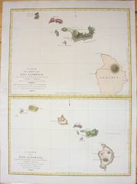
1798M7217Paris 1798. Very Good;small restoration at left margin. Size : 490x678 mm 19.29x26.69 Inches Coloring: Hand Colored Category: Maps United States West Hawaii; unknown
1799PHO-333Paris, Jansen, an VIII (1799) 2 vol. in-8 ,demi-veau havane, dos lisse orné (rel. Légt post., mors usagés et rongés) et un atlas in-folio en seconde édition (1817) brochure moderne en papier marbré. Texte :Tome I : xvi pp. (dont faux-titre et titre), 440 pp.Tome II : 332 pp. (dont le faux-titre et le titre), 109 pp., (1)f. Atlas : titre gravé, grande carte sur double page (Mer des Indes et une partie de celle du Sud, par Darbié du Bocage - volante) et 43 planches (vues, scènes, costumes, portraits et types, faune et flore) gravées sur cuivre par Dien, Copia, Pérée, etc., d'après Piron, Redouté, Audebert, etc. représentant des personnages, des scènes de vie, des armes, des vues, la faune et la flore. Nombreuses piqûres et taches d'humidité, mais papier solide, à bonnes marges.
17993812959Stockholm: Johan Pfeiffer 1799. A few light spots but a very good copy. Small octavo; in attractive original Scandinavian half calf binding. <p><p>Rare Swedish edition of the voyage of La Pérouse whose fame was so widespread that there was a ready market for accounts of his voyage across Europe and beyond. Within four years of the publication of the official French edition in 1797 translations appeared in London Edinburgh Paris Stockholm Leipzig Berlin Copenhagen Haarlem St. Petersburg Boston and Amsterdam.</p> <p>This Swedish version was prepared by Samuel Ödmann from the octavo French edition. He also provides a preface. Not in the catalogue of the Hill collection; Ferguson knew the book only from copies in the Mitchell Library and the Kroepelien Collection Oslo.</p> </p> . Johan Pfeiffer unknown
17988611<p><strong>First visit of a foreigner to missionary establishments in Upper California</strong></p><p>3 volumes. Octavo 8½x5 inches. Pp. x 2 532 x 498 viii 466 1-60 Tables. 42 copper-engraved maps views charts and specimens mostly folding. Full brown calf gilt & blind rules on spines black leather spine labels. Volume I rebacked to match with original spine label and new endpapers. Bookplates on inner covers of volumes II and III. Early inked signature on each title page crossed out ink on verso of titles. Front hinges of volumes II and III broken but attached rear hinges starting. General wear to edges and corners. Most maps and plates foxed or toned small closed tear to p.477-78 of Volume II with remnants of old repair folding frontis plate in volume III with early paper reinforcement on the verso of one fold. Overall a very good set. Collated complete.</p><p>First English edition. "There are three separate translations into English from the original French of which two this one published by Johnson and another one published by Stockdale appeared in the same year 1798. Johnson's was issued slightly earlier. Both of these 1798 editions are abridged. In both first English printings the number of maps were reduced "Stockdale's edition reproduced only fifty-one of the original plates and Johnson's edition only forty-two" Hill. La Perouse sailed to the Pacific and the west coast of North America to examine regions not explored by Cook; to seek the famous Northwest Passage; to obtain information about the fur trade and the Spanish settlements in California; to make scientific observations; and to promote French enterprise in the region. He made valuable contributions to the history of geographical discovery particularly in regard to the American coast. He sent his dispatches from Kamchatka and Botany Bay. After leaving Botany Bay his expedition disappeared and his ships' wrecks were not discovered for another 39 years on one of the Santa Cruz Islands. Hill <em>Collection of Pacific Voyages</em>: p. 974.</p> Printed for J. Johnson, St. Paul’s Church Yard hardcover