104 résultats
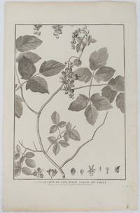
1798175968London. 1798. Engraving on watermarked wove paper 33.3 x 24.9 cm plate mark 42 x 26.6 cm sheet edges a little browned and dusty but a very good dark impression. Fine botanical illustration of the climbing chili prepared for the 'Account of the Voyage of Jean-François Galaup-La Pérouse' 1785-1788 the great but ill-fated French voyage of discovery and exploration. Guillaume Prevost was botanical artist on the ship L'Astrolabe and from a noted family of botanical artists. . unknown
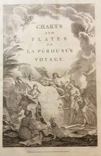
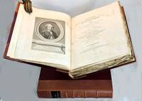
179843609London: Published as the Act directs Nov 1st 1798. by G.G.& J. Robinson 1798. Folio. 43x 27cm. 17" x 14.5". Atlas Volume First English Edition foliated engraved frontis portrait and engraved title-page 68 fine engraved plates maps charts and views many double page and include several plate illustrations on botanical and ornithological subjects. The plates are numbered 2 - 69 without the world map as usual plates are all very good to fine in contemporary half crimson morocco and marbled boards binding heavily dust worn similar wear on the edges upper hinge loose internally very good to fine condition. The map of the world is sometimes described as wanting however it would usually be in the two volume and is not call for in the list of plates <br /> <br /> ~ ~ ~ Hill #'s 972-979. "La Perouse expedition was one of the most important scientific explorations ever undertaken to the Pacific and North West Coast of North America. Hill. "Sabin 38960; Cox I-67. Fine copy of this Important 'Surveying Atlas' to the Pacific and west coast of North America. 1798. The plates are spectacular. - Atlas to the English edition of the report of the famous voyage around the world. Cook Bougainville and La Pérouse contributed decisively to the exploration of the Pacific. <br /> On the unexpected publication of this famous voyage at Paris in the previous year 1797 there was considerable competition among English publishers to bring out the English translation. Three different translations were made and published during 1798-99 and different engravers were employed for making the plates. Stockdale's appeared first in June 1798. Robinson's edition of 1799 is the most esteemed edition in English later editions being usually based on it." The atlas bears the date 1798 in the imprint but was published together with two text volumes in 1799. Published, as the Act directs, Nov, 1st, 1798. by G.G.& J. Robinson unknown
180021185London 1800. Very good overall. Copper engraving of two Tlingit women of the Pacific Northwest. Port des Francais is now known as Lituya Bay in southeast Alaska. The engraving depicts the women at the sea coast seated under trees wearing fur cloaks one viewed in profile each with lip plates or labrets. Engraved by Deeves after a drawing by Prior. From Voyage de La Perouse Autour du Monde. 4to 8x 10" paper; 6 1/4 x 8 1/2" image. unknown
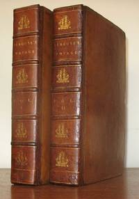
179823577London: John Stockdale 1798. First Stockdale edition. Hardcover. Recently expertly rebacked retaining all original materials some toning to text and plates but a very good copy. 2 volumes contemporary full tan calf by H. Faulkner; 20 cxc 290; viii 442 119 pp 51 engraved plates in the 2 volumes including 3 folding maps in first volume. Printed label at upper corner of verso of front free endpaper: "Bound by H. Faulkner George Court Adelphi." The British Book Trade Directory finds a Henry Faulkner Sr. succeded by Henry Faulkner Jr. at a George Court Adelphi from 1790 to 1825. <br/><br/>Originally published in French in 1797 this is one of two English-language translations published in 1798. This edition preceded earlier in the year by the Johnson edition which had only 41 plates. "The narrative of the enterprising but ill-fated Pérouse is full of interest in all portions but his relations of the peculiarities he observed in the natives of the northwest coast of North America are especially valuable. The mysterious fate of this distinguished navigator has never been satisfactorily cleared up. The above account was transmitted from Botany Bay after leaving this place the expedition was never heard of again" Sabin. In fact recent investigations into the fate of La Perouse have determined that both ships in the expedition were wrecked on the reefs of Vanikoro in the Solomon Islands. Cox I p. 67; Hill 974 observing that "The preface to the Stockdale edition leads one to suppose that the Johnson edition was published slightly earlier; Sabin 38964. John Stockdale hardcover
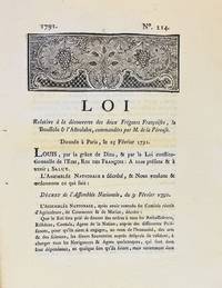
17913590A Dijon: De l'Imprimerie de Capel 1791. First edition. Woodcut headpiece. Contemporary manuscript certification at the end signed by two officials of the Département de la Côte-d'Or dated Dijon 23 avril 1791. Unbound as issued. In fine condition. First edition. Woodcut headpiece. Contemporary manuscript certification at the end signed by two officials of the Département de la Côte-d'Or dated Dijon 23 avril 1791. Unbound as issued. 3 1 blank p. <p><br /> The first formal document acknowledging fears of La Pérouse's disappearance in a rare provincial printing issued shortly after the royal decree.<br /> <p><p><br /> Very rare Dijon printing of the first formal decree acknowledging concern over the disappearance of La Pérouse's expedition. This decree issued by the Assemblée Nationale and promulgated in the name of Louis XVI on 25 February 1791 initiated the official search for La Boussole and L'Astrolabe last heard from in 1788 following their departure from Botany Bay. It instructed France's ambassadors consuls and agents abroad to solicit assistance from foreign powers and navigators-especially in the southern Pacific-"de faire toutes recherches des deux frégates Françoises La Boussole & L'Astrolabe. de même que toute perquisition qui pourroit constater leur existence ou naufrage."<br /> <p><p><br /> The decree also called for the arming of one or more vessels carrying scientists naturalists and artists tasked with both locating La Pérouse and conducting a broader exploratory mission "utile & avantageuse à la navigation à la géographie au commerce aux arts & aux sciences." This ultimately led to the voyage of Rear Admiral Bruni d'Entrecasteaux 1791-1794.<br /> <p><p><br /> La Pérouse's expedition 1785-88 commissioned by Louis XVI and modelled in part on the voyages of Cook was the most ambitious French maritime expedition of the Enlightenment. Departing from Brest in August 1785 the two frigates visited South America including Chile Easter Island Alaska California Macao the Philippines and Australia Botany Bay sending reports and scientific observations until their disappearance after March 1788. Their fate remained a mystery until the wreckage was found decades later on Vanikoro Island.<br /> <p><p><br /> The Dijon edition printed by Capel and officially certified by the departmental administration is part of a coordinated provincial dissemination of the decree alongside other issues printed in Pau Orléans Grenoble Valenciennes Auxerre and Évreux.<br /> <p><p><br /> References: cf. Ferguson 106a Auxerre ed.; Kroepelien 710; McLaren 132 Valenciennes ed.; Horner Looking for La Pérouse pp. 4-6.<br /> <p>. De l'Imprimerie de Capel unknown
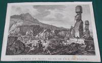
1797014743Paris: L'Imprimerie de la Republique 1797. Print measures 40x25.cm. Some light surface wear stain mark on margin. Print in good clean condition. . Near Very Good. Illus. by Godefroy. L'Imprimerie de la Republique unknown
196855058Amsterdam And NY: N. Israel and Da Capo Press. Near Fine. 1968. Hardcover. Two volume set; lacks atlas volume. Faux vellum gilt. Facsimile edition. Corners lightly bumped. Contents fine. The clear plastic DJs have some chips/tears. ; quarto . N. Israel and Da Capo Press hardcover
1799101564London: A. Hamilton for G. G. and J. Robinson J. Edwards and T. Payne. 1799. First thus two text volumes quarto later half-leather binding with gilt title labels and raised bands spines cloth sides Vol. I: pp. x lvi 539; Vol. II: pp. viii 531 plus index and errata page pp xiii. Engraved frontis portrait plate of La Perouse by Heath in first volume light water stain to upper plate and title page all edges untrimmed some unopened at top edge very light scattered foxing mostly to title pages minor scuffs to leather spine. The two text volumes without the Atlas volume complete and unabridged. Very good condition. The first quarto unabridged and "best edition" in English. A translation of La Perouse's scientific voyage around the world which departed France in 1785 and visited Chile and Hawaii Alaska California Japan Russia the South Pacific and Australia visiting Botany Bay in 1788 before sailing on and eventually discovered to have been wrecked in the Solomon Islands. A landmark work of exploration. 1st thus. Half leather. A. Hamilton for G. G. and J. Robinson, J. Edwards and T. Payne, hardcover
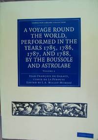
2011H048095--ParCambridge University Press. FREE U.K. Shipping. FAMILY Business. FIRST Class Service. Full refund if not totally satisfied. 2011 Paperback edition. excellent condition. Volume 2. Book is heavy and will incur a postal surcharge outside of the U.K. . Very Good. Soft cover. 1st Edition. 2011. Cambridge University Press paperback
1968208132Amsterdam. Nico Israel. 1968. 4to. 539547pp. Publisher's mylar djs on text volumes. Sl.discolouration to the spine of the atlas volume. Scarce. Bibliotheca Australiana nos. 27 28 & 29 Facsimile re-issue of the London edition of 1799. An interesting French perspective on the arrival of the First Fleet in 1788. Amsterdam. Nico Israel. unknown
17988611<p><strong>First visit of a foreigner to missionary establishments in Upper California</strong></p><p>3 volumes. Octavo 8½x5 inches. Pp. x 2 532 x 498 viii 466 1-60 Tables. 42 copper-engraved maps views charts and specimens mostly folding. Full brown calf gilt & blind rules on spines black leather spine labels. Volume I rebacked to match with original spine label and new endpapers. Bookplates on inner covers of volumes II and III. Early inked signature on each title page crossed out ink on verso of titles. Front hinges of volumes II and III broken but attached rear hinges starting. General wear to edges and corners. Most maps and plates foxed or toned small closed tear to p.477-78 of Volume II with remnants of old repair folding frontis plate in volume III with early paper reinforcement on the verso of one fold. Overall a very good set. Collated complete.</p><p>First English edition. "There are three separate translations into English from the original French of which two this one published by Johnson and another one published by Stockdale appeared in the same year 1798. Johnson's was issued slightly earlier. Both of these 1798 editions are abridged. In both first English printings the number of maps were reduced "Stockdale's edition reproduced only fifty-one of the original plates and Johnson's edition only forty-two" Hill. La Perouse sailed to the Pacific and the west coast of North America to examine regions not explored by Cook; to seek the famous Northwest Passage; to obtain information about the fur trade and the Spanish settlements in California; to make scientific observations; and to promote French enterprise in the region. He made valuable contributions to the history of geographical discovery particularly in regard to the American coast. He sent his dispatches from Kamchatka and Botany Bay. After leaving Botany Bay his expedition disappeared and his ships' wrecks were not discovered for another 39 years on one of the Santa Cruz Islands. Hill <em>Collection of Pacific Voyages</em>: p. 974.</p> Printed for J. Johnson, St. Paul’s Church Yard hardcover
138579917X.Ghardcover. Good. Access codes and supplements are not guaranteed with used items. May be an ex-library book. hardcover
196850398Amsterdam and New York: N. Israel and Da Capo Press 1968. Later printing. Hardcover. Very good condition. Quarto. 25391; 253117pp. Index. Plus facsimiles of the original 1799 title pages and 56 facsimile pages of the original prefaces and introductions. Publisher's mylar dust jackets. Faux vellum boards with gilt lettered blue labels on front covers and spines.<br /> <br /> "Bibliotheca Australiana #27 and #28."<br /> <br /> The text is complete in two volumes but this set lacks the atlas volume and is priced accordingly. Mylar with wear small chips and tears some tears larger. N. Israel and Da Capo Press hardcover
117147234X.Gpaperback. Good. Access codes and supplements are not guaranteed with used items. May be an ex-library book. paperback
1385794992.Ghardcover. Good. Access codes and supplements are not guaranteed with used items. May be an ex-library book. hardcover
1385831642.Ghardcover. Good. Access codes and supplements are not guaranteed with used items. May be an ex-library book. hardcover
1171460058.Gpaperback. Good. Access codes and supplements are not guaranteed with used items. May be an ex-library book. paperback
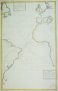
1788M6850Paris 1788. Very Good; laid on acid-free paper for long-term preservation. Notes: This handsome sea chart that indicates magnetic needle readings along various routes through the Atlantic. Size : 850x532 mm 33.46x20.94 Inches Coloring: Hand Colored in Outline Category: Maps Sea Chart; Maps Ocean Atlantic; unknown
17978615<p><strong>Atlas to the first edition of "Voyage de La Perouse"</strong></p><p>Folio. 17 ¼ x 11 ¼ inches.Frontis portrait engraved title page 69 engraved plates. Extra map from English edition.Contemporary binding of leather over marbled boards. Covers very worn front cover completely detached remnants of a hand-written label. Embossed stamp to corner of the title page. A few plates with minor discoloration in the gutter from old tape residue but the plates generally clean some trimmed a bit close. A good copy collated complete and with maps and plates in generally fine condition.</p><p>First edition. Atlas volume only. Bound into this copy is an additional map from the English version of the Atlas; Plate 3 "Chart of the Great Pacific Ocean" as well as a partial piece of the English Plate 4 "Plan of the Bay of Conception in Chili". La Perouse sailed to the Pacific and the west coast of North America to examine regions not explored by Cook; to seek the famous Northwest Passage; to obtain information about the fur trade and the Spanish settlements in California; to make scientific observations; and to promote French enterprise in the region. He made valuable contributions to the history of geographical discovery particularly in regard to the American coast. He sent his dispatches from Kamchatka and Botany Bay. After leaving Botany Bay his expedition disappeared and his ships' wrecks were not discovered for another 39 years on one of the Santa Cruz Islands.</p> [Imprimerie De La Republique] hardcover
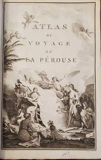
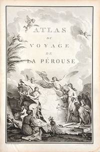
179066877Paris. c.1790. An extremely decorative title page featuring a huge scrolled map assorted angels and winged cherubs together with various seated and standing peoples of the world undoubtedly encountered during the La Perouse voyages. Size: 445 x 295 mm. Copperplate engraving. Good condition. unknown
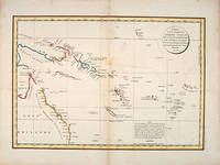
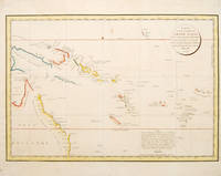
179755868Paris: 1797. Interesting chart of part of the south-western Pacific showing the routes taken by the Spanish explorer Don Francisco Antonio Maurelle in 1781 along the northern coast of New Guinea and across the Pacific to Fiji and Tonga. Maurelle was credited with the discovery of the Hermit Islands on this voyage. The map includes the north-eastern coast of Australia and parts of the coast of New Guinea. The map shows the 1781 route of his ship "The Princesa" through the Bismarck Archipelago north of New Guinea through the Archipel de Salomos i.e. Solomon Islands and then east across the Pacific to the Iles de Amis i.e. the Friendly Islands now Tonga where he discovered I. Vavao i.e. Vava'u with one of the best anchorages in the South Pacific. The map includes the Iles de Navigateurs i.e. Samoa I. Fidji i.e. Fiji Iles de Esprit i.e. Vanuatu or the New Hebrides Isles and Nouvelle Caledonie i.e. New Caledonia. Many small islands are depicted with notes regarding their sightings by Abel Tasman William Bligh and Maurelle. A note on the chart states that the publisher has placed the islands according to the longitude of other navigators rather than on Maurelle's figures which were considered estimates only and also that Maurelles chart was based on a French chart by Jacques Nicolas Bellin published in 1742. The French cartographers at the time did not consider the Spanish charts to be sufficiently accurate so they preferred to make their own corrections. Size: 490 x 340 mm. Copper engraving. Hand coloured. Good condition. Watermark slight browning and an old repair to the central fold. Good margins. unknown
178553439Atlas du Voyage de la Perouse. c.1785. Interesting chart of part of the south-western Pacific showing the routes taken by the Spanish explorer Don Francisco Antonio Maurelle in 1781 along the northern coast of New Guinea and across the Pacific to Fiji and Tonga. Maurelle was credited with the discovery of the Hermit Islands on this voyage. The map includes the north-eastern coast of Australia and parts of the coast of New Guinea. The map shows the 1781 route of his ship "The Princesa" through the Bismarck Archipelago north of New Guinea through the Archipel de Salomos i.e. Solomon Islands and then east across the Pacific to the Iles de Amis i.e. the Friendly Islands now Tonga where he discovered I. Vavao i.e. Vava'u with one of the best anchorages in the South Pacific. The map includes the Iles de Navigateurs i.e. Samoa I. Fidji i.e. Fiji Iles de Esprit i.e. Vanuatu or the New Hebrides Isles and Nouvelle Caledonie i.e. New Caledonia. Many small islands are depicted with notes regarding their sightings by Abel Tasman William Bligh and Maurelle. A note on the chart states that the publisher has placed the islands according to the longitude of other navigators rather than on Maurelle's figures which were considered estimates only and also that Maurelle's chart was based on a French chart by Jacques Nicolas Bellin published in 1742. The French cartographers at the time did not consider the Spanish charts to be sufficiently accurate so they preferred to make their own corrections. Copper engraving. Good condition. One light and one dark spot of foxing to the upper centre. A slight faint watermark. Later colour. Size: 49 x 34 cm. 19½ x 13½ inches unknown
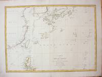
1787M7397Paris c.1787. Very Good;. Size : 495x680 mm 19.49x26.77 Inches Coloring: Hand Colored in Outline Category: Maps Asia Far East China; Maps Asia Far East Japan & Korea; unknown
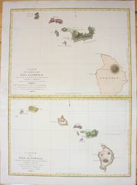
1798M7217Paris 1798. Very Good;small restoration at left margin. Size : 490x678 mm 19.29x26.69 Inches Coloring: Hand Colored Category: Maps United States West Hawaii; unknown
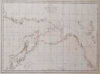
1797016791Paris: La Perouse 1797. Map. Very good condition. Unbound. First Edition. Folio. A large map in black and white. The map is included in the Atlas volume of La Perouse's Voyages. The west coast of North America is shown as south as Baja California and north to above 70 degrees latitude. Shows part of China and all of Japan and Kamtschatka and an attractive depiction of the Behring Straits and the Alaskan Archipelago. There are about a dozen small dark spots and dozens of others that are tiny but the map remains quite clean retaining large margins. La Perouse Paperback