104 résultats
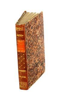
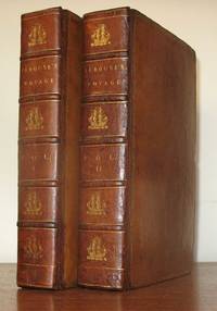
179823577London: John Stockdale 1798. First Stockdale edition. Hardcover. Recently expertly rebacked retaining all original materials some toning to text and plates but a very good copy. 2 volumes contemporary full tan calf by H. Faulkner; 20 cxc 290; viii 442 119 pp 51 engraved plates in the 2 volumes including 3 folding maps in first volume. Printed label at upper corner of verso of front free endpaper: "Bound by H. Faulkner George Court Adelphi." The British Book Trade Directory finds a Henry Faulkner Sr. succeded by Henry Faulkner Jr. at a George Court Adelphi from 1790 to 1825. <br/><br/>Originally published in French in 1797 this is one of two English-language translations published in 1798. This edition preceded earlier in the year by the Johnson edition which had only 41 plates. "The narrative of the enterprising but ill-fated Pérouse is full of interest in all portions but his relations of the peculiarities he observed in the natives of the northwest coast of North America are especially valuable. The mysterious fate of this distinguished navigator has never been satisfactorily cleared up. The above account was transmitted from Botany Bay after leaving this place the expedition was never heard of again" Sabin. In fact recent investigations into the fate of La Perouse have determined that both ships in the expedition were wrecked on the reefs of Vanikoro in the Solomon Islands. Cox I p. 67; Hill 974 observing that "The preface to the Stockdale edition leads one to suppose that the Johnson edition was published slightly earlier; Sabin 38964. John Stockdale hardcover
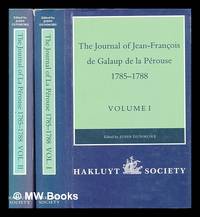
1994448960London : The Hakluyt Society 1994. First Edition. Hardcover. Fine cloth copies in a fine very slightly edge-dulled dust wrappers. Well-preserved overall. Not price-clipped. Volumes one and two. Series: Works issued by the Hakluyt Society. 2nd series ; 179. Physical description: 2 volumes ccxl 613 pages : illustrations maps ; 23 cm. Notes: Translated from the French. Subjects; Boussole Ship. Astrolabe Ship. Voyages and travels History 18th century. Explorers France Biography. London : The Hakluyt Society hardcover
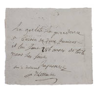
1781H1RDFKW35E6FAt sea 1781. Short manuscript note in ink on a small sheet of laid paper 12 x 13.5 cm. An exceptionally rare autograph note signed by the great French explorer La Pérouse. The extraordinary story and achievements of La Pérouse are well known and recounted in the handsome official account of his expedition. However because he was lost without trace mid-voyage manuscript material relating to his life is very rare indeed. In the present note La Pérouse asks that his boat be given an impressive 286 "aunes" of canvas which is needed on board. An "aune" is an old-fashioned French measure usually translated as ell or cubit: its length could vary but the normal French/Parisian aune was about 118 cm meaning that La Pérouse is in fact asking for about 340 metres of canvas. The sheer quantity of the request speaks to La Pérouse having written the note while in charge of a large vessel.The document is counter-signed and noted as "delivered" by one "Deletombe": it seems very likely that this is Philippe-André-Joseph de Létombe who arrived in the United States in 1781 and was the French Consul in Boston and a correspondent of Thomas Jefferson. If this identification is correct the note would possibly date from La Pérouse's cruising in the West Indies and along the coast to Hudson Bay in 1781 and 1782.With old folds clearly and legibly written and docketed; in very good condition. unknown
17993812959Stockholm: Johan Pfeiffer 1799. A few light spots but a very good copy. Small octavo; in attractive original Scandinavian half calf binding. <p><p>Rare Swedish edition of the voyage of La Pérouse whose fame was so widespread that there was a ready market for accounts of his voyage across Europe and beyond. Within four years of the publication of the official French edition in 1797 translations appeared in London Edinburgh Paris Stockholm Leipzig Berlin Copenhagen Haarlem St. Petersburg Boston and Amsterdam.</p> <p>This Swedish version was prepared by Samuel Ödmann from the octavo French edition. He also provides a preface. Not in the catalogue of the Hill collection; Ferguson knew the book only from copies in the Mitchell Library and the Kroepelien Collection Oslo.</p> </p> . Johan Pfeiffer unknown
179953594Leipsick No publisher 1799. Contemp. hcalf. Spine gilt and with gilt lettering. XXXVI562 pp. 5 engraved plates and 1 large folded engraved world map: "Mappemonde ou Carte réduite des Parties connues du Globe pour servir au Voyage de la Pérouse." 52 x 425 cm. A few margins of text at beginning and at end stained. The portrait lacks. <br/><br/><em>Sabin 38959. </em> unknown
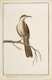
179755673Paris. 1797. Print of a Californian Cape bird. From the Voyages of La Pérouse who set sail from France in 1785 to continue the discoveries of Captain Cook. He was shipwrecked in 1788 but his narrative maps and views survived and were published in 1797. Atlas Du Voyage De La Pérouse Size: 255 x 400 mm. Copper engraving. Uncoloured. Very good condition. Slight browing around edges but not effecting image. unknown
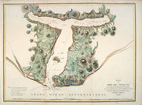
179755881Paris: 1797. From the Voyages of La Pérouse who set sail from France in 1785 to continue the discoveries of Captain Cook. He was shipwrecked in 1788 but his narrative maps and views survived and were published in 1797. Thirty-eight years later the scattered remains of La Boussole and L'Astrolabe was discovered wrecked on a vicious reef on an atoll in the New Hebrides. Attractive sea chart showing the entrance to Port des Français. Engraved by BOUCLET. Atlas Du Voyage De La Pérouse. Size: 680 x 495 mm. Copper engraving. Hand coloured. Fine condition. Good margins. unknown
1788M4779Paris 1788. Very Good. Size : 685x495 mm 27x19.5 Inches Coloring: Hand Colored Category: Maps Russia; Maps Asia Far East Japan & Korea; unknown
179756362Paris: 1797. Fine sea chart of the bay and Bio Bio River region with great topographical and hydrological detail. Villages and Fort St. Pierre are depicted. From the Voyages of La Pérouse who set sail from France in 1785 to continue the discoveries of Captain Cook. He was shipwrecked in 1788 but his narrative maps and views survived and were published in 1797. Thirty-eight years later the scattered remains of La Boussole and L'Astrolabe was discovered wrecked on a vicious reef on an atoll in the New Hebrides. Copper engraving. Very good condition; slight browning to the centrefold. Hand coloured. Size: 57 x 42 cm. unknown
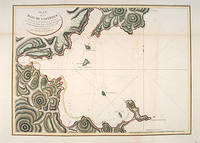
179755877Atlas Du Voyage De La Pérouse. Paris: L'Imprimerie de la Republique. 1797. From the Voyages of La Pérouse who set sail from France in 1785 to continue the discoveries of Captain Cook. He was shipwrecked in 1788 but his narrative maps and views survived and were published in 1797. An attractive sea chart showing a bay at the coast of Eastern Tartary. Relief shown by hachures; depths by soundings. This is how this part of La Pérouse's journey was described in a diary: 'On 11 August they reached the southwestern point of Sakhalin Island which La Pérouse named Cap Crillon Mys Kril'on. The ships anchored near Mys Kril'on and Vaujuas went ashore where he met more Ainu people some of whom also visited the ship. The ships began to sail through the strait the next day. La Pérouse called it Canal de Castries but it would later be called La Perouse Strait.' Copper engraving. Very good condition. Faint vertical waterstains. Some very slight browning to lower margin. Good margins. Hand coloured. Size: 68 x 49 cm. 27 x 19½ inches unknown
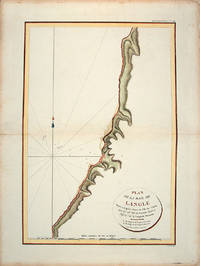
179755866Paris: L'Imprimerie de la Republique.Atlas Du Voyage De La Pérouse. 1797. From the Voyages of La Pérouse who set sail from France in 1785 to continue the discoveries of Captain Cook. He was shipwrecked in 1788 but his narrative maps and views survived and were published in 1797. Tomari Region Russia ; Sakhalin Russia Full Title: Plan de la Baie de Langle. Situee a la partie ouest de l'Ile de Tchoka par 47048'36" de latitude nord et 139057'54" de longitude orientale. L. Aubert scripsit. Atlas du Voyage de la Perouse no. 49. Paris: L'Imprimerie de la Republique An V 1797. Engraved by AUBERTL. Size: 255 x 400 mm. Copper engraving. Hand coloured. Very good condition. unknown
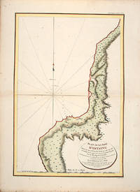
179755865Atlas Du Voyage De La Pérouse. 1797. From the Voyages of La Pérouse who set sail from France in 1785 to continue the discoveries of Captain Cook. He was shipwrecked in 1788 but his narrative maps and views survived and were published in 1797. Uglegorsk Region Russia Full Title: Plan de la Baie d'Estaing. Situee a la cote de l'ouest de Tchoka par 48059'38" de latitude nord et par 14000'42" de longitude orientale prise du mouillage de l'Astrolabe. Cette Baie fut decouverte le 20 juillet 1787 par les Fregates Francaises la Boussole et l'Astrolabe commandees par MM. de La Perouse et de Langle. L. Aubert scripsit. Atlas du Voyage de la Perouse no. 51. Paris: L'Imprimerie de la Republique An V 1797. Engraved by AUBERTL. Size: 255 x 400 mm. Copper engraving. Uncoloured. Very good condition. unknown
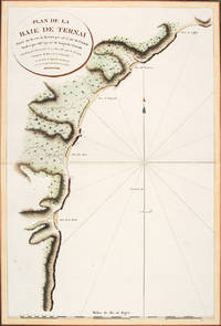
179756364Atlas Du Voyage De La Pérouse. Paris: L'Imprimerie de la Republique. 1797. A crisp clear map of the Bay of Ternai in Tartary. Relief shown by hachures; depths by soundings. From the Voyages of La Pérouse who set sail from France in 1785 to continue the discoveries of Captain Cook. He was shipwrecked in 1788 but his narrative maps and views survived and were published in 1797. Thirty-eight years later the scattered remains of La Boussole and L'Astrolabe was discovered wrecked on a vicious reef on an atoll in the New Hebrides. Copper engraving. Fine condition; slight browning and foxing to wide margins not affecting the image. Hand coloured. Size: 42.5 x 56.5 cm. 16½ x 22 inches unknown
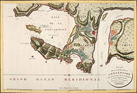
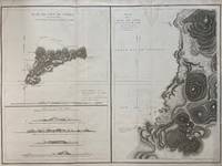
1797299774Paris: L'Imprimerie de la Republique 1797. Map. Engraving with hand coloring. Sheet measures 21 1/4" x 28"<br/> <br/> This chart depicts Easter Island with a close-up of Cook's Bay. Relief is depicted by hachure and elevation is shown from several vantage points. Points and peaks of the elevation views correspond to labels on the map. The Bay shows depths and various structures are labeled. The map appeared as Plate 10 in "Atlas du Voyage de La Perouse." It is in very good condition. Stain to upper margin minor foxing marks.<br> <br> Jean Francois de Galaup 1741-c.1788 was a French Navy officer and explorer known for his travels in Oceania. In 1787 he explored the northeast and mainland Asian coasts in the area of Korea. Other voyages included Alaska Japan Australia and the South Pacific. This map demonstrates some of the many observations and findings made on his journeys.<br/> <br/> L'Imprimerie de la Republique unknown
1797016788Paris: La Perouse 1797. Map. Very good condition. Unbound. First Edition. Folio. A large map beautifully decorated with original outline color. The map is included in the Atlas volume of La Perouse's Voyages but was drawn from Spanish manuscripts as it was thought that it might be a part of the Northwest Passage. The map has an extra vertical crease from mis-folding but is quite clean and has large margins which are lightly soiled here and there. La Perouse Paperback
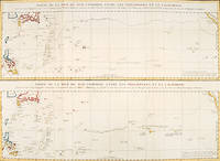
179756361Paris: 1797. An interesting large sheet with two maps covering the same area. The top chart shows the routes of the Spanish galleons from Acapulco to the Philippines. The bottom chart shows La Perouse's route from Monterey through Hawaii and the Marianas to Macao. From the Voyages of La Pérouse who set sail from France in 1785 to continue the discoveries of Captain Cook. He was shipwrecked in 1788 but his narrative maps and views survived and were published in 1797. Thirty-eight years later the scattered remains of La Boussole and L'Astrolabe was discovered wrecked on a vicious reef on an atoll in the New Hebrides. Full title: "Partie de la Mer du Sud comprise entre les Philippines et la Californie d'apres de Carte Espagnole trouvee sur le Galion pris par l'Amiral Anson en 1743 qui represente l'etat des connaissances a cette epoque et les routes que suivaient ordinairement les Galions dans leur traversee de Manille a Acapulco. Partie de la Mer du Sud comprise entre les Philippines et la California d'apres une autre Carte Espagnole communiquee a La Perouse dans sa relache a Monterey sur laquelle il avait trace sa route ainsi que les Iles qu'il avait reconnues avec des notes sur celles qu'il n'avait pas retrouvee." Copper engraving. Very good condition; some light stains along the lower horizontal fold; a tear and some foxing to the upper margin; wide margins. Hand coloured. Size: 79 x 55.5 cm. unknown
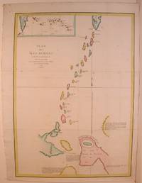
1798496London: G & T Robinson 1798. The English edition of a map published to accompany La Perouse' Voyage. G&T Robinson Nov. 1st 1798. Covers from the Gulf of Carpentaria to the Solitaire Islands to the Navigator Islands in the east and to above New Guinea. Charts Maurelle's tracks. G & T Robinson unknown
0259332135.Gpaperback. Good. Access codes and supplements are not guaranteed with used items. May be an ex-library book. paperback
1788M6851Paris 1788. Very Good; laid on acid-free canvas for long-term preservation. Notes: This handsome sea chart depicts magnetic needle readings along various routes in the North Pacific ocean.<br> Size : 590x1090 mm 23.23x42.91 Inches Coloring: Hand Colored in Outline Category: Maps Sea Chart; Maps Ocean Pacific; Maps United States West; unknown
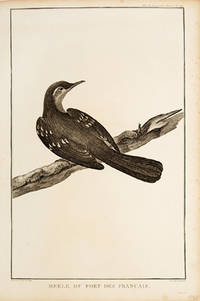
179755672Paris. 1797. Print of an Alaskan Merle Bird. From the Voyages of La Pérouse who set sail from France in 1785 to continue the discoveries of Captain Cook. He was shipwrecked in 1788 but his narrative maps and views survived and were published in 1797. Atlas Du Voyage De La Pérouse. Size: 255 x 400 mm. Copper engraving. Uncoloured. Very good condition. Slight browing around edges but not effecting image. unknown
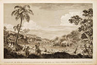
179755648Atlas Du Voyage De La Pérouse. 1797. Scene showing the locals attacking voyagers as they disembark from their boats. From the Voyages of La Pérouse who set sail from France in 1785 to continue the discoveries of Captain Cook. He was shipwrecked in 1788 but his narrative maps and views survived and were published in 1797. Copper engraving. Very good condition. slight browing around edges but not effecting image Uncoloured. Size: 40 x 25.5 cm. 15½ x 10 inches unknown
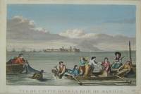
17973921Paris c. 1797. Copper engraving by Simonet after Duche de Vancy and J.M. Moreau le Jeune approx 29 x 42 cms trimmed to platemark left-hand margin extended hand-coloured blank verso. Map unknown
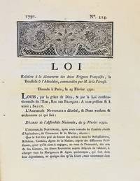
17913590A Dijon: De l'Imprimerie de Capel 1791. First edition. Woodcut headpiece. Contemporary manuscript certification at the end signed by two officials of the Département de la Côte-d'Or dated Dijon 23 avril 1791. Unbound as issued. In fine condition. First edition. Woodcut headpiece. Contemporary manuscript certification at the end signed by two officials of the Département de la Côte-d'Or dated Dijon 23 avril 1791. Unbound as issued. 3 1 blank p. <p><br /> The first formal document acknowledging fears of La Pérouse's disappearance in a rare provincial printing issued shortly after the royal decree.<br /> <p><p><br /> Very rare Dijon printing of the first formal decree acknowledging concern over the disappearance of La Pérouse's expedition. This decree issued by the Assemblée Nationale and promulgated in the name of Louis XVI on 25 February 1791 initiated the official search for La Boussole and L'Astrolabe last heard from in 1788 following their departure from Botany Bay. It instructed France's ambassadors consuls and agents abroad to solicit assistance from foreign powers and navigators-especially in the southern Pacific-"de faire toutes recherches des deux frégates Françoises La Boussole & L'Astrolabe. de même que toute perquisition qui pourroit constater leur existence ou naufrage."<br /> <p><p><br /> The decree also called for the arming of one or more vessels carrying scientists naturalists and artists tasked with both locating La Pérouse and conducting a broader exploratory mission "utile & avantageuse à la navigation à la géographie au commerce aux arts & aux sciences." This ultimately led to the voyage of Rear Admiral Bruni d'Entrecasteaux 1791-1794.<br /> <p><p><br /> La Pérouse's expedition 1785-88 commissioned by Louis XVI and modelled in part on the voyages of Cook was the most ambitious French maritime expedition of the Enlightenment. Departing from Brest in August 1785 the two frigates visited South America including Chile Easter Island Alaska California Macao the Philippines and Australia Botany Bay sending reports and scientific observations until their disappearance after March 1788. Their fate remained a mystery until the wreckage was found decades later on Vanikoro Island.<br /> <p><p><br /> The Dijon edition printed by Capel and officially certified by the departmental administration is part of a coordinated provincial dissemination of the decree alongside other issues printed in Pau Orléans Grenoble Valenciennes Auxerre and Évreux.<br /> <p><p><br /> References: cf. Ferguson 106a Auxerre ed.; Kroepelien 710; McLaren 132 Valenciennes ed.; Horner Looking for La Pérouse pp. 4-6.<br /> <p>. De l'Imprimerie de Capel unknown
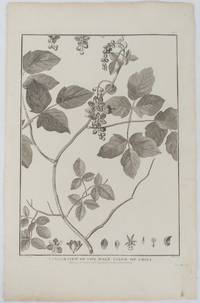
1798175968London. 1798. Engraving on watermarked wove paper 33.3 x 24.9 cm plate mark 42 x 26.6 cm sheet edges a little browned and dusty but a very good dark impression. Fine botanical illustration of the climbing chili prepared for the 'Account of the Voyage of Jean-François Galaup-La Pérouse' 1785-1788 the great but ill-fated French voyage of discovery and exploration. Guillaume Prevost was botanical artist on the ship L'Astrolabe and from a noted family of botanical artists. . unknown
H492Berlin und Hamburg 1800. Bibliothek der neuesten und interessantesten Reisebeschreibungen Band 23. 8vo. 410 S. mit 1 gest. Frontispiz 1 Portraitvignette auf dem Titel 2 Kupfertafeln 1 gef. Karte; 344 S. mit gest Frontispiz 1 Titelvignette 1 gefalt. Karte. Halblederb‰nde der Zeit mit RSchild etwas berieben Rotschnitt guter Zustand. unknown