Carnegie, David WBiblio.com
705 résultats
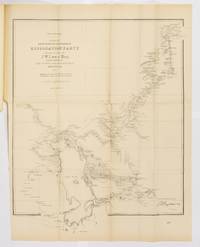
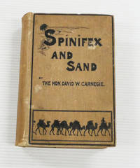
1898BIB329903London: C. Arthur Pearson Ltd. 1898. Large octavo size 16x24cm approx. Good condition. Decorated brown boards. Gilt top edge and Gilt title to spine. Four 4 folded maps - two to text block and two in pocket at rear. Maps are worn but complete and some have repairs done by previous owner. Hinges professionally repaired with strengthening tape. Black & white illustrations - all present. Fergusson 7959 refers. 454 pages. The Hon. David Wynford Carnegie 23 March 1871 - 27 November 1900 was an explorer and gold prospector in Western Australia. In 1896 he led an expedition from Coolgardie through the Gibson and Great Sandy Deserts to Halls Creek and then back again. . Good. 1st Edition. Hardback. C. Arthur Pearson Ltd hardcover
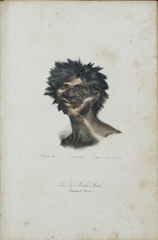
1840PHO-1421Gayet et Lebrun, Paris, 1840. 4 tomes en 2 volumes in-8 (220x142) ,2ff-400pp ,2ff-417pp, 4ff-399pp ,3ff-451 pp , illustré de 56 (60) gravures colorisées et gommées, et de deux portraits en noir de Jacques et François Arago ,petit dictionnaire du dialecte des différents peuples rencontrés à la fin du quatrième tome . Relié demi cuir époque ,dos lisse avec auteur , titre et tomaison, frottements au plats , coins , coupes et coiffes usées ,début de fente aux charnières, peu de rousseurs , qlqs planches brunies, titre tome 1 et feuillets détachés , certains avec marge abîmée .
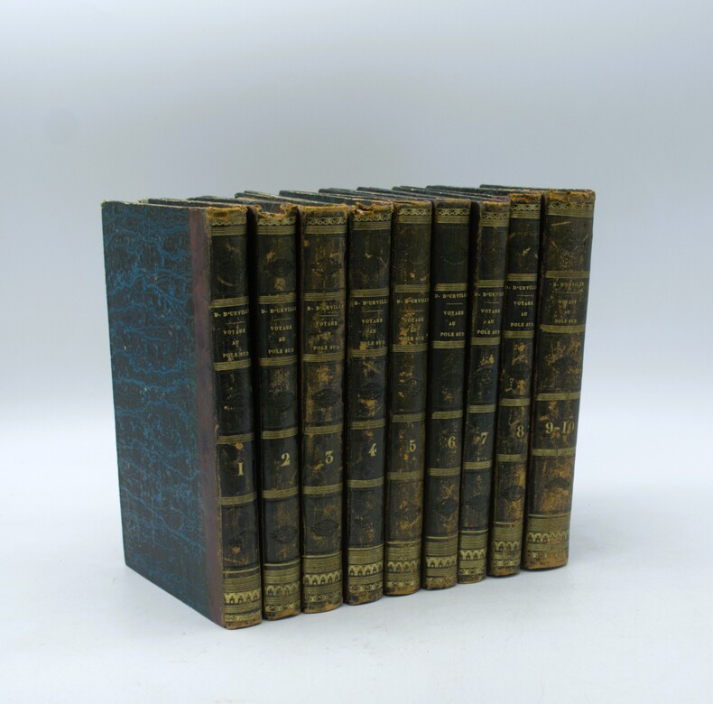
1841PHO-2141Paris, Gide, 1841-1846, 10 tomes en 9 volumes in-8 (22,5x14cm), demi basane, dos lisse orné avec auteur, titre et tomaison, ex-libris manuscrit au faux titre du tome 1 et cachet répété « ex-libris de Cayrol », frottements aux reliures, quelques coiffes abimées, rousseurs, papier bruni, complet des 9 cartes dépliantes in fine.
187524335Adelaide: Government Printer 1875. Fine. Adelaide Government Printer 1875. A large map 690 x 550 mm folding down to foolscap folio size. One edge very slightly chipped; one tiny marginal tear expertly repaired; a fine copy detached from a bound volume with the preceding one-leaf parliamentary paper retained for the time being for protection. South Australian Parliamentary Paper Number 57 of 1875 no text accompanied this map. McLaren 12530-31-32 are confusing confused: the first entry refers to this item by correct Parliamentary Paper number but the title is incorrect; the third entry shows the correct title for a map accompanying the journal published the following year as SAPP19 of 1876. Feeken Feeken and Spate comment on the fact that although Lewis reported his arrival at Beltana on 12 July 1875 after completing his surveys 'Curiously the map of his surveys was signed by Surveyor-General Goyder already on 15 July'. We have not inspected the map issued in 1876 but the present copy contains a lithographed note that may explain the apparent anomaly: 'Copied from Plan forwarded by J.W. Lewis Esq. in the Office of The Surveyor General by Edwin S. Berry and H.C. Talbot . June 15th 1875'. Little is known about J.W. Lewis not to be confused with John Lewis of 'Fought and Won' fame but he accompanied Warburton across the Great Sandy Desert in 1872-73. 'Warburton admitted that Lewis had several times saved the party from perishing on that epic journey' Feeken. An abridged account of Lewis' Lake Eyre expedition will be found in Threadgill along with a reduced facsimile of a later version of the map which includes 'a detailed examination of the course of the Barcoo as far as Innamincka'. Government Printer unknown
1884056002Brisbane: James C. Beal Government Printer. 1884. 210 pages. Publisher's green cloth decorated in blind and titled in gilt to front. Foxing to endpapers/prelims some foxing to page edges. A very nice copy with the binding in particular in superb condition-appears unread. The Journals of the Explorations by Messrs Gregory in the Western Northern and Central portions of Australia had previously only been partially published in a fragmentary form. This was their first appearance in toto and is scarce as such. Includes explorations in Western Australia what is now Queensland Victoria and New South Wales. Of note is the inclusion of papers concerning the expedition to determine the fate of Leichhardt. Ferguson 10075 listed in error as having illustrations Wantrup 190a correcting Ferguson's error. An attractive clean complete and entirely original copy that would grace any collection. First Edition. Hard Cover. Very Good. 8vo. James C. Beal, Government Printer. Hardcover
1888324991Hobart: William Thomas Strutt Government Printer 1888. 1st Edition . Hardcover. Very Good. 4to - over 9¾ - 12" tall. Hardcover with morocco and gilt spine titles. Looks like an older rebind.in tan cloth. Preface contents bibliography extensive 408ppfolding map of Tasmania torn numerous illus. including 57 lithographs of fossils elevations including one in colour. Some wear to edge of this foldout. Paper shows some tanning <br/> <br/> William Thomas Strutt Government Printer hardcover
182580009London: William Darton 1825. First Edition. Hardcover. Very Good. London William Darton circa 1825. Octavo xii 64 pages plus 64 engraved portraits with tissue-guards. Early gilt-decorated half calf and marbled papered boards a little rubbed and bumped at the extremities; corners and the rear leading edge a little worn; 'Vol III' label missing from the spine; occasional scattered foxing and offsetting; a very good copy. Provenance: James Hurtle Fisher with his armorial bookplate on the pastedown and his signature in ink at the head of the engraved title page. Sir James Hurtle Fisher 1790-1875 'was one of the most important pioneers of South Australia' 'Australian Dictionary of Biography'. He commenced practice as a solicitor in London in 1816 and 'was drawn into the colonizing movement in 1835. He was selected as resident commissioner one of the most important offices under the South Australian Act . second only to the governor'. Fisher 'left England in July 1836 with the governor's party in the "Buffalo" arriving on 28 December 1836 at Holdfast Bay where the official oaths were administered a proclamation was read and a ceremony marked the beginning of settlement. In January 1837 Fisher erected his reed hut and Land Office near the survey camp of Colonel William Light at the north-western corner of the new capital site; the destruction of these temporary buildings by fire on 23 January 1839 caused both men serious loss. <p>Fisher had been allowed to draft his own instructions which were not shown to Governor Sir John Hindmarsh. Disputes between the two men over their respective powers had begun on the voyage and were soon revived in the new Council of Government and more violently outside and led in February 1837 to the Resident Magistrate's Court binding the participants over to keep the peace towards each other. The new governor George Gawler was appointed both governor and resident commissioner a radical departure from the principles on which the colony had been founded'. Fisher returned to his profession and became a leader of the South Australian Bar. In October 1840 he was elected first mayor of Adelaide; in 1860 he became the first resident South Australian to be knighted. The destructive fire referred to above is described in detail in the biography of Light Dutton and Elder 1991. <p>Light was living 'in the wood and reed surveyor's hut alongside Fisher's equally combustible house in the parklands on North Terrace. In his own account ". we discovered Fisher's house to be on fire. At the same time the breeze freshening up the destruction to both houses became inevitable. In less than ten minutes both houses were burnt to the ground mine catching fire at the roof by a lighted piece from Fisher's. We saved nothing of value"'. Accordingly personal mementoes such as this presumably brought by Fisher to South Australia on the 'Buffalo' must be of the utmost rarity. William Darton hardcover
1900134834Adelaide: W.C. Rigby for the Royal Society of South Australia 1900. First Edition. Paperback. Very Good. Adelaide W.C. Rigby for the Royal Society of South Australia 1900 to 1913. Large quarto eight parts issued as and here bound in two volumes; full details of each part are listed below. Later binder's cloth retaining the original wrappers; cloth slightly scuffed and rubbed; both volumes a little bumped at the foot of the spines; small cancelled library stamp on each front wrapper 'College of Advanced Education Library Adelaide. 7 June 1973'; small light tidemark to the top inner corner of Volume I Part 3; minimal signs of age and use; in excellent condition. All four parts of the first volume are by STIRLING E.C. and A.H.C. ZIETZ: Fossil Remains of Lake Callabonna. An interesting note from the editor is printed on the verso of the front wrapper of the first part: 'For the purpose of presenting the descriptions of the "Fossil Remains ." in a more suitable form than is permitted by the size of the "Transactions" the Council has decided to publish in royal octavo a series of "Memoirs" . This issue is the first Fasciculus of the first Volume . of which other parts will appear as circumstances permit'. Individual subtitles are as follows. <p>Volume I Part 1. Description of the Manus and Pes of 'Diprotodon Australia' Owen. 1900. 40 pages plus 18 plates. <p>Volume 1 Part 2. Genyornis Newtoni. A New Genus and Species of Fossil Struthious Bird. and The Physical Features of Lake Callabonna. Circa 1900. iv 41-80 xv pages plus 7 pages of plates 3 of them folding. <p>Volume 1 Part 3. Description of the Vertebrae of Genyornis Newtoni. 1905. ii 81-110 pages plus 11 pages of plates. <p>Volume 1 Part 4. Description of Some Further Remains . 1913. vi 111-178 pages plus 23 pages of plates. Loosely inserted in the first part is a colour transparency of a watercolour illustration of a diprotodon. <p>Volume II Part 1. ETHERIDGE Robert: The Cretaceous Mollusca of South Australia and the Northern Territory. 1902. iv 54 pages plus 7 pages of plates and a publisher's slip tipped in at the first page 'The remainder of Vol. I of these Memoirs has been reserved for further descriptions of the "Fossil Remains of Lake Callabonna"'. <p>Volume II Part 2. TAYLOR T. Griffith: The Archaeocyathinae from the Cambrian of South Australia. An Account of the Morphology and Affinities of the Whole Class. Edited by Walter Howchin. 1910. vi 55-188 pages with 51 illustrations plus 15 pages of plates a large folding chart and a large 'Index Slip' tipped in at the contents page. <p>Volume II Part 3. MAWSON Douglas: Chiastolites from Bimbowrie South Australia . Edited by Walter Howchin. 1911. iv 189-210 pages with a map and 12 illustrations plus 11 pages of plates including one colour plate. <p>Volume II Part 4. MAWSON Douglas: Geological Investigations in the Broken Hill Area . Edited by Walter Howchin. 1912. viii 211-319 pages plus 26 pages of plates containing 81 plates and an illustration 5 pages of illustrations containing 3 maps and 4 sections and a very large folding colour geological map 525 × 680 mm 'Geological Sketch Map of the Olary-Broken Hill Area. In all instances each page of plates is accompanied by a leaf of text. The first part of the first volume and the first two parts of the second volume must be considered rare if our experience is any guide. 2 items. W.C. Rigby (for the Royal Society of South Australia) paperback
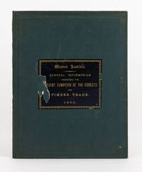
1882138714Perth: Richard Pether Government Printer 1882. First Edition. Hardcover. Very Good. Perth Richard Pether Government Printer 1882 and London L. Reeve & Co. 1879. Large quarto 28 pages last blank with several tables plus 2 tinted lithographs and 2 colour maps one folding 490 × 370 mm; and viii 30 pages plus 21 plates including 17 full-page uncoloured lithographs of eucalypts after drawings by R. Austen. Pebble-grain dark green cloth with a large title-label printed in gilt on black paper on the front cover; minor loss to the label removing two letters of one word; cloth a little marked with light wear to the extremities; small section 25 mm of the leading edge of the rear cover a little abraded; endpaper hinges neatly reinforced; light tidemarks to two small sections of the endpapers with a little foxing confined mainly to the inner surfaces of the free endpapers and the adjacent pages; one tear to the folding map expertly sealed; minimal loss to silverfish to the bottom margin of the small map; mild signs of age and use; a very good copy. The balance of the first title is 'with some remarks and suggestions on future conservation and management of the timber areas from various authorities. With a reprint of the regulations and laws in force for the renting or leasing of timbered lands'. <p>The introduction to the combined work compiled under the direction of Malcolm Fraser the WA Surveyor General has this to say: 'In compliance with your instructions and so far as the information and means at my command allowed I have collected in a general way such information about our timber Forests as was available to me and I have endeavoured to weave this together somewhat in a connected form. <p>By including the valuable Report on the Forest Resources of Western Australia by Baron Ferd. von Mueller it will be brought more prominently before the public than it has hitherto been. the drawings give a very fair idea of the character of the Jarrah and Karri forests'. Richard Pether, Government Printer hardcover
185480666Adelaide: printed and published at the 'Register' and 'Observer' Office 1854. First Edition. Paperback. Very Good. Adelaide printed and published at the 'Register' and 'Observer' Office 1854. Duodecimo xii 244 42 Directory 36 advertisements pages with the hand-coloured plate featuring nine 'Signals used at the West Terrace Flagstaff'. Flush-cut quarter cloth and printed card covers repeating the title page details on the front with advertisements on the rear; covers rubbed marked and lightly tidemarked with some simple arithmetic on the front cover and front free endpaper; extremities of the covers lightly worn; minimal expert restoration to the foot of the front joint; title written in ink on the spine; minor signs of age and use; essentially a very good copy with the contemporary ownership details of Joseph Grivell 1854 on the flyleaf and indistinctly on the front cover. His name does not appear in the directory suggesting he lived outside Adelaide see below. In the preface dated 10 January 1854 the compiler apologises for the lateness of the appearance of the almanack the delay being 'occasioned by the extreme difficulty in obtaining compositors' - presumably all off to the diggings. He also apologises for the 'total omission of the Country Directory' for various reasons so the 42-page directory covers only Adelaide and suburbs. <p>Most of the balance of the book is given over to the usual statistics regulations and lists of assorted office-bearers. However the farmers' and gardeners' calendar runs to 18 pages and there is a lengthy and important contribution by E.W. Andrews: 'Navigation of the Murray. Being extracts from a journal kept on board the "Lady Augusta" during Captain Cadell's exploratory voyage from the Goolwa to Ganawarra' 51 pages. Fellow-passengers James Allen and Arthur Kinloch published their independent accounts of this pioneering trip in book form in late 1853. In any event Andrews' account was reasonably hot off the press; his last journal entry was dated 15 October 1853 less than three months before this almanack delayed in publication appeared. Ferguson 9829f. printed and published at the 'Register' and 'Observer' Office paperback
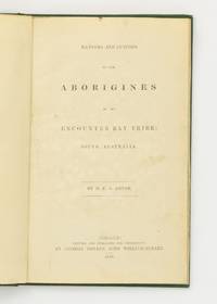
1846139553Adelaide: 'Printed and published for Government by George Dehane' 1846. First Edition. Hardcover. Very Good. Adelaide 'Printed and published for Government by George Dehane' 1846. Octavo ii 15 pages. Later green binder's cloth lettered in black along the spine; title leaf a little marked with a light abrasion near the gutter; a few minor spots and marks; a very good copy. Heinrich Edward August Meyer was a Lutheran missionary who arrived in Australia in 1840 and spent just over two years living with the Raminyeri tribe of the Encounter Bay area before publishing in 1843 'the first grammar and vocabulary on Ngarrindjeri "Vocabulary of the Language spoken by the Aborigines of the Encounter Bay Tribe South Australia". He lived at Encounter Bay until 1848 . Meyer was part of an Adelaide-based community of missionaries from the Dresden Missionary School which placed great emphasis on learning the language because it believed in the importance of communicating with the Aboriginal people in their own language . He also had continuing contact with other missionaries who were also involved in writing grammars such as Clamor Schurmann who had published a grammar of Kaurna the language to the North of Ngarrindjeri just before Meyer's arrival. This background as well as the assertion in his introduction to the 1843 grammar that the whole publication had been twice reviewed with different natives so that the meaning assigned to the words may be relied upon as correct . has resulted in a text that is considered to be a reliable reflection of the language at the time and a good grammar for its time' Corinne Bannister: 'A Longitudinal Study of Ngarrindjeri' online. <p>In this short but closely printed pamphlet Meyer in 'giving an account of these people . endeavours to trace the life of one from his birth upwards'. His extended period of living with the Encounter Bay people in these early years of white settlement adds authenticity to his detailed account of subjects such as hunting sorcery and burial customs. <p>Ferguson 4348; see also Ferguson 13095 WOODS J.D. editor: The Native Tribes of South Australia Adelaide Wigg 1879 which reprints this item; Greenway 6696. 'Printed and published for Government, by George Dehane' hardcover
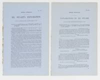
1858114206Adelaide: Government Printer 1858. Fine. Adelaide Government Printer 1858. Foolscap folio 8 pages last blank plus a large folding map 'Country explored by John McDouall Stuart. June to September 1858'; 600 × 510 mm with lakes and coastlines hand-coloured in outline; 'Richd Jno. Loveday Litho'. Drop-title; minimal residual glue to the spine and a few needle-holes to the inner margin previously bound now disbound; tiny sealed tear to the stub of the map; essentially a fine copy. South Australian Parliamentary Paper Number 119 of 1858. This is an account of Stuart's first independent expedition; he had previously travelled with Sturt's 1844-45 expedition into Central Australia. The party of three 'started out from the Northern Flinders Ranges in mid-May. They skirted the south end of Lake Torrens and then turned north and north-west until they reached the present site of Coober Pedy. They then followed a southerly course to Lake Gairdner passing it on the west side. After a strenuous march they arrived at Ceduna . By now the men had run out of provisions. They travelled along the coast to Streaky Bay and from there to the settled districts at Mount Arden in a state of semi-starvation' Feeken Feeken and Spate 1970. <p>Offered with South Australian Parliamentary Paper Number 114 of 1858 'Explorations of Mr Stuart. Correspondence relative to Explorations . to the North of Port Augusta and West of Lake Torrens' foolscap folio 2 pages. The paper reprints three letters each from Stuart and Francis Dutton Commissioner of Crown Lands and Immigration written between 27 October and 2 November 1858. McLaren 15449 not recording the map and 15448. The first paper was reprinted by the Victorian Government see McLaren 15457; not only was the text reset the map was newly lithographed and issued without additional hand-colouring. The visual comparisons between the two versions are striking. 2 items. Government Printer unknown
1891114267Adelaide: Government Printer 1891. First Edition. Paperback. Very Good. Adelaide Government Printer 1891. Octavo ii 84 pages plus a very large folding colour geological chart 340 × 1060 mm and a folding map 340 × 620 mm. Original blue printed wrappers very slightly chipped or rubbed at the extremities; a few small light marks to the wrapper and geological map; one tear to each map and the rear wrapper expertly sealed; an excellent copy. Ferguson 17169; Wantrup 207 noting that James Dally had established a print run of only 600 copies. Government Printer paperback
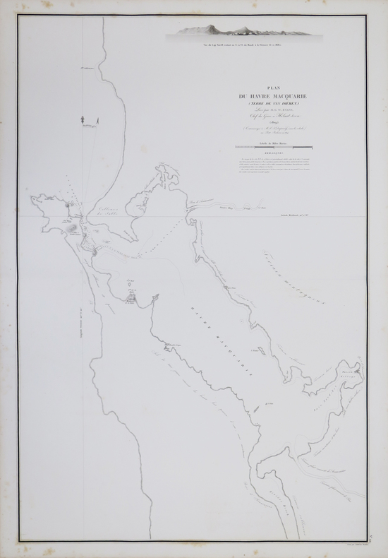
1827LBW-4433[1827]. 756 x 501 mm.
1824LBW-1064[1824]. 182 x 212 mm.
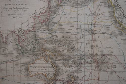
1820P1-22ATLASP1-4E-0AVEC L'ATLAS: LA HARPE (J.F). Abrégé de l'histoire générale des voyages, contenant ce qu'il y a de plus remarquable, de plus utile et de mieux avéré dans les pays où les voyageurs ont pénétré; les mœurs des habitants, la religion, les usages, arts et sciences, commerce et manufactures; par J.F. LAHARPE. Nouvelle édition, revue et corrigée avec le grand soin, et accompagnée d'un bel Atlas In-folio. Paris, Etienne Ledoux, 1820. 24 volumes in-8° (205x135) reliés demi-maroquin olive, dos ornés, tranches marbrées, belle série. 500pp. par volume, le dernier (XXIV) étant la table des matières. TARDIEU A., Atlas pour servir à l'intelligence de l'histoire générale des voyages de LA HARPE. In-folio (455x295mm), couverture éditeur, coins écornés. Paris, Ledentu, 1825. 15 cartes géographique (595x460mm), contours couleurs dressés par AMBROISE TARDIEU. Mappemonde, Afrique, Asie (2), Indes, Océanie, Chine, Japon, Sibérie, Golfe du Mexique, Mexique, Amérique Méridionale, Pérou, Brésil, Amérique Septentrionale, Europe.
1833LBW-1978Paris, 1833-1839. 268 x 358 mm.
185257668New York: Cornish Lamport & Co. Publishers 1852. First edition. Handcoloured folding map at front. iv 5-154 2 ads pp. 1 vols. 8vo. Brown blind-stamped cloth. Spine ends chipped else Fine. Ex-library stamps on map and title page card pockets removed. First edition. Handcoloured folding map at front. iv 5-154 2 ads pp. 1 vols. 8vo. Ferguson: "At this time the author was conducting an 'Australian Emigration Office' at 120 Wall Street New York." Ferguson 10892 2 copies P.L. N.S.W. Cornish, Lamport & Co., Publishers unknown
185257668New York: Cornish Lamport & Co. Publishers 1852. First edition. Handcoloured folding mapat front. iv 5-154 2 ads pp. 1 vols. 8vo. Brown blind-stamped cloth. Spine ends chipped else Fine. Ex-library stamps on map and title page card pockets removed. First edition. Handcoloured folding mapat front. iv 5-154 2 ads pp. 1 vols. 8vo. Ferguson: "At this time the author was conducting an 'Australian Emigration Office' at 120 Wall Street New York." Ferguson 10892 2 copies P.L. N.S.W. Cornish, Lamport & Co., Publishers unknown books
1841BOOKS0057972 Volumes: Volume I xiv412 pages with black and white frontispiece 5 color and 5 black and white plates 11 in text illustrations 2 maps in pocket. Volume II viii482 pages with color frontispiece 10 black and white plates 17 in text illustrations lacks four page prospectus for Gould's Birds of Australia. Royal Octavo " x 6" bound in original publisher's brown cloth with gilt lettering to spine. <i>Ferguson</i> 3228 First edition.<br /><br />Grey is best known for his expeditions in the north-west interior of the continent which resulted in the discover of the Glenelg River Stephen Range and Mount Lyell. As a young lieutenant he had made a proposal to the Colonial Office to mount an expedition to the north-west coast of Australia for the purposes of establishing a settlement there for starving Irish peasants. His plans were approved and he sailed for Australia in the Beagle in 1837. He wen on to mount two expedition in the north-west in 1838 and 1839 which yielded particularly important geographical discoveries: "His expeditions were the first to examine the previously ignored north-west interior of the continent and he discovered much useful territory. The inland explorations of Grey and Lushington his deputy complemented by the associated coastal explorations of Wickham and Stokes in the Beagle were a major advance in the discovery of the Australian continent" Wantrup p 206 <br /><br /><b>Condition:</b><br /><br />Recased with original spines laid on scattered foxing corners bumped. Else a very good copy. T & W Boone hardcover books
186780150Adelaide: David Gall 1867. First Edition. Hardcover. Very Good. Adelaide David Gall 1867. Duodecimo vi 82 52 'Chowla Advertiser' pages. Original flourescent green papered boards with expanded title page details repeated within a border on the front cover and with the contents listed on the rear; covers slightly marked and a little rubbed bumped and worn at the extremities with the hinges a little cracked; spine sunned lightly mottled and a little glue-stained; thin light tidemark to the top edge of the front endpaper; a very good copy of a scarce book rarely found with the spine intact and internally this copy is nothing short of fine. 'Storrie exhibits a keen sense of satire not only with regard to conventional tales whose perclivities are mercilessly ridiculed but also with regard to colonial society itself' Depasquale: A Critical History of South Australian Literature 1836-1930. Incidentally this is the first novel published in Adelaide. See Ferguson 16305 for confirmation of the Storrie/ McTavish connection. David Gall hardcover
1842144203London: John Arrowsmith 1842. First Edition. Hardcover. Very Good. London John Arrowsmith Published 18 May 1842. A hand-coloured engraved map printed surface 402 × 551 mm external dimensions 446 × 591 mm cut into eight uniform panels mounted on linen as issued folding down to approximately 225 × 150 mm. When folded the two outside surfaces of linen are lined with plain purple textured cloth; a long sealed tear runs though the two top right-hand panels containing the printed title and a centimetre into the next-left panel but the only printed surface affected is the thin right-hand border: in spite of its length it is inoffensive and unobtrusive and may well be a production fault; in very good condition complete with the publisher's original slipcase in matching cloth lettered 'Wellington' in gilt on one thin side worn at the corners of the closed end and a little marked. John Arrowsmith 1790-1873 'was an important English cartographer especially for Australians. A member of a family of geographers his production focused on mapping British colonies around the world at a scale that surpassed that of any other contemporary map maker. Additionally he had access to the very latest despatches received at the Colonial Office and the British Admiralty which formed the source for many of his productions. His work covers the period 1832 to 1862'. <p>His lasting contribution is his 'London Atlas of Universal Geography' which went through at least eight editions between 1834 and 1858 Dorothy Prescott: 'Arrowsmith's Australian Maps' online resource. <p>We have previously sold uncut examples of this map on paper sourced from copies of the atlas. This cased example produced from the same plate used for the atlases shows the original allotments along the River Murray at Wellington and the upper entrance to Lake Alexandrina. This copy has three of these allotments additionally hand-coloured with initials added in black ink. They are blocks 8 blue FB 51 blue JB and 90 red FB. The two inset maps show the south-eastern portion of Australia and a 'Sketch of the Country between the Gulf of St. Vincent and the Great Bend of the River Murray shewing the Position of the Two Special Surveys of the Secondary Towns Association on the River Light'. <p>Tooley 115 b uncut version. John Arrowsmith hardcover
1845036628London: T. And W. Boone 1845. xi 243pp 7 engraved plates map. Or cloth boards decorated in blind titled in gilt with gilt kangaroos to base of spine. Cloth splitting along rear spine edge front board starting to separate at top hinges starting. Ex- Mines Department library with usual stamps etc quite heavy foxing to map plates and title page. Corners bumped. Text pages generally clean. Scarce early account of the early settlement of Moreton Bay and New South Wales from Port Macquarie north. A great deal on the Aborigines. First Edition. Hard Cover. Good. 8vo. Ex-Library. T. And W. Boone Hardcover
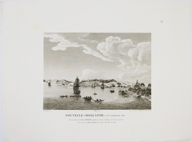
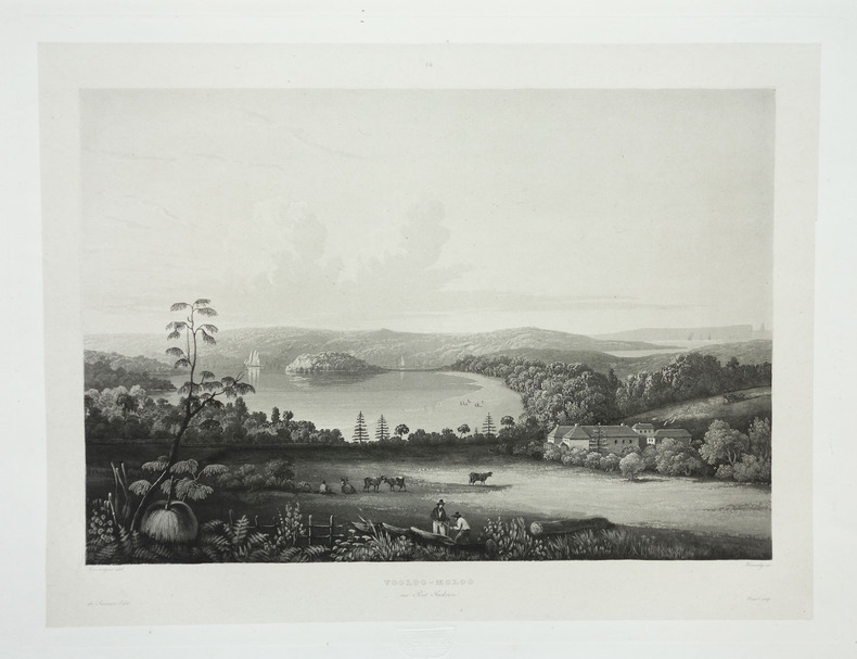
1833PHO-1811Paris,1833, in-folio, demi-reliure basane rouge, dos lisse, muet (rel. mod.), illustré avec 1 portrait en frontispice, lithographié par Lemercier d'après A. Maurin, [1] f. (titre gravé avec vignette), 20 planches disparates (8 cartes gravées sur acier dont 6 doubles, 11 vues reliées (dont 5 coloriées) et 15 planches en feuilles, papier des plats gondolé, quelques rousseurs aux planches libres avec défauts en marges.Recueil réunissant : 1 carte générale ; 1 carte de Nouvelle-Zélande (côte partielle); 1 carte du Pacifique; 1 de Nouvelle-Guinée; 1 de l'Archipel des îles Viti; 1 de l'île Tonga-Tabou; 1 des îles Vanikoro; 1 de Nouvelle-Zélande (nord); des vues de paysages; de personnages locaux (dont 7 coloriées).