1 660 résultats
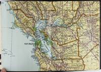
192862600Ottawa ONT: Natural Resources Intelligence Service 1928-1929. Four large folding colour maps. atlas folio w/ largest sized 45 x 35 in. w/ each sheet including an index map indicating there are 4 in total with outlines fold creases as issued minor age toning to fore-edges a few minor closed tears at fold creases still a VG set of maps. Early printing of this four sheet map depicting the automobile roads connecting Canada and the United States during the 1920’s as the Good Roads Movement rapidly expanded through the Northern Country following World War I. These maps depict the burgeoning highway and national road system which had been fostered by urban centers attempting to convince rural municipalities to replace their seasonal dirt roads with those of gravel or crushed stone and facilitate much greater movement of agricultural and manufacturing products across the continent and with the U.S. The Atlantic map stretches from the maritime provinces down to Washington D.C. and over to Niagara Falls and Buffalo NY; The Middle West map documents the main automobile roads and highways from Port Albert to Port Arthur and South from Denver to St. Louis indicating provincial federal and state roads and highways; The Great Lakes section tracks the extensive network of roads and highways surrounding the Great Lakes including those in Iowa Kentucky Wisconsin New York and the Canadian provinces of Quebec and Ontario; while the Pacific Map records the highways from San Francisco to Denver and up through Alberta and over to British Columbia. Uncommon with all four maps present. See: J.I. Little Confronting Rural Localism: The Good Roads Movement in Quebec’s Eastern Townships 1897-1920 Social History/Histoire sociale Vol. 57 No. 117 May 2024. Natural Resources Intelligence Service, unknown
193860338Marshfield OR: Oregon Coast Highway Association 1938. 4to. 16 pp unpaginated. numerous text illustrations double-page centerfold map by T.J. Greene small closed tear minor creasing self-printed photo-illustrated colour-softcovers center crease and printed in double-columns for folding slight soiling front cover still VG- copy w/ small rubber stamp of Breakers Motor Apts. Crescent City California on front cover. First edition thus of this automobile and bus travel tour guide to the newly completed US Highway 101 which finally had completed paved highway and bridges including the iconic Yaquina Bay bridge designed by Conde B. McCullough. Throughout the 1930’s with substantial support from the WPA and PWA projects as well as the U.S. Bureau of Public Works the highway became a scenic continuous drive. Oregon Coast Highway Association, paperback
193849584Chicago: Rand McNally Co. ca. 1938. Large colour map 26.5 x 19.5 in. which folds into 12 sections w/ several inset colour maps on verso colour-illustrated Art Deco cover art of couple driving from the front & back advertising Triton Oil minor shelfwear some dustsoiling still VG map. First edition thus including large Highway map on one side of Washington & Oregon along with smaller inset maps for Portland Everett Salem Seattle Spokane and Tacoma before World War II. Rand McNally Co., unknown
194962765London & Paris: British European Airways 1949. 4to. 20 pp unpagianted. colour-illustrated maps and red & black text throughout. Self-printed colour-illustrated maps w/ ad for BP Aviation Service and Anglo-Iranian Oil Co. Ltd. on back cover Dunlop tire ad verso of front center crease fold as issued w/ original BEA sleeve from the library of Archibald Angus MacDonald 1892-1977 stepson of famed southern California oil man William F. Byrne as well as oil company and drilling equipment owner and manager of MacDonald & Burns Oil Producers. First edition of this surprisingly scarce BEA route map book issued following World War II and prior to the establishment of the Western US UK and French Zones into the Federal Republic of German and the Soviet Zone into the German Democratic Republic East Germany. In 1946 BEA was established to feed short commuter flights across Europe and until 1950 used a fleet of Douglas DC-3 aircraft based out of Croydon and Northold Airports moving to Heathrow in 1950. No copies in Worldcat. British European Airways, unknown
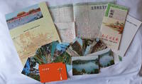
1970223347Beijing. 1970s. Collection of six items. <br> <br>Two postcard sets by the Peking Post Office: <br>北京风光 Bei jing feng guang: 8 postcards. <br>北京风景 Bei jing feng jing: 9 postcards. <br>Both in original envelope 8 x 15cm. <br> <br>Two copies of the large colour folding map "北京游览图 Beijing Youlantu" showing with detailed maps of major tourist destinations and bus routes in Beijing. Text in simplified Chinese characters 73 x 51cm folded 18 x 12.5cm. One in original paper case. <br> <br>A trifold brochure with colour map of Beijing text in English 25 x 12cm. <br> <br>"Visitors Guide to Peking" booklet in stapled wrappers folding maps one at rear and another loosely inserted 43pp 23.5 x 10.5cm. Prepared by members of the Australian Embassy for Australian tourists in Beijing. <br> <br>Some minor wear at extremities overall in very good condition. . unknown
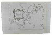
1749136827Paris. Circa1749. Engraved map on watermarked laid paper 20 x 27.3 cm of Fuzhou and coastline of Fujian Province original folds designed by the great French cartographer Jacques-Nicolas Bellin. This map is from the impressive 15-volume "Histoire Génèrale des Voyages" compiled by Antoine François Prévost map no. 2 Vol. 6. This map shows the estuary of Yangtze River Rivière de Chang. Very light browning on sheet edges but in very good condition. . unknown
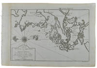
1749136826Paris. circa1749. Black and white engraved map on watermarked laid paper 20.9 x 32.7cm showing coastal area of Zhejiang Province Province de Che-kiang including Zhoushan Archipelago Isle de Chusan Zhoushan Bay Bay de Chusan and Xiangshan County Siang-chan-luen a walled city outside of upper border Ningbo Ning-po prefecture under Qing administration title cartouche lower left original folds. This map is No. 3 Vol. 6 from the impressive 15-volume "Histoire Generale des Voyages" compiled by Antoine François Prévost. Even browning mainly to the sheet edges in very good condition. . unknown
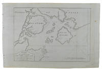
1749136795Paris. circa1749. Black and white engraved map of Quanzhou and Zhangzhou 21.1 x 30 cm here spelled Chin-chew and Chang-chew and both final words with added superscript "ou" on watermarked laid paper 25.6 x 38 cm original folds a few marginal spots simplified compass rose and a decorative fleur de lis bottom right in very good condition. Attractive map including the estuary of Quanzhou River Xiamen Emowi and Kinmen or Quemoy Quemowi island. The map was designed by the eminent French cartographer Jacques-Nicolas Bellin and here published as plate No. 22 in the impressive 15 volume compilation of voyages "Histoire Generale des Voyages" by Antoine François Prévost. . unknown
1749136781Paris. circa1749. Black and white engraved map on laid paper showing entrance to Pearl/Canton river Macao and the area which would become Hong Kong Sinn-gan-hien folded designed by the prominent French cartographer Jacques-Nicolas Bellin. This map is No. 16 Vol. 5 from the impressive 15-volume "Histoire Generale des Voyages" compiled by French novelist Antoine François Prévost. The walled city of Canton upper section is divided into areas of Tartar and Chinese. <br> <br>Some light even browning on paper added at margins good copy. Map measures 25.7 x 20.5. . unknown
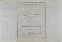
1749136794Paris. circa1749. Black and white engraved plan map of Peking on laid paper folded designed by the prominent French cartographer Jacques-Nicolas Bellin. This map is No. 18 Vol. 5 from the impressive 15-volume "Histoire Generale des Voyages" compiled by French novelist Antoine François Prévost. This city map shows two areas of walled cities: Ville Tartare Imperial city and the Forbidden City and Ville Chinoise ethnic Han residential area. <br> <br>Notes A and B represents buildings within the Forbidden City. A: Lieu de Plaisance ou l'on voit une Montagne faite a la main B: Grandes Cours du Palais de l'Empereur. Two missionary buildings French and Portuguese as well as the Tower of Mathematics illustrated within Ville Tartare. Two temples illustrated side by side near the south gate of the Ville Chinoise. <br> <br>Overall in good condition very light browning on edges and darker toning along the borders of the map. Text in French. Map measures 21 x 16.4cm. . unknown
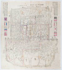
1900169765Circa1900. Large illustrated map of Beijing showing the city in the period following the invasion of the military forces of the Eight National Alliance old folds scale not given. Some scattered light foxing particularly at edges short closed tear at fold lower edge neat non acidic tape repair short section upper edge wear along folds and a couple of small unobtrusive holes with minor image loss. Blocks of text in traditional Chinese right and left upper sections stating each nation's occupied zone Japanese text title accompanies the English title along the upper section of the map. 63.7 x 56.9cm. Very good overall. A rare and significant large Japanese woodblock map of Peking Beijing issued just after the suppression of the Boxer Rebellion. Centred on the Forbidden City the map depicts Peking following the multinational suppression of the Boxer Rebellion or Yihetuan Movement of 1900. The map was issued to illustrate the areas of occupation associated with each of the powers in the Eight Nation Alliance. <br> <br>The map gives measurements of the city walls detailed names of streets and buildings and the boundaries of the inner and outer city including the forbidden city are shown with demarcation lines in pink yellow and blue. The hand coloured eight national flags of the occupation powers are featured at the right and left. <br> <br>This map is essentially a later edition of 京城内外首善全圖 a map of Beijing issued by the Qing for administrative purposes in the mid-19th century. The Japanese seized the wood blocks during the suppression of the Rebellion and subsequently pulled new impressions overprinting them additional details including flags and demarcations of areas of the city held by members of the Alliance. Versions are known in French German Japanese and as with the present example English. An attractive map of great historical interest. . unknown
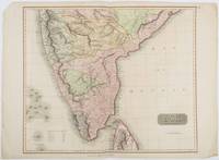
1816185242London.: Thomson. 1816. Engraved map with full handcolour 50.5 x 59.7 cms ; 53.9 x 73.8 cms sheet central fold a few minor edge tears one intruding into the top border the map unscathed marginal edgewear two corners with some loss but the map in very good crisp condition. An elegant map with great detail prepared for John Thomson's influential "New General Atlas" 1814-1821. Showing India from 20 degrees to 7 degrees north of the equator and includes the northern half of Ceylon with territorial interests attractively coloured. . Thomson. unknown
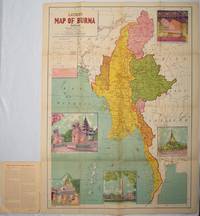
1951214601Delhi.: S.B. Makhija & Brothers. circa1951. Printed colour map 98.6 x 69 cms folding into pictorial wrappers 25.3 x 19.5 cms five pictorial colour inserts of pagodas and the Shwethalyaung reclining Buddha wrappers a little chipped marginal wear and three small fold splits in the map but overall in very good condition. Attractive large map of Burma with the provinces coloured steamship routes shown in red and printed in the booklet a range of information printed based on the 1951 census including climate agriculture and form of government "Burma became an independent nation completely outside the British Empire on January 4 1948 and is now a sovereign independent republic known as the Union of Burma". . S.B. Makhija & Brothers. unknown
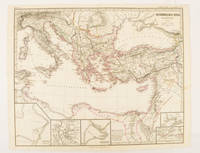
174950Gotha.: Justus Perthes. Map with original colour and outline hand-colour 32.2 x 40 cm text in German five inset maps central fold slight marginal toning and spotting on the verso but in very good condition. A most handsome and highly detailed map detailing the Eastern provinces of the Byzantine/Roman Empire in the time of the Roman Emperor Justinian 527-565. The inset maps depict Carthage Rome Constantinople Naples and a Western continuation of the main map originally issued for the "Hand-Atlas für die Geschichte des Mittelatters und die Neueren Zeit" . Justus Perthes. unknown
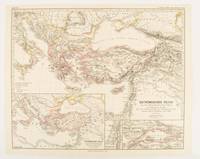
1874174914Gotha: Justus Perthes. 1874. Map with original colour and outline hand-colour 32.2 x 40 cm three inset maps text in German central fold slight marginal toning in very good condition. A most handsome map detailing the Eastern Roman Empire from the immigration of Hungarians in Ponnonia around 895 to the subjugation of the Bulgarian Empire by Emperor Basilius in 1019. The inset maps depict Divisions of the Empire Palestine and the Themata around Propontis present day Sea of Marmara issued for the "Hand-Atlas für die Geschichte des Mittelatters und die Neueren Zeit". . Justus Perthes unknown
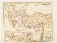
1876174911Gotha: Justus Perthes. 1876. Map with original colour and outline hand-colour 32.2 x 40 cm text in German four inset maps central fold slight marginal toning and spotting on the verso but in very good condition. A most handsome and highly detailed map detailing the Eastern provinces of the Byzantine/Roman Empire before the Fourth Crusade. The inset maps depict Constantinople Divisions of the Empire and Antioch issued for the "Hand-Atlas für die Geschichte des Mittelatters und die Neueren Zeit" . Justus Perthes unknown
19282443San Francisco and Los Angeles: The Heald-Menerey Company 1928. Very good. Large color map measuring 44 x 64 inches cut into eight sections and folded into book form. Original black limp textured cloth yapp edges titled in pale yellow on front cover. Moderate edge wear titles on front cover almost completely worn away. Internally clean. A rare portable version of the large and impressive Heald-Menerey's Geographical Commercial and Recreational Map of California produced in the late-1920s. According to the sheet of instructions bound before the map: "The first of its kind ever devised for desk home or automobile use. It consists of the California Survey 44 x 64 inches in size cut into eight strips and folded to make a book of 64 pages. Page No. 1 is the extreme northwest corner of our Survey and page No. 64 is the extreme southwest corner." The instructions proceed to inform the user on how to locate points on the map given its form as a book. The verso of the instructions page is a county index keyed to the pages of the map. The cover title begins "California Survey" but the remainder is rubbed beyond readability.<br /> <br /> The map was produced by the Schmidt Lithograph Company of San Francisco. The legend of the map contains symbols representing roads trails railroads streams springs swamps aqueducts lighthouses county and state boundary lines national forests mountain peaks township and range lines base and meridian lines and more. There are also two inset maps - one showing San Francisco and vicinity and the other Los Angeles and its immediate surroundings. OCLC records just a handful of copies of this book-form map published between 1928 and 1933. The Heald-Menerey Company unknown
193856963Fresno CA: City Planning Commission 1938. Oblong folio. 13.5 x 9.25 in. 17 blueprint maps variously numbered. w/ first map as the Key Map for the remainders. Stapled at gutter margin w/ protective green-tinted back softcover folded to provide reinforcement at spine from the library of George Reed Volker 1925-2018 former World War II pilot and urban planner in California New York and Washington State. First editions of these exceedingly scarce land use district zoning maps drawn up in 1938 after the passage of the 1937 Housing Act which unfortunately upended much of the spending not only by the WPA but also required any federal money to spent in “blighted†areas. These detailed maps show major streets demarcate singe family housing multi-family housing manufacturing and commercial bases for the community. Eventually the Public Housing which was built in Fresno during World War II began in West Fresno or “Chinatown first with the Sequoia Courts and later the Sierra Plaza followed by others. No copies located in Worldcat; See: Bibliography of Research Projects Reports W.P.A. Technical Series Research and Records Projects Bibliography No. 1 Feb. 2 1940 p. 53 Zoning Ordinance. City Planning Commission, paperback
196078704Atladena California: Altadena Federal Savings and Loan Association 1960. Printed on both sides on an 18 1/2" x 23 1/2" sheet of white paper that folds to 4" x 9 1/4" 24 panels. There is printing in red and a color rendering of the Altadena Federal Savings building on one side. Handwritten name on the front panel; else near fine. Scarce OCLC locates no holdings.<br /> <br /> Fully indexed street map of the unincorporated Los Angeles County California community that was devastated by the Eaton Fire in January 2025. Situated next to and within the foothills of the San Gabriel Mountains Altadena has long resisted annexation to Pasadena though that city has taken 46 "bites" of it over the years seeking tax revenues. That independent spirit is reflected in the mosaic of ethnic diversity that made Altadena one of the most integrated communities in Southern California. Altadena Federal Savings and Loan Association unknown
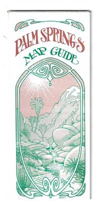
197678705Orange and Palm Springs California: Ken and Ruth Du Maurier The Palm Springs Map Guide 1976. Tourist map to the desort resort city in Riverside County California. In addition to a large street map of Palm Springs there are smaller maps of the city bus route Cathedral City and the Coachella Valley respectively. Also provides a list with addresses of movie star and celebrity homes a brief history of the region a description of the picturesque canyon areas and descriptive lists of local shops restaurants hotels golf courses activities service stations etc. Features photographic illustrations and numerous advertisements. Printed in green and desert rose on a 30" x 25 1/2" sheet of white paper that folds to 3 3/4" x 8 1/2" 48 panels. A fresh and clean example. Scarce OCLC locates only one holding at the Library of Congress. Ken and Ruth Du Maurier, The Palm Springs Map Guide unknown
198154177Gettysburg PA: W.C. Darrah Publisher 1981. First edition. 4to. illustrated. A fine copy in a fine dust jacket. SIGNED by the author on the title page. W.C. Darrah, Publisher unknown
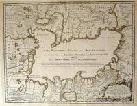
172354819Rainer Ottens. 1723. A most attractive map with early outline hand colour vertical fold barely visible diagonal crease upper half of map few very pale small brown spots otherwise a clean and bright image. Numbering in red pencil few annotations in pencil and light number stamp on reverse however not at all visible from front of map or affecting image. Sheet measures 46.6 x 60.2cm. . Rainer Ottens. unknown
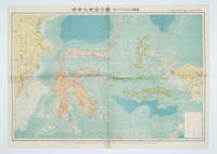
1572160554Tokyo 東京: 統制社Tosei-sha. 昭和 Showa 18. 1943. Colour folding map 54 x 75.5cm with original envelope. Envelope a little torn some occasional browning very good. The 13th map in this Standard Maps of Greater East Asia series of 20 maps. All text in Japanese. Shows railways shipping routes administrative boundaries airfields ports lighthouses mines oil wells etc. . 統制社(Tosei-sha) unknown
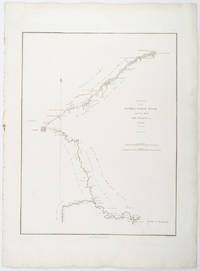
1796209283London.: George Nicol. 1796. Engraved copperplate map on Whatman paper 43.8 x 33.6 cm; 57 x 42 cm sheet including plate markscale in nautical and English miles; light undulation to sheet marginal toning and edgewear but in very good condition. Finely engraved and detailed map of two routes to Pekin Beijing along the White River Baihe from the Gulf of Petcheli and along the Imperial Highway from Jehol and includes commentary locating palaces and gardens type of cultivation "many barges" and "the road shaded by willow trees". The map elegantly drawn by Henry William Parish was published in George Staunton's account of Earl Macartney's embassy to China 1792-1794. . George Nicol. unknown
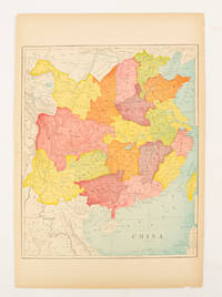
1900174904circa1900. Map printed in colour text in English provinces shaded in colour 28.3 x 23.2 cm central fold paper toned a small edge tear confined to the outer margin but in good condition. . unknown