1 660 résultats
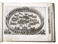
1550ABC_49514Italy 1550. 17th-century gold-tooled brown calf sewn on 6 supports with the corresponding raised bands on the spine a red morocco title label on the spine with the title "Novissima urbis Romae descriptio" lettered in gold gold-tooled board edges. Large oblong folio ca. 59 x 42.3 cm. With 76 full-page engravings and 12 full-page etchings. Remarkable album with 77 beautiful examples of 16th-century Italian cartography all in very fine dark impressions. The collection includes plans of important Italian towns such as Rome Venice Genoa Naples Milan Florence Palermo Siena Bologna and Pisa as well as detailed views of individual buildings and monuments in Rome. They are engraved by several cartographers from the school of Antonio Lafreri 1512-1577 primarily Claudio Duchetti d. 1585 Matteo Florimi d. 1613 and Lafreri himself. Florimi's works are among the rarest of the Lafreri school map makers especially his Siena imprints of which several have here been included.In the middle of the 16th century Italy was the centre of map production and distribution in Europe. This industry primarily took place in Venice and Rome. The most notable of the publishers in Rome was Lafreri. His most important and most popular work is the Speculum Romanae magnificentiae a collection of plans an views of Rome's monuments; no two copies of the Speculum are the same. The present collection contains more than thirty plates from the Speculum. When Lafreri died his nephew Claudio Duchetti inherited the company. He continued to produce the Speculum plates but often made small adjustments and signed his own name at the bottom. Most of the Speculum plates in the present album are by Duchetti. After his death the copperplates were sold to other publishers such as Giovanni Orlandi before 1590-after 1640 who reissued them. The majority of the plates in the present album were printed by Orlandi in 1602.The album further contains 32 engraved city plans mostly of Italian towns although a few foreign cities are also included; one of the rarest is the view of Moscow which is also included here. The collection ends with a incomplete series of 11 etchings of landscapes and biblical scenes.A list of contents is available upon request.With the bookplate of Louis Routy de Charodon seigneur de Grésigny and Charodon 1710-1794 on the front pastedown and remnants of another bookplate above. The boards are somewhat scratched and stained the spine shows traces of use the edges of the boards have been professionally restored and the boards have been lengthened to fit the maps. The maps are slightly browned some are slightly foxed the first few maps have been mounted onto 17th-century leaves the longer maps are somewhat soiled on the fore edge three maps are restored at the fore edge and one at the bottom edge some maps have been cut slightly short. Otherwise in good condition.l Cf. Parshall P. "Antonio Lafreri's "Speculum Romanae magnificentiae"" in: Print Quarterly vol. 23 1 2006 pp. 3-28. hardcover
38009901Korea late 18th-early 19th century 1780-1810. Eight color gouache pastel tinted maps ca. 57.5 x 90.1 cm.contemporary re-backing very solid clean examples complete set of all provinces hand-painted gouache manuscripts. RARE & OBSCURE . . . . A RARE & COMPLETE SET OF ANTIQUARIAN MANUSCRIPT KOREAN . . . YI PERIOD PROVINCIAL MAPS . . "P'ALTO CHIDO" OR "EIGHT PROVINCES MAPS" . . . DELUXE ELEPHANT FOLIO SIZE SHEETS . . . HAND-COLORED GOUACHE PASTELS . This is a very RARE & COMPLETE set of eight Korean provincial manuscript maps. Drawn circa 1780-1810 by an unsigned Korean cartographer. These maps are of historical importance giving place names isolating the time frame. . Painted on very thin finely hand-made mulberry-fiber tissue paper contemporary re-backed with a stiff hand-made paper. Beautifully hand-painted & colored in gouache pastels. . The record shows several reliable verities of manuscript maps showing the eight ancient Korean provinces. . Commonly these maps had no title cartographer's name date or other critical bibliographic colophon data. This is a common theme with Korean manuscript maps. . Political divisions of Korea are by and large mostly stable making name comparisons easier. . PROBABLE MAP TITLES INCLUDE: . a. The "SINJUNG-TONGGUK-YOJI-SUNGNAM:" "EIGHT SEPARATE MAPS EACH SHOWING ONE COMPLETE PROVINCE OF THE EIGHT KOREAN PROVINCES similar in intention to the "P'ALTO CHIDO." . The eight provinces were established during the Chosen dynasty 1392-1910 alternately and commonly called the Yi dynasty. . The eight provinces are from the north to south: . 1. Hamgyong 2. P'yong'an 3. P'yongyang 4. Kangwon 5. Hwanghae 6. Kanghwa 7. Kyongsang 8. Cholla'ungch'ong . During the Sejo reign 1455-68 Yang Songji made the first "P'Alt-do "P'ALTO CHIDO" type maps of the eight provinces this type and style became the "standard" for future examples. There after his style and format were copied by others for centuries. . b. A second version and style of the above eight provinces maps is called "TONGGUK CHIDO: MAP OF THE EASTERN COUNTRY i.e. KOREA" showing a compressed northern frontier along Manchuria the characteristic "CHONG CH'OK" style. . c. A third similar map: "P'ALDO-CHONGDO: A SINGLE MAP SHOWING THE EIGHT PROVINCES OF KOREA." . These maps are pictorially beautiful and artistically drawn in detail. Graphics expressing a primitive naive folk charm depicts prominent geological landscape features. Mountain ranges hills forests in green streams/rivers blues political district seats distinctively painted cartouches box-like in various differing colors for each province. Roads paddy coastal shore line & islands in blue tints with other features nicely colored. . There are a large number of name throughout each map all written in Hanzi traditional Chinese characters called "Hanja" in Korean as was the common practice at that time for Koreans. There are no Hangul characters at all. The Hanja identify navigational directions names of surrounding ocean harbors beaches geographical names city towns villages mountains rivers roads and the like. . Each of the eight maps illustrates a complete single province. Within each of the various political divisions and boundaries outlined and named. . RARITY OF KOREAN ANTIQUITIES: Antiquarian Korean examples are sparse when compared to items of the same period in China and Japan. Korean works are less than 10% of those created elsewhere. . Fewer Korean items were made survived and preserved. The attrition rate: bad weather unstable ancient mud building structures fires natural disasters earthquakes war and other factors diminished the remaining examples. . Those the numbers that come to marked are steadily reduced while the value continues to appreciate. Many never return to market when acquired by institutions or private collectors who eventually donate to museums. . DATING THESE MAPS: These were mostly undated. . There are three possible methods of dating. . a. BY PLACE NAME: there are details in the reference books about county seat names being colored or put in various kinds of 'boxes' on the map depending on that according to the resources approximate dates can be derived. . b. PAPER TECHNOLOGY & FIBERS: Koreans have been using hand-made mulberry bark and fiber paper from the Zhenguan period AD 627-649 printing Buddhist sutras by woodblocks on similar kinds of paper. . These two technologies papermaking and woodblock printing was transmitted to Japan around 700 AD. . Since that time both Koreans & Japanese have utilized mulberry paper Washi in Japanese to woodblock print and paint a large variety of items including maps books and single page works. . By comparing the paper of these maps with known dated printed Japanese books a very close approximate date can be derived. . These Korean map papers are nearly identical to dated woodblock-printed Japanese examples we have. It is therefore highly possible these maps were painted on hand-made mulberry paper from circa 1780-1810 period. . In ancient times sheet size was limited to a small size then joined to other sheets to create a large size single sheet. These maps are of that format. See McCune below where he states the kind of paper used which matches our examples. . CONDITION: Per McCune we summarize: as usual these maps were folded several times from their creation time so they could be safely stored and carried in small 'book' format in covers with a tied string. See McCune below. . Being painted on very fine & thin hand-made mulberry paper most all examples were eventually re-backed. Ours as typical have period re-backing using the same character hand-made mulberry fiber paper of a thicker quality. . They are well preserved however nevertheless as usual there remains some old original wear at the folds the expected light water stains dustiness with other typical very minor flaws for an item of this grand size being 200 years old. These do not detract from the overall excellent impression and stunning appeal. . RARITY: . The complete set is RARE! The work is nicely executed in a firm hand with artistic value illustrating artistically hills mountains and other features of the map pictorially. It is not only a map but a work of art. Tastefully colored in subtle pastels nice representation of water rives and sea. . Such early and beautifully artistic examples seldom come to market. . A RARE AND FRESH EXAMPLE NEVER BEEN ON THE MARKET IN THE LAST 120 YEARS ! . PROVENANCE: These items were acquired from a former missionary's estate who was stationed in Korea from circa 1900-1930's. They have been in this private collection since and have never been on the market. . Color scans are posted to our website. . REFERENCES: . TOOLEY Ronald V. et al.: Article: Shannon McCune: SOME KOREAN MAPS pp.70-102 with illustrations. McCUNE Shannon.: KOREAN MAPS OF THE YI DYNASTY KOREAN CULTURE Korean Consulate General L.A. Ca. Sept. 1983 pp.21-31 34 back cover color plate color & b.w. illustrated. . He discusses "P'ALTO CHIDO""EIGHT PROVINCES MAP" origins maps without scale and were copies of a Korean scholar named Won his title was: Haksaeng works based on Chong Ch'ok's 1390-1475 TONGGUK CHIDO MAP OF THE EASTERN COUNTRY then modified by Won to be the more typical "P'ALTO CHIDO" "EIGHT PROVINCES MAP" but in his new style. This new style clearly resembles our maps in layout format color of county seats and similar boxes around them and other critical details. KOREAN CONSUL GENERAL KOREAN CULTURE September 1983 pp.21-31 34 color map on back cover color and b.w. illustrated. . It was from these maps that the later versions similar to ours eventually emerged mostly by Imperial Order by the ".Yi Dynasty court specifically decreed that both magistrates and governors should prepare up-to-date maps of their territories udder their supervision." p.25. HARLEY J.B. ed. et al.: CARTOGRAPHY IN THE TRADITIONAL EAST AND SOUTHEAST ASIAN SOCIETIES. Ahead of Title: THE HISTORY OF CARTOGRAPHY Vol. 2 Book 2 an excellent article by Gari Ledyard: CARTOGRAPHY IN KOREA pp. 235-345239 figures 10.23 10.24 et al. NAKAMURA Hiroshi.: EAST ASIA IN OLD MAPS. . --. NIHON KO CHIZU TAISEI: GREAT COLLECTION OF OLD JAPANESE MAPS MONUMENTA CARTOGRAPHICA JAPONICA . --. OLD CHINESE WORLD MAPS PRESERVED BY THE KOREANS. Article in IMAGO MUNDI IV 1958. LEE Chan. CH'AN Yi.: OLD MAPS OF KOREA. Han'guk ko chido. By: Ch'an Yi Hong-gyu Che Han'guk Tosogwanhak Yon'guhoe. He discusses and illustrates a good number of similar examples. On pp.226-27 he outlines an early Yi Dynasty example of: THE MAP OF EIGHT provinces found in TONGGUK YOJI SUNGNAM Chong Sang-gi's Tongguk Chido. These manuscripts were on large paper one province per sheet. Many other fine related examples are illustrated & discussed. . --. OLD MAPS OF KOREA: HISTORICAL SKETCH. He traces the early origins of Early Yi dynasty1392-1910 Eight Provinces Map origins and progressions excellent lucid article with illustrations and references to Yi HOE's MAP OF EIGHT PROVINCES. Excellent essay on provincial maps. SHIN Michael D. ed.: KOREAN HISTORY IN MAPS: From Prehistory to the Twenty-First Century. British Museum similar examples cited: commons-wikimedia-org/wiki/Category:Room_67_British_Museum# /media/File:Map_of_the_Jeolla_Province_British_Library_c.27. f.14_fol.12_n02.jpg Library of Congress: Young Il Kim: dong-kookyu-do: A RECENTLY DISCOVERED MANUSCRIPT OF A MAP OF KOREA. Imago Mundi vol.21 1967 pp.31-49 illustrated. . . unknown
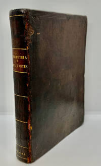
16491000378<p>Geometria à Renato Des Cartes Anno 1637 Gallicè edita; nunc autem Cum Notis Florimondi de Beaune In Curiâ Blaesensi Consiliarii Regii In linguam Latinam versa & commentariis illustrata Operá atque studio Francisci à Schooten Leydensis in Academiâ Lugduno-Batavâ Matheseos Professoris Belgicè docentis. Lugduni Batavorum Leiden: Ex Officinâ Ioannis Maire 1649. First separate and first Latin edition of "La Géometrie". 18th-century leather binding with spine lettering wear to corners and ends but binding is firm. Occasional foxing. The previous owner was John Fitzwilliam died 1699 who was elected fellow of Magdalen in 1661 and became the librarian there in 1662. He would become tutor to Lady Rachel Wriothesley later Lady Russell whose husband Lord Russel was executed under the Rhy House Plot to assassinate King Charles II. The work for a time was part of the private library of Makree Castle in Collooney Ireland but was later owned by the celebrated collector philanthropist Harrison Horblit. "The work was the first to propose the idea of uniting algebra and geometry into a single subject and invented an algebraic geometry called analytic geometry which involves reducing geometry to a form of arithmetic and algebra and translating geometric shapes into algebraic equations. For its time this was ground-breaking. It also contributed to the mathematical ideas of Leibniz and Newton and was thus important in the development of calculus." $12000.00</p> hardcover
168424285Edo Tokyo: Hyoshiya Ichirobe Hayashi-shi Yoshinaga First month 1684 But Third month 1680. A large woodcut map of Edo Tokyo with fine handcolouring on joined and folded paper. The map is breathtaking in its detail and features many paintings of important landmarks temples bridges and people who are often pictured working or fishing from boats on the waterways running through Tokyo. A stunning and very rare woodblock map beautifully and unusually handcoloured. Roads blocks buildings open areas canals and waterways are all vividly laid out on this huge and most impressive map. 123.5 by 149.5 cm. folded within paper covers folds to 28 by 18 cm now preserved in a fine clamshell box. A remarkably well preserved and very rare item with some light rubbing due to age and as to be expected. A bit of old worming or light soiling and occasional small repairs but in all quite astonishing in its quality and beautifully preserved with bright and vivid colour and detail. AN EXTRAORDINARY ITEM REMARKABLE FOR BOTH ITS CARTOGRAPHIC DETAIL AND ITS ARTISTIC BEAUTY. The wood block printing shows land tenures of Daimyo and Hatamoto. It also shows temples and shrines includes a distance chart and descriptive listing of Daimyo showing crests and halberds. There is also a inset of the eastern portion of Edo. Hyoshiya Ichirobe (Hayashi-shi Yoshinaga) unknown
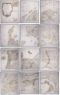
179023331Paris: Jean A. Dezauche successor of Delisle & Buache 1790. Each map in contemporary box with green morocco spines with titles 'Hollande' and 'Zelande' lettered in gold and green paper sides with ornamental gilt borders along the edges. Together ca. 230 x 155 cm. Engraved and etched map hand-coloured in outlines the cities coloured red. Printed on 12 sheets each divided into 4 segments numbered 1-48. The 48 segments are mounted on contemporary linen and folded the edges reinforced with blue ribbon. With: 2 LE ROUGE George Louis. Topographie de la Zelande en 9 feuilles traduitte de l'Hollandois. Second title: Partie orientale de la Flandre Hollandoise Paris Jean A. Dezauche 1790. Large engraved and etched wall map hand-coloured in outlines the cities coloured in red printed on 9 numbered sheets each divided in 4 segments numbered 1-36 size each sheet 48 x 56.5 cm; the 36 segments are mounted on contemporary linen the edges reinforced with blue ribbon. Two large complementary wall maps of the seven Dutch provinces covering 1 the provinces Holland Utrecht Friesland Groningen Overijssel and Gelderland and a part of Brabant bound to the line Steenbergen - Roermond and 2 Zeeland. Both are rare especially the map of Zeeland. They were the first maps of the Netherlands on such a large scale mostly about 1:105000 but with some eastern regions squeezed in at about 1:140000. Fully assembled the map of Hollande would measure about 230 x 155 cm and the map of Zeeland about 143 x 175 cm.Originally published in 1748 Le Rouge's 21 plates for the two maps were revised for publication in a second state by Jean Crepy ca. 1770. The map in its present third state was revised and published by Jean A. Dezauche in 1790. On the back of each sheet is an engraved label with the sheet number and the name of the region covered added in manuscript.From the library of Marco-Antonio III 1730-1800 Prince Borghese: on each box is the engraved armorial bookplate of the library of this Borghese Prince. Marc-Antonio's son Camillo Filippo Ludovico 1775-1832 married Napoleon's sister in 1803.Boxes are slightly scuffed. A remarkable copy with a princely provenance.l De Vries 'Een Franse wandkaart van Nederland uit 1748' in: Caert-Thresoor 1 1982 pp. 24-29; cf. BMC Printed maps VIII cols. 967 & 969 1748 edition; not in Donkersloot-de Vrij; Oehme A French world atlas in: Imago mundi 25 1971 pp. 55-64 on Le Rouge. Jean A. Dezauche, successor of Delisle & Buache, unknown
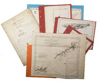
1942L7VCIV4N38L2UK Government: Survey Directorate HQ Tenth Army / Indian Field Survey Co. 1942. 42 chromolithographed topographic maps of parts of Iraq made from aerial photographs during World War II on a scale of 1:100000 and 1:253440 a quarter-inch to a mile. 68 x 50.5 cm & 60 x 47 cm. An impressive collection of Iraq maps compiled from the most current aerial photography and produced by the British Army for use in the Persian theatre of war during World War II. The cities and regions covered include Ain Sifni Aqra Tel Afar Salman Pak BaQuba Sumaika Penjwin Halabja Baghdad Kirkuk Dulaim Erbil and Mosul divisions.Previously folded. Generally well-preserved. Survey Directorate HQ Tenth Army / Indian Field Survey Co., unknown
1838021038London: T. McLean D.& P. Colnaghi and John F. Lewis 1838. 1838. Book. Illus. by John F. Lewis. Near Fine. Hardcover. First Edition. Folio approx. 55 x 36.5cm. Complete with all Lithographic plates as called for; tinted frontispiece tinted title-vignette further 27 tinted views on 25 leaves all by Lewis after Coke Smyth. A very clean bright copy. Finely bound in modern brown morocco to style with gilt lettering to the spine and gilt bands to the top and bottom of the spine. Contents clean and tight new light brown endpapers in keeping with the new binding two blank leaves to the front and rear all pages have been professionally cleaned and restored by a paper conservator minimal and unobtrusive water staining remains to some pages and plates mostly confined to the margins and blank areas most plates unaffected new archival paper guards to all plates no inscriptions. A fine complete copy beautifully rebound. References -. Abbey Travel II 394; Atabey 722; Blackmer 1015; Contominas 413; RIBA 1886. T. McLean, D.& P. Colnaghi and John F. Lewis [1838]. Hardcover
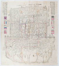
1900169765Circa1900. Large illustrated map of Beijing showing the city in the period following the invasion of the military forces of the Eight National Alliance old folds scale not given. Some scattered light foxing particularly at edges short closed tear at fold lower edge neat non acidic tape repair short section upper edge wear along folds and a couple of small unobtrusive holes with minor image loss. Blocks of text in traditional Chinese right and left upper sections stating each nation's occupied zone Japanese text title accompanies the English title along the upper section of the map. 63.7 x 56.9cm. Very good overall. A rare and significant large Japanese woodblock map of Peking Beijing issued just after the suppression of the Boxer Rebellion. Centred on the Forbidden City the map depicts Peking following the multinational suppression of the Boxer Rebellion or Yihetuan Movement of 1900. The map was issued to illustrate the areas of occupation associated with each of the powers in the Eight Nation Alliance. <br> <br>The map gives measurements of the city walls detailed names of streets and buildings and the boundaries of the inner and outer city including the forbidden city are shown with demarcation lines in pink yellow and blue. The hand coloured eight national flags of the occupation powers are featured at the right and left. <br> <br>This map is essentially a later edition of 京城内外首善全圖 a map of Beijing issued by the Qing for administrative purposes in the mid-19th century. The Japanese seized the wood blocks during the suppression of the Rebellion and subsequently pulled new impressions overprinting them additional details including flags and demarcations of areas of the city held by members of the Alliance. Versions are known in French German Japanese and as with the present example English. An attractive map of great historical interest. . unknown
182342750London: T. Cadell and W. Davies 1823. First edition. Hardcover. g to vg. Large quarto 11 1/4 x 9". 2 xxviii xxiii 1 812pp; xix 13 715pp 1pp Errata 2pp Publisher's advertisement; 2 xv 12 20 822pp; 2 xx 14 735pp 1pp Errata; xii 14 763pp 1pp Errata; 2 iv 14 555 1pp. Modern half black morocco over dark grey cloth with gold lettering and ruling to spines. Raised bands. First volume with a striking tissue-guarded frontispiece portrait of the author engraved by Richard Golding after a painting by John Opie. Tissue-guarded engraved frontispiece in each volume.<br /> <br /> First edition of Edward Daniel Clarke's magnum opus "Travels in Various Countries of Europe Asia and Africa" the author's personal account of a fascinating journey throughout three continents. <br /> <br /> Following a tour of Scandinavia in 1799 Edward Daniel Clarke 1769-1822 travelled through Russia and the Crimea before proceeding to Constantinople Rhodes and afterwards Egypt and Palestine. Greece was the country next visited. While touring this country Clarke as a mineralogist and antiquary collected marbles coins and vases and purchased a large ancient statue at Eleusis. From Athens he proceeded by land to Constantinople and after a short stay in that city directed his course homewards through Rumelia Austria Germany and France.<br /> <br /> Each of the six volumes is lavishly illustrated throughout with numerous in-text vignettes and woodcuts as well as full-page copper plates many folded depicting views monuments natives in traditional costume ceremonies and processions antiquities etc. Includes several folded maps and charts. All the 185 copper plates and 157 vignettes and cuts are accounted for.<br /> <br /> Plates engraved by Joseph Skelton R. Pollard Laetitia and Elizabeth Byrne F. R. Hay J. Fittler and R. Cooper after illustrations by E. D. Clarke Angelica Clarke Guarenghi Martin Dreier W. Havell Camporesi J. B. Lusieri Morritt W. Harraden Grelot Fauvel G. Wilkins Henry Wrighte and Preaux. Most of the delightful vignettes were engraved by Elizabeth and Laetitia Byrne. The maps and plans were engraved by S. I. Neele and H. Mutlow.<br /> <br /> Some offsetting to text pages facing plates. Moderate to heavy foxing to plates throughout. Minor foxing to text pages. Sporadic clear water-staining along edges of plates in second volume Part 2 section 1. Ex-library copy with perforating library stamp to each title page and small reference stamp at inner gutter of the first text leaf of each volume not affecting lettering. Bindings in overall very good interior in good to very good condition. T. Cadell and W. Davies hardcover
1755ABC_474521755. Manuscript of 24 pages 6 printed maps on cardboard. This wonderful logbook details the journey of a French captain from Manila to the Maluku Islands in todays Indonesia. The journey took place during the months of March to May of 1755. The captain of the ship recounted with great detail the events of every day of the journey with detailed daily accounts of the weather winds manoeuvres of the ship its departures anchorages and precise coordinates at every point of the journey. The captain furthermore had a keen eye for the geographical and nautical details along the journey. He recounted the exact locations of for example sandbanks and bays where ships and their crews can take provisions and fresh water. The accounts are detailed and captivating: "After our boats were back on board we set sail . in the afternoon to moor under the old Portuguese fort on the Solor island Indonesia the winds for the tide were fresh at 1:34 a.m. . sand and gravel and then I went back to mooring. The pavilion of the fort . the village is under the said fort at 3 cables from us .". The captain goes on to describe the geographical features of the islands as well as other places en route with great detail. Curiously we find inscriptions in Spanish and the names of one don Phelipe Qui who describes himself as el piloto and one Padre Don Estevan de Melo. The latter might be identical with Don Estevan Roxas y Melo a native of Lima Peru and secretary to the Archbishop of Manila Rodriguez since 1736. Roxas y Melo was part of the 1751 reconstruction of the Cathedral of Manila working under the auspice of the Italian architect Juan de Uguccioni.The logbook comes with six printed maps partly illustrating the journey of the captain pasted on contemporary cardboard. They depict the Bay of Sulavesi with the city of Bantang Pitcairn the coast of New Guinea the coast of Queensland the Santa Cruz Islands in the present-day Solomon Islands and Alejandro Selkirk Island. The plates stem from the French translation of James Hawkesworths An Account of the Voyages Hawkesworth Relation des voyages entrepris par ordre de sa Majesté Britannique actuellement regnante; pour faire des découvertes dans l'hemisphère meridional Paris 1774.Some holes on the first sheet not affecting the text. Small water damage some slighlty affecting the text. Remnants of seals on last page. Otherwise in good condition. unknown
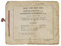
1944ABC_4794483 Rep Group. I.E." 1944. Original beige printed paper wrappers side stichted by hand through 3 holes with a reddish pink cloth ribbon. Oblong 21 x 255 cm. With 1 index map and 16 numbered folding strip maps. Exceptionally rare collection of folded strip maps of roads in Western Iran which was very likely meant for military use during the Second World War. The abbreviated inscription on the front wrapper possibly stands for "24th brigade branch transportation office" though it is unknown which 24th brigade this would have been. The maps were originally printed on quarter inch sheets in 1942 and have been significantly enlarged for this edition to a scale of 1 inch to 2 miles. We have not been able to trace any other copies of either the first or second edition of this work anywhere.With an owner's inscription on the front wrapper. The maps and back wrapper have been reinforced with bookbinder's gauze. The wrappers are somewhat soiled creased and the edges are somewhat frayed. The maps have slightly browned and the index map has a small brown stain in the lower outer corner without affecting the image. Otherwise in good condition. 83 Rep Group. I.E.", hardcover
16876047<p>Das von den Türcken lang-gequälte nun durch die Christen neu-bescelte Königreich Hungarn Theodoro Tscherning; maps by Martin Stier. Published by Martin Endter Nuremberg 1687. First Edition. 16mo up to 6½" tall. 464pp. fold out dedication to the Holy Roman Emperor Leopold I dated 1687 with detailed engraving of a double-headed eagle holding a scepter and orb; 12 folding maps as called for; index 12pp. Individual maps removed and placed together form one large map. Half leather over marbled boards banded spine red edges. Browning to title page and light toning thereafter. Maps are in very good to fine condition. Partial split to leather at outer upper hinge and partial crack to inner hinge. In very good condition.</p><p>The Kingdom of Hungary long tormented by the Turks now blessed by the Christians. According to the attached XII most accurate maps clearly handled and provided with the newest most remarkable events extending up to the present time. A brief presentation and description of the Hungarian cities fortresses and castles including the neighboring lands of Austria Moravia Carinthia Carniola Styria Bosnia Dalmatia Croatia Slavonia Bulgaria Transylvania etc.</p><p>Published during a pivotal era for the Habsburgs shortly after the 1683 Battle of Vienna and the same year 1687 as the Battle of Mohács which helped solidify Habsburg control over Hungary.</p> Martin Endter hardcover
184987523Washington D.C.: Government Printing Office 1849. Hardcover. Very Good. Octavo 9.2 in. x 6 in. pp. 678 1 index. Personal copy with gilt ownership plate to front board of DeWitt C. Lawrence Chief Clerk of the Patent Office. Illustrated with sixteen folding maps. Black half calf with decorative gilt chain rule over marbled boards. Rebacked spine. Gilt name on black ownership panel to front board. Black title on paper panel to spine. Marbled endpapers. Front free endpaper detached but present. Detailed pencil notes presumably from DeWitt Lawrence to preliminary pages index and rear endpapers and to occasional penciled comments on margins of main text providing reference and guidance. Fremont Preuss's maps #II-VIII in VG condition. Other maps in G condition with additional creases a few short closed tears at seams and light browning to several edges. <br /> <br /> ALL16 maps detached as they were removed for preservation and study. Maps I IX-XVI folded in archival pocket. The PREUSS Maps II-VIII "The Rockwell Maps" are laying flat preserved in archival sheath and will be mailed separately under cover. Includes additional copy of Rockwell's map of "Section III". The 16 folded maps include: #I. Map of the Country Between the Atlantic and Pacific Oceans. 1848. Rob Mills. Pencil notes on map. #II-VIII. Road from Missouri to Oregon in 7 Sections 1848. Charles Preuss. Includes two identical copies of Section #III map. All eight Preuss maps in VG condition #IX. Republica Mexicana Plano del Curso del Rio Coatzacoalcos. 1843 #X. Profils en Long et en Traviors du Canal. L'Isthme de Panama1841. Garella. #XI. Profile of That Section of the Country between Nicaragua and the South Sea 1838. Based on Thompson's Guatamala. #XII. Nicaragua Realejo Harbour Edward Belcher Harbour of San Juan de Nicaragua George Peacock 1832 #XIII. Chart of the Bay of Limon or Navy Bay 1829. J.A. Lloyd. #XIV. Republica Mexicana Pano de la Parte Austral del Istmo de Tehuantepec 1843. Jose de Garay. #XV. Panama Canal Longitudinal Section. J.A. Lloyd. Four inch closed tear with 1/2 inch chip to seam. #XVI. Carte Topographique de la Partie De L'Isthme de Panama comprise entre Panama Chagres. 1845. Garella. Uniquely annotated copy. <br /> <br /> The "first major government report devoted to interoceanic communication.Rockwell in addition to his prime focus on Central American canals compiled memorable documents on the suddenly urgent need for more directly binding California to the Union.Foremost.was the matchless seven-section map of the Oregon Trail made by Charles Preuss Fremont's gifted cartographer. Lieut. G.K. Warren in his 1859 memoir wrote that Preuss's 'skill in sketching topography in the field and in representing it on the map has probably never been surpassed in this country.' <br /> <br /> ".The Senate had issued this map separately in 1846; now the House was trying to make available to the Forty-0niners what was by far the best trail map of them all.this treasure was so deeply buried in this report that but few gold seekers found it and it is still so rare in both editions that Wheat lamented that it ' has been insufficiently appreciated by students of Western history.' ." Plains & Rockies 1800-1865: Supplemental volume to the series News of the Plains and Rockies; 2001 Arthur H. Clark Spokane. [Government Printing Office] hardcover
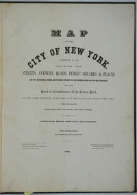
187226020New York 1872. Hardcover. Very good condition. Maps of Manhattan's west side prior to the completion of Central Park which was finished in 1876. The maps were compiled by longtime New York City Department of Public Works map clerk and city surveyor Otto Sackersdorff noted for his 'Maps of Farms Commonly called The Blue Book 1815". The Blue Book was not published until 1868 as a demonstration of northern economic might at the end of the Civil War. <br /> <br /> The real estate maps show property lines existing roads parks shorelines wetlands and the Manhattan grid extending from west of 8th Avenue at 59th Street and Columbus Circle up to 222nd Street and Spuyten Duyvil & Kingsbridge. Parks and major thoroughfares include: Central Park St. Nicholas Avenue Fort Washington Park Kingsbridge Road and High Bridge Park.<br /> <br /> Folio 15 x 20 1/2" 14 maps in total: 1 full page and 13 double page 28 x 20" hand colored lithographed map sheets. Each map contiguous with one another. Period quarter green gilt leather and dark green buckram boards. Spine gently rubbed; the maps exceptionally bright and clean. <br /> <br /> Previous owner inscription in pencil E. B. Van Winkle from Chas. H. Myers July 1875. Van Winkle was a civil engineer with an interest in road construction and drainage having written a report on the drainage of the 23rd & 24th wards of New York City. Myers was an Assistant Engineer in Charge of Sewers for New York City.<br /> <br /> OCLC: 41175506 at Princeton and OCLC: 40671892 at Columbia and the New York Public Library. hardcover
1888J4KDIGIVEPWUFrance 1888. Brown and black ink watercolour chalk and gold paint on paper mounted on several laminated sheets of paper 69.5 x 52.5 cm. Charming trompe-l'oeil of maps of European countries on a decorated background somewhat reminiscent of a church ceiling. It contains a French inscription "to my beloved parents" which together with some inconsistencies in the use of perspective suggest a young French artist. The maps show some interesting departures from reality: in the Netherlands parts of the province of Gelderland are shifted 50 kilometres to the north replacing Zwolle with Arnhem and Sweden lacks Stockholm but includes Copenhagen in place of Malmö. However the most humorous is in the map of Germany which lacks its western neighbours - the Netherlands Belgium Luxemburg and France - giving it an extensive North Sea coast. The gothic lettering is inconsistent in style with the artist apparently improvising an alphabet for each inscription in the process forgetting Denmark.Somewhat soiled and browned at the edges with several white spots due to overpainting; the sheets are coming loose from one another. unknown
186161812New York: W. Schaus; printed by Sarony Major & Knapp 1861. Second Edition. 59 x 76cm open. 19.5x19cm closed. Tinted lithographic map backed in brown silk in black slipcase with printed paper label. Bookseller's ticket of Rev. A. O. Brickman Baltimore. Two ownership inscriptions of "J. M. Deems Maj. 1st MD Cav" and inscribed "Deems" on the slipcase. Trimmed; splits along half of one horizontal fold; minor stains and discoloration to verso not affecting image which is bright and generally Very Good. Hand-made slipcase worn with portion cut out but with manuscript ownership label intact. <br /> <br /> Uncommon Civil War map used by a distinguished Union Army officer. James Monroe Deems 1818-1901 was a composer and music educator from Baltimore who secured a commission as a major in 1861. He was promoted to Lieutenant Colonel in spring 1863; led the First Maryland Cavalry during the Battle of Gettysburg; retired due to rheumatism in November 1863; and was brevetted Brigadier General in 1867. He likely acquired this map in Baltimore near the beginning of his military career and certainly before his promotion in 1863 given the use of "Maj." in his ownership inscriptions. <br /> <br /> The map itself is the second edition of this design by J. Schedler despite the title it is not a bird's-eye view. The more common first edition has two insets showing the Lower Mississippi Valley and the city of Richmond see Stephenson 17.3. This version has only one inset showing the eastern United States. Stephenson describes this edition as having a Washington DC bookseller's ticket; the present copy has a Baltimore bookseller's ticket instead. <br /> <br /> This copy was mounted for use in the field: it was trimmed down to the neatline the captions removed the image cut up into segments and mounted on linen. The printed label on the slipcase appears to be a portion of the original title. This may have been done by the bookseller Brickman possibly at Deems' request. <br /> <br /> Uncommon. OCLC records about 10 similarly titled maps but few listings distinguish between the first and second editions. STEPHENSON LC Civil War Maps 2nd ed 17.35. 61812. [W. Schaus; printed by Sarony, Major & Knapp] unknown
1692Alibris.0018045Francofurti Ad Moenum: Frederici Knochii 1692. Ultima editio cum optimis colla. Full leather. Good. No dust jacket as issued. . Good. Scarce edition. Worldcat locates only 1 copy. Spine well worn and chipped. Moderate foxing throughout Includes: illustrations diagrams. On the rear endpaper is an Armorial bookplate of the Princes of Liechtenstein "Ex Libris Liechtensteinianis" above arms with chain of the Order of the Golden Fleece associated with Prince Franz Joseph II 1906-1989. Frederici Knochii hardcover
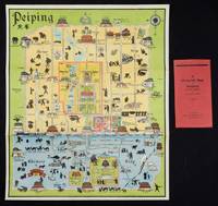
1934158433Peiping.: Peiyang Press. circa1934. Coloured folding plan of Peking with original envelope. 60 x 50cm. A few neat repairs at folds two panels evenly browned on reverse. A very good copy of a scarce pictorial plan with its envelope. This delightful and scarce pictorial map of Peking with landmarks and streets in romanised Chinese with occasional Chinese characters is surprisingly scarce. Although apparently issued in several editions in the 1920s and 30s it appears relatively infrequently on the market. The divisions of the Legation District are indicated by their flags - this edition shows the German Legation by use of the black white and red bands of the German flag. This flag which was no longer used after 1935 helps date this edition. Other landmarks and attractions shown included theatres foreign shopping area adjacent to the legations quarter Liu Li Chang Curio District the racecourse the many city gates etc. . Peiyang Press. unknown
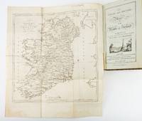
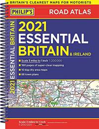
1783ST19355London: Engraved by G. Terry and Sold by T. Longman London and W. Wilson Dublin 1783. Second Corrected Edition. 260 x 155 mm. 10 1/4 x 6". XXVII 289 pp. 4 leaves index. <br/> Contemporary half calf over marbled boards flat spine divided into panels by gilt rules red morocco label very neat repair to head of front joint and top of spine. Engraved title page with vignette and dedication leaf large folding map of Ireland and 289 engraved maps. Title page with early ink signature of Jos. Sabine. Moreland & Bannister p. 190; Tooley "Maps and Mapmakers" p. 94. Small signs of age and wear to the binding including slight crackling and nicks to the spine folding map with faint dampstain to tail margin two negligible ink spots to blank area on the map of the Irish Sea but A VERY APPEALING COPY quite clean and remarkably fresh internally and in an entirely solid period binding.<br/> <br/> This is the second corrected edition of the first comprehensive road atlas of Ireland offered here in especially attractive condition. In response to increasing demand for accurate maps of the country's road system the Irish House of Commons commissioned George Taylor and Andrew Skinner who together had previously produced the first road atlas of Scotland among other works to undertake a survey of the land. Taylor and Skinner completed their work in 1777 and published the first edition of their findings in 1778. This second edition includes updates to the year 1783 as well as an additional map no. 289. Renowned for their precision and detail Taylor and Skinner's maps clearly show roads crossroads and bridges as well as topographical features such as hills lakes and rivers including the direction of the water flow; landmarks such as castles churches and ruins; and the names of local landlords and their homes. The maps appear either as half-page strips or in full-page and the distances are given in both Irish and English miles 11 Irish miles being equal to 14 British miles. The robust list of subscribers which includes a number of earls viscounts lords bishops and British and Irish army men demonstrates the great need for and widespread success of this important work. Our former owner may well be the famed and controversial naturalist Joseph Sabine 1770-1837 who often signed his name as "Jos. Sabine" as seen here. He certainly had good reason to own maps of Ireland. He was from an Anglo-Irish family himself and was Honorary Secretary of the Horticultural Society a position which at the time carried great clout in the botanical community and one that presupposed knowledge of geography across the realm. DNB tells us that "Sabine played a leading part in the establishment of the society's garden first at Hammersmith and afterwards at Chiswick; in sending out David Douglas and others as collectors; in starting local societies in connection with the Horticultural Society; and in growing and distributing new and improved varieties of flowers fruits and vegetables throughout the country." While not a rare book this is the kind of volume that would have normally encountered frequent and inevitably damaging use so to find a copy as well preserved as this one is a lucky occurrence. Engraved by G. Terry and Sold by T. Longman, London and W. Wilson, Dublin unknown
1788024356London: Printed for J. Walker 1788. Book. Very Good. Hardcover. First Edition. 12mo. A very good four volume set in contemporary full tree calf binding with double lettering pieces in red and green. Complete pp. iii-vii 1 222; 2 206; 2 238 & 2 198. No half-titles which may or may not be wanting but the pagination for the prelims to vol. I might suggest that one is required Very good bindings with a little rubbing a couple of volumes slightly chipped to the head/tail of the spines corners lightly bruised. Contents clean and tight manuscript Greek initials to title pages dated 1788 otherwise unmarked no foxing paper crisp. A very good set. A Rare Eighteenth Century Novel. We have managed to located just one other copy at auction in the last thirty years and that at Sotheby's sale of July 21 1993 where it made £1000 on the hammer though seemingly not such a nice copy. Referenced by: ESTC T068744. Printed for J. Walker Hardcover
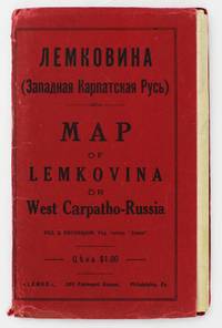
19295372Philadelphia: Lemko Press 1929. Very good. Lithographed folding map approximately 32 x 40 inches printed in pink and black. Housed in original red wrappers printed in black. Modest wear along folds a couple of small separations at crossfolds light marginal toning. Wrappers with minor spine and edge wear. An extremely rare map of "Lemkovina" the homeland of the Lemko an Eastern Slavic people from the Central Carpathian Mountains where Poland Slovakia and Ukraine meet in the present day. From the late-19th century to the 1920s tens of thousands of Lemkos immigrated to the Unites States and Canada -- fleeing war oppression and seeking better economic opportunities. Once in the United States Lemko intellectuals founded institutions to preserve and promote Lemko culture in the New World and to lobby for sovereignty of the Lemko homeland. The present large-format map is an intriguing artifact of the Lemko-American immigrant experience. The map was drafted by the Lemko-American activist Dmitriy Vislocky and published by the Lemko Press in Philadelphia in 1929; it showcases the areas where the Lemko population prevailed as well as areas of mixed Lemko-Slovakian and Lemko-Polish demographics; while it does not explicitly define Lemkovina as a sovereign state its rhetorical direction is nevertheless clear.<br /> <br /> The Lemko are an Eastern Slavic people who originate from a large area along both slopes of the Central Carpathian Mountains in a region traditionally often referred to as "West Carpatho-Russia" located along the eastern stretch of today's border of Poland and Slovakia and extending slightly east into Ukraine. The Lemko language is akin to Ukrainian and is written in Cyrillic. Traditionally many consider the Lemkos to be a subgroup of Russians or Ukrainians although many Lemkos have tended to self-identify as a distinct ethnicity. The Lemkos have vibrant and sophisticated cultural traditions with distinct music folklore clothing and customs. Most Lemkos are Eastern rite or Byzantine-rite Catholics although some have converted to the Eastern Orthodox faith. The period leading up to during and after World War I was traumatic for the Lemkos. The group splintered their loyalties with some supporting the Russians both Red and White factions while others were sympathetic to Ukrainian nationalism and some either voluntarily or under coercion were allied with Austria-Hungary. Lemkos caught on the wrong side of events often met with cruel fates. In the aftermath of the war Lemkos who supported the Red Russians formed the "Lemko-Rusyn People's Republic" which existed from December 1918 to March 1920 a state that took in part of the northern slope of the Central Carpathians of Lemkovina. Meanwhile further to the east was the pro-Ukrainian "Eastern Lemko Republic" November 1918 to January 24 1919. However these republics were soon extinguished with all Lemkovina being divided between Czechoslovakia and Poland. The Lemkos in Poland would have a very difficult time as the Polish state considered them disloyal. Eventually they were forcibly displaced from their homeland. <br /> <br /> Lemkos began to immigrate to the United States and Canada in the late 19th century in good part due to economic opportunities. The greatest center of activity for Lemko peoples in North America was in Pennsylvania although large communities could be found across the American Northeast and Midwest as well as in places such as Toronto Canada. Many Lemkos found decent jobs initially in the burgeoning manufacturing industry. Smaller but still significant Lemko communities developed as far away as Colorado and Alberta where they were engaged in the ranching and mining industries. Today hundreds of thousands of North Americans count Lemko ancestry. Lemkos adjusted very well to life across the Atlantic and generally met with success. The most famous of all Lemko-Americans was the artist Andy Warhol 1928-1987 who was born in Pittsburgh the son of Lemko immigrant parents. In the 1920s Lemko intellectuals in America largely based in Pennsylvania formed a movement to preserve Lemko culture while lobbying for the eventual resurrection of an autonomous if not sovereign Lemko homeland – Lemkovina. However there was a great deal of internecine dispute over the nature of this proposed state as some favored a pro-Ukraine sovereign entity while others wanted it to be Soviet satellite yet the dream of a future sovereign Lemko nation of any sort was never to be realized as powers ranging from the Czechoslovak and Polish governments to Hitler and Stalin would never allow it. Lemko culture flourished in the U.S. and Canada centered around Lemko halls and churches and beginning in the 1920s a handful of small printing presses were established to serve and educate the community issuing Lemko-language almanacs primers newspapers and pamphlets. One of the most important of these houses was the Lemko Press of Philadelphia which under the leadership of Dmitriy Vislocky published the Lemko Gazette. The circle of the Lemko Press had a pronounced Ukrainophone allegiance and was at odds with some other Lemko-North American groups.<br /> <br /> As a major part of their campaign to define "Lemkovina" and call for its eventual nationhood presumably as a pro-Ukrainian sovereign state in opposition to both the Soviets and Poland Dmitriy Vislocky and the Lemko Press produced the present map. As best as we are aware it is the only large format map of the period to specifically show Lemkovina as a distinct entity and being published in Philadelphia it stands as a remarkable feat of Lemko-American immigrant cartography. The large format map executed to the ample scale of 1:200000 with text in Cyrillic and lithographed from a hand-drawn template shows the Polish-Slovakian frontier region which today extends east into Ukraine along the Central Carpathian Mountains an area traditionally sometimes known as "West Carpatho-Russia." A very rugged and rural area it is roughly framed by the the Dunajec River in the west and the San and Uzh Rivers in the east and with the cities of Nowy S cz Poland to the northwest and Košice Slovakia to the southeast. The map delineates all major rivers roads and railways and locates cities towns and villages. The legend below the title explains the color-coding employed to define demographic areas. Territory shaded in bold pink are of majority ‘Russian’ meaning Lemko and Rusyn population i.e. core Lemkovina while the areas covered by southwest-northeast hashed lines are of mixed Lemko/Rusyn-Slovakian population and the areas with northwest-southeast hashed lines are of mixed Lemko/Rusyn-Polish population. Beyond are labeled the lands of Poland to the north Slovakia to the south Eastern Galicia to the northeast and Sub-Karpatsky Russia Ukraine to the southwest while the map defines the Polish-Czechoslovak border as it was then internationally recognized. While the map does not explicitly state that Lemkovina is a country Dmitriy Vislocky’s sovereignist direction of travel is nevertheless clear.<br /> <br /> The present map is extremely rare. It was likely issued in only a small print run and the survival rate of such fragile ephemeral American immigrant publications is very low. We can trace only a single institutional example of the map held by the David Rumsey Map Collection at Stanford University. Beyond that we are aware of only a single other example as having appeared on the market in the last twenty-five years.<br /> David Rumsey Map Collection Stanford University: 11153.000. Lemko Press unknown
17088917London: John Nicholson 1708. Full Leather. Very Good binding. Octavo. xxxviii 2 412; 2 382 2 ads 32 index pp. maps. First edition. Contemporary paneled-calf boards with modern reback. Title page to Volume 1 and four of the eight maps are lacking but are supplied in tasteful facsimile. The maps in facsimile are the North America New England Virginia and Maryland and Carolina. Bindings are solid and presently nicely; contents are clean and bright; but for the maps and title page this is an exceptional set. <br /> <br /> Of this work William Reese writes: "This basic 18th-century reference work on British America . . . offers an excellent comprehensive survey of Great Britain's American colonies at the point when those on the mainland of North America had grown past their initial phase and were expanding rapidly in population and productivity. . . . This important contemporary work would probably have been the first point of reference for any Englishman at the time" Reese Struggle for North America 1. Usually attributed to Oldmixon who penned the dedication but occasionally gets attributed to Moll according to Sabin. A significant work by the British historian. Howes O-61 "aa"; European Americana 1708/95; ESTC T45485; Sabin 57156. John Nicholson unknown
GOR013594973Paperback. Acceptable. paperback
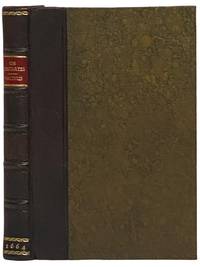
16642341508London: Excudebat J.F. James Flesher pro Jona Hart 1664. First Thus. Hard Cover. Near Fine/No Jacket. Rebound with new end sheets: brown leather spine marbled paper over boards red morocco spine label gilt titles and rules. Binding tight pages clean and unmarked. 1664 Hard Cover. viii 230 pp. Last text page misnumbered 216. Descartes's fundamental and originating work of the modern era in Western philosophy bound together with a work by one of the Utrecht Cartesians Lambert van Velthuysen. This is the first British printing of the Meditations though it does not include Descartes's 'Objections and Replies' as many editions do. Velthuysen was connected by marriage to Descartes's friend Henry Regnier and corresponded with scientists and philosophers such as von Leeuenhoek Spinoza and Leibniz. The work included here shows the influence of Thomas Hobbes - unsurprising given that Velthuysen is credited with translating Leviathan into Dutch. John Locke may have met Velthuysen while in Utrecht in 1684/85 and had eight titles by Velthuysen in his personal library including the Rheims edition of the present title. Bound into this volume are two plates not called for in either work which may be taken from the Hart printing of Principia Philosophia which was published the same year. Wolf 736 Wing D1133a. Excudebat J.F. [James Flesher] pro Jona Hart hardcover
196380578Wesleyan University Press. As New. 1963. Hardcover. FREE UPGRADE to Courier/Priority Shipping Upon Request - IN STOCK AND IMMEDIATELY AVAILABLE FOR SHIPMENT - AS NEW THE TEXT BLOCK IS PRISTINE CLEAN UNMARKED AND IN EXCELLENT CONDITION - - xiv 430 pp. 154 photos. bibliog. index 4to. -- with a bonus offer-- . Wesleyan University Press hardcover