1 660 résultats
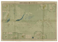
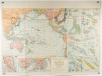
1930205997Sydney: H.E.C. Robinson. Circa1930s. Printed colour maps in all 65.5 x 99cm the main map roughly 50 x 65 cms on a single sheet 76 x 101.3 cms; a little carelessly folded decorative blue title cover a little dusty and a few fold splits and edgewear but in good condition. The exceptional feature of this map are the twenty six large scale inset maps of Pacific islands including: Malay States Singapore Hong Kong these at lower left Japan Philippine Islands Hawaiian Islands Fiji Solomon Islands Western and Eastern Samoa Tahiti Saipan New Caledonia and Dependencies and many others. <br> <br>The main map of the Pacific Ocean stretches from Southeast Asia including all of Australia and New Zealand the west coast of the Americas the Kamchatka Peninsula Manchukuo Manchuria and most of China. Korea and Taiwan are marked as Japanese Territory. Possessions of Britain France the Netherlands and the United States are highlighted. <br> <br>An incredibly rich source of information on the Pacific theatre during the years leading up to World War II. From the Sydney publisher H.E.C. Robinson the firm founded in 1895 by Herbert Robinson 1857-1933 a founder of the Royal Geographical Society of Australasia. . H.E.C. Robinson. unknown
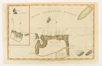
1784174895London.: Alexander Hogg at the King's Arms. circa1784. Engraved map on laid paper 21.4 x 33.7 cm inset of Gower's Simson's and Carteret's Island early outline hand colour trimmed to the plate mark at the top edge three small edge tears affecting the upper margin only slight paper toning but a most attractive map in very good condition. Fine impression of the Queen Charlotte's Islands Solomon Islands. It features the Swallow's track the ship's route taken by Captain Philip Carteret in 1767 the British naval officer and explorer who participated in two of the Royal Navy's circumnavigation expeditions in 1764–66 and 1766–69. . Alexander Hogg at the King's Arms. unknown
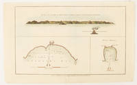
1784174896London.: Alexander Hogg at the King's Arms. circa1784. Engraved map in triptych on laid paper 20.1 x 32.7 cm three insets: cross section of the north side of Queen Charlotte's Islands Solomon Islands with detail of a volcano "6 leagues North"; Swallow's Bay Harbour; and Byron's Harbour early hand colour trimmed to the plate mark at the top edge neat sealed tear affecting the publisher's caption slight edge wear and paper toning but a most attractive map in very good condition. Attractive engraving of the Queen Charlotte's Islands Solomon Islands. The Islands were named for the consort of King George III by Philip Carteret the British naval officer and explorer who participated in two of the Royal Navy's circumnavigation expeditions in 1764–66 and 1766–69. His ship the Swallow gave her name to the Bay and Carteret's commanding officer on the first of his voyages John Byron to the Harbour depicted in this most attractive early chart. . Alexander Hogg at the King's Arms. unknown
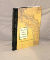
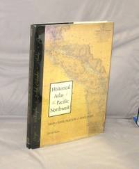
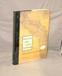
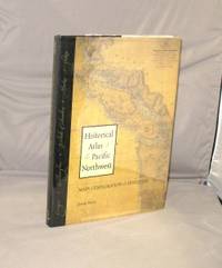
199928781Seattle:: Sasquatch Books 1999. First Printing of the First US Edition. A Fine copy in a Fine bright unclipped dust jacket. This volume provides a visual journey through four centuries of exploration and discovery beginning with the 16th Century Spanish and English explorers. Included are accounts and the cartographic contributions of Sir Francis Drake Vitus Bering James Cook Alexander Mackenzie George Vancouver Lewis & Clark and dozens of other important travelers. Includes 325 map reproductions. Sasquatch Books, unknown
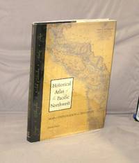
199928908Seattle:: Sasquatch Books 1999. Third Printing of the First US Edition. A Fine copy in a Fine bright unclipped dust jacket. This volume provides a visual journey through four centuries of exploration and discovery beginning with the 16th Century Spanish and English explorers. Included are accounts and the cartographic contributions of Sir Francis Drake Vitus Bering James Cook Alexander Mackenzie George Vancouver Lewis & Clark and dozens of other important travelers. Includes 325 map reproductions. Sasquatch Books, unknown
199929157Seattle:: Sasquatch Books 1999. Second Printing of the First Edition. A Fine copy in a Near Fine bright unclipped dust jacket. This volume provides a visual journey through four centuries of exploration and discovery beginning with the 16th Century Spanish and English explorers. Included are accounts and the cartographic contributions of Sir Francis Drake Vitus Bering James Cook Alexander Mackenzie George Vancouver Lewis & Clark and dozens of other important travelers. Includes 325 map reproductions. Sasquatch Books, unknown
199929225Seattle::: Sasquatch Books 1999. Third Printing of the First Edition. A Fine copy in a Fine bright unclipped dust jacket. This volume provides a visual journey through four centuries of exploration and discovery beginning with the 16th Century Spanish and English explorers. Included are accounts and the cartographic contributions of Sir Francis Drake Vitus Bering James Cook Alexander Mackenzie George Vancouver Lewis & Clark and dozens of other important travelers. Includes 325 map reproductions. Sasquatch Books,, unknown
199929316<p>Seattle::: Sasquatch Books 1999. First Printing of the First US Edition. A Fine copy in a Fine bright unclipped dust jacket. This copy is signed by the author. This volume provides a visual journey through four centuries of exploration and discovery beginning with the 16th Century Spanish and English explorers. Included are accounts and the cartographic contributions of Sir Francis Drake Vitus Bering James Cook Alexander Mackenzie George Vancouver Lewis & Clark and dozens of other important travelers. Includes 325 map reproductions.</p> Sasquatch Books,, hardcover
199929402Seattle::: Sasquatch Books 1999. Third Printing of the First Edition. A Fine copy in a Fine bright unclipped dust jacket. This volume provides a visual journey through four centuries of exploration and discovery beginning with the 16th Century Spanish and English explorers. Included are accounts and the cartographic contributions of Sir Francis Drake Vitus Bering James Cook Alexander Mackenzie George Vancouver Lewis & Clark and dozens of other important travelers. Includes 325 map reproductions. Sasquatch Books,, unknown
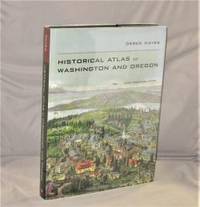
201128184Berkeley:: University of California Press 2011. First Printing of the First US Edition. A Fine copy in a Fine bright unclipped dust jacket. This gorgeous atlas illustrated throughout with more than 500 colorful images and maps provides a visually rich and textually engaging history of the states of Oregon and Washington. Derek Hayes brings his enthusiasm and expertise to a full range of topics beginning with the first inhabitants and tracing the westward expansion conflict between settlers and Native Americans and the establishment of the Oregon Trail. We see in vivid images old maps and lively text the coming of the railroads and the rapid establishment of the coastal ports northwest cities and roads the fur and lumber industries and the large farms. University of California Press, unknown
19529160DuBois PA: Samuel A. King 1952. Revised 1952. Folding map 25x19" printed in red and black. Sportsman's club label to upper margin with some offsetting to lower. Small split at fold intersections title and a few stains to blank verso otherwise a clean near fine example. <br /> <br /> Very popular map which was originally designed and published by Samuel A. King in 1951 and revised in 1952 and 54. According to OCLC there were also 1960s and 70s printings under slightly different titles. This map shows the Allegheny National Forest and surrounding counties with animal silhouettes tracks and a portrait of John O'Bail the Cornplanter last of the great Seneca chiefs. Made for motorists hunters and anglers it shows paved and clay roads trails pipe and power lines fire and lookout towers state parks game lands airports and towns with post offices. <br /> <br /> The early copies of this map are somewhat scarce and there are many modern reprints available. OCLC cites 8 holdings for the '51-54 editions with just 1 being the '52. A lovely example. . Samuel A. King unknown
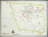
1960206510circa1960. Printed pictorial map 44.8 x 58 cms 46.7 x 60.3 cms sheet original folds a little wear but in very good condition. Attractive 1960s tourist map of Baguio city when it was the "Summer Capital" of the Philippines. Tourist attractions are shown pictorially in red blue triangles denote wood carving shops the city boundaries outlined in yellow sealed and unsealed roads are also shown. . unknown
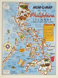
1945204557U.S.A.: Mem-O-Map Co. 1945. Colour pictographic / pictorial map 32.1 x 23.8 cms; 35.4 x 26.6 cms sheet very good condition. Rare pictorial map published in 1945 by John G. Drury aTechnical Officer who served with the 214th Ordnance Battalion to mark the end of World War II as souvenirs for the military. Military personnel could fill in banners "came in on good ship." and "departed on good ship." their name organisation and "Line of Advance or movement" blank in this example. Pictographs mark various memorable spots and wildlife including larger-than-life insects. A "Terrible Tillie Typhoon" looms over the coast at Luzon. <br>Drury published a series of five maps: Philippines and Okinawa in 1945; Japan and Korea Oahu and Europe in 1946. They are all scarce. “These almost whimsical maps are designed to support the creation of personalised geographies. At a time when digital mapping is beginning to experiment with the creation of personalised content that would render the same map in different ways for different users Mem-O-Maps demonstrate the principle in action." Kenneth Field ICA Commission on Map Design. . Mem-O-Map Co. unknown
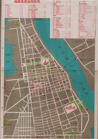
1960217495國家旅行社. National Travel Company. Circa1960s. Folding tourist brochure of Phnom Penh and environs in total 64.5 x 49.8cm 15 panels folded size 21.5 x 9.8cm. Two maps one of the city of Phnom Penh with street names in Khmer transliterated into Latin script 43 x 30cm. On reverse a coloured topographical map of southen Cambodia showing border with Vietnam 20 x 28.5cm. Numerous black and white photographic illustrations to accompany information on flights trains tourist entry requirements sights of interest to tourists. All information in traditional Chinese characters. Slight browning on one panel and two small holes mended with washi paper else in very good condition. Of particular interest in the visitor information is a description of an area about 150 km from the city of Phnom Penh which tourists can visit to take photographs of or hunt wild animals as long as they bring their own rifles. . 國家旅行社. National Travel Company. unknown
197054789circa1970. Collection of 20 black and white photographic plates with their accompanying negatives of maps showing patterns of land use and land forms throughout Pakistan. These photographs are of two sets of maps prepared by the Canadian government covering the whole of Pakistan. A very useful set. From the collection of Professor Basil Johnson Emeritius Professor of Geography at the Australian National University Canberra. From the collection of geographer Professor Basil Johnson who was the author of a number of works on South Asia including "India Resources and Development" and "Geographical Dictionary of India". . unknown
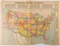
1938215547Los Angeles.: Los Angeles Examiner. Sunday 1 May1938. Printed colour pictorial map 33 x 48 cms; 41.8 x 54.5 cms sheet central fold sheet toned corners chipped with some loss to the bottom border and at the central fold in good condition; and on the verso "Movie-Go-Round" by Louella O. Parsons black and white photos and advertisements. Pictorial map printed for the weekend supplement of the Randolph Hearst owned newspaper the Los Angeles Examiner. The map-maker and artist Howard Burke had also worked for the San Francisco Examiner and was known for pictorial maps many with a persuasive or rhetorical edge and as here were designed to shore up American patriotism and defences against a wider world in the increasingly turbulent pre-war 1930s. The caption to this map outlines a multi-billion dollar 25 year proposal by Congressman J. Buell Snyder for a network of coast to coast transcontinental highways "in case of an attack by a foreign power at any point along the border". Buell Snyder earned the soubriquet "the father of superhighways" and during the War he was assigned to a Congressional Committee in charge of appropriations for the War Department. Scarce. . Los Angeles Examiner. unknown
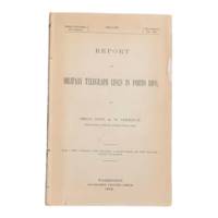
19006902Washington D.C.: Government Printing Office 1900. First edition. 8vo 100pp. Color folding map 42x108cm attached at rear. Stitched lacking wrappers or disbound from a larger publication paper toned with light chipping. Map clean. A good copy. <br /> <br /> Senate Document No. 429 56th congress. This report was given by Adolphus Washington Greely 1844-1935 then Brigadier General and Chief Signal Officer of the U.S. Army. Greely was in charge of maintaining communications networks during the Spanish-American War and oversaw construction and maintenance of telegraph lines in Puerto Rico Cuba and the Philippines. <br /> <br /> The map in this report is "Map of the Island of Porto Rico Showing the lines of signal communication telegraph telephone and heliograph operated by the Signal Corps U.S. Army with Military Posts." It was prepared by major William A. Glassford under the direction of Greely. <br /> <br /> <br /> OCLC cites 11 holdings. . Government Printing Office unknown
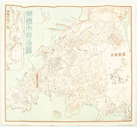
1572171093Qingdao: Taiheiyoko. 太平洋行. 昭和 13 1938. Coloured folding plan of Qingdao in 1938. some browning on reverse with a small lighter section on map Japanese place names no scale 36 x 39cm 3 inset maps. This 1938 Qingdao city map shows street names in Chinese characters and location of Chinese and Japanese public buildings such as the hospital shrines Japanese primary schools and high schools. The 3 inset maps show railway and transport routes as well as outskirts of the city. . [Taiheiyoko]. 太平洋行. unknown
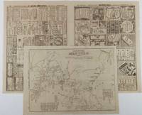
1904216797大阪. Osaka.: 大阪毎日新聞社. Ōsaka Mainichi Shinbunsha. Meiji 37 1904. Two black and white newspaper maps issued in the Ōsaka Mainichi Shinbunsha one pictorial with accompanying text and adverts printed on newsprint folded. 39.5 x 55cm Very good condition. This pictorial map of Port Arthur and Dalian was published on 4 July 1904 by the Osaka Mainichi Shinbun as a supplement. It shows Port Arthur encircled by Japanese naval vessels while Dalian is depicted as being occupied by Japanese troops. On the reverse there is an essay on the war accompanied by illustrations of Russian generals and a list of wounded soldiers who had been transported to the rear.<br><br>A second map detailing developments in the Russo-Japanese War was published by the same newspaper just days later on 8 August 1904. This map provides the dates of various battles along with a chronology of the movements of the Russian Vladivostok fleet and Japanese attacks on Port Arthur. These two maps are rare examples of the kind of information made available to the general public on a day-to-day basis during the war. . 大阪毎日新聞社. [Ōsaka Mainichi Shinbunsha]. unknown
18819118Algiers: Adolphe Jourdan Libraire-Editeur 1881. First edition. 22x14cm vi 70 2. Large folding map "Carte du Sahara Central par M. Camille Sabatier" and table of contents at rear. Stitched in gray laid paper wraps. Single pencil annotation on pg. 47 else clean internally and nearly fine. <br /> <br /> Scarce French Algerian text by Camille Sabatier 1851-1919 lawyer and politician who wrote extensively on the geography and politics of the Sahara region. Sabatier was French deputy in Algeria from 1885-1889. He was a member of the geographical societies of Oran and Algiers and prepared the map in this text with the assistance of French cartographer Justin Pouyanne.<br /> <br /> The work focuses on the local tribes of the Sahara region including Hamyan Trafi Laghouati Chambaa Ait-Atta Arib and Doui-Menia their interactions religions etc. The text also details trade routes geography and climate of the region arguing the ignorance of seeing the Sahara as just "a sea of sands" leads to political surprise and disaster. <br /> <br /> OCLC cites 6 holdings 4 of them in France. <br /> <br /> <br /> . Adolphe Jourdan, Libraire-Editeur unknown
1819155215統正社 Tōseisha . Showa 18 1943. Colour folded map 54. x 76.5cm. Pinholes at corners light even browning good copy. This Japanese map of Micronesia shows the Mariana Islands Eastern and Western Caroline Islands Marshall Islands and Gilbert Islands. The separate maps around the edge are clockwise from the upper right corner: Jaluit Atoll Guam Island Rota Island Saipan Island Palau Islands Yap Island Hall Islands Pohnpei Island Truk Islands and Kusaie Island. . 統正社 [Tōseisha ]. unknown
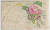
1877159812Kyoto.: 村上勘兵衛 文部省刊行. Murakami Kanbē; Monbushō kankō. Meiji 10 1877. Colour woodblock map of North and Central America. From the Journal of World Geography 萬國地誌略 published in 1877. Printed area measures 33.5 x 21cm a good copy with occasional soiling. . 村上勘兵衛, 文部省刊行. [Murakami Kanbē; Monbushō kanko& unknown
194156936Washington D.C. & Chicago IL: Household Goods Carriers’ Bureau Rand McNally & Co. 1941; 1947. Two vols. 296 pp. including 22 large folding colour maps a few w/ minor toning to fore-edges some dustsoiling a few w/ minor tape repairs especially at a couple folds and near gutter margin. Quarter-green cloth over printed light green softcovers stapled as issued minor soiling some slight foxing & toning still VG copy; 9 3 pp. Stapled as issued minor toning light creasing at corners VG. First edition of this essential HHGCB mileage guide issued just weeks before Pearl Harbor and the entry of the United States into World War II. Originally established in 1936 after the passage of the Reed-Bulwinkle and Interstate Commerce Commission Acts the HHGCB organized to file the required mileage tariffs with the ICC and issued this guidebook. This mileage guide contained maps from the Rand McNally Co. together with charts to determine highway distances between principal points in the United States and allow transport charges to be computed. This guidebook offers an essential snapshot of not only the existing transportation network during World War II but also the vital routes of trucking goods across the country locally or into Canada and Mexico prior to the creation of the Interstate Highway System later authorized in 1956 by President Eisenhower. The supplement updated many of the mileage references following the War acknowledging the tremendous build-up of infrastructure during and in Post-War America. The HHGCB continued to operate in assorted consolidations and mergers until the 2007 decision eliminating all motor carrier rate bureaus. Worldcat locates 1 copy of No. 4 no copies located of Supplement No. 10 US Dept. of Transportation Library. Household Goods Carriers’ Bureau, Rand McNally & Co., paperback
19501749Vichy France: Société des Cartes Folkloriques de France 1950. Wraps. Near fine. R. MARGOTTON. FRENCH LANGUAGE POSTCARDS FASHION / TRADITIONAL DRESS. R. MARGOTTON illustrator. <br /> 6 1/8" x 4 1/8" ; 84 cards numbered; half-bound tweed cloth folder with ties marbled paper over board color paper label to front folder; 3 black cloth folder ties; hand-colored wood-engraved cards verso is a divided back postcard with labeling and numbering within the series and four printed lines on which to write an address; light age-toning of edges; near fine. OCLC locates 3 copies all in the U.S. The art on the post cards is signed R. Margotton and it is possible this was Rene Margotton 1915-2009 although by the early 1950s he was a major French painter and one of the cubists from the early part of the 20th century. The laid-in form in the rear pocket is a listing of the cards by area. Société des Cartes Folkloriques de France unknown
1805175148London & Glasgow.: W. and D. Brownlie. 1805. Engraved map 18.7 x 23.9 cm original folds age toned and spotted inner margin a trifle ragged paper thinning in a few spots in good condition. Attractive map engraved for "A System of Geography; or A Descriptive Historical and Philosophical View of the Several Quarters of the World" published in 1805. . (W. and D. Brownlie) unknown