Dalrymple, Byron; Maps by Delos D Rowe Associates with basic maps courtesy ofRand McNally & CompanyBiblio.com

1 660 résultats
1970Q-1199360163Harper & Row Publishers 1970-01-01. hardcover. New. In shrink wrap. Looks like an interesting title! Harper & Row, Publishers hardcover
1997Q-0002555093HarperCollins 1997-01-01. Hardcover. New. In shrink wrap. Looks like an interesting title! HarperCollins hardcover
2014x-0729541533Churchill Livingstone 2014. Paperback. New. 2nd edition. 296 pages. 9.65x6.89x0.71 inches. Churchill Livingstone paperback
21683857like new. unknown
21683857-nnew. unknown
197320-28357Reliance Printers 1973-01-01. Paperback. Good. Good condition with some wear to cover. Reliance Printers paperback
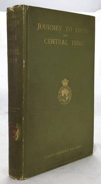
19021607050057John Murray 1/1/1902. Stated 2nd Edition revised. Hardcover. Good. Bound in publisher's green cloth. Gilt lettered and stamp of the Royal Geographical Society on front cover. Library stamps and markings. 285 pages. 34 illustrations and maps 6 of which are folding. Large color map of Tibet at rear. Many of the plates are stamped with library stamps on blank side. <br> Sarat Chandra Das 1849-1917 was a Bengali scholar of Tibet. Das has been described as "a traveler explorer.linguist a lexicographer an ethnographer and an eminent Tibetologist." Das was also a British spy. Born in Chittagong Das trained as an engineer in Calcutta. He became headmaster of the Bhutia Boarding School in Darjeeling. Bhutia was a school for Sikkimese and Tibetan boys many of who would be trained to fill a special place in the British colonial regime the role of a Pundit. Das became a "pundit" and an instructor at the school for British intelligence. Pundits acted as a network of British-trained operatives who were tasked to make inroads in the foreboding inner regions of Asia where white embassies could not gain entry. Tibet and other inland areas were increasingly gaining attention from competing British Russian and Chinese economic and strategic interests. Derek Waller speculates that the character of Huree Chunder Mookerjee in Kipling's Kim was based on Das p.193. As a teacher Das learned Tibetan to speak with his students. He read the limited books on the region available notably of Bogle 1773-5 and Manning's travels 1811 to Tibet. Manning and Bogle were the last successful British explorations of Tibet a nation who steadfastly resisted western intrusion. Das's language ability secured him entry with his colleague Lama Ugyen Gyasto to Tashilhunpo monastery in 1879 as the Prime Minister wished to learn Hindi from him. In 1881 Das returned to Tashilhunpo and made his way to Lhasa Sakya and the Tsangpo River. There he met with Thupten Gyatso the 13th Dalai Lama d. 1933 and returned to Darjeeling with a Yak loaded with over 200 Tibetan manuscripts. After Das was revealed to be a British agent Tibetan authorities increased restrictions on travelers and the Minister who had sponsored his entry was put to death. What makes Das's expedition so interesting is that he successfully brought back a wealth of information on an unknown land to the larger world. The Tibet that Das glimpsed is now gone with the passage of history and the destructive forces of modernity and Chinese domination. This book compiles the story of Das's journey his reports photographs diagrams ethnographic observations etc of a lost Tibet. Das went on to become an important Tibetan scholar and author an extensive multi-volume dictionary. The British would not successfully return to Tibet until 1903-4 with Colonel Francis Edward Younghusband's exhibition invasion and massacre of ~5000 Tibetans. Significantly Younghusband was the President of the Royal Geographical Society which notably published the 1902 edition of Das's book. An interesting and dark connection to Das's legacy. Ref: Derek Waller's The Pundits: British Exploration of Tibet and Central Asia. University Press of Kentucky 1990 pp. 193-209. Also Samanth Subramanian's superb piece in the New York Times Magazine March 20 2016 p. MM61. Peter Hopkirk The Great Game: The Struggle for Empire in Central Asia Kodansha 1992. Yakushi D55 Yakushi D356. Marshall 1459 John Murray hardcover
1985Q-0671466755Simon & Schuster 1985-04-01. Hardcover. New. New. In shrink wrap. Looks like an interesting title! Simon & Schuster hardcover
252090Ditchling Press 1980. Octavo red heavy card boards gilt lettering to spine gilt military motifs to front board illus eps frotnispiece xvii 370pp folding maps throughout VG light creasing & bruising to spine extrems & board corners light foxing to page edges & eps in d/w VG light creasing to edges moderate sun fading to spine light chafing & soiling to covers price clipped Ditchling Press 1980 hardcover
183261842collection of 18 hand coloured folding maps including Derbyshire Devonshire Durham Essex Hampshire Kent Lancashire Leicestershire Norfolk Northamptonshire Northumberland Nottinghamshire Shropshire Somersetshire Staffordshire Suffolk Surrey & Sussex each are by Robert K. Dawson 1798‱861 - an English surveyor and cartographer. Plus reports from some of the counties reports signed L. B. Allen or J. G. S. Lefevre" hardcover
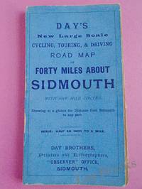
1900033970Sidmouth: Day Brothers 1900. Map. Very Good. Unframed. New Edition. Undated but circa 1900 Engraved map main roads coloured orange 445 x 575 mm folding down to 150 x 85 mm with printed blue covers published by Day Brothers "Printers Stationers & Booksellers Observer Office Sidmouth". Generally in very good condition with light general wear and some rubbing to edges of covers. An attractive map. Scarce. Day Brothers unknown
366634US: Houghton Mifflin 1952. Houghton Mifflin 1952 First Edition NAP Fine/Very Good DJ Author: De Voto Bernard; Raisz Erwin maps. Light blue cloth with grey text bloacks and brown lettering. USA map end papers. Pages lightly tanned with many smaller maps in text. xxii647 pages with index. Bright glossy clipped dust jacket with small mended tears protected in clear dust jacket cover. HEAVY ITEM 1.89 Pounds. Size: 8 5/8 x 6 x 1 1/2 inches. First Edition NAP. Hardcover. Fine/Very Good DJ. No Exp. Houghton Mifflin Hardcover
1988045015Norco: Tales Of The Mojave Road Publishing Company 1988. 1st Edition 1st Printing. Hardcover. Near Fine. Maps Photographs Cartoons. 305 Pp. Red Boards Gilt. First Printing. Very Near Fine. <br/> <br/> Tales Of The Mojave Road Publishing Company hardcover
1990045014Essex Ca: Tales Of The Mojave Road Publishing Company 1990. 1st Edition 1st Printing. Hardcover. Near Fine. 303 Pp. First Printing. Gold Cloth Stamped In Brown. First Printing. Very Near Fine. <br/> <br/> Tales Of The Mojave Road Publishing Company hardcover
19631125558442Chicago: Denoyer-Geppert Social Science Maps 1963. Book. Very Good. No Binding. 1 map : color ; 69 x 105 cm folded to 42 x 28 cm. showing transport routes America wide.main lines and secondary routes divided in sections and laid on canvas eyelets for hanging very good conditionScale ca. 1:4500000 Denoyer-Geppert social science maps A19. Denoyer-Geppert Social Science Maps unknown
18739509Paris 1873. French naval chart sheet 3273 sheet size 105.5 x 72 cm engraved by Nyon black and white centrefold one or two marginal nicks and tears blank verso. This detailed chart of Grenada was derived from British Admiralty surveys. Map unknown
18739508Paris 1873. French naval chart sheet 3256 sheet size 72.5 x 105 cm engraved by Delamare black and white with coastal profiles in the lower part of the chart centrefold one or two marginal nicks and tears blank verso. This detailed chart of Isla Culebra now an island-municipality of Puerto Rico was derived from British Admiralty surveys. With no permmanent population for centuries the island was settled by the Spanish in the 1880s and ceded to the United States after the Spanish-American War. Map unknown
18738667Paris 1873. French naval chart sheet 3119 50 x33 cm black and white blank verso. Chart of the island of Montserrat in the British West Indies featuring coastal profiles dominated by the Soufrière Hills volcano and an inset of Plymouth the former capital of the island which was destroyed in the volcanic eruptions of the mid 1990s. Map unknown
18738669Paris 1873. French naval chart sheet 3245 sheet size 51 x 36 cm engraved by Régnier after a British Admiralty chart of 1871 black and white blank verso. Akkeshi Bay located in Kushiro Subprefecture on the east coast of Hokkaido the most northerly of the main islands of Japan. Map unknown
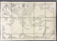
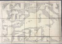
1914005933Paris: Dépôt des Cartes et Plans de la Marine 1914. Cloth Backed. Very good. This extensive uncolored sea chart provides comprehensive coverage of the entire Eastern Mediterranean Sea in multiple panels which have been assembled and backed with cloth to form a large composite map. Published by the official French hydrographic office in Paris the "Dépôt des Cartes et Plans de la Marine" which became the Service Hydrographique de la Marine around this time the chart is a practical navigational aid rather than a decorative one. It features a dense network of hydrographic data including numerous soundings indications of sea bed composition and detailed representations of coastlines and harbors. The chart's functional uncolored style is typical of official government maritime surveys designed for practical use by mariners with details corrected and augmented over time to reflect the most current surveys. Sheet dimensions: 76 cm x 107 cm approx. assembled from multiple sheets. Condition: Very Good. Sound paper uncolored as issued minimal signs of wear along seams where sheets are joined. Please see photos for full appraisal of condition. Dépôt des Cartes et Plans de la Marine unknown
1914005930Paris: Dépôt des Cartes et Plans de la Marine 1914. Loose Sheet. Very good. This extensive uncolored sea chart provides comprehensive coverage of the entire Western Mediterranean Sea in multiple panels which have been assembled and backed with cloth to form a large composite map. Published by the official French hydrographic office in Paris the "Dépôt des Cartes et Plans de la Marine" which became the Service Hydrographique de la Marine around this time the chart is a practical navigational aid rather than a decorative one. It features a dense network of hydrographic data including numerous soundings indications of sea bed composition and detailed representations of coastlines and harbors. The chart's functional uncolored style is typical of official government maritime surveys designed for practical use by mariners with details corrected and augmented over time to reflect the most current surveys. Sheet dimensions: 76 cm x 107 cm approx. assembled from multiple sheets. Condition: Very Good. Sound paper uncolored as issued minimal signs of wear along seams where sheets are joined. Please see photos for full appraisal of condition. Dépôt des Cartes et Plans de la Marine unknown
19208575Paris 1920. French naval chart 63 x 91.5 cms black and white with beacons highlighted in yellow insets of Port dAbri the inner harbour at modern day Izmir and two coastal profiles slightly dusty lower margin one or two closed marginal tears blank verso. Engraved in 1866 after British charts by Copeland and Spratt this example of the map was printed in September 1920 during the Greek occupation of the Zone of Smyrna part of the territory awarded to Greece at the expense of the Ottoman Empire by the Allied powers after the Great War. Smyrna became an important base for Greek forces during the resulting Greco-Turkish War of 1919-1922 and in the bloody aftermath of the Greek withdrawal half the city was razed in the Great Fire of Smyrna also known as the Smyrna Catastrophe. Map unknown
18728668Paris 1872. French naval chart sheet 3068 sheet size 36 x 53 cm engraved by Régnier black and white blank verso. The anchorage at San Juan Bautista located on Cumberland Bay Robinson Crusoe Island; the main settlement in the Juan Fernández Islands off the coast of Chile. Map unknown
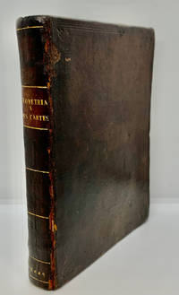
16491000378<p>Geometria à Renato Des Cartes Anno 1637 Gallicè edita; nunc autem Cum Notis Florimondi de Beaune In Curiâ Blaesensi Consiliarii Regii In linguam Latinam versa & commentariis illustrata Operá atque studio Francisci à Schooten Leydensis in Academiâ Lugduno-Batavâ Matheseos Professoris Belgicè docentis. Lugduni Batavorum Leiden: Ex Officinâ Ioannis Maire 1649. First separate and first Latin edition of "La Géometrie". 18th-century leather binding with spine lettering wear to corners and ends but binding is firm. Occasional foxing. The previous owner was John Fitzwilliam died 1699 who was elected fellow of Magdalen in 1661 and became the librarian there in 1662. He would become tutor to Lady Rachel Wriothesley later Lady Russell whose husband Lord Russel was executed under the Rhy House Plot to assassinate King Charles II. The work for a time was part of the private library of Makree Castle in Collooney Ireland but was later owned by the celebrated collector philanthropist Harrison Horblit. "The work was the first to propose the idea of uniting algebra and geometry into a single subject and invented an algebraic geometry called analytic geometry which involves reducing geometry to a form of arithmetic and algebra and translating geometric shapes into algebraic equations. For its time this was ground-breaking. It also contributed to the mathematical ideas of Leibniz and Newton and was thus important in the development of calculus." $12000.00</p> hardcover
1692Alibris.0018045Francofurti Ad Moenum: Frederici Knochii 1692. Ultima editio cum optimis colla. Full leather. Good. No dust jacket as issued. . Good. Scarce edition. Worldcat locates only 1 copy. Spine well worn and chipped. Moderate foxing throughout Includes: illustrations diagrams. On the rear endpaper is an Armorial bookplate of the Princes of Liechtenstein "Ex Libris Liechtensteinianis" above arms with chain of the Order of the Golden Fleece associated with Prince Franz Joseph II 1906-1989. Frederici Knochii hardcover