HOFFMAN, WALTER K (CARTOGRAPHER).Biblio.com
1 660 résultats
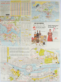
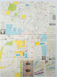
1977161880Hong Kong.: A-O-A Ltd. June/July1977. Coloured tourist maps of Hong Kong printed both sides on a sheet folded. One general area map of Hong Kong and three detailed street maps featuring Kowloon Peninsula Tsimshatsui and Central District. Generally in very good condition text in traditional Chinese English and Japanese. Sheet measures 58.2 x 43cm. The tourist maps include currency rate tourist advice advertisements for foreign and local brands and shops e.g. A-O-A Gambling Handbook for Macau Duty Free shopping centres Chinese Arts & Crafts centres acupuncture clinic etc. The maps of Central and TST have the names of many hotels businesses post offices etc marked on them. . A-O-A Ltd. unknown
1976161881Hong Kong.: Walter K. Hoffman. January/February1976. Coloured tourist map brochure of maps of Hong Kong printed both sides six maps in total folded. Brochure also includes advertisements currency rates. Minor tears along folds otherwise in good condition. Text in traditional Chinese English and Japanese. Sheet measures 58.2 x 43.4cm. Sheet includes 6 individual maps: Map of British Crown Colony of Hong Kong Map of the Urban Area with routes for public transportation Map of Tsimshatsui large scale street map Map of Central District large scale street map Map of Wanchai large scale street map Map of Causeway Bay large scale street map Map of Portuguese Overseas Province of Macau. On the maps of Central and TST the names of many businesses hotels etc are marked. . Walter K. Hoffman. unknown
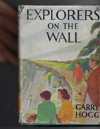
1948100515London: Nelson. Very Good in Good dust jacket. 1948. Second Printing. Hardcover. A scarce title in the Explorers Awheel Series with an extremely scarce dustwrapper. The book is in green cloth boards with white lettering to spine. Maps to endpapers. A prize presentation inscription on blank endpaper ; The Explorers; 8vo 8" - 9" tall . Nelson, hardcover
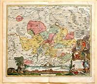
171761880Nuremberg.: Johann Baptist Homann. 1717. A beautifully engraved hand coloured map of North East Germany showing the area around Erfurt in detail. In the centre of the map is a small plan of Erfurt which is also shown as a panoramic view at the foot of the map and titled 'St. Petersburg'. An elaborate decorative title cartouche in the lower right corner depicts allegorical figures surrounded by the produce of the land including sheaves of wheat; a beehive; and a cornucopia of fruits. Cherubs holding a coat of arms float up from the scene on the right while on the lower left a centaur sits meditatively beneath a pine tree amongst slaughtered cattle. Physical features of the area are illustrated and farming areas shown by fields which criss-cross across the map. A clear dark impression the work of an outstanding German cartographer who in 1715 was appointed as imperial geographer by Emperor Charles VI. This map also includes "Schwan See" Swan Lake under a town of the same name which has since disappeared. Hand coloured two very minor splits at upper and lower edges on centre fold and not affecting engraved area a handsome map 54 x 61.5 cm. . [Johann Baptist Homann.] unknown
609610 October 1891; Paris. On printed receipt. On one side of piece of discoloured paper roughly 13 x 22 cm. Delongueil's circular engraved device 3 cm diameter in top left-hand corner. Charges for striking a medal in bronze and silver of Olivier de Serres. 10 October 1891; Paris. On printed receipt. unknown
1994Q-0719550173John Murray 1994-01-01. Hardcover. New. In shrink wrap. Looks like an interesting title! John Murray hardcover
S17M-01576Horton Family Maps. Used - Good. Good condition. A copy that has been read but remains intact. May contain markings such as bookplates stamps limited notes and highlighting or a few light stains. Horton Family Maps unknown
0883077663.Gpaperback. Good. Access codes and supplements are not guaranteed with used items. May be an ex-library book. paperback
1998OS-6693-TOB4-0.73House of Maps. Good. 1998. Unknown Binding. 8vo 8" - 9" tall; The book is in great overall condition showing only minor cosmetic wear.; - We're committed to your satisfaction. We offer free returns and respond promptly to all inquiries. Your item will be carefully wrapped in bubble wrap and securely boxed. All orders ship on the same or next business day. Buy with confidence. . House of Maps unknown
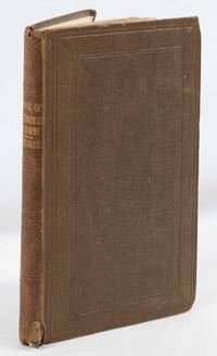
1852180552London.: Longman Brown Green & Longmans. Second Edition. 1852. 5 folding mathematical projections at the rear. v 143pp plus 5 pages of publisher's adverts. Original cloth lettered in gilt on the spine and ruled in blind title page slightly browned head & tail of spine slightly chipped else a lovely clean copy. A presentation copy "With the Author's Cordial Regards' dated July 6th" 1854. 17.5x 10.5cm Born in Westminster London in 1818 William Hughes was a prolific mapmaker geographer engraver printer and publisher. . Longman, Brown, Green, & Longmans. hardcover
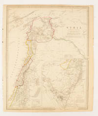
1843174934London.: Chapman & Hall. 1843. Engraved map with outline hand colour 39.4 x 31.4 cm inset map "Continuation from the Dead Sea to Mount Sinai" with finely engraved notes and a key to the Divisions under control of the Turkish Government manuscript pagination in an early hand to the top right edge tear nicks and browning but in very good condition. A most attractive map with detailed notes published when Syria was still under control of the Ottoman Empire. . Chapman & Hall. unknown
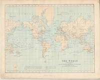
1874174897London.: Virtue & Co. circa1874. Printed colour map 18.4 x 24.1 cm edge wear marginal spotting and on the verso but the map in very good condition. Unusual map showing time differences east and west of Greenwich before the atomic clock and well before satellites! The explanatory text notes aso that: "The space comprehended between the meridiens of 120 & 160 E. is repeated in order to show the relative position of England to Australia both eastward and westward." . Virtue & Co. unknown
RY-O4EE-72UHHardcover. Good. Jacket has average wear tear and fading. Book has some bumps pages yellowed with an occasional minor blemish binding firm. Good plus. hardcover
197823102CReated & Publ. Gousha/Chek-Chart San Jose Mitock North Hollywood 1978. PBO Spiral Bound Softcover 1978 1st Edition Nice Condition You turn over Book to Back for different 2 Counties NF/NF- SOFTCOVER COVER light ruB wear Creases & Scuff Hotels ETC Orange County & Los Angeles Street Index. First Edition. Soft Cover. CReated & Publ. Gousha/Chek-Chart, San Jose Mitock North Hollywood paperback
0282061835.Gpaperback. Good. Access codes and supplements are not guaranteed with used items. May be an ex-library book. paperback
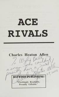
1995Q-0964540401Baywood Publishing 1995-01-01. paperback. New. In shrink wrap. Looks like an interesting title! Baywood Publishing paperback
0331288966.Gpaperback. Good. Access codes and supplements are not guaranteed with used items. May be an ex-library book. paperback
0331502216.Ghardcover. Good. Access codes and supplements are not guaranteed with used items. May be an ex-library book. hardcover
1528518934.Gpaperback. Good. Access codes and supplements are not guaranteed with used items. May be an ex-library book. paperback
1528400879.Gpaperback. Good. Access codes and supplements are not guaranteed with used items. May be an ex-library book. paperback
1527726789.Gpaperback. Good. Access codes and supplements are not guaranteed with used items. May be an ex-library book. paperback
1332615007.Gpaperback. Good. Access codes and supplements are not guaranteed with used items. May be an ex-library book. paperback
0259197726.Gpaperback. Good. Access codes and supplements are not guaranteed with used items. May be an ex-library book. paperback
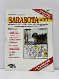
20042471-NE<p>Wide World of Maps 2004. Softcover / Spiral Bound. New. New no remainder mark wire-ring bound 86 pp. plus several of index.</p> Wide World of Maps paperback
1332329969.Gpaperback. Good. Access codes and supplements are not guaranteed with used items. May be an ex-library book. paperback