1 660 résultats
1839782121839. Longman Rees and Co. 1839. Early Edition. Hardback. No DW. Brown textured cloth. 9cm x 12.5cm. Linen-backed fold-out map in colour 35cm x 42cm . Ownership signature to inside cover. A lovely copy. hardcover
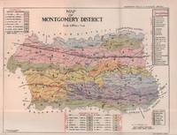
1935215892Lahore.: Government Printing. Revised Edition. 1935. Four folding colour maps xi 311 pages 26.5 x 18 cms; original papered boards spotted and a trifle scuffed linen backstrip with paper title label worn; foredges and endpapers spotted a few leaves toned but on the whole in very good condition the maps particularly bright and clean. A remarkable association copy: the author Frederick Blyth Wace's copy with his inked initials to the front free endpaper and his humorous unpublished foreword tipped in opposite the preface together with a dedication leaf both in Wace's hand and his business card loose within. As a further dedication makes clear this copy was given by Wace's son a couple of his loose notes on scrap paper are included the eminent botanist Nigel Morritt Wace 1929-2005 late head of the Australian National University's department of Biogeography and Geomorphology in 2003 to his fellow academic and marsupial biologist Dr. Hugh Tyndale-Biscoe. Both Wace and Biscoe were born in India and began their schooling in Kashmir at the school founded by Tyndale-Biscoe's father a Christian missionary and for whom the school is named. <br> <br>From the collection of Hugh Tyndale-Biscoe. . Government Printing. hardcover
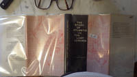
30286<p>HBDJ 1968 EARLY Edition VG/VG- AS-IS Original publisher's blue paper-covered boards pictorial dustjacket large 8vo: xij 108pp. fold-in map in Middle and in back footnotes bibliographical notes. Verynear fine copy.Octavo. 5.5 x 8.5 in. lived to be hundreds of years old and were capable of telepathy astral travel and teleportation.ATLANTIS they became greedy petty and "morally bankrupt" and the gods "became angry because the people had lost their way and turned to immoral pursuits" Orser says. As punishment he says the gods sent "one terrible night of fire and earthquakes" that caused Atlantis to sink into the sea.</p> LONDON, Illinois: Theosophical Publishing House, hardcover
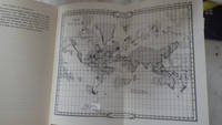
197230289<p>HBDJ 1972 Revised VG-/VG AS-IS Blue cloth lettered in White Interior Nice tight light Wear SOME INK NOTES AND UNDERLINING but has FoX Stains 108 pgs DJ light wear & SCUFFING Extremities DJ 8vo - over 51â„4" - 83â„4" with 2 FOLD OUT Maps</p><p>According to Churchward Lemurians developed homes with transparent roofs lived to be hundreds of years old and were capable of telepathy astral travel and teleportation. ATLANTIS they became greedy petty and "morally bankrupt" and the gods "became angry because the people had lost their way and turned to immoral pursuits" Orser says. As punishment he says the gods sent "one terrible night of fire and earthquakes" that caused Atlantis to sink into the sea.</p> LONDON, Illinois: Theosophical Publishing House, hardcover
18191405618Paris: Menard et Desenne 1819. Dernière édition. Hardcover. Octavo 684 pages. In Fair minus condition. Spine is tan with gold print on red banner. Boards half bound with green leather to spine and corners and green cloth to boards; corner leather not present spine leather is toned with some rubbing and wear to hinges board cloth has worn edges rubbing shelf wear. Text block has deckle edges; cracked front hinge foxing and toning throughout. Illustrated: “Enrichie de sept Cartes géographiques conformes aux nouvelles divisions et ornée des Pavillons des vingt principales Puissances maritimesâ€â€” title page; however illustrations may not be present. Text in French. <br /> <br /> NOTE: Shelved in Netdesk Column W. 1405618. FP New Rockville Stock. Menard et Desenne hardcover
19702080502106505576Fukui Agata History Reprint Publishing Society 1970. Soft Cover. Fine. Number of books: 4 Fukui Agata History Reprint Publishing Society paperback
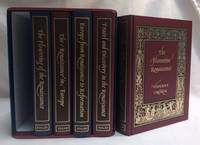
2001299994London: The Folio Society 2001-01-01. Hardcover. Near Fine/Very Good Slipcase. 9x7x7. Complete five-volume box set with slipcase. All 5 books are in near fine condition: texts unmarked and clean; pages and illustrations bright and crisp; bindings tight sturdy and square; exteriors look like new. Box is in very good condition has bump to back bottom corner light bump to front bottom corner and minimal rubbing. From a private collection. Ships from Dinkytown in Minneapolis Minnesota. Due to the size/weight of this book extra charges may apply for international shipping. The Folio Society hardcover
BN92838Veiatlas Norge: Veikart = road maps = Strassenkarten 1:300 000 : bykart = city maps = Stadtplane 1:20 000 Norwegian Edition Unknown Binding <br/><br/>Veiatlas Norge: Veikart = road maps = Strassenkarten 1:300 000 : bykart = city maps = Stadtplane 1:20 000 Norwegian Edition Unknown Binding Veiatlas Norge: Veikart = road maps = Strassenkarten 1:300 000 : bykart = city maps = Stadtplane 1:20 000 Norwegian Edition Unknown Binding unknown
1959ZB1332156University of Texas 1959. Price HAS BEEN REDUCED by 10% until Monday June 29 SALE item 836 pp. two volumes maps paperbacks ex library else text and binding clean and tight. - If you are reading this this item is actually physically in our stock and ready for shipment once ordered. We are not bookjackers. Buyer is responsible for any additional duties taxes or fees required by recipient's country. University of Texas paperback
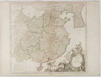
1751177606Paris. 1751. Engraved map 48 x 52.2 cm; 51 x 67.6 cm sheet provinces highlighted with outline hand-colour elaborate title cartouche central fold small tear at the foot affecting the border old paper repair on the verso affecting the margin only pin-holes to the four marginal corners margins a little browned and dusty a handsome map in good condition. Fine large format map showing China Korea Taiwan and parts of Central Asia prepared for De Vaugondy's "Atlas Universel". The beautifully foliated cartouche features a duo of joyful Chinese musicians one dancing and a diminutive figure holding a parasol. <br> <br>From the Estate of the late collector and scholar Arthur Hacker. . unknown
194121072Window Rock AZ: United States Department of the Interior Office of Indian Affairs Navajo Service 1941. First Edition. Small quarto 26.25cm; mimeographed sheets printed recto and verso and side-stapled into illustrated wrappers; vi 180pp 20; illus. Former owner's name in ink to front wrapper with chipping thin splits and short tears to same; thin vertical paint streak to rear wrapper; text remains fresh and clean; Very Good.<br /> <br /> Guide book and gazeteer of the Navajo country and adjacent regions compiled by Richard Fowler Van Valkenburgh a former Bureau of Indian Affairs worker and long-time archeological assistant with the L.A. County Museum of History Art and Science. Contains a 4pp key to the Navajo alphabet palatalization and labialization an extensive list of Navajo place names providing detailed information regarding their origins history and significance. Illustrated throughout with maps drawn by Charles Keetsie Shirley. Scarce in commerce. United States Department of the Interior, Office of Indian Affairs, Navajo Service unknown
1854182A61A.O.P. Nicholson Printer Washington D.C.: . 1854 2 pp. Title-page with list of contents on the verso 45 maps and plans of various sizes some quite large most folding. Some damp stain and foxing but nothing too substantial except to the endpapers. Original full black cloth binding stamped in blind and lettered in gold gilt. Lightly worn. 4to. 300mm. These maps and plans illustrate the Reports of: the Commissioner of the General Land Office 8: Commissioner of Public Buildings 1-4; National Hospital for the Insane 1; Colonel of Topographical Engineers 31; and the Report of the Chief of Ordnance and Hydrography 1 Officers Quarters at Annapolis. Significant regions covered include parts of: Kansas; Nebraska; Arkansas; Florida; Michigan; Iowa; California; Minnesota; Wisconsin; Ohio; District of Columbia; New York; as well as a Topographical Map of a portion of the Isthmus of Darien in site of proposed inter-oceanic navigation canal. These reports were apparently an adjunct to the MAPS AND CHARTS OF THE UNITED STATES COAST SURVEY. A wonderful addition to any collection of U.S. Maps. . PRICE JUST REDUCED! W155 CTR Language: eng. Full Cloth. Hardcover. Very Good. A.O.P. Nicholson, Printer, Washington [D.C.]: . hardcover
1774gnt774London: David Henry; Elizabeth Newbery. G: in good condition without dust jacket. 20th century binding with new eps. Inner hinge cracking. Sporadic foxing browning marking and off-setting from illustrations. Occasional pencil annotations. Loss to lower edge of prelims slightly impinging on content. 1774. First Edition. Buff hardback cloth cover. 220mm x 140mm 9" x 6". iv 628pp xvi plates. 20 b/w plates 3 fold-out plans 18 fold-out John Gibson and Thomas Bowen road maps. . David Henry; Elizabeth Newbery hardcover
Q-0316706078Little Brown & Company 1929-01-01. Hardcover. New. In shrink wrap. Looks like an interesting title! Little Brown & Company hardcover
1766016077London: Printed for S. Crowder 1766. Book. Very Good. Hardcover. The Second Edition. Folio 21 x 32cm. The second edition with additions and improvements; pp. iv 45 iii publisher's adverts; engraved frontispiece map of the world five further engraved plates of maps and one engraved plate of globes ten engraved figures and diagrams within the text. Contemporary half textured calf binding with marbled paper boards expertly restored with a new spine in matching style re-corned. contents clean and tight a few small marks/reading wear; frontispiece plate with a couple of short edge-tears expertly and inconspicuously repaired a few corners re-tipped. A very good well-presented copy. Scarce. Printed for S. Crowder Hardcover
8170530660.Gpaperback. Good. Access codes and supplements are not guaranteed with used items. May be an ex-library book. paperback
8170530164.Gpaperback. Good. Access codes and supplements are not guaranteed with used items. May be an ex-library book. paperback
8170530857.Gpaperback. Good. Access codes and supplements are not guaranteed with used items. May be an ex-library book. paperback
8170530962.Gpaperback. Good. Access codes and supplements are not guaranteed with used items. May be an ex-library book. paperback
1990MST13651Easton Press. Very Good with no dust jacket. 1990. Hardcover. Leather-bound hard cover published by Easton Press in 1990. No dust jacket. Black leather covers with gilt decorations and lettering. Corners are slightly bumped. Spine has three raised bands. Page edges are gilt-covered. Silk moire endpapers. Gray satin bookmark ribbon is attached to headband. Included are an unused and unattached bookplate from Easton Press and the Collector's Notes from Easton Press. Book is in very good plus condition. Large 8vo 366 pages 2.2 lb. ; Large 8vo 9" - 10" tall; 366 pages . Easton Press hardcover
1986Q-0333428897MacMillan 1986-01-01. Hardcover. New. New. In shrink wrap. Looks like an interesting title! MacMillan hardcover
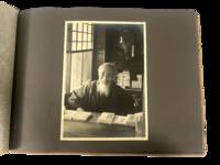
1930223021930. Japan travel photograph album. 1930s. This album documents Western travel through Japan during a period of expanding imperial influence and managed international tourism recording temple architecture theatrical performance and curated cultural sites alongside limited family portraiture. The photographs provide primary visual evidence of how foreign visitors encountered Japan through established travel circuits that emphasized religious monuments scenic landscapes and staged cultural forms while also including a labeled image from Korea that situates the journey within the geography of Japanese colonial rule.<br /> <br /> Album containing 22 silver gelatin photographs each mounted one per page with white ink captions identifying locations including "Nikko" "Kyoto" "Shochiku-za" "Koya San" "Akashi" "Takao" and "Korea." Three photographs depict members of a Western family posed in studio and outdoor settings including portraits in front of temple gates and residential entrances. The remaining images focus on architectural and cultural sites including temple facades with detailed ornamentation mountain and waterfall landscapes and a staged theatrical performance at the Shochiku-za theatre in Osaka showing performers in elaborate costume and makeup. One photograph labeled "Korea" depicts seated women wearing hanbok indicating travel beyond the Japanese home islands. The photographs are consistently sized at approximately 5 x 7 inches and mounted in an album measuring approximately 8.5 x 12 inches bound in cloth boards with decorative striping and cord binding.<br /> <br /> The album was produced during a decade when Japan promoted domestic and imperial sites as destinations for foreign travelers integrating religious landmarks urban infrastructure and colonial territories into a coherent tourist experience. Sites such as Nikko and Koya San were presented as emblematic of national heritage while theatrical venues and scenic locations formed part of structured itineraries. The inclusion of Korea reflects the extension of these travel routes into occupied regions where colonial subjects and landscapes were incorporated into representations of the empire. Photographs remain clear with strong contrast; minor wear to album consistent with handling; overall very good. A focused visual record of Western travel in 1930s Japan documenting how cultural sites and imperial geography were presented to foreign visitors. unknown
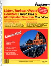
2000Q-0880976403Hagstrom Map Co 2000-01-28. paperback. New. In shrink wrap. Looks like an interesting title! Hagstrom Map Co paperback
1566953049.Gmap. Good. Access codes and supplements are not guaranteed with used items. May be an ex-library book. unknown
0365078743.Gpaperback. Good. Access codes and supplements are not guaranteed with used items. May be an ex-library book. paperback