46 résultats
196525042USSR 1965. The 7 year plan economic map with good lithographic color key gives interpretation and on back various charts show growth over time. The district map in black and white with numbers keyed to the list of districts on the back; text entirely in Cyrillic. Approx. 9 3/4" x 13" size; a little edge-wear one short 1/4" closed edge-tear; in very good condition. First Edition. Not Bound. Very Good. paperback books
14434Archive of 9 large World War II Maps these maps were used by US troops during the liberation of Europe. RARE ORIGINAL WORLD WAR TWO VINTAGE ALLIED FORCES EUROPEAN THEATER OF OPERATIONS Maps of German cities and one of Paris France. Comes from a WW2 US Army Soldier. These 69 original maps are mostly in very good condition and as follows: <br/><br/>Magdeburg Germany map - US Army Air Map of Magdeburg "First Edition" Sheet M.53 1:250000. 1943. With handwriting in upper right corner. 30x26"<br/>KasselGermany map- US Printed Map of Kassel region of Germany. "Emergency Road Map." Color. First Edition. sheet L52 Based on 1938 map supplemented by other sources collected during the war. 22x28"<br/>Dusseldorf Germany map- same as above but faded and with some highlighting some writing. sheet k52<br/>Hanover Germany map- same as above sheet L53. Printed 1943.<br/>Berlin Germany map- similar to above but "Army/Air" not Emergency Road. Sheet N53. Published by War Office 1943<br/>Halle Germany map- Halle Saale is a city in the southern part of the German state Saxony-Anhal. Sheet M52. "War and Navy Department Agencies only. Not for sale or distribution." 1943. <br/>Wernigerode Germany- town in the district of Harz Saxony-Anhalt German 19x24. Sheet 4130. FIrst Edition. US "Published by War Office 1944." B&W. exposed to water. Hardened. y<br/>Julich Germany- town in the district of Düren in the federal state of North Rhine-Westphalia Germany "Published by War Office 1944." G.S.G.S. No. 4507. 35x30"<br/>Paris France map - 42x34 - U.S. 1944. The Liberation of Paris took place from 19 August 1944 until the German garrison surrendered on 25 August 1944. Paris had been ruled by Nazi Germany since the signing of the Second Compiègne Armistice on 22 June 1940. unknown books
192638565Chicago: Harvard University Press 1926. First edition. Illustrated with 74 maps with great textual descriptions. 299 pp. 1 vols. Folio. Original blue cloth some very minor rubbing else fine. First edition. Illustrated with 74 maps with great textual descriptions. 299 pp. 1 vols. Folio. Harvard University Press unknown books
193691525Milano: Touring Club Italiano 1936. Very Good. 12 of 37 unbound sheets. 4p.center 2 pages are 34 cm. x 25 cm. map. Partly colored. Scale: 1:1000000. Italian text. <br/><br/> Touring Club Italiano unknown books
1992UKINANO00CCWSeal Press 1992. Very Good. Kingsolver Barbara. Another America Otra America with Spanish Translations. Cartes translator Rebeca. Seattle: Seal Press 1992. 103pp. 12mo. Paperback. Book condition: Very good with lightly rubbed and bumped edges. Seal Press paperback books
1992RKINANO00JKNSeal Press 1992. Fine. Kingsolver Barbara. Another America: Otra America Bilingual English / Spanish. Cartes translator Rebecca. Seattle: Seal Press 1992. 104pp. 8vo. Black cloth with gilt lettering. Signed by author. Inscribed by author. Book condition: Near fine. Inscribed by author on title page. Dust Jacket Condition: Near fine. Very slight weat along bottom edge. In protective cover. Seal Press hardcover books
14433Archive of 6 large original World War II Maps these maps were used by US troops during the liberation of Europe. RARE ORIGINAL WORLD WAR TWO VINTAGE ALLIED FORCES EUROPEAN THEATER OF OPERATIONS Czech Republic cities and one Map of Hamburg - German . Comes from a WW2 US Army Soldier. These 6 original maps came from a US soldier that was in European theatre in WWII they are mostly in very good condition and as follows: <br/><br/>Mesto Tepla Czech Republic - size 19x24".<br/>Plzen Czech Republic 4151 - size24x19". Black and white with green overlay. <br/>Horsovsky Tyn Czech Republic 4150 - size24x19"<br/>Kralovice KraloviceCzech Republic 4051 - <br/>Czechoslovakia promotional map dated 1938. a very arge map size 34x22"<br/>Hamburg - German map. size 28x24". dated 1939 in print. <br/><br/>All maps are original and have some folds and wrinkling overall in Good Condition. unknown books
19891323176Baltimore: Safety Through Knowledge 1989. Other. Tall Octavo; VG-; Paperback with comb binding; Covers have moderate stains to the front and rear; Fore edge has minor foxing otherwise text block is clean; 116p. 1323176. FP New Rockville Stock. Safety Through Knowledge unknown books
1900424581900. MAPS. BIRD'S EYE VIEW OF NARA. Osaka: K. Kawakami c. 1900. Folding panorama c. 22" x 25" colored green and view. Some notes by contemporary tourist added to key. Heavily worn at folds and edges partly separated at folds. unknown books
19901334823New York: Simon and Schuster 1990. Hardcover. Octavo; VG/VG-; Hardcover with DJ; DJ spine black with gold print; DJ has slight edgewear but is clean and bright; Boards quarter bound with red cloth to spine and grey paper to boards clean and strong; Text block clean and tight; Signed in ink by the author on front endpaper; 1052 pages illustrated 2-color. 1334823. FP New Rockville Stock. Simon and Schuster hardcover books
1842WRCAM9643Paris 1842. Partially colored map 27 x 20 inches. Center fold some foxing else very nice. Archival matting and protected with Mylar sheet. Shows all of North America with Russian British U.S. and Mexican possessions. Texas is shown as part of the United States with the Nueces as the boundary line with Mexico. unknown books
194633453Washington D.C.: Maps and Graphic Division 1946. 1st. revision March 1946. Edges browned 4 inch and 2 inch tears on folds one with small loss at double fold small chip and stain to margins top and bottom some minor edge wear and marginal tears; a good copy. 1 pp. 110 x 90 cm. Color map of China's transportation routes during the war. Scale ca. 1:2750000; E 1000--E 1260/N 420--N 180. Map no. 1379 June 15 1945. OCLC shows only one copy at the LOC of this revised copy. Maps and Graphic Division unknown books
14430Collection of 10 German-made WWII-era maps. All printed in German sometimes with foreign translations.<br/><br/>Includes arial bombing maps of Chesterfield Tube Works Great Britain Dec. 1942 showing a geographical arial photograph of the factory area and an overlay of roads bridges and potential targets. The German forces tried to bomb Chesterfield and the railway tracks nearby where the Tube Works produced important cylinders and compressors for the war effort. Instead their bomb fell on a golf course 4 miles away doing no harm. Bears the warning: "Nur fur den Diensfgebrauch" or "For Internal Use Only." 12"x12.5" 2 pg<br/><br/>Also includes a "Map of the Former Czechoslovakia" In German: "Karte der ehemaligen Tschechoslowakei". The German occupation of Czechoslovakia lasted from1938 to 1945 beginning with the Nazi annexation of the northern and western border regions known collectively as the Sudetenland under terms outlined by the Munich Agreement. Hitler's pretext for this effort was the alleged privations suffered by the ethnic German population living in those regions. Czechoslovakia was finally liberated with the Allied Victory in 1945. Map in black and white with red elevations. Bears the large tage at the top: "Sondersausgabe!" or "Special Edition!" Also includes a map of a Czech city which played an important part in World War II History. Situated at the very end of the Sudentenland the borders of the Third Reich were literally on Plzen's outer limits. Occupied by Nazi forces starting in 1939 and divided by the loyalties of its half-German population Plzen was finally liberated with the rest of Czechoslovakia in 1945. The map is written in German with Czech translation of each heading. It has seen substantial use and the key has been cut out of the upper left side. 37"x27"<br/><br/>Koln - German map - Near mint condition. 22x17". Translates to "Cologne" which is a city in Germany.<br/><br/>Umgebung von Wein - German. 44x34"<br/><br/>"Deutschesreich" translates to "German Empire"- western half- 56x42" extra large German map - over outline map - no date<br/><br/>Frankreich - same as German Empire. Shows paris and london. <br/><br/>Italien - same as above.<br/><br/> "Blatt Sudost" Translates to "Southeast Sheet" - Ubersichtskarte translates to "Overview Map" - 56x42". Color. Attractive gold pink and blue. 1:1000000.See photos. no date. Very nice condition on printed side. unknown books
1800D4116England 1800. Near Fine. Two custom cases gilt-stamped morocco containing 34 cabinet cards 4.25 by 6.5 inches and 45 cartes-de-visite 2.5 by 4 inches. Cases are in excellent condition just a little scuffed along the edges; images mostly albumens are remarkably crisp and clean some of them in original glassine envelopes. Produced by Cromack of Scarborough Brigham also Scarborough Elliott and Fry Portman Square Frank M. Sutcliffe Whitby Yorkshire and others these formal portraits include men women and children sometimes the same image is repeated and sometimes the same face is repeated though in a different setting or posture. <br/><br/> unknown books
19639010503Indianapolis: Bobbs-Merrill 1963. 1st. Hardcover. Book fine Dust jacket fine. The dust jacket is price clipped and has minor chips and closed tears to the extremities. <br/><br/> Bobbs-Merrill hardcover books
LD7400c. early 19th century. Hardcover. Very Good. Half cloth and marbled paper over boards handwritten label on upper board; oblong folio 460 x 360 mm; entirely handwritten and drawn in black ink on the rectos only with "tableau des batiments militaires" and 7 maps. Boards heavily scuffed; binding shaken; some dusty finger-smudges here and there. <br/><br/> hardcover books
199034882Bankok: White Lotus Co 1990. 1st Edition. Illustrated laminated wrappers with black title lettering printed to front wrapper and spine. Last page is dog-eared PO stamp to preliminary title page. A VG copy. xi 1 blank 378 2 pp including appendix. Many b/w illustrations and maps. One fold-out image. 8-1/2" x 6" <br/><br/> White Lotus Co unknown books
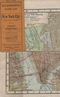
191315611New York: Wehman Brothers Publishers 1913. Very good. Folding color map. Measuring approximately 18" x 36" when unfolded. In original printed card wrapper. Verso a thorough printed street index. Mild handling wear toning. A few tiny holes near fold corners. Overall well preserved; very good. <br/><br/>An impressive color map of the island of Manhattan and the Bronx. Scale is 1" equals 1/2 mile and includes railroads subways elevated railroads surface railroads and proposed railroads. An uncommon early 20th Century New York City street map. Wehman Brothers Publishers unknown books
20089009390Yardley Pennsylvania: Westholme Publishing 2008. 1st. Hardcover. Book fine Dust jacket fine. <br/><br/> Westholme Publishing hardcover books
1976160565NY THOMAS Y. CROWELL 1968 1976 1976. DUST JACKET UNCLIPPED FIRST AMERICAN EDITION VERY GOOD. 1st Edition. Hardcover. NY, THOMAS Y. CROWELL [1968, 1976] hardcover books
228477London: Edward Stanford. Hard Cover. Very Good binding. Engraved on Copper Plates in the Finest Style of the Art; "Property of M.I.D. G-2" stamped in atlas. No markings on fold-out map. Red cloth covers with beige title label. Light edgewear to head and tail of spine.Hardcover with Fold-out Map. Very Good binding. Edward Stanford unknown books
19012221875<p>Map of San Francisco: Showing points of special interest to attendants the Fifth International Convention of the Epworth League July 18-21 1901 folding map of 21" x 28" printed in black & red.With numbered locations of places of Methodist interest and historical. Verso of map with 23 panels detailing trips excursions to Yosemite Valley Southern California including Pasadena Redlands Riverside Palo Alto Santa Cruz Lick Observatory. Very good minor wear; short tears at folds.</p><p>San Francisco before the 1906 devastating earthquake.</p> unknown books
1968799791968. MAPS MAPS FOR THE JEWISH SCHOOL PORTFOLIO 1. New York: Jewish Education Committee Press January 1968. Ten color maps 9 1/2 x 14 inches plus bonus map of the Six Day War. Includes maps of ancient history and contemporary Israel as well as Eastern Europe. Maps fine original envelope has closed tears light soil. unknown books
1800D7401unknown: unknown likely early 1800s. Ephemera. Very Good. A collection of 8 engraved maps 420 x 280 mm including wide margins numbered in Arabic or Roman numerals see below otherwise seemingly uniform. From an unknown source. It includes: 1 Bombardement de Lille par l'Armee Autrichienne en 1792 with the stamp of Depot de la Guerre Bibliotheque in the top margin; 2 Siege de la Citadelle d'Anvers par l'Armee Francaise en 1792; III Siege de Valenciennes par l'Armee Coalisee Anglaise Hannovrienne et Autrichienne en 1793; VIII Siege d'Ypres par l'Armee Francaise en 1794; IX Siege de Charleroy par les Francais en 1794; X Siege de Landrecies par les Francais en 1794; XI Siege du Quesnoy par les Francaise in 1794; and XIII Siege de Nieuport par l'Armee Francaise en 1794. A bit foxed; flattened crease down the middle from folding these were perhaps pulled from a book where they were mounted on stubs along the crease. <br/><br/> [unknown] unknown books
1977170527Ikeja: Longman Nigeria Ltd 1977. Paperback. viii 230p. preface appendices illustrations maps lightly-worn reprint trade paperback in red pictorial wraps. Longman Nigeria Ltd paperback books