46 résultats
19971206114Norwalk CT: Easton Press 1997. Collector's Edition of the Fiftieth Anniversary Edition. Small octavo; VG/No-DJ; Dark blue leather spine with gilt lettering; Cover has gilt bird design and titles on front very light wear to edges some rubbing and blemishes to front cover; A.E.G. minimal rubbing to gilt edges of text block; Bound-in bookmark; Binding is tight; Text block is pristine; NOTE: No leaflet or other Easton Press ephemera; 656 pp. 1206114. Rockville Non-Retail Listings. Easton Press unknown books
1965540161965. MAPS. THE VINLAND MAP AND THE TARTAR RELATION. By R.A Skelton et al. New Haven: Yale University Press 1966. Fourth printing. The historian John Muir Whitehill's copy with his notes on the preliminary leaves. 4to. red paper-covered boards; 291pp. A very good copy with a little scuffing to the boards. unknown books
1980005434Boston: Houghton Mifflin 1980. First Printing with complete number row.Near Fine very scant and faint foxing to end pages in a Fine dust jacket. Map attached at rear. Uncommon in such exceptional condition a lovely copy. . First American Edition. Cloth. Near Fine/Fine. 8vo. Houghton Mifflin Hardcover books
1979UWALVOY00LNWFriends of Bancroft Library 1979. Very Good. Wallis Helen Keeper of Maps British Library. The Voyage of Sir Francis Drake Mapped in Silver and Gold. Berkeley: Friends of Bancroft Library 1979. 26pp. 8vo. Blue wraps. Book condition: Very good. Friends of Bancroft Keepsake #27. Friends of Bancroft Library paperback books
1966193708Holt Rinehart and Winston 1966-01-01. First Edition. Hardcover. Very Good. First Edition stated. No dust jacket. Gray and orange cloth boards- cloth lightly rubbed at the top edge of the spine. Clean has a good binding no marks or notations. Holt, Rinehart and Winston hardcover books
19041336482New York: Frederick A. Stokes Company 1904. First American Edition. Hardcover. Octavo xiii 359 pages; VG-; bound in publisher's decorated green cloth gilt and black titling to spine; mild wear and rubbing primarily to head of spine and corners; bookplate to ffep; with 54 maps and plates; scarce; LJ consignment; shelved case 8 1/2. Also published in London the same year.;. 1336482. Shelved Dupont Bookstore. Frederick A. Stokes Company hardcover books
1860WRCAM48522Antigua but actually Philadelphia: R.B. Eldridge & Co. 1860. Lithographic sheet map 20 1/2 x 26 1/2 inches. Backed with contemporary blue paper. Light foxing and toning. A few small tears in margins. Very good. An unusual lithographic edition of Norie's 1827 revision of this handsome chart lithographed by Wagner & McGuigan in Philadelphia. A statement in the cartouche reads: "Presented by R.B. Eldridge Antigua to Captain Andrew Tyler." The captain's name is accomplished in manuscript. R.B. Eldridge is not listed in Tooley's DICTIONARY OF MAPMAKERS and appears to be unrelated to publisher of charts George Eldridge. It seems most likely that he was rather an Antigua merchant who commissioned a reprint of the chart for complimentary distribution to sea captains. A handsome piece. R.B. Eldridge & Co. unknown books
19801293597New York: Macmillan Publishing Co 1980. First Edition First Printing. Hardcover. Quarto; VG/VG; illustrated spine with white text; jacket has some rubbing and scuffing minor spotting on verso side fold in upper corner of front flap; boards are strong spine slightly cocked; textblock has spotting on head and fore edges otherwise clean; pp 438. 1293597. Full-priced Rockville. Macmillan Publishing Co hardcover books
19521329900Boston: Houghton Mifflin and CompanyH 1952. Hardcover. Octavo; pp 647; VG-/G-; dark yellow spine with beige text; dust jacket has sunned spine; modest wear to exterior; some rubbing to edges; price clipped flap; mylar wrap; cloth has only light to exterior; clean strong boards; text block has slight foxing to exterior edges; pictorial endpapers; illustrated; deckled fore edge; tight binding;. 1329900. FP New Rockville Stock. Houghton, Mifflin and CompanyH hardcover books
1835291674London: Willaim Darton and Son 1835. Half Leather. Very Good binding. Darton's Counties of England complete with 42 decorative engraved map 3 of which are folding with original hand-coloring. The maps have attractive vignettes of sights within each county and references to the "Hundreds" and "Market Towns and Market Days". Some offsetting as is usual. This is a later state of "Complete Atlas of the English Counties" begun by Thomas Dix of North Walsham and completed by William Darton in 1822. Undated but the imprint on most maps reads "London: William Darton & Son 58 Holborn Hill" which was Darton's company name only between 1835 and 1837. Rebacked in calf with a new spine label. Very Good binding. Willaim Darton and Son unknown books
19661326637New York: Landmark Books Random House 1966. Hardcover. Octavo; G-/no DJ; Hardcover w/out DJ; Spine white with red print; Boards in illustrated cloth wear to corners and spine caps toning to spine edgewear/shelfwear; Text block has name in ink on front endpapers cracked hinges front and rear clean text light age-toning to paper; 178 pages frontispiece illustrated b&w. 1326637. FP New Rockville Stock. Landmark Books, Random House hardcover books
195830952Leesburg VA: Potomac Press 1958. First Edition. Limited to an unspecified number of copies. Slim octavo 23.5cm.; original cloth in white pictorial dust jacket; 2123pp.; 4 leaves of illus. printed on rectos and versos text illus. throughout map endpapers additional bookplate of maps laid in. Jacket extremities chipped and worn spine crown pulled but present three small losses to spine one touching one letter without loss of meaning. Near Fine in Good or better jacket. Inscribed and signed to local historian and educator Garland Quarles on half title page: "For: Garland R. Quarles / With best wishes / Joseph Dorst Patch. Potomac Press unknown books
188174181Washington DC: U. S. Congress. Very Good. 1881. Pamphlet. Snake Upper Red and Minnesota Rivers Minnesota; Reservoirs at sources of Rock River Wisconsin and Illinois. Letter from the Secretary of War transmitting surveys .United States. War Department. 1881. 16 pages maps 2 folded ; 23 cm. Washington Govt. Print. Off. 1881. Disbound Pamphlet. The contents are nice and the 2 folding maps are bright and clean. . U. S. Congress unknown books
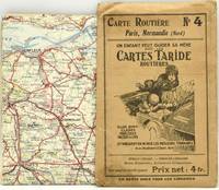
290392Paris: Imp. Gaillac. A roadmap of France. Measuring about 73.5 x 92.5 cm unfolded. Housed in the publisher's paper sleeve. Imp. Gaillac unknown books
1953264337London: Andrew Melrose 1953. Hardcover. 334p. cloth-covered boards 6x9.25 inches frontispiece portrait of Carew corners bumped boards have a stained/mottled appearance offsetting to endpapers from dj old price stamped on front paste-down endpaper else good condition in a worn dj with a small splash stain on the spine panel. Andrew Melrose hardcover books
195994939Boston: Atlantic Monthly Press/Little Brown and Company 1959. Hardcover. xvii 435p. 8p. photos later printing cloth edgeworn dj. Atlantic Monthly Press/Little, Brown and Company hardcover books
1954UTUCPOL00JMJBobbs-Merrill 1954. Very Good. Tucker Glenn. Poltroons and Patriots: A Popular Account of the War of 1812 Two volumes. Tucker Maps W.T. Indianapolis: Bobbs-Merrill 1954. 812pp. Indexed. Illustrated. 8vo. Cloth with gilt lettering. Book condition: Very good with lightly bumped and yellowed spines. Slipcase is very good with light rubbing and yellowing. Includes monthly bulletin of American History Publication Society. Bobbs-Merrill hardcover books
43520Liverpool: George Philip and Son nd. Hardcover. Very good. Boards rubbed and darkened cloth backing slightly tanned else very good. <br/><br/> George Philip and Son hardcover books
2012UCARPAR00TMW.W. Norton 2012. Fine. Caro Ina. Paris to the Past: Traveling Through French History by Train. Cain maps David. New York: W.W. Norton 2012. 381pp. Indexed. Bibliography. 8vo. Paperback. Book condition: Near fine. W.W. Norton paperback books
19351319874New York: Harcourt Brace and Company 1935. First Edition. Hardcover. 10mo; pp 255; G/Poor; blue spine with ivory text; dust jacket has noticeable chips to edges; some toning to exterior; mylar wraps; cloth has slight wear to exterior; minor wear to corners; strong boards; text block has age toned exterior edges; illustrated endpapers; previous owner's name to verso of ffep; frontispiece; illustrated; interior clean;. 1319874. FP New Rockville Stock. Harcourt, Brace and Company hardcover books
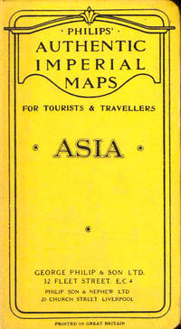
006893London UK: George Philip & Son Ltd. Good. 0. Hardcover. Dark blue cloth boards with gilt title. Map folds out to 22 x 28 inches. No date circa 1900s. Boards worn on edges corners bumped spine starting to split.; Book; 12mo - over 6¾ - 7¾" tall . George Philip & Son, Ltd. hardcover books
1977170527Ikeja: Longman Nigeria Ltd 1977. Paperback. viii 230p. preface appendices illustrations maps lightly-worn reprint trade paperback in red pictorial wraps. Longman Nigeria Ltd paperback books
1800D7401unknown: unknown likely early 1800s. Ephemera. Very Good. A collection of 8 engraved maps 420 x 280 mm including wide margins numbered in Arabic or Roman numerals see below otherwise seemingly uniform. From an unknown source. It includes: 1 Bombardement de Lille par l'Armee Autrichienne en 1792 with the stamp of Depot de la Guerre Bibliotheque in the top margin; 2 Siege de la Citadelle d'Anvers par l'Armee Francaise en 1792; III Siege de Valenciennes par l'Armee Coalisee Anglaise Hannovrienne et Autrichienne en 1793; VIII Siege d'Ypres par l'Armee Francaise en 1794; IX Siege de Charleroy par les Francais en 1794; X Siege de Landrecies par les Francais en 1794; XI Siege du Quesnoy par les Francaise in 1794; and XIII Siege de Nieuport par l'Armee Francaise en 1794. A bit foxed; flattened crease down the middle from folding these were perhaps pulled from a book where they were mounted on stubs along the crease. <br/><br/> [unknown] unknown books
1968799791968. MAPS MAPS FOR THE JEWISH SCHOOL PORTFOLIO 1. New York: Jewish Education Committee Press January 1968. Ten color maps 9 1/2 x 14 inches plus bonus map of the Six Day War. Includes maps of ancient history and contemporary Israel as well as Eastern Europe. Maps fine original envelope has closed tears light soil. unknown books
19012221875<p>Map of San Francisco: Showing points of special interest to attendants the Fifth International Convention of the Epworth League July 18-21 1901 folding map of 21" x 28" printed in black & red.With numbered locations of places of Methodist interest and historical. Verso of map with 23 panels detailing trips excursions to Yosemite Valley Southern California including Pasadena Redlands Riverside Palo Alto Santa Cruz Lick Observatory. Very good minor wear; short tears at folds.</p><p>San Francisco before the 1906 devastating earthquake.</p> unknown books