National Geographic MapsBiblio.com
1 660 résultats
1597756040.Gmap. Good. Access codes and supplements are not guaranteed with used items. May be an ex-library book. unknown
20151-1597756040Natl Geographic Maps 2015. Map. New. 2015 edition. 10 pages. 9.50x4.25x1.00 inches. Natl Geographic Maps unknown
0881308633.Gspiral_bound. Good. Access codes and supplements are not guaranteed with used items. May be an ex-library book. unknown
3869516-6Used - Good. Pages intact with minimal writing/highlighting. The binding may be loose and creased. Dust jackets/supplements are not included. Stock photo provided. Product includes identifying sticker. Better World Books: Buy Books. Do Good. unknown
0331288966.Gpaperback. Good. Access codes and supplements are not guaranteed with used items. May be an ex-library book. paperback
0331502216.Ghardcover. Good. Access codes and supplements are not guaranteed with used items. May be an ex-library book. hardcover
2001SONG1566958636National Geographic 2020-01-01. 2020. map. Used: Good. 5.12x0.71x9.37. Buy with confidence. Excellent Customer Service & Return policy. National Geographic unknown
1566958636New. Brand new and still unused unknown
1566958636.Gmap. Good. Access codes and supplements are not guaranteed with used items. May be an ex-library book. unknown
1845876075.Gpaperback. Good. Access codes and supplements are not guaranteed with used items. May be an ex-library book. paperback
1910218499.Gmap. Good. Access codes and supplements are not guaranteed with used items. May be an ex-library book. unknown
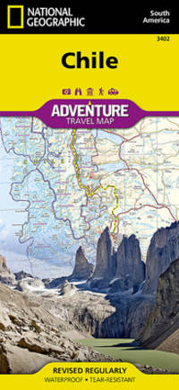
20199781566955461-2025Natl Geographic Society Maps 2019. Paperback. New. <p><strong>Author:</strong> National Geographic Maps - Adventure</p><p><strong>Publisher:</strong> Natl Geographic Society Maps</p><p><strong>Binding:</strong> Paperback</p><p><strong>ISBN:</strong> 9781566955461</p><p><strong>Release Date:</strong> 2019</p><p><strong>Number Of Pages:</strong> 2</p><p><strong>Details:</strong> • Waterproof • Tear-Resistant • Travel MapNational Geographic's Chile Adventure Map is the perfect travel companion for adventure travelers exploring this long and narrow coastal country occupying much of South America's Pacific coastline. Expertly researched the map combines unparalleled detail with a user-friendly design including a handy index of towns cities and National Parks and Reserves to help locate them quickly as well as a clearly marked road network of highways major and minor roads and unpaved roads labeled with distances. In addition hundreds of well-known and off the beaten path cultural historical and recreational points of interest are highlighted including UNESCO World Heritage Sites archeological sites beaches lighthouses monuments churches spas and areas for skiing fishing and surfing. Outdoor adventurers will find mapped hiking trails along with such topographic features as contour lines elevations and labeled peaks.The map conveniently covers the country in four sections: from its northern borders with Peru and Bolivia to the city of Copiapo; the next section continues south through the capital of Santiago to Concepcion; then into Patagonia and the city of Coihaique the Chonos Archipelago and Moraleda Channel; finally to the southernmost part of the country with its National Parks and Preserves including Alberto de Agostini National Park. The long border with Argentia is shown with border crossings. Inset maps cover Easter Island and the Juan Fernandez Islands. This unique map with its abundance of specialized content. compliments any guidebook.Every Adventure Map is printed on durable synthetic paper making them waterproof tear-resistant and tough — capable of withstanding the rigors of international travel.Map Scale = 1:1750000Sheet Size = 37.75" x 25.5"Folded Size = 4.25" x 9.25"</p> Natl Geographic Society Maps paperback
Q-1566955467Natl Geographic Society Maps 2019-01-01. Map. New. In shrink wrap. Looks like an interesting title! Natl Geographic Society Maps unknown
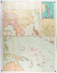
1943206908Chicago.: Geographical Publishing Company. 1943. 10 printed colour maps on a large single sheet 91 x 71 cms small inset map of the European theatre chronology of events original folds a few short fold splits archivally sealed; in very good condition. A suite of numbered U.S. war maps with Allied action overstamped in red by the publisher that for Germany and France with pictorial stamps for strategic targets including "Chemical Factories" and "Airplane Factories". The maps numbered 1 to 10: English Channel; Italy; Southern Greece; Western Mediterranean Sea; Germany and France; Baltic Sea and Scandinavia; China Burma India; Japan; Tokyo; and Greater Pacific Battle Zone: a large half sheet map noting the placement of US and Japanese bases. The "Chronology of Important War Events" lists action from the bombing of Pearl Harbour: "Japan's day of Infamy: Japanese air attack cripples American Fleet at Pearl Harbour" to March 21 1944 "Germans take over key political posts in Bulgaria and Romania". <br> <br>Issued by the Geographical Publishing Company of Chicago this educational sheet includes an advertisement for WLS Chicago "The prairie farmer station" with a list of their war broadcasts and a world clock. . Geographical Publishing Company. unknown
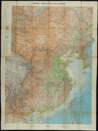
1953161304Edinburgh.: John Bartholomew & Son Ltd. 1953. Colour folding map laid down on linen. Scale 1:450000. 97 x 72 cm. Small holes and tears at some folds a little light browning. Cloth tape repair at fold adjoining upper card cover. Frederick Warne label upper cover a little creased and torn key includes glossary of Chinese geographical terms translated into English. Contour-coloured world map series. Published in the period immediately following the Korean War this map shows the 38th Parallel. . John Bartholomew & Son Ltd. hardcover
194633453Washington D.C.: Maps and Graphic Division 1946. 1st. revision March 1946. Edges browned 4 inch and 2 inch tears on folds one with small loss at double fold small chip and stain to margins top and bottom some minor edge wear and marginal tears; a good copy. 1 pp. 110 x 90 cm. Color map of China's transportation routes during the war. Scale ca. 1:2750000; E 1000--E 1260/N 420--N 180. Map no. 1379 June 15 1945. OCLC shows only one copy at the LOC of this revised copy. Maps and Graphic Division unknown
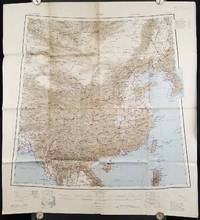
1945206545Calcutta: Compiled and drawn by the Survey of India. Second Edition. 1945. Large folding colour map 77.5 x 80cm; 95.5 x 86.2cm sheet including legend and small inset showing adjoining maps light toning and wear to upper margins and at corners and folds; but in very good condition. Very large clear map of China printed in 1945. The projection is noted as the "Lambert Conical Orthomorphic" a polyconic projection employed by the exhaustive Survey of India and the map includes surrounding countries: Taiwan Korea French Indo-China with a small inset key to Korean place-name abbreviations. As is typical of maps of this period Arunachal Pradesh is shown as Tibetan territory.The legend lists borders and provinces railways roads and canals with topography indicated with colouration. . Compiled and drawn by the Survey of India. unknown
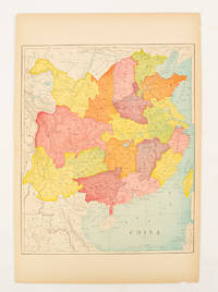
1900174904circa1900. Map printed in colour text in English provinces shaded in colour 28.3 x 23.2 cm central fold paper toned a small edge tear confined to the outer margin but in good condition. . unknown
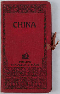
1920161936no date. circa1920. Linen backed colour folding map of China insets of Peking and Environs and Hongkong and Canton in lower left corner. 54 x 63.8cm. Table of place names at upper left gives the cities that "By a recent ordinance of the Republic all 'Fu' 'Chow'' and 'Ting' cities have been nominally reduced to the rank of 'Hsien'. The following parallel list gives the 'Fu' cities the names of which have been officially changed together with the new form adapted." Map folds into a red cloth covered case with ribbon ties 19 x 10.3cm. Title and decoration printed in black on upper cover. Trifle foxed on linen backing a little insect damage case in a few small places otherwise a very good clean map. . hardcover
1527708276.Gpaperback. Good. Access codes and supplements are not guaranteed with used items. May be an ex-library book. paperback
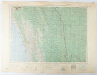
1955173072Washington D.C.: Army Map Service U.S. Army. 1955. Large colour map. 1:250000 scale. Transverse mercator projection. 23°00'N 91°30'E-22°00'N 93°00'E. Series U502 Sheet NF 46-6 Edition 1-AMS. Map measures 57.3 x 75.8cm. Slight wear creasing even light browning small closed tears on edges upper-right corner little foxed. Shows signs of use but map is clean and complete. Corps of Engineers Army Map Service map of Chittagong and surrounds compiled in 1955. Based on the British Indian one-inch and half-inch map series from 1938-43 and 1936-43 respectively. . Army Map Service, U.S. Army. unknown
1581740700.Gspiral_bound. Good. Access codes and supplements are not guaranteed with used items. May be an ex-library book. unknown
1581743793.Gspiral_bound. Good. Access codes and supplements are not guaranteed with used items. May be an ex-library book. unknown
19792083002116202317Meiji Maps Minoru Nagayasu and others 1979. Soft Cover. Fine. Number of books: 2 Meiji Maps Minoru Nagayasu and others paperback
19802083002116201553Meiji Maps Katsumi Okada 1980. Soft Cover. Fine. The book is in fine condition. Meiji Maps Katsumi Okada paperback