12 878 résultats
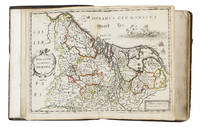
TARIDE A.. NON DATE. In-Plano Carré. En feuillets. Bon état. Couv. convenable. Dos satisfaisant. Intérieur frais. 1 carte dépliante en couleur de dimension 67 Cm X 99 Cm environ. 1 petit accroc sans conséquence réelle sur la lecture.
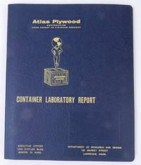
195627405Boston 16 Mass: Atlas Plywood Corporation 1956. Boards. Near Fine. 9 1/2 x 11 3/8 inches dimensions of tabbed loose leaf binder. Fourteen 8 x 10 inch approximate photographs plus "title page" photograph. Boards. A loose leaf binder with photographs depicting testing of crates and the attendant necessary equipment. Photos show a "large revolving drum" construction shop a compression machine what looks like a drop test chassis with crate affixed two photos of several men in a laboratory using a microscope and several other instruments a blueprint in progress two closeup images of instruments including a mullen tester a very large press used to compress pieces of plywood together testing in action and several other images. No doubt used as a sales tool demonstrating how thoroughly the company could build and test crates for reliable performance.<br /> <br /> The tenth edition of Industrial Research Laboratories of the United States 1956 locates the Atlas Plywood Corporation's Department of Research and Design at 431 Market Street Lawrence Mass. the same address as on the card cover of this folder hence our approximate dating. Atlas Plywood Corporation unknown
5067George Philip & son, Londres, fin 19ème – in-8, 182 pp – broché, couv. bradel verte, illustration premier plat or, 32 cartes couleur de l'Irlande et des comtés, autres p. blanches, un index à la fin
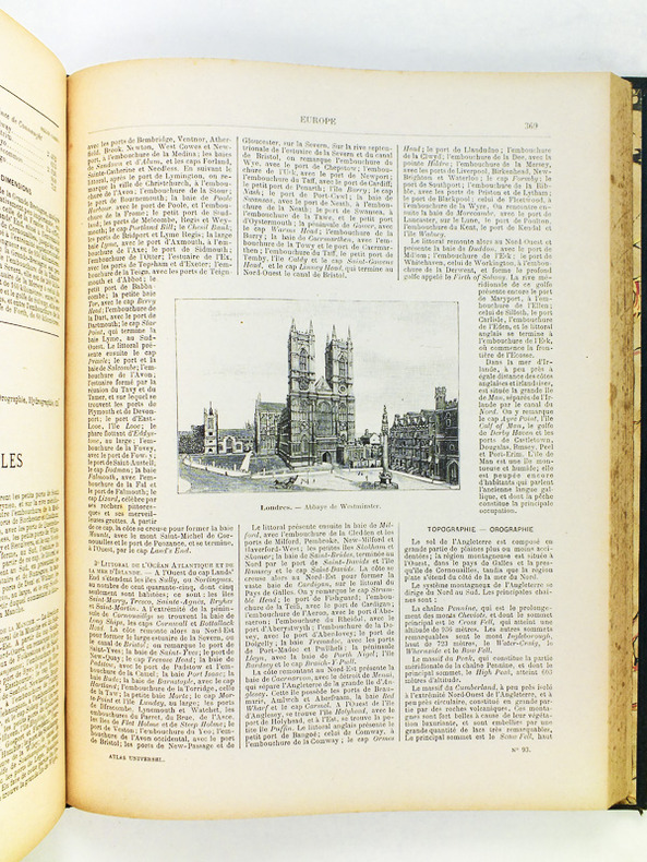
1 vol. in-folio reliure de l'époque demi-chagrin vert, [ Fayard Frères, 1896 ] , 623 pp. Rare exemplaire de cet ouvrage, proposant le texte seul (sans les cartes). Etat satisfaisant (pas de pages de titre, peut-être présente seulement dans le volume de cartes). Prix en l'état. Une présentation de l'état du monde à la fin du XIXe siècle, très riche en chiffres et autres informations. Français
1896425921 vol. in-folio reliure de l'époque demi-chagrin vert, [ Fayard Frères, 1896 ] , 623 pp.
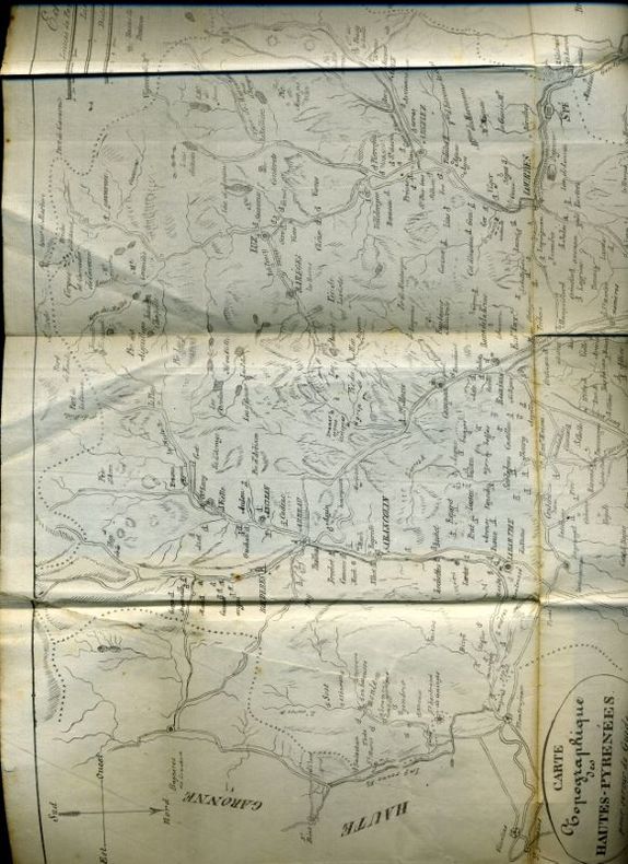
183311453Paris DIDIER 1833 1 P., Didier, à Tarbes, Lagleize, à Bagnères, Dossun, 1833, 228 pp., demi-bas. verte, dos plat orné de fers à froid et à chauds. Tranches marbrées.
199535044ABMünchen, ADAC Verlag, 1995. 38 cm, 144, IV Seiten, mit zahlreichen Karten, broschiert. Lizenzausgabe, Ausgabe 1995/1996 Kanten etwas bestoßen und berieben, Preisschild auf vorderem Buchdeckel, gut erhalten. Ein ADAC-Atlas
184040826Mainz, G. Faber, um 1840. 39,5 x 48 cm. Mittig gefaltet (wie erschienen).
Very Good Turkish, Ottoman (1500-1928) Original color lithograph map. Folded. Oblong folio. (35 x 52 cm). In Ottoman script (Old Turkish with Arabic letters). It shows Sudan and West Africa, Atlas Ocean shores, Sahra Desert, and other parts of Africa. Scale: 1:15.000.000. A very detailed and attractive map. Slightly fading. Otherwise a very good copy. Dated Hegira: 1310 = [Gregorian 1894]. Taken from his attractive atlas titled "Yeni cografya atlasi. [i.e. New Geographical Atlas]". The cartographer, Ali Seref, or Hafiz Ali Seref (or Esref) Pasha (1840-1907) was an Ottoman soldier and mapmaker who was schooled in Paris as a cartographer around 1862. While in Paris he published his first atlas with 22 maps, called the Yeni atlas. Upon his return to Istanbul, he became the chief cartographer at the Matbaa-i Amire Printing Press in Beyazit. Chipping on extremities. Slight foxing. Overall a good copy. Not in OCLC.; Not in TBMM Map Collection.
Very Good Turkish, Ottoman (1500-1928) Original color map. Folded. Oblong folio. (35 x 52 cm). In Ottoman script. Color lithograph. It shows Sudan and West Africa, Atlas Ocean shores, Sahra Desert, and other parts of Africa. Scale: 1:15.000.000. A very detailed and attractive map. Slightly fading. Otherwise a very good copy. Dated Hegira: 1310 = [Gregorian 1894]. [EARLY OTTOMAN MAP of SUDAN] Sudan. Sâye-i Türkiye Hazret Gazi Sultan Abdülhamid Hân-i Sâni'de Maarif Umûmiye Nezâret-i Celîlesi ruhsatiyle meshur Haset tarafindan Fransa Cemiyet-i Cografya âzâlarindan mütesekkil komisyona mahsûs tanzîm edilmis oldugu son defaki atlasinin tercümesi olarak bu def'a Erkân-i Umûmiyye Dairesi Besinci Fen Subesi'ne me'mûr piyade mirlivâlarindan saâdetlü Ali Seref Pasa ve rifatlubinbasi fütûvvetlü Muhyiddin Efendi maarifetleriyle tertib ettirilmistir. Ali Seref Pasa or Hafix Ali Esref. He was a soldier, who was schooled in Paris as a cartographer around 1862. Already in Paris he published his first atlas with 22 maps, called 'Yeni atlas'. Upon his return to Istanbul he became a chief cartographer at the Maatbaa-i amire Printing Press in Beyazit, which was the successor of the Muteferrika press from 1727. Among others he translated the large Kiepert map of Anatolia to Ottoman. He died in 1907, leaving his large project of a gigantic map of Anatolia in 100 sheets unfinished. Ali's name is often misunderstood or even listed as two different people: Ali Seref Pasa and Hafiz Ali Esref. Until the surname law adopted on June 21, 1934, Turks did not have surnames. They were born with one first name and were until the adulthood described only as sons or daughters of their parent's names. Later they were given titles such as Effendi (Sir), Bey (Chief) or Hanim (Madam) for higher classes, or they were given names according to their work or class. The names were not inherited by children until 1934, when the surname law was enforced. The map maker Ali received names Seref, the honourable, and Pasa, the dignitary. He was also known as Hafiz, the memorizer of Qur'an and Esref, Proud. So Ali Seref Pasa would have a meaning 'Honourable Dignitary Ali, and Hafiz Ali Esref, Memorizer of Qur'an, Proud Ali. Daruttibaa - Matbaa-I Amire Printing Press: The first press in the Muslim world, called Daruttibaa, was founded in Istanbul by Ibrahim Muteferrika in 1727, with a permission of Sultan Ahmeet III. It was located in Muteferrika's house. The first book was published in 1729 and until 1742 sixteen other works followed. After Muteferrika's death, the press was supressed for printing, as printed books were considered dangerous. In 1796 the press was purchased by the government and moved to Uskudar in Istanbul, and in 1831 finally to Beyazit, where it was renamed to Matbaa-i Amire in 1866. The press was closed in 1901 and was reopened in 1908 under the name 'Âmire' In 1927 the name changed to State Printing House. The press still exists and is known for publishing school and educational books. Extremely rare. Not in OCLC.; Not in TBMM Map Collection.
191656549Washington D.C. & Juneau A.T.: Superintendent of Documents U.S. Surveyor General’s Office 1916. Oblong Atlas Folio. 24 x 19 in. 14 colour maps 1 large folding 17.25 x 41.5 in. Printed softcovers stapled and paper reinforcement at gutter margin some minor toning & soiling to fore-edges edgewear to spine minor scuffing and a couple removed label ghosting still VG- bright copy. First edition of this remarkably scarce plat map atlas for the Matanuska coal fields and township sites surveyed by Walker & McDaniel during their surveys following those on the Kenai Peninsula. By 1912 with the act establishing Alaska as a U.S. Territory and in 1914 the authorization to construct an Alaska Railroad there became an increased need and demand for coal. The Matanuska mines located about 45 miles northeast of Anchorage first began production in 1916 and would stay in continuous production through both World War I and World War II and well into the 20th Century re-opening again in the 21st Century. Not only do these maps show available government lease sites for coal mines but also available Township sites for homesteaders as required by the original Homestead Acts of 1866 and the 1916 Act for Alaska requiring surveys and resurveys to accurately determine boundaries of unsold railroad lands and identify their boundaries. Worldcat locates 2 copies Anchorage Museum & Univ. of Calgary; See: Catalogue of the Public Documents of the Sixty-Fourth Congress Index Vol. 13 1922 p. 74; C. Albert White A History of the Rectangular Survey System 1983 p. 189. Superintendent of Documents, U.S. Surveyor General’s Office, paperback
17945887<p>THE FIRST ENGLISH SEA ATLAS OF AMERICA</p><p>Folio 47.7 x 31 cm 66 pp. with pagination errors with 26 engraved maps 21 of which are double-page or folding the first chart with letterpress text attached as called for numerous woodcuts in the text. Bound in contemporary sheep rebacked blind-tooled borders to upper and lower covers. Minor rubbing to covers. Some spotting to the fourth map Verner no. 62 and adjacent letterpress pages small tear to fold of map 10 Verner no. 60 two small circular mends to title page not affecting text otherwise remarkably well preserved.</p><p>A spectacular copy of the final edition of the <em>English Pilot</em> <em>The Fourth Book</em> the first wholly English sea atlas of American waters. The work was sufficiently in demand to justify 37 legitimate editions from 1689 to 1794 and three pirated editions. All editions are rare. During the history of this title its charts underwent numerous changes. The first edition contained only 18 maps whereas this 1794 final edition contained 26.</p><p>"<em>The English Pilot</em> was the first major sea-atlas produced in England. In its final form it consisted of five separate books and <em>The Fourth Book</em> was the first wholly English sea-atlas of American waters. Although the idea originated with John Seller he was involved in producing only the first two books. William Fisher and John Thornton produced <em>The Fourth Book</em> in 1689 and their successors Mount and Page continued to print it for over 100 years Seller's proposal for a 'Sea Waggoner' resulted in the production of <em>The English Pilot</em> which consisted of five separate volumes with a common generic title. Book One included the southern navigation and Book Two the northern. Book Three was concerned with the Orient Book Four with America and Book Five contained Africa. Each book or volume has its own independent publishing history and appeared in numerous editions. The five separate books constitute a set only by virtue of the general title and under that title <em>The English Pilot</em> is the first great sea-atlas produced in England. Of the five books the fourth has the longest publication history and is the best known" Verner p. v.</p><p>Throughout its history <em>The Fourth Book</em> showed very few changes in textual matter and the content of the volume was established between the editions of 1706 and 1721.</p><p>The present example of the 1794 edition is complete and contains the following maps see Verner pp. xv-xx for full list of editions and charts from 1689 to 1794:</p><p>1. A New and Correct Chart of the Western and Southern Oceans Showing the Variations of the Compass with letterpress text attached</p><p>2. A New and Correct Chart of the North Part of America from New Found Land to Hudson's Bay</p><p>3. A New Generall Chart for the West Indies of E. Wright's Projection</p><p>4. A New and Accurate Chart of the Vast Atlantic or Western Ocean by Eman. Bowen</p><p>5. Harbour of Casco Bay Capt. Cyprian Southicke 1720 Em. Bowen</p><p>6. A New and Correct Chart of the Coast Line of Newfoundland from Cape Raze to Cape Bionavista</p><p>7. Island of St. Peters </p><p>8. Chart of the South East Coast of Newfoundland</p><p>9. New and Correct Chart of the Sea Coast of New-England from Cape Cod to Casco Bay Henry Barnsley</p><p>10. A Map of the Coast of New England from Staten Island to the Island of Breton Capt. Cyprian Southack</p><p>11. A Chart of New York Harbour with the Banks </p><p>12. Virginia Maryland Pennsylvania East & West New Jersey </p><p>13. A Draught of Virginia by Mark Tiddeman</p><p>14. Barbados copperplate in text</p><p>15. A New Mapp of the Island of St. Christophers Survey taken by Mr. Andrew Norwood</p><p>16. A Large Draft of the Island of Antegua copperplate in the text</p><p>17. A Draught of South Carolina and Georgia from Sewee to St. Estaca by Andrew Hughes</p><p>18. A Correct Chart of the Caribee Islands</p><p>19. A Correct Chart of Hispaniola with the Windward Passage by C. Price</p><p>20. A Draught of the West End of the Island of Porto Rico </p><p>21. A New & Correct Chart of Cuba Streights of Bahama Windward Passage </p><p>22. A New and Correct Draught of the Bay of Matanzas by Rob.t Pearson</p><p>23. Bermudas copperplate in text</p><p>24. A New and Correct Chart of the Island of Jamaica</p><p>25. A Chart of the Coast of Guayana By R. Waddington</p><p>26. A New and Correct Chart of the Trading Part of the West Indies</p><p> <em>The English Pilot: The Fourth Book</em> Amsterdam 1967 with an introduction by Coolie Verner.</p> Printed for Mount and Davidson hardcover
193012302Velhagen & Klasing, Bielefeld, 1930. VI,644 Seiten, ca 28,5x23 cm, goldbedruckter flexibler OLeinenband, mehrspaltiger Druck. Über der Verlagsnennung ein Aufkleber: "Verkehrs-Verlag J. Fischer Düsseldorf". Gutes Exemplar.
Very Good Arabic Original hand-colored map on tissue paper. 23x19 cm. In Ottoman script and Arabic. No scale. Manuscript notes of toponyms. The manuscript shows Egypt, Ethiopia, Sudan, the Red Sea along the line of Red Sea shores. Manuscript notes show that the map was used for military purposes in the last Ottoman Imperial period. Habesh Eyalet, Ethiopia in northeast Africa was conquered by Özdemir Pasha in 1557. His son, Osman Pasha, transformed the region into an eyalet, which remained under Ottoman suzerainty until the early 19th century when Egypt assumed its administration. (Source: Pashas, Begs, Effendis: A historical dictionary of titles and terms in the Ottoman Empire, Bayerle, Gustav.).
Very Good Turkish Original manuscript map of Alexandria Port and its immediate hinterland. Folio. (33 x 41 cm). In Turkish (Modern). Folded. No scale. The manuscript shows Alexandria Port and the Palace of the King Farouk of Egypt, customs shores, ports and harbors, locations of the British ships, radio station, location of SS Ramlah, strait, Great Pass (?), waterfront for the lumber ships, sea current zones and probably entrance and exit routes etc. A very detailed map, decorated with ships. Some repairs with tape, tears, foxing and stains. Overall a good copy.
S.l., Brepols, s.d.; in-folio, 232 pp., cartonnage d'éditeur, dos lisse, sous jaquette imprimée. Traduction de l'anglais par Chr. Cannuyer et R. F. Poswick. Cet atlas est autant historique que géographique ou même artistique et culturel. Très fouillé, il permet selon les époques étudiées de centrer les préoccupations et les éléments essentiels. Ouvrage intelligent et documenté. Nombreuses illustrations (documents photographies et dessins). Très bon état.
183553619New York: Published by Huntington and Savage 216 Pearl St. 1835. Imperial 4to. 16 x 14 in. 10 leaves 8 engraved plates 2 double-page 7 hand-coloured minor foxing edgewear faint tidemark to lower margin of first few leaves. Original printed yellow softcovers mounted on thicker paper stock cover art woodcut of astronomer gazing at the stars w/ telescope testimonials printed on back cover soiling edgewear rubbing tide-mark to lower margin bumping to corners pencil drawings by child on verso of some plates trying to reproduce some of the figures still G copy. First edition thus stated “New Edition†which in actuality was an updated and revised edition with new engraved plates executed by W.G. Evans of New York fl. 1830-1845 who also engraved the famed Map of Lewis & Clark’s Track Across the Western Portion of North America in 1842 revised by Archibald M’Vickar. Burritt 1794-1838 an American astronomer and mathematician created his textbook and the later atlas as a low-cost alternative to celestial globes which were often too expensive for many schools in Jacksonian America. The atlas could be purchased for $ 1.25 at the time and the Geography of the Heavens textbooks and Atlases would prove immensely popular in classrooms up until 1876. Adapting most of his constellation figures from Alexander Jamieson’s A Celestial Atlas 1822 Burritt included a plan of the Solar System Celestial maps of the skies in January-March October-December April-June July-September South Pole North Pole and Planisphere of the Whole Heavens on Mercator’s Projection. This was the last decorative celestial reference in the 19th century and even served as inspiration of H.P. Lovecraft who notes it as prized possession in letter to Maurice Moe in 1915. See: Kidwell Elijah Burritt and the Geography of the Heavens Sky & Telescope Vol. 69 January 1985 pp. 26-28; Boston University Art Gallery Celestial Images: Antiquarian Astronomical Charts and Maps from the Mendillo Collection 2005 75. Published by Huntington and Savage, 216 Pearl St., paperback
199243475Mansfield, Martino, o. J. (um 1990; Nachdruck der Ausgabe Washington 1909-1992). Gr.-8°. Zus. ca. 6000 S., OLwd.-Bde.
173017253Haarlem 1730. Small 8vo 16 x 10 cm. Bernardus Cleynhens Half textured red cloth ca. 1860 sewn on 2 tapes chemical-marbled sides in brown and blue. With 25 double-page engraved maps 2 overview maps the second serving as a key to the 23 numbered detail maps and an engraved plate with 8 scales all hand-coloured partly in outline. The 2 overview maps slightly wider than the others have a flap folded in at each side. Further with 1 rococo woodcut tailpiece 1 woodcut decorated initial and a fleuron on the title-page. 40 23 1 blank pp. plus maps and plate of scales. A surprisingly rare pocket atlas illustrating the theatre of the "tegenwoordigen" present war probably meaning the War of the Austrian Succession 1740-1748 but possibly the Seven Years' War 1756-1763. The title-page notes that it is suited for officers travellers and lovers of geography to carry in a pocket. The text in Dutch gives a geographic description only of "Duytsland" Germany including Austria Bohemia and a few other areas whereas the maps also cover the Low Countries the English Channel northwest France and to the east as far as Warsaw Krakow and Belgrade. The 23 detail maps were designed so that they could be assembled with the key map to make a single wall map whose cartographic image would measure 53 x 90 cm.With a contemporary owner's bookplate embossed stamp and library labels. With the text leaves somewhat browned not affecting the maps or the plate with scales and the first 2 leaves slightly worn but generally in good condition. A rare pocket atlas from the War of the Spanish Succession.l Koeman I Cle 1; STCN 2 copies; WorldCat 2 copies. hardcover
1770D18502Paris circa 1770. Paperback. Very Good. Chez Lattre Graveur Ordinaire de Monseigneur le Dauphin de Monseigneur le Duc d'Orleans et de la Ville. Engraved title-page dedication and 7 full-page engraved maps with original hand-color. 8vo format 10x6¾ inches original blue paste-paper wrappers light wear; minor worm track confined to the margins. A charming eighteenth-century traveler's guide from Paris to Compiegne. OCLC locates one copy listed under a different publisher. <br/><br/> paperback
1851D6GE1B01U79OMontpellier 1851. Contemporary bindings: vol. 1 red half goatskin with binder's/stationer's ticket of "Papeterie Sijas Montpellier" red textured paper sides "E.M." in gold on front board marbled endpapers Wolfe 159; vol. 2 black half goatskin black embossed paper sides "C. du M." in gold on front board marbled endpapers Wolfe 112; vol. 3 black sheepskin "C. du M." in gold on front board white watered-silk endleaves. Folio vol. 1 and large 4to 32 x 25.5. cm. vols. 2-3. Neatly written manuscripts on paper with 23 graphically vibrant maps coloured in outline with subtly shaded washes in grey for the coasts and numerous bright colours for political boundaries and with calligraphic headings. 3 volumes. A 3-volume historical manuscript atlas with beautiful manuscript maps the volumes titled: Atlas historique Souvenirs historiques and Tableaux et cartes. The Atlas historique contains finely calligraphed chronological tables displaying events in ecclesiastical history the history of the Roman Empire and France from the first century to 1850 followed by coloured double-page maps of France the Ottoman Empire Europe and the Roman Empire. The Souvenir historiques has the same structure but is solely devoted to the history of England Spain Germany and Italy covering the period from the fifth century to 1850 with coloured double-page maps of the British Isles the Iberian Peninsula the German states and Italy. The Cartes et tableaux is the most ambitious volume containing no fewer than 14 coloured double-page maps including two world maps maps of Africa Asia America Oceania Europe etc. and numerous chronological tables.The ink has sometimes left a browned shadow on the back of the leaves or facing leaves and occasionally eaten a small hole in the paper but the atlas is otherwise in very good condition. Bindings slightly chafed. A graphically vibrant French historical manuscript atlas. unknown
1718D14120Amsterdam: Aux dépens de la Compagnie 1718. Hardcover. Good. Contemporary speckled calf handsomely rebacked but one board detached; gilt-stamped lettering in tan leather spine label second compartment gilt-stamped ornament on 5 raised bands and direct in spine compartments; 3 volumes 12mo 163x95mm; pp. 10 336 35; 16 333 51; 14 468 32; with hand-colored engraved half-title in Volume I 18 hand-colored plates many folding hand-colored decorative head- and tail-pieces. Front rear board on volume one detached. Boards a bit scuffed along the edges; corners bumped; spines dry. Internally bright and clean; previous owner's tasteful bookplate. Plates are lovely. <br/><br/> Aux dépens de la Compagnie hardcover
16525476Antwerp 1652. 4to 18 x 14.5 cm. Jan Huyssens Later 17th-century mottled calf sewn on 4 double cords gold-tooled spine and board edges. With a double-page letterpress title-page with a frame built up from typographic ornaments and 39 unnumbered double-page engraved maps of the northern and southern Low Countries by Jacob Aertsz. Colom each map coloured in outline. Interleaved with 38 blank leaves and with a manuscript table of contents 3 3 blank pp. at the end. Double-page title-page and 39 double-page maps. Second known copy of a pocket-atlas published at Antwerp but containing a selection of the maps of the Low Countries originally published by Jacob Aertsz. Colom at Amsterdam in 1635 with the title De Vyerighe Colom the title Colom had first used for his famous pilot guide in 1632 and the name he had given to his Amsterdam printing office where he worked from 1622 to his death in 1673 as a bookseller printer and mapmaker. The only other copy known is at the Royal Library in Brussels. The Vyerighe Colom with 47 maps and 3 plates and with extensive text in Dutch and French went through several editions in the 17th century but it was once thought that all editions before his death in 1673 had been published at Amsterdam by Colom himself. The Royal Library copy like the present one contains 39 maps but each contains one map not in the other so there are forty in total: the present copy includes Drentiae not in the Royal Library copy which includes Le terres entre la Meuse Vahal et Rhin not present here. The maps are also bound in a different order.The present edition is of great interest and gives cause to review Colom's activities. It is printed from Coloms plates so Colom may have licenced the Antwerp publisher to produce a variant edition of his Vyerighe Colom to broaden his market possibly reacting to the signing of the Peace of Münster in 1648 which finally ended the Eighty Years War and opened trade and communication between the northern and southern Low Countries. Jan Huyssens made an entirely new and practical atlas out of Colom's Vyerighe Colom. He omitted all text and the three plates that do not show maps and selected only maps of general interest leaving out the map of the ancient Low Countries and such typical Dutch maps as the separate maps of the polders De Zype Beemster Wormer Purmer Byllemermeer and Waterland also - at least in the present copy - completely rearranging the maps more in order of their geographical sequence. The title suggests that Huyssens originally planned to include a text so the present extremely rare edition may be the only surviving result of an abandoned project.l Koeman & Van der Krogt 365.23 IIIB pp. 644-645 2 copies: the present & Royal Library Brussels; UniCat 99095764 Royal Library Brussels only; cf. Koeman II Col 1 1635 Amsterdam ed.; not in KVK; STCV; WorldCat. unknown
189255835Chicago & New York: Rand McNally & Co. 1892. Thick elephant folio. 16.5 x 23 x 3 in. 597 1 pp. plus 4 pp. Classified List of Subscribers in Portland Oregon. With over 150 wax engraved colour maps colour diagrams and charts many double-page numerous black & white text maps for cities streets and townships. Full embossed brown morocco over beveled boards gilt lettering & embossed borders on front cover gilt decoration & lettering on spine gilt inner dentelles marbled endpapers spine rebacked w/ original laid back down minor repairs to leather on back cover some scuffing edgewear wear to corners still a VG copy with superb clean interior. First edition thus of the subscriber’s edition of Rand McNally & Co.’s famed Indexed Atlas which encompasses both Western and Eastern Hemispheres offering an essential cartographic and historic reference for the world at the height of the Victorian era on the eve of the 1893 Columbian Exposition in Chicago Illinois. The detailed maps for the United States drew upon the 1890 census results and presented the population of every city town village and settlement in America at the time including Alaska the Indian Territory and Oklahoma all with maps present as well as many large maps of major cities such as Chicago including the site of the forthcoming Columbian Exposition a Chicago Railway Terminal map as well as such cities as Baltimore Cincinnati Louisville San Francisco and many others. Rand McNally & Co. were famed for their relief plate engraving process was engraving which produced fine detailed maps with exceptional detail and colour in competition with such companies as Colton Asher & Adams of New York Matthews-Northrup Co. and George Cram. The atlas also encompasses large detailed maps of Africa India China Asia Europe the Russian Empire and more along with detailed economic and statistical charts across the World. This Indexed Atlas was also released in other variations such as two volumes for Eastern and Western Hemispheres as well as a more compact version with less maps and descriptive text and without the subscriber’s list although all were issued with the same title page. The subscriber’s list for Portland reads as a Who’s Who of the most important firms in the business at the time including the Weinhard Brewery Stranahan & Du Puy architects the Portland Bottline Works owned by Cordes & Johannsen Max Smith’s Vienna Cafe Edison General Electric the Portland Cracker Company and many more. Worldcat locates 7 copies California State Notre Dame & Toronto Complete w/ varying paginations; Univ. of Illinois & Rutgers Vol. I only Rutgers substantially incomplete; Case Western Reserve copy not listed as present in their catalogue LOC; See: Phillips & Le Gear A List of Geographical Atlases in the Library of Congress Vol. I 975. Rand, McNally & Co., hardcover
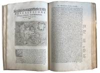
157643595Venice: Calignani & Porro 1576. Foliated 29.7 x 20.9cm a large complete untrimmed copy The enlarged Second Edition small folio 29.8 x 20.2cm 24201.1 colophon foliated with 47 copper plate maps decorated initial letters head and tail pieces in later full vellum red leather label gilt titles title page is lightly sprinkled with tiny spots a very good to fine large complete untrimmed copy of this enlarged edition containing 17 additional maps not in the first edition of 1752. fine. ~ ~ ~ ~ <br /> Header:. Porcacch. The Most Famous Islands Of The World. 1576. <br /> <br /> ~ ~ ~ Shirley. The Mapping of the World 127; The World Encompassed 87; Phillips. Atlases I67; European Americana 576/35; Sabin 64149; JCB I 263-264; Adams P-1905. This is one of the most beautiful works of its kind produced in the 16th century and is the ï¬rst to have maps engraved on copper rather than on woodblocks. "The popularity of Bordone's Isolario brought forth a successor which from both the cartographical and topographical point of view was far more distinguished. Porcacchi's description of the "most famous islands of the world" included the areas represented in the other atlas and devoted the third book to islands of the New World of the Pacific and the Indian Ocean. " "The ï¬rst world map is a ï¬nely-executed reduction of Camocio's large world map of 1567 one of the last in the long line of derivatives from Gastaldis prototype of 1546. The illustrated tract on islands presented here is said to be Porcacchi's most important work. - <br /> <br /> ~ ~ ~ Most of the maps included are: Iceland Hebridean islands and Orkney Gotland Hibernia Ireland England Scotland Sealand Maiorica Menorica Spain Malta Venice Italian archipelago corfu Curzolari Ionia Kefalonia island in the Ionian Sea Zante Morea Cerigo Candi of Indonesia Scarpanto Rhodi Santorini Milo Nixsia Cyrus Metellino Constantinople Stalimene Aegean Negroponte Greece Ciprus Temistitan Mondo Nuouo Spagnola Cuba San Lorenzo Peru S.Giovanni deL isole Molucche Indonesia and Del Mappamondo. The word Atlas was first used in the first collection of maps by Gerardys Mercator's "Atlas sive cosmographicae. 1585-1595 Calignani & Porro unknown