Blanchard, Theophile und Barrere FreresAntiquariat.de

430 résultats
184417558Paris, Ateliers catholiques du Petit-Montrouge, 1844. 3 Bll. (Vortitel, Titel, Avertissement). 77 teils gefalt. Tafeln (meist in Stahlstich, teils in Lithographie). 4°. HLdr.der Zeit (stark beschabt und bestoßen, Rücken-Kapitelle geklebt). [5 Warenabbildungen]
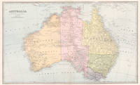
18875941887. Chromolithograph. 425mm by 645mm sheet. Detailed map of Australia. From 'Picturesque Atlas of Australasia'. <br /> Central vertical fold as issued. A couple of small foxing spots. Slight foxing evident on reverse. Central fold strengthened at top and bottom by acid free conservation tape ob the reverse. unknown
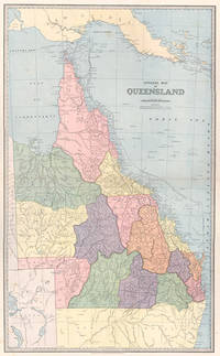
18875571887. Chromolithograph. 610mm by 370mm image. Detailed map of Queensland with counties marked in colours. <br /> From 'Picturesque Atlas of Australasia'. Central horizontal fold as issued. Index on reverse. unknown
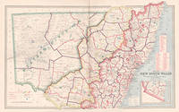
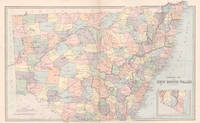
18876011887. Chromolithograph. 425mm by 645mm sheet. Detailed map of New South Wales. From 'Picturesque Atlas of Australasia'.<br /> Central vertical fold as issued. unknown
185125168Alle Tafeln mit Bezeichnung Allg. Bauzeitung 1851. Halbledereinband der Zeit. 13 z. T. gefaltete und z. T. doppelbl.gr. Tafeln mit Grund- und Aufrißen bzw. Ansichten, alle die Architektur-Denkmäler "Die Otto´s Universität" und "Das Erechtheion" in Athen betr. 2°. Stellenweise vereinzelt gering fl. Gut erhalten.
189654607ABBielefeld und Leipzig, Verlag von Velhagen & Klasing, 1896. gr2° / gr Folio (46x31), 2 Bl. (Titel/Inhalt), 188 S. (Namenverzeichnis) + Kartenteilanz- und doppelseitige montierte Karten (1-140 + 59a 60a 91a), 1 Bl., Hldr d.Zt. mit LdrEcken, goldRPrägung, SchmuckVorsätze, 3. Aufl., 2. revidierter Abdruck Ecken Kanten bestossen, etwas berieben, vereinzelt gering fingerfleckig, ordentliches festes Exemplar,
188733799ABBielefeld, Lpg. Velhagen & Klasing 1887. 2. wesentlich verbesserte u. um ein Viertel des Umfangs vermehrte Auflage. Folio 1 Blatt, 120(2) farbige Karten, 112 S.Register (7-spaltig) OHalbleder mit Goldaufschrift a. Deckel und Rü., Neu aufgebunden unter Verwendung des Originaleinbandes und Originalrückens, Titelblatt, Schnitt und einige Blätter an den Rändern stockfleckig, Einband etwas berieben und Ränder etwas bestoßen, im Ganzen gut erhalten. 2
182216764London, Longman, Hurst u.a., 1822. (Spät.) hangebundener Halblederband mit montiertem altem Deckeltitel.
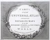
1813373400John Cary London 1813. Unframed Print. Very Good Condition. ENGRAVED TITLE ONLY. Framed with botanical motifs of grapevines lilies and acanthus leaves it evokes a classical aesthetic that elevates the atlas from mere utility to an object of refinement. These flourishes suggest the Enlightenments reverence for nature and knowledge uniting visual beauty with intellectual pursuit. Printed in a crisp serif typeface and etched with meticulous lines the engraving embodies the precision of pre-industrial printing. Carys reputation for clarity and accuracy meant that his atlases werent only elegant they were dependable reference tools. Engraving 21 x 26 cms sheet 26 x 32 cms. An attractive and bright sheet. A very attractive engraved page. Category: PRINTS : Antiquarian Interest; PRINTS : Historic Interest; Special Interest. This item may require more postage than the rates shown for delivery outside the UK. If extra postage is required we will contact you before processing your order and you will be given the details and option to decline the extra cost. John Cary unknown
18538333Berlin : Kortmann, 1853. [22] Taf. mit Kt. 2°. HLwd. d. Zeit mit marmoriertem Einband u. Deckelschild.
1830D19538Boston: Crocker & Brewster 1830. Hardcover. Very Good. Publisher's cloth boards gilt modern cloth over spine. 26 hand-colored engraved maps some folded. Contents lightly toned some offsetting as typical; generally speaking a nice copy. <br/><br/> Crocker & Brewster hardcover
1889262371889. WOLVERTON'S ATLAS OF MONMOUTH COUNTY. EATONTOWN MAP 1889. A 20-inch by 30-inch hand-colored map of Eatontown also showing Monmouth Park and Oceanport. Probably one of the best early maps of Eatontown ever made. $150.00. unknown
1889262421889. WOLVERTON'S ATLAS OF MONMOUTH COUNTY. HOWELL TOWNSHIP 1889 MAP. A 20-inch by 30-inch hand-colored map of Howell Township showing West Farms Fairfield Farmingdale Jerseyville Turkey Blue Ball Greenville Runyons Bethel and Squankum. $150.00. unknown
1889262381889. WOLVERTON'S ATLAS OF MONMOUTH COUNTY. MILLSTONE TOWNSHIP 1889 MAP. A 20-inch by 30-inch hand-colored map of Millstone Township also showing the Navesink section of Middletown Township. $150.00. unknown
18811197114Berlin; Verlag von Dietrich Reimer, o.J. (1881?). Ca. 60 Seiten; großformatige, farb. illustr. Karten; 36,5 cm. Originalleinenband.
18425119876Düsseldorf, im Verlage der lithographischen Anstalt von Arnz & Co. Ohne Jahr (um 1842). 19 nicht num. Blätter. Quer-2° (35 x 27,5 cm). Halbleinenband der Zeit mit schönem grünem Marmorpapierbezug.
189950664Bielefeld-Leipzig, Velhagen & Klasing, 1899. Gr.-Fol. 2 Bll., 186 farb. lithogr. Kartenseiten, 179 (1) S. Register, OHLdr.
18875971887. Chromolithograph. 425mm by 645mm sheet. Detailed map of New South Wales. From 'Picturesque Atlas of Australasia'. <br /> Central vertical fold as issued. Key on reverse.A little light foxing. unknown
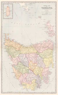
18875951887. Chromolithograph. 645mm by 425mm sheet. Detailed map of Tasmania with inset map of 'King Island'. From 'Picturesque Atlas of Australasia'. <br /> Central horizontal fold as issued. Key on reverse.A little light foxing. unknown