Atlas, JamesBiblio.com

990 résultats
199032897Knoxville TN U.S.A: Whittle Communications. As New. 1990. Hardcover. 0962474533 . FREE UPGRADE to Courier/Priority Shipping Upon Request - IN STOCK AND IMMEDIATELY AVAILABLE FOR SHIPMENT - TEXT PRISTINE & UNMARKED CRISP TIGHT TO THE SPINE - Discusses leading figures such as the late Allan Bloom. Educational values and standards vs. Test scores. 91pp. -- with a bonus offer-- . Whittle Communications hardcover
34025As New. Hardcover. FREE UPGRADE to Courier/Priority Shipping Upon Request - IN STOCK AND IMMEDIATELY AVAILABLE FOR SHIPMENT - AS NEW THE TEXT BLOCK IS PRISTINE CLEAN UNMARKED AND IN EXCELLENT CONDITION - - Color Illustrated Maps & Flags. 192 pp Index. This book contains general reference maps physical maps economic maps with new maps of each state in the union on a large scale and in full detail. Nelson's Complete Encyclopedia Atlas Section Index of Continents Countries States Provinces and Dependencies. -- with a bonus offer-- . hardcover
2015110857Prestel USA. New. 2015. Hardcover. 3791381008 . FREE UPGRADE to Courier/Priority Shipping Upon Request - IN STOCK AND IMMEDIATELY AVAILABLE FOR SHIPMENT - Flawless copy brand new pristine never opened - -- with a bonus offer-- . Prestel USA hardcover
198517247A. C. Black / W. W. Norton. As New. 1985. Paperback. 0713627174 . FREE UPGRADE to Courier/Priority Shipping Upon Request - IN STOCK AND IMMEDIATELY AVAILABLE FOR SHIPMENT - AS NEW THE TEXT BLOCK IS PRISTINE CLEAN UNMARKED AND IN EXCELLENT CONDITION - -- with a bonus offer-- . A. C. Black / W. W. Norton paperback
198754176Cambridge MA: Schenkman Books. New. 1987. Hardcover. 0870470299 . FREE UPGRADE to Courier/Priority Shipping Upon Request IN STOCK AND IMMEDIATELY AVAILABLE FOR SHIPMENT - Flawless copy brand new pristine never opened -- 413 pages. -- with a bonus offer-- . Schenkman Books hardcover
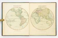
1809127861London: Printed for C. Smith Mapseller Extraordinary to his Royal Highness the Prince of Wales 1809. First Edition. Hardcover. Very Good. London Printed for C. Smith Mapseller Extraordinary to his Royal Highness the Prince of Wales 1809. Folio 404 × 330 mm engraved title leaf letterpress contents leaf and 43 hand-coloured copper-engraved maps numbered as 45 the map of Germany comprises two double-page sheets numbered 19-20 and 21-22. All leaves are printed one side only; all maps are dated 1808. Modern half calf and cloth with a gilt-lettered contrasting leather title-label on the spine; short scratch to the leather on the rear cover; title page a little tanned and discoloured around the margins by the leather corners of an earlier binding; scattered light foxing; insignificant short tears to some margins now sealed; trifling signs of age and use; overall in excellent condition. An attractive Georgian atlas 'on a Scale sufficiently large for the Purposes of general Reading and yet not too inconvenient for the Study or the Table' advertisement at the foot of the contents page. The three maps showing Australia 'Eastern Hemisphere' 'The World on Mercator's Projection' and 'Asia' all show the southern coast of the continent as uncharted. The expeditions of Flinders and Baudin had both charted this coast in 1802 but their maps were not published until 1814 and 1811 respectively. Printed for C. Smith, Mapseller Extraordinary to his Royal Highness the Prince of Wales hardcover
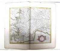
085473N: N 1985. Pp. viii242colophon blank pictorial title page printed in red & black 5 decorative initials printed in red black & white pictorial or decorative tailpieces pictorial endpapers notes bibliography; med. folio; qr. vein-patterned vellum spine lettered in gilt grey papered boards decorated in gilt; fore and bottom edges uncut; within black cloth slipcase which is a trifle marked; Stone & Lorson Fullerton California 1985. Edition limited to 115 copies; this one of 89 thus bound. Hamel 186. The hand coloured double page map tipped-in at the centre shows Pede Montana regio cum Genvensium territorio part of modern Italy. The French text on the reverse includes a large decorative initial and is lightly foxed. The leaf is from the 1619 French edition of Mercator's World Atlas which was the fourteenth edition of the celebrated cartographer's magnus opus. Parts of the atlas had been printed during Mercator's lifetime but the entire work was not published until a couple of years after his death in 1594. N unknown
187354200Chicago IL: Warner & Beers 62 & 64 Lake Street 1873. Atlas folio. 16 x 18.7 in. 3 3 5-91 1 pp. Woodcut-engraved title page 42 hand-coloured steel-engraved maps all w/ nicely executed engraved borders couple double-page additional steel-engraved “Family Records†page filled-out in manuscript inserted. Original front panel stamped in decorative gilt lettering mounted on recent black cloth binding occasional edgewear minor soiling to fore-edges of textblock couple very minor closed tears still VG copy from the library of John Inkster 1828-1908 Scottish-American farmer who immigrated in 1860 to Pilot Township Kankakee IL to farm with his brother James and then continued West to farm in Coast Fork Lane Co. Oregon and finally the Washington Territory in 1881 where he homesteaded near Davenport WT assisted in building Fort Spokane and served as County Commissioner from 1886-1892. First edition of this exceedingly scarce Illinois Atlas published just after the great Chicago Fire of 1871 featuring an unrecorded platt map of Pilot Township in Kankakee County Illinois showing all the properties and property owners in 1872. This atlas also features the Railway map of Illinois City Map of Chicago maps of all the Illinois Counties and large map of the United States. Of special interest are the excellent early western maps of Texas; Minnesota Nebraska and the Dakota Territory; Wyoming Montana and Idaho Territories; Nevada and California along with map of Oregon and Washington and Alaska Territories. The Beers and Warners were successful map publishers in Chicago IL from about 1850 to 1886 and often publishing as Warner & Beers the cartographers produced a series of early state and county atlases and regional maps which were considered the most detailed maps produced at the time of the respective regions. As their Township and County maps often detailed individual homes and landowners they provide invaluable reference tools to researchers historians and genealogists. No copies located of this specific Warner & Beers Atlas in Worldcat; No individual copies located of the Pilot Township Map; See: Portrait & Biographical Record of Kankakee County Illinois 1893 pp. 390-391; An Illustrated History of the Big Bend Country embracing Lincoln Douglas Adams & Franklin Counties 1904 pp. 421-425. Warner & Beers, 62 & 64 Lake Street, hardcover
189056329Yamada Village Japan: n.p. ca. 1890. 4to. 7.5 x 11 in. 354 pp index maps & sections separately paginated. entirely in original manuscript with over 250 plat and section maps many double-page some folding many w/ additions tipped-in or laid-in as supplemental overlays and many w/ additional manuscript annotations most hand-coloured throughout. Original beige limp boards punch-sewn at gutter margin title in manuscript on front cover some scuffing wear occasional internal worming mildly affecting some maps still a VG- exemplar. An extraordinary Meiji-era manuscript real estate plat map atlas for the Yamada Village and environs of the Keta District in present-day northern Hyogo Prefecture. Traditionally ruled over by descendants of the Miwabe-no-Atai clan this real estate atlas volume encompasses hundreds of plat maps tied to outline maps with the plats all numbered and many colour-coded with colour coding to the opening index. The creator of this map atlas appears to have been commissioned by local land agents following the economic expansion after the opening of the Hyogo Harbor in 1867 for foreign trade while quickly became one of the largest trading ports in Japan. The Tajima province is perhaps best known as the birthplace of Kobe Beef or Tajima Wagyu traditionally compact working cattle with a calm nature but which quickly came into high demand as Kobe Beef in the late 1880s as the large foreign trading and tourist community desired beef and the Tajima cattle were especially desired. This also contributed to a rising demand for land in which to raise the Tajima Wagyu cattle and land prices. At the same time the nearby coast also began slowly developing a small tourist trade and coastal resorts. The map sections include No. 5 -- Kitakami no machi; No. 11 -- Sampo no matsu; No. 12 - Shita takimiya; No. 13 - Okawahara; No. 14 - Takimiya; No. 30 - Kita shitaya as well as No. 36 - Kawahara. In April 1896 the Keta District was dissolved and merged into the Kinosaki District along with the Mikumi District and became the Hyogo Prefecture anchored by the city of Kobe. The additional supplemental pieces tipped-in others laid-in and the many add-ons to the folding map with many bearing annotations indicate that this was a meticulously maintained working document for Meiji land agents. We have been unable to locate any similar manuscript or printed real estate atlases for this era and geographical location. See: Mochizuki Kotaro Japan To-Day: A Souvenir of the Anglo-Japanese Exhibition Held in London 1910 Special Number of the “Japan Financial and Economic Monthly;†Mike Buchanan Hyogo Prefecture Tajima Wagyu History Australian Wagyu Forum 2018; Masanobu Suzuki Development and Dispersal Process of Ancient Japanese Clans 2003. [n.p.], hardcover
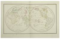
182812553Paris Julie Bouesche 1828. In-folio 323 x 226 cm 2 ff 8 double maps 10 plates each with a page of explanations 1 f table of geographical & spherical figures contained in this Atlas. The maps show the world map Europe the Kingdom of France 2x Asia Africa North America and South America. The plates show the terrestrial globe celestial globe Ptolomean system Copernican sphere right sphere parallel sphere Copernican system Ticho-Brahé system eclipses and phases of the moon. The atlas is entirely manuscript in brown ink and hand-coloured. Contemporary binding red chagrin spine green cardboard boards gilt framing with the crowned figure of Miss Julie Bouresche on the first board gilt edges. Paris, Julie Bouesche hardcover
177851680Edinburgh and London 1778. Large 4to. 32 x 245 cm. Contemp. hcalf. Raised bands. Title-label with gilt lettering. Top of spine lacks ca. 1 cm. of leather bottom of spine ca. 1/2 cm. Spine rubbed wear along hinges. Old owner inscription on top of title-page. Ex Libris Scholae Regis Edinensis. Engraved title-page and 23 double-page numb. 1-23 and all with original handcolouring. The map of the world 2 hemispheres: printed size 25 x 46 cm. sheet: 31 x 485 cm. Printed on heavy paper verso blank all clean and fine. <br/><br/><em>First edition. Not in Shirley. The copy described by Shirley I T.YOU - 1 a having another imprint dated 1782. All the maps in our copy is signed "Published as the Act directs 1st July 1778". Shirley mentions that the Atlas was doubtless intended for educational use. </em> hardcover
DADAX1469873206LWW 2016-09-28. Fifth. hardcover. New. 8.75x2.75x11.00. Buy with confidence. Excellent Customer Service & Return policy. LWW hardcover
9a395Wohl 4. Auflage. Glogau Flemming ca. 1856. 1 Blatt Inhaltsverzeichnis 109 statt 110 grenzkolorierte Karten original Halbleder Querformat-Folio Rücken mit Fehlstelle/berieben und bst./Bezugspapier teils fehlend/teils stark stock- und wasserfleckig/einige Randlasuren/die letzten 3 Tafeln mit Knickspuren letzte Tafel mit Kantenausbrüchen/Karten mit alter Handschrift numeriert/Tafel 110 Neu-Süd-Wales fehlt. - Vgl. Espenhorst S. 224. Enthält diverse Karten von Deutschland und Europa Amerika 1 Texas Asien Afrika Australien 2 - unknown
181254863Paris Francois Buisson 1812. Large 4to. 34 x 25 cm. Contemp. hcalf. Gilt spine. Titlelabel with gilt lettering. Wear to spine and some leather at upper part of spine gone. Taped at foot of spine. 4111-errata pp. and 75 3 extra engraved maps all handcoloured in outline. The three extra inserted are: France Pologne Confederation Germanique. Scattered faint brownspots to textleaves. Maps clean with faint scattered marginal brownspots. <br/><br/><em>First edition. - Sabin 44159. </em> hardcover
184117957Paris J. Andriveau-Goujon 1841. Folio. Bound in full leather with a closing flap just like a briefcase. Slightly scratched and a few tears to binding. Titlepage with a tear no loss. Complete with 30 double-page ca 41x53 cm full handcoloured engraved maps. A few tears in centerfoldings very ligh brownspottings otherwise good. <br/><br/><em>Philipps No 324 listing an edition from 1838 but not this second edition . This fine engraved atlas comprises 10 historical maps and 20 recent 1841 among these Mappemonde North-and South America Asia Africa Europe etc. </em> hardcover
182054816Weimar 1820. Folio. Image of maps: ca. 35 x 44 cm. Paper size: ca. 46 x 56 cm. Engraved title with outline of the maps title-page in French numbered as Section I. Comprising the Sections I-XXXVI XXIX and XXXII with a and b all but the General map in 2 parts not present. Some maps with markings in red and blue. One with dampstain in lower margin a few with minor traces of use but all intact. In all 38 engraved sheets. unknown
0486427331New. Brand new and still unused unknown
1837891931837. JAPANESE ATLAS Ichikawa Tokei. KOKUGUN ZENZU 2 volumes. Nagoya Edo Osaka Kyoto. Eirakuya Toshiro et al. Preface dated 1837. String-bound Japanese-style fukuro-toji printed paper title labels. Original yellow covers. Covers are a bit soiled with ownership labels. Internal occasional marginal worming. Printed in color woodblock throughout an interesting atlas of the traditional governing divisions of Edo-era Japan. unknown
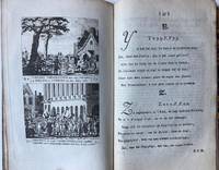
BB110059Half linnen binding 8º 205 x 125 cm. With 12 engraved pages each with 2 history prints in the period 1785-1789 the time of the Batavian Republic Bataafse republiek. BB110059Patriotten - patriots - ABC book - Schoolbook ABC- en geschiedenisboekje in enen waarin elke bladzijde getuigt van diepe liefde voor het Oranjehuis en zo mogelijk nog diepere afschuw van het landbedervend rot der patriotten. Elk van de 24 illustraties de letters J en X ontbreken gaat vergezeld van een zesregelig rijm en een beschrijving van de afgebeelde gebeurtenis. Op het alfabet volgen een dagboek op rijm waarin de gebeurtenisssen van de laatste vier vijf jaren op een rijtje zijn gezet en een vaderlandse geschiedenis in de toen zeer gebruikelijke vraag- en antwoordvorm beide eindigend met de gezegende omwenteling de restauratie van het stadhouderlijk gezag in 1787. Zeldzaam werk dat als een tegenhanger kan worden beschouwd van het ""Vaderlandsch A B boek voor de Nederlandsche jeugd""; dat de patriotsgezinde J.H. Swildens in 1781 had laten verschijnen. Lit.: Buijnsters BNK 1189 unknown
194764270Portland OR: Oregon Blue Print Co. 1947-1959. Oblong atlas folio. 21 x 17.5 in. 52 leaves not contiguously numbered. all dyazo-print whjteprint maps w/ first consisting of a large folding “Oswego Oregon Street Map†many leaves w/ creasing corners worn some with closed tears secured at gutter margin w/ 4 brass split-pins over thick brown paper stock still a VG- exemplar. First edition thus of this exceedingly rare realty atlas for Oswego Oregon chronicling its’ explosive growth following World War II prior to the consolidation with surrounding suburbs and renaming as the City of Lake Oswego in 1960. These real estate atlases were sold in installments to Lake Oswego & Portland area real estate agents land use boards and public institutions with installments appearing from 1947-1959 but the Oswego atlas sheets are far scarcer than even the very rare Portland issues. Oswego and surrounding suburbs such as Alto Park Acres Forest Hills Lake Grove Rainbow Terrace Uplands Crest and Woodmont were all developed initially by the Ladd Estate Company which first platted the area with Paul C. Murphy overseeing the design with the aid of of Frederick & John Olmsted to create a park like setting around the Lake. This atlas with key map opening details the evolution from 1947-1959 the street-by-street and plat-by-plat of the surrounding area providing essential information on the emergence of these suburbs from the original donation land claims as the city grew from about 1500 to over 10000 by 1959. The more than 100 new residential plats created from the original donation land claims throughout the Lake Oswego area including the plats on the south side of South Shore Drive which created the Palisades Neighborhood and just prior to the July 2 1959 annexation which brought all of Oswego Lake parts of Lake Grove Palisades and others in the Lake Grove Sanitary District all evolve through these maps. Researchers can trace the evolution of the Portland-Salem Expressway later called the Baldock Freeway and further developed into the I-5 corridor alongside Lake Oswego along with the rapid growth of the area. Original Donation Land Claims are clearly demarcated including those of Charles Brown Bryant Waters Carman Albert Durham and many others. Oregon Blue Print Co. was established on SE Hawthorne in Portland OR by the early 1940’s and were the printers for the Pittmon maps which were extensively used and continually updated in the Portland area. Under Walter & Min Underwood the company focused on blueprinting and engineering plans as well as land promotion brochures and street maps. Company still remains family owned. It appears that later versions of the Oswego Oregon Street Map were used as land promotion brochures and some early versions do survive in holdings of Lake Oswego City Government and 1 in OHS but no other examples are located in Worldcat. No similar versions of this atlas have survived in institutional holdings that this cataloguer could identify accurately. See: Mid-Century Lake Oswego: A Look at Lake Oswego’s Modern Developments 1935-1965 August 2010. Oregon Blue Print Co., hardcover
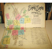
189715960New York: Sanborn-Perris Map Co. 1897. Third edition with additions. Hardcover. Good overall. Folio published in November 1897 with 18 hand colored maps including a title page on the key map. This is the third edition of the atlas according to the Library of Congress Census the first edition being published in 1886 but with only 13 sheets. The second edition was published in 1891 with an extra 2 sheet making a total of 16 sheets. Small private library stamp on the verso of the key map. There are very small pencil annotations on the maps obviously by F.J. Washburn the local insurance agent. <br /> Originating in London in the mid 18th century insurance maps had become invaluable in the US in the 1860's when Sanborn started work. The company started to standardize the maps and publish them in atlases under the town or city. Each map/sheet measures 21 x 25" and is drawn to a scale of 50 feet to an inch with color applied by hand at the time of publication. Every atlas records all town buildings shown to scale its construction material and use noted as well as fire-proofing thickness of walls elevators chimneys fire alarm boxes hydrants sprinkler systems and a wealth of other detail. Ultimately Sanborn produced maps and atlases for 12000 locations. Being so specific the demand was very slight. The Library of Congress estimates that there were usually fewer than twenty orders for a single sheet so production was small and usually produced for a specific Insurance company or agent. Because of this a very small number of copies of any atlas are offered on the market today. The maxim "if it turns up buy it because you won't find another copy" springs to mind. Folio maroon leather spine with printed hard boards rubbed but edges. Sanborn-Perris Map Co. hardcover
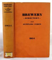
19341904190136New York : Atlas Pub. Co 1934. First Edition. Hardcover. Very Good. Bound in publisher's orange cloth. Hardcover. No dust jacket. Good binding and cover. Clean unmarked pages. Numerous ads. Includes listings for Schlitz etc. "breweries; brewery officials; brewmasters; purchasing agents; manufacturers of equipment and supplies used in breweries; beer jobbers and distributors; beer brands; bottling plants; beer and liquor legislation; associations and their officers; statistics etc." Interesting early post-prohibition book detailing the rebounding liquor industry 1933 repeal. Quite scarce. New York : Atlas Pub. Co hardcover
1718D14120Amsterdam: Aux dépens de la Compagnie 1718. Hardcover. Good. Contemporary speckled calf handsomely rebacked but one board detached; gilt-stamped lettering in tan leather spine label second compartment gilt-stamped ornament on 5 raised bands and direct in spine compartments; 3 volumes 12mo 163x95mm; pp. 10 336 35; 16 333 51; 14 468 32; with hand-colored engraved half-title in Volume I 18 hand-colored plates many folding hand-colored decorative head- and tail-pieces. Front rear board on volume one detached. Boards a bit scuffed along the edges; corners bumped; spines dry. Internally bright and clean; previous owner's tasteful bookplate. Plates are lovely. <br/><br/> Aux dépens de la Compagnie hardcover
184927973Kjöbenhavn Chr. Steen & Søn 1849-61. Titelbladet uden år. Stor folio. Samt. hldrbd. Forperm med orig. bogtrykt omslag påsat. Udvendig noget slidt og med brugsspor. Litograferet titelblad med trykt indholdsfortegnelse over atlassets 20 dobbeltsidede foliokort alle litograferede og håndkoloreret hvert målende ca 52x64 cm. Her og der med lidt brunpletter særligt marginer men indvendigt iøvrigt i god stand. Kortene er litograferede hos Emil Bærentzen & Co. Lith. Institut og alle daterede mellem 1849 og 1861 opsat på false. <br/><br/><em>Prægtigt stort atlas af dansk oprindelse. Ikke anført i Dansk Bogfortegnelse - ikke hos Phillips. Indeholder: 1. Den östlige og vestlige Halvkugle. 2. Europa. 3. Asien. 4. Afrika. 5. Nordamerika. 6. Sydamerika. 7. Australien. 8. Danmark. 9. Norge og Sverrig. 10. Storbrittanien og Irland. 11. Frankrig. 12. Spanien og Portugal. 13. Schweitz. 14. Tyskland. 15. Preussen. 16. Nederlandene og belgien. 17. Italien. 18. österrig. 19. Rusland. 20. Tyrkiet og Grækenland. </em> unknown
181956069København 1819. Folio. 44 x 27 cm. Original blue wrappers with some dampstains and rear somewhat soiled. With the engraved oval title on upper wrapper. In a later hcloth portfolio. With 19 all engraved maps charts plans coastal profiles of which 7 are double-page. Maps numbered in letters A-K profiles numbered I-IX.The maps depicting the main harbours with townplans and anchorages. Maps with a few small marginal closed tears. <br/><br/><em>Extremely scarce Danish edition a compilation from Vicente Tofino's "Atlas Maritimo" where the sheets have Danish text. This maritime-atlas was probably intended to accompagny Løvenørn's "Beskrivelse til det voxende Kaart over Kysterne af Spanien og Portugal." 1818.Bibl. Danica II 362 a. 367. - Luisa Martín-Merás: Catálogo analítico de los Atlas del Museo Naval de Madrid 2007". No 232. </em> hardcover