12 889 résultats
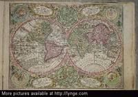
129020aafSumtibus Homannianis Heredibus Norimbergae, 1769, gr. in-Folio, (ca. 60:36 cm), Gest. Titel mit lateinisch-deutschem Index u. 20 altkolorierten Kupferkarten + 1 zusätzl. doppelblattgr. Karte v. Neuchâtel (1778) - Teilw. gebräunt, Ränder stellenweise etwas angestaubt u. fingerfleckig. Kupfertitel mit Randeinriss. Sammlung loser Tafeln / collection des cartes complète de l’atlas, non relié.
1841276611841 B.Dusillion, Paris, 1841- Un volume grand in Folio (597x438 mm), Titre gravé et 89 cartes doubles montées sur onglet, de dimension 597x850 mm.Interieur bon,dos manquant
174520271Augsburg, Pfeffel, (1745). 1 Kupfertitel, 1 Bl. (Vorbericht), 68 teils kolorierte Kupfertafeln. Quer-Gr.-Fol. Mod. Ldr. [5 Warenabbildungen]
177124831771 1771 P.LATTRE , DELALAIN s .d .( 1771) Edition originale in folio 1/2 veau , tranches rouges, titre gravé, 2 pages imprimées de texte de présentation et 41 cartes aux contours coloriés (50x80 cm), coloris de l'époque ,à double page gravées par Lattré , d'aprés Bonne, Zannoni etc, 13 cartes des provinces de France et 28 cartes d'Europe ,d' Amérique, d' Afrique, d' Asie ,liste détaillée sur demande
172055277Augsburg, Elias Baeck, o. J. (um 1720). Qu.-4°. Mit gest. Titel, gest. Widmungsblatt m. allergor. Kartusche, 44 Kupferkarten u. einem gest. Register. HLdr. d. Zt.
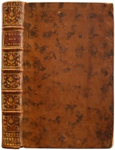
LCS-11086Édition originale de cette remarquable relation par La Condamine de la première descente scientifique de l’Amazone. L’un des quelques exemplaires imprimés sur grand papier. S.l., 1746. In-8 de : I/ (2) ff., xvi pp., 216 pp., 1 carte dépl. ; II / (1) f., 108 pp., (2) ff., 1 pl. dépl. Relié en veau fauve marbré, dos à nerfs orné de fleurons dorés, pièce de titre en maroquin rouge, tranches mouchetées. Coins frottés, petit manque aux coiffes. Reliure de l’époque. 198 x 125 mm.
176130654Paris, l'Auteur & Desnos (vol. I), Chec l'Auteur (vols. 2-3), 1761-62. Folio. (34x28,5 cm.). 3 cont. hcalf. Backs worn, tears to spine ends, hinges weakening, corners bumped. Vol.I: 57 double-folio leaves, all engraved including engraved ornamental title in rococo-style (leaves numb. 1-57). - Vol. II: 70 double-folio leaves, all engraved including double-page engraved title (different from the title in vol. 1) + Table des Matieres. - Vol. III: 60 double-folio leaves, all engraved including double-page engraved title (the same as in vol. II) + Table des Matieres (numb. 71-130). With in all 119 handcoloured engraved maps and astronomical plates. Further 68 other plates with tables, text etc. All maps and illustrations having engraved text on both sides. On good thick paper. A few brownspots, some dampstains mainly marginal, 2 plates with small tears, no loss.
176130654Paris l'Auteur & Desnos vol. I Chec l'Auteur vols. 2-3 1761-62. Folio. 34x285 cm. 3 cont. hcalf. Backs worn tears to spine ends hinges weakening corners bumped. Vol.I: 57 double-folio leaves all engraved including engraved ornamental title in rococo-style leaves numb. 1-57. - Vol. II: 70 double-folio leaves all engraved including double-page engraved title different from the title in vol. 1 Table des Matieres. - Vol. III: 60 double-folio leaves all engraved including double-page engraved title the same as in vol. II Table des Matieres numb. 71-130. With in all 119 handcoloured engraved maps and astronomical plates. Further 68 other plates with tables text etc. All maps and illustrations having engraved text on both sides. On good thick paper. A few brownspots some dampstains mainly marginal 2 plates with small tears no loss. <br/><br/><em>First edition of this atlas which could be called an Atlas-series as the different parts were sold separately. The first volume having its own title deals with the historical development of cosmography geology astronomy oceanography winds streams etc. and illustrates this in a series of impressive pictures with globes spheres continents world-systems etc. having many maps of the continents globe-projections etc. - Volumes 2-3 deal mainly with historical geography and mapping having 84 handcoloured maps. Another volume which is not present here deals with contemporary geography. A fifth volume was announced but is unknown to the bibliographies. Phillips No. 628. - Shirley: T-buy 1a-2a. </em> unknown
176651834P., Desnos & chez l'Auteur 1766 In-4, demi-basane brune, dos à nerfs, titre gravé, grand plan général dépliant et 34 planches sur double page, 28 ff.n.ch. de tables d. Petits frottements. Infimes rousseurs. Très bon exemplaire.
173017253Haarlem 1730. Small 8vo 16 x 10 cm. Bernardus Cleynhens Half textured red cloth ca. 1860 sewn on 2 tapes chemical-marbled sides in brown and blue. With 25 double-page engraved maps 2 overview maps the second serving as a key to the 23 numbered detail maps and an engraved plate with 8 scales all hand-coloured partly in outline. The 2 overview maps slightly wider than the others have a flap folded in at each side. Further with 1 rococo woodcut tailpiece 1 woodcut decorated initial and a fleuron on the title-page. 40 23 1 blank pp. plus maps and plate of scales. A surprisingly rare pocket atlas illustrating the theatre of the "tegenwoordigen" present war probably meaning the War of the Austrian Succession 1740-1748 but possibly the Seven Years' War 1756-1763. The title-page notes that it is suited for officers travellers and lovers of geography to carry in a pocket. The text in Dutch gives a geographic description only of "Duytsland" Germany including Austria Bohemia and a few other areas whereas the maps also cover the Low Countries the English Channel northwest France and to the east as far as Warsaw Krakow and Belgrade. The 23 detail maps were designed so that they could be assembled with the key map to make a single wall map whose cartographic image would measure 53 x 90 cm.With a contemporary owner's bookplate embossed stamp and library labels. With the text leaves somewhat browned not affecting the maps or the plate with scales and the first 2 leaves slightly worn but generally in good condition. A rare pocket atlas from the War of the Spanish Succession.l Koeman I Cle 1; STCN 2 copies; WorldCat 2 copies. hardcover
LCS-4074Jolie édition du “routier le plus célèbre du XVIIe siècle” (A. Charon). Exemplaire très pur conservé dans son vélin souple de l’époque. Le Havre, 1731. Au Havre de Grace, chez la veuve de Guillaume Gruchet, 1731. In-4 de (4) ff., 413 pp., bifeuillet signé “Entre C D” ajouté entre les cahiers C et D, 23 pp., nombreuses figures et cartes gravées dans le texte. Rousseurs, pages de garde couvertes d’annotations manuscrites. Relié en vélin souple de l’époque, dos lisse avec le titre calligraphié, quelques taches. Reliure de l’époque. 178 x 140 mm.
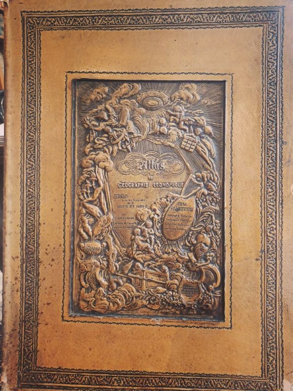
1932LCI-6454Editions geographiques Khanzadian 1932 1 Folio feuillets sous coffrage RARETÉ HISTORIQUE — EXEMPLAIRE DÉDICACÉ — FORMAT FOLIO — ÉTAT EXCEPTIONNELL’Atlas de géographie générale de la Palestine (1932) — rédigé par la Société des Nations (SDN) — est un témoignage cartographique unique d’une époque où la géopolitique du Proche-Orient était redéfinie. Rareté absolue : Très peu d’exemplaires subsistent, surtout en format folio — ce qui en fait un objet imposant, rare et prestigieux. Preuve sociale forte : Ce livre a été utilisé par des institutions académiques et des diplomates de l’époque — aujourd’hui, il est recherché par les chercheurs sur la Palestine pré-1948. Contexte géopolitique brûlant : Dans un monde où la Palestine est au cœur des débats, cet atlas devient un artefact politique et historique vivant — un outil de compréhension, pas seulement un objet. Contenu détaillé : L’atlas comprend 135 cartes en noir et en couleur, couvrant :La géographie physique et humaine de la PalestineLes frontières et les territoires administrés par la SDNLes ressources naturelles et les infrastructuresLes données démographiques et religieusesLes zones de conflit et les projets de développement Dédicace manuscrite de l’auteur — une connexion personnelle avec l’histoire, rare et émouvante. État du cartonnage : Légères usures aux angles — signes d’authenticité et d’usage historique — mais reliefs centraux magnifiques, soulignant l’élégance originale de la reliure.Ne cherchez pas ailleurs — ce n’est pas un livre, c’est un témoignage.
16525476Antwerp 1652. 4to 18 x 14.5 cm. Jan Huyssens Later 17th-century mottled calf sewn on 4 double cords gold-tooled spine and board edges. With a double-page letterpress title-page with a frame built up from typographic ornaments and 39 unnumbered double-page engraved maps of the northern and southern Low Countries by Jacob Aertsz. Colom each map coloured in outline. Interleaved with 38 blank leaves and with a manuscript table of contents 3 3 blank pp. at the end. Double-page title-page and 39 double-page maps. Second known copy of a pocket-atlas published at Antwerp but containing a selection of the maps of the Low Countries originally published by Jacob Aertsz. Colom at Amsterdam in 1635 with the title De Vyerighe Colom the title Colom had first used for his famous pilot guide in 1632 and the name he had given to his Amsterdam printing office where he worked from 1622 to his death in 1673 as a bookseller printer and mapmaker. The only other copy known is at the Royal Library in Brussels. The Vyerighe Colom with 47 maps and 3 plates and with extensive text in Dutch and French went through several editions in the 17th century but it was once thought that all editions before his death in 1673 had been published at Amsterdam by Colom himself. The Royal Library copy like the present one contains 39 maps but each contains one map not in the other so there are forty in total: the present copy includes Drentiae not in the Royal Library copy which includes Le terres entre la Meuse Vahal et Rhin not present here. The maps are also bound in a different order.The present edition is of great interest and gives cause to review Colom's activities. It is printed from Coloms plates so Colom may have licenced the Antwerp publisher to produce a variant edition of his Vyerighe Colom to broaden his market possibly reacting to the signing of the Peace of Münster in 1648 which finally ended the Eighty Years War and opened trade and communication between the northern and southern Low Countries. Jan Huyssens made an entirely new and practical atlas out of Colom's Vyerighe Colom. He omitted all text and the three plates that do not show maps and selected only maps of general interest leaving out the map of the ancient Low Countries and such typical Dutch maps as the separate maps of the polders De Zype Beemster Wormer Purmer Byllemermeer and Waterland also - at least in the present copy - completely rearranging the maps more in order of their geographical sequence. The title suggests that Huyssens originally planned to include a text so the present extremely rare edition may be the only surviving result of an abandoned project.l Koeman & Van der Krogt 365.23 IIIB pp. 644-645 2 copies: the present & Royal Library Brussels; UniCat 99095764 Royal Library Brussels only; cf. Koeman II Col 1 1635 Amsterdam ed.; not in KVK; STCV; WorldCat. unknown
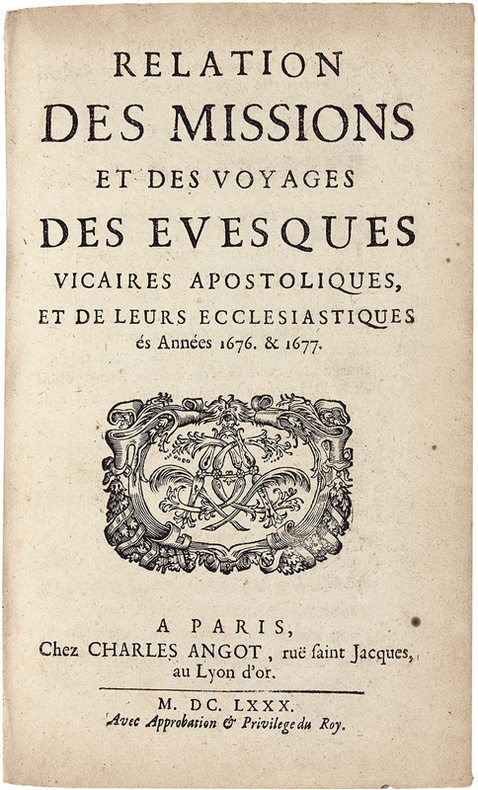
LCS-18085Précieuse édition originale de ce récit des « missions de la Cochinchine, du Tonkin, Siam et Cambodge. Très rare » (Chadenat, II, 4391). Paris, Charles Angot, 1680. In-8 de (8) ff., 242 pp., (1) f. de privilège. Plein veau brun granité, dos à nerfs orné, roulette dorée sur les coupes. Reliure de l’époque. 187 x 116 mm.
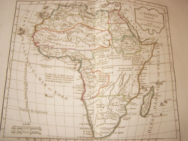
LCS-15364Précieuse description de l’Afrique de la plus grande rareté. L’exemplaire Phillips. Tournai, Adrien Quinque, 1622. 2 parties en 1 volume petit in-4 de (2) ff., 152 pp., (3) ff., 194 pp., (3) ff. insérés parmi ces 194 pp., (3) ff. Relié en plein vélin de l’époque, dos lisse avec le titre manuscrit. Reliure de l’époque. 200 x 150 mm.
178065196Nürnberg, Christoph Weigel, 1780. 8°. Mit 37 doppelblattgr. kolor. Kupferkarten. 8 Bll., 186 S., 98 Bll., HLdr. d. Zt. a. 5 Bünden m. Rückenverg., goldgepr. Rückenschild u. Rotschnitt.
354239Au Dépôt Général De La Marine S.L. 1831 Grand in-folio ( 675 X 525 mm ), demi-toile bleue à coins, plats de percaline maroquinée. Exemplaire complet de son feuillet d'index gravé et de ses 32 cartes gravées -majoritairement marines- dont 8 sur double page ( dont carte générale de la Corse ) et montées sur onglet. EDITION ORIGINALE. Rousseurs passim et petite mouillure claire en marge intérieure. Bon exemplaire. TRES RARE. Cervoni, Image de la Corse, 138.
43243Londres, Robert Wilkinson, 1792 [1793]. Pt. in-folio (34 X 25 cm), 44 ff. Reliure plein veau marbré, pièce de titre rouge.
163475459Paris, Michel Vanlochom 1634 In-4 à l’italienne 26,5 x 39 cm. Reliure plein vélin souple de l’époque, titre manuscrit, 2 ff.- 14 pp. & 32 planches dont 2 de titre gravé, une carte générale repliée restauration sans manque et 29 cartes particulières une infime restauration. Texte sur deux colonnes latin et français en regard. Marges brunies. Humidité marginale éparse. Ex-libris Prosper Falgairolle. Bon exemplaire.
17710044961771 Paris, Imprimerie Didot, 1771. In-quarto (204 X 255 mm) veau blond, plats ornés d'un encadrement de triple filet doré, dos cinq nerfs filetés, caissons dorés ornés aux petits fers avec fleuron central, roulettes en queue, pièce de titre maroquin marron, coupes et coiffes filetées, bordure intérieure, tranches rouges (reliure de l'époque) ; (1) f. blanc, XII-235 pages, 49 planches hors-texte, (1) f. blanc.
Obra adoptada por texto por el Consejo de Instruccion Publica para los establecimiento de 2a ensenanza, dessiné et lithographié par E. Massinger, 1 vol. petit in-folio reliure moderne demi-percaline bordeaux, Madrid, 1852, Imprenta de A. Vicente (texte), Lita. [ litografia ]de Bachiller (cartes), 1 f. (page de titre), 104 ff. avec une alternance de page de texte et de cartes rehaussées en couleurs, et 1 grande carte dépliante de l'Espagne en couleurs. Les cartes sont datées de 1849 à 1852 (1853 pour la grande carte dépliante). Très rare atlas espagnol destiné à l'enseignement secondaire, décrivant les 49 provinces et îles espagnoles, ainsi que les possessions espagnoles en Afrique, aux Philippines, aux Carolines et aux Mariannes, à Cuba et Porto Rico. Bel exemplaire (minimes frott. sur reliure et petite déchirure sans atteinte à la gravure sur la grande carte dépliante), très rare ainsi parfaitement complet et en bel état. L'unique exemplaire répertorié sur Worldcat, celui de la Henry Charles Lea Library (University of Pennsylvania) qui provient de la propre bibliothèque du célèbre historien américain et grand spécialiste de l'histoire espagnole, ne semble pas contenir la grande carte dépliante en couleur de l'Espagne, bien présente dans notre exemplaire. Rare atlas describing the 49 Spanish provinces and islands, and the Spanish possessions in Africa, the Philippines, the Carolines and the Marianas, Cuba and Puerto Rico. Fine copy (minor rubbings on binding, a small tear without damage to the engraving on the large folding map). The only copy listed in WorldCat, one of the Henry Charles Lea Library (University of Pennsylvania), from the library's of the famous American historian and leading scholar in Spanish history, did not appear to contain the large Spain folding map in color, that can be found in our copy. Not in Phillips / 52 cartas geograficas (con los limites coloreados) que contienen por orden alfabetico las 49 provincias de Espana, islas de Cuba y Puerto-Rico, posesiones espanolas en Africa, é islas espanolas Filipinas, Carolins y Marianas, una grandes mapa en color : "Carta general de Espana con todas sus posesiones de Ultramar é islas adyacentes en 1853" (full original colors), y 52 hojas de testo esplicativo. Muy raras. La única copia que aparece en WorldCat, la de las colección de Henry Charles Lea (University of Pennsylvania), que proviene de la la propia biblioteca del famoso historiador estadounidense y especialista de la historia española, no contiene el gran mapa de colores de Espana (presente en nuestra copia). Français
174420097Augsburg, Augustæ Vind, (1744). 4to-oblong. Cont. hcalf. Back and covers somewhat worn. Platesizes ca. 20,5 x 27 cm. (32) pp. and 60 full-page engraved maps (of 64 listed). Lacking the engraved title and 5 other maps (Africa, America septentrionalis, Regum Portugalliæ, Regnum Hispaniæ, Italia totur and Palæstina), but having 2 more not listed and some in the German section does not corresponds with the maps listed in the index. All maps in original handcolouring, occasionally a little brownspotted and traces of use in lower right corners. One map have a little loss of image in lower middle (Austria Saliburgensis).
174420097Augsburg Augustæ Vind 1744. 4to-oblong. Cont. hcalf. Back and covers somewhat worn. Platesizes ca. 205 x 27 cm. 32 pp. and 60 full-page engraved maps of 64 listed. Lacking the engraved title and 5 other maps Africa America septentrionalis Regum Portugalliæ Regnum Hispaniæ Italia totur and Palæstina but having 2 more not listed and some in the German section does not corresponds with the maps listed in the index. All maps in original handcolouring occasionally a little brownspotted and traces of use in lower right corners. One map have a little loss of image in lower middle Austria Saliburgensis. <br/><br/><em>Phillips No 3494. 2 maps relating to America Globus Terrestris World Map and America Meridionalis. Having maps of Europe Asia Russia Turkey Scandinavia etc. The World Map engraved by Andr. Silbereisen and most of the other maps engraved by A.C. Seutter and Tobias C. Lotter married to Seutters daughter and his successor. </em> unknown
88415aafParis, de l’imprimerie de J. P. Jacob à Paris chez Deterville et à la Librairie Economique, 1805, gr. in-4to (oblong), page de titre poussiéreuse et renforcée + au total 55 planches gravées, sur le titre pt. timbre rouge ‘Cabinet Topographique du Roi’ et cote ms. (E. 5 / 48), cartonnage du XIXe s. couvert de papier marbré, pièce de titre maroquin rouge au dos. Bel exemplaire.
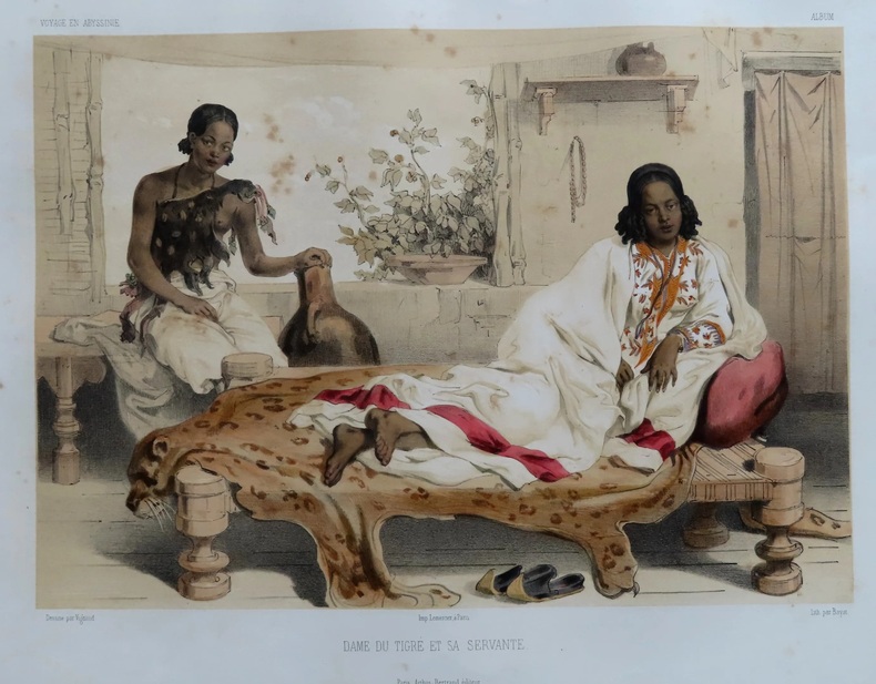
PHO-1198Paris, Arthus Bertrand, sans date (1845-1850). In-folio ,demi-veau vert, dos lisse orné (reliure de l'époque). Atlas seul composé d'une grande carte dépliante, de 14 planches d'archéologie et de 45 planches sur 42 feuilles dont 27 finement coloriées à l'époque et 3 dépliantes. Reliure usagée (début de fente), quelques rousseurs, la carte et deux planches dépliantes sont détachées, réparation à une planche dépliante.