12 878 résultats
1886R260110508JOUVET ET Cie. 1886. In-Folio. Relié. Etat passable, Plats abîmés, Dos abîmé, Intérieur acceptable. 41 cartes sur double pages en couleurs. Dos toilé rouge. Une carte détachée, quelques légères déchirures sur quelques cartes. Une carte abîmée, manques en bordure et réparée par collage de papier. Plats et page de faux-titres, détachés. Manque au dos. Revêtement des plats abîmé.. . . . Classification Dewey : 912-Atlas, cartes et plans
2005RO80180976LE FIGARO COLLECTIONS. 2005. In-4. Cartonné. Bon état, Couv. convenable, Dos satisfaisant, Intérieur frais. 1232 Pages pour l'ensemble des 11 volumes. Nombreuses photos et cartes en couleur et en noir et blanc dans et hors texte. 4 Photos disponible. . . . Classification Dewey : 912-Atlas, cartes et plans
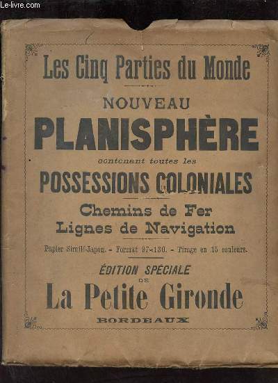
R320167559A.Taride. non daté. In-Plano. En feuillets. Etat d'usage, Couv. convenable, Dos satisfaisant, Intérieur acceptable. Une carte en couleur dépliante format 97 x 130 cm sur papier simili japon, tirage en 15 couleurs - carte sous chemise souple conservé - quelques piqûres de vers sur la carte.. . . . Classification Dewey : 912-Atlas, cartes et plans
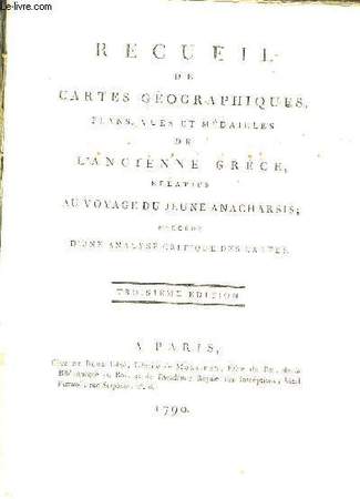
1790RO80070534DE BURE L'Aîné. 3ème édition. 1790. In-4. Broché. Etat passable, Couv. défraîchie, Dos abîmé, Intérieur frais. XLII pages + 12 cartes en doubles-planches couleurs + 19 doubles-planches de plans, cartes et illustrations en noir et blanc. Papier à la forme. Dos absent. Coins et coupes des plats frottés.. . . . Classification Dewey : 912-Atlas, cartes et plans
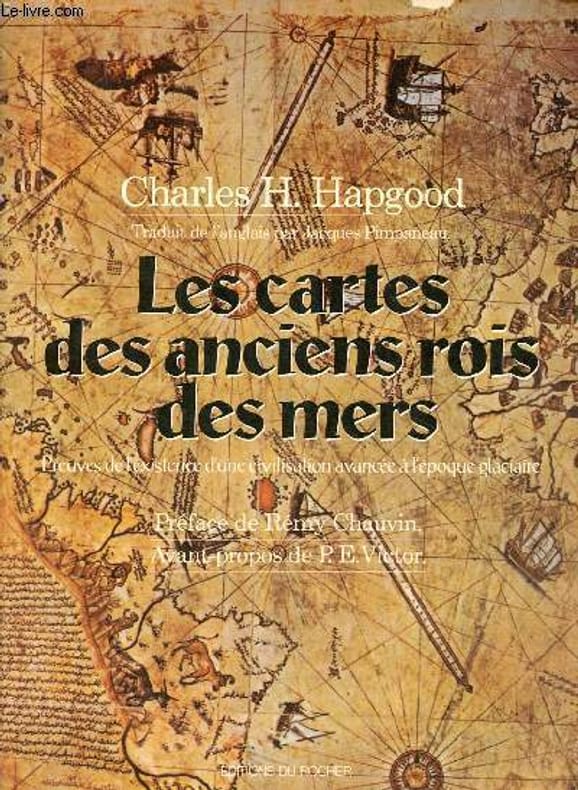
1981R100062369Editions du Rocher. 1981. In-8. Broché. Etat d'usage, Coins frottés, Dos plié, Intérieur frais. 297 pages - nombreuses cartes en noir et blanc dans et hors texte.. . . . Classification Dewey : 912-Atlas, cartes et plans
1836RO30109525L. HACHETTE ; DEUXIEME EDITION. 1836. In-Folio. Cartonné. Etat d'usage, Couv. défraîchie, Dos satisfaisant, Intérieur frais. 61 pages. Nombreux tableaux généalogique. Cartes manquantes.. . . . Classification Dewey : 912-Atlas, cartes et plans
1845R320093932FIRMIN DIDOT FRERES. 1845. In-8. Relié demi-cuir. Etat d'usage, Coins frottés, Dos frotté, Intérieur frais. 3 volumes d' ATLAS représentant 611 planches de gravures en noir et blanc - Signets conservés - Plats et contre-plats jaspés - Coins émoussés - 2 PHOTOS DISPONIBLES - . . . . Classification Dewey : 912-Atlas, cartes et plans
FIRMIN DIDOT FRERES. 1845. In-8 Carré. Relié demi-cuir. Etat d'usage. Coins frottés. Dos frotté. Intérieur frais. 3 volumes d' ATLAS représentant 611 planches de gravures en noir et blanc - Signets conservés - Plats et contre-plats jaspés - Coins émoussés - 2 PHOTOS DISPONIBLES - COLLECTION "UNIVERS PITTORESQUE - EUROPE - FRANCE".
Fine English Original bdg. HC with embossed and decorated bound. 4to. (31 x 22 cm). 4 volumes set (In total 1830 p.). Facsimile in Ottoman Turkish, Ottoman reading, translation into modern Turkish and English opposite page. Many illustrations and maps. Kitab-i bahriye. 4 volumes set. Edited by Ertugrul Zekai Ökte. Coordinated by Tülay Duran. Transcription by Vahit Çubuk. Turkish text by Vahit Çubuk and Tulay Duran. English text by Robert Bragner. OTTOMANIA Navigation Book of the sea Geography Map Travel Piri Reis Memoirs.
2013x-1466582928CRC Pr I Llc 2013. Hardcover. New. 1st edition. 556 pages. 11.75x9.00x1.50 inches. CRC Pr I Llc hardcover
188136891881 reliure demi chagrin in-quarto, dos long - titre frappé or - triple liserets - et tomaison, plats légèrement frottés, tranches jaspées, 5 volumes + 1 volume ATLAS, gravures in et h-txt., volume I : très légère épidermure sur la coiffe de queue, légères piqûres principalement marginales, volume II : légères piqûres et rousseurs, volume III : idem, volume IV : idem, volume V : idem, volume ATLAS : reliure demi chagrin rouge in-octavo, dos 4 nerfs décorés or, fleurons et titre frappé or, rousseurs sur la page de titre, quelques piqûres, 39 cartes en couleurs, 1 plan de paris replié en couleurs (sur onglet - 2ème contreplat), 1881 Paris Rouff Editeur,
3 vols., 8vo., First Edition thus, with 3 coloured frontispieces and 12 coloured illustrations; pictorial boards, backstrips lettered in black, a fine copy in publisher's blocked and lettered board slip-case.
1946644371 vol. in-folio (51 x 39 à la reliure) sous reliure mobile éditeur, Comité National de Géographie, s.d. [ 1945-1946 ], 3 ff. et 84 cartes doubles
Very Good Turkish Original manuscript color map of Middle East including Syria, Palestine and Transjordan. Signed by cartographer. 28x20 cm. In Turkish (with Latin letters). The Mapping Department, which moved to Ankara from Istanbul after the Independence War, settled in the Attar Basi Khan in Koyunpazari and the press section also started its studies in the building which is the Art School in Ulus today. In 1924, the department, which is still inside the General Directorate Garrison, moved to the hut-shaped buildings with single floor between the Military Sewinghouse and the General Directorate. On the other hand, the production of maps and plans, which were to be used in development services carried out in parallel to the revolutions starting with the declaration of the Republic and following each other, was considered to be based on a legal arrangement. Because of the necessity of an urgent legal arrangement, the bill of law concerning to the General Directorate of Mapping, whose preparations were initiated by Lieut. Gen. M. Sevki (Ölçer) who knew the importance of the subject, was sent to the Ministry of Defense at the beginning of 1925. After the approval of Ministry of Defense, the bill, which was sent to the Prime Ministry, was discussed in the Council of Ministers and presented to the Grand National Assembly of Turkey. As a result; the Mapping Department was re-organized as the General Directorate of Mapping affiliated with the Ministry of Defense with the law bearing the number 657 on May 2, 1925 in order to do all mapping works and meet the needs of maps and plans of all ministries, institutions and organizations. [.] The first application of photogrammetry was made in Kayas, Ankara with the Wild Autograph plotting apparatus which was purchased in that year. Captain Ömer Kadri and Captain Niyazi came back from their photogrammetry education in Germany. Major Halit and Major Nüzhet were sent to France for photogrammetry education and Captain Ishak and Captain Bahri were sent to Germany. Captain Ahmet (Denkmen) and Captain Ömer Kadri attended the Congress of Photogrammetry assembled in Berlin. (Source: The Illustrated History Of Turkish Cartography). Halid Ziya was born in Izmir, Tire. He went to Istanbul and continued to Hendese-i Mülkiye and Engineer Mekteb-i Âlîsi for seven years. After starting with "Aydin Province Umur-i Nafia Third Class Engineering", Halid Ziya Bey, who continued to work as a deputy chief engineer on 14 March 1910, left Aydin and returned to Istanbul after continuing this duty for about six and a half months. As a teacher, he taught Accounting, Algebra, Geometry, and Topography at Halkali Ziraat Mekteb-i Âlîsi and Darussafaka. Halid Ziya Bey, who was appointed as a teacher of Hendese and Cosmography in Kabatas High School, started to practice the profession of engineering and cadastral, which was his main specialty in 1327. After the First World War, the Istanbul Government started its activities in order to capture and neutralize Halid Ziya Bey and his friends. Upon the harsh measures taken, Halid Ziya Bey had to live as a fugitive in the Hasirci Mountains of Eskisehir for a while with the armed force attached to him. Halid Ziya Bey, who was involved in the movement in Anatolia until the end of the National Liberation Struggle, returned to his engineering duty after the proclamation of the Republic and was included in the cadastral works again. In 1925, Halid Ziya Bey was appointed as the Head of the Science Committee of the new cadastre organization. He wrote 5 books on cadastre, photogrammetry, trigonometry, and cadastral tools in 1928 and 1929. In addition, as a result of personal work in 1928, the road between the provincial division of the Republic of Turkey with cities has prepared a comprehensive map to show up in the forest and mining. (Source: Kadastro ne idi, nedir, ne olacaktir, Kadioglu - Yildirir. From Preface.). No scale.
Very Good Turkish, Ottoman (1500-1928) A very attractive chromo-lithograph map on paper. Oblong: 26,5x37,5 cm. In Ottoman script (Old Turkish with Arabic letters). Light foxing and fading on margins and printed area. A very detailed and fine double hemisphere map of the northern and southern skies, showing the various constellations, together with a third map showing the zodiacs on one paper. On the bottom margin, it's written 'Printed in the 549 Numbered Press', and 'Dersaadet...'. This map seems to be influenced (or, a direct translation) from the map of the sky of Sir Francis Baily, (1774-1844), who was one of the leading English Astronomers of the first part of the 19th Century. He is most famous for his observations of "Baily's beads" during a total eclipse of the Sun. Baily was also a major figure in the early history of the Royal Astronomical Society, as one of the founders and as the president four times. After a tour in the unsettled parts of North America in 1796-1797, his journal of which was edited by Augustus de Morgan in 1856, he entered the London Stock Exchange in 1799. The successive publication of Tables for the Purchasing and Renewing of Leases (1802), of The Doctrine of Interest and Annuities (1808), and The Doctrine of Life-Annuities and Assurances (1810), earned him a high reputation as a writer on life-contingencies; he amassed a fortune through diligence and integrity and retired from business in 1825, to devote himself wholly to astronomy. He had already, in 1820, taking a leading part in the foundation of the Royal Astronomical Society. In 1827, the Society awarded him its Gold Medal for preparation of the Astronomical Society's Catalogue of 2881 stars. He was instrumental in the reform of the Nautical Almanac in 1829. In 1837, he recommended to the British Association and later worked extensively on the reduction of Joseph de Lalande's and Nicolas de Lacaille's catalogues containing about 57,000 stars. He also supervised the compilation of the British Association's Catalogue of 8377 stars (published 1845) and revised the catalogues of Tobias Mayer, Ptolemy, Ulugh Beg, Tycho Brahe, Edmund Halley and Hevelius. His notice of Baily's Beads, during an annular eclipse of the sun on May 15 1836, at Inch Bonney in Roxburghshire, started the modern series of eclipse-expeditions. Very rare.
Very Good Turkish, Ottoman (1500-1928) Original folded b/w military map. Atlas folio. (70 x 57 cm). In Ottoman script. Shows a very vast area on north: from Adriatic Sea to Black Sea and Sevastopol; on south: from Benghazi (Tripoli) to Cyprus, Mediterranean Sea and Port Said; and it shows armies on Shkodra, Metroviche, Ipek, Ilebsan, Yanya (Ioannina), Manastir (Bitola), Selânik (Thessaloniki - Salonica), Dirama, Siroz, Istranca, Usküp (Skopje), Gümülcine (Komotini), Kircaali, Edirne (Adrianople), Dimetoka, Uzun Köprü, Kirk Klise, Çorlu, Tekfur Dagi, Istanbul (Constantinople), Gelibolu (Gallipoli) and Izmir (Smyrna). Lieutenant Colonel Mehmet Nihat Bey of Bursa who was born in 1886 accomplished to write 39 books about military history which are including his war experience and his translation works. Nihat Bey who is the first and the most important military historian in the Republic of Turkey, was an intellectual person rather than a soldier. He meticulously evaluated many mistakes and points should be learn about war by an objective eye in his works. Although it past a century from the time this books had been written this great person couldn't have been totally discovered by researchers yet. The first military historian in Republic of Turkey Mehmet Nihat Bey, participated in Tripoli, Balkan, Gallipoli and Turkish War of Independence. He taught in military academy for many years and he impressed many staff officers in terms of idea. During the first years of republic era in Turkey he lectured about military history and until the last year before he died he had given so useful informations in warfare of Çanakkale for visitors. Nihat Bey evaluated the conditions about the period of his life and the wars he participated by an objective view and he left great materials for next generations succeeding him. He enlightened Turkish recent history by writing the events which he had witnessed. Studies of Nihat Bey has an important impact for the researchers who want to have knowledge about Balkan and Gallipoli wars which fulfilled their 100th anniversary.
New English In original cloth bdg. In publisher's original slip-case and box. Elephant folio. (48 x 33 cm). In Turkish. Many color and b/w ills. 264 p. 1513 World atlas of Piri Reis. A very heavy volume. Pîrî Reis 1513 dünya haritasi. XIII. yy. sonrasi Islâm-Osmanli haritaciligi. Edited by Bülent Özükan.
184249180ABParis, Vaugondy , Geograph du Roi. 1842. 27 x35 cm. 37 doppelbl. Karten ( 37 maps) Halbldr., Einb. stärker berieb.+bestosss., Besitzereintr. auf Vorsatz u.Deckel, Exlibris, ob. Gelenk gelockert.,einige Karten etwas stockfl.(meist i. Randbereich), einen Karte mit Tintenfl. am Rand, insgesamt solider Zust.,
2058Hildburghausen, Bibliographischen Instituts, sans date. In-4 de 120 planches, demi-basane marron, dos lisse orné de fleurons dorés, coiffes frottées, coins inf. de chaque plat largement frottés.
18376842Paris, Delloye, 1837. Grand in-4 de [4]-XX-104p., demi-chagrin brun, dos lisse orné de fleurons dorés, manque la coiffe et haut du dos sup., coins frottés, légères rousseurs. Texte sur 2 colonnes.
17112088A Paris, Chez Claude Jombert, 1711. In-8 de [18]-268 pages suivies des planches, plein veau brun, dos à nerfs orné de fleurons dorés, étiquette de ttitre maroquin bordeaux. Coins frottés, mors épidermé, plats griffés, coiffe supérieure manquante.
178660376Antwerpen:: C. M. Spanoghe 1786. First Dutch translation. old paste-grain decorated paper boards sewn over tapes. Old ink ownership signature; a very attractive copy. 12mo. Engraved frontispiece 22 folding engraved maps with outline color and 2 folding plates. C. M. Spanoghe, hardcover
190763122Chicago & New York: George F. Cram 55-61 Market Street 1907. Folio. 12.25 x 15 in. 160 pp. Illustrated title in blue. Over 100 photo illustrations maps colour maps many double-page with Cram’s Kansas 51.5 x 31.5 inch map in full colour laid-in minor soiling faint markings from glue offsetting where previously attached to rear pastedown. Dark forest-green coloured publisher’s cloth silver lettering & decoration embossed on front cover minor soiling minor wear to corners slight bumping head & foot of spine light restoration back cover still a VG- copy. First edition of this rare Cram’s reference atlas replete with colour World maps and maps of the individual states and many different local cities including Omaha Minneapolis St. Paul St. Louis Chicago and others. The section on Kansas includes two colour maps depicting manufacturing and mechanical industries by counties as well as statistical map showing live stock and dairy products. The photos depict the Kansas oil fields brick yards in Pittsburg KS; oil tank farms in Neodesha Strawboard Factory in Coffeyville streets in Atchison and other areas across the state. The atlas is also unusually complete with the very scarce giant oversize colour Kansas map typically missing from these Cram’s local history reference atlases. George F. Cram, 55-61 Market Street, hardcover
195059129Portland OR: Multnomah County Assessor’s Office ca. 1950. Oblong folio. 21 x 13.5 in. 1 1-71 74 leaves as issued. Including Multnomah County key map w/ 73 whiteprint diazo process maps all w/ borders key map w/ small closed tear at lower fore-edge w/ ghosting from old removed scotch tape now neatly repaired on verso. Original black cloth post-binder gilt lettering stamped on front cover 3 nickel-plates screwposts at gutter margin minor rubbing still VG copy. First edition thus of this exceedingly scarce plat map atlas for Multnomah County Oregon surveyed and issued after the famed May 30 1948 Memorial Day flood destroyed Vanport the Wartime Housing Authority of Portland project still existing following V-J Day 3 years earlier. The Vanport community housed the majority of African-American residents in Oregon who were prevented through racist real estate covenants and local ordinances from moving elsewhere prior to the flood and afterwards 1000’s were confined to the Albina area of North Portland. In addition the ongoing highway project for Highway 99 or the Pacific Highway is still demarcated without reference to I-5 which after the 1956 Highway Act would eventually serve to sever North Portland and eliminate entire neighborhoods when later completed. These maps offer an essential snapshot of development in Post-War Portland and guide to neighborhoods and land developments radically changed by expansion of the Portland Airport Interstate Construction and more. Worldcat locates 1 copy OR Hist. Soc. Lib. incorrect collation. Multnomah County Assessor’s Office, hardcover
1831D19539Karlsruhe: Verlag Von Gottlieb Braun 1831. Neue Ausgabe. Hardcover. Good. Two volumes bound in one. Oblong with cloth spine and corners marbled paper boards printed label to upper board. 45 21 & 24 hand-colored lithographed maps some folding. Rubbing and wear to boards spotting throughout but hardly untypical. A rather scarce student atlas. <br/><br/> Verlag Von Gottlieb Braun hardcover