Livre Rare Book

278 résultats
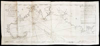
1750AMO-3597Antique Map / Carte géographique ancienne / Routes maritimes / Marine ANSON imprimée vers 1748 / 1750 ou légèrement plus tard (vers 1765 selon d'autres sources) Carte de la Mer du Sud ou Mer Pacifique entre l'Equateur et le 39. 1/2 de latitude septentrionale (cotes de la Californie et du Mexique) Dimensions de la feuille 61,5 cm x 40,5 cm Dimensions de la carte 28 cm x 55 cm Très belles et grandes marges conservées de tous côtés. Carte qui a été pliée à l'époque (traces de plis modérées). Contours à l'aquarelle en jaune à l'époque et deux tracés maritimes (voie empruntée par le Galion depuis Acapulco jusqu'à Guam et delà vers les îles Philippines où ce galion fut pris par le Centurion commandé par M. Anson le 30 juin 1743 et cours du centurion depuis Acapulco jusqu'à Tinian et de la vers la Chine). Notre carte n'a pas été insérée dans l'ouvrage de Anson elle porte en haut à gauche le numéro "N°115". Excellent état. Rare dans cette belle condition avec d'aussi belles marges. Très belle et grande carte géographique très bien conservée. Voir photos.
1795111CqLondres Peacock 1795 In16 - plein veau d'époque - 33 + 372 pages ( imprimées sur 2 colonnes ) + 30 pages concernant les monnaies - 6 cartes dépliantes hors texte - Petit dictionnaire portatif peu courant .
1795111CqLondres Peacock 1795 In16 - plein veau d'époque - 33 + 372 pages ( imprimées sur 2 colonnes ) + 30 pages concernant les monnaies - 6 cartes dépliantes hors texte - Petit dictionnaire portatif peu courant .
177897379HBAmsterdam:, de Erven van F. Houttuyn, 1778. 3 Bll., 190 Seiten, 9 Bll., XXII altkolorierte gestochene Kartenblätter, schlichter Lederband der Zeit, 15,5 x 9,5 cm.
17908504Paris, De Bure, 1790. troisieme edition. mit 31 zumeist gefalteten Kupfertafeln (davon 19 Karten, 9 Pläne, 3 Ansichten und eine Medaillenansicht) HLwd.d.Zt., XL S. + 31 Tafeln., Gr.8° [3 Warenabbildungen]
178011723(Ohne Ort und Drucker, um 1780). 66 altkolorierte meist doppelblattgr. Kupferstichkarten bzw. Kupfertafeln. Gr.-Fol. HLdr. der Zeit mit modernen Marmorpapierbezügen (Rücken mit kl. Wurmgängen, etw. beschabt und bestoßen).
172017031(Augsburg). (Um 1720). Format ca. 16,5 x 22,5 cm (Mit leichten Längsknick in der Mitte u. etwas fleckig).
171534417London, Printed for William Mount and Thomas Page on Tower Hall, no date (c. 1715). Folio. 53X35 cm. Cont. hcalf with marbled boards. Rebacked and recornered in old style with raised bands. Engraved typographical titlepage with a large engraved vignette showing the English King's Coat of Arms. With all 15 double-page engraved sea-charts (numbered (1)-(15) in lower right corners). Neat repairs to inner margins of free endpapers and titlepage. Some browning to charts. Chart 5 (45x75,5 cm) having the right margin shaved reaching the printed frame.
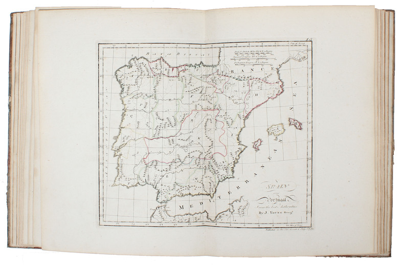
177851680(Edinburgh and London ?), (1778). Large 4to. (32 x 24,5 cm.). Contemp. hcalf. Raised bands. Title-label with gilt lettering. Top of spine lacks ca. 1 cm. of leather, bottom of spine ca. 1/2 cm. Spine rubbed, wear along hinges. Old owner inscription on top of title-page. Ex Libris Scholae Regis Edinensis. Engraved title-page and 23 double-page (numb. 1-23) and all with original handcolouring. The map of the world (2 hemispheres): printed size 25 x 46 cm. (sheet: 31 x 48,5 cm.). Printed on heavy paper, verso blank, all clean and fine.
179655711Paris, J.B. Delaval, (1796/97). Folio-oblong. (40 x 55 cm.). Contemp. modest hcalf. A paperlabel pasted on upper part of spine. Marbled paper on covers. A stamp on title-page. Engraved title-page and engraved Tableau (dated AN V). With 67 engraved maps (incl. Tableau, numb. (1)-65 + 53 bis and 58 bis). On title-page the name P.G. Chanlaire is erased. Engraved title-page slightly soiled, Tableau, the first and last map a bit brownspotted and last map with a closed marginal tear, otherwise clean.
1781107133BBParis, Laporte, 1781. 8°. 16 S. und 28 doppelblattgr. gestoch. Karten. Pbd. der Zeit. Nouv. édition, augmentée de trois nouvelles cartes
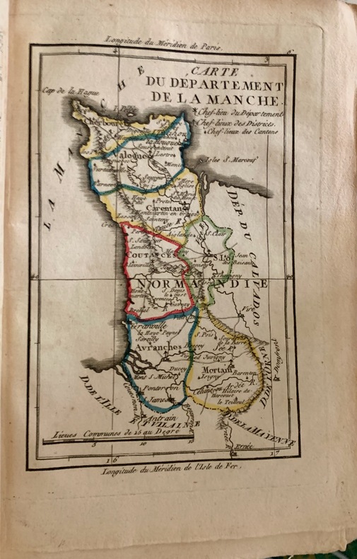
1793125131793 Paris, chez l'éditeur rue des Marais, 1793; fort volume in-8 ( 21 x 15 cm), de (6) - (2) -366 - (2)pp.; grande carte dépliante de la France de 1793 en couleurs en frontispice sur papier bleuté et 84 cartes hors texte en couleurs.
17945887<p>THE FIRST ENGLISH SEA ATLAS OF AMERICA</p><p>Folio 47.7 x 31 cm 66 pp. with pagination errors with 26 engraved maps 21 of which are double-page or folding the first chart with letterpress text attached as called for numerous woodcuts in the text. Bound in contemporary sheep rebacked blind-tooled borders to upper and lower covers. Minor rubbing to covers. Some spotting to the fourth map Verner no. 62 and adjacent letterpress pages small tear to fold of map 10 Verner no. 60 two small circular mends to title page not affecting text otherwise remarkably well preserved.</p><p>A spectacular copy of the final edition of the <em>English Pilot</em> <em>The Fourth Book</em> the first wholly English sea atlas of American waters. The work was sufficiently in demand to justify 37 legitimate editions from 1689 to 1794 and three pirated editions. All editions are rare. During the history of this title its charts underwent numerous changes. The first edition contained only 18 maps whereas this 1794 final edition contained 26.</p><p>"<em>The English Pilot</em> was the first major sea-atlas produced in England. In its final form it consisted of five separate books and <em>The Fourth Book</em> was the first wholly English sea-atlas of American waters. Although the idea originated with John Seller he was involved in producing only the first two books. William Fisher and John Thornton produced <em>The Fourth Book</em> in 1689 and their successors Mount and Page continued to print it for over 100 years Seller's proposal for a 'Sea Waggoner' resulted in the production of <em>The English Pilot</em> which consisted of five separate volumes with a common generic title. Book One included the southern navigation and Book Two the northern. Book Three was concerned with the Orient Book Four with America and Book Five contained Africa. Each book or volume has its own independent publishing history and appeared in numerous editions. The five separate books constitute a set only by virtue of the general title and under that title <em>The English Pilot</em> is the first great sea-atlas produced in England. Of the five books the fourth has the longest publication history and is the best known" Verner p. v.</p><p>Throughout its history <em>The Fourth Book</em> showed very few changes in textual matter and the content of the volume was established between the editions of 1706 and 1721.</p><p>The present example of the 1794 edition is complete and contains the following maps see Verner pp. xv-xx for full list of editions and charts from 1689 to 1794:</p><p>1. A New and Correct Chart of the Western and Southern Oceans Showing the Variations of the Compass with letterpress text attached</p><p>2. A New and Correct Chart of the North Part of America from New Found Land to Hudson's Bay</p><p>3. A New Generall Chart for the West Indies of E. Wright's Projection</p><p>4. A New and Accurate Chart of the Vast Atlantic or Western Ocean by Eman. Bowen</p><p>5. Harbour of Casco Bay Capt. Cyprian Southicke 1720 Em. Bowen</p><p>6. A New and Correct Chart of the Coast Line of Newfoundland from Cape Raze to Cape Bionavista</p><p>7. Island of St. Peters </p><p>8. Chart of the South East Coast of Newfoundland</p><p>9. New and Correct Chart of the Sea Coast of New-England from Cape Cod to Casco Bay Henry Barnsley</p><p>10. A Map of the Coast of New England from Staten Island to the Island of Breton Capt. Cyprian Southack</p><p>11. A Chart of New York Harbour with the Banks </p><p>12. Virginia Maryland Pennsylvania East & West New Jersey </p><p>13. A Draught of Virginia by Mark Tiddeman</p><p>14. Barbados copperplate in text</p><p>15. A New Mapp of the Island of St. Christophers Survey taken by Mr. Andrew Norwood</p><p>16. A Large Draft of the Island of Antegua copperplate in the text</p><p>17. A Draught of South Carolina and Georgia from Sewee to St. Estaca by Andrew Hughes</p><p>18. A Correct Chart of the Caribee Islands</p><p>19. A Correct Chart of Hispaniola with the Windward Passage by C. Price</p><p>20. A Draught of the West End of the Island of Porto Rico </p><p>21. A New & Correct Chart of Cuba Streights of Bahama Windward Passage </p><p>22. A New and Correct Draught of the Bay of Matanzas by Rob.t Pearson</p><p>23. Bermudas copperplate in text</p><p>24. A New and Correct Chart of the Island of Jamaica</p><p>25. A Chart of the Coast of Guayana By R. Waddington</p><p>26. A New and Correct Chart of the Trading Part of the West Indies</p><p> <em>The English Pilot: The Fourth Book</em> Amsterdam 1967 with an introduction by Coolie Verner.</p> Printed for Mount and Davidson hardcover
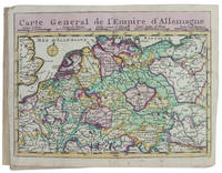
173017253Haarlem 1730. Small 8vo 16 x 10 cm. Bernardus Cleynhens Half textured red cloth ca. 1860 sewn on 2 tapes chemical-marbled sides in brown and blue. With 25 double-page engraved maps 2 overview maps the second serving as a key to the 23 numbered detail maps and an engraved plate with 8 scales all hand-coloured partly in outline. The 2 overview maps slightly wider than the others have a flap folded in at each side. Further with 1 rococo woodcut tailpiece 1 woodcut decorated initial and a fleuron on the title-page. 40 23 1 blank pp. plus maps and plate of scales. A surprisingly rare pocket atlas illustrating the theatre of the "tegenwoordigen" present war probably meaning the War of the Austrian Succession 1740-1748 but possibly the Seven Years' War 1756-1763. The title-page notes that it is suited for officers travellers and lovers of geography to carry in a pocket. The text in Dutch gives a geographic description only of "Duytsland" Germany including Austria Bohemia and a few other areas whereas the maps also cover the Low Countries the English Channel northwest France and to the east as far as Warsaw Krakow and Belgrade. The 23 detail maps were designed so that they could be assembled with the key map to make a single wall map whose cartographic image would measure 53 x 90 cm.With a contemporary owner's bookplate embossed stamp and library labels. With the text leaves somewhat browned not affecting the maps or the plate with scales and the first 2 leaves slightly worn but generally in good condition. A rare pocket atlas from the War of the Spanish Succession.l Koeman I Cle 1; STCN 2 copies; WorldCat 2 copies. hardcover
1770D18502Paris circa 1770. Paperback. Very Good. Chez Lattre Graveur Ordinaire de Monseigneur le Dauphin de Monseigneur le Duc d'Orleans et de la Ville. Engraved title-page dedication and 7 full-page engraved maps with original hand-color. 8vo format 10x6¾ inches original blue paste-paper wrappers light wear; minor worm track confined to the margins. A charming eighteenth-century traveler's guide from Paris to Compiegne. OCLC locates one copy listed under a different publisher. <br/><br/> paperback
1718D14120Amsterdam: Aux dépens de la Compagnie 1718. Hardcover. Good. Contemporary speckled calf handsomely rebacked but one board detached; gilt-stamped lettering in tan leather spine label second compartment gilt-stamped ornament on 5 raised bands and direct in spine compartments; 3 volumes 12mo 163x95mm; pp. 10 336 35; 16 333 51; 14 468 32; with hand-colored engraved half-title in Volume I 18 hand-colored plates many folding hand-colored decorative head- and tail-pieces. Front rear board on volume one detached. Boards a bit scuffed along the edges; corners bumped; spines dry. Internally bright and clean; previous owner's tasteful bookplate. Plates are lovely. <br/><br/> Aux dépens de la Compagnie hardcover
17284155Paris, de Beaurain Geographe du Roy, 1728. 1728 1 vol. in-4° (273 x 250 mm) de : 1 titre manuscrit avec lettres caligraphiées en rouge, bleu et or dans un encadrement de frises ; [188] ff. (dont 50 ff. de texte sur double page, 5 ff. de texte sur page simple, 133 cartes et planches sur double page dont 13 dépliantes). (Corps d'ouvrage très frais). Plein maroquin brun d'époque, dos à nerfs orné, triple encadrement de filets dorés sur les plats avec fleurons angulaires, roulette dorée sur les coupes, dentelles intérieures tranches dorées.
178660376Antwerpen:: C. M. Spanoghe 1786. First Dutch translation. old paste-grain decorated paper boards sewn over tapes. Old ink ownership signature; a very attractive copy. 12mo. Engraved frontispiece 22 folding engraved maps with outline color and 2 folding plates. C. M. Spanoghe, hardcover
176651834P., Desnos & chez l'Auteur 1766 In-4, demi-basane brune, dos à nerfs, titre gravé, grand plan général dépliant et 34 planches sur double page, 28 ff.n.ch. de tables d. Petits frottements. Infimes rousseurs. Très bon exemplaire.
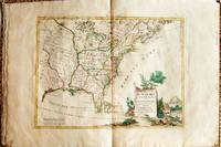
1778019206Venice: Antonio Zatta 1778. First Edition. Softcover. Some minor worming to inner marginal folds of maps occasional spotting. Complete with vibrant coloring. Close to Fine. Oblong folio 16 1/4" x 12" bound in contemporary limp decorated paper covers. Containing 15 double-page engraved maps including the double-page title each beautifully hand-colored depicting Bermuda; the east coast of North America from Nova Scotia to Florida west to the Great Lakes and south to "Luigiana" and "Messico"; Lake Superior and its coast with an inset of eastern Florida including the Keys and Bahamas; Canada between the Ottawa River and Hudson Bay; Labrador; Lake Michigan including parts of Michigan Illinois Indiana Wisconsin Minnesota and Iowa; Lake Huron Ontario Erie Ohio Pennsylvania New York the Hudson River Long Island and western New England; the Canadian and New England coast from Acadia and the Bay of Fundy down the coast to the Long Island Sound; Virginia the Mississippi and Missouri Rivers Louisiana and the Carolinas; Maryland New Jersey Virginia and the Carolinas; Jamaica; the Gulf of Mexico including the coast between Florida and New Orleans north into Indian territory; the east coast of northern Florida Georgia up to Cape Fear; Newfoundland and Cape Breton; and Hudson Bay. <br/><br/> Antonio Zatta paperback
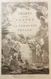
179843609London: Published as the Act directs Nov 1st 1798. by G.G.& J. Robinson 1798. Folio. 43x 27cm. 17" x 14.5". Atlas Volume First English Edition foliated engraved frontis portrait and engraved title-page 68 fine engraved plates maps charts and views many double page and include several plate illustrations on botanical and ornithological subjects. The plates are numbered 2 - 69 without the world map as usual plates are all very good to fine in contemporary half crimson morocco and marbled boards binding heavily dust worn similar wear on the edges upper hinge loose internally very good to fine condition. The map of the world is sometimes described as wanting however it would usually be in the two volume and is not call for in the list of plates <br /> <br /> ~ ~ ~ Hill #'s 972-979. "La Perouse expedition was one of the most important scientific explorations ever undertaken to the Pacific and North West Coast of North America. Hill. "Sabin 38960; Cox I-67. Fine copy of this Important 'Surveying Atlas' to the Pacific and west coast of North America. 1798. The plates are spectacular. - Atlas to the English edition of the report of the famous voyage around the world. Cook Bougainville and La Pérouse contributed decisively to the exploration of the Pacific. <br /> On the unexpected publication of this famous voyage at Paris in the previous year 1797 there was considerable competition among English publishers to bring out the English translation. Three different translations were made and published during 1798-99 and different engravers were employed for making the plates. Stockdale's appeared first in June 1798. Robinson's edition of 1799 is the most esteemed edition in English later editions being usually based on it." The atlas bears the date 1798 in the imprint but was published together with two text volumes in 1799. Published, as the Act directs, Nov, 1st, 1798. by G.G.& J. Robinson unknown
170817300Amsterdam Chatelain 1708 in-folio velin sur cartons, lies marron (reliure de remplacement ) titre, frontispice (Romain de Hooge), (6ff.nc), 90pp., 26 planches doubles h.t., 7 chronologies (33ff.),
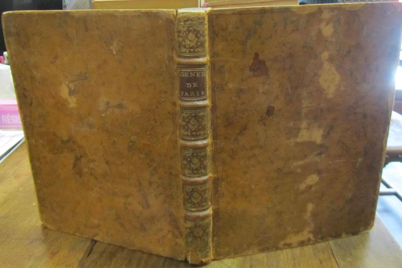
1763617011763 P., Savoye, Despilly, Duchesne, Dessaint et Saillant, Guillyn, Grange et Dufour, et l'Auteur, 1763, in 4° relié plein veau de l'époque, dos à cinq nerfs orné, étiquette rouge, tranches marbrées, VIII [Discours préliminaire] - XXXIV [Description de la Généralité de Paris] - 122 pages - 1 feuillet [carton du feuillet XXXIII/XXXIV, avec errata] et XII pages [Table générale des Matières / Fautes à corriger] ; titre gravé, une planche à double page [Statue Equestre de Louis le bien Aimé] et 25 cartes aquarellées, à double-page ; quelques très rares rousseurs éparses ; coiffes usées, coins émoussés, un mors fendu sur 5 cm, et petits frottis.
1780D19540Lyon: Chez Bernuset 1780. Hardcover. Very Good. Nouvelle Edition revue corrigee & augmentee. Contemporary calf. 515 pp. 17 maps. <br/><br/> Chez Bernuset hardcover
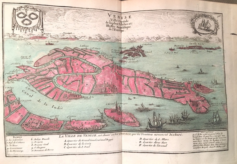
1708116863Amsterdam, les Frères Chatelain, 1708-1714, 4 vol. in-folio, (18)-8-(4)82, (16)-(10)-162 (pagination continue) et (12)-98 pp, lettrines, culs-de-lampes, reliures plein veau raciné, dos à 6 nerfs guillochés et caissons très ornés, pièces de titre et de tomaison basane naturelle, coupes guillochées, tranches rouges (rel. de l'époque), pet. travail de ver au tome 1 sans perte de texte, coiffes abîmées, qqs épidermures, 1 mors fendu sur 8 cm au tome 3, intérieurs propres, bon état