Antiquariat.de

56 résultats
172017031(Augsburg). (Um 1720). Format ca. 16,5 x 22,5 cm (Mit leichten Längsknick in der Mitte u. etwas fleckig).
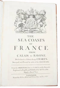
171534417London Printed for William Mount and Thomas Page on Tower Hall no date c. 1715. Folio. 53X35 cm. Cont. hcalf with marbled boards. Rebacked and recornered in old style with raised bands. Engraved typographical titlepage with a large engraved vignette showing the English King's Coat of Arms. With all 15 double-page engraved sea-charts numbered 1-15 in lower right corners. Neat repairs to inner margins of free endpapers and titlepage. Some browning to charts. Chart 5 45x755 cm having the right margin shaved reaching the printed frame. <br/><br/><em>Second edition of this scarce "Atlas Maritime". According to Shirley it was first published by Richard Mount and Thomas Page in 1701 and re-issued with undated title as this in ab. 1715 but with the charts unchanged and a new engraved titlepage. A third issue came out in 1737 with a dated title. The fine charts are copied from Pieter Mortier's famous "Neptune Francois" 1693-1702 and reduzed in size."The charts in this early Mount & Page atlas "The Sea-Coasts of France" are re-engravings reduzed in size from the charts in the French Neptune of 1693. The charts may also be found in the 1702 edition of Mount and Page's Atlas Maritimus Novus." Rodney Shirley. - Not in Phillips. - Shirley Vol. II: M.M&P - 12 b. </em> hardcover
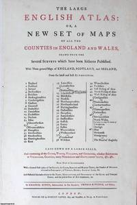
1760373384Robert Sayer London c.1760. Unframed Print. Very Good Condition. The letterpress title page of The Large English Atlas adopts a dignified full-folio design declaring the works grand ambition and learned purpose through finely set serif type. The title itself dominates in full capitals while italic accents lend emphasis and rhythm. Clear hierarchies and generous spacing enhance legibility and poise. Stripped of decoration or ornament the page conveys assurance through restraint confident in its authority. Letterpress 25 x 49; sheet 39 x 58 cms. Category: PRINTS : Antiquarian Interest; PRINTS : Historic Interest; Printed before 1800; Special Features. This item may require more postage than the rates shown for delivery outside the UK. If extra postage is required we will contact you before processing your order and you will be given the details and option to decline the extra cost. Robert Sayer unknown
17945887<p>THE FIRST ENGLISH SEA ATLAS OF AMERICA</p><p>Folio 47.7 x 31 cm 66 pp. with pagination errors with 26 engraved maps 21 of which are double-page or folding the first chart with letterpress text attached as called for numerous woodcuts in the text. Bound in contemporary sheep rebacked blind-tooled borders to upper and lower covers. Minor rubbing to covers. Some spotting to the fourth map Verner no. 62 and adjacent letterpress pages small tear to fold of map 10 Verner no. 60 two small circular mends to title page not affecting text otherwise remarkably well preserved.</p><p>A spectacular copy of the final edition of the <em>English Pilot</em> <em>The Fourth Book</em> the first wholly English sea atlas of American waters. The work was sufficiently in demand to justify 37 legitimate editions from 1689 to 1794 and three pirated editions. All editions are rare. During the history of this title its charts underwent numerous changes. The first edition contained only 18 maps whereas this 1794 final edition contained 26.</p><p>"<em>The English Pilot</em> was the first major sea-atlas produced in England. In its final form it consisted of five separate books and <em>The Fourth Book</em> was the first wholly English sea-atlas of American waters. Although the idea originated with John Seller he was involved in producing only the first two books. William Fisher and John Thornton produced <em>The Fourth Book</em> in 1689 and their successors Mount and Page continued to print it for over 100 years Seller's proposal for a 'Sea Waggoner' resulted in the production of <em>The English Pilot</em> which consisted of five separate volumes with a common generic title. Book One included the southern navigation and Book Two the northern. Book Three was concerned with the Orient Book Four with America and Book Five contained Africa. Each book or volume has its own independent publishing history and appeared in numerous editions. The five separate books constitute a set only by virtue of the general title and under that title <em>The English Pilot</em> is the first great sea-atlas produced in England. Of the five books the fourth has the longest publication history and is the best known" Verner p. v.</p><p>Throughout its history <em>The Fourth Book</em> showed very few changes in textual matter and the content of the volume was established between the editions of 1706 and 1721.</p><p>The present example of the 1794 edition is complete and contains the following maps see Verner pp. xv-xx for full list of editions and charts from 1689 to 1794:</p><p>1. A New and Correct Chart of the Western and Southern Oceans Showing the Variations of the Compass with letterpress text attached</p><p>2. A New and Correct Chart of the North Part of America from New Found Land to Hudson's Bay</p><p>3. A New Generall Chart for the West Indies of E. Wright's Projection</p><p>4. A New and Accurate Chart of the Vast Atlantic or Western Ocean by Eman. Bowen</p><p>5. Harbour of Casco Bay Capt. Cyprian Southicke 1720 Em. Bowen</p><p>6. A New and Correct Chart of the Coast Line of Newfoundland from Cape Raze to Cape Bionavista</p><p>7. Island of St. Peters </p><p>8. Chart of the South East Coast of Newfoundland</p><p>9. New and Correct Chart of the Sea Coast of New-England from Cape Cod to Casco Bay Henry Barnsley</p><p>10. A Map of the Coast of New England from Staten Island to the Island of Breton Capt. Cyprian Southack</p><p>11. A Chart of New York Harbour with the Banks </p><p>12. Virginia Maryland Pennsylvania East & West New Jersey </p><p>13. A Draught of Virginia by Mark Tiddeman</p><p>14. Barbados copperplate in text</p><p>15. A New Mapp of the Island of St. Christophers Survey taken by Mr. Andrew Norwood</p><p>16. A Large Draft of the Island of Antegua copperplate in the text</p><p>17. A Draught of South Carolina and Georgia from Sewee to St. Estaca by Andrew Hughes</p><p>18. A Correct Chart of the Caribee Islands</p><p>19. A Correct Chart of Hispaniola with the Windward Passage by C. Price</p><p>20. A Draught of the West End of the Island of Porto Rico </p><p>21. A New & Correct Chart of Cuba Streights of Bahama Windward Passage </p><p>22. A New and Correct Draught of the Bay of Matanzas by Rob.t Pearson</p><p>23. Bermudas copperplate in text</p><p>24. A New and Correct Chart of the Island of Jamaica</p><p>25. A Chart of the Coast of Guayana By R. Waddington</p><p>26. A New and Correct Chart of the Trading Part of the West Indies</p><p> <em>The English Pilot: The Fourth Book</em> Amsterdam 1967 with an introduction by Coolie Verner.</p> Printed for Mount and Davidson hardcover
1748453058299xbvk(Paris), Avec Privilège, 1748. Gravure en taille-douce avec des frontières coloriées (copperplate-engraving with coloured borders); ca. 24 x 38 cm (feuille / sheet), ca. 17 x 21 cm (carte géographique / map).
1748453058304xbvk(Paris), Avec Privilège, 1748. Gravure en taille-douce avec des frontières coloriées (copperplate-engraving with coloured borders); ca. 24 x 38 cm (feuille / sheet), ca. 17 x 21 cm (carte géographique / map).
177064868Ohne Ort, ohne Verlag bzw. Drucker, o. J. (um 1770). Qu.-4° (32,5 x 28 cm). Mit gest. Titel von J. J. Mezger u. 19 grenz- u. flächenkolor. Kupferkarten. Einfacher grüner Kart.-Umschlag d. Zt. m. handschriftl. Deckeltitel.
178011723(Ohne Ort und Drucker, um 1780). 66 altkolorierte meist doppelblattgr. Kupferstichkarten bzw. Kupfertafeln. Gr.-Fol. HLdr. der Zeit mit modernen Marmorpapierbezügen (Rücken mit kl. Wurmgängen, etw. beschabt und bestoßen).
1748453058300xbvk(Paris), Avec Privilège, 1748. Gravure en taille-douce avec des frontières coloriées (copperplate-engraving with coloured borders); ca. 24 x 38 cm (feuille / sheet), ca. 17 x 16 cm (carte géographique / map).
17908504Paris, De Bure, 1790. troisieme edition. mit 31 zumeist gefalteten Kupfertafeln (davon 19 Karten, 9 Pläne, 3 Ansichten und eine Medaillenansicht) HLwd.d.Zt., XL S. + 31 Tafeln., Gr.8° [3 Warenabbildungen]
178078258Bruxelles: Benoît Le Francq 1780. Full leather hardcover. xx240 pp. illustrated with a black-and-white frontispiece showing Atlas as a child holding up the celestial sphere and 24 old hand-colored folding maps/plates after G. Dellisle. Rare Brussels pocket atlas based on the 5th Amsterdam edition published by B. Vlam in the same year 1780. Includes B. Vlam's bookseller's list at the end. One map has a repaired taped tear and some maps have frayed edges. Bound in a leather cover with various damages. The book is complete and the maps remain visually attractive. Text in French / Français. See pictures. Benoît Le Francq hardcover
178660376Antwerpen:: C. M. Spanoghe 1786. First Dutch translation. old paste-grain decorated paper boards sewn over tapes. Old ink ownership signature; a very attractive copy. 12mo. Engraved frontispiece 22 folding engraved maps with outline color and 2 folding plates. C. M. Spanoghe, hardcover
1748453058302xbvk(Paris), Avec Privilège, 1748. Gravure en taille-douce avec des frontières coloriées (copperplate-engraving with coloured borders); ca. 24 x 38 cm (feuille / sheet), ca. 17 x 20 cm (carte géographique / map).
1718D14120Amsterdam: Aux dépens de la Compagnie 1718. Hardcover. Good. Contemporary speckled calf handsomely rebacked but one board detached; gilt-stamped lettering in tan leather spine label second compartment gilt-stamped ornament on 5 raised bands and direct in spine compartments; 3 volumes 12mo 163x95mm; pp. 10 336 35; 16 333 51; 14 468 32; with hand-colored engraved half-title in Volume I 18 hand-colored plates many folding hand-colored decorative head- and tail-pieces. Front rear board on volume one detached. Boards a bit scuffed along the edges; corners bumped; spines dry. Internally bright and clean; previous owner's tasteful bookplate. Plates are lovely. <br/><br/> Aux dépens de la Compagnie hardcover
1780D19540Lyon: Chez Bernuset 1780. Hardcover. Very Good. Nouvelle Edition revue corrigee & augmentee. Contemporary calf. 515 pp. 17 maps. <br/><br/> Chez Bernuset hardcover
174520271Augsburg, Pfeffel, (1745). 1 Kupfertitel, 1 Bl. (Vorbericht), 68 teils kolorierte Kupfertafeln. Quer-Gr.-Fol. Mod. Ldr. [5 Warenabbildungen]
1770D18502Paris circa 1770. Paperback. Very Good. Chez Lattre Graveur Ordinaire de Monseigneur le Dauphin de Monseigneur le Duc d'Orleans et de la Ville. Engraved title-page dedication and 7 full-page engraved maps with original hand-color. 8vo format 10x6¾ inches original blue paste-paper wrappers light wear; minor worm track confined to the margins. A charming eighteenth-century traveler's guide from Paris to Compiegne. OCLC locates one copy listed under a different publisher. <br/><br/> paperback
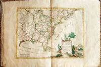
1778019206Venice: Antonio Zatta 1778. First Edition. Softcover. Some minor worming to inner marginal folds of maps occasional spotting. Complete with vibrant coloring. Close to Fine. Oblong folio 16 1/4" x 12" bound in contemporary limp decorated paper covers. Containing 15 double-page engraved maps including the double-page title each beautifully hand-colored depicting Bermuda; the east coast of North America from Nova Scotia to Florida west to the Great Lakes and south to "Luigiana" and "Messico"; Lake Superior and its coast with an inset of eastern Florida including the Keys and Bahamas; Canada between the Ottawa River and Hudson Bay; Labrador; Lake Michigan including parts of Michigan Illinois Indiana Wisconsin Minnesota and Iowa; Lake Huron Ontario Erie Ohio Pennsylvania New York the Hudson River Long Island and western New England; the Canadian and New England coast from Acadia and the Bay of Fundy down the coast to the Long Island Sound; Virginia the Mississippi and Missouri Rivers Louisiana and the Carolinas; Maryland New Jersey Virginia and the Carolinas; Jamaica; the Gulf of Mexico including the coast between Florida and New Orleans north into Indian territory; the east coast of northern Florida Georgia up to Cape Fear; Newfoundland and Cape Breton; and Hudson Bay. <br/><br/> Antonio Zatta paperback
178065196Nürnberg, Christoph Weigel, 1780. 8°. Mit 37 doppelblattgr. kolor. Kupferkarten. 8 Bll., 186 S., 98 Bll., HLdr. d. Zt. a. 5 Bünden m. Rückenverg., goldgepr. Rückenschild u. Rotschnitt.
1748453058303xbvk(Paris), Avec Privilège, 1748. Gravure en taille-douce avec des frontières coloriées (copperplate-engraving with coloured borders); ca. 24 x 38 cm (feuille / sheet), ca. 17 x 21 cm (carte géographique / map).
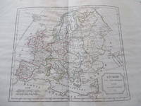
179617505AB1796. Paris Delamarche 1796 - 1826. 335 : 26 cm. 10 double-page engraved maps partly coloured. Contemporary half cloth. Contains the following maps: Carte del'Empire Romain - Europe au Vem siècle - Europesous Charlemagne - Europe à lepoque dudémembrement de l'Empire - Europe vers la fin du XLem siécle - Empire des Monmgols - Europe vers l'an1300 - Europe vers le an 1453 - Europe moderne - Francedivisée par provinces. - Partly some water-stains; binding worn. hardcover
179329054Paris Mondhare et jean 1793. Small folio. 36x31 cm. Cont. hcalf. Back somewhat rubbed and with some cracking along first hinges but tight and not loose. Engraved titlepage and engraved Table of maps bound at end - bottom a little shawed. With 64 double-page engraved maps the first 7 are hemispheres world-systems etc all handcoloured in outline. All maps have engraved text in borders. On good paper with only minor scattred brownspots in margins. Plates numb. 1-64. <br/><br/><em>Scarce last edition of Clouet's fine general atlas first issued 1767. Phillips records 2 other editions form 1787 Phillips No. 661 and 1791 Phillips No. 673 but not this. - Not in Shirley: Maps and Atlases in The British Library. </em> unknown
1748453058296xbvk(Paris), Avec Privilège, 1748. Gravure en taille-douce avec des frontières coloriées (copperplate-engraving with coloured borders); ca. 24 x 38 cm (feuille / sheet), ca. 16 x 19 cm (carte géographique / map).
177897379HBAmsterdam:, de Erven van F. Houttuyn, 1778. 3 Bll., 190 Seiten, 9 Bll., XXII altkolorierte gestochene Kartenblätter, schlichter Lederband der Zeit, 15,5 x 9,5 cm.
170448770Amsterdam Franciscus Halma 1704. Folio. 455 x 29 cm. Contemp. full blindtooled Dutch vellum. Raised bands. Spine ends with tears some cracking along fronthinge but not loose. Vellum at frontcover a bit soiled. Egraved titlepage Coxis del. ianen fecit. Printed titlepage in red/black with an engraved vignette. 15119511 pp. 1 engraved plate with portrait and coat of arms. 4 large folded engraved maps. Light yellowing to margins of textleaves but maps and text fine and clean. 3 of the maps engraved by F. Halma. <br/><br/><em>The maps are the Francois Halma reissues of Sanson's maps from 1683. </em> hardcover