990 résultats
198744496Anchorage AK: Salmon Atlas. VG. 1987. 1st Edition. Paperback. Paperback in Very Good condition. . 4to 11" - 13" tall. 92 maps covering the Kenai Peninsula Mat-Su the Anchorage area West Cook Inlet Prince William Sound and Kachemak Bay. . Quick Shipping All Books Mailed in Boxes Free Tracking Provided . Salmon Atlas paperback
B9789401184007Paperback / softback. New. This volume is the first part of a larger work on the philosophy of Solomon Maimon and its systematic place in the history of thought. paperback

ria9789401184007_inpPaperback. New. New Book; Fast Shipping from UK; Not signed; Not First Edition; N/A paperback
1964mon0000012512Martinus Nijhoff / The Hague 1964. Hardcover. Good. This is a Hardcover copy. Dust jacket shows some browning and soiling as well as some chipping and tears around edges and an old price sticker on back cover. Book itself shows some light scuffing on edges. Martinus Nijhoff / The Hague hardcover
648023294Springer pp. 352 . Papeback. New. Springer unknown
1978biblio2111<p>American Academy Jewish Research 1978. Fine Hardcover. Signature on the Flyleaf otherwise book is New. The DJ got small tear. 9.2"x6.25"x1.0". be46162H.</p> American Academy Jewish Research hardcover
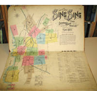
189715960New York: Sanborn-Perris Map Co. 1897. Third edition with additions. Hardcover. Good overall. Folio published in November 1897 with 18 hand colored maps including a title page on the key map. This is the third edition of the atlas according to the Library of Congress Census the first edition being published in 1886 but with only 13 sheets. The second edition was published in 1891 with an extra 2 sheet making a total of 16 sheets. Small private library stamp on the verso of the key map. There are very small pencil annotations on the maps obviously by F.J. Washburn the local insurance agent. <br /> Originating in London in the mid 18th century insurance maps had become invaluable in the US in the 1860's when Sanborn started work. The company started to standardize the maps and publish them in atlases under the town or city. Each map/sheet measures 21 x 25" and is drawn to a scale of 50 feet to an inch with color applied by hand at the time of publication. Every atlas records all town buildings shown to scale its construction material and use noted as well as fire-proofing thickness of walls elevators chimneys fire alarm boxes hydrants sprinkler systems and a wealth of other detail. Ultimately Sanborn produced maps and atlases for 12000 locations. Being so specific the demand was very slight. The Library of Congress estimates that there were usually fewer than twenty orders for a single sheet so production was small and usually produced for a specific Insurance company or agent. Because of this a very small number of copies of any atlas are offered on the market today. The maxim "if it turns up buy it because you won't find another copy" springs to mind. Folio maroon leather spine with printed hard boards rubbed but edges. Sanborn-Perris Map Co. hardcover
170448770Amsterdam Franciscus Halma 1704. Folio. 455 x 29 cm. Contemp. full blindtooled Dutch vellum. Raised bands. Spine ends with tears some cracking along fronthinge but not loose. Vellum at frontcover a bit soiled. Egraved titlepage Coxis del. ianen fecit. Printed titlepage in red/black with an engraved vignette. 15119511 pp. 1 engraved plate with portrait and coat of arms. 4 large folded engraved maps. Light yellowing to margins of textleaves but maps and text fine and clean. 3 of the maps engraved by F. Halma. <br/><br/><em>The maps are the Francois Halma reissues of Sanson's maps from 1683. </em> hardcover
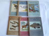
2d13765J.F. Schreiber Verlag Esslingen und München um 1920. Je Heft ca. 24 S. mit zahlr. Farbdrucktafeln und zahlr. naturgetreuen Abbildungen kartoniert teils leicht fleckig. - enthalten: Schreibers kleiner Atlas der Kriechtier und Lurche/der Säugetiere/fremdländischer Vögel Heft 1 und 2/der Schmetterlinge und Raupen/der Fische - unknown
2006Q-084933795XCRC Press 2006-05-17. Hardcover. New. In shrink wrap. Looks like an interesting title! CRC Press hardcover
20192-0367453606CRC Press 2019. Paperback. New. 2nd reprint edition. 524 pages. 9.50x6.75x1.00 inches. CRC Press paperback
DA02C-03006hf ULLMANN. Collectible - Good. Collectible - Good. Good dust jacket. Human Anatomy Human Body NOT AVAILABLE FOR SHIPMENT OUTSIDE OF THE UNITED STATES. hf ULLMANN unknown
1850137729Leipzig and Glogau: C. Flemming 1850. The 1850 supplement to the Sohr-Berghaus Hand-Atlas comprising in total 40 maps including Texas and a world map. The atlas and its supplements were published in various editions from 1847 to 1906. Sohr is a pseudonym probably of Friedrich Handtke the editor and main cartopgrapher; from 1848 onwards the inclusion of three maps contributed by the geographer Heinrich Berghaus led to the atlas being published as the Sohr-Berghaus atlas. The atlas and supplement was issued in series and are often found with maps in variant orders; this volume does not include the map of Morocco. Folio 370 x 233 mm. 38 double-page lithographic maps with hand colouring 2 large folding maps bound at rear from different atlas series. Contemporary quarter sheep spine lettered in gilt brown cloth sides. Binding somewhat soiled and worn at extremities contents foxed the two folding maps substantially torn but others all intact contemporary manuscript title to most maps on recto. A good copy. hardcover
199440421994. Crew of the Atlas 3 Space Shuttle. Large over-sized signed FDC from the day of the launch November 3 1994. Envelope measures 5x12" and is decorated with a brightly colored decal commemorating the launch. Signed by the entire crew "McMonagle" "Brown" "Ochoa" Tanner" "Parazynski" and "Clervoy." Very attractive. unknown
181956069København 1819. Folio. 44 x 27 cm. Original blue wrappers with some dampstains and rear somewhat soiled. With the engraved oval title on upper wrapper. In a later hcloth portfolio. With 19 all engraved maps charts plans coastal profiles of which 7 are double-page. Maps numbered in letters A-K profiles numbered I-IX.The maps depicting the main harbours with townplans and anchorages. Maps with a few small marginal closed tears. <br/><br/><em>Extremely scarce Danish edition a compilation from Vicente Tofino's "Atlas Maritimo" where the sheets have Danish text. This maritime-atlas was probably intended to accompagny Løvenørn's "Beskrivelse til det voxende Kaart over Kysterne af Spanien og Portugal." 1818.Bibl. Danica II 362 a. 367. - Luisa Martín-Merás: Catálogo analítico de los Atlas del Museo Naval de Madrid 2007". No 232. </em> hardcover
0762528117.Gspiral_bound. Good. Access codes and supplements are not guaranteed with used items. May be an ex-library book. unknown
198119342-RFTight squared copy crisp unmarked text; light discoloration page edges name penned on cover overall minor outer wear. Dresser Industries paperback
196643325Standard Atlas Co. Very Good. 1966. Spiral bound. Brown stiff covers rubbed with moderate edge wear first few pages only have thin dampstain lower edge does not impact maps or text. Township maps show landowners with index of rural residents alphabetical directory listing family members occupation plus church histories numerous historical photographs. ; MCN35682; Folio 13" - 23" tall . Standard Atlas Co. unknown
6100779230Taylor & Francis Group pp. 364 . Hardback. New. Taylor & Francis Group hardcover
30872's-Gavenhage Staatsdrukkerij. gebonden in blauw linnen Groot folio. l In kunstleren ringband unknown
1984707's-Gravenhage: Staatsdrukkerij 1984-1987. 36 x 306 cm 240 pp. Deze atlas bestaat uit twintig delen van 24 pagina's in totaal honderden kaarten en de mens in Nederland staat centraal. In die zin kan deze atlas als een aanvulling gezien worden op die van 1963-1977. De twintig delen zijn compleet en worden bewaard in de verzamelbox die voor intekenaren destijds werd bijgeleverd. Cond.: gaaf / fine. . Staatsdrukkerij unknown
198429394's-Gravenhage: Staatsdrukkerij 1984-1987. 36 x 306 cm 240 pp. Deze atlas bestaat uit twintig delen van 24 pagina's in totaal honderden kaarten en de mens in Nederland staat centraal. In die zin kan deze atlas als een aanvulling gezien worden op die van 1963-1977. De twintig delen zijn compleet en worden bewaard in de verzamelbox die voor intekenaren destijds werd bijgeleverd. Met register. Cond.: zeer goed / very good. . Staatsdrukkerij unknown
18-0525Germany: Justus Perthes 1870s - 1880s. 9 x 12 inches. Very Good. Some foxing from age. Folded hand-colored map of Denmark. Text in German. Germany: Justus Perthes, [1870s - 1880s?]. unknown
18-0524Germany: Justus Perthes 1870s - 1880s. 9 x 12 inches. Very Good. Some toning from age. Folded hand-colored map of Northwest Germany. Text in German. Germany: Justus Perthes, [1870s - 1880s?]. unknown
18-0523Germany: Justus Perthes 1870s - 1880s. 9 x 12 inches. Very Good. Some foxing from age. Folded hand-colored map of Germany Norway and Denmark. Text in German. Germany: Justus Perthes, [1870s - 1880s?]. unknown