ATLAS GOAD, Charles EBiblio.com

990 résultats
39507Toronto and Montreal. Underwriters Survey Bureau Limited. 1922. 65x55cm 3 sheets in colour fine. Toronto and Montreal. Underwriters Survey Bureau Limited. 1922 unknown
39504Toronto and Montreal. Underwriters' Survey Bureau Limited. 1950. 65x55cm 4 sheets in colour fine. Toronto and Montreal. Underwriters' Survey Bureau Limited. 1950 unknown
192437960Toronto & Montreal: Underwriter's Survey Bureau Limited 1924. Hardcover. Very Good to Fine. Atlas Folio. 54.5 x 31.5cm 13 double page scale maps in colour linen backed green cloth covered boards pressed boards Underwriter's Survey Bureau Limited hardcover
37962Toronto & Montreal. Underwriter's Survey Bureau Limited. 1923. Hardcover. Atlas Folio. 54.5x31cm 4 double page scale maps in colour linen backed a bit wrinkled green cloth boards over black cloth very good to fine. Toronto & Montreal. Underwriter's Survey Bureau Limited. 1923 hardcover
195037963Toronto & Monteal: Underwriter's Survey Bureau Limited. 1950 1950. Hardcover. Very Good to Fine. Atlas Folio. 54.5 x 32cm with 17 double page scale maps in colour linen backed linen is a bit frayed doesn't effect maps black boards over green cloth spine Underwriter's Survey Bureau Limited. 1950 hardcover
194937964Toronto & Montreal: Underwriter's Survey Bureau Limited. 1949 1949. Hardcover. Very Good Rare. Atlas Folio. 55x31.5cm 18 linen backed double page scale maps a bit wrinkled green cloth covered boards Underwriter's Survey Bureau Limited. 1949 hardcover
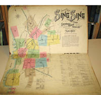
189715960New York: Sanborn-Perris Map Co. 1897. Third edition with additions. Hardcover. Good overall. Folio published in November 1897 with 18 hand colored maps including a title page on the key map. This is the third edition of the atlas according to the Library of Congress Census the first edition being published in 1886 but with only 13 sheets. The second edition was published in 1891 with an extra 2 sheet making a total of 16 sheets. Small private library stamp on the verso of the key map. There are very small pencil annotations on the maps obviously by F.J. Washburn the local insurance agent. <br /> Originating in London in the mid 18th century insurance maps had become invaluable in the US in the 1860's when Sanborn started work. The company started to standardize the maps and publish them in atlases under the town or city. Each map/sheet measures 21 x 25" and is drawn to a scale of 50 feet to an inch with color applied by hand at the time of publication. Every atlas records all town buildings shown to scale its construction material and use noted as well as fire-proofing thickness of walls elevators chimneys fire alarm boxes hydrants sprinkler systems and a wealth of other detail. Ultimately Sanborn produced maps and atlases for 12000 locations. Being so specific the demand was very slight. The Library of Congress estimates that there were usually fewer than twenty orders for a single sheet so production was small and usually produced for a specific Insurance company or agent. Because of this a very small number of copies of any atlas are offered on the market today. The maxim "if it turns up buy it because you won't find another copy" springs to mind. Folio maroon leather spine with printed hard boards rubbed but edges. Sanborn-Perris Map Co. hardcover
1992ZB1254874Western Atlas International Inc 1992. Price HAS BEEN REDUCED by 10% until Monday June 29 SALE item 312 pp. spiral-bound hardcover very good. - If you are reading this this item is actually physically in our stock and ready for shipment once ordered. We are not bookjackers. Buyer is responsible for any additional duties taxes or fees required by recipient's country. Western Atlas International Inc hardcover
0762528117.Gspiral_bound. Good. Access codes and supplements are not guaranteed with used items. May be an ex-library book. unknown
19722310120086Issued by Ministry of Education & Youth Services for Irrigation Commission Calcutta 1972. Hardcover. Good. Atlas folio 58 cm. Hardcover. Binding splitting at spine. Clean unmarked pages. 35 p. of col. maps. Scale of maps 1:1000000. India v. 4. This is an oversized or heavy book which requires additional postage for international delivery outside the US. Issued by Ministry of Education & Youth Services for Irrigation Commission, Calcutta hardcover
1985Q-0915361205Modan Pub 1985-10-01. Library Binding. New. In shrink wrap. Looks like an interesting title! Modan Pub unknown
2090202118204164Not Available N.A. Soft Cover. Fine. The book is in fine condition. Not Available paperback
BN262097Kardiale Ultraschalldiagnostik. Handbuch und Atlas Hardcover <br/><br/>Kardiale Ultraschalldiagnostik. Handbuch und Atlas Hardcover Kardiale Ultraschalldiagnostik. Handbuch und Atlas Hardcover hardcover
1837891931837. JAPANESE ATLAS Ichikawa Tokei. KOKUGUN ZENZU 2 volumes. Nagoya Edo Osaka Kyoto. Eirakuya Toshiro et al. Preface dated 1837. String-bound Japanese-style fukuro-toji printed paper title labels. Original yellow covers. Covers are a bit soiled with ownership labels. Internal occasional marginal worming. Printed in color woodblock throughout an interesting atlas of the traditional governing divisions of Edo-era Japan. unknown
2001BN100906Köln : Emons 2001. 2001. Köln: der historisch-topographische Atlas. Dorothea Wiktorin Jürgen Blenck Josef Nipper Manfred Nutz Klaus Zehner Autoren <br/><br/>Köln: der historisch-topographische Atlas. Dorothea Wiktorin Jürgen Blenck Josef Nipper Manfred Nutz Klaus Zehner Autoren Köln : Emons unknown
2005BN206620Editions Atlas 2005. 2005. Hardcover. L'atlas : La mythologie égyptienne <br/><br/>L'atlas : La mythologie égyptienne Editions Atlas Editions Atlas hardcover
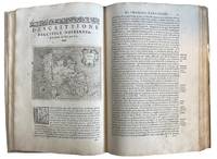
157643595Venice: Calignani & Porro 1576. Foliated 29.7 x 20.9cm a large complete untrimmed copy The enlarged Second Edition small folio 29.8 x 20.2cm 24201.1 colophon foliated with 47 copper plate maps decorated initial letters head and tail pieces in later full vellum red leather label gilt titles title page is lightly sprinkled with tiny spots a very good to fine large complete untrimmed copy of this enlarged edition containing 17 additional maps not in the first edition of 1752. fine. ~ ~ ~ ~ <br /> Header:. Porcacch. The Most Famous Islands Of The World. 1576. <br /> <br /> ~ ~ ~ Shirley. The Mapping of the World 127; The World Encompassed 87; Phillips. Atlases I67; European Americana 576/35; Sabin 64149; JCB I 263-264; Adams P-1905. This is one of the most beautiful works of its kind produced in the 16th century and is the ï¬rst to have maps engraved on copper rather than on woodblocks. "The popularity of Bordone's Isolario brought forth a successor which from both the cartographical and topographical point of view was far more distinguished. Porcacchi's description of the "most famous islands of the world" included the areas represented in the other atlas and devoted the third book to islands of the New World of the Pacific and the Indian Ocean. " "The ï¬rst world map is a ï¬nely-executed reduction of Camocio's large world map of 1567 one of the last in the long line of derivatives from Gastaldis prototype of 1546. The illustrated tract on islands presented here is said to be Porcacchi's most important work. - <br /> <br /> ~ ~ ~ Most of the maps included are: Iceland Hebridean islands and Orkney Gotland Hibernia Ireland England Scotland Sealand Maiorica Menorica Spain Malta Venice Italian archipelago corfu Curzolari Ionia Kefalonia island in the Ionian Sea Zante Morea Cerigo Candi of Indonesia Scarpanto Rhodi Santorini Milo Nixsia Cyrus Metellino Constantinople Stalimene Aegean Negroponte Greece Ciprus Temistitan Mondo Nuouo Spagnola Cuba San Lorenzo Peru S.Giovanni deL isole Molucche Indonesia and Del Mappamondo. The word Atlas was first used in the first collection of maps by Gerardys Mercator's "Atlas sive cosmographicae. 1585-1595 Calignani & Porro unknown
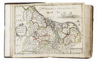
16525476Antwerp 1652. 4to 18 x 14.5 cm. Jan Huyssens Later 17th-century mottled calf sewn on 4 double cords gold-tooled spine and board edges. With a double-page letterpress title-page with a frame built up from typographic ornaments and 39 unnumbered double-page engraved maps of the northern and southern Low Countries by Jacob Aertsz. Colom each map coloured in outline. Interleaved with 38 blank leaves and with a manuscript table of contents 3 3 blank pp. at the end. Double-page title-page and 39 double-page maps. Second known copy of a pocket-atlas published at Antwerp but containing a selection of the maps of the Low Countries originally published by Jacob Aertsz. Colom at Amsterdam in 1635 with the title De Vyerighe Colom the title Colom had first used for his famous pilot guide in 1632 and the name he had given to his Amsterdam printing office where he worked from 1622 to his death in 1673 as a bookseller printer and mapmaker. The only other copy known is at the Royal Library in Brussels. The Vyerighe Colom with 47 maps and 3 plates and with extensive text in Dutch and French went through several editions in the 17th century but it was once thought that all editions before his death in 1673 had been published at Amsterdam by Colom himself. The Royal Library copy like the present one contains 39 maps but each contains one map not in the other so there are forty in total: the present copy includes Drentiae not in the Royal Library copy which includes Le terres entre la Meuse Vahal et Rhin not present here. The maps are also bound in a different order.The present edition is of great interest and gives cause to review Colom's activities. It is printed from Coloms plates so Colom may have licenced the Antwerp publisher to produce a variant edition of his Vyerighe Colom to broaden his market possibly reacting to the signing of the Peace of Münster in 1648 which finally ended the Eighty Years War and opened trade and communication between the northern and southern Low Countries. Jan Huyssens made an entirely new and practical atlas out of Colom's Vyerighe Colom. He omitted all text and the three plates that do not show maps and selected only maps of general interest leaving out the map of the ancient Low Countries and such typical Dutch maps as the separate maps of the polders De Zype Beemster Wormer Purmer Byllemermeer and Waterland also - at least in the present copy - completely rearranging the maps more in order of their geographical sequence. The title suggests that Huyssens originally planned to include a text so the present extremely rare edition may be the only surviving result of an abandoned project.l Koeman & Van der Krogt 365.23 IIIB pp. 644-645 2 copies: the present & Royal Library Brussels; UniCat 99095764 Royal Library Brussels only; cf. Koeman II Col 1 1635 Amsterdam ed.; not in KVK; STCV; WorldCat. unknown
157418848Venetia Venice Giordano Ziletti 1574-73. 4to. Hcalf from ab 1820. Gilt back. Slight rubbing to spine. 78350 pp. and 65 double-page engraved maps with text on verso of plates 130 pp5665 pp. 6 textlvs. at end with brownspots in right margin sometimes a little browning to pages few brownspots and a few textlvs. with minor wormtracts. Complete with all 65 maps called for each measuring ab. 19 x 26 cm. A great part of the maps have some background shadowing from the printers ink mainly due to the fact that this is the third Ruscelli-edition where the plates have been used before. 3 printer's wood-cut devices and 20 smaller and larger woodcuts in the text. 2 woodcuts with Ptolemy shown observing. <br/><br/><em>Third edition of Ruscelli's translation from Venice 1561. The maps are printed from the same plates with the exception of Ptolemy's map of the world for which Malomba had returned to the original conical projection of Ptolemy. Moreover one map is added: the map of "Territorio di Roma". In general the maps are enlarged copies of Gastaldi's maps from the edition of 1548 which came out in 8vo. The Ruscelli translation contains an important innovation namely the division of the world map into two parts one for the Old World and one for the New as seen on the plate "Tavola Universal" depicting the 2 hemispheres. The atlas contains 27 ptolemaic maps and 38 new. 1 World 1 Hemisphere 10 Europe 4 Africa 12 Asia and 38 others. 10 of the maps relate to America.Philipps I:380. Sabin 66505. Nordenskiöld Nr. 34 p.27. </em> unknown
19314532<p>La provincia heroica y legendaria camaguey ano 1931 the heroic and legendary province primera edicion 1931 bilingual edition spanish and english.nueva encuadernacionguia de la provincia de camaguey ano 1931en buenas condiciones edicion original de la epoca.con ilustracioens con un directorio profesional y comercial por cada municipio ademas un listado de las principales companias de la provincia.</p> El camagueyano s a impresores hardcover
199414585Stockholm: SNA Publishing 1994. First edition. Blue Full Leather With Gilt Lettering. Very good condition but mild ex-library. Folio pp. 160. Indexed profusely illustrated in b/w and color. A very nice ex-library copy of this scarce volume of the National Atlas of Sweden. SNA Publishing hardcover
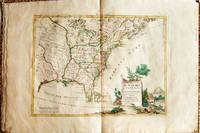
1778019206Venice: Antonio Zatta 1778. First Edition. Softcover. Some minor worming to inner marginal folds of maps occasional spotting. Complete with vibrant coloring. Close to Fine. Oblong folio 16 1/4" x 12" bound in contemporary limp decorated paper covers. Containing 15 double-page engraved maps including the double-page title each beautifully hand-colored depicting Bermuda; the east coast of North America from Nova Scotia to Florida west to the Great Lakes and south to "Luigiana" and "Messico"; Lake Superior and its coast with an inset of eastern Florida including the Keys and Bahamas; Canada between the Ottawa River and Hudson Bay; Labrador; Lake Michigan including parts of Michigan Illinois Indiana Wisconsin Minnesota and Iowa; Lake Huron Ontario Erie Ohio Pennsylvania New York the Hudson River Long Island and western New England; the Canadian and New England coast from Acadia and the Bay of Fundy down the coast to the Long Island Sound; Virginia the Mississippi and Missouri Rivers Louisiana and the Carolinas; Maryland New Jersey Virginia and the Carolinas; Jamaica; the Gulf of Mexico including the coast between Florida and New Orleans north into Indian territory; the east coast of northern Florida Georgia up to Cape Fear; Newfoundland and Cape Breton; and Hudson Bay. <br/><br/> Antonio Zatta paperback
2006H-425-444Editions ATLAS 2006. Paperback. Very Good. Ammareal gives back up to 15% of this item's net price to charity organizations. Editions ATLAS paperback
BN106128Editions ATLAS. Softcover. Le crochet: 55 modèles à réaliser <br/><br/>Le crochet: 55 modèles à réaliser Editions ATLAS paperback
2005300002733Editions ATLAS 2005. 2005. 340 pages. Editions ATLAS unknown