990 résultats
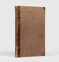
187743308Gotha Justus Perthes n.d. 1877-78 Folio. Orig. full blindstamped cloth. Frontcover with gilt title. Lower part of spine ca. 8 cm. lacks and top of spine with some wear otherwise fine. With 31 double-page 37x435 steel-engraved maps with outline colouring. All maps clean and fine. Maps dated 1877 a. the last 1878. hardcover
1971742828PN. New. 1971. Soft Cover. Date is original print. This is a reprint edition. . PN paperback
1998Q-0809230011McGraw-Hill 1998-04-01. Paperback. New. New. In shrink wrap. Looks like an interesting title! McGraw-Hill paperback

1902mon0003335558J.H. Stuart & Co. South Paris M 1902T. hardcover. Acceptable. . 1890 edition. Ex-library copy with usual markings. Cover shows minor wear and soiling binder's tape around all the edges. Facsimile title page bound-in to replace missing original page. Pages tanned and clean. J.H. Stuart & Co. South Paris, M hardcover
0843709561New. paperback. New. Satisfaction Guaranteed or your money back. paperback
188518330Lille folio. Samt. hldrbd. 8 pp. samt 22 dobbeltsidede farvelitograferede kort hel verden. unknown
1850137729Leipzig and Glogau: C. Flemming 1850. The 1850 supplement to the Sohr-Berghaus Hand-Atlas comprising in total 40 maps including Texas and a world map. The atlas and its supplements were published in various editions from 1847 to 1906. Sohr is a pseudonym probably of Friedrich Handtke the editor and main cartopgrapher; from 1848 onwards the inclusion of three maps contributed by the geographer Heinrich Berghaus led to the atlas being published as the Sohr-Berghaus atlas. The atlas and supplement was issued in series and are often found with maps in variant orders; this volume does not include the map of Morocco. Folio 370 x 233 mm. 38 double-page lithographic maps with hand colouring 2 large folding maps bound at rear from different atlas series. Contemporary quarter sheep spine lettered in gilt brown cloth sides. Binding somewhat soiled and worn at extremities contents foxed the two folding maps substantially torn but others all intact contemporary manuscript title to most maps on recto. A good copy. hardcover
2012Q-1401324401Hyperion 2012-04-24. Hardcover. New. New. In shrink wrap. Looks like an interesting title! Hyperion hardcover
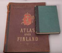
248475Helsingfors Aktiebolaget F. Tilgmanns Bok- och Stentryckeri 1899. Folio & stor 8vo. Atlas: 12 s. Kartene i farger nummerert 1-32b tekst. Illustrert. tabeller. Atlas i originalt dekorert helsjirtingbind med skinnrygg Ryggen slitt med tap av skinn ved øvre kapitél. tekstbd.: Samtidig skinnbind. Komplett. . unknown
187551587Montreal Toronto & London: George N. Tackabury Printed by the Burland-Desbarats Lithographic Co. 1875. Folio. 14.25 x 17.75 in. 251 1 pp. Colour lithograph illustrated title page showing the Parliament Building in Ottawa Canada from photograph by W. Notman 53 colour lithograph maps many double-page many tables. Publisher’s plum-coloured embossed cloth gilt decorative lettering on front cover marbled endpapers nicely rebacked in simulated black calf corners renewed some wear & rubbing to corners 1 leaf w/ repairs to creases minor tidemark to upper right corner not affecting maps still G copy. First edition of this fine atlas of Victorian-era Canada including maps of climatology possessions provinces prior to Alberta Saskatchewan & Newfoundland becoming provinces plat maps of counties Railways as well as maps of the United States and Europe. Of particular interest are the city maps of Quebec Ottawa London Hamilton Kingston Toronto and Montreal. This excellent reference work also provides a comprehensive list of railways in Canada steamships in use lists post offices railway stations cities and populations as well as business cards located by city and town. George N. Tackabury, [Printed by the Burland-Desbarats Lithographic Co.], hardcover
1979329295San Francisco: Griffin International 1979. Magazine. 48p. includes covers 8.5x11 inches entirely b&w color and sepia toned full-frontal nudes of men very good magazine in stapled pictorial wraps with light crease on cover. Ten sensual men from Griffin Int. Griffin International unknown
1991mon0000159718Avalon Hill 1991-01-01. Paperback. Acceptable. 0.1000 in x 11.0000 in x 8.4000 in. Some soiling and wear. Scarce. Avalon Hill paperback
1998Q-0195092236Oxford University Press 1998-03-26. Plastic Comb. New. New. In shrink wrap. Looks like an interesting title! Oxford University Press unknown
ANAIS-1596090405Chamberlain Bros. paperback. Good. 7.1x1.6x10.2. Buy with confidence. Excellent Customer Service & Return policy. Chamberlain Bros paperback
1596090405.Gpaperback. Good. Access codes and supplements are not guaranteed with used items. May be an ex-library book. paperback
1908276101The Twentieth Century Peerless Atlas. The Crowell Publishing Company 1908. Map. Sheet 13.5 x 21.7 inches with map 12 x 20 inches. Printed in black blue green yellow and pink. Western part of Texas on inset bottom right. Very good copy. Archival tape repair on verso to closed tear on left. Map previously folded. Map will be shipped folded.<br> The Twentieth Century Peerless Atlas. The Crowell Publishing Company unknown
46644Geographia Ltd. London. 1923. Cr 8vo 128pp. Red cloth boards in fair condition with a fraying worn spine with early hinging and the title embossed in black on the front board and spine text is in very good condition though with significant tanning of title page and endpapers and prior owner highlightings of certain destinations. In an age of GPS navigation perusing a gem like this early road atlas is a real journey back in time and a must for any tourist from this era. It even includes a perpetual lamplighting table in Great Britain relative to London. Geographia Ltd. London. 1923. hardcover
1805D19536Boston: J. T. Buckingham for Thomas & Andrews 1805. Hardcover. Good. Two volumes. A matched set: volume one is a fifth edition with old stamps and bookplates from Meadville Theological School; volume two is a fourth edition bookplate of Anne and Clarence Kilburn. Both in contemporary calf spine labels; volume two with front board detached. Engraved maps throughout. Contents with occasional spotting and toning a few of the maps with creases and short edge tears but quite respectable relative to other sets. <br/><br/> J. T. Buckingham, for Thomas & Andrews hardcover
066608016X.Ghardcover. Good. Access codes and supplements are not guaranteed with used items. May be an ex-library book. hardcover
0282567704.Gpaperback. Good. Access codes and supplements are not guaranteed with used items. May be an ex-library book. paperback
1830D19538Boston: Crocker & Brewster 1830. Hardcover. Very Good. Publisher's cloth boards gilt modern cloth over spine. 26 hand-colored engraved maps some folded. Contents lightly toned some offsetting as typical; generally speaking a nice copy. <br/><br/> Crocker & Brewster hardcover
199032897Knoxville TN U.S.A: Whittle Communications. As New. 1990. Hardcover. 0962474533 . FREE UPGRADE to Courier/Priority Shipping Upon Request - IN STOCK AND IMMEDIATELY AVAILABLE FOR SHIPMENT - TEXT PRISTINE & UNMARKED CRISP TIGHT TO THE SPINE - Discusses leading figures such as the late Allan Bloom. Educational values and standards vs. Test scores. 91pp. -- with a bonus offer-- . Whittle Communications hardcover
19762859.1973<p>1976 Institute of Mediaeval Music hardcover; no dust jacket; lightcover wear; pages clean/tight; good condition</p> Institute of Mediaeval Music hardcover
SKU05900Institute of Mediaeval Music. Very Good. Please note! this is a 2 vol set!!Vol 1 Commentary Vol 2 TranscriptionsNo DJ Previous Owner name inside Vol. 1 VG on both books Green cloth binding Free of any markings and no writing. For Additional Information or pictures Please Inquire. Institute of Mediaeval Music hardcover
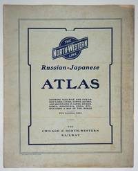
190427334Chicago: Rand McNally and Company; Chicago and North Western Railway Company 1904. First printing. Staplebound Wraps. Very good condition. Maps of the Russo-Japanese War five maps with a key printed in the margins comprised by the North-Western Line on inside front cover b&w World map; Asia; Eastern China; Japan and Korea all in color and 'the Only Double-Track Railway Between Chicago and the Missouri River and the Route of the Overland Limited' inside the back cover b&w. <br /> <br /> OCLC: 928938679 at Newberry Library Baskes Collection. Small folio printed paper wrappers grey covers with blue titles on front/back. Maps in color and b&w. Covers dusty slt. chip on foredge original folds. Rand McNally and Company; Chicago and North Western Railway Company unknown