D'Four, AtlasBiblio.com

990 résultats
1849440417.Gpaperback. Good. Access codes and supplements are not guaranteed with used items. May be an ex-library book. paperback
194764270Portland OR: Oregon Blue Print Co. 1947-1959. Oblong atlas folio. 21 x 17.5 in. 52 leaves not contiguously numbered. all dyazo-print whjteprint maps w/ first consisting of a large folding “Oswego Oregon Street Map†many leaves w/ creasing corners worn some with closed tears secured at gutter margin w/ 4 brass split-pins over thick brown paper stock still a VG- exemplar. First edition thus of this exceedingly rare realty atlas for Oswego Oregon chronicling its’ explosive growth following World War II prior to the consolidation with surrounding suburbs and renaming as the City of Lake Oswego in 1960. These real estate atlases were sold in installments to Lake Oswego & Portland area real estate agents land use boards and public institutions with installments appearing from 1947-1959 but the Oswego atlas sheets are far scarcer than even the very rare Portland issues. Oswego and surrounding suburbs such as Alto Park Acres Forest Hills Lake Grove Rainbow Terrace Uplands Crest and Woodmont were all developed initially by the Ladd Estate Company which first platted the area with Paul C. Murphy overseeing the design with the aid of of Frederick & John Olmsted to create a park like setting around the Lake. This atlas with key map opening details the evolution from 1947-1959 the street-by-street and plat-by-plat of the surrounding area providing essential information on the emergence of these suburbs from the original donation land claims as the city grew from about 1500 to over 10000 by 1959. The more than 100 new residential plats created from the original donation land claims throughout the Lake Oswego area including the plats on the south side of South Shore Drive which created the Palisades Neighborhood and just prior to the July 2 1959 annexation which brought all of Oswego Lake parts of Lake Grove Palisades and others in the Lake Grove Sanitary District all evolve through these maps. Researchers can trace the evolution of the Portland-Salem Expressway later called the Baldock Freeway and further developed into the I-5 corridor alongside Lake Oswego along with the rapid growth of the area. Original Donation Land Claims are clearly demarcated including those of Charles Brown Bryant Waters Carman Albert Durham and many others. Oregon Blue Print Co. was established on SE Hawthorne in Portland OR by the early 1940’s and were the printers for the Pittmon maps which were extensively used and continually updated in the Portland area. Under Walter & Min Underwood the company focused on blueprinting and engineering plans as well as land promotion brochures and street maps. Company still remains family owned. It appears that later versions of the Oswego Oregon Street Map were used as land promotion brochures and some early versions do survive in holdings of Lake Oswego City Government and 1 in OHS but no other examples are located in Worldcat. No similar versions of this atlas have survived in institutional holdings that this cataloguer could identify accurately. See: Mid-Century Lake Oswego: A Look at Lake Oswego’s Modern Developments 1935-1965 August 2010. Oregon Blue Print Co., hardcover
0578599368.Ghardcover. Good. Access codes and supplements are not guaranteed with used items. May be an ex-library book. hardcover
1922830191922. Ordnance Survey Southampton. 1922. Landscape 4to. Maroon cloth gilt to upper board. 24 linen-backed colour maps each measuring 75 x 35 cm. Extremities a llittle rubbed; a little mild soiling and some surface scratch marks to boards with discolouration to cloth at bottom edge of rear board; small white paint spots to spine. All maps clean and sound. hardcover
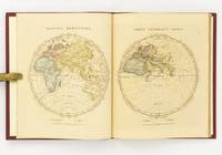
1828142642London: The Author 1828. First Edition. Hardcover. Very Good. London The Author 1828. Large quarto 358 × 295 mm vi pages engraved title dedication and index printed rectos only plus 53 extensively hand-coloured maps all printed recto or verso only with all but the last one - the Western Hemisphere - presented as facing pairs modern followed by ancient. Later quarter red morocco and cloth spine lettered in gilt; top corners slightly bumped; all edges speckled red; a few small inkspots to the top edge with minimal bleeding into a few top margins; all maps offset; blotted ink marks to the top corner of the map of 'Terra Sancta' map 20; trifling signs of age and use; overall in excellent condition. The extensive hand-colouring would appear to be the exception rather than the rule hand-coloured in outline only. The Author hardcover
182834844London Published by the Author 1828. Large 4to. 35x29 cm. Original worn hcalf part of back lacks. Orig. printed paperlabel with title on frontboard. Sewing loosening. Engraved title dedication-leaf a. Index-leaf. With 53 all engraved maps handcoloured in outline. Marginal tears to the 3 first leaves. 3 maps with marginal tears no loss. Some traces of use. Light scattered brownspotting. Maps loosening. Maps numb. 1-26 1-25 double-numb. unknown
BOOK_9781550092158New. unknown
SKU0609388Amer Society for Microbiology 2014-03-18. paperback. New. 6x0x9. New Textbook Ships with Tracking Amer Society for Microbiology paperback
Jul18-2nd1555818420-6974Amer Society for Microbiology 2014-03-18. Paperback. Good. 0x0x0. US Edition Textbook May Have Highlights Notes and/or Underlining BOOK ONLY-NO ACCESS CODE NO CD Ships with Emailed Tracking from USA Amer Society for Microbiology paperback
DADAX1555818420ASM Press 2014-03-18. 1. paperback. New. 6.90x0.80x9.90. Buy with confidence. Excellent Customer Service & Return policy. ASM Press paperback
2014x-1555818420Amer Society for Microbiology 2014. Paperback. New. 1st edition. 318 pages. 9.50x6.75x0.50 inches. Amer Society for Microbiology paperback
ria9781555818425_inpPaperback. New. New Book; Fast Shipping from UK; Not signed; Not First Edition; N/A paperback
20866364-nnew. unknown
20866364like new. unknown
A9781555818425Hardback. New. Written by scientists working in the field this book will provide a series of "stories" about how disruption of the environment and transmission from animal hosts is responsible for emerging human and animal diseases. hardcover
6100779230Taylor & Francis Group pp. 364 . Hardback. New. Taylor & Francis Group hardcover
195910437Cleveland OH: Bloch and Compant 1959. First edition. Hard Cover. Very Good mild ex-library. Folio pp 10 per volume. Full set consists of Set 1: North America feat. maps produced in 1757; Set II: South America feat. maps produces 1753-57; Set III: Mexico Central America and the West Indies feat. maps produced 1754-58; Set IV: Africa feat. maps produced 1738-46; and Set V: Asia feat maps produced 1748-52. In very good condition only minor library markings. This series is a good set of old reference maps from around the world. Bloch and Compant hardcover
19744463New York : Schram ; London : Prior 1974. 1974. 1st Edition 1st Printing. Hardcover. Very Good/Fine. 1st edition 1st printing ; 234 pp. ; illustrated ; ISBN:0839001304 ; LC: Z286.A55R67 ; Dewey: 658.809070573 ; LCCN: 74-8970 ; OCLC: 181818298 ; brown cloth with gold lettering in brown red and white pictorial dustjacket ; 12 pages of black an d white photographs with slight edge wear at gutters; slight foxing slight knock ; "From the Renaissance to a refugee-bookseller's Manhattan office to an old house in the Bronx the authors trace the engrossing and sometimes hilarious story of th e founding of the business and partnership of Leona Rostenberg Books that were to bring them lasting and fruitful associations with booksellers librarians and collectors throughout the world.The authors vividly convey the fascination of the search.from an entire library of Italian Renaissance books in a suburban house to single rarities or sleepers: modest calfbound volumes printed at clandestine subversive presses flimsy-looking pamphlets that once shook the world political manifestos reform and revolution psychiatry and modern science--a panorama of new ideas in dust-laden books published between 1500 and 1800." ; VG/VG <br/> <br/> New York : Schram ; London : Prior, 1974. hardcover
0843714700.Gpaperback. Good. Access codes and supplements are not guaranteed with used items. May be an ex-library book. paperback
0843709405.Gpaperback. Good. Access codes and supplements are not guaranteed with used items. May be an ex-library book. paperback
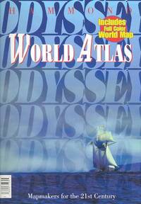
Q-0843714700Hammond World Atlas Corp. Paperback. New. New. In shrink wrap. Looks like an interesting title! Hammond World Atlas Corp paperback
187826194PARLORS OF THE ARLINGTON 1878. WOOLMAN AND ROSE ATLAS OF THE NEW JERSEY COAST. OCEAN GROVE: PARLORS OF THE ARLINGTON 1878. A hand-colored original 11.5-inch by 14-inch print showing the Parlors of the Arlington in Ocean Grove property of Charles E. Howland. $100.00. PARLORS OF THE ARLINGTON unknown
1878261001878. WOOLMAN AND ROSE ATLAS OF THE NEW JERSEY COAST. WEST CREEK CRANBERRY PLANTATION 1878. Print showing the Stafford Forge Cranberry Plantation West Creek Ocean County the property of Daniel R. Gowdy. Hand-colored. $100.00. unknown
178078258Bruxelles: Benoît Le Francq 1780. Full leather hardcover. xx240 pp. illustrated with a black-and-white frontispiece showing Atlas as a child holding up the celestial sphere and 24 old hand-colored folding maps/plates after G. Dellisle. Rare Brussels pocket atlas based on the 5th Amsterdam edition published by B. Vlam in the same year 1780. Includes B. Vlam's bookseller's list at the end. One map has a repaired taped tear and some maps have frayed edges. Bound in a leather cover with various damages. The book is complete and the maps remain visually attractive. Text in French / Français. See pictures. Benoît Le Francq hardcover
18-0524Germany: Justus Perthes 1870s - 1880s. 9 x 12 inches. Very Good. Some toning from age. Folded hand-colored map of Northwest Germany. Text in German. Germany: Justus Perthes, [1870s - 1880s?]. unknown