990 résultats
1865291807New York: J. H. Colton 1865. Second Edition. Colored engraved map with a bit of creasing at the fold. 11 3/4 x 9 1/2â€. From the second edition of Colton’s Condensed Octavo Atlas of the Union. J. H. Colton unknown
1865291848New York: J. H. Colton 1865. Second Edition. Colored engraved map with a bit of creasing at the fold. 11 3/4 x 9 1/2â€. From the second edition of Colton’s Condensed Octavo Atlas of the Union. J. H. Colton unknown
BN324088Transösophageale Echokardiographie monoplan/biplan: Atlas und Lehrbuch Hammentgen Ralf <br/><br/>Transösophageale Echokardiographie monoplan/biplan: Atlas und Lehrbuch Hammentgen Ralf Transösophageale Echokardiographie monoplan/biplan: Atlas und Lehrbuch Hammentgen Ralf unknown
0259365610.Gpaperback. Good. Access codes and supplements are not guaranteed with used items. May be an ex-library book. paperback
1334616574.Gpaperback. Good. Access codes and supplements are not guaranteed with used items. May be an ex-library book. paperback
1390507904.Gpaperback. Good. Access codes and supplements are not guaranteed with used items. May be an ex-library book. paperback
0573640386.Gpaperback. Good. Access codes and supplements are not guaranteed with used items. May be an ex-library book. paperback
1331519853.Gpaperback. Good. Access codes and supplements are not guaranteed with used items. May be an ex-library book. paperback
0332966828.Ghardcover. Good. Access codes and supplements are not guaranteed with used items. May be an ex-library book. hardcover
180756070Weimar Geographischen Institute 1807-13. Folio-oblong. Loose sheets in a box. Containg 128 engraved maps each measuring ca. 30 x 45 cm. Mostly clean and fine but some with annotations some with browning and some with traces of use. <br/><br/><em>Present are the following maps Sections: 3-12 17-24 29-36 42-48 53-60 64-66 71-74 80-81 86-90 97-98 103-108 114-126 135-142 151-159 167-173 180-186 193-197 204-208 216-219 227-231 239-243 and 248-254. </em> unknown
182054816Weimar 1820. Folio. Image of maps: ca. 35 x 44 cm. Paper size: ca. 46 x 56 cm. Engraved title with outline of the maps title-page in French numbered as Section I. Comprising the Sections I-XXXVI XXIX and XXXII with a and b all but the General map in 2 parts not present. Some maps with markings in red and blue. One with dampstain in lower margin a few with minor traces of use but all intact. In all 38 engraved sheets. unknown
DADAX1442204133Rowman & Littlefield Publishers 2014-06-10. Reprint. paperback. New. 6.06x0.83x8.91. Buy with confidence. Excellent Customer Service & Return policy. Rowman & Littlefield Publishers paperback
2014x-1442204133Rowman & Littlefield Pub Inc 2014. Paperback. New. reprint edition. 253 pages. 9.25x6.25x1.00 inches. Rowman & Littlefield Pub Inc paperback
B9781442204133Paperback / softback. New. paperback
34025As New. Hardcover. FREE UPGRADE to Courier/Priority Shipping Upon Request - IN STOCK AND IMMEDIATELY AVAILABLE FOR SHIPMENT - AS NEW THE TEXT BLOCK IS PRISTINE CLEAN UNMARKED AND IN EXCELLENT CONDITION - - Color Illustrated Maps & Flags. 192 pp Index. This book contains general reference maps physical maps economic maps with new maps of each state in the union on a large scale and in full detail. Nelson's Complete Encyclopedia Atlas Section Index of Continents Countries States Provinces and Dependencies. -- with a bonus offer-- . hardcover
19965575305Oxford Clarendon Press 1996. This is an ex-library book and may have the usual library/used-book markings inside.This book has hardback covers. In good all round condition. No dust jacket. Please note the Image in this listing is a stock photo and may not match the covers of the actual item600grams ISBN:0198165803 Oxford Clarendon Press hardcover
2001Q-076790690XClarkson Potter 2001-06-19. Paperback. New. In shrink wrap. Looks like an interesting title! Clarkson Potter paperback
2004Q-0767913965Clarkson Potter 2004-02-10. Paperback. New. In shrink wrap. Looks like an interesting title! Clarkson Potter paperback
318424Edinburgh: W. & A.K. Johnston nd. 24th Edition 240000th. With a tipped in 1842 Map of South America as Frontispiece. Folio. Bound in three quarters modern half brown mottled calf. Fine. 24th Edition 240000th. With a tipped in 1842 Map of South America as Frontispiece. Folio. W. & A.K. Johnston unknown
3912098085.Ghardcover. Good. Access codes and supplements are not guaranteed with used items. May be an ex-library book. hardcover
2011Q-0762440139Running Press Adult 2011-01-11. Paperback. New. In shrink wrap. Looks like an interesting title! Running Press Adult paperback
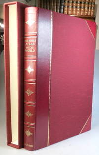
199937957London: Times Books; The Folio Society 1999. Limited edition no. 810 of 1000 copies folio 67 249 220 4 pp. 123 double page and one single page coloured map. Maroon half goatskin slipcase a couple of minor marks to the spine ends otherwise a lovely copy. (London: Times Books; The Folio Society unknown
1988199800Lond. John Bartholomew & Times Bks. 1988. Elephant folio. Or.bds. Dustjacket. xlvii123 colour plates 228pp. Index-gazatteer. Fine copy. A splendid reference atlas. Lond. John Bartholomew & Times Bks. unknown
1980122499New York: Times Books 1980. Hardcover. fine. Comprehensive edition. xl227pp. Folio. Illustrated with coloured maps and photos. Original black cloth with gilt lettering on front cover and spine in dust jacket. Fine condition. 1980 Times Books hardcover
Q-1435118170Unknown 1888-01-01. Hardcover. New. In shrink wrap. Looks like an interesting title! Unknown hardcover