990 résultats
104629Groningen Wolters Noordhoff. 1987. Original publisher's hardback pictorial covers 4to Vol. 1: West-Nederland: pictorial endpapers xvi 136pp. index. Vol. 2: Noord-Nederland: pictorial endpapers xvi 142pp. index. Vol. 3: Oost-Nederland: pictorial endpapers xvi 176pp. index. Vol. 4: Zuid-Nederland: pictorial endpapers xvi 176pp. index. Als new. Complete in 4 Volumes: 1: West-Nederland - 2: Noord-Nederland - 3: Oost-Nederland - 4: Zuid-Nederland. Groningen, Wolters Noordhoff. 1987 hardcover
1878293111878. WOOLMAN AND ROSE ATLAS OF THE NEW JERSEY COAST. GREAT EGG HARBOR 1878. A 14-inch by 22-inch map showing the Atlantic Ocean coastline from Great Egg Harbor south to the Townsend Inlet. $65.00. unknown
0843715588New. map. New. Satisfaction Guaranteed or your money back. unknown
0871319780New. New. Satisfaction Guaranteed or your money back. unknown
0871318539New. New. Satisfaction Guaranteed or your money back. unknown
2002Q-0871319780M. Evans & Company 2002-04-18. Paperback. New. In shrink wrap. Looks like an interesting title! M. Evans & Company paperback
1998Q-0871318539M. Evans and Company Inc 1998-04-28. Hardcover. New. New. In shrink wrap. Looks like an interesting title! M. Evans and Company, Inc hardcover
1998DADAX0871318539Brand: M. Evans n Company 1998-04-28. Revised Updated. hardcover. New. 7.82x1.11x9.54. Buy with confidence. Excellent Customer Service & Return policy. Brand: M. Evans n Company hardcover
WAL-M-5a-001928SELECOES READER S DIGEST. Used - Good. . . All orders guaranteed and ship within 24 hours. Your purchase supports More Than Words a nonprofit job training program for youth empowering youth to take charge of their lives by taking charge of a business. SELECOES READER S DIGEST unknown
20181038743921Mohawk Publishing 2018. Paperback. Good. Pages can have notes/highlighting. Spine may show signs of wear. ~ ThriftBooks: Read More Spend Less.Shelf and handling wear to cover and binding with general signs of previous use. Binding and pages are intact. All pages are clear from notations. Secure packaging for safe delivery.Dust jacket quality is not guaranteed. Mohawk Publishing paperback
1732475903.Gpaperback. Good. Access codes and supplements are not guaranteed with used items. May be an ex-library book. paperback
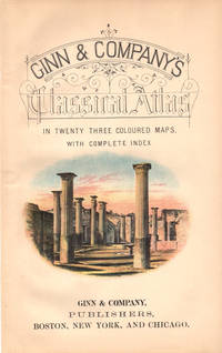
41183Boston New York & Chicago. Ginn & Company Publishers. 1886. 4to. 29cm colour vignette on title-page 23 double-page colour engraved maps 12 p. text 31 page index publisher's ads. on the front and rear endpapers original black stamped decorated green cloth with gilt Roman figure top and bottom spine edges worn internally sound and clean a very good to fine copy gar. ~ A new edition of "School and College Atlas of Ancient Geography" with cartography by Scottish geographer and cartographer Alexander Keith Johnston 1844-1879 and new preface text and orthography by Scottish geographer James Cranstoun. The maps were printed by W. & A.W. Johnston Edinburgh & London. Outstanding maps primarily of the Roman period named in Latin with scales in English and Roman. Includes: Imperium Romanum; Roma Vestus; Hispania; Gallia; Britannica; Germania; Macedonia; Italia Superior and Inferior; Graecia; Asia Minor; Syria et Palestina; Armenia; Persia et India: Egyptus; Africa. Boston, New York & Chicago. Ginn & Company, Publishers. [1886] unknown
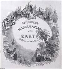
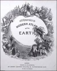
1840373394Henry George Collins London c.1840. Unframed Print. Very Good Condition. TITLE PAGE ONLY. Atlases of this era werent just functional they were status objects designed to project worldliness and imperial reach. The title page illustration operates like a microcosm of Victorian ideals: order exploration dominion and grandeur. Engraving 22 x 29 cms sheet 25 x 32 cms. This Title Page has no publisher's details at the foot. Category: PRINTS : Antiquarian Interest; PRINTS : Historic Interest; This item may require more postage than the rates shown for delivery outside the UK. If extra postage is required we will contact you before processing your order and you will be given the details and option to decline the extra cost. Henry George Collins unknown
1840373393Henry George Collins London c.1840. Unframed Print. Very Good Condition. TITLE PAGE ONLY. Atlases of this era werent just functional they were status objects designed to project worldliness and imperial reach. The title page illustration operates like a microcosm of Victorian ideals: order exploration dominion and grandeur. Engraving 22 x 29 cms sheet 25 x 32 cms. Category: PRINTS : Antiquarian Interest; PRINTS : Historic Interest; This item may require more postage than the rates shown for delivery outside the UK. If extra postage is required we will contact you before processing your order and you will be given the details and option to decline the extra cost. Henry George Collins unknown
0331324288.Gpaperback. Good. Access codes and supplements are not guaranteed with used items. May be an ex-library book. paperback
1527859061.Gpaperback. Good. Access codes and supplements are not guaranteed with used items. May be an ex-library book. paperback
170448770Amsterdam Franciscus Halma 1704. Folio. 455 x 29 cm. Contemp. full blindtooled Dutch vellum. Raised bands. Spine ends with tears some cracking along fronthinge but not loose. Vellum at frontcover a bit soiled. Egraved titlepage Coxis del. ianen fecit. Printed titlepage in red/black with an engraved vignette. 15119511 pp. 1 engraved plate with portrait and coat of arms. 4 large folded engraved maps. Light yellowing to margins of textleaves but maps and text fine and clean. 3 of the maps engraved by F. Halma. <br/><br/><em>The maps are the Francois Halma reissues of Sanson's maps from 1683. </em> hardcover
2n515Diàfora S.A. Barcelona 1974. 80 S. Pbd. quart Einband gering berieben. - Text spanisch - unknown
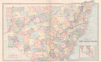
18875971887. Chromolithograph. 425mm by 645mm sheet. Detailed map of New South Wales. From 'Picturesque Atlas of Australasia'. <br /> Central vertical fold as issued. Key on reverse.A little light foxing. unknown
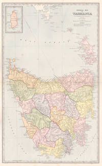
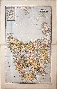
18875951887. Chromolithograph. 645mm by 425mm sheet. Detailed map of Tasmania with inset map of 'King Island'. From 'Picturesque Atlas of Australasia'. <br /> Central horizontal fold as issued. Key on reverse.A little light foxing. unknown
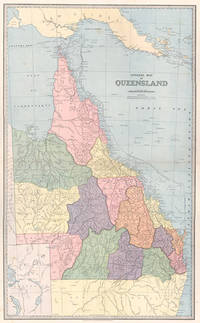
18875571887. Chromolithograph. 610mm by 370mm image. Detailed map of Queensland with counties marked in colours. <br /> From 'Picturesque Atlas of Australasia'. Central horizontal fold as issued. Index on reverse. unknown
188861874Sydney.: The Picturesque Atlas Publishing Company. 1888. A large and detailed map of Tasmania from The Picturesque Atlas Publishing Company showing railroads existing as well as under construction and coloured regions dividing the island into districts. Hachures depict landforms detailed index to place names on verso small inset upper left corner showing Kind Island printed colour 70 x 45.5 cm. . The Picturesque Atlas Publishing Company. unknown
9786559773404-11-101148Atlas. New. Atlas unknown
9401184003.Gpaperback. Good. Access codes and supplements are not guaranteed with used items. May be an ex-library book. paperback
1964210303The Hague: Martinus Nijhoff 1964. Hardcover. Faint stains to the foredge else very good plus condition with text clean & binding sound / very good lightly chipped dust jacket which is now in a clear protective mylar sleeve. 335pp. Martinus Nijhoff hardcover