990 résultats
187354200Chicago IL: Warner & Beers 62 & 64 Lake Street 1873. Atlas folio. 16 x 18.7 in. 3 3 5-91 1 pp. Woodcut-engraved title page 42 hand-coloured steel-engraved maps all w/ nicely executed engraved borders couple double-page additional steel-engraved “Family Records†page filled-out in manuscript inserted. Original front panel stamped in decorative gilt lettering mounted on recent black cloth binding occasional edgewear minor soiling to fore-edges of textblock couple very minor closed tears still VG copy from the library of John Inkster 1828-1908 Scottish-American farmer who immigrated in 1860 to Pilot Township Kankakee IL to farm with his brother James and then continued West to farm in Coast Fork Lane Co. Oregon and finally the Washington Territory in 1881 where he homesteaded near Davenport WT assisted in building Fort Spokane and served as County Commissioner from 1886-1892. First edition of this exceedingly scarce Illinois Atlas published just after the great Chicago Fire of 1871 featuring an unrecorded platt map of Pilot Township in Kankakee County Illinois showing all the properties and property owners in 1872. This atlas also features the Railway map of Illinois City Map of Chicago maps of all the Illinois Counties and large map of the United States. Of special interest are the excellent early western maps of Texas; Minnesota Nebraska and the Dakota Territory; Wyoming Montana and Idaho Territories; Nevada and California along with map of Oregon and Washington and Alaska Territories. The Beers and Warners were successful map publishers in Chicago IL from about 1850 to 1886 and often publishing as Warner & Beers the cartographers produced a series of early state and county atlases and regional maps which were considered the most detailed maps produced at the time of the respective regions. As their Township and County maps often detailed individual homes and landowners they provide invaluable reference tools to researchers historians and genealogists. No copies located of this specific Warner & Beers Atlas in Worldcat; No individual copies located of the Pilot Township Map; See: Portrait & Biographical Record of Kankakee County Illinois 1893 pp. 390-391; An Illustrated History of the Big Bend Country embracing Lincoln Douglas Adams & Franklin Counties 1904 pp. 421-425. Warner & Beers, 62 & 64 Lake Street, hardcover
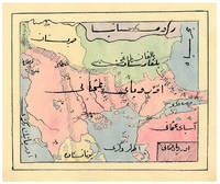
1910ABC_47241Ottoman Empire 1910. Gold-stamped cloth with the tughra of Mehmed V ruled 1908-18 on the front board when reading right to left and "Album" on the back board the front when reading left to right with an inscription below the tughra and the European numerals 16 and 2 flanking an ornament below the inscription the whole framed by 4 large floral cornerpieces. Oblong 4to 26.5 x 19.5 cm. 14 leaves with 10 pen-and-ink maps hand coloured with watercolours. Tissue guards. An album of hand-drawn maps forming an atlas of the western mostly European parts of the Ottoman Empire with legends in Ottoman Turkish written in the Arabic script. The overview map shows Albania Kosovo Macedonia and the Ottoman controlled northern parts of Greece coloured together with Thrace and the northwest parts of Anatolia shown treating them as a single unit while Serbia and Bulgaria like the small parts of territories outside Ottoman control are coloured separately. Most of the other maps give more detailed views of some of these regions including the Bosporus the Dardanelles Halkidiki Chalcidice Albania etc. but there is also a map of Crete not in the overview map.In fine condition. hardcover
0843711809.Ghardcover. Good. Access codes and supplements are not guaranteed with used items. May be an ex-library book. hardcover
GOR013803725Paperback. Very Good. paperback
0843711809New. hardcover. New. Satisfaction Guaranteed or your money back. hardcover
95253701Beijing 1980 Science Press. Tan boards very good 174p. 286 color photos 56 maps 2 ep maps pictorial d.j. SUBTITLE: cont. Academy of Sciences. A positively fascinating compilation of paleoanthropological research in China detailing the human fossils & paleolithic stone artifacts discovered in China over a 50-year period. Includes photos and discussion of human and animal fossils stone artifacts bone implements ornaments and traces of the use of fire. The maps show the distribution of major sites of various fossil and artifact findings paintings that depict the life and work of primitive man give the reader a fuller sense of the society and environment of an- cient cultures. unknown
0471874345.Gpaperback. Good. Access codes and supplements are not guaranteed with used items. May be an ex-library book. paperback
196643325Standard Atlas Co. Very Good. 1966. Spiral bound. Brown stiff covers rubbed with moderate edge wear first few pages only have thin dampstain lower edge does not impact maps or text. Township maps show landowners with index of rural residents alphabetical directory listing family members occupation plus church histories numerous historical photographs. ; MCN35682; Folio 13" - 23" tall . Standard Atlas Co. unknown
1977324203Title Atlas Company 1977. Trade Paperback -- Spiral Bound -- Folio - over 12" - 15" tall -- Very Good -- Clean and tight with only lightest of wear. Containing Maps Plats of the Townships Rural Directory Pictures of Farms and Families Articles about History Etc. Trade Paperback. Very Good. Folio - over 12" - 15" tall. Title Atlas Company Paperback
3030919935-VGUsed - Very Good. Very Good Condition! Crisp copy with a sturdy binding and light shelf wear. May have minimal notes or highlighting. Very Good Condition! Crisp copy with a sturdy binding and light shelf wear. May have minimal notes or highlighting. unknown
3030919935-GUsed - Good. A Good Used Book has a good binding with some shelf wear. May have minimal notes or highlighting. A Good Used Book has a good binding with some shelf wear. May have minimal notes or highlighting. unknown
1899867341899. ATLAS. ATLAS OF DORCHESTER WEST ROXBURY AND BRIGHTON CITY OF BOSTON in one volume. Boston: L. J. Richards 1899. Folio. 22" Street index plus 40 double page maps measuring 32" x 22". Bound in 1/2 leather which is largely absent. Front board is detached. Interiors are clean and free from staining with the exception of some light red or graphite pencil annotations on a few plates and soiled end-papers. Plates with pencil annotations: 28 29 30 37 39. Maps printed in as many as seven colors. A good copy. unknown
196539365Title Atlas Co. Very Good. 1965. 1st Edition. Spiral bound. Stiff card covers show mild wear a bit of marginalia. Approximately 100 pages total. Township maps show landowners directory includes names of spouse and children occupations etc. illustrated with numerous photographs.; MCN32439; Folio 13" - 23" tall . Title Atlas Co. unknown
187961342Chicago: J.H. Beers & Co. Publishers Lakeside Building Cr. of Clarks & Adams 1879. Atlas folio. 15 x 17.5 in. 82 pp fairly continuous pagination including maps & lithographs. With 39 hand-coloured lithographed maps several double-page Indiana United States World Columbus Township Columbus Plat Sand Creek & Wayne numerous lithographed plates some large double-page tables charts. Quarter-sheep over black embossed publisher’s cloth gilt lettering stamped on front cover borders embossed in blind wear & bumping to corners some chipping head & foot of spine some wear to fore-edges somewhat shaken still a G copy. First edition of this uncommon original 19th-Century plat map atlas for Bartholomew County Indiana during the Gilded Age. J.H. Beers specialized in County Plat Map atlases and histories from 1878-1900 and also focused on producing municipal history and biographical history titles primarily in and around the Midwest. Their well-executed lithograph birds-eye views of businesses towns family farms and more were quite popular were generally pre-sold through subscription and prosperous towns businesses and farms who paid extra were able to secure a biographical section or view within the volumes. Bartholomew County located about 40 miles south of Indianapolis was originally established in 1821 and named for Lt. Col. Joseph Bartholomew a militia officer wounded at the battle of Tippecanoe. The County featured such companies as the Reeves Pulley Co. Ceraline Manufacturing Orinoco Furniture and others in the 19th Century and as of this publication the population was about 30000 inhabitants and today the County features approximately 82000 inhabitants. The atlas was later reprinted in 1969 1979 and 1986 in very poor smaller reproductions. J.H. Beers & Co., Publishers, Lakeside Building Cr. of Clarks & Adams, hardcover
DA02C-03006hf ULLMANN. Collectible - Good. Collectible - Good. Good dust jacket. Human Anatomy Human Body NOT AVAILABLE FOR SHIPMENT OUTSIDE OF THE UNITED STATES. hf ULLMANN unknown
1523501561.Gcalendar. Good. Access codes and supplements are not guaranteed with used items. May be an ex-library book. unknown
2024416877Workman Publishing Company 2024. Hardcover. A new copy.<br> <br> <p>From the bestselling authors of Atlas Obscura and Gastro Obscura comes a nature book like no other--a dazzling over-the-top collection of the world's most extraordinary wild species that takes you to all seven continents and beyond. It's more than a field guide-it's an adventure. National Bestseller Named a Best New Book by BookRiot New York Post and more Named a Best White Elephant Gift Under $30 by Taste of Home. <p/> From the curious minds of Atlas Obscura authors of #1 New York Times bestselling Atlas Obscura and Gastro Obscura comes an unputdownable celebration of the world's living wonders. </p> Learn how dung beetles navigate by the stars and trees communicate through their roots. Meet one of the strongest animals in the world: the puny peacock mantis shrimp. Pay your respects to a 44000 year old shrub float along flying rivers and explore a garbage dump overseen by endangered storks. Examine old examples of bird song notation written on sheet music. Also first person interviews: hear from a honey hunter and his avian partners a scientist working to find the world's only ocean-dwelling insects and an offshore radio DJ who is at the heart of the local fishing community. <p> Featuring over 500 extraordinary plants animals and natural phenomena with illustrations and photos on every page the book takes readers around the globe--from Antarctic deserts to lush jungles and into the deepest fathoms of the ocean and the hearts of our densest cities. Teeming with detail and wildly entertaining Wild Life reinvigorates our sense of wonder awe and amazement about the incredible creatures we share our planet with. </p> Workman Publishing Company hardcover
2024SKU1728234Workman Publishing Company 2024-09-17. hardcover. New. 7x1x10. New Book Ships with Tracking Workman Publishing Company hardcover
2024SKU1733645Workman Publishing Company 2024-09-17. hardcover. New. 7x1x10. New Textbook Ships with Tracking Workman Publishing Company hardcover
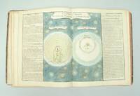
176130654Paris l'Auteur & Desnos vol. I Chec l'Auteur vols. 2-3 1761-62. Folio. 34x285 cm. 3 cont. hcalf. Backs worn tears to spine ends hinges weakening corners bumped. Vol.I: 57 double-folio leaves all engraved including engraved ornamental title in rococo-style leaves numb. 1-57. - Vol. II: 70 double-folio leaves all engraved including double-page engraved title different from the title in vol. 1 Table des Matieres. - Vol. III: 60 double-folio leaves all engraved including double-page engraved title the same as in vol. II Table des Matieres numb. 71-130. With in all 119 handcoloured engraved maps and astronomical plates. Further 68 other plates with tables text etc. All maps and illustrations having engraved text on both sides. On good thick paper. A few brownspots some dampstains mainly marginal 2 plates with small tears no loss. <br/><br/><em>First edition of this atlas which could be called an Atlas-series as the different parts were sold separately. The first volume having its own title deals with the historical development of cosmography geology astronomy oceanography winds streams etc. and illustrates this in a series of impressive pictures with globes spheres continents world-systems etc. having many maps of the continents globe-projections etc. - Volumes 2-3 deal mainly with historical geography and mapping having 84 handcoloured maps. Another volume which is not present here deals with contemporary geography. A fifth volume was announced but is unknown to the bibliographies. Phillips No. 628. - Shirley: T-buy 1a-2a. </em> unknown
0007144989.Ghardcover. Good. Access codes and supplements are not guaranteed with used items. May be an ex-library book. hardcover
BN168199Fischer. Atlas mobiler Langzeit- EEG- Ableitungen. Atlas of Mobile Long- Term EEG Recordings Hardcover <br/><br/>Atlas mobiler Langzeit- EEG- Ableitungen. Atlas of Mobile Long- Term EEG Recordings Hardcover Atlas mobiler Langzeit- EEG- Ableitungen. Atlas of Mobile Long- Term EEG Recordings Hardcover Fischer hardcover
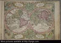
174420097Augsburg Augustæ Vind 1744. 4to-oblong. Cont. hcalf. Back and covers somewhat worn. Platesizes ca. 205 x 27 cm. 32 pp. and 60 full-page engraved maps of 64 listed. Lacking the engraved title and 5 other maps Africa America septentrionalis Regum Portugalliæ Regnum Hispaniæ Italia totur and Palæstina but having 2 more not listed and some in the German section does not corresponds with the maps listed in the index. All maps in original handcolouring occasionally a little brownspotted and traces of use in lower right corners. One map have a little loss of image in lower middle Austria Saliburgensis. <br/><br/><em>Phillips No 3494. 2 maps relating to America Globus Terrestris World Map and America Meridionalis. Having maps of Europe Asia Russia Turkey Scandinavia etc. The World Map engraved by Andr. Silbereisen and most of the other maps engraved by A.C. Seutter and Tobias C. Lotter married to Seutters daughter and his successor. </em> unknown
BN66092Atlas metamorpher Gesteine und ihrer Gefüge in Dünnschliffen Hardcover <br/><br/> hardcover
BN66750Atlas Major Van Der Krogt Peter <br/><br/> unknown