[Maine]Biblio.com
4 996 résultats
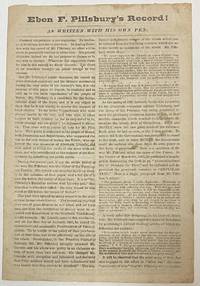
186634393Augusta 1866. 4 pp. Folded. Caption title as issued. Printed in two columns per page. Lightly foxed and worn Good.<br /> <br /> Pillsbury the Democrats' candidate for Governor of Maine had been editor of the Farmington Patriot during the Civil War. His editorial comments-- expressing "disloyal sentiments during the very crisis of his country's fate"-- disqualify him from public office. Pillsbury "charged Mr. Lincoln with deception and falsehood" called the draft unconstitutional and otherwise "encouraged the hosts of Rebeldom."<br /> Pillsbury's opponent Joshua Lawrence Chamberlain was meanwhile in the thick of the most crucial battles of the War. His record is "WRITTEN WITH HIS OWN SWORD." "Voters of Maine!! Read them both and choose between them on the 14th of September.!" <br /> Not located on OCLC as of August 2021 or the online sites of Harvard or Bowdoin. unknown
5335Laval, 1837 in-8, 117 pp., broché.
219961Laval, J. Feillé-Grandpré, 1843 in-8, 446 pp., 2 planches dont une repliée, cartonnage demi-percaline rouille (reliure de l'époque). Reliure modeste.
192041275Washington D.C.: Published by the United States Coast and Geodetic Survey 1920. Large folding nautical chart printed on heavy paper stock. Uncolored. A rare original coastal survey of the Fox Islands including Vinalhaven and North Haven.<br/> <br/> Established by President Thomas Jefferson in 1807 as the Survey of the Coast the U.S. Coast and Geodetic Survey was the United States' first civilian scientific agency. This agency has followed its mission to survey the U.S. coastline create nautical charts of the coast and help increase maritime safety since its founding and has often played fascinating roles in significant chapters of U.S. history. It served in all theaters of the Civil War in the service of the Union Army and Navy pioneered acoustic exploration in the wake of the sinking of the Titanic and during WWI it worked to detect enemy submarines. In addition this agency worked to survey and produce detailed maps and renderings of the U.S. coast. These nautical survey maps commonly referred to as "T-sheets" provide fascinating insights into the history of the United States coastline which has and will continue to shift. These maps are the most important data source for understanding the physical and ecological characteristics of the U.S. shoreline. The present map is a highly detailed and accurate sea chart of the Fox Islands and an important historical view of developing Maine. Published by the United States Coast and Geodetic Survey unknown
192041268Washington D.C.: Published by the United States Coast and Geodetic Survey 1920. Large folding nautical chart printed on heavy paper stock. Colored. A rare original coastal survey of Frenchman Bay including Acadia National Park Bar Harbor Lamoine Hancock Sullivan.<br/> <br/> Established by President Thomas Jefferson in 1807 as the Survey of the Coast the U.S. Coast and Geodetic Survey was the United States' first civilian scientific agency. This agency has followed its mission to survey the U.S. coastline create nautical charts of the coast and help increase maritime safety since its founding and has often played fascinating roles in significant chapters of U.S. history. It served in all theaters of the Civil War in the service of the Union Army and Navy pioneered acoustic exploration in the wake of the sinking of the Titanic and during WWI it worked to detect enemy submarines. In addition this agency worked to survey and produce detailed maps and renderings of the U.S. coast. These nautical survey maps commonly referred to as "T-sheets" provide fascinating insights into the history of the United States coastline which has and will continue to shift. These maps are the most important data source for understanding the physical and ecological characteristics of the U.S. shoreline. The present map is a highly detailed and accurate sea chart of Frenchman Bay and an important historical view of developing Maine. Published by the United States Coast and Geodetic Survey unknown
192041296Washington D.C.: Published by the United States Coast and Geodetic Survey 1920. Nautical chart printed on heavy paper stock. Uncolored. A rare original coastal survey of Maine including Camden and Rockport.<br/> <br/> Established by President Thomas Jefferson in 1807 as the Survey of the Coast the U.S. Coast and Geodetic Survey was the United States' first civilian scientific agency. This agency has followed its mission to survey the U.S. coastline create nautical charts of the coast and help increase maritime safety since its founding and has often played fascinating roles in significant chapters of U.S. history. It served in all theaters of the Civil War in the service of the Union Army and Navy pioneered acoustic exploration in the wake of the sinking of the Titanic and during WWI it worked to detect enemy submarines. In addition this agency worked to survey and produce detailed maps and renderings of the U.S. coast. These nautical survey maps commonly referred to as "T-sheets" provide fascinating insights into the history of the United States coastline which has and will continue to shift. These maps are the most important data source for understanding the physical and ecological characteristics of the U.S. shoreline. The present map is a highly detailed and accurate sea chart of the harbors of Camden and Rockport and an important historical view of developing Maine. Published by the United States Coast and Geodetic Survey unknown
192041284Washington D.C.: Published by the United States Coast and Geodetic Survey 1920. Large folding nautical chart printed on heavy paper stock. Colored. A rare original coastal survey of the Kennebec and Sheepscot Rivers including Bath Georgetown Boothbay and Wiscasset.<br/> <br/> Established by President Thomas Jefferson in 1807 as the Survey of the Coast the U.S. Coast and Geodetic Survey was the United States' first civilian scientific agency. This agency has followed its mission to survey the U.S. coastline create nautical charts of the coast and help increase maritime safety since its founding and has often played fascinating roles in significant chapters of U.S. history. It served in all theaters of the Civil War in the service of the Union Army and Navy pioneered acoustic exploration in the wake of the sinking of the Titanic and during WWI it worked to detect enemy submarines. In addition this agency worked to survey and produce detailed maps and renderings of the U.S. coast. These nautical survey maps commonly referred to as "T-sheets" provide fascinating insights into the history of the United States coastline which has and will continue to shift. These maps are the most important data source for understanding the physical and ecological characteristics of the U.S. shoreline. The present map is a highly detailed and accurate sea chart of the Kennebec and Sheepscot Rivers and an important historical view of developing Maine. Published by the United States Coast and Geodetic Survey unknown
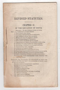
184238794Augusta: William R. Smith & Co. printers 1842. First edition. Stitched paper wrappers. Lacking the wrappers and title page else very good scattered foxing. 27 1 pp. 8vo. Attested to by Philip C. Johnson Secretary of State on May 3 1842. Includes Article I: Of the General Duties of the Towns; Article II: Of the Powers and Obligations of School Districts and the Assessments and Collection of Moneys Raised by such Districts; Article III: Of the Duties and Powers of the Superintending School Committees and School Agents and the Qualifications and Duties of Instructors; Article IV: Special Provisions Relating to the Regulations and Endowment of Schools and Affecting the Government and Discipline of Literary Institutions.<br /> <br /> Very rare. OCLC locates one copy: Trinity College. Sabin and American Imprints report a copy at the Boston Public Library but not found on their online catalogue. The printed version of Sabin lists this item as 43959 but the online version compiled by Gale assigns this number incorrectly to an 1826 version of 11 pages. American Imprints 423157. Sabin 43959. [William R. Smith & Co., printers] unknown
192041272Washington D.C.: Published by the United States Coast and Geodetic Survey 1920. Large folding nautical chart printed on heavy paper stock. Uncolored. A rare original coastal survey of Maine from Little River to Petit Manan including Milbridge Addison Great Wass Island Preserve Jonesport Machias and an inset map of Moose-a-Bec Bar and Pig Island in top left corner.<br/> <br/> Established by President Thomas Jefferson in 1807 as the Survey of the Coast the U.S. Coast and Geodetic Survey was the United States' first civilian scientific agency. This agency has followed its mission to survey the U.S. coastline create nautical charts of the coast and help increase maritime safety since its founding and has often played fascinating roles in significant chapters of U.S. history. It served in all theaters of the Civil War in the service of the Union Army and Navy pioneered acoustic exploration in the wake of the sinking of the Titanic and during WWI it worked to detect enemy submarines. In addition this agency worked to survey and produce detailed maps and renderings of the U.S. coast. These nautical survey maps commonly referred to as "T-sheets" provide fascinating insights into the history of the United States coastline which has and will continue to shift. These maps are the most important data source for understanding the physical and ecological characteristics of the U.S. shoreline. The present map is a highly detailed and accurate sea chart of coastal Maine and an important historical view of the developing state. Published by the United States Coast and Geodetic Survey unknown
192941282Washington D.C.: Published by the United States Coast and Geodetic Survey 1929. Large folding nautical chart printed on heavy paper stock. Colored. A rare original coastal survey of Maine from Monhegan Island to Cape Elizabeth including Bristol Damariscotta Wiscasset Boothbay Georgetown Harpswell Bath Brunswick Freeport Yarmouth and Portland.<br/> <br/> Established by President Thomas Jefferson in 1807 as the Survey of the Coast the U.S. Coast and Geodetic Survey was the United States' first civilian scientific agency. This agency has followed its mission to survey the U.S. coastline create nautical charts of the coast and help increase maritime safety since its founding and has often played fascinating roles in significant chapters of U.S. history. It served in all theaters of the Civil War in the service of the Union Army and Navy pioneered acoustic exploration in the wake of the sinking of the Titanic and during WWI it worked to detect enemy submarines. In addition this agency worked to survey and produce detailed maps and renderings of the U.S. coast. These nautical survey maps commonly referred to as "T-sheets" provide fascinating insights into the history of the United States coastline which has and will continue to shift. These maps are the most important data source for understanding the physical and ecological characteristics of the U.S. shoreline. The present map is a highly detailed and accurate sea chart of coastal Maine around Portland and an important historical view of the developing state. Published by the United States Coast and Geodetic Survey unknown
192041269Washington D.C.: Published by the United States Coast and Geodetic Survey 1920. Large folding nautical chart printed on heavy paper stock. Colored. A rare original coastal survey of Maine from Nash Island to Schoodic Island including Gouldsboro Prospect Harbor Steuben Milbridge Cherryfield Addison and Harrington.<br/> <br/> Established by President Thomas Jefferson in 1807 as the Survey of the Coast the U.S. Coast and Geodetic Survey was the United States' first civilian scientific agency. This agency has followed its mission to survey the U.S. coastline create nautical charts of the coast and help increase maritime safety since its founding and has often played fascinating roles in significant chapters of U.S. history. It served in all theaters of the Civil War in the service of the Union Army and Navy pioneered acoustic exploration in the wake of the sinking of the Titanic and during WWI it worked to detect enemy submarines. In addition this agency worked to survey and produce detailed maps and renderings of the U.S. coast. These nautical survey maps commonly referred to as "T-sheets" provide fascinating insights into the history of the United States coastline which has and will continue to shift. These maps are the most important data source for understanding the physical and ecological characteristics of the U.S. shoreline. The present map is a highly detailed and accurate sea chart of coastal Maine and an important historical view of the developing state. Published by the United States Coast and Geodetic Survey unknown
192041271Washington D.C.: Published by the United States Coast and Geodetic Survey 1920. Large folding nautical chart printed on heavy paper stock. Colored. A rare original coastal survey of Penobscot Bay including Belfast Isleboro Deer Isle Stonington North Haven Vinalhaven Rockland Camden and Rockport.<br/> <br/> Established by President Thomas Jefferson in 1807 as the Survey of the Coast the U.S. Coast and Geodetic Survey was the United States' first civilian scientific agency. This agency has followed its mission to survey the U.S. coastline create nautical charts of the coast and help increase maritime safety since its founding and has often played fascinating roles in significant chapters of U.S. history. It served in all theaters of the Civil War in the service of the Union Army and Navy pioneered acoustic exploration in the wake of the sinking of the Titanic and during WWI it worked to detect enemy submarines. In addition this agency worked to survey and produce detailed maps and renderings of the U.S. coast. These nautical survey maps commonly referred to as "T-sheets" provide fascinating insights into the history of the United States coastline which has and will continue to shift. These maps are the most important data source for understanding the physical and ecological characteristics of the U.S. shoreline. The present map is a highly detailed and accurate sea chart of Penobscot Bay and an important historical view of developing Maine. Published by the United States Coast and Geodetic Survey unknown
192041290Washington D.C.: Published by the United States Coast and Geodetic Survey 1920. Large folding nautical chart printed on heavy paper stock. Colored. A rare original coastal survey of Portland Harbor including Cape Elizabeth Westbrook and Portland.<br/> <br/> Established by President Thomas Jefferson in 1807 as the Survey of the Coast the U.S. Coast and Geodetic Survey was the United States' first civilian scientific agency. This agency has followed its mission to survey the U.S. coastline create nautical charts of the coast and help increase maritime safety since its founding and has often played fascinating roles in significant chapters of U.S. history. It served in all theaters of the Civil War in the service of the Union Army and Navy pioneered acoustic exploration in the wake of the sinking of the Titanic and during WWI it worked to detect enemy submarines. In addition this agency worked to survey and produce detailed maps and renderings of the U.S. coast. These nautical survey maps commonly referred to as "T-sheets" provide fascinating insights into the history of the United States coastline which has and will continue to shift. These maps are the most important data source for understanding the physical and ecological characteristics of the U.S. shoreline. The present map is a highly detailed and accurate sea chart of Portland Harbor and an important historical view of developing Maine. Published by the United States Coast and Geodetic Survey unknown
192141280Washington D.C.: Published by the United States Coast and Geodetic Survey 1921. Large folding nautical chart printed on heavy paper stock. Colored. A rare original coastal survey of Maine from Petit Manan to Quoddy Roads including Harrington Addison Jonesport and Machias.<br/> <br/> Established by President Thomas Jefferson in 1807 as the Survey of the Coast the U.S. Coast and Geodetic Survey was the United States' first civilian scientific agency. This agency has followed its mission to survey the U.S. coastline create nautical charts of the coast and help increase maritime safety since its founding and has often played fascinating roles in significant chapters of U.S. history. It served in all theaters of the Civil War in the service of the Union Army and Navy pioneered acoustic exploration in the wake of the sinking of the Titanic and during WWI it worked to detect enemy submarines. In addition this agency worked to survey and produce detailed maps and renderings of the U.S. coast. These nautical survey maps commonly referred to as "T-sheets" provide fascinating insights into the history of the United States coastline which has and will continue to shift. These maps are the most important data source for understanding the physical and ecological characteristics of the U.S. shoreline. The present map is a highly detailed and accurate sea chart of coastal Maine from Quoddy Roads to Petit Manan and an important historical view of the developing state. Published by the United States Coast and Geodetic Survey unknown
192041292Washington D.C.: Published by the United States Coast and Geodetic Survey 1920. Nautical chart printed on heavy paper stock. Uncolored. A rare original coastal survey of Richmond Island Harbor including Cape Elizabeth and Richmond Island.<br/> <br/> Established by President Thomas Jefferson in 1807 as the Survey of the Coast the U.S. Coast and Geodetic Survey was the United States' first civilian scientific agency. This agency has followed its mission to survey the U.S. coastline create nautical charts of the coast and help increase maritime safety since its founding and has often played fascinating roles in significant chapters of U.S. history. It served in all theaters of the Civil War in the service of the Union Army and Navy pioneered acoustic exploration in the wake of the sinking of the Titanic and during WWI it worked to detect enemy submarines. In addition this agency worked to survey and produce detailed maps and renderings of the U.S. coast. These nautical survey maps commonly referred to as "T-sheets" provide fascinating insights into the history of the United States coastline which has and will continue to shift. These maps are the most important data source for understanding the physical and ecological characteristics of the U.S. shoreline. The present map is a highly detailed and accurate sea chart of Richmond Island Harbor and an important historical view of developing Maine. Published by the United States Coast and Geodetic Survey unknown
192041285Washington D.C.: Published by the United States Coast and Geodetic Survey 1920. Nautical chart printed on heavy paper stock. Uncolored. A rare original coastal survey of Rockland Harbor Maine.<br/> <br/> Established by President Thomas Jefferson in 1807 as the Survey of the Coast the U.S. Coast and Geodetic Survey was the United States' first civilian scientific agency. This agency has followed its mission to survey the U.S. coastline create nautical charts of the coast and help increase maritime safety since its founding and has often played fascinating roles in significant chapters of U.S. history. It served in all theaters of the Civil War in the service of the Union Army and Navy pioneered acoustic exploration in the wake of the sinking of the Titanic and during WWI it worked to detect enemy submarines. In addition this agency worked to survey and produce detailed maps and renderings of the U.S. coast. These nautical survey maps commonly referred to as "T-sheets" provide fascinating insights into the history of the United States coastline which has and will continue to shift. These maps are the most important data source for understanding the physical and ecological characteristics of the U.S. shoreline. The present map is a highly detailed and accurate sea chart of Rockland Harbor and an important historical view of developing Maine. Published by the United States Coast and Geodetic Survey unknown
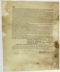
182634420Maine 1826. Folio sheet folded to 8" x 9-1/2". One printed page followed by three blanks. Addressed on final blank with folds for mailing and remnant of wax seal to William Thomas of Gorham Maine. Spotted Good or so.<br /> <br /> The document is signed in type at the end by Committee Members Daniel Gilbert Thomas Browne and Ethan Earle. It is dated in ink "Sept. 5th 1826." The Committee urges Maine "to send forth from our state an unequivocal voice in favor of the Head of the National Government" by voting for Adams supporters Enoch Lincoln Governor Stephen Longfellow Congress and other members of the State ticket.<br /> Allusions to the bitter 1824 presidential contest are numerous; the wounds inflicted by that campaign are obviously still open: "We have placed the man of our choice at the head of our government." If "we abandon him to the rude tempest of a bitter opposition how shall we answer it to our consciences and our country. What then has the President done that we should leave him to his enemies. We do not profess one thing and intend another-- we do not cry 'Adams' but mean 'Crawford'." <br /> Not located on OCLC as of November 2017. unknown
192041279Washington D.C.: Published by the United States Coast and Geodetic Survey 1920. Large folding nautical chart printed on heavy paper stock. Colored. A rare original coastal survey of St. George River and the Muscle Ridge Channel including Thomaston Cushing and St. George.<br/> <br/> Established by President Thomas Jefferson in 1807 as the Survey of the Coast the U.S. Coast and Geodetic Survey was the United States' first civilian scientific agency. This agency has followed its mission to survey the U.S. coastline create nautical charts of the coast and help increase maritime safety since its founding and has often played fascinating roles in significant chapters of U.S. history. It served in all theaters of the Civil War in the service of the Union Army and Navy pioneered acoustic exploration in the wake of the sinking of the Titanic and during WWI it worked to detect enemy submarines. In addition this agency worked to survey and produce detailed maps and renderings of the U.S. coast. These nautical survey maps commonly referred to as "T-sheets" provide fascinating insights into the history of the United States coastline which has and will continue to shift. These maps are the most important data source for understanding the physical and ecological characteristics of the U.S. shoreline. The present map is a highly detailed and accurate sea chart of Maine and an important historical view of the developing state. Published by the United States Coast and Geodetic Survey unknown
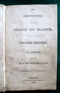
18203763<b>First Official Printing of Maine's Constitution</b><br /><br />A very scarce example of the first printing of the Maine Constitution. As noted on the verso of the title leaf 200 copies were ordered "printed for the use of the Legislature." In contrast the next printing ordered by the Legislature -- in 1825 -- was for 10000 copies. OCLC locates examples at six institutions. <br /><br /><br /><b>References:</b> Noyes <i>Maine Imprints to 1820</i>: 931. Skillin <i>A Bibliography of Maine Imprints 1785-1820</i>: 20-70. Not in Williamson A <i>Bibliography of the State of Maine</i>. Thompson:<i> Important Maine Maps Books Prints and Ephemera</i>: 28A. The Thompson copy sold for $1840 in 2003. Sprague <i>The Mirror of Maine</i>: see 11 for the 1825 edition. Shoemaker <i>A Checklist of American Imprints for 1820</i>: 2075.<br /><br /><b>Condition:</b> Contemporary calf. Boards well-scuffed and with small gouged area. Significant chipping of spine leather; hinges and joints cracked. Age-toned and areas of staining throughout. An unsophisticated but appealing example of a very scarce book. Published by Order of the Legislature. Printed by Francis Douglas. hardcover
171521151London 1715. Broadsheet. 1p. plus printed docket title on verso. Small folio. Bound to style in half calf over marbled paper-covered boards. Ornamental border. Minor foxing. Very good. A project for colonizing Maine in 1715. One of only two surviving copies.<br/> <br/> A rare early petition relating to British settlement in the eastern part of present-day Maine. The authors refer to petitioning "his Majesty in Council on the 6th Day of December last for having a Colony settled between New England and Nova Scotia" with "over one thousand disbanded men" and to be funded with the proceeds of a proposed coinage operation. The only copy of this document listed by OCLC and ESTC is at the New-York Historical Society which estimates merely that the document was printed during the 1700s. The historical context the text cited above and discovery of this broadsheet among similar petitions dating almost exclusively to 1714 and 1715 however make 1715 an extremely likely date of printing. In the Treaty of Utrecht 1713 the French ceded the land east of the Kennebec River presumably the area in question here to the British; this event and the reference to "disbanded soldiers" suggest that the War of the Spanish Succession had recently ended which it finally did in 1714. George I succeeded Queen Anne in late 1714 meaning that the petitioning of "December last" could not have been earlier than that year. With the new monarchy and a major upheaval in the House of Commons following the general election of 1715 petitionary literature distributed in the lobby of Parliament surged with this document almost certainly among the examples from that year. The petitioners evidently officers who had served in the recent war call attention to the fact that the lands they hope to settle "were formally survey'd and given by King Charles the Second to the Duke of York" and that the area has been confirmed as rich for farming. They ask that Parliament allow them to present their formal proposals for the settlement or "if not thought proper to have a Colony settled in that part of North-America" at least still to grant them a contract to coin 1000 tons' worth of half-pence and farthings. A very important Maine document one of only two surviving copies. unknown
192041277Washington D.C.: Published by the United States Coast and Geodetic Survey 1920. Large folding nautical chart printed on heavy paper stock. Colored. A rare original coastal survey of West Penobscot Bay including Camden Rockport Rockland the Fox Islands and Islesboro.<br/> <br/> Established by President Thomas Jefferson in 1807 as the Survey of the Coast the U.S. Coast and Geodetic Survey was the United States' first civilian scientific agency. This agency has followed its mission to survey the U.S. coastline create nautical charts of the coast and help increase maritime safety since its founding and has often played fascinating roles in significant chapters of U.S. history. It served in all theaters of the Civil War in the service of the Union Army and Navy pioneered acoustic exploration in the wake of the sinking of the Titanic and during WWI it worked to detect enemy submarines. In addition this agency worked to survey and produce detailed maps and renderings of the U.S. coast. These nautical survey maps commonly referred to as "T-sheets" provide fascinating insights into the history of the United States coastline which has and will continue to shift. These maps are the most important data source for understanding the physical and ecological characteristics of the U.S. shoreline. The present map is a highly detailed and accurate sea chart of Penobscot Bay and an important historical view of developing Maine. Published by the United States Coast and Geodetic Survey unknown
41295Washington D.C.: Published by the United States Coast and Geodetic Survey. Nautical chart printed on heavy paper stock. Uncolored. A rare original coastal survey of Winter Harbor Maine.<br/> <br/> Established by President Thomas Jefferson in 1807 as the Survey of the Coast the U.S. Coast and Geodetic Survey was the United States' first civilian scientific agency. This agency has followed its mission to survey the U.S. coastline create nautical charts of the coast and help increase maritime safety since its founding and has often played fascinating roles in significant chapters of U.S. history. It served in all theaters of the Civil War in the service of the Union Army and Navy pioneered acoustic exploration in the wake of the sinking of the Titanic and during WWI it worked to detect enemy submarines. In addition this agency worked to survey and produce detailed maps and renderings of the U.S. coast. These nautical survey maps commonly referred to as "T-sheets" provide fascinating insights into the history of the United States coastline which has and will continue to shift. These maps are the most important data source for understanding the physical and ecological characteristics of the U.S. shoreline. The present map is a highly detailed and accurate sea chart of Winter Harbor and an important historical view of developing Maine. Published by the United States Coast and Geodetic Survey unknown
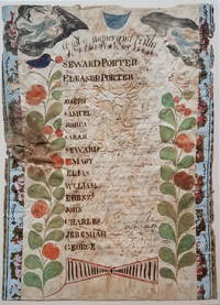
18003722<b><i>Family Register of Seward Porter circa 1800</i></b><br /><br /><br />A nicely accomplished though primitive family register of the Seward and Eleanor Porter family. Two colorful plants with birds in their top branches fill the sides of the register. At the top hover two angel-like figures one bearing an hour glass the other blowing a horn. <p>Seward and Eleanor Porter were from Weymouth Massachusetts but relocated to Falmouth in the District of Maine in about 1777 and then to Freeport in about 1782. This family register lists the names birth places and birth dates of the Porter's 13 children from 1778 to 1797. </p>Their fourth son on the list -- also named Seward Porter -- would become a prominent Maine mariner and entrepreneur. He brought the first steamboat to Maine in 1823. In 1837 he published a now-highly-prized set of charts of the Maine coast. For Seward Porter the son see:<i>Tooley's Dictionary of Mapmakers</i>: Vol 3 p. 453 and Guthorn <i>United States Coastal Charts 1783-1861</i>: p. 29. <br /><br /><b>Condition:</b> Approximately 14 x 10." Iron gall ink on wove sheet with colored decorations. The sheet is mounted on a ca. 1815 newspaper and strips of wallpaper about 1" wide have been applied along the left and right sides. The piece is in fair condition with overall cockling and some water damage. There is a small puncture on the left edge. The ink notations of the birth dates and locations are faded but legible.<br /><br />ICN 3198.
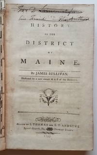
17953732This is the first general history of Maine written in the post-Revolutionary War time period that saw several state histories published including those by Belknap Jefferson and Ramsay. Despite its distinctly chilly initial reception and the less than impressive editorial standards Sullivan's <i>History</i>is a cornerstone work in any collection of Maine material. <p>The <i>History</i>includes as the frontispiece Osgood Carleton's <i>A Map of the District of Maine Drawn from the latest Surveys and other best Authorities by Osgood Carleton</i>. The map measuring 20 5/16 x 16 3/8" includes an inset titled <i>A Map of those parts of the Country most famous for being harassed sic by the Indians</i>. Carleton's map was the most detailed done of Maine to that time. </p><p>At the head of the title page is an inscription which has been lined out: "For D. Laincourt from his Friend the Author."</p><p><b>References:</b> Evans: 29589. Howes <i>USiana:</i> S-1122. Sabin: 93499. Williamson <i>A Bibliography of the State of Maine</i>: 9608. Thompson: <i>Important Maine Maps Books Prints and Ephemera</i>: 18A. For the map: Wheat & Brun <i>Maps and Charts Published in America before 1800</i>: 171. McCorkle <i>New England in Early Printed Maps 1513-1800</i>: Me795.1. </p><p><b>Condition: </b>vii iv 421 pp. With folding map frontispiece.Original full calf with worn red title label. Boards scuffed and bumped with areas of abrasion; joints cracked. Text block is very tight. Occasional light foxing and staining throughout. The map is in remarkably good condition especially in comparison to the usual state in which it is found. Trimmed close as usual along the binding edge. A sharp dark impression with minimal foxing or offsetting. <br /></p><p>ICN 7660.3.</p> Printed by I. Thomas and E.T. Andrews hardcover
1825860481825 Fougères, Vannier, Paris, Tourneux, 1825, petit in 12 broché, 130 pages ; des rousseurs ; couverture fanée.