737 résultats
196087541London: Hodder & Stoughton 1960. First edition. Hardcover. Jacket artwork by Martin Kaye. 1960 First edition first impression. 8vo. Original cloth. Dust-jacket price-clipped. A near-future SF thriller involving suspended animation space travel and the ethics of scientific experimentation. Minor foxing ex-libris bookplate and small ownership stamp to front pastedown; cloth very good; jacket price-clipped with a little rubbing but overall very good. Very good Hodder & Stoughton hardcover
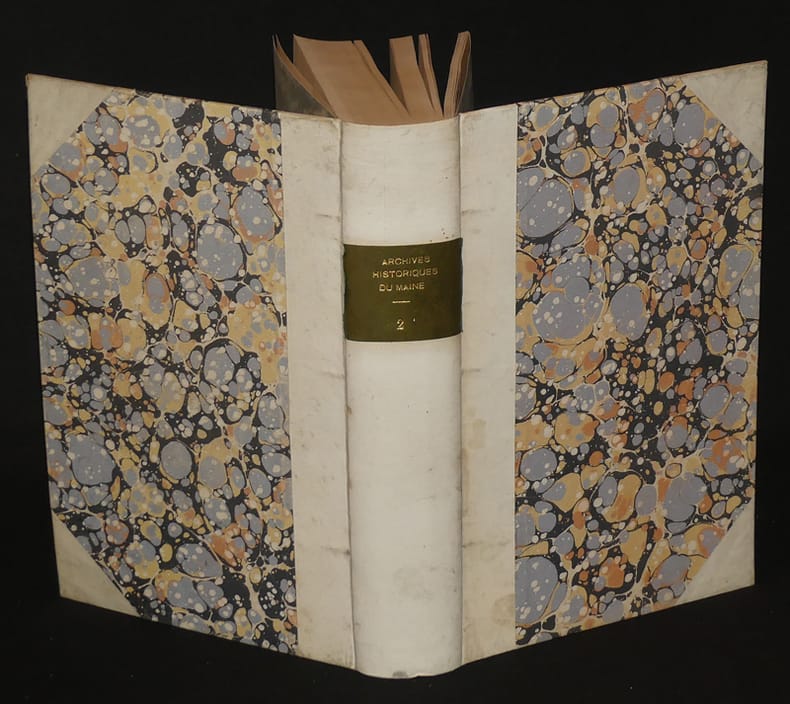
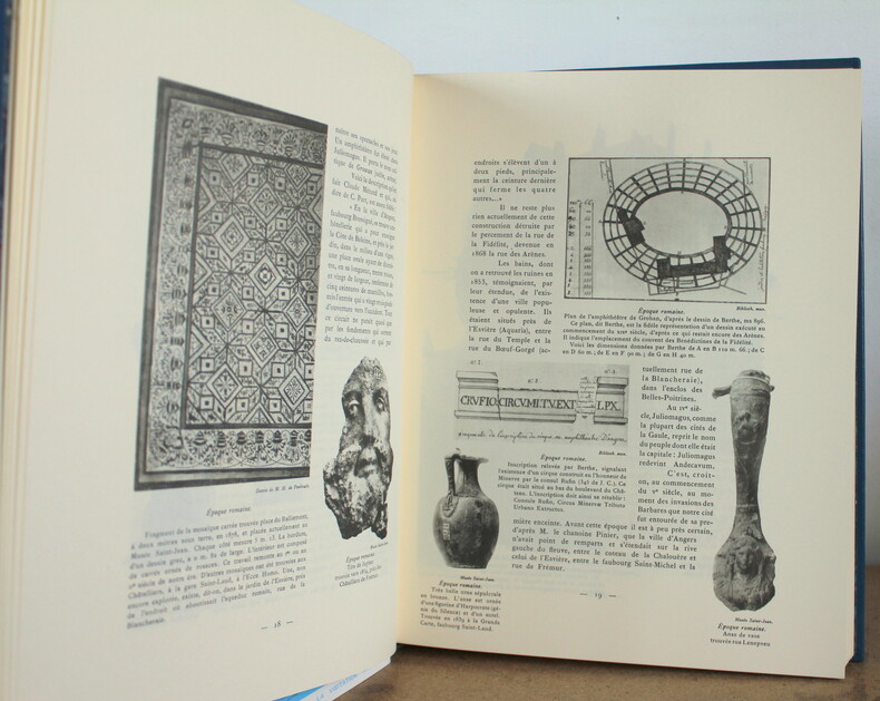
1901vz449Société des archives historiques du Maine Relié 1901 In-8 (16,5 x 24,7 cm), reliure demi-parchemin à coins, 603 pages, tome 2 seul, tirage à 200 exemplaires ; parchemin un peu sali, quelques rousseurs en début et fin de volume, par ailleurs bon état général. Livraison a domicile (La Poste) ou en Mondial Relay sur simple demande.
19555981Paris, Les Heures Claires, 1955. 2 volumes 250 x 195 mm, 151-(12) pp. + 147-(15) pp., frontispices et 2 x 18 illustrations en pointes sèches in-texte de Ch. SAMSON protégées de serpentes, en feuilles sous couvertures rempliées, chemise et étui cartonnés d'éditeur, trace de mouillure en pied de l'étui et de la chemise cartonnée, tirage à 700 exemplaires, 1 des 550 exemplaires sur vélin pur fil de Rives, numérotés de 151 à 700 (ici le n° 638). Très bel exemplaire.
19619430GOLDMANN WILHELM 1961. 1. hardcover. GOLDMANN, WILHELM hardcover
1990Q-0935447075Maine Historic Preservation 1990. Paperback. New. In shrink wrap. Looks like an interesting title! Maine Historic Preservation paperback
193537589None: 1935. 1935. TRADE CATALOG. 6" x 8" in colorful pictorial wrappers. 38 pp. illustrations index specifications diagrams pricing. Offers canoe history grades of canoes specifications and diagram of Old Town Canoes followed by photographs and descriptions of as well as specifications for and pricing for 8 different canoe models. Photographs and descriptions of as well as specifications for and pricing for 4 rowboat models. Also photographs specifications pricing for dinghies and several different outdoor motor boats. Illustrations and price list for miscellaneous boating equipment names monograms striping for canoes etc. Information on care and refinishing of canoes and boats. Inside rear wrapper are color illustrations designs available for Old Town Canoes along with pricing. Numerous photographs throughout. Previous owner's business stamp to rear wrapper. Wrappers lightly soiled and with text pulling away from rusty staples at spine. Very good. 1935. unknown
192041292Washington D.C.: Published by the United States Coast and Geodetic Survey 1920. Nautical chart printed on heavy paper stock. Uncolored. A rare original coastal survey of Richmond Island Harbor including Cape Elizabeth and Richmond Island.<br/> <br/> Established by President Thomas Jefferson in 1807 as the Survey of the Coast the U.S. Coast and Geodetic Survey was the United States' first civilian scientific agency. This agency has followed its mission to survey the U.S. coastline create nautical charts of the coast and help increase maritime safety since its founding and has often played fascinating roles in significant chapters of U.S. history. It served in all theaters of the Civil War in the service of the Union Army and Navy pioneered acoustic exploration in the wake of the sinking of the Titanic and during WWI it worked to detect enemy submarines. In addition this agency worked to survey and produce detailed maps and renderings of the U.S. coast. These nautical survey maps commonly referred to as "T-sheets" provide fascinating insights into the history of the United States coastline which has and will continue to shift. These maps are the most important data source for understanding the physical and ecological characteristics of the U.S. shoreline. The present map is a highly detailed and accurate sea chart of Richmond Island Harbor and an important historical view of developing Maine. Published by the United States Coast and Geodetic Survey unknown
1909mon0000146188B&M 1909. Paperback. Good. in x in x in. 1909. 132pp plus ads. Some mild wear to the edges. Scarce. B&M paperback
193073512Félix Alcan 1930. Book. Good. Soft cover. 8vo - over 7¾" - 9¾" tall. 2 volumes In-8 brochés Bon Etat édition établie par Pierre Tisserand. Félix Alcan Paperback
1997x-0415159350Routledge 1997. Hardcover. New. new ed edition. 304 pages. 8.43x5.67x1.10 inches. Routledge hardcover
1944167941944 12 fascicules (plaquettes) de la revue "LES CAHIERS DU MAINE LIBRE (1944-1945)" reliés en un volume, reliure demi-maroquin rouge in-octavo (binding half moroco in-8) (16 x 23,5 cm) avec étui recouvert de papier peigné, dos à nerfs (spine with raised band) décoré or (gilt decoration) et à filets or et à froid (gilt and blind-stamping decoration), titre frappé or (gilt title), pièce de titre à filets or sur fond noir (label of title with gilt line) or, entre-nerfs à fleuron au fer plein (between the raised bands floweret with full blocking stamp), année 1944-1945 dorée en pied, papier peigné aux plats (cover with painting paper), toutes tranches lisses (all smooth edges), première et quatrième de couverture en couleurs conservées (front and back cover of the preserved paperback edition), Edition Numérotée tirage limité 25 Exemplaires sur raisin simili japon pour les 12 "LES CAHIERS DU MAINE LIBRE" (N°23) , orné de trés nombreux dessins et photographies in et hors-texte en noir, 32 + 32 + 32 + 32 + 32 + 32 + 24 + 16 + 24 + 24 + 24 + 24 pages, du N° 1 de septembre 1944 au N°12 d' Octobre-Novembre 1945 Le Mans Imprimerie Commerciale du Maine Libre Editeur,
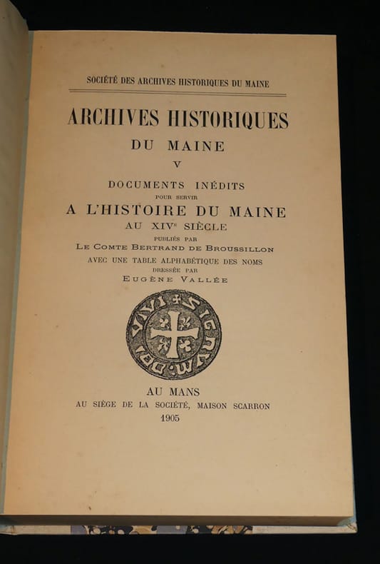
1905vz450Société des archives historiques du Maine Relié 1905 In-8 (16,5 x 24,7 cm), reliure demi-parchemin à coins, 580 pages, tome 5 seul, tirage à 200 exemplaires ; parchemin un peu sali, quelques rares rousseurs, par ailleurs bon état général. Livraison a domicile (La Poste) ou en Mondial Relay sur simple demande.
19307631Au Mans, Chez l'auteur, 1930. 1970 g In-4 en feuilles sous portefeuille à rabats, [1] ffb., [1] ff., xvi-86 pp., [1] ff.. Illustré de 54 planches hors-texte dont une double et de 51 dessins dans le texte d'après les dessins du docteur A. Sinan (le titre n'en annonce que 50). Commentaires par le chanoine Ledru, Robert Triger, le docteur Paul Delaunay, le chanoine Denis, Raoul de Linière, Robert Delagrange et Docteur Sinan. Ouvrage tiré à 300 exemplaires numérotés. Petit manque de papier sur un plat du portefeuille. . (Catégories : Maine, Sarthe, Livres illustrés, )
19194707New York: The American Historical Society 1919. First Edition. Hardcover. Very Good Textblocks Fine. No DJ. Light shelf/edge wear light toning to spines hint of toning to gilt else tight bright and unmarred. Halfbound black cloth spine and tips green cloth boards four raised bands gilt lettering and decorative elements marbled endpages speckled dye at textblock edges frontispieces. 4to. 306pp; 629pp 936pp; 339pp; 425pp. Illus. b/w plates. Index. <br/><br/>A detailed and respected history of Maine from the colonial period through the wars and boundary disputes statehood the Civil War and a wide variety of social economic religious and other aspects of the evolution of the state. A handsome set seldom found in such nice condition nor complete with the Biographical volumes. The American Historical Society hardcover books
19194707New York: The American Historical Society 1919. First Edition. Hardcover. Very Good Textblocks Fine. No DJ. First Edition. Hardcover. A detailed and respected history of Maine from the colonial period through the wars and boundary disputes statehood the Civil War and a wide variety of social economic religious and other aspects of the evolution of the state. A handsome set seldom found in such nice condition nor complete with the Biographical volumes. Light shelf/edge wear light toning to spines hint of toning to gilt else tight bright and unmarred. Halfbound black cloth spine and tips green cloth boards four raised bands gilt lettering and decorative elements marbled endpages speckled dye at textblock edges frontispieces. 4to. 306pp; 629pp 936pp; 339pp; 425pp. Illus. b/w plates. Index. The American Historical Society hardcover
1979264Angers à travers les âges, Réimpression en fac-simile de l'édition originale parue en octobre 1913 de l'Abbé A. Guéry, avec une préface de M. René Bazin aux Éditions J. Siraudeau en 1979. Édition numérotée 27/250/1500 sur papier simili-Japon de Hollande.Le livre est illustré de 436 illustrations (documents d'archives, dessins anciens, photos originales) imprimées en bichromie offset. Le livre mesure 25x33 cm et pèse 2 kg (c) pour 238 pages. Reliure plein cuir, marquée au fer à l'or fin 18 carats, d'après un graphisme original de l'illustrateur Maurice Pouzet, avec signet et tranchefiles. Présentation dans un étui habillé, comme les gardes du volume, d'un riche papier cuve à l'ancienne. Le livre est en très bon état, une signature manuscrite, quelques frottis sur l’emboîtage, dos insolé.
197118104London: Hodder and Stoughton 1971. A first edition first printing published by Hodder and Stoughton in 1971. A very good book with a small stain to the top edge. SIGNED and inscribed 'To Ron/Whatever happened to/all those years in between/All good wishes/Charles Eric Maine/ Oct 1973'. In a very good unclipped wrapper with a little staining to the edges of the endflaps. "The Random Factor" by Charles Eric Maine is a captivating science fiction novel that explores the consequences of a world governed by random chance. Set in a future where society relies on a computerised random selection system for decision-making protagonist Richard Forde discovers unsettling patterns suggesting manipulation. As he delves deeper Forde uncovers a conspiracy threatening to disrupt the fragile balance of power. Maine skilfully weaves themes of control fate and human resilience into a suspenseful narrative prompting readers to question the nature of free will in a world dictated by randomness. Hodder and Stoughton unknown
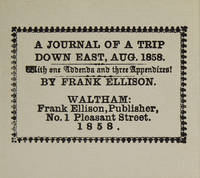
1981316097Dallas: The Somesuch Press 1981. Limited edition no. 56 of 200 copies signed by the printer and the publisher. vii 10 33 9 pp. 1 vols. Miniature 2-5/8 x 3 inches. Printed wrappers. As new. Limited edition no. 56 of 200 copies signed by the printer and the publisher. vii 10 33 9 pp. 1 vols. Miniature 2-5/8 x 3 inches. Facsimile of a rare and curious miniature book printed in 1858 reporting on a hunting trip to Maine. The Somesuch Press unknown
192041283Washington D.C.: Published by the United States Coast and Geodetic Survey 1920. Large folding nautical chart printed on heavy paper stock. Uncolored. A rare original coastal survey of New Hampshire and Maine including Portsmouth Exeter Dover and the Piscataqua River.<br/> <br/> Established by President Thomas Jefferson in 1807 as the Survey of the Coast the U.S. Coast and Geodetic Survey was the United States' first civilian scientific agency. This agency has followed its mission to survey the U.S. coastline create nautical charts of the coast and help increase maritime safety since its founding and has often played fascinating roles in significant chapters of U.S. history. It served in all theaters of the Civil War in the service of the Union Army and Navy pioneered acoustic exploration in the wake of the sinking of the Titanic and during WWI it worked to detect enemy submarines. In addition this agency worked to survey and produce detailed maps and renderings of the U.S. coast. These nautical survey maps commonly referred to as "T-sheets" provide fascinating insights into the history of the United States coastline which has and will continue to shift. These maps are the most important data source for understanding the physical and ecological characteristics of the U.S. shoreline. The present map is a highly detailed and accurate sea chart of coastal New Hampshire and Maine and an important historical view of the developing states. Published by the United States Coast and Geodetic Survey unknown
192041293Washington D.C.: Published by the United States Coast and Geodetic Survey 1920. Large folding nautical chart printed on heavy paper stock. Colored. A rare original coastal survey of the approach to Penobscot Bay including Matinicus Island and an inset map of Matinicus Harbor in the bottom right corner.<br/> <br/> Established by President Thomas Jefferson in 1807 as the Survey of the Coast the U.S. Coast and Geodetic Survey was the United States' first civilian scientific agency. This agency has followed its mission to survey the U.S. coastline create nautical charts of the coast and help increase maritime safety since its founding and has often played fascinating roles in significant chapters of U.S. history. It served in all theaters of the Civil War in the service of the Union Army and Navy pioneered acoustic exploration in the wake of the sinking of the Titanic and during WWI it worked to detect enemy submarines. In addition this agency worked to survey and produce detailed maps and renderings of the U.S. coast. These nautical survey maps commonly referred to as "T-sheets" provide fascinating insights into the history of the United States coastline which has and will continue to shift. These maps are the most important data source for understanding the physical and ecological characteristics of the U.S. shoreline. The present map is a highly detailed and accurate sea chart of Penobscot Bay and an important historical view of developing Maine. Published by the United States Coast and Geodetic Survey unknown
190234346Bangor Maine: Perkins & Danforh Spoolwood Co 1902. Ledger. Good. Folio ledger. Approx. 14" x 9". A-Z thumb index 561 pages. 325 pages used for record keeping pages 328-561 are blank. Contents include some loose misc. paper records laid in between pages relating to specific accounts. Ledger has black cloth covered boards with leather corners and spine. The outer joints are cracked and split. The leather on the corners and spine is cracked and rubbed. Cloth is lightly shelf worn and chipped on the back cover. Inner hinges are sturdy. <br /> <br /> Accounts are neatly organized with printed page numbers located in the upper corners. Paper is lined with red vertical columns. The hand writing and contents are neat and clean. Dates for the ledger start in 1894 and the latest entries are dated December 1902. Accounts cover manufacturing railroads paper and beef companies individual businesses and partnerships etc. Most of the accounts record payments and dates. The Katahdin account and a few others record agricultural commodities perishable foods labor costs etc. A sample of company names include the Katahdin Iron Works which has 59 account pages Arnold J M Shoe Co. Bangor Pulp and Paper Co. Belknap Motor Co. Brownville Main Slate Co. Bangor Beef Co. Coats J & P Ltd. Doble Brothers Eastern Manufacturing Co. Great Northern Paper Co. Hincks Coal Co. Jordan Lumber Co. Northern Telegraph Co. National Pipe Bending Co. Perkins & Danforth Spoolwood Co. Public Works Co. Old Town Woolen Co. Overseers of the Poor Sweet Caldwell Whittier Beef and dozens more. Perkins & Danforh Spoolwood Co unknown
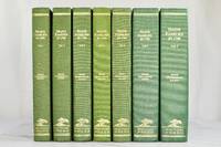
1988092121-03Picton Press 1988. Near Fine. Six volumes. Excellent unread condition. Interiors are pristine. No writing or markings of any kind. Ships wrapped in bubble wrap and packed securely in a box. Picton Press unknown
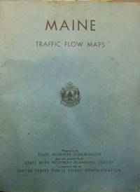
19411None listed: State of Maine Highway Commission 1941. First Edition. Stiff wraps. Very good. Elephant folio; 56pp; 55 full page maps in black and blue ink; blue textured wrappers with title on front cover and state seal 5 staple binding; soiling to wrapper some light page edge soiling soiling to pp 21-22 binding sound without pulling. Very Good. The first of traffic flow maps issued by the state the next not issued until 1955. The maps are of each county with details that include road types bridges water features boundaries natural features railroads airways parks and reservations and city and village centers. Traffic patterns indicated in blue ink. Fascinatingìì detailed look at each Maine county. [State of Maine Highway Commission] unknown
191941297Washington D.C.: Published by the United States Coast and Geodetic Survey 1919. Large folding nautical chart printed on heavy paper stock. Uncolored. A rare original coastal survey of Bath and Boothbay Harbor including Bath Georgetown Boothbay and Westport and Southport Islands.<br/> <br/> Established by President Thomas Jefferson in 1807 as the Survey of the Coast the U.S. Coast and Geodetic Survey was the United States' first civilian scientific agency. This agency has followed its mission to survey the U.S. coastline create nautical charts of the coast and help increase maritime safety since its founding and has often played fascinating roles in significant chapters of U.S. history. It served in all theaters of the Civil War in the service of the Union Army and Navy pioneered acoustic exploration in the wake of the sinking of the Titanic and during WWI it worked to detect enemy submarines. In addition this agency worked to survey and produce detailed maps and renderings of the U.S. coast. These nautical survey maps commonly referred to as "T-sheets" provide fascinating insights into the history of the United States coastline which has and will continue to shift. These maps are the most important data source for understanding the physical and ecological characteristics of the U.S. shoreline. The present map is a highly detailed and accurate sea chart of Bath and Boothbay Harbor and an important historical view of developing Maine. Published by the United States Coast and Geodetic Survey unknown
192041296Washington D.C.: Published by the United States Coast and Geodetic Survey 1920. Nautical chart printed on heavy paper stock. Uncolored. A rare original coastal survey of Maine including Camden and Rockport.<br/> <br/> Established by President Thomas Jefferson in 1807 as the Survey of the Coast the U.S. Coast and Geodetic Survey was the United States' first civilian scientific agency. This agency has followed its mission to survey the U.S. coastline create nautical charts of the coast and help increase maritime safety since its founding and has often played fascinating roles in significant chapters of U.S. history. It served in all theaters of the Civil War in the service of the Union Army and Navy pioneered acoustic exploration in the wake of the sinking of the Titanic and during WWI it worked to detect enemy submarines. In addition this agency worked to survey and produce detailed maps and renderings of the U.S. coast. These nautical survey maps commonly referred to as "T-sheets" provide fascinating insights into the history of the United States coastline which has and will continue to shift. These maps are the most important data source for understanding the physical and ecological characteristics of the U.S. shoreline. The present map is a highly detailed and accurate sea chart of the harbors of Camden and Rockport and an important historical view of developing Maine. Published by the United States Coast and Geodetic Survey unknown