[Maine]Biblio.com

737 résultats
192041285Washington D.C.: Published by the United States Coast and Geodetic Survey 1920. Nautical chart printed on heavy paper stock. Uncolored. A rare original coastal survey of Rockland Harbor Maine.<br/> <br/> Established by President Thomas Jefferson in 1807 as the Survey of the Coast the U.S. Coast and Geodetic Survey was the United States' first civilian scientific agency. This agency has followed its mission to survey the U.S. coastline create nautical charts of the coast and help increase maritime safety since its founding and has often played fascinating roles in significant chapters of U.S. history. It served in all theaters of the Civil War in the service of the Union Army and Navy pioneered acoustic exploration in the wake of the sinking of the Titanic and during WWI it worked to detect enemy submarines. In addition this agency worked to survey and produce detailed maps and renderings of the U.S. coast. These nautical survey maps commonly referred to as "T-sheets" provide fascinating insights into the history of the United States coastline which has and will continue to shift. These maps are the most important data source for understanding the physical and ecological characteristics of the U.S. shoreline. The present map is a highly detailed and accurate sea chart of Rockland Harbor and an important historical view of developing Maine. Published by the United States Coast and Geodetic Survey unknown
194261353Grand Lake ME and other sites 1942. 4to 12 3/4 x 10 1/4 inches with 79 mounted photographs mostly in the 2 1/2 x 3 inch range with a few much smaller and a few 7 x 9 almost all with ink captions and with a little other manuscript commentary six on them picturing a 1940 hunting trip to Grand Lake Washington County Maine guns but no game 36 picturing May and June 1941 fishing trips to Grand Lake Maine plenty of fish and 10 picturing a September 1941 fishing trip to Grand Lake Stream Maine more fish the balance picturing a day at the Suffolk Downs Boston races 14 photographs including two with the horses approaching the wire club gatherings some with an outdoor theme and family and business activities; also included is a signed copy of the 1942 Massachusetts Fish and Game Association annual meeting program. Royce 1876-ca. 1950 apparently a principal at the Harvard Brewery in Lowell Massachusetts here records in short photographic essays his sporting outings with fellow New England brewers and other friends. Paper browned and somewhat brittle but a good solid album throughout. Brown pebbled cloth and board album tied. #8478. <br/><br/> hardcover books
197221562PABEL/MOEWIG VERLAGSUNION 10/1972. 1. softcover. SF/UTOPISCHE ROMANE PABEL/MOEWIG VERLAGSUNION paperback
192041289Washington D.C.: Published by the United States Coast and Geodetic Survey 1920. Large folding nautical chart printed on heavy paper stock. Colored. A rare original coastal survey of Maine and New Hampshire including Portsmouth York Ogunquit Kennebunkport Biddeford and Cape Elizabeth.<br/> <br/> Established by President Thomas Jefferson in 1807 as the Survey of the Coast the U.S. Coast and Geodetic Survey was the United States' first civilian scientific agency. This agency has followed its mission to survey the U.S. coastline create nautical charts of the coast and help increase maritime safety since its founding and has often played fascinating roles in significant chapters of U.S. history. It served in all theaters of the Civil War in the service of the Union Army and Navy pioneered acoustic exploration in the wake of the sinking of the Titanic and during WWI it worked to detect enemy submarines. In addition this agency worked to survey and produce detailed maps and renderings of the U.S. coast. These nautical survey maps commonly referred to as "T-sheets" provide fascinating insights into the history of the United States coastline which has and will continue to shift. These maps are the most important data source for understanding the physical and ecological characteristics of the U.S. shoreline. The present map is a highly detailed and accurate sea chart of the coasts of Maine and New Hampshire and an important historical view of the developing states. Published by the United States Coast and Geodetic Survey unknown
192041286Washington D.C.: Published by the United States Coast and Geodetic Survey 1920. Large folding nautical chart printed on heavy paper stock. Colored. A rare original coastal survey of the Damariscotta and Medomak rivers including Bristol Waldoboro and Damariscotta.<br/> <br/> Established by President Thomas Jefferson in 1807 as the Survey of the Coast the U.S. Coast and Geodetic Survey was the United States' first civilian scientific agency. This agency has followed its mission to survey the U.S. coastline create nautical charts of the coast and help increase maritime safety since its founding and has often played fascinating roles in significant chapters of U.S. history. It served in all theaters of the Civil War in the service of the Union Army and Navy pioneered acoustic exploration in the wake of the sinking of the Titanic and during WWI it worked to detect enemy submarines. In addition this agency worked to survey and produce detailed maps and renderings of the U.S. coast. These nautical survey maps commonly referred to as "T-sheets" provide fascinating insights into the history of the United States coastline which has and will continue to shift. These maps are the most important data source for understanding the physical and ecological characteristics of the U.S. shoreline. The present map is a highly detailed and accurate sea chart of the Damariscotta and Medomak rivers and an important historical view of developing Maine. Published by the United States Coast and Geodetic Survey unknown
192041275Washington D.C.: Published by the United States Coast and Geodetic Survey 1920. Large folding nautical chart printed on heavy paper stock. Uncolored. A rare original coastal survey of the Fox Islands including Vinalhaven and North Haven.<br/> <br/> Established by President Thomas Jefferson in 1807 as the Survey of the Coast the U.S. Coast and Geodetic Survey was the United States' first civilian scientific agency. This agency has followed its mission to survey the U.S. coastline create nautical charts of the coast and help increase maritime safety since its founding and has often played fascinating roles in significant chapters of U.S. history. It served in all theaters of the Civil War in the service of the Union Army and Navy pioneered acoustic exploration in the wake of the sinking of the Titanic and during WWI it worked to detect enemy submarines. In addition this agency worked to survey and produce detailed maps and renderings of the U.S. coast. These nautical survey maps commonly referred to as "T-sheets" provide fascinating insights into the history of the United States coastline which has and will continue to shift. These maps are the most important data source for understanding the physical and ecological characteristics of the U.S. shoreline. The present map is a highly detailed and accurate sea chart of the Fox Islands and an important historical view of developing Maine. Published by the United States Coast and Geodetic Survey unknown
192041269Washington D.C.: Published by the United States Coast and Geodetic Survey 1920. Large folding nautical chart printed on heavy paper stock. Colored. A rare original coastal survey of Maine from Nash Island to Schoodic Island including Gouldsboro Prospect Harbor Steuben Milbridge Cherryfield Addison and Harrington.<br/> <br/> Established by President Thomas Jefferson in 1807 as the Survey of the Coast the U.S. Coast and Geodetic Survey was the United States' first civilian scientific agency. This agency has followed its mission to survey the U.S. coastline create nautical charts of the coast and help increase maritime safety since its founding and has often played fascinating roles in significant chapters of U.S. history. It served in all theaters of the Civil War in the service of the Union Army and Navy pioneered acoustic exploration in the wake of the sinking of the Titanic and during WWI it worked to detect enemy submarines. In addition this agency worked to survey and produce detailed maps and renderings of the U.S. coast. These nautical survey maps commonly referred to as "T-sheets" provide fascinating insights into the history of the United States coastline which has and will continue to shift. These maps are the most important data source for understanding the physical and ecological characteristics of the U.S. shoreline. The present map is a highly detailed and accurate sea chart of coastal Maine and an important historical view of the developing state. Published by the United States Coast and Geodetic Survey unknown
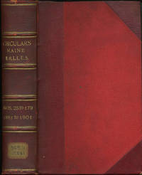
190131931Portland: Commandery of the State of Maine 1901. First edition. Three quarter morocco over red boards four raised bands ruled in gilt gilt titles. A very good copy with shelf sticker on foot of backstrip. 8vo. The Military Order of the Loyal Legion of the United States begun in Philadelphia in 1865 was modeled on the Society of the Cincinnati and formed to protect the republic amid rumors of a plot to destroy the government after the assassination of Abraham Lincoln. Among its members were Presidents Ulysses S. Grant Rutherford B. Hayes Benjamin Harrison and William McKinley. By 1899 it had over 8000 members which included nearly every officer of note. This volume contains 155 Maine circulars 22-179 for the years 1881 to 1901 Contains circulars meeting notices black bordered "In Memoriam" notices biographies of the deceased. Many items annotated and signed by the recorders Eward M. Rand and Henry S. Burrage. A wealth of information. [Commandery of the State of Maine ] hardcover
190131931Portland: Commandery of the State of Maine 1901. First edition. Three quarter morocco over red boards four raised bands ruled in gilt gilt titles. A very good copy with shelf sticker on foot of backstrip. 8vo. The Military Order of the Loyal Legion of the United States begun in Philadelphia in 1865 was modeled on the Society of the Cincinnati and formed to protect the republic amid rumors of a plot to destroy the government after the assassination of Abraham Lincoln. Among its members were Presidents Ulysses S. Grant Rutherford B. Hayes Benjamin Harrison and William McKinley. By 1899 it had over 8000 members which included nearly every officer of note. This volume contains 155 Maine circulars 22-179 for the years 1881 to 1901 Contains circulars meeting notices black bordered "In Memoriam" notices biographies of the deceased. Many items annotated and signed by the recorders Eward M. Rand and Henry S. Burrage. A wealth of information. [Commandery of the State of Maine ] hardcover books
191228706bouaye 1912-14 8 LETTRES AUTOGRAPHES MANUSCRITES SIGNÉES, 5 sur bristol crème arrondi aux angles et doré sur tranche à l'emplacement des angles avec tampon préimprimé en noir en haut à gauche : "Le Bois de la Noë, Bouaye, Loire-inférieure", manuscrites à l'encre brune, format : 11,5 x 9 cm + 2 sur bristol bleu arrondi aux angles et doré sur tranche à l'emplacement des angles, à en-tete manuscrit "La Beuverie" par Liré, manuscrites à l'encre bleue, format : 11 x 8,7 cm + une lettre de 4 pages, sur papier vergé filigrané : "TONGIMED'S PAPER", avec tampon préimprimé en noir en haut à gauche : "Le Bois de la Noë, Bouaye, Loire-inférieure", manuscrite à l'encre brune, format : 17,7 x 11,4 cm + UNE CARTE DE VISITE IMPRIMÉE EN NOIR : "COMTE DE MELQUÉ, LE BOIS DE LA NOË PAR BOUAYE (L.-INF.)" ET AUTOGRAPHE MANUSCRITE à l'encre brune ou il indique à la main sa nouvelle adresse après le 15 Octobre(1913) : Chateau de la beuverie par Liré (Maine et Loire), carte sur bristol crème, format : 5,6 x 9,6 cm
1950024219Maine ATC 1950. Staple Wraps. Very Good. 4to - 11" Tall. The collection of hiking accounts by George H. Witherle renamed thus and mimeographed by the Maine ATC in 1950 this remains a very uncommon publication. Original typed titles on tanned wrappers stapled twice on the side with 43 pages mimeographed 1 side. Page ghost and original likely owners name to upper FC rear clean light edge wear. A nice example of an exceedingly scarce early AMC/MATC item. <br/> <br/> Maine ATC paperback
192041272Washington D.C.: Published by the United States Coast and Geodetic Survey 1920. Large folding nautical chart printed on heavy paper stock. Uncolored. A rare original coastal survey of Maine from Little River to Petit Manan including Milbridge Addison Great Wass Island Preserve Jonesport Machias and an inset map of Moose-a-Bec Bar and Pig Island in top left corner.<br/> <br/> Established by President Thomas Jefferson in 1807 as the Survey of the Coast the U.S. Coast and Geodetic Survey was the United States' first civilian scientific agency. This agency has followed its mission to survey the U.S. coastline create nautical charts of the coast and help increase maritime safety since its founding and has often played fascinating roles in significant chapters of U.S. history. It served in all theaters of the Civil War in the service of the Union Army and Navy pioneered acoustic exploration in the wake of the sinking of the Titanic and during WWI it worked to detect enemy submarines. In addition this agency worked to survey and produce detailed maps and renderings of the U.S. coast. These nautical survey maps commonly referred to as "T-sheets" provide fascinating insights into the history of the United States coastline which has and will continue to shift. These maps are the most important data source for understanding the physical and ecological characteristics of the U.S. shoreline. The present map is a highly detailed and accurate sea chart of coastal Maine and an important historical view of the developing state. Published by the United States Coast and Geodetic Survey unknown
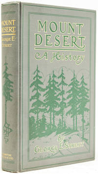
190540168Boston: Houghton Mifflin and Company 1905. First edition. Illustrated. 1 vols. 8vo. Grey cloth. Printed in green and gold t.e.g. Fine. First edition. Illustrated. 1 vols. 8vo. Houghton, Mifflin and Company unknown books
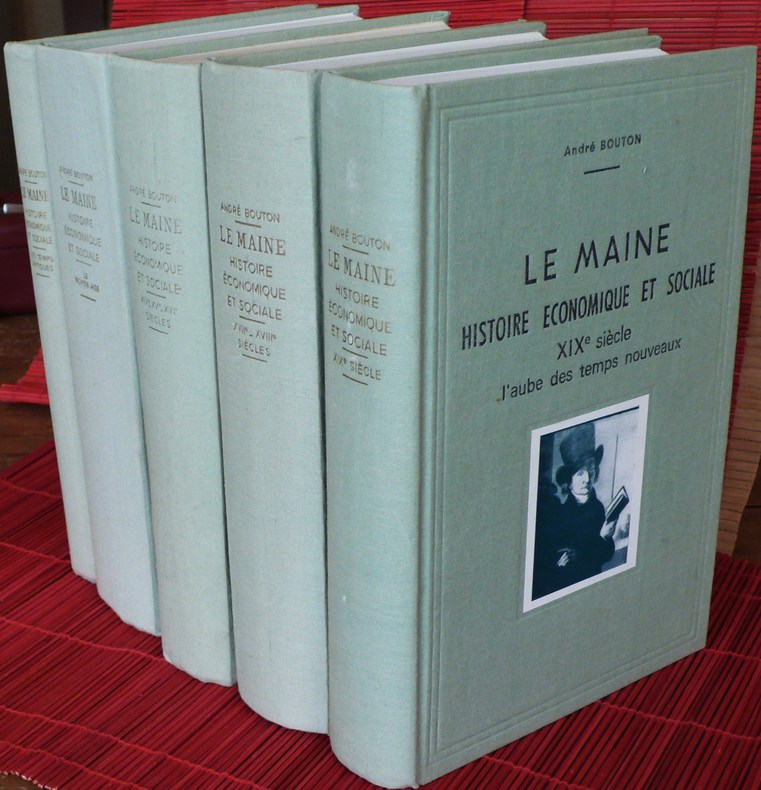
197501949Le Mans : l'auteur, 1971 à 1976. 5 volumes gr. in-8 (25 cm), cartonnage de l'éditeur vert tendre, vignette contre-collée au 1er plat, I : Les Temps antiques 2 éd. revue et augmentée, 1975, 220 p.-18 p. de pl. - II : Le Moyen âge 2 éd. revue et augmentée, 1976, 757 p.-61 p. de pl. en noir et en coul. dont 7 dépliantes - III : XIVe, XVe et XVIe siècles, 1971, 1038 p., plan dépliant - IV : XVIIe et XVIIIe siècles, 1972, 661 p.-19 p. de pl. dont 1 dépliante - V : XIXe siècle : l'aube des temps nouveaux, 1974, 559 p.-26 p. de pl., 6900 gr.
197421354Angers Atelier d'art P. Petit 1974 in-8 plein skivertex 3 volumes, reliure plein skivertex marron in-octavo(full binding imitation leather in-8) avec un etui toilé saumon editeur pour les 3 volumes, titre en doré sur pièce de titre de toile noire, toutes tranches lisses, Réédition en Fac-Similé intégral de l'édition Originale à laquelle il a été rajouité la reproduction des 101 gravures de Pierre VIDAL hors-texte en noir, ([8]-LII-812 p.-[45] p. de pl., 776 p.-[23] p. de pl., 761 p.-[33] p. de pl.) pages, 1974 à Angers : Atelier d'art P. Petit Editeur,
192041281Washington D.C.: Published by the United States Coast and Geodetic Survey 1920. Large folding nautical chart printed on heavy paper stock. Uncolored. A rare original coastal survey of Maine from Nash Island to Cross Island including Jonesport Jonesboro Great Wass Island Preserve and Bucks Harbor.<br/> <br/> Established by President Thomas Jefferson in 1807 as the Survey of the Coast the U.S. Coast and Geodetic Survey was the United States' first civilian scientific agency. This agency has followed its mission to survey the U.S. coastline create nautical charts of the coast and help increase maritime safety since its founding and has often played fascinating roles in significant chapters of U.S. history. It served in all theaters of the Civil War in the service of the Union Army and Navy pioneered acoustic exploration in the wake of the sinking of the Titanic and during WWI it worked to detect enemy submarines. In addition this agency worked to survey and produce detailed maps and renderings of the U.S. coast. These nautical survey maps commonly referred to as "T-sheets" provide fascinating insights into the history of the United States coastline which has and will continue to shift. These maps are the most important data source for understanding the physical and ecological characteristics of the U.S. shoreline. The present map is a highly detailed and accurate sea chart of coastal Maine from Cross Island to Nash Island and an important historical view of the developing state. Published by the United States Coast and Geodetic Survey unknown
192141280Washington D.C.: Published by the United States Coast and Geodetic Survey 1921. Large folding nautical chart printed on heavy paper stock. Colored. A rare original coastal survey of Maine from Petit Manan to Quoddy Roads including Harrington Addison Jonesport and Machias.<br/> <br/> Established by President Thomas Jefferson in 1807 as the Survey of the Coast the U.S. Coast and Geodetic Survey was the United States' first civilian scientific agency. This agency has followed its mission to survey the U.S. coastline create nautical charts of the coast and help increase maritime safety since its founding and has often played fascinating roles in significant chapters of U.S. history. It served in all theaters of the Civil War in the service of the Union Army and Navy pioneered acoustic exploration in the wake of the sinking of the Titanic and during WWI it worked to detect enemy submarines. In addition this agency worked to survey and produce detailed maps and renderings of the U.S. coast. These nautical survey maps commonly referred to as "T-sheets" provide fascinating insights into the history of the United States coastline which has and will continue to shift. These maps are the most important data source for understanding the physical and ecological characteristics of the U.S. shoreline. The present map is a highly detailed and accurate sea chart of coastal Maine from Quoddy Roads to Petit Manan and an important historical view of the developing state. Published by the United States Coast and Geodetic Survey unknown
192041288Washington D.C.: Published by the United States Coast and Geodetic Survey 1920. Large folding nautical chart printed on heavy paper stock. Colored. A rare original coastal survey of Portsmouth Harbor including Kittery Point New Castle Island and Portsmouth.<br/> <br/> Established by President Thomas Jefferson in 1807 as the Survey of the Coast the U.S. Coast and Geodetic Survey was the United States' first civilian scientific agency. This agency has followed its mission to survey the U.S. coastline create nautical charts of the coast and help increase maritime safety since its founding and has often played fascinating roles in significant chapters of U.S. history. It served in all theaters of the Civil War in the service of the Union Army and Navy pioneered acoustic exploration in the wake of the sinking of the Titanic and during WWI it worked to detect enemy submarines. In addition this agency worked to survey and produce detailed maps and renderings of the U.S. coast. These nautical survey maps commonly referred to as "T-sheets" provide fascinating insights into the history of the United States coastline which has and will continue to shift. These maps are the most important data source for understanding the physical and ecological characteristics of the U.S. shoreline. The present map is a highly detailed and accurate sea chart of Portsmouth Harbor and an important historical view of developing New Hampshire and Maine. Published by the United States Coast and Geodetic Survey unknown
192241276Washington D.C.: Published by the United States Coast and Geodetic Survey 1922. Large folding nautical chart printed on heavy paper stock. Colored. Bisected into two maps. A rare original coastal survey of Maine including Boothbay Harbor Bath and Georgetown.<br/> <br/> Established by President Thomas Jefferson in 1807 as the Survey of the Coast the U.S. Coast and Geodetic Survey was the United States' first civilian scientific agency. This agency has followed its mission to survey the U.S. coastline create nautical charts of the coast and help increase maritime safety since its founding and has often played fascinating roles in significant chapters of U.S. history. It served in all theaters of the Civil War in the service of the Union Army and Navy pioneered acoustic exploration in the wake of the sinking of the Titanic and during WWI it worked to detect enemy submarines. In addition this agency worked to survey and produce detailed maps and renderings of the U.S. coast. These nautical survey maps commonly referred to as "T-sheets" provide fascinating insights into the history of the United States coastline which has and will continue to shift. These maps are the most important data source for understanding the physical and ecological characteristics of the U.S. shoreline. The present map is a highly detailed and accurate sea chart of coastal Maine from Boothbay Harbor to Bath and an important historical view of the developing state. Published by the United States Coast and Geodetic Survey unknown
192041287Washington D.C.: Published by the United States Coast and Geodetic Survey 1920. Large folding nautical chart printed on heavy paper stock. Colored. A rare original coastal survey of Maine at East Penobscot Bay including the Fox Islands Deer Isle Stonington and Isle Au Hunt.<br/> <br/> Established by President Thomas Jefferson in 1807 as the Survey of the Coast the U.S. Coast and Geodetic Survey was the United States' first civilian scientific agency. This agency has followed its mission to survey the U.S. coastline create nautical charts of the coast and help increase maritime safety since its founding and has often played fascinating roles in significant chapters of U.S. history. It served in all theaters of the Civil War in the service of the Union Army and Navy pioneered acoustic exploration in the wake of the sinking of the Titanic and during WWI it worked to detect enemy submarines. In addition this agency worked to survey and produce detailed maps and renderings of the U.S. coast. These nautical survey maps commonly referred to as "T-sheets" provide fascinating insights into the history of the United States coastline which has and will continue to shift. These maps are the most important data source for understanding the physical and ecological characteristics of the U.S. shoreline. The present map is a highly detailed and accurate sea chart of East Penobscot Bay and an important historical view of developing Maine. Published by the United States Coast and Geodetic Survey unknown
192041284Washington D.C.: Published by the United States Coast and Geodetic Survey 1920. Large folding nautical chart printed on heavy paper stock. Colored. A rare original coastal survey of the Kennebec and Sheepscot Rivers including Bath Georgetown Boothbay and Wiscasset.<br/> <br/> Established by President Thomas Jefferson in 1807 as the Survey of the Coast the U.S. Coast and Geodetic Survey was the United States' first civilian scientific agency. This agency has followed its mission to survey the U.S. coastline create nautical charts of the coast and help increase maritime safety since its founding and has often played fascinating roles in significant chapters of U.S. history. It served in all theaters of the Civil War in the service of the Union Army and Navy pioneered acoustic exploration in the wake of the sinking of the Titanic and during WWI it worked to detect enemy submarines. In addition this agency worked to survey and produce detailed maps and renderings of the U.S. coast. These nautical survey maps commonly referred to as "T-sheets" provide fascinating insights into the history of the United States coastline which has and will continue to shift. These maps are the most important data source for understanding the physical and ecological characteristics of the U.S. shoreline. The present map is a highly detailed and accurate sea chart of the Kennebec and Sheepscot Rivers and an important historical view of developing Maine. Published by the United States Coast and Geodetic Survey unknown
192941282Washington D.C.: Published by the United States Coast and Geodetic Survey 1929. Large folding nautical chart printed on heavy paper stock. Colored. A rare original coastal survey of Maine from Monhegan Island to Cape Elizabeth including Bristol Damariscotta Wiscasset Boothbay Georgetown Harpswell Bath Brunswick Freeport Yarmouth and Portland.<br/> <br/> Established by President Thomas Jefferson in 1807 as the Survey of the Coast the U.S. Coast and Geodetic Survey was the United States' first civilian scientific agency. This agency has followed its mission to survey the U.S. coastline create nautical charts of the coast and help increase maritime safety since its founding and has often played fascinating roles in significant chapters of U.S. history. It served in all theaters of the Civil War in the service of the Union Army and Navy pioneered acoustic exploration in the wake of the sinking of the Titanic and during WWI it worked to detect enemy submarines. In addition this agency worked to survey and produce detailed maps and renderings of the U.S. coast. These nautical survey maps commonly referred to as "T-sheets" provide fascinating insights into the history of the United States coastline which has and will continue to shift. These maps are the most important data source for understanding the physical and ecological characteristics of the U.S. shoreline. The present map is a highly detailed and accurate sea chart of coastal Maine around Portland and an important historical view of the developing state. Published by the United States Coast and Geodetic Survey unknown
196126558London: Hodder and Stoughton. Near Fine in Near Fine dj. 1961. First Edition. Hardcover. price-clipped nice tight clean copy just the teensiest bumping to the lower front corner; the jacket is virtually flawless downgraded from Fine only because of the price-clipping and a touch of soiling to the rear panel. "John Soames is thirty years old and physiologically speaking alive. But by some trick of fate he has never become conscious. He is awoken and brought to full consciousness by a surgeon's knife a newborn baby with the body of a healthy young man." Basis for the 1970 British-American film of the same name starring Terence Stamp and Robert Vaughn; a critical and box-office disappointment on its original release the film has gained a bit of a retrospective cult reputation with one online critic calling it "a dark gem and a worthy pretender to the British horror hall of fame." Uncommon in the first edition all the more so in such outstanding condition. . Hodder and Stoughton hardcover books
196126558London: Hodder and Stoughton. Near Fine in Near Fine dj. 1961. First Edition. Hardcover. price-clipped nice tight clean copy just the teensiest bumping to the lower front corner; the jacket is virtually flawless downgraded from Fine only because of the price-clipping and a touch of soiling to the rear panel. "John Soames is thirty years old and physiologically speaking alive. But by some trick of fate he has never become conscious. He is awoken and brought to full consciousness by a surgeon's knife a newborn baby with the body of a healthy young man." Basis for the 1970 British-American film of the same name starring Terence Stamp and Robert Vaughn; a critical and box-office disappointment on its original release the film has gained a bit of a retrospective cult reputation with one online critic calling it "a dark gem and a worthy pretender to the British horror hall of fame." Uncommon in the first edition all the more so in such outstanding condition. . Hodder and Stoughton hardcover
19389734London: John Murray 1938. Sara Delano Roosevelt's copy of her son's biography with her initials "SDR" in pencil to the front free end paper from the collection of Frederick Baldwin Adams a relative of FDR and his mother. Sara Delano Roosevelt clearly read the book with close interest as indicated by the marginal pencil lines scattered throughout the text. As these annotations are fairly extensive albeit heavily concentrated in the latter two-thirds of the book which concentrate on F.D.R.'s political career 1910s-1930s it is difficult to identify Sara's precise points of interest although there is the odd occurrence. For example on p.96 a less-encountered double-line is pencilled next to a sentence regarding F.D.R.'s embarkation on a new destroyer the Dyer during the First World War on which occasion "since he was sailing under secret orders neither his wife nor his mother could see him off" perhaps a difficult memory that stuck in Sara's mind. More broadly sections concerning family friends and commentary regarding F.D.R.'s political achievements appear to have elicited the most interest. A touching relic indicative of Sara's famous devotion and steadfast support for her son whom she lived to see elected three times as President of the United States. An account of the life and character of President Franklin Delano Roosevelt by family friend writer and music critic Basil Maine 1894-1972. The present copy comes from the Franklin Delano Roosevelt collection of Frederick Baldwin Adams Jr 1910-2001 the son of Ellen Walters Delano who was a first cousin to President Roosevelt. Adams became a passionate bibliophile who served as director of the Pierpont Morgan Library in New York City for two decades and compiled a significant personal collection relating to F.D.R. In 1969 he married his third wife who was a Swedish princess and with whom he shared the final years of his life in France. Adams' move to France explains the presence of his books in the United Kingdom. First edition. Publisher's original pink cloth with titles in gilt to the spine. Illustrated with nine black and white photographs. Panels of the original dustwrapper loosely laid in along with a newspaper obituary of Sir Sayaji Rao Indian ruler of Baroda who was a guest at the White House in 1934. A very good copy the binding square and firm with a little fading to the spine. The contents with toning to two text pages resulting from the insertion of the newspaper cutting are otherwise excellent throughout. Please contact Christian White Rare Books Ltd for more information or images of this item 1938 John Murray hardcover