2 671 résultats
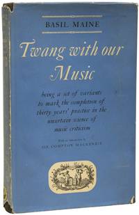
71707London: Rupert Hart-Davis 1955. Music History FIRST EDITION. Octavo 22 x 15cm pp.156. Publisher's black cloth with silver titles to spine typographic dust-jacket priced at 15s. Contents clean covers a little soiled jacket is used with some chips and tears tape repair to rear. Very good. The Reverend Basil Maine music scholar and biographer of Elgar taught the Fleming brothers Peter and Ian at Durnford School Dorset. A family friend of the Flemings he later took the service when Peter Fleming married Celia Johnson. This copy is from the comprehensive archive assembled by Ian Fleming bibliographer Jon Gilbert with pencil ownership. Gilbert pp.654 657. London: Rupert Hart-Davis, 1955 unknown
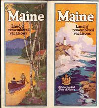
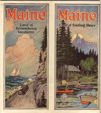
193641294Augusta: Maine Development Commission n.d. ca 1936. 1936. First edition. 9" x 8" with vertical fold at center and with bright colorful cover showing a coastal scene on 1/2 and a cabin scene on the other. 70 pp. including wrappers. Illustrations. Foreword. Maps. Map Index. General Index. Information and black and white photographs of the Maine seacoast to include the Yorks the Scarboro Beaches Portland and Casco Bay Bowdoin College Boothbay Harbor Bar Harbor Bangor Camden and Prescott Bay Narraguagus Bay Passamaquoddy Bay Eastport etc.; Inland Maine to include Sebago country Bridgton Harrison the Saco Valley the Oxford County Hills the Poland County etc.; Northwestern Maine to include the Rangeley region the Kennebago country the Dead River region etc.; Central Maine to include Moosehead Lake and Mount Kineo Kennebec Belgrade Lake Parlin etc.; and Eastern and Northern Maine to include the Grand Lakes country in Washington County Northern Aroostook County Patten Norcross Mount Katahdin etc. Information on various camping opportunities winter sports Maine's industry and agriculture as well as a history of Maine and its colonization. At center is a two-page map of the state of Maine showing the location of all cities towns and seacoast and inland resorts. Much valuable information. Light soiling to wrappers and with wear to the extremities. Maine Development Commission, n.d. [ca 1936]. unknown
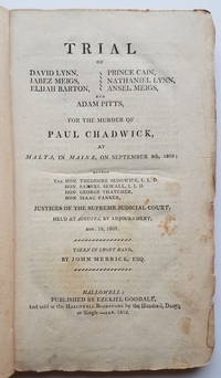
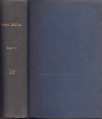
18103720<p><b><i>Early Maine Murder Trial Gone Awry</i></b><br /></p><p>An account of a murder trial in Malta now Windsor in the District of Maine. Paul Chadwick was a surveyor on what was then the northern frontier of Maine and in an area where disputed land titles were common. Chadwick was shot while conducting a survey by a group of landowners disguised as Indians. Despite fairly overwhelming evidence of the guilt of the accused the jury found all not guilty. <br /></p>Previous owner's Rice Dudley book label on front pastedown. Another early owner's name Moody Kent in ink in several places.<br /><br /><b>References:</b> Shaw & Shoemaker: 21516 3 locations. Sabin: 47985. Williamson: 5651. Noyes: 505. Skillin: 10-32. McDade: 641. <br /><br /><b>Condition:</b> 186 2 pp. Original blue/gray paper-covered boards with chipping. Paper spine cracked and eroded. Original paper spine label with vertical separation. Occasional foxing and staining mostly very light. A solid example of a scarce early Maine imprint. Ezekiel Goodale
192041289Washington D.C.: Published by the United States Coast and Geodetic Survey 1920. Large folding nautical chart printed on heavy paper stock. Colored. A rare original coastal survey of Maine and New Hampshire including Portsmouth York Ogunquit Kennebunkport Biddeford and Cape Elizabeth.<br/> <br/> Established by President Thomas Jefferson in 1807 as the Survey of the Coast the U.S. Coast and Geodetic Survey was the United States' first civilian scientific agency. This agency has followed its mission to survey the U.S. coastline create nautical charts of the coast and help increase maritime safety since its founding and has often played fascinating roles in significant chapters of U.S. history. It served in all theaters of the Civil War in the service of the Union Army and Navy pioneered acoustic exploration in the wake of the sinking of the Titanic and during WWI it worked to detect enemy submarines. In addition this agency worked to survey and produce detailed maps and renderings of the U.S. coast. These nautical survey maps commonly referred to as "T-sheets" provide fascinating insights into the history of the United States coastline which has and will continue to shift. These maps are the most important data source for understanding the physical and ecological characteristics of the U.S. shoreline. The present map is a highly detailed and accurate sea chart of the coasts of Maine and New Hampshire and an important historical view of the developing states. Published by the United States Coast and Geodetic Survey unknown
192041283Washington D.C.: Published by the United States Coast and Geodetic Survey 1920. Large folding nautical chart printed on heavy paper stock. Uncolored. A rare original coastal survey of New Hampshire and Maine including Portsmouth Exeter Dover and the Piscataqua River.<br/> <br/> Established by President Thomas Jefferson in 1807 as the Survey of the Coast the U.S. Coast and Geodetic Survey was the United States' first civilian scientific agency. This agency has followed its mission to survey the U.S. coastline create nautical charts of the coast and help increase maritime safety since its founding and has often played fascinating roles in significant chapters of U.S. history. It served in all theaters of the Civil War in the service of the Union Army and Navy pioneered acoustic exploration in the wake of the sinking of the Titanic and during WWI it worked to detect enemy submarines. In addition this agency worked to survey and produce detailed maps and renderings of the U.S. coast. These nautical survey maps commonly referred to as "T-sheets" provide fascinating insights into the history of the United States coastline which has and will continue to shift. These maps are the most important data source for understanding the physical and ecological characteristics of the U.S. shoreline. The present map is a highly detailed and accurate sea chart of coastal New Hampshire and Maine and an important historical view of the developing states. Published by the United States Coast and Geodetic Survey unknown
192041288Washington D.C.: Published by the United States Coast and Geodetic Survey 1920. Large folding nautical chart printed on heavy paper stock. Colored. A rare original coastal survey of Portsmouth Harbor including Kittery Point New Castle Island and Portsmouth.<br/> <br/> Established by President Thomas Jefferson in 1807 as the Survey of the Coast the U.S. Coast and Geodetic Survey was the United States' first civilian scientific agency. This agency has followed its mission to survey the U.S. coastline create nautical charts of the coast and help increase maritime safety since its founding and has often played fascinating roles in significant chapters of U.S. history. It served in all theaters of the Civil War in the service of the Union Army and Navy pioneered acoustic exploration in the wake of the sinking of the Titanic and during WWI it worked to detect enemy submarines. In addition this agency worked to survey and produce detailed maps and renderings of the U.S. coast. These nautical survey maps commonly referred to as "T-sheets" provide fascinating insights into the history of the United States coastline which has and will continue to shift. These maps are the most important data source for understanding the physical and ecological characteristics of the U.S. shoreline. The present map is a highly detailed and accurate sea chart of Portsmouth Harbor and an important historical view of developing New Hampshire and Maine. Published by the United States Coast and Geodetic Survey unknown
1876S11176Paris:: Germer Bailliere 1876. 1876. Thick 8vo. 4 c 519 3 pp. Original printed wrappers; extremities chipped spine ends and cover corners missing small pieces. As is. SIGNED AND INSCRIBED from Gerard to M. H. Chotard verso title page. Maine de Biran 1766-1824 was a French philosopher who evolved from a sensualist to a mystical theosophist proposing that "human conscious experience might be exhibited as growing or developing from its essential basis in connection with external conditions" Wikip. Martin Henri Chotard 1821-1904 to whom the book is inscribed was a historian and lecturer first at Basencon and then at Claremont-Ferrand where he became dean. He was described by one inspector sitting in on his lectures as someone who "worked hard and did his utmost not to be common. . . 'Speaking easily clearly and soberly he does not hanker after rhetorical or declamatory effect. He has the tone and approach truly befitting a professor'" the inspector said den Boer 232. den Boer Pim. History as a Profession: The Study of History in France 1818-1914. Princeton NJ: Princeton University Press 1998. Germer Bailliere, 1876. unknown
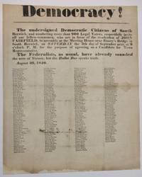
184037337South Berwick ME 1840. Broadside 11-3/4" x 14-1/2." Text as recited above in bold type of various sizes. Beneath are the printed signatures in smaller type of about 200 local citizens endorsing the call for assembly. Old folds as usual with several small pinholes along the folds which do not affect text. Ink signature on blank verso "Micajah Grant" preceded by "Mrs" "Hon.". Good plus.<br /> <br /> South Berwick Democrats seek support for the re-election of Maine Governor John Fairfield 1797-1847. Elected in 1838 he beat his Whig i.e. "Federalist" opponent in the 1840 campaign. <br /> Not located on OCLC as of May 2024 or online AAS Bowdoin Colby U ME U So. ME sites. unknown
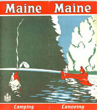
192941238N.P.: Maine Development Commission 1929. 1929. 18" x 16" sheet folded to 16 panels. 2 color cover panels showing a canoeing scene with a campsite in the background. 1-panel of information on camping and 1-panel of information on canoeing. 4 panels offering black and white photographs of scenery wildlife and individuals participating in various activities. Opposite panels offer 11 1/4" x 9" map of the state printed in black blue and red. Along the sides of the map is information on various cruises to include the Allagash trip; the St. John trip; the Fish River trip; the Rangeley Lakes trip; the Grand Lake - Machias trip; and the East and West Branch trips of the Penobscot River. 1/2" split to one fold and with light foxing and with light wear to the extremities. Very good. Maine Development Commission, 1929. unknown
192841239Augusta: Kennebec Journal Co. 1928. 1928. First edition. 9" x 8" with vertical fold at center and with bright colorful cover showing a coastal scene on 1/2 and a cabin scene on the other. 72 pp. including wrappers. Illustrations. Foreword. Maps. Map Index. General Index. Information and black and white photographs of the Maine seacoast to include the Yorks the Scarboro Beaches Porland and Casco Bay Bowdoin College Boothbay Harbor Bar Harbor Bangor Camden and Prescott Bay Narraguagus Bay Passamaquoddy Bay Eastport etc.; Inland Maine to include Sebago country Bridgton Harrison the Saco Valley the Oxford County Hills the Poland County etc.; Northwestern Maine to include the Rangeley region the Kennebago country the Dead River region etc.; Central Maine to include Moosehead Lake and Mount Kineo Kennebec Belgrade Lake Parlin etc.; and Eastern and Northern Maine to include the Grand Lakes country in Washington County Northern Aroostook County Patten Norcross Mount Katahdin etc. Information on various camping opportunities winter sports Maine's industry and agriculture as well as a history of Maine and its colonization. At center is a two-page map of the state of Maine showing the location of all cities towns and seacoast and inland resorts. Much valuable information. Light soiling to wrappers and light wear to the extremities. Very good. Kennebec Journal Co., 1928. unknown
190433991Bethel Maine: Printed by E. C. Bowder 1904. First Edition. Hardcover. Good. Thick octavo. 3 169 pages 2. Ex-institutional copy from the Long Island Historical Society with blind stamp on he title page page 169 written numbers on the copyright page and rear paste down. Later blue cloth with title on the spine. Blue linen inner hinges. Contents are clean. Printed by E. C. Bowder hardcover
190833992Bethel Maine: Printed by E. C. Bowder 1908. First Edition. Hardcover. Good. Thick octavo. 3 148 pages 5. Ex-institutional copy from the Long Island Historical Society with blind stamps on he title page page 148 written numbers on the copyright page and rear paste down. Later blue cloth with title on the spine.Blue linen inner hinges. Contents are clean. Printed by E. C. Bowder hardcover
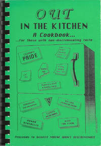
199510214Lenexa Kan.: Cookbook Publishers Inc. 1995. Comb-bound octavo 23 x 16 cm. viii 105 viii pages. Introduction; illustrated with a cover design by Cheryl Green. Title from Cover. FIRST EDITION. An important civil rights fundraising cookbook raising awareness and money to help defeat a state referendum question which would have overturned the Portland Human Rights Ordinance which extended protected classifications to "gays and lesbians" the nomenclature of the era. The cookbook itself was issued just as the referendum was defeated and the civil rights of gays and lesbians were upheld. In 2009 Maine was the first state to legalize same-sex marriage though the law was overturned in 2012. The text includes "A brief history of gay rights legislation in Maine". Lightest rubbing to black-printed green card stock covers otherwise fine with black comb-binding. Scarce. OCLC locates six copies. [Cookbook Publishers, Inc.] unknown
1898List2965United States and Caribbean 1898. Approximately twenty-nine pieces: logbook of eighty-four double-sided pages measuring 13 x 20 inches; eight letters seventeen documents and forms and three pieces of miscellany. Much wear and significant damage to logbook including water damage mildew and tearing; log book overall fair to good minus. Other materials good to very good. Overall good. William Higgins 1791–1872 was a farmer sea captain and owner of and investor in ships from Bowdoinham Maine. According to the Maine Maritime Museum which holds his family papers Higgins’ ships traded mainly in lumber which they took from Wilmington North Carolina to the Caribbean.<br /> <br /> Offered here is a logbook recording the travels of several of Higgins’ ships particularly the brigs Mary Jane and Llewellyn alongside related documents and personal letters. The logbook dating between 1832 and 1836 extensively documents the course wind data and weather remarks for travels of the ships between east coast US port cities and various locations in the Caribbean including Barbados St. Thomas and Martinique. The logbook also contains a copy of astronomer and mathematician Elijah Burritt’s illustration “A Plan of the Solar System Exhibiting its Relative Magnitudes and Distances†engraved by W. G Evans and printed in 1835 by F.J. Huntington.<br /> <br /> The letters and documents date from 1830 to 1867 and are also mostly business-related including an insurance document for the brig William Parrington a roll of sailors enlisted to work on a six-month journey between the Caribbean and the US in 1845 a bill of sale for ¼ stake in the brig Mary Jane and receipts and logs for items including various liquors sugar molasses casks and so on. One letter from a young man in Wilmington requests advice on how to start his own business in the style of Higgins’; other letters concern family matters. One interesting undated document is a writ addressed to the Marshal of the District of Maine concerning a lawsuit filed against Higgins and Rufus Carr master of the William Parrington by Zachrisson Nelson Co. The suit alleged that Carr acting as an agent for the ship’s owners that is Higgins had agreed to an affreightment involving shipping from Jamaica to Spain to New York but had then “wholly neglected and refused to do soâ€.<br /> <br /> Of interest to scholars of maritime history and trade in the mid-19th century. unknown
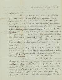
1845List2966Kennebunk Maine 1845. Two 7 ½ x 9 ¾ inch pages. Near fine. A letter from Barnabas Palmer in Kennebunk to Charles G. Bellamy Esquire in Kittery. Bellamy 1811–1892/1899 was a captain in the Maine militia a member of the Maine House of Representatives 1842–3 and State Senate 1846–7 York County Sheriff and then Inspector of Timber at the Navy Yard in Portsmouth.1 Palmer 1791–1867 may have been military; he appears in Maine state records as an agent for the Kennebunk Gun House which is listed in other records as under the purview of the Quartermaster General.<br /> <br /> Palmer gives Bellamy his opinion on the political prospects of “Pierce†versus “Hammond†commenting:<br /> <br /> “I did not hear of any legislative recommendation of Hammond while I was at Augusta and if there was and their late abolition speeches & Texan resolutions is a specimen of the support they intend to give Mr Polk it should not have much effect.â€<br /> <br /> The US under President Polk had not yet annexed Texas and Palmer is apparently underwhelmed by Maine’s support for the cause. He also remarks on Joshua Herrick’s 1793–1874 bid for re-nomination to Congress; though he feels that he had “been badly treated†by Herrick’s competition “Judge Hayes†Palmer nonetheless feels compelled to vote for Hayes over Herrick. Of interests to historians of Maine state politics.<br /> <br /> 1 John E. Frost Colonial Village Gundalow Club: 1948 28. unknown
1922IAIe[MAI58Edinburgh & London: T.N.Foulis Ltd. 1922. 1922. 4to. ff. 24. printed in red & black. 10 full-page illus. decorative headpieces initials & title vignette. unopened in original cloth-backed gilt bds. First Edition. F. Hardcover. Edinburgh & London: T.N.Foulis, Ltd., [1922]. Hardcover
185025184Rockville CT: Press of the Tolland County Republican 1850. 8pp untrimmed. Folded fold splitting pinned. Tanned with some spotting. Good. <br /> <br /> The author writes humorous poetry to express his distress at new and excessive tax laws. A complete list of taxable property would take "Methuselah's hours.Although I have little that now commands cash; I've plenty in 'ruins' all broken to smash; A fine dish of 'all-sorts' to publish in form; Would make out a list thrice as long as my arm. So I must abbreviate and name them in groups; then let our great ASSES-ors examine to boot."<br /> OCLC 15328280 9. Press of the Tolland County Republican unknown
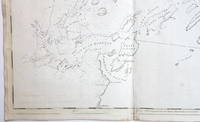
17763748<b>Striking Casco Bay Chart from the Atlantic Neptune 1776</b><br /><br />This is an exceptional chart of the coast of Maine between Cape Elizabeth and Popham from the early Revolutionary War period. It is from Des Barres' monumental <i>Atlantic Neptune</i> a sea atlas published by the British Admiralty during the last quarter of the 18th century. The <i>Atlantic Neptune</i> has been called "the most splendid collection of charts plans and views ever published." <br /><br />The present chart includes all of Casco Bay naming the larger islands and extends east to include Seguin "Segevin Island" and Georgetown Islands. Among the numerous geographic features named are Great Jebieg Chebeague Merrymeeting Bay Segadahock River Arrowsick Island and Halfway Road i.e. Rock. Roads are shown on the chart as are individual buildings. <br /><br />The chart is dated July___ 1776 i.e. with a prominent space after the month as if a date were going to be inserted. There is no type-stamped "15" at the upper right as called for in some copies of state "b" of the Stevens Catalogue. <br /><br />The chart was folded into four vertical panels about 30 1/4 x 12" to accommodate being "bound up in tall narrow form" Stevens' Catalogue p. vii. The chart paper has the LVG watermark consistent with the earlier issues of the chart. <br />A scarce early state of a desirable chart. <br /><br /><b>References:</b> Stevens <i>Catalogue of the Atlantic Neptune</i>: 105 State: b. Sellers & Van Ee <i>Maps and Charts of North America and the West Indies</i> 1750-1789: 855. <br /><br /><b>Condition: </b>A wonderfully clean example of a striking chart of Casco Bay.<br /><br />ICN 3763. From The Atlantic Neptune.
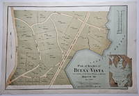
18883832<p>This attractively executed map/plan is for a proposed development by the Maine Central Railroad conveniently located "near terminus of the Mt. Desert Branch" of the railroad. The plan was "laid out by Joseph H. Curtis landscape engineer from surveys by J.G. Kelley." The completion of the Mt. Desert Branch in 1884 made possible an all-rail journey from Portland and points south to the Mt. Desert area. The proposed development apparently did not occur since a note on OCLC states: "Later maps show no evidence of the planned roads or lots."</p><p>Scarce with OCLC locating examples at the University of Maine at Orono Yale and Columbia. The Osher Map Library also has an example.</p><p><strong>Condition:</strong> Litho in green blue and brown. Very good with a small smudge at the middle of the right blank margin and remnants of mounting tape on the reverse.</p><p>ICN 7807.2</p> Heliotype Printing Co.
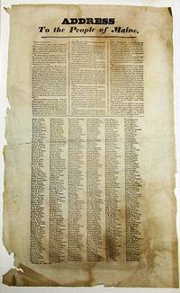
183234328Portland 1832. Broadside 11-3/4" x 19". Lightly foxed generously margined and untrimmed with lower blank margins chipped some old folds. Else Very Good. Matted. Dated in type at the end: Portland Oct. 25th 1832."<br /> <br /> The text of this rare broadside urging the defeat of President Jackson in the upcoming presidential election is printed in three columns. It is followed by six columns consisting of hundreds of printed names of Portland citizens endorsing its sentiments. <br /> Despite his promises to the contrary Jackson has expanded the power of the presidency reneged on his promise to serve only one term and enthusiastically practiced the Spoils System. "The expenses of his administration have largely exceeded those of any of his six predecessors." He has claimed the power of "interpreting for himself" the Constitution although contradicted by "the Supreme Judiciary." <br /> AI 10824 1- Harvard. OCLC 58786948 3- AAS NYHS Harvard as of November 2023. unknown
192041293Washington D.C.: Published by the United States Coast and Geodetic Survey 1920. Large folding nautical chart printed on heavy paper stock. Colored. A rare original coastal survey of the approach to Penobscot Bay including Matinicus Island and an inset map of Matinicus Harbor in the bottom right corner.<br/> <br/> Established by President Thomas Jefferson in 1807 as the Survey of the Coast the U.S. Coast and Geodetic Survey was the United States' first civilian scientific agency. This agency has followed its mission to survey the U.S. coastline create nautical charts of the coast and help increase maritime safety since its founding and has often played fascinating roles in significant chapters of U.S. history. It served in all theaters of the Civil War in the service of the Union Army and Navy pioneered acoustic exploration in the wake of the sinking of the Titanic and during WWI it worked to detect enemy submarines. In addition this agency worked to survey and produce detailed maps and renderings of the U.S. coast. These nautical survey maps commonly referred to as "T-sheets" provide fascinating insights into the history of the United States coastline which has and will continue to shift. These maps are the most important data source for understanding the physical and ecological characteristics of the U.S. shoreline. The present map is a highly detailed and accurate sea chart of Penobscot Bay and an important historical view of developing Maine. Published by the United States Coast and Geodetic Survey unknown
192041278Washington D.C.: Published by the United States Coast and Geodetic Survey 1920. Large folding nautical chart printed on heavy paper stock. Colored. A rare original coastal survey of Blue Hill Bay including Swans Island Deer Isle Mt Desert and Tremont.<br/> <br/> Established by President Thomas Jefferson in 1807 as the Survey of the Coast the U.S. Coast and Geodetic Survey was the United States' first civilian scientific agency. This agency has followed its mission to survey the U.S. coastline create nautical charts of the coast and help increase maritime safety since its founding and has often played fascinating roles in significant chapters of U.S. history. It served in all theaters of the Civil War in the service of the Union Army and Navy pioneered acoustic exploration in the wake of the sinking of the Titanic and during WWI it worked to detect enemy submarines. In addition this agency worked to survey and produce detailed maps and renderings of the U.S. coast. These nautical survey maps commonly referred to as "T-sheets" provide fascinating insights into the history of the United States coastline which has and will continue to shift. These maps are the most important data source for understanding the physical and ecological characteristics of the U.S. shoreline. The present map is a highly detailed and accurate sea chart of Blue Hill Bay and an important historical view of developing Maine. Published by the United States Coast and Geodetic Survey unknown
191941297Washington D.C.: Published by the United States Coast and Geodetic Survey 1919. Large folding nautical chart printed on heavy paper stock. Uncolored. A rare original coastal survey of Bath and Boothbay Harbor including Bath Georgetown Boothbay and Westport and Southport Islands.<br/> <br/> Established by President Thomas Jefferson in 1807 as the Survey of the Coast the U.S. Coast and Geodetic Survey was the United States' first civilian scientific agency. This agency has followed its mission to survey the U.S. coastline create nautical charts of the coast and help increase maritime safety since its founding and has often played fascinating roles in significant chapters of U.S. history. It served in all theaters of the Civil War in the service of the Union Army and Navy pioneered acoustic exploration in the wake of the sinking of the Titanic and during WWI it worked to detect enemy submarines. In addition this agency worked to survey and produce detailed maps and renderings of the U.S. coast. These nautical survey maps commonly referred to as "T-sheets" provide fascinating insights into the history of the United States coastline which has and will continue to shift. These maps are the most important data source for understanding the physical and ecological characteristics of the U.S. shoreline. The present map is a highly detailed and accurate sea chart of Bath and Boothbay Harbor and an important historical view of developing Maine. Published by the United States Coast and Geodetic Survey unknown
192041267Washington D.C.: Published by the United States Coast and Geodetic Survey 1920. Large folding nautical chart printed on heavy paper stock. Uncolored. A rare original coastal survey of Blue Hills Bay in Maine including Ellsworth Surry Tremont Southwest Harbor Swans Island Blue Hill and Acadia National Park.<br/> <br/> Established by President Thomas Jefferson in 1807 as the Survey of the Coast the U.S. Coast and Geodetic Survey was the United States' first civilian scientific agency. This agency has followed its mission to survey the U.S. coastline create nautical charts of the coast and help increase maritime safety since its founding and has often played fascinating roles in significant chapters of U.S. history. It served in all theaters of the Civil War in the service of the Union Army and Navy pioneered acoustic exploration in the wake of the sinking of the Titanic and during WWI it worked to detect enemy submarines. In addition this agency worked to survey and produce detailed maps and renderings of the U.S. coast. These nautical survey maps commonly referred to as "T-sheets" provide fascinating insights into the history of the United States coastline which has and will continue to shift. These maps are the most important data source for understanding the physical and ecological characteristics of the U.S. shoreline. The present map is a highly detailed and accurate sea chart of Blue Hills Bay and an important historical view of developing Maine. Published by the United States Coast and Geodetic Survey unknown
192241276Washington D.C.: Published by the United States Coast and Geodetic Survey 1922. Large folding nautical chart printed on heavy paper stock. Colored. Bisected into two maps. A rare original coastal survey of Maine including Boothbay Harbor Bath and Georgetown.<br/> <br/> Established by President Thomas Jefferson in 1807 as the Survey of the Coast the U.S. Coast and Geodetic Survey was the United States' first civilian scientific agency. This agency has followed its mission to survey the U.S. coastline create nautical charts of the coast and help increase maritime safety since its founding and has often played fascinating roles in significant chapters of U.S. history. It served in all theaters of the Civil War in the service of the Union Army and Navy pioneered acoustic exploration in the wake of the sinking of the Titanic and during WWI it worked to detect enemy submarines. In addition this agency worked to survey and produce detailed maps and renderings of the U.S. coast. These nautical survey maps commonly referred to as "T-sheets" provide fascinating insights into the history of the United States coastline which has and will continue to shift. These maps are the most important data source for understanding the physical and ecological characteristics of the U.S. shoreline. The present map is a highly detailed and accurate sea chart of coastal Maine from Boothbay Harbor to Bath and an important historical view of the developing state. Published by the United States Coast and Geodetic Survey unknown