Wells, MaineBiblio.com
2 671 résultats
0331303248.Ghardcover. Good. Access codes and supplements are not guaranteed with used items. May be an ex-library book. hardcover
042874334X.Ghardcover. Good. Access codes and supplements are not guaranteed with used items. May be an ex-library book. hardcover
198370692Augusta ME: Mallar Development Services and Maine tomorrow 1983. Paperback. Fine. 31 pp; plus appendicies; with 5 b & w illustrations and 1 chart; feasability study prepared for the cities of Augusta Gardiner and Hallowell on ways to best take advantage of the array of attractiuons that exist on the lower Kennebec River type written pages printed on recto only; in illustrated wraps with plastic comb binding. <br/><br/> Mallar Development Services and Maine tomorrow paperback
1764312885Kittery ME 1764. 1 p. pen and ink on paper. Oblong 12mo. Very Good. 1 p. pen and ink on paper. Oblong 12mo. A receipt from Caleb Emery to his brother Daniel Emery Jr. 1697-1778 reading: "Received of Daniel Emery junr. Five Shillings Lawfull sic money in Full of all accounts Debts Dues & Demand of any sort whatsoever to the Date hereof - By me" Caleb Emery 1710-1793 son of Daniel Emery Sr. and Margaret Gowen Emery married Jane Frost of Berwick where he was a lawyer farmer and tanner. "He read law with his brother Noah and was admitted to the Court of Common Pleas in 1750. He was a man of plain manners of strict integrity of peaceful character discouraging litigation among his neighbors even after he had entered the legal profession. He had the confidence of all with whom he came in contact and was highly esteemed by his relatives and clients." Genealogical records of descendants of John and Anthony Emery of Newbury Mass. 1590-1890 Emery Rufus 1827-1913. A Brother's Debt Paid. <br/><br/> unknown
186178439Kelay House Camp Beal Nov. 12 1861. Fine original condition. 8vo. Thanking her for sending stamps as the troops have not been paid and "they do not take Maine money here." Most of the companies are guarding the railroad to Annapolis Junction. He describes his Captain's attitude and his own toward the men. unknown
00286204Maine: Privately Printed Blue/gilt autograph album from a Dr. Painter of Monmouth Maine. early 1950's with many of Maine's locals Smith invites "Mickey" to come visit her in Washington April 5 1951 Governor Payne and his wife wish him well state Police Captain teachers many admires a few poems Scarce. Size: Oblong. Inscribed by Authors. First Edition. Cloth. Very Good. Privately Printed hardcover
1966A107343London: Hodder & Stoughton 1966. 1st edition. As New. small octavo. hardback with dust jacket 190pp. Superb dust jacket. Designed by Studio Stead. Only the tiniest wear to peripheries o/w unusually fine copy Hodder & Stoughton hardcover
ria9780443158834_inpHardback. New. New Book; Fast Shipping from UK; Not signed; Not First Edition; N/A hardcover
1532145357.Glibrary. Good. Access codes and supplements are not guaranteed with used items. May be an ex-library book. unknown
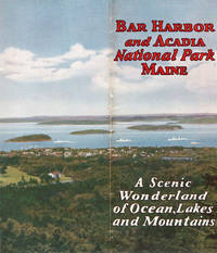
192945531Bar Harbor: Sherman Publishing Co. 1929. 1929. MAINE. 9" x 8" pictorial wrappers n. p. 16 pp. illustrated maps. The covers when fully extended provide a 9" x 16" view of Bar Harbor and Acadia National Park in the background. Views of Kebo Valley Club House Thunder Hole the Shore Drive the YWCA building the high school the Robert Abbe Memorial Museum Sieur de Monts Spring views in Acadia National Park views from Cadillac Mountain Road etc. Map show location of Bar Harbor and how to get there and another map is of Mount Desert Island showing Bar Harbor and Acadia National Park. Originally named Lafayette National Park the park changed to Acadia National Park in 1929. It is still one of the country's most visited parks. Lightly rubbed at spine else a very good copy. Sherman Publishing Co., 1929]. unknown
63-7657Port Clyde Maine: Blue Water Fine Arts 2015. 4to. Tri-folder 6 pp. Near Fine. Color Plates. Scarce.Provenance: From the Peter Selz collection. Port Clyde, Maine: Blue Water Fine Arts, 2015. unknown
ria9786208208042_inpPaperback. New. New Book; Fast Shipping from UK; Not signed; Not First Edition; N/A paperback
191941297Washington D.C.: Published by the United States Coast and Geodetic Survey 1919. Large folding nautical chart printed on heavy paper stock. Uncolored. A rare original coastal survey of Bath and Boothbay Harbor including Bath Georgetown Boothbay and Westport and Southport Islands.<br/> <br/> Established by President Thomas Jefferson in 1807 as the Survey of the Coast the U.S. Coast and Geodetic Survey was the United States' first civilian scientific agency. This agency has followed its mission to survey the U.S. coastline create nautical charts of the coast and help increase maritime safety since its founding and has often played fascinating roles in significant chapters of U.S. history. It served in all theaters of the Civil War in the service of the Union Army and Navy pioneered acoustic exploration in the wake of the sinking of the Titanic and during WWI it worked to detect enemy submarines. In addition this agency worked to survey and produce detailed maps and renderings of the U.S. coast. These nautical survey maps commonly referred to as "T-sheets" provide fascinating insights into the history of the United States coastline which has and will continue to shift. These maps are the most important data source for understanding the physical and ecological characteristics of the U.S. shoreline. The present map is a highly detailed and accurate sea chart of Bath and Boothbay Harbor and an important historical view of developing Maine. Published by the United States Coast and Geodetic Survey unknown
2002Q-0696215128Meredith Books 2002-01-01. Spiral-bound. New. New. In shrink wrap. Looks like an interesting title! Meredith Books unknown
55693739-6Center Point Large Print. Used - Good. Pages intact with minimal writing/highlighting. The binding may be loose and creased. Dust jackets/supplements are not included. Stock photo provided. Product includes identifying sticker. Better World Books: Buy Books. Do Good. Center Point Large Print unknown
14370215-6Center Point Large Print. Used - Very Good. Former library copy. Pages intact with possible writing/highlighting. Binding strong with minor wear. Dust jackets/supplements may not be included. Includes library markings. Stock photo provided. Product includes identifying sticker. Better World Books: Buy Books. Do Good. Center Point Large Print unknown
0964962004.Gpaperback. Good. Access codes and supplements are not guaranteed with used items. May be an ex-library book. paperback
192041267Washington D.C.: Published by the United States Coast and Geodetic Survey 1920. Large folding nautical chart printed on heavy paper stock. Uncolored. A rare original coastal survey of Blue Hills Bay in Maine including Ellsworth Surry Tremont Southwest Harbor Swans Island Blue Hill and Acadia National Park.<br/> <br/> Established by President Thomas Jefferson in 1807 as the Survey of the Coast the U.S. Coast and Geodetic Survey was the United States' first civilian scientific agency. This agency has followed its mission to survey the U.S. coastline create nautical charts of the coast and help increase maritime safety since its founding and has often played fascinating roles in significant chapters of U.S. history. It served in all theaters of the Civil War in the service of the Union Army and Navy pioneered acoustic exploration in the wake of the sinking of the Titanic and during WWI it worked to detect enemy submarines. In addition this agency worked to survey and produce detailed maps and renderings of the U.S. coast. These nautical survey maps commonly referred to as "T-sheets" provide fascinating insights into the history of the United States coastline which has and will continue to shift. These maps are the most important data source for understanding the physical and ecological characteristics of the U.S. shoreline. The present map is a highly detailed and accurate sea chart of Blue Hills Bay and an important historical view of developing Maine. Published by the United States Coast and Geodetic Survey unknown
1999Q-0936077344Gurze Books 1999-08-01. Paperback. New. New. In shrink wrap. Looks like an interesting title! Gurze Books paperback
192241276Washington D.C.: Published by the United States Coast and Geodetic Survey 1922. Large folding nautical chart printed on heavy paper stock. Colored. Bisected into two maps. A rare original coastal survey of Maine including Boothbay Harbor Bath and Georgetown.<br/> <br/> Established by President Thomas Jefferson in 1807 as the Survey of the Coast the U.S. Coast and Geodetic Survey was the United States' first civilian scientific agency. This agency has followed its mission to survey the U.S. coastline create nautical charts of the coast and help increase maritime safety since its founding and has often played fascinating roles in significant chapters of U.S. history. It served in all theaters of the Civil War in the service of the Union Army and Navy pioneered acoustic exploration in the wake of the sinking of the Titanic and during WWI it worked to detect enemy submarines. In addition this agency worked to survey and produce detailed maps and renderings of the U.S. coast. These nautical survey maps commonly referred to as "T-sheets" provide fascinating insights into the history of the United States coastline which has and will continue to shift. These maps are the most important data source for understanding the physical and ecological characteristics of the U.S. shoreline. The present map is a highly detailed and accurate sea chart of coastal Maine from Boothbay Harbor to Bath and an important historical view of the developing state. Published by the United States Coast and Geodetic Survey unknown
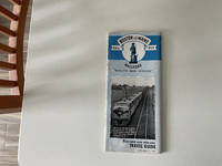
1945247<p>Cover has some minor stains and wear especially along the spine edges which is pretty typical for something from 1945. Inside though the pages are clean bright and free of marks or highlights. So overall I'd say it's in good condition especially considering its age with just some typical wear on the outside.</p><p>The Boston & Maine Railroad Minuteman Service Travel Guide published on October 15 1945 was a promotional pamphlet highlighting a premier rail route through Northern New England. It provided schedule details for the Minuteman train connecting Boston and Troy New York and showcased attractions like the White Mountains. The guide was created by the railroad's Passenger Department and didn't credit an individual author.</p> The Boston & Maine Railroad Minuteman Service Travel Guide, dated October 15, 1945 paperback
ria9781108470872_inpHardback. New. New Book; Fast Shipping from UK; Not signed; Not First Edition; This book explains how and why some national mandates for participatory policymaking develop into powerful institutions for citizen engagement. It argues that participatory institution building can happen when new participatory institut hardcover
0364146869.Gpaperback. Good. Access codes and supplements are not guaranteed with used items. May be an ex-library book. paperback
0332882926.Ghardcover. Good. Access codes and supplements are not guaranteed with used items. May be an ex-library book. hardcover
1332042422.Gpaperback. Good. Access codes and supplements are not guaranteed with used items. May be an ex-library book. paperback