1 053 résultats
1868GAST0075Wien, Wilhelm Braumüller 1868. Gr. - 8. 225 S. mit 31 Holzschnitten. Bedruckte Obrosch., Rü. ausgeblichen, Deckel mit mont. Bibliotheksschild. Kapitale stark berieben, Ecken eselohrig. Titelbl. mit Bibliotheksstempel (Bibliothek d. k. k. Ministeriums d. Inneren) , innen gut erhalten u. noch unaufgeschnitten.
181015997Wien, Anton von Haykul, 1810. Gr.-8°. 6 S., Heftstreifen.
18305247BBLunéville, um 1830. Visit., Handschuhe - Nathan, Béer & Trefousse, Lunéville und Paris
1806SB-14230Weimar, Landes Industrie Comptoir, 1806. 280 S. Original-Broschuren mit umlaufender Ornamentleiste. Mit 8 mehrfach gefalteten Kupferstich-Illustrationen, darunter eine kolorierte Frankreich-Karte im Format 45 x 33 cm, zwei Paris-Ansichten sowie drei Trachten-Bildtafeln.
184050069ABParis, Galignani, 1840. 16 x 11 cm. X, 570, 18 S. mit 59 Stahlstichansichten. HLdr. d. Zt., Paris (etwas berieben u. bestoßen, Rücken angeplatzt).
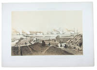
1856G5DC4C01U79OParis: Arthus-Bertrand printed by Becquet frères 1856. Later half blue cloth portfolio patterned white silk sides printed in blue in period style printed spine label. 1mo 63 x 46 cm. An album of views most including ships on the river from the Battle of Kinburn in the Crimean War comprising 17 plates: 1 tinted lithographed title-page 15 tinted and double-tinted lithographed views image size 30 x 46 cm and a lithographed map. Many views also coloured by hand. A rare lithographic print series commemorating the Battle of Kinburn Kil-Bouroun on the south bank of the Dnieper River near the Crimea. On 17 October 1855 during the Crimean War the French and British navies attacked the Russian outpost there with a fleet of ironclad ships destroying the fortifications within hours and suffering only light damage. This decisive success seven years before the famous battle of the Monitor and the Merrimack in the American Civil War heralded the demise of the traditional wooden warship. Though made from the land mostly after the battle itself nearly all show maritime scenes with large and detailed depictions of the ironclad ships on the ice-bound river. They also show the ruined fortifications in great detail. With some marginal tears repaired but still in very good condition with only an occasional minor spot. The portfolio is also very good with a couple small water stains on the silk of the front board. A lovely series of views of ironclad ships on the frozen Dnieper River during the Crimean War.l Collection De Vinck 17202-17206 17209 17211-17221; WorldCat 4 copies. Arthus-Bertrand (printed by Becquet frères), hardcover
1880M204Mailand, Edoardo Sonzogno, 1880. (Il Romanziere del Popolo Anno II, No. 64-90) - Frühe italienische Ausgabe des wohl berühmtesten Romans von Victor Hugo (1802-1885), erschienen im "Il Romanziere del Popolo" vom 21. März bis 19. September 1880, reich illustriert mit den berühmten, ausdrucksstarken Bildern in Holzstich. Papierbedingt teils etwas gebräunt, sonst kaum Gebrauchsspuren.
186680182Paris, Imprimeries réunies établissement A (nach 1866). Mit Abbildungen zahlr. Sammlungsstempel. CXI, 409, 152, 201 S. 8vo. OLwd.
185180958Paris, Pillet Fils Ainé 1851. 84 S. Kl.-8vo. OHLdr.
181829317Paris, chez NEPVEU-Libraire/Les Suisses et Portiers, 1818. kl. 8°, 82 S. + Faltpläne; Description de cet Édifice à l'interieur; détails sur la destination de chacune de ses parties, sur les peintures et les statues qui le décorent; description de ses jardins, de ses dépendances, et d'une partie du quartier qui l'avoisine; Pour servir de Guide a oeux qui visitent ce Palais; in französischer Sprache, Bezahlung per PayPal möglich , we accept PayPal, Regalspuren am Fußschnitt, Einband beschabt und bestoßen, altersbedingte Bräunungen, Gebr.sp., broschiert
1900149851Helsingfors : Impr. Centrale 1900. First Edition. Hardback. Fine copy in the original gilt-blocked cloth over bevelled boards. Slightest suggestion only of dust-dulling to the panel edges. Remains particularly well-preserved overall; tight bright clean and strong. ; 527 pages; Physical desc. : 527 p. In various paginations: ill. plates maps ; 23 cm. Other names: Mechelin Leo 1839-1914. Finland. Teollisuushallitus. Exposition universelle internationale de 1900 Paris France. Contents: Pays et population. --Organisation politique et administrative. --Culture intellectuelle. --Culture materielle. --Etat social. Language: French. Helsingfors : Impr. Centrale hardcover
189776209Berlin, Langenscheidtsche Verlagsbuchhandlung ca 1897. 11. Tausend (2. Auflage) XVI, 343 S., 93 S. Anhang Reise nach Paris; 15cm Leinen 0
186243890ABParis, Chaix, 1862. 587, 32pp. With fold. plan and 19 plates. Orig. red cloth.
1900284176Paris: Garnier Freres um 1900-. große farbige lith. Faltkarte ca. 40x50 in Mappe.+ ca. 20 S.
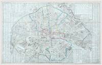
1811172418Paris: Esnault 1811. Paris at the height of Napoleonic rule Rare iteration of this attractive map untraced institutionally originally published in 1782; all early versions are scarce. This is an excellent copy housed in its original case. The Place Vendôme includes the imposing Colone de la Grande Armee commemorating Napoleon's great victory at Austerlitz in 1805 which was constructed on his orders and completed in 1810. The nascent Rue de Rivoli is shown laid out in the year of publication confined to the north side of the Tuileries. Also constructed in 1811 was the rue de Castiglione connecting the rue de Rivoli with the Place Vendôme and the passage Montesquieu one of the new arcades dry and well lit where Parisians could shelter from the weather and loiter at shops and cafes. Folding engraved map 1110 x 690 mm hand-coloured in outline in red blue green and yellow 24 panels mounted on linen as issued. Housed in original blue slipcase panelled in gilt red label lettered in gilt. Light staining verso a little soiled slipcase worn. A very good example. unknown
1855132478A. Bès et F. Dubreuil éditeurs 1855. map. Gravée par J.N. Henriot rehaussée en couleurs. <b>Carte géographique en français</b>. - Une feuille 60 x 88 cm repliée en 8. Légèrement défraîchie. Cachet de colportage. <i>ref. 132478</i> A. Bès et F. Dubreuil, éditeurs unknown
187052960Paris: Le Soudier Editeur, 174 Bouleavard St. Germain, um. 1870. teilkolorierte Karte, Grave par L. Sonnet. Register 16 S. 93x70cm aufgefaltet Orig.pappband, Einband berieben und bestoßen, Bibliotheksstempel hinten, Karte sehr gut erhalten
185596501BBParis:, P. Marie et A. Bernard, 1855. Kl.-8°. Mit Strassenregister. Ohne Massstab-Angabe. Koloriert. Gebäudevignetten. Eisenbahnlinie und Schiffahrt sichtbar. Mit Papierkleber der Verkaufsstelle. Auf braunes, auf der Rückseite mit hellen Sternen versehenes, Leinen montiert. (altersmässig gebräunt; Papierkleber beschabt mit kleiner Fehlstelle; gut erhalten)
186527529Paris, Bernadin Bechel, 1865. Kl.-8°. OPpbd. mit mont. gestoch. Deckelschild (leichte Gebrauchsspuren, Rücken geklebt). Gebietskolorierter Faltplan in Stahlstich. 62 x 90 cm.
1890284174Paris: Lanee um 1890. 67 S. Nomenclature Itinéraire des omnibus et tramways + große farbige Faltkarte ca. 87,5:67,5 cm) in Mappe.
1867284172Paris: Hachette 1867. 50 S Liste alphabétique des rues... + Karte ca. 60 x 80 cm. in Leinen Mappe *Rücken überklebt*.
1870284168Paris: Hachette 1870. 106/80 S., 1 mehrf. gef. Karte, getönt ca. 50x80 im Kl 8° Mappe Ln.
187812276AB(Paris?), Assier 1878. Original-Halbleinwand mit Deckeltitel in Gold. Gelockert, Ecken berieben. Der Plan von Paris in den Falzen teils eingerissen. Der 5. Plan (oder doch Ansicht?) unten links ist vollständig herausgeschnitten und fehlt.
18721015471872. Paris 1872. 4 pages. In orange paper wrappers. unknown
184298020Paris: Delay / Risler 1842. VIII, 464 Seiten. 8° (17,5-22,5 cm). Zeitgenössische Pappbände. [Hardcover / fest gebunden].