Baker Hughes Oil ToolsBiblio.com

347 résultats
P2954Used; Very Good. 61-C-24 Baker Hughes Oil Tools 2006 Spiral Notebook bound. Text is clean and unmarked. Covers have light wear. Book Condition; Very Good . 2006. FLEX-BINDING. unknown
197113349Baker Packers/Baker Oil Tools Inc. 1971. Book. Very Good. Soft cover. Very good condition. Some edge and corner wear and light cover shelf wear. Previous owner name on table of contents page. All intact. No other writing or marking. Not Ex-Library. Baker Packers/Baker Oil Tools, Inc. Paperback
1907106115Baxter Oil Company Ltd. 1907. Disbound. Good . 21 x 28 cm. Tear in one crease. Staple in one corner. <br/><br/>John H. Thomas owned 4700 Baxter shares. Baxter Oil Company, Ltd. unknown
1945589142 volumes 59 & 29 pages illustrated with diagrams Published by Belliss & Morcom Limited & The National Gas and Oil Engine Company paperback
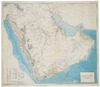
56801Washington D.C.: Department of the Interior United States Geological Survey and the Kingdom of Saudi Arabia Ministry of Finance 1963. SECOND EDITION ENGLISH ISSUE. Large chromolithohraphed map 122 x 139 cm of the Arabian peninsula shown with topographic relief and marked with water pipelines oases oil fields oil pipelines ports and harbours oil wells natural gas fields quarries and mines. Key lower left. The map includes the territories of modern day Kuwait Qatar Bahrain United Arab Emirates Oman and Yemen and was the work of a team lead by the distinguished geologist Glen F. Brown whose pioneering work on surface geology with its emphasis on water resources minerals and oil pertains to this day. Minor light spotting lower right generally in excellent condition. Issued simultaneously in an English and Arabic versions. Originally conceived in 1953 this second edition shows significant additional topographical detail and noticeably showing the growth in oil fields and accompanying infrastructure. Brown 1911-2001 began his career conducting coal investigations in South China and the Philippines and ground water investigations in Mississippi and Colorado the latter mostly concerned with supplying water to military installations. In response to a request from Ibn Sa'ud for assistance from the United States Geological Survey USGS Brown was selected in 1944 to investigate water supplies in the Saudi Arabian desert. Brown "arrived in Saudi Arabia early in 1945 and joined a mission sponsored by the US Foreign Economic Administration to study possibilities for agricultural development in central Arabia. As part of the mission he carried out a detailed investigation of the geologic formations in the Al Kharj district and identified substantial ground-water resources in buried aquifers. His report on the results of that investigation was very enthusiastically received by Saudi officials. Brown returned to Saudi Arabia at the request of Ibn Saud to conduct reconnaissance geologic mapping mineral evaluation and water-resource studies in the western and central parts of the kingdom. The mapping was carried forward from 1950 to 1958 by Brown with USGS and Saudi associates and extended to the entire Arabian Peninsula in cooperation with the Arabian American Oil Company Aramco as well as to organizations and companies of other countries in the peninsula. This resulted in a remarkable series of bilingual geologic and geographic maps of Saudi Arabia at a scale of 1:500000 and a geologic and geographic map of the entire Arabian Peninsula at a scale of 1:2000000 all of which were published by the USGS. These maps together with reports on the geology mineral deposits and water resources prepared by Brown and his associates providing the basis for Saudi Arabia to undertake a major national resource exploration and development program" obituary Geological Society of America. The map includes the territories of modern day Kuwait Qatar Bahrain United Arab Emirates Oman and Yemen. Although the hunt for oil gas and minerals ultimately drove geological survey work across the region in its early years it was the need for continual water sources which was the catalyst for Saudi Arabia's resource exploration. In 1944 King 'Abd al-'Aziz approached the United States for a technical expert who could assist with the identification and plotting of the kingdom's natural resources particularly its groundwater reserves. Glen F. Brown who undertook the task and is responsible for this map was one of the pioneers of a partnership between the United States Geological Survey USGS and the government of Saudi Arabia. This collaboration was one of international importance spanning the next five decades and influencing the development of the kingdom significantly. By 1954 the Saudi Ministry of Finance United States Geological Survey USGS and Aramco were working together to produce the first full series of geographic and geologic maps of the country. The first of their type in the Peninsula were published between the late 1950s and early 1960s in both Arabic and English copies. The information these maps contained formed the basis of subsequent Saudi national development plans. To this day all modern maps of the kingdom trace their roots back to these publications. Washington D.C.: Department of the Interior, United States Geological Survey and the Kingdom of Saudi Arabia Ministry of Finance unknown
199422740Cincinnati Ohio U.S.A.: North Light Books 1994. Clean with light general wear to dustjacket. In brodart. A nice copy! bx 128. ISBN: 0891345132. Hard Cover. Very Good/Good. North Light Books hardcover
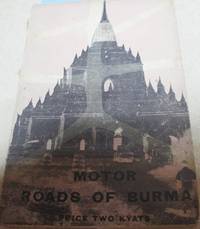
1962X3070Bangkok: White Lotus Press 1962. Paperback. Very Good/no dj. 1.00. Burma Oil Co.1954 Ltd The. Motor Roads of Burma The White Lotus Press paperback
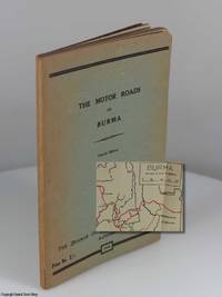
19481215The Burmah Oil Co. Burma Trading Ltd Rangoon 1948. Fourth Edition. Softcover Perfect Bound. Very Good Condition. Book A very good copy of the first post-war edition of the guidebook including the map which has seen very little if any use. The "Fourth Edition" reflects the fact that this is the fourth guidebook that was issued. The Third Edition was published around the start of World War II in 1939. As the Foreword notes "For four years little or no maintenance was carried out roads previously good fell into disrepair bridges were bombed and destroyed and opposing armies constructed new highways" p. 1. The folded map printed in black and red opens up to 13" wide by 20" high. Roads are marked in red and designated "all weather" "fair weather" and "unclassified." Places with petrol pumps are underlined in red. The map is in excellent condition with three creases in the margins and only one 1/4" tear at the outside edge of one of the folds. WorldCat shows two entries for the book OCLC #250091811 and #19666339 with a total of only 16 libraries including the Department of State's Ralph J. Bunche Library the U.S. Transportation Department Library the Library of Congress and the British Library. Size: Around 7" or slightly taller - Duodecimo 12mo. 121 pages. Item Type: Book. The text block is tight and unmarked. None of the many Notes pages have any entries. The thin cheap paper has browned from age but is in good condition. The last three leaves have a 2" diagonal crease at the bottom corner not reaching the text. Green paper wrapper that has browned around the edges from age. About 1/8" of the upper right corner of the front cover is missing. The first and last pages are glued to the front cover so the first page is tight and the rear cover is creased where the page is no longer glued in probably because of the weight of the map that is in a pocket on the inside rear cover. No foxing in this copy. Page edges browned slightly. Quantity Available: 1. Category: Antiquarian & Rare; Automobile travel -- Burma -- Guidebooks; Myanmar; 1940s; Travel & Places. Main Picture: Burmah Oil Company. The Motor Roads of Burma. Rangoon: 1948 Fourth Ed. - Front cover and spine with inset of a section of the map. Picture 2: Burmah Oil Company. The Motor Roads of Burma. Rangoon: 1948 Fourth Ed. - Rear cover and spine. Picture 3: Burmah Oil Company. The Motor Roads of Burma. Rangoon: 1948 Fourth Ed. - Rear cover and page edges. Picture 4: Burmah Oil Company. The Motor Roads of Burma. Rangoon: 1948 Fourth Ed. - Front cover and page edges. Picture 5: Burmah Oil Company. The Motor Roads of Burma. Rangoon: 1948 Fourth Ed. - Unfolded map showing the roads of the region in Southeast Asia including Burma and Siam. Picture 6: Burmah Oil Company. The Motor Roads of Burma. Rangoon: 1948 Fourth Ed. - First page with the Foreword. Picture 7: Burmah Oil Company. The Motor Roads of Burma. Rangoon: 1948 Fourth Ed. - First page of the Table of Contents. Picture 8: Burmah Oil Company. The Motor Roads of Burma. Rangoon: 1948 Fourth Ed. - Example of a two-page spread with a map table of mileages and description of the sections of the road. Picture 9: Burmah Oil Company. The Motor Roads of Burma. Rangoon: 1948 Fourth Ed. - Inside rear cover with the pocket created to hold the folded map. Pictures of this item not already displayed here available upon request. Inventory No: 1215. . The Burmah Oil Co. (Burma Trading) Ltd paperback
1258776170.Gpaperback. Good. Access codes and supplements are not guaranteed with used items. May be an ex-library book. paperback
B9781377129471Paperback. New. paperback
A9781345284256Hardback. New. hardcover
A9781377129471Paperback. New. paperback
1991ZB1272930Canadian Heavy Oil Association 1991. Price HAS BEEN REDUCED by 10% until Monday June 29 weekend SALE item 595 pp. folding map Hardcover ex library else text clean and binding tight. - If you are reading this this item is actually physically in our stock and ready for shipment once ordered. We are not bookjackers. Buyer is responsible for any additional duties taxes or fees required by recipient's country. Photos available upon request. Canadian Heavy Oil Association hardcover
2005145208Calgary: Canadian Heavy Oil Association 2005. First Edition. Hardcover. Very Good/Very Good. 4to. pp. 684 charts graphs b/w illustrations. Unopened CD at the back of the book. Top corner of rear board is bumped. Heavy book additional postage will apply. Canadian Heavy Oil Association hardcover
45021801San Francisco 1918 Young. A board advertisement32 x 23.5 cm. mounted on a museum board ca. 36 x 28 cm. multi-color silk-screened verticle crack wear/chips to upper right and lower edgesstrong image artist's "L.B.C." in lower corner. . . . AN EARLY 20TH CENTURY ADVERTISEMENT FOR CHINESE TEA OIL . . . SHAMPOO . . . FEATURING A CHINESE GIRL PAGODA BRIDGE & LANTERNS . . . CHINESE HANZI CHARACTERS READ: . . . "TIEN XIANG" "HEAVENLY FRAGRANCE" . A charming and quaint old advert board. This is a thick color silk-screened illustration perhaps from an old box that contained Tea Oil Shampoo. . It appears that this illustration was laid down on a museum board to protect and make solid. There is an old San Francisco printed paper partially remaining which shows a date of January 29 1919.which may be related to this old advertisement. . THE ARTIST: The artist's initials are at the left lower margin reading: "L.B.C." Although we searched the internet we could not find this artist more than likely from the 1919 date of an old partial label on the back side. The publisher may be "Young & Mcalli." else parts missing. Srr spine.jpg photo on our website. . TEA OIL SHAMPOO: This is still a popular shampoo with medicinal properties available on the market in great profusion. Internet finds a large number of articles and products for sale. . CONDITION: This item was laid down on a museum board to make solid the image which has a vertical crack. There are signs of a small part missing from upper right margin and a small triangle piece from lower margin with mild and usual edge & corner wear. Please see photos and not to the left side of the Chinese girl is the vertical crack. . The image has an excellent impression and coloring. There is some of the usual minor loss to the bottle of shampoo to the left of the Chinese girl nevertheless this is a very RARE & OBSCURE example of an early advertisement. . The item is ready for framing and display. . SPECIAL NOTE: Due to condition issues this is sold "as is" and is NOT RETURNABLE or REFUNDABLE. . By ordering you agree to these special terms of business. . Color photos are posted to our website. . . unknown
0705P29XNWJHardcover. Very Good. Bucureşti : Foreign languages Pub. House 1959. Very good cloth in good ripped chipped color pict. dustjacket. Scarce. Our pics. Fold-out maps and illus. very good. No reader remainder or ex-library marks. hardcover
63-6553Bakersfield CA: Charles A. Barlow 1916. Letter-Sized Page Signed on Barlow & Hill Oil Operators and Oil Lands Letterhead Good with perforation marginal tears some creasing light toning.Provenance: Letters and Autographs from a Who's Who in California 1914 - 1917 to the author Ellis A. Davis regarding Davis' Commercial Encyclopedia of the Pacific Southwest California Nevada Utah Arizona. Sold by Cherokee Book Shop to Frederick Ruffner Jr. the founder of Gale Research Detroit. Bakersfield, CA: Charles A. Barlow, 1916. unknown
2090502113711138Not Available N.A. Soft Cover. Fine. The book is in fine condition. Not Available paperback
030927429X.Gpaperback. Good. Access codes and supplements are not guaranteed with used items. May be an ex-library book. paperback
ria9780309274296_inpPaperback / softback. New. New Book; Fast Shipping from UK; Not signed; Not First Edition; N/A paperback
1023339269.Ghardcover. Good. Access codes and supplements are not guaranteed with used items. May be an ex-library book. hardcover
026004797X.Ghardcover. Good. Access codes and supplements are not guaranteed with used items. May be an ex-library book. hardcover
1527878449.Gpaperback. Good. Access codes and supplements are not guaranteed with used items. May be an ex-library book. paperback
139735853X.Ghardcover. Good. Access codes and supplements are not guaranteed with used items. May be an ex-library book. hardcover
133331714X.Gpaperback. Good. Access codes and supplements are not guaranteed with used items. May be an ex-library book. paperback