2 245 résultats
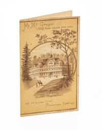
3735323<p>New York: Judge Publishing Co. Lith ca. 1885. 4 pp. Bifolium brochure. 6 x 3½ inches. Lithographic covers. Pages 3-4 with one diagonal crease line; good.</p> <p>A rare promotional piece advertising The Hotel Balmoral and Mt. McGregor Railroad Company aimed at tourists visiting Saratoga Springs New York for a mountain-top excursion. A timetable inside notes that the train journey from Saratoga Springs to the summit of Mt. McGregor took about 35 minutes. Visitors could enjoy expansive views from the summit and tour General Grant’s Drexel Cottage. In a nineteenth-century hand “July 23 1885†is neatly inked at the bottom of the back cover.</p> unknown
AQ24783s.l.: s.n. s.d. Manuscript of paper. 14pp. Bound with: ACTS - GEORGE III. Drop-head title: An act for Amending an Act made in the Twenty-ninth Year of the Reign of His Present Majesty for making and repairing the Road from the City of Glasgow in the County off Lanerk to Muirkirk in the County of Ayr. s.l. s.n. 1791. 11pp 1. Docket title to verso of final leaf of text. Not in ESTC. And: ACTS - GEORGE III. Drop-head title: An act.for Making and repairing the Road from the City of Glasgow by Muirkirk to the Confines of the County of Ayr. s.l. s.n. 1798. 16pp. Docket title to verso of final leaf of text. Not in ESTC. And: ACTS - GEORGE III. Drop-head title: An act for Continuing altering and enlarging the Terms abnd Powers of several Acts for making and maintaining certain Roads in the Counties of Lanrak Ayr and Renfrew and building a Bridge over the River Clyde at Dalmarnock. London. J. Richardson 1819. 40pp 2. Docket title to verso of final leaf of text. And: Nine leaves of manuscript abstracts of minutes of meetings held by the committee charged with road maintenance of the Muirkirk and Cambuslang roads and related amendments to legislation between 1819 and 1834. Folio. Nineteenth-century half-calf marbled boards contrasting red morocco lettering-piece. Extremities worn upper board detached. Inked ownership inscription of J. Ewing to recto of FFEP manuscript headings to drop-head titles of all printed material occasional dust-soiling scattered foxing. A sammelband of manuscript and apparently unrecorded printed material relating to the construction and maintenance of the Muirkirk and Cambuslang roads from the late-eighteenth to mid-nineteenth-century. . [s.n.], [s.d.] hardcover
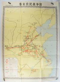
1981173280Beijing.: 地图出版社. Di tu chu ban she. 1st Edition 2nd Printing. 1981. Large Chinese coloured educational map folded scale 1:2000000. Legend lower left corner shows the routes of military advance led by peasant rebellion leaders' 陈胜Chen Sheng and 吴广Wu Guang in red and other military activities led by 项羽Xiang Yu and 刘邦Liu Bang in various colours. In original worn paper wrapper map in very good condition. Text in Chinese. Map measures 105.5 x 76.6cm. . 地图出版社. [Di tu chu ban she]. unknown
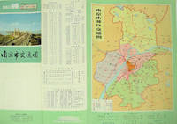
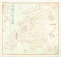
1977137003No place of publication.: 江苏人民出版社.Jiangsu ren min chu ban she. 1st Edition 2nd Printing. 1977. Colour Chinese transportation map featuring the city of Nanjing capital city of Jiangsu Province and its surrounding regions. Upper side: A transpiration map of Nanjing and neighbouring counties right section with a list of names of stations buses trains coaches ferries and their addresses lower right edge tourist guide including the addresses and phone numbers of major travel agents hospitals cinemas and more left section accompanied by two tables of bus routes. On reverse: a "Map of Nanjing Municipal Transpiration Map" scale not given a chart of terminus for bus and trolley bus lower right section. Some soiling on reverse stamp of a prior dealer in Guangzhou a handwritten date of "September 17th 1977" upper side light creases good copy. Text in Chinese. Sheet measures 37.8 x 52.3cm. . 江苏人民出版社.[Jiangsu ren min chu ban she]. unknown
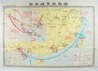
1978171343北京. Beijing.: 地图出版社.Di tu chu ban she. 1978. Large Chinese map in colour showing southern part of China and northern Vietnam folded in original envelope scale 1: 150000 inset map upper left corner scale 1:800000. Both maps show the battles between Qing court and French army between 23 Aug 1884 and 25 Mar 1885. Original paper envelope repaired with acidic free tape map in very good condition. Text in Chinese. Sheet measures 76.8 x 107.1cm. . 地图出版社.[Di tu chu ban she]. unknown
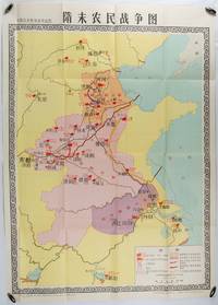
1980176714北京. Beijing.: 地图出版社.Di tu chu ban she. 1st Edition 1st Printing. 1980. Large Chinese education map folded with original envelope scale 1:1500000 legend left lower corner showing the military advance routes and battle grounds led by several leaders of the agrarian rebels including 王薄 Wang Bo 窦建德 Dou Jiande 杜伏威 Du Fuwei and 翟让 Zhai Rang. Very good copy. <br> <br>Text in Chinese. Sheet measures 106.8 x 76.52cm. . 地图出版社.[Di tu chu ban she]. unknown
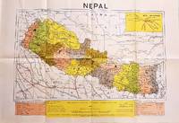
1979207710Dehli.: Indian Book Depot Map House. 1979. Colour map on blush coloured paper 44.2 x 63.6 cms; 53.6 x 75.9 cms sheet inset map of air service routes folding into pictorial card wrappers 25.5 x 19.3 cms issued into colour pictorial paper folder in very good condition. Map shows Nepal and surrounding borders with India Tibet and China provinces picked out in colour international and state boundaries sealed roads railway lines canals lakes springs rivers towns and villages tourist places temples and the inset map shows air services from Nepal to Thailand and India. The rear wrapper shows a view of Pashupatinath Temple the oldest Hindu temple in Kathmandu. . Indian Book Depot (Map House). unknown
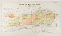
1912177249Sydney.: W.A. Gullick Govt. Printer. 1912. Large lithographed folding county map 78.8 x 45.4 cm the parishes highlighted in colour two small fold splits slight toning in very good bright condition. Attractive map from the Report on the first Interstate Conference on Artesian Water Sydney 1912 showing boundaries of water trust districts proposed boundaries with position and length of drains for the counties of Denham and Jamison in northern New South Wales boundaried by the Namoi River to the South. . [W.A. Gullick, Govt. Printer] unknown
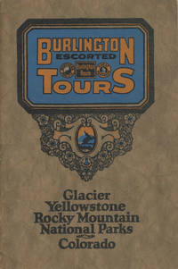
192548702N.P.: Privately printed n.d. ca 1925. ca 1925. 9" x 6" color pictorial wrappers. 47 pages tinted illustrations maps tour plans. Numerous tour itineraries and schedules with numerous beautifully colored photographs of various areas buildings and parks. Tours discussed include Glacier and Yellowstone; Colorado and Yellowstone; Inter-Mountain Route From Colorado to Yellowstone and Glacier; Colorado and Glacier. General information for the tourist including cost of tours discussion of climate apparel booklets of possible interest a list of ticket routing for various tours calendar schedules for various tours etc. Separate map depicting each tour. Very good plus. Privately printed, n.d. [ca 1925]. unknown
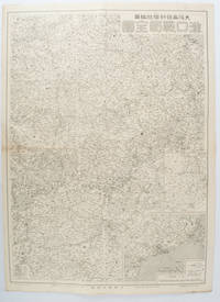
1572172829大阪. Osaka.: 大阪毎日新聞社. Osaka Mainichi Shinbunsha. 昭和 13 1938. Black and white map folded showing Hankow one of the three cities which merged to become Wuhan 54.5 x 49cm scale 1:2000000. Some light browning tiny closed tear upper margin neatly repaired with conservation standard tape. Good copy. This Hankow/Hankou War Situation Map is a supplement map of Osaka Mainichi Newspaper on 25 August 1938. The two inset maps show the region around Nanjing and Hong Kong. It gives detailed place names of Hankow area. . 大阪毎日新聞社. [Osaka Mainichi Shinbunsha]. unknown
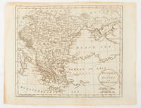
1816175252Philadelphia.: Carey Mathew and Warner Benjamin. 1816. Engraved map 19 x 22.3 cm original folds some offsetting to the map marginal browning and staining small archival repairs to the outer margin but in good condition. Fine map Plate 19 prepared for Carey and Benjamin's "General Atlas.". . (Carey, Mathew and Warner, Benjamin). unknown
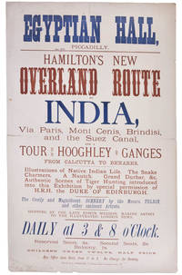
99252London Printed by S. Golbourn February 1876. . Broadsheet 51.25 x 31.4 cm printed in blue and tan horizontal centre fold short split short splits to head a good example.<br /> Rare broadsheet advertising an exhibition at the Egyptian Hall. The Egyptian Hall was a leading venue for exhibitions featuring original artwork and relics.<br /> London, Printed by S. Golbourn, February 1876. unknown
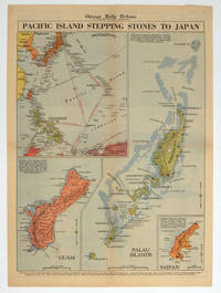
1944208880Chicago.: Chicago Daily Tribune. 28 September1944. Colour pictorial map on a single newspaper leaf archivally laid down on linen 50 x 39.2 cms; 59.3 x 43.3 cms sheet including captions faint toning to fold lines very good condition. Vivid colour maps of the Palau Islands Guam and Saipan in the Marianas and an inset location map published in the "Chicago Daily Tribune" in September 1944 months after the landing of US and Allied Forces in the offensive against the Japanese during the Pacific War. . Chicago Daily Tribune. unknown
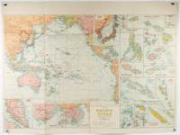
1930205997Sydney: H.E.C. Robinson. Circa1930s. Printed colour maps in all 65.5 x 99cm the main map roughly 50 x 65 cms on a single sheet 76 x 101.3 cms; a little carelessly folded decorative blue title cover a little dusty and a few fold splits and edgewear but in good condition. The exceptional feature of this map are the twenty six large scale inset maps of Pacific islands including: Malay States Singapore Hong Kong these at lower left Japan Philippine Islands Hawaiian Islands Fiji Solomon Islands Western and Eastern Samoa Tahiti Saipan New Caledonia and Dependencies and many others. <br> <br>The main map of the Pacific Ocean stretches from Southeast Asia including all of Australia and New Zealand the west coast of the Americas the Kamchatka Peninsula Manchukuo Manchuria and most of China. Korea and Taiwan are marked as Japanese Territory. Possessions of Britain France the Netherlands and the United States are highlighted. <br> <br>An incredibly rich source of information on the Pacific theatre during the years leading up to World War II. From the Sydney publisher H.E.C. Robinson the firm founded in 1895 by Herbert Robinson 1857-1933 a founder of the Royal Geographical Society of Australasia. . H.E.C. Robinson. unknown
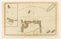
1784174895London.: Alexander Hogg at the King's Arms. circa1784. Engraved map on laid paper 21.4 x 33.7 cm inset of Gower's Simson's and Carteret's Island early outline hand colour trimmed to the plate mark at the top edge three small edge tears affecting the upper margin only slight paper toning but a most attractive map in very good condition. Fine impression of the Queen Charlotte's Islands Solomon Islands. It features the Swallow's track the ship's route taken by Captain Philip Carteret in 1767 the British naval officer and explorer who participated in two of the Royal Navy's circumnavigation expeditions in 1764–66 and 1766–69. . Alexander Hogg at the King's Arms. unknown
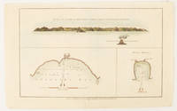
1784174896London.: Alexander Hogg at the King's Arms. circa1784. Engraved map in triptych on laid paper 20.1 x 32.7 cm three insets: cross section of the north side of Queen Charlotte's Islands Solomon Islands with detail of a volcano "6 leagues North"; Swallow's Bay Harbour; and Byron's Harbour early hand colour trimmed to the plate mark at the top edge neat sealed tear affecting the publisher's caption slight edge wear and paper toning but a most attractive map in very good condition. Attractive engraving of the Queen Charlotte's Islands Solomon Islands. The Islands were named for the consort of King George III by Philip Carteret the British naval officer and explorer who participated in two of the Royal Navy's circumnavigation expeditions in 1764–66 and 1766–69. His ship the Swallow gave her name to the Bay and Carteret's commanding officer on the first of his voyages John Byron to the Harbour depicted in this most attractive early chart. . Alexander Hogg at the King's Arms. unknown
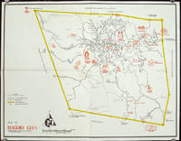
1960206510circa1960. Printed pictorial map 44.8 x 58 cms 46.7 x 60.3 cms sheet original folds a little wear but in very good condition. Attractive 1960s tourist map of Baguio city when it was the "Summer Capital" of the Philippines. Tourist attractions are shown pictorially in red blue triangles denote wood carving shops the city boundaries outlined in yellow sealed and unsealed roads are also shown. . unknown
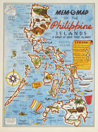
1945204557U.S.A.: Mem-O-Map Co. 1945. Colour pictographic / pictorial map 32.1 x 23.8 cms; 35.4 x 26.6 cms sheet very good condition. Rare pictorial map published in 1945 by John G. Drury aTechnical Officer who served with the 214th Ordnance Battalion to mark the end of World War II as souvenirs for the military. Military personnel could fill in banners "came in on good ship." and "departed on good ship." their name organisation and "Line of Advance or movement" blank in this example. Pictographs mark various memorable spots and wildlife including larger-than-life insects. A "Terrible Tillie Typhoon" looms over the coast at Luzon. <br>Drury published a series of five maps: Philippines and Okinawa in 1945; Japan and Korea Oahu and Europe in 1946. They are all scarce. “These almost whimsical maps are designed to support the creation of personalised geographies. At a time when digital mapping is beginning to experiment with the creation of personalised content that would render the same map in different ways for different users Mem-O-Maps demonstrate the principle in action." Kenneth Field ICA Commission on Map Design. . Mem-O-Map Co. unknown
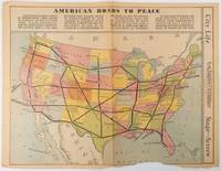
1938215547Los Angeles.: Los Angeles Examiner. Sunday 1 May1938. Printed colour pictorial map 33 x 48 cms; 41.8 x 54.5 cms sheet central fold sheet toned corners chipped with some loss to the bottom border and at the central fold in good condition; and on the verso "Movie-Go-Round" by Louella O. Parsons black and white photos and advertisements. Pictorial map printed for the weekend supplement of the Randolph Hearst owned newspaper the Los Angeles Examiner. The map-maker and artist Howard Burke had also worked for the San Francisco Examiner and was known for pictorial maps many with a persuasive or rhetorical edge and as here were designed to shore up American patriotism and defences against a wider world in the increasingly turbulent pre-war 1930s. The caption to this map outlines a multi-billion dollar 25 year proposal by Congressman J. Buell Snyder for a network of coast to coast transcontinental highways "in case of an attack by a foreign power at any point along the border". Buell Snyder earned the soubriquet "the father of superhighways" and during the War he was assigned to a Congressional Committee in charge of appropriations for the War Department. Scarce. . Los Angeles Examiner. unknown
1572171093Qingdao: Taiheiyoko. 太平洋行. 昭和 13 1938. Coloured folding plan of Qingdao in 1938. some browning on reverse with a small lighter section on map Japanese place names no scale 36 x 39cm 3 inset maps. This 1938 Qingdao city map shows street names in Chinese characters and location of Chinese and Japanese public buildings such as the hospital shrines Japanese primary schools and high schools. The 3 inset maps show railway and transport routes as well as outskirts of the city. . [Taiheiyoko]. 太平洋行. unknown
3001Trenton: The Company; Press of the Emporium 1846. . 8vo self-wrappers side-stitched Not found in OCLC. Trenton: [The Company]; Press of the Emporium, 1846. unknown
3006Milwaukee: The Company; Daily News Book and Job Steam Printing Office 1857. . 8vo yellow wrappers front printed This is not a later printing of Library of Congress Modelski No. 440. There is no inset and the copyright is 1856 Milwaukee: [The Company]; Daily News Book and Job Steam Printing Office, 1857. unknown
190060562Buffalo NY: Kellogg Iron Works ca. 1900. Oblong 8vo. 9.5 x 6 in. 16 pp unpaginated. printed photo plate followed by plates of elevations and bridge plans. Original gray printed softcovers black lettering front cover minor corner chip to first page couple closed tears w/ minor repairs dustsoiling to fore-edges still a VG- copy. First edition of this exceedingly scarce catalogue of touting “Kelloggâ€truss bridges which consisted of Pratt inner bracing with additional diagonals and were popular in the Northeast at the end of the 1800’s until about 1901-1905 spanning between 75 to 150 feet. These types of bridges played a crucial role in road building driven by the Good Roads Movement during the opening decades of the 20th century. At the end of the 19th century less than 50% of roads within American cities were paved and the very few highways and turnpikes connecting cities and towns were little more than crushed rock macadam dirt roads or even paths. Although founded in the 1880s by bicycling enthusiasts the Good Roads Movement at the beginning of the 20th century began to be driven largely by advocates of the automobile who favored sturdy durable bridges which could be easily maintained. These Kellogg truss bridges featured riveted steel trusses and were often anchored in stone foundations. Charles H. Kellogg the elder was an active bridge engineer and builder whose firm wen through several different configurations and owners between 1870-1915 while his son Charles H. Kellogg the younger operated his own company from 1891-1901 and should not be confused with the short-lived Kellogg Iron Bridge Works Co. which was using the Union Bridge Company’s shop. No copies in Worldcat; See: Mead & Hunt Contextual Study of New York State’s Pre-1961 Bridges pp. 23 & 93 1999. Kellogg Iron Works, paperback
191862523Peoria IL: Avery Company Manufacturers 1918. 4to. 24 pp unpaginated. printed in red gray & black throughout. Photo text illustrations throughout decorative borders illustrations. Self-printed colour-illustrated softcovers cover art of Avery road tractors and scrapers front & back minor edgewear creasing minor wear & dustsoiling w/ tiny closed tears at spine still VG- copy. First edition of this uncommon catalogue of equipment which played a crucial role in road building driven by the Good Roads Movement during the opening decades of the 20th century. At the end of the 19th century less than 50% of roads within American cities were paved and the very few highways and turnpikes connecting cities and towns were little more than crushed rock macadam dirt roads or even paths. Sidewalks were nearly unknown and unlike Europe road construction was not primarily managed by national or local governments. Although founded in the 1880s by bicycling enthusiasts the Good Roads Movement at the beginning of the 20th century began to be driven largely by advocates of the automobile. This catalogue illustrates Avery road tractors graders scarifiers blades drag scrapers and more building roads in Texas Oklahoma Idaho Nebraska Kansas Indiana and more. The Avery company was founded initially in Galesburg IL following the Civil War by Robert and John Avery with Robert as the ever-intrepid inventor and machinist one of whose earliest inventions was the riding cultivator. By 1883 and teamed up with his brother Cyrus the company proved successful and after 1892 became well-known for their internal combustion engine equipment. By 1920 the company led by Bartholomew employed 4000 people and pioneered motor cultivators and road-building equipment but was hit by the post-World War I depression about the time this catalogue was issued and although the company attempted to reorganize and laid off 90% of its workforce it failed by 1923 and was renamed the Avery Power Machinery Co. The company limped through the Great Depression and closed finally in World War II. No copies in Worldcat; See: Mowitz The Once-Great Tractor Innovator Lost to Time Successful Farming Nov. 20 2024. Avery Company Manufacturers, paperback
192859837Chicago IL: The Austin-Western Road Machinery Co. 1928. Oblong 4to. 11.2 x 8.25 in. 60 pp. Colour-tinted decorated title colour-tinted borders throughout some illustrations w/ colour-tinting 100s of photo & text illustrations some full page. Colour-illustrated softcovers cover art illustration of beautifully built highway with towering trees and Austin-Western road grader smoothing road in front of picturesque bungalow w/ mountains in the distance minor shelfwear rubbing still NF copy w/ promotional sheet detailing the equipment in this catalogue on Austin-Western Road Machinery Co. letterhead. First edition of this scarce catalogue of equipment which played a crucial role in road building driven by the Good Roads Movement during the opening decades of the 20th century. At the end of the 19th century less than 50% of roads within American cities were paved and the very few highways and turnpikes connecting cities and towns were little more than crushed rock macadam dirt roads or even paths. Sidewalks were nearly unknown and unlike Europe road construction was not primarily managed by national or local governments. Although founded in the 1880s by bicycling enthusiasts the Good Roads Movement at the beginning of the 20th century began to be driven largely by advocates of the automobile. In 1901 the F.C. Austin Manufacturing Co. and the Western Wheeled Scraper Co. which had been fierce competitors formed a selling corporation known as Austin-Western Road Machinery Co. The company specialized initially in building scrapers but during the opening decades of the 20th century began producing wheel graders patrol graders self motor graders snow plows rollers dump wagons gutter cleaners and even asphalt hot patch outfits all shown in this catalogue. In 1916 just 12 years before President Wilson had signed the Federal Aid Road Act enabling America to embark on a truly national highway and road construction campaign that continued to the end of the 1920s. No copies located in Worldcat; See: Austin-Western Road Machinery Grader History 2017; Thomas Berry Austin-Western Road Machinery Company 1905-1936 Historical Construction Equipment Association 2005. The Austin-Western Road Machinery Co., paperback