2 245 résultats
189457598San Francisco CA: Standard Asphalt Company of California Printed by Bosqui Printing & Engraving Co. 1894. 8vo. 8 pp unpaginated. printed in red & black. Black printed softcovers white lettering front cover company logo illust. on back cover minor shelfwear slight rubbing very slight chip to upper right corner still VG copy. First edition of this scarce promotional brochure by this pioneering California oil and mining company initially drawing upon petroleum and asphalt mines near Bakersfield California by the late 1880’s. They had originally drawn upon deposits in Asphalto and Hazleton but later these were played out due to high production costs to refine out the clay but later the company made a large discovery in 1893 just prior to the publication of this promotional piece touting 79% level of bitumen and production of asphalt vital for use in lacquers paints and road construction. Worldcat locates 1 copy UC Berkeley; See: Asphaltum Mineral Resources of the United States 1893-1894 1895 pp. 633-634; Asphaltum Standard Asphalt Company of California Los Angeles Herald April 5 1891 p. 6. Standard Asphalt Company of California, Printed by Bosqui Printing & Engraving Co., paperback
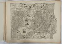
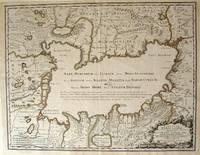
172354819Rainer Ottens. 1723. A most attractive map with early outline hand colour vertical fold barely visible diagonal crease upper half of map few very pale small brown spots otherwise a clean and bright image. Numbering in red pencil few annotations in pencil and light number stamp on reverse however not at all visible from front of map or affecting image. Sheet measures 46.6 x 60.2cm. . Rainer Ottens. unknown
192544354Chicago IL: Engineering and Contracting Publishing Co. 1925. 4to. 320 pp. 100s of photo illusts. diagrams text illusts. Embossed & decorated gray cloth lettering & decorated border red & black lettering on spine minor shelfwear light rubbing to corners VG copy w/ former ownership markings on ffep. First edition numbered on verso of title of this fascinating work illustrating the equipment and materials needed to build the roads and highways in the early automobile era. Included are asphalt companies oil burning equipment for road building and repairs expansion joint steel fencing companies steam rollers graders cranes excavators and much more. Engineering and Contracting Publishing Co., hardcover
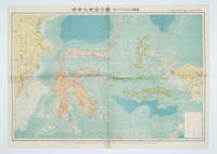
1572160554Tokyo 東京: 統制社Tosei-sha. 昭和 Showa 18. 1943. Colour folding map 54 x 75.5cm with original envelope. Envelope a little torn some occasional browning very good. The 13th map in this Standard Maps of Greater East Asia series of 20 maps. All text in Japanese. Shows railways shipping routes administrative boundaries airfields ports lighthouses mines oil wells etc. . 統制社(Tosei-sha) unknown
193358148Chicago: Chicago Burlington & Quincy Railroad Printed by Poole Bros. Inc. 1933. Tall 8vo. 4 x 9 in. which folds out into 8 x 9 in. 4to. 20 pp unpaginated illustrated & printed in red & black throughout numerous photo illustrations text illustrations 1 double-page maps 1 double-page. Colour-illustrated softcovers cover art on front of the Hall of Sciences back cover w/ pictorial map of Burlington Routes slight shelfwear NF copy. First edition of this very scarce promotional brochure advertising the low round trip rates being offered by the Burlington Route for tourists to the 1933 Chicago World’s Fair. Detailed descriptions are included of the Exposition exhibits a birds-eye view of the Century of Progress grounds amenities in Chicago and the Travel & Transport Building which held a special Burlington Route exhibit. Kaufmann & Fabry was an active commercial photographic firm specializing in architectural photography in Chicago from before 1910 and are still in existence. No copies located in Worldcat. Chicago, Burlington & Quincy Railroad, [Printed by Poole Bros., Inc.,] paperback
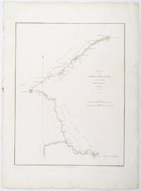
1796209283London.: George Nicol. 1796. Engraved copperplate map on Whatman paper 43.8 x 33.6 cm; 57 x 42 cm sheet including plate markscale in nautical and English miles; light undulation to sheet marginal toning and edgewear but in very good condition. Finely engraved and detailed map of two routes to Pekin Beijing along the White River Baihe from the Gulf of Petcheli and along the Imperial Highway from Jehol and includes commentary locating palaces and gardens type of cultivation "many barges" and "the road shaded by willow trees". The map elegantly drawn by Henry William Parish was published in George Staunton's account of Earl Macartney's embassy to China 1792-1794. . George Nicol. unknown
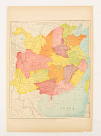
1900174904circa1900. Map printed in colour text in English provinces shaded in colour 28.3 x 23.2 cm central fold paper toned a small edge tear confined to the outer margin but in good condition. . unknown
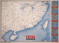
1945194660New York.: Army Information Branch. Volume III No. 51F. 9 April1945. Folding colour map and six inset maps in a vertical panel 88 x 119 cms sheet and on the recto circular map of Europe smaller inset map of Asia and of the Ryukyu Islands descriptive text original folds in very good bright condition. Scarce Newsmap of "China Southeast Coast" from Shanghai to French Indochina with the islands of Formosa and Hainan. At the right edge are inset maps of the vicinities of Shanghai Wenchow Foochow Swatow Canton and Hong Kong. On the verso is a large map of the European theatre of operations centred on Berlin a map of the Pacific area noting the American occupation of Okinawa with a detailed map of this island. In unusually fine bright condition. . Army Information Branch. unknown
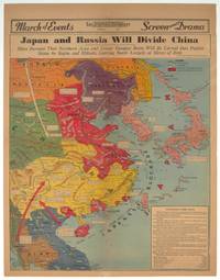
1940209821Los Angeles.: Los Angeles Examiner. 1940. Printed colour pictorial map on a single newspaper leaf 42.3 x 39.9 cms; 54.3 x 42.5 cms sheet archivally laid down on linen slight discoloration to lower centrefold and sheet slightly age-toned but in very good condition. A striking geopolitical map by Los Angeles Examiner artist Howard Burke covering China Japan Southern Russia and the northern part of French Indochina and Siam showing how the "Aggressors Divide China." Areas under Japanese occupation are shown in red and their naval blockade shown by an arc of naval vessels with vivid arrows indicating lines of supply. Text labels including sources of agricultural and raw materials provide a dynamic overview of the geopolitical situation and show the influence of American scientific illustrator and cartographer Richard Edes Harrison who argued for examining geographic issues from multiple perspectives and Los Angeles Times artist Charles Owens. . Los Angeles Examiner. unknown
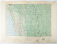
1955173072Washington D.C.: Army Map Service U.S. Army. 1955. Large colour map. 1:250000 scale. Transverse mercator projection. 23°00'N 91°30'E-22°00'N 93°00'E. Series U502 Sheet NF 46-6 Edition 1-AMS. Map measures 57.3 x 75.8cm. Slight wear creasing even light browning small closed tears on edges upper-right corner little foxed. Shows signs of use but map is clean and complete. Corps of Engineers Army Map Service map of Chittagong and surrounds compiled in 1955. Based on the British Indian one-inch and half-inch map series from 1938-43 and 1936-43 respectively. . Army Map Service, U.S. Army. unknown
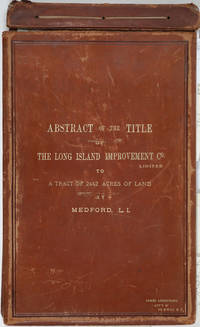
188525162Riverhead New York 1885. Hardcover. Very good condition. The original manuscript title to a very large tract of land near Brookhaven Long Island acquired by John A. Bowman from the individual proprietors and conveyed here by Bowman in its entirety to the Long Island Improvement Company Ltd. <br /> <br /> The Long Island Improvement Company was formed by Austin Corbin then president of the L. I. Rail Road and others in 1881. Corbin sought the land in order to develop expensive summer residences on Long Island; Bowman was acting as Corbin's agent in the acquisition of this valuable property. Austin Corbin 1827 – 1896 was an American railroad executive plantation owner resort operator banker and robber baron. In Iowa as a bank president he engaged in mortgage scams. Later through theft and corruption he consolidated the individual rail lines into the profitable Long Island Rail Road. He was widely despised in his day: Puck Sept 1882 printed a caricature in which Corbin appears at a Louis XIV styled party where he carouses with Jay Gould and other robber barons. <br /> <br /> The Abstract a bound sml. folio volume records that Bowman paid $5 per acre for most of the parcels in 1882 then conveyed January of 1883 the incalculably valuable entire tract to the LI Improvement Co for $1. The Abstract volume concludes with the Suffolk County embossed seal and is signed by the Clerk at Riverhead 1st June 1885. It includes the ownership history of each parcel as well as a history of the town of Brookhaven from its founding.<br /> <br /> The Abstract volume is accompanied by the original hand colored manuscript map on architectural vellum of the entire tract with silk ribbon binding showing the 25 property owner names and parcel sizes. Surveys were conducted by Justus Roe. The map is titled "Map of Property of the Long Island Improvement Company Limited at Medford LI". The scale is 300 feet to the inch. The northern boundary of the tract shows the Brewster Terry Property and Horse Block Road; the western edge defined by Tunnel and Progues Road and the Austin Roe and Daniel Gerard property; the southern boundary with Georgianna Rider property and Canaan and Medford Roads; the eastern boundary with the Robinson property and Lime Road. The Long Island RR can be seen running from east to west at approximately one third of the way through the tract at the north side. The map signed in ink at the lower right corner E. H. H. Forder.<br /> <br /> The Abstract bound in full gilt tan leather 9 x 14 3/4" attorney's name stamped in gilt at lower corner James Armstrong Attny 115 B'Way N. Y. Boards slightly rubbed; front board detached but present. Pages very bright and clean. The map 67 x 44" a few short splits at folds but very bright and clean in very good condition.<br /> <br /> A remarkable record of Long Island land speculation in the late 1880s. hardcover
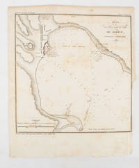
1839175248Paris.: Librairie de Gide. 1839. Engraved map 21.1 x 20.8 cm 27 x 22 cm sheet original folds trimmed to the inner margin with slight loss to the border only map spotted but otherwise in sound condition. Map of the Port of Kerch in Crimea prepared for the 1839 edition of the French Journal "Nouvelles Annales des Voyages." the editors for this edition amongst others the translator and geographer Jean-Baptiste Benoît Eyriès and Alexander von Humboldt founding members of the world's first geographical society the Société de Géographie. . (Librairie de Gide). unknown
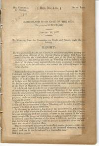
183728840Washington 1837. 24th Cong. 2d Sess. H. Rep. 135. 38pp disbound folding sketch of wire suspension bridge across the Ohio River at Wheeling. Some leaves browned else Very Good. unknown
186985507h<p>London: Illustrated London News 1869. Book. Near Fine. Hardcover. Folio - over 12 - 15" tall. Half-year run bound in early half-leather over pebbled cloth boards. Some edge-wear and bumping to covers; small paper label painted over to upper spine. Edges toned and old library bookplate and marks to front and rear endpapers. Front hinge nearly exposed internally at endpaper but still firm. Otherwise clean tight and unmarked. Very neat -- a sound and handsome volume and internally unusually bright and clean. Superb illustrations.</p> Illustrated London News hardcover
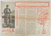
1967169746Beijing.: 地图戰報.Di tu zhan bao. September1967. Maps printed in red and black single sheet printed on both sides folded scale not given photographic image of Mao Zedong. Some light browning at edges with tears and losses on left edge still good. Text in Chinese. Sheet measures 26.5 x 38.4cm. Includes a map of Autumn Harvest Uprising and also shows the routes of the military advancing towards Jinggangshan between September and October 1927. On reverse left section a map shows the route along which Chairman Mao led the Fourth Army of the Chinese Red Army marching towards south of Anhui and Jiangxi Provinces in 1929. On reverse right section a map titled "The Long March of The Chinese Workers' and Peasants' Red Army October 1934-October 1935". Quotations of Chairman Mao about the Long March insert on corners of the map. <br> <br>Issue no. 6 of a series of maps with text issued by the Red Guards organisations in the form of Cultural Revolution tabloid-sized newspaper. This issue is designed to celebrate the 40th anniversary of the Autumn Harvest Uprising which was one of the earliest armed uprisings organised by the Chinese Communist Party. . 地图戰報.[Di tu zhan bao]. unknown
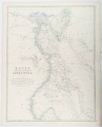
1861177021Edinburgh & London.: William Blackwood & Sons. 1861. Engraved map with original outline hand-colour 57 x 43.8 cm 61.1 x 49 cm sheet central fold very slight edge toning but the map in very good bright condition. First edition. Fine large folding map: the Nile delta and river with attractive original outline colour railways and canals marked and name references to biblical and classical geography. Published for inclusion as map 39 in "Keith Johnston's royal atlas of modern geography" . William Blackwood & Sons. unknown
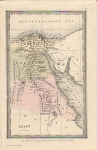
1833174939London.: Published for the Proprietors by Mr. Bull. 1833. Engraved map 14.1 x 8.8 cm original hand colour in very good condition. Fine miniature map with appealing hand colour denoting Lower Central and Upper Egypt. . Published for the Proprietors by Mr. Bull. unknown
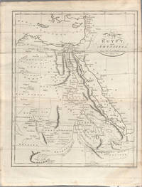
1803174955London. circa1803. Engraved map 23 x 18.5 cm original folds small split to one fold affecting the margin only paper age- toned lower corner darkened and on the verso inked circles to the lower half in an early hand but in good condition. Finely engraved early 19th Century map also showing to the north Syria Palestine and Cyprus and Darfur and Mountains of the Moon Sources of the Nile to the South. . unknown
1880174937London Edinburgh & Glasgow.: William Mackenzie. 1880. Map printed in colour with original outline hand colour 29.8 x 22.7 cm central fold edge toning but in very good condition. Published for inclusion in "The National Encyclopaedia: A Dictionary of Useful Knowledge". . William Mackenzie. unknown
1942207841London.: Royal Engineers. July1942. Printed colour topographical map mounted on linen 56.7 x 79.2 cms; 64.6 x 89. 5 cms sheet original folds edgewear small marginal chips a little dusty but in good condition. Detailed World War II operational map of Egypt and the Middle East issued by 512 Army Field Survey Company of the Royal Engineers. The map is marked "Not to be Published" in the upper right margin. Railways roads camel tracks telegraph lines boundaries altitudes towns and villages are marked. . Royal Engineers. unknown
1932176499London.: Royal Geographical Society. 1932. Twenty one loose maps with tissue guards printed on sheets 49.5 x 63.5 cm in the original folio title-wrappers the maps with some edge wear and toning but on the whole in very good condition the wrappers browned and stained torn with minor loss at the foot of the title wrapper small closed edge tears now re-enforced with archival material and sound. Lacking the introductory notes by Edward Heawood. The complete suite of maps: an impressive production. The first map is a general map of England and Ireland by an unknown author 1594; nineteen county maps; and a final sheet of miniature county maps printed as a deck of playing-cards. The county maps proper vary in date from Saxton's “Southamtonia” of 1575 to John Speed's version of Norden's map of Sussex dated 1610. A contemporary reviewer dubbed it " a rich cartographical feast" allowing easy access to rare and valuable maps and comparison of maps by different cartographers for the same county. <br>The county maps reproduced include five by Christopher Saxton three by John Norden Philip Symonson's map of Eastern Kent published in 1596 a series of seven maps dating from the early years of the seventeenth century two maps prepared for Camden and two published by John Speed. . Royal Geographical Society unknown
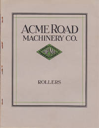
1927014098NY: Acme Road Machinery Company 1927. Quarto. 48 pp; illustrated throughout in b/w. Stapled wraps. Very good with some rusting to staples and a small split to top of spine. Internally clean and bright. Early examples of heavy road working equipment. Soft Cover. Near Fine. Acme Road Machinery Company Paperback
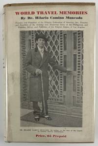
193212800Washington DC: Claude T. Clements Press 1932. 14362pp. Profusely illustrated. Publisher's tan cloth with titles stamped in brown on spine and front board. In original unclipped pictorial dust jacket. Minor edge wear light insect damage to boards. Dust jacket either trimmed a bit short or originally produced a half-inch shorter than boards. Minor dust-soiling to jacket with minor insect damage to rear flap. Internally clean. Overall very good. The rare autobiographical travel narrative by one of the most important Filipino-American political leaders in history especially notable for retaining the original pictorial dust jacket. Hilario Camino Moncado established the Filipino Federation of America in 1925 in Los Angeles California. It was also known at various times as the Filipino World Federation and the Filipino Crusaders World Army. As one of the fraternal organizations appealing to the small but growing Filipino immigrant community the FFA distinguished itself from competitors by accentuating "clean living" and rules of moral conduct. Moncado earned a law degree and also edited and published Filipino Nation. Through his work Moncado sought to portray the immigrant community as responsible and healthy in contrast to the then-prevalent depictions of them as uneducated gamblers. Much less publicly the FFA developed a set of religious teachings that held Moncado to be the reincarnation of Jesus Christ by way of José Rizal the Filipino patriot executed in the waning days of Spanish rule. Moncado's birthday was changed to make him appear to have been born after Rizal's death so that his identity as Rizal's reincarnation would be more plausible.<br /> <br /> In the present travel memoir Moncado focuses on political and social issues encountered on a trip around the world conveying an impression of worldliness which burnished his reputation within the Filipino-American community. He visits England Holland Germany France Italy Egypt India China Japan and "Home Sweet Home Philippines." A sampling of chapters focus on London his visit to Oxford University the refusal of Germany to pay reparations from the First World War mentioning the German people's and particularly Hitler's stance against paying them any further his visit to the League of Nations "Mussolini - Benevolent Despot or Tyrant" Gandhi and "India's Revolution" China "The Awakening Giant" "Americanized Japan" and the betrayal of the Filipino independence movement by the American Congress.<br /> <br /> OCLC records just eight institutional copies including one in the Philippines one in Singapore and six in the United States at NYPL UC-Davis the University of Hawaii Michigan Washington and Wisconsin. Claude T. Clements Press unknown
13915London. May and June 1888. 4pp. foolscap 8vo. Bifolium. In fair condition on aged paper. First page headed: 'The Edgware Road Fire The proprietor of "The Daily Telegraph" have as hitherto on similar occasions opened a Subscription list for the Sufferers and it is estimated that £3000 will be required to meeet the urgent claims for relief which are already too well known I shall be glad to receive any donations you may be pleased to give on their behalf JNER.'. Arranged in eight columns two to a page with running totals and a grand total of £16 1s 0d. The first donation is for 10s 6d from 'Mr. Kynock' and the last for 1s from Mr Catliffe'. Accompanying the list are two newspaper cuttings laid down on one side of a piece of 12mo paper with manuscript heading The Edgware Rd. Fire Fund'. The first cutting records the donation of £20 by 'Fredk. Gorring Buckingham Palace-road' and of £16 1s 0d by 'Employés of Fredk. Gorringe'; the second cutting reproduces a letter from Gorringe reading: 'TO THE EDITOR OF "THE DAILY TELEGRAPH." SIR - I have pleasure in sending a cheque for £20 towards the fund being raised for the assistants who are sufferers by the Edgware-road fire; also one for £16 1s from my employés. - Yours faithfully FREDK. GORRINGE. Buckingham Palace-road June 5.' The fire had occurred on 30 May 1888 with The Times devoting the following day's editorial to it beginning: 'London has been visited by many greater and more destructive fires but by few more tragic and pathetic in their circumstances than that which occurred in the Edgware-road shortly after six o'clock yesterday morning. The large drapery establishment of Messrs. GARROULD occupying the angle formed by the Edgware-road and Queen-street was suddenly attacked by fire and five of the young assistants who slept in the upper floors were burnt to death or suffocated while five more were seriously scorched or injured by jumping from the windows.' The Times drew parallels with another fire eight months before at the Exeter Theatre and concluded that it had 'once more taught Londoners the lesson that they cannot have efficient protection from fire without paying for it'. [London. May and June 1888.] unknown
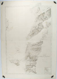
1883178272Paris.: Service hydrographique et océanographique de la marine. 1883 but1894. Engraved hydrographical chart on watermarked double sheet 99 x 63 cm soundings in metres lighthouses picked out in yellow and red inset map of the port and town of Tenedos central fold a few very slight edge tears to the generous margins light spotting and surface soiling but in very good condition. Fine and impressive large naval chart of this strategically important strait then still under the control of the Ottoman Empire. <br> <br>From a private collection; "Lord John Fitzroy Royal Yacht Squadron" in manuscript on the verso. . Service hydrographique et océanographique de la marine unknown