892 résultats
192544354Chicago IL: Engineering and Contracting Publishing Co. 1925. 4to. 320 pp. 100s of photo illusts. diagrams text illusts. Embossed & decorated gray cloth lettering & decorated border red & black lettering on spine minor shelfwear light rubbing to corners VG copy w/ former ownership markings on ffep. First edition numbered on verso of title of this fascinating work illustrating the equipment and materials needed to build the roads and highways in the early automobile era. Included are asphalt companies oil burning equipment for road building and repairs expansion joint steel fencing companies steam rollers graders cranes excavators and much more. Engineering and Contracting Publishing Co., hardcover
191046197New Orleans: Privately printed 1910. 1910. First edition. 6" x 4 1/2" in colorful pictorial wrappers. 40pp. Illustrations. Map. Overview of New Orleans in the winter. Information on various streets houses and buildings important people cemeteries and with much on Mardis Gras. Also discusses "New" New Orleans with information on cemeteries the Jackson Barracks Canal Street City Park the West End Audubon Park Riverfront etc. Listing of theaters hotels restaurants railroad depots etc. Opposite each page of text is a full-page green-tinted photograph of the various buildings streets areas etc. in New Orleans. Appears that someone unstuck the tops of the first few pages leaving page residue at tops as well as some closed tearing to those pages. Wrappers lightly soiled. Very good. Nicely produced. Privately printed, 1910. unknown
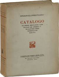
194987925Mexico: Libreria de Porrua Hnos. y CIA 1949. Limited Edition. One of 400 copies of which this is No.154 softcover. Octavo 24.5cm; white paper wrappers; xxiv12-8897pp; fore- and bottom- edges untrimmed; black-and-white illustrations throughout. Some pages of text unopened. Text in Spanish. Tanned with modest shelf-wear and trace shelf-soil; Very Good. Catalogue on literature of Mexico and the Americas. 87925. Libreria de Porrua Hnos. y CIA unknown
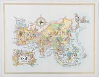
1964195995Pan American World Airways. 1964. Colour pictographic/pictorial map of Asia 23.2 x 30.1 cms gilt double-rule border printed on a folding decorative menu card 32 x 50 cms open highlighted in gilt text in English French and Japanese central fold and later central vertical crease in very good condition. Pan Am menu card for First Class passengers dubbed "The President Special" the deluxe cuisine by fabled Maxim's of Paris "Good food is the basis for true happiness". Passengers were feted with gourmet meals on bone china with silver cutlery. The witty pictorial cover-map of Asia was by French artist and commercial illustrator Jacques Liozu 1910-1974 also known for his larger scale maps. . Pan American World Airways. unknown
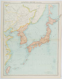
1922215880Edinburgh.: John Bartholomew & Son Ltd. 1922. Large double page map 54.2 x 43 cms map original fold some edge toning and to the fold but in very good condition. Large map prepared as plate 65 for “The Times Survey Atlas of the World” in 1922 and was prepared at the Edinburgh Geographical Institute under the direction of J G Bartholomew. The map shows Japan's territory inclusive of Korea southern Sakhalin and Taiwan. . John Bartholomew & Son Ltd. unknown
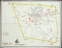
1960206510circa1960. Printed pictorial map 44.8 x 58 cms 46.7 x 60.3 cms sheet original folds a little wear but in very good condition. Attractive 1960s tourist map of Baguio city when it was the "Summer Capital" of the Philippines. Tourist attractions are shown pictorially in red blue triangles denote wood carving shops the city boundaries outlined in yellow sealed and unsealed roads are also shown. . unknown
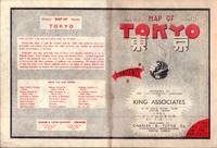
1954194113Tokyo.: Charles E. Tuttle Company. 1954. Printed four colour map 92 x 71cm; 102.5 x 74.5cm sheet folding into pictorial wrappers 25.6 x 19 cms inset map of the Marounouchi District and on the verso an extensive grid reference in English and Japanese and over four panels a map of the streetcar railway and subway system scant spotting to cover two small fold splits without loss and toning most evident at the folds in very good condition. Comprehensive 1950s map of Tokyo by US publisher Charles E. Tuttle "Here at last is the map that makes order out of chaos.extending as far as Haneda Airport Grant Hights Harbor Area and Nakano Ward" blurb. . Charles E. Tuttle Company. unknown
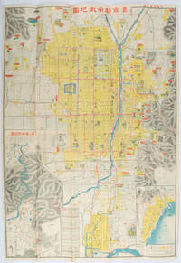
1922171899京都. Kyoto.: 山中書房. Yamanaka Shobō. 大正 11 1922. Attractive colour folding map of Kyoto with a quite detailed illustrated tourist guide printed in blue and white on the reverse some light browning holes at some folds good copy. 78.5 x 54cm This 1922 colour folding tourist map of Kyoto offers sightseeing information each panel showing a photographic monochrome image of the site discussed. <br> <br>The two inset maps on the Kyoto map show Otsu city on the shore of Lake Biwa and the Arashiyama area north of Kyoto. The main map highlights the major temples and famous sights in red geographic features such as rivers and hills are shown and an inset chart shows distances of sights from the nearby stations. The information on the reverse gives more detail on the famous sights a calendar of events seasonal highlights and details of the Imperial graves around Kyoto. . 山中書房. [Yamanaka Shobō]. unknown
1998DADAX0854047387Royal Society of Chemistry 1998-01-01. 1. hardcover. New. 6.25x1.00x9.25. Buy with confidence. Excellent Customer Service & Return policy. Royal Society of Chemistry hardcover
1912109577Rey 1912 Jules Rey Editeur, Grenoble, 1912, 169 p., reliure en toile de jute, tranche supérieure dorée, environ 33x26cm, premier plat d'origine conservé, avec une carte dépliante en couleurs. Dos un peu insolé, des rousseurs sur la tranche et les pages (sur les premières et les dernières pour l'essentiel), bon état pour le reste.
190510770Paris, Ch. Béranger, Encyclopédie des Travaux Publics, 1905 ; 2 tomes brochés : texte, in-8 ; atlas, in-folio ; (4), 306 pp., 104 figures ; (4), 8 très grandes planches dépliantes de 6 à 14 pages ; couvertures jaunes imprimées.
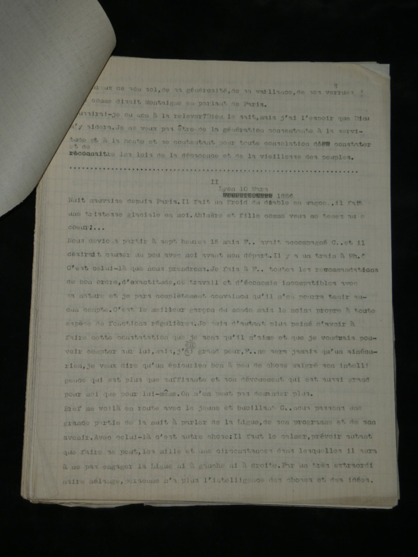
1907boz_006219Free eBay listing template designed by dewiso.com Paul Déroulède. Tapuscrit de 103 pages "Feuilles de route, Lyon 1886", 1907 Poète, auteur dramatique, romancier et militant politique français. Tapuscrit de 103 pages de Paul Déroulède, de son œuvre intitulée "Feuilles de route", avec quelques ratures et corrections au crayon. Important et volumineux ensemble de 103 pages dactylographiées constituant une étape de travail essentielle pour l'édition de l'œuvre majeure de Paul Déroulède, Feuilles de route. Dans cet ouvrage autobiographique et patriotique emblématique, l'auteur livre ses souvenirs poignants de la guerre franco-prussienne de 1870 et de sa captivité. Dimensions : 21 x 27 cm État : Voir photos et description pour plus de détails. Nombre de pages : 103 pages Paul Déroulède Paul Déroulède, né le 2 septembre 1846 à Paris et mort le 31 janvier 1914 à Nice, sur le mont Boron, est un poète, auteur dramatique, romancier et militant politique français. Son rôle de fondateur de la Ligue des patriotes et son revanchisme en font un acteur important de la droite nationaliste en France. Wikipédia Contactez-nous Lettres autographes, vieux papiers, livres anciens, photographies, gravures, timbres... Nous expertisons et/ou rachetons dans toute la France vos lettres, collections de lettres et livres anciens. Une question ? Une précision ? N'hésitez pas à me contacter Paiement Sont acceptés les paiements par eBay, par PayPal, par virement ou par chèque. Envoi Envoi soigné dans un emballage rigide et étanche sous trois jours. Prévoir les délais postaux habituels en plus. Retour Satisfait ou remboursé. Si vous n'êtes pas entièrement satisfait, retour à la charge du vendeur pour l'Europe. À la charge de l'acheteur pour le reste du monde.
1959498BGHerzogenbuchsee, Ernst Ingold, 1959. Farbiger Offsetdruck auf Papier auf Leinen aufgezogen. Bildformat: 66 x 90 cm. + Wichtig: Für unsere Kunden in der EU erfolgt der Versand alle 14 Tage verzollt ab Deutschland / Postbank-Konto in Deutschland vorhanden +, bild
1940124822Whitehorse Yukon: Murdoch's Gem Shop c1940s. Undetermined. very good. Complete deck of 52 cards plus 2 Joker's. Also included is a single card with map on one side and a table of distances along the White Pass route. Minor soiling to the surfaces of some cards but overall in very nice condition. Missing the box. very good The images on the individual cards show scenes along the White Pass route as well as many general Yukon views. A number of images are dated in the caption 1899. The back of the cards are labeled the White Pass and Yukon Route Gateway to the Yukon. It would appear that Murdoch's was the publisher with their website indicating they started in business in the 1940's. 1940 Murdoch's Gem Shop unknown
19822111902154612046Fuji City Board of Education etc. 1982. Soft Cover. Fine. The book is in fine condition. Fuji City Board of Education, etc. paperback
1955ZB585541Corvallis 1955. 112 pp issued as Oregon State College Engineering Experiment Station Circular No. 18; text darkening still very good in paper wrappers. - If you are reading this this item is actually physically in our stock and ready for shipment once ordered. We are not bookjackers. Buyer is responsible for any additional duties taxes or fees required by recipient's country. Photos available upon request. Corvallis unknown
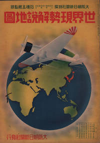
1937208633大阪朝日新聞社. Osaka Asahi Shinbunsha. Showa 12 1937. 10 colour maps not including insets or sketch maps in text on 12 pages. Handsome world map features as the centre fold colour pictorial paper wrappers. A little light soiling and horizontal crease wrappers. An attractive atlas. 38 x 26.7cm. A large format atlas with six pages of coloured maps showing the nations of the world and five pages of Japanese text. The publication seems to have been produced to celebrate the 1937 world record flight from Tokyo to London by Iinuma Masaaki and Tsugayoshi Kenji in their plane 'Kamikaze' which was sponsored by the Asahi Newspaper. The front cover depicts the plane soaring over a map of the world while the back cover also had a colour image of the 'Kamikaze' with an advertisement for the Oji Paper Company which we are told donated a hundred million yen to support the flight. The name 'Kamikaze" had at that stage not yet taken on the connotations which it acquired during the Pacific War. <br> <br>The maps inside the volume show political boundaries major cities and transport routes. The opening pages show the Japanese Empire including Japan proper Korea Karufuto and Manchukuo with small insets covering Taiwan the Chishima Archipelago and Japan's South Sea mandate. The accompanying text focuses on Japan's newly acquired client state of Manchukuo detailing its area population principle products etc while the map includes graphs illustrating Japan's trade with the world and with Manchukuo. China receives an entry of its own with a map of the Chinese Republic and information on the political situation population trade and infrastructure. The central pages of the volume are taken up with a double-spread map of the world including depictions of the flags of a selection of the world's nations. Other sections of the work cover Asia Europe America Africa and Oceania grouped together. The discussion of Oceania includes a section on Hawaii and some small and improbable depictions of Maori and Indigenous Australians. . 大阪朝日新聞社. [Osaka Asahi Shinbunsha]. unknown
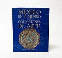
1994029030Secretaria de Relaciones Exteriores UNAM CONACULTA 1994. Book. Near Fine. Cloth. 1st Edition. 381 pages. Hardcover. Texts in Spanish. Minimal shelfwear to the edges of the boards with equally light wear and rubbing to the dustjacket with two remaining pieces of adhesive tape on the inside flaps of the jacket following the removal of a protective plastic cover. Else the binding is tight the interior clean and free of markings. Bound in black cloth covered boards and wrapped in a bright illustrated paper dustjacket. . Secretaria de Relaciones Exteriores, UNAM, CONACULTA Hardcover
1943TECH1133(Wien 1943). 4°, 68 Bl. Manuskriptdruck + 30 gef. Abb. in Kart.-Umschl. m. Leinenbindung, zus. in Leinenband m. ms. geschrieb. Rückenschildch., die Abb. sind sep. in Umschlaglasche am inn. Vorderdeckel, Rü. stärker ausgebleicht, Ecken etw. bestoß., abgegriff., papierbed. gebr., Bibl.-Expl. mehrf. gestemp.
1998C139268Watermark Publications 1998. Hardcover Hardcover. Very Good. 13 vols. Oblong octavos. Green cloth. A near fine set. No slip cases. Watermark Publications, hardcover
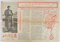
1967169746Beijing.: 地图戰報.Di tu zhan bao. September1967. Maps printed in red and black single sheet printed on both sides folded scale not given photographic image of Mao Zedong. Some light browning at edges with tears and losses on left edge still good. Text in Chinese. Sheet measures 26.5 x 38.4cm. Includes a map of Autumn Harvest Uprising and also shows the routes of the military advancing towards Jinggangshan between September and October 1927. On reverse left section a map shows the route along which Chairman Mao led the Fourth Army of the Chinese Red Army marching towards south of Anhui and Jiangxi Provinces in 1929. On reverse right section a map titled "The Long March of The Chinese Workers' and Peasants' Red Army October 1934-October 1935". Quotations of Chairman Mao about the Long March insert on corners of the map. <br> <br>Issue no. 6 of a series of maps with text issued by the Red Guards organisations in the form of Cultural Revolution tabloid-sized newspaper. This issue is designed to celebrate the 40th anniversary of the Autumn Harvest Uprising which was one of the earliest armed uprisings organised by the Chinese Communist Party. . 地图戰報.[Di tu zhan bao]. unknown
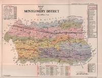
1935215892Lahore.: Government Printing. Revised Edition. 1935. Four folding colour maps xi 311 pages 26.5 x 18 cms; original papered boards spotted and a trifle scuffed linen backstrip with paper title label worn; foredges and endpapers spotted a few leaves toned but on the whole in very good condition the maps particularly bright and clean. A remarkable association copy: the author Frederick Blyth Wace's copy with his inked initials to the front free endpaper and his humorous unpublished foreword tipped in opposite the preface together with a dedication leaf both in Wace's hand and his business card loose within. As a further dedication makes clear this copy was given by Wace's son a couple of his loose notes on scrap paper are included the eminent botanist Nigel Morritt Wace 1929-2005 late head of the Australian National University's department of Biogeography and Geomorphology in 2003 to his fellow academic and marsupial biologist Dr. Hugh Tyndale-Biscoe. Both Wace and Biscoe were born in India and began their schooling in Kashmir at the school founded by Tyndale-Biscoe's father a Christian missionary and for whom the school is named. <br> <br>From the collection of Hugh Tyndale-Biscoe. . Government Printing. hardcover
19642407100220xbvkKyoto, Jimbunkagaku Kenkyusho Kyoto University, 1964. 889 (1) pages. - Publisher's gilt titled orange-colour cloth-binding in the publ. slipcase; 4to.(ca. 26 x 19 x 5 cm; ca. 2 kg.).
19652407100221xbvkKyoto, Jimbunkagaku Kenkyusho Kyoto University, 1965. 20 p., pages 883-1.825 (1) pages. - Publisher's gilt titled orange-colour cloth-binding in the publ. slipcase; 4to.(ca. 26 x 19 x 5 cm; ca. 2 kg.).
19602407100214xbvkKyoto, Jimbunkagaku Kenkyusho Kyoto University, 1954/1960. 120 (1) / 178 (1) pages. - Publisher's gilt titled orange-colour cloth-bindings in the publ. slipcases; 4to.(ca. 26 x 19 x 4 cm; ca. 2 kg.).