892 résultats
1978013369Genève Claude Givaudan 1978 In-8 Cartonnage de L'éditeur Edition originale
193232287Editions du Comité de l'Afrique Française, 1932. In-8 relié de pleine toile rouge brique (21 x 13,7 cm), couverture imprimée conservée, 324 pages, orné de 18 photographies dont 16 de Georges bruel, et 3 cartes. En guise de préface : Alfred Fourneau, l'un des "premiers cent" du Congo par Auguste Terrier.- Annotations de Georges Bruel.- 450g.- Pas de rousseurs, reliure en très bon état. EDITION ORIGINALE.
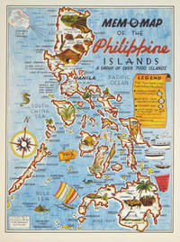
1945204557U.S.A.: Mem-O-Map Co. 1945. Colour pictographic / pictorial map 32.1 x 23.8 cms; 35.4 x 26.6 cms sheet very good condition. Rare pictorial map published in 1945 by John G. Drury aTechnical Officer who served with the 214th Ordnance Battalion to mark the end of World War II as souvenirs for the military. Military personnel could fill in banners "came in on good ship." and "departed on good ship." their name organisation and "Line of Advance or movement" blank in this example. Pictographs mark various memorable spots and wildlife including larger-than-life insects. A "Terrible Tillie Typhoon" looms over the coast at Luzon. <br>Drury published a series of five maps: Philippines and Okinawa in 1945; Japan and Korea Oahu and Europe in 1946. They are all scarce. “These almost whimsical maps are designed to support the creation of personalised geographies. At a time when digital mapping is beginning to experiment with the creation of personalised content that would render the same map in different ways for different users Mem-O-Maps demonstrate the principle in action." Kenneth Field ICA Commission on Map Design. . Mem-O-Map Co. unknown
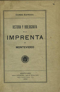
191235822Montevideo: Libreria Cervantes 1912. First edition. Cloth. A very good copy original wrappers lightly worn. 318 pp. Sm. 4to. Palau 84328. Jones 2829. Libreria Cervantes hardcover books
191235822Montevideo: Libreria Cervantes 1912. First edition. Cloth. A very good copy original wrappers lightly worn. 318 pp. Sm. 4to. Palau 84328. Jones 2829. Libreria Cervantes hardcover
1992047410Pachuca Mexico: Consejo de Recursos Minerales 1992 Book. As New. Hardcover. 1st US Ed. The state of Zacatecas is one of Mexico's most historically and economically significant mining regions often highlighted in specialized geological reports including this comprehensive Geological-Mining Monograph of the State of Zacatecas with its detailed text stratigraphic charts and geological maps often in 1:250000 scale that serve as a guide for exploration and academic study of this major mining region. Published by the Consejo de Recursos Minerales now part of the Mexican Geological Survey - SGM 155 p. illus charts col large format fold out maps in rear pockets. As new except for an ownerhip stamp NOTE : Very Heavy 1.5 kg/ large format volume. 35 x24 x24 cm. Consejo de Recursos Minerales hardcover
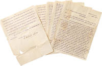
1901325474Central Valley N.Y. 1901. 5 pp. 4to. Some splitting at folds with minor loss more on last leaf. Fragile. 5 pp. 4to. Palma 1832-1908 was the president of the Cuban Republic in Arms during the Ten Years' War and the first President of Cuba between 1902-1906. He worked with José Martí to gather support for a revolution in Cuba and was the head of the Cuban Revolutionary party. He was elected while living in the United States at his homebase in Central Valley NY where he founded a multilingual co-ed private school licensed by New York State. <br /> <br /> Written to a newspaper during his presidential campaign the letter outlines the siutuation in Cuba and his hopes for the country. He was media-savy and used Hearst newspapers to spread his message and worked with the US Congress to pass a resolution renouncing the Spanish colonial hold on Cuba and announcing support for the creation of an independent Republic of Cuba. Upon his election in absentia at age 67 he returned to a Cuba from which he'd been effectively exiled a quarter-century before. He was elected to a second term in 1905 and died in 1908. unknown
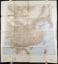
1945206545Calcutta: Compiled and drawn by the Survey of India. Second Edition. 1945. Large folding colour map 77.5 x 80cm; 95.5 x 86.2cm sheet including legend and small inset showing adjoining maps light toning and wear to upper margins and at corners and folds; but in very good condition. Very large clear map of China printed in 1945. The projection is noted as the "Lambert Conical Orthomorphic" a polyconic projection employed by the exhaustive Survey of India and the map includes surrounding countries: Taiwan Korea French Indo-China with a small inset key to Korean place-name abbreviations. As is typical of maps of this period Arunachal Pradesh is shown as Tibetan territory.The legend lists borders and provinces railways roads and canals with topography indicated with colouration. . Compiled and drawn by the Survey of India. unknown
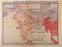
1944214362Los Angeles.: Los Angeles Examiner. April 31944. Colour pictorial map on a single newspaper leaf 37 x 50 cms; 41.5 x 54.6 cms sheet unrelated text on the verso although with an interesting account from a soldier's letter about an air raid in China toning more marked at the central fold two small splits no loss to the map edge wear with several small marginal edge tears neatly repaired on the verso with archival washi map unaffected in good condition. A dynamic map prepared and illustrated by the Examiner's art critic and editor Howard Burke covering the area surrounding India and Central Asia showing Japanese conquered territory in Malaya Thailand Indo-China and Burma; and in India British-controlled states and native feudal and protected states. <br> <br>Text boxes and pictographs give an overview of the geopolitical situation from the Allied perspective. One box notes "Chanda Bose has many adherents and fanatical followers in Bengal. They may prove to be a powerful fifth column in India". Text at lower edge opines "The situation in India is critical and has grown more so as the all-out offensive against Japan has been delayed. If the Allies do not act at once and with great force all our gains may be wiped out and the war in the Pacific prolonged indefinitely." <br> <br>The decisive and devastating bombings that were to signal such an end were four months away. <br> <br>Rare on the market. . Los Angeles Examiner. unknown
194651162BB2 Bände. Buenos Aires, Editorial Losada, 1946. 8°. 265 S., 216 S. Originalbroschur mit Schutzumschlägen.
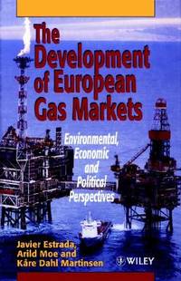
1996__0471960128John Wiley & Sons Inc 1996. Hardcover. New. 1st edition. 375 pages. 9.50x6.25x1.00 inches. John Wiley & Sons Inc hardcover
1986x-9061935431Dr W Junk Pub Co 1986. Hardcover. New. 406 pages. 11.34x8.58x1.10 inches. Dr W Junk Pub Co hardcover
1996DADAX0471960128Wiley 1996-04-19. 1. hardcover. New. 6.26x1.13x9.09. Buy with confidence. Excellent Customer Service & Return policy. Wiley hardcover
1981mon0000977443Ross Erikson 1981T. paperback. Very Good. 0.7008 in x 8.9016 in x 5.7008 in. Rubbing on front cover. Water marks on spine and small part of back cover. Ross Erikson paperback
19992080302106809654Toei Kawagoe Road Residential Ruins Survey 1999. Soft Cover. Fine. Number of books: 6 Toei Kawagoe Road Residential Ruins Survey paperback
1924015720Paris Au Sans Pareil 1924 In-12 Broché, couverture illustrée Edition originale
19702091202133106272Ministry of Construction Road Bureau Kinki Regional Construction Bureau 1970. Soft Cover. Fine. Number of books: 2 Ministry of Construction Road Bureau Kinki Regional Construction Bureau paperback
195676405San Jose: H.M. Gousha Co. on or before 1956. First edition of this gathering. Folio 13 1/4 x 18 inches. 62 unused road maps in color and with inserts each neatly divided by side tabs. All maps bound on stubs. Original red cloth portfolio with flap and snap fasteners the Shell logo stamped on front cover some soiling or darkening to extremities. The portfolio has some expected wear but the maps are fresh and clean. Shell maps of this era are notable for their high-quality cartography colorful graphics and often included travel tips local advertisements and information about Shell services. None located by OCLC. Harry Mathias Gousha a former Rand McNally went independent in 1926 and relocated to California in 1947. It was a propitious time as the 50s in most respects witnessed the onset of the great American phenomenon of the Road Trip. With the improvement in cars longer and longer trips became feasible. None of the great Interstates as we know them today were in existence at that time so road maps were essential for any successful road trip. The H.M. Gousha Company was one of the "Big Three" major producers of road maps and atlases in the United States during the 25 years following World War II General Drafting and Rand McNally were the other two. Shell maps of this era although free are notable for their high-quality cartography colorful graphics and often included travel tips local advertisements and information about Shell services. The H. M. Gousha Company produced millions of oil company road maps used as marketing tools distributed at no charge at gas stations by customers that included Gulf Oil Conoco Shell Standard Oil and dozens of others. Though most Gousha maps were produced for oil companies many others were issued for customers not related to the petroleum industry including automobile clubs state governments banks and realtors. Ironically the company was purchased by Rand McNally in 1996. H.M. Gousha Co. hardcover
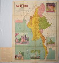
1951214601Delhi.: S.B. Makhija & Brothers. circa1951. Printed colour map 98.6 x 69 cms folding into pictorial wrappers 25.3 x 19.5 cms five pictorial colour inserts of pagodas and the Shwethalyaung reclining Buddha wrappers a little chipped marginal wear and three small fold splits in the map but overall in very good condition. Attractive large map of Burma with the provinces coloured steamship routes shown in red and printed in the booklet a range of information printed based on the 1951 census including climate agriculture and form of government "Burma became an independent nation completely outside the British Empire on January 4 1948 and is now a sovereign independent republic known as the Union of Burma". . S.B. Makhija & Brothers. unknown
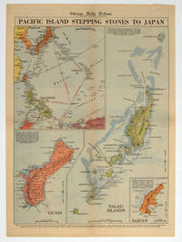
1944208880Chicago.: Chicago Daily Tribune. 28 September1944. Colour pictorial map on a single newspaper leaf archivally laid down on linen 50 x 39.2 cms; 59.3 x 43.3 cms sheet including captions faint toning to fold lines very good condition. Vivid colour maps of the Palau Islands Guam and Saipan in the Marianas and an inset location map published in the "Chicago Daily Tribune" in September 1944 months after the landing of US and Allied Forces in the offensive against the Japanese during the Pacific War. . Chicago Daily Tribune. unknown
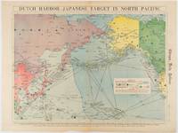
1942180751Chicago.: Chicago Daily Tribune. Friday June 51942. Printed colour map on a single newspaper leaf 37.5 x 53.2 cm; 44.7 x 59.8 cm sheet inset legend marginal browning and at the folds some undulation of paper and tide mark along lower section but in remarkably bright very good condition. Strategic map published in the Chicago Daily Tribune "The World's Greatest Newspaper" on June 5th 1942 two days after the Japanese attack on Dutch Harbor the site of the US army and navy bases in the Aleutians and as it transpired at the outset of the Battle of MIdway. The owner and proprietor of the Tribune Robert McCormick was staunchly against the United States entering the war and had firm views once it had occurred that American resources should not be used defending the British Empire. Famously the Tribune published the "Victory Program" Roosevelt’s military plan to prepare the United States for possible entry into World War II and was subject to prosecution for an alleged violation of the Espionage Act relating to the newspaper’s front-page account of the Battle of Midway 4-7 June 1942. It became an important test case for the limits of free speech and censorship during war-time. <br> <br>The Legend shows territorial Control of Ocean Areas marking Japanese Naval and Air bases as of 1941 and "according to latest reports" those established in the first six months of 1942. Also shown are pre-war sovereignties as at the bombing of Pearl Harbour on December 7th 1941. The Anson Archipelago is shown but a question mark "indicates islands etc. whose existence or give position is doubtful…". . Chicago Daily Tribune. unknown
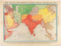
1942180782Chicago.: Chicago Daily Tribune. April 211942. Printed colour map on a single newspaper leaf 37.5 x 53.2 cm; 60 x 45 x 59.6 cm sheet marginal browning and at the folds but remarkably bright in very good condition. World War II map of Asia save for Japan showing British allies colonies and lines of supply and marking Japanese territorial occupation published in the Chicago Daily Tribune "The World's Greatest Newspaper" in April 1942. <br>"The Indian Ocean and the Bay of Bengal are the strategic waters in this campaign in which the occupied parts of Burma and the Andaman Islands serve as bases" caption <br>". the historic Chicago Tribune was an innovator in color inks and printing but also a pioneer in bringing colorful art in the form of illustrations photographs cartoons and advertisements to the average person in an everyday medium." see The Janet A. Ginsburg Chicago Tribune Collection Michigan State University Libraries. . Chicago Daily Tribune. unknown
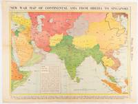
1942180760Chicago.: Chicago Daily Tribune. January 91942. Printed colour map on a single newspaper leaf 37.2 x 53.4 cm; 45 x 59.9 cm sheet inset legend marginal browning and at the folds lower margin with small edges tears not affecting the caption but remarkably bright in very good condition. Rare map of Asia "Between Suez on the west and Shanghai on the east" showing territorial interests and theatres of war published in the Chicago Daily Tribune in January 1942 barely two months after the Uniited States had joined the war effort after the bombing of Pearl Harbour. Thailand and Vietnam "French Indo-China" are marked "Occupied by the Japanese" and north-eastern China similarly marked Iran "Anglo-Russian Occupation" and the Gulf states "British Ally". The caption notes that "The map inludes waters thru which runs the British life line from the Suez canal to remote Australia and New Zealand. Nearly half the people in the world live in the lands shown on this map--more than 450 million for example in China and more than 375 million in India". <br> <br>". the historic Chicago Tribune was an innovator in color inks and printing but also a pioneer in bringing colorful art in the form of illustrations photographs cartoons and advertisements to the average person in an everyday medium." see The Janet A. Ginsburg Chicago Tribune Collection Michigan State University Libraries. . Chicago Daily Tribune. unknown
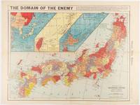
1941180789Chicago.: Chicago Daily Tribune. December 121941. Printed colour map on a single newspaper leaf 41.5 x 53 cm; 45.1 x 59.9 cm sheet three inset maps of the Japanese Empire; Taiwan and Ryukyu Islands; and Hokkaido and Chisima marginal browning and at the central fold but remarkably bright in very good condition. Map of the Japanese Empire ominously titled published in the Chicago Daily Tribune one week after the bombing of Pearl Harbour. Prefectures are attractively coloured. <br> <br>Based on a Rand McNally map the Tribune briskly got to work issuing maps for readers showing the beginnings of the war with Japan. Later maps were also published for sale separately but remarkably few have survived. <br>". the historic Chicago Tribune was an innovator in color inks and printing but also a pioneer in bringing colorful art in the form of illustrations photographs cartoons and advertisements to the average person in an everyday medium." see The Janet A. Ginsburg Chicago Tribune Collection Michigan State University Libraries. . Chicago Daily Tribune. unknown
1981ABE-1695424354339Ross-Erikson Inc. 1981 Cloth 8vo. 1st edition. 239 pp. Red boards with gilt at spine. Illustrated DJ. Translated by Henry Munn. Scarce hardcover edition. 1st Edition. Hardcover. Near Fine/Near Fine. Ross-Erikson Inc. hardcover