[LINEN BACKED MAP OF CHINA]Biblio.com
4 344 résultats
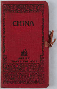
1920161936no date. circa1920. Linen backed colour folding map of China insets of Peking and Environs and Hongkong and Canton in lower left corner. 54 x 63.8cm. Table of place names at upper left gives the cities that "By a recent ordinance of the Republic all 'Fu' 'Chow'' and 'Ting' cities have been nominally reduced to the rank of 'Hsien'. The following parallel list gives the 'Fu' cities the names of which have been officially changed together with the new form adapted." Map folds into a red cloth covered case with ribbon ties 19 x 10.3cm. Title and decoration printed in black on upper cover. Trifle foxed on linen backing a little insect damage case in a few small places otherwise a very good clean map. . hardcover
179621090Brest 1796 1 feuillet avec en-tête préimprimé en noir : Liberté Egalité Fraternité et orné d'une vignette en noir (avec symboles révolutionnaires : faisceaux d'Armes et bonnet Phrygien et marianne avec imprimé en bas "république Française"), manuscrit à l'encre brune sur papier vergé ligné filigrané, format 22,6 centimètres de large par 33,8 centimètres de haut, Lettre écrite à LORIENT, le 1er Messidor, An 4 (1796), de la République Française, une et indivisible, signature manuscrite de l'Adjudant Général MOLINI et de Mr BIVAUX secrétaire du Bureau de l'Etat Major Général de la Marine de Lorient,
179621091Lorient 1796 1 feuillet avec en-tête préimprimé en noir : Liberté Egalité Fraternité et orné d'une vignette en noir (avec symboles révolutionnaires : faisceaux d'Armes et bonnet Phrygien et marianne avec imprimé en bas "république Française", manuscrit à l'encre brune sur papier vergé ligné filigrané, format 21,5 centimètres de large par 33,5 centimètres de haut, Lettre écrite à LORIENT, le 20 floreal, An 4 (1796), de la République Française, signature manuscrite de PHILIPPE-ALEXIS-LAURENT HENRY, Chef de Division, Commandant des Armes au port de LORIENT et de Mr BIVAUX secrétaire du Bureau de l'Etat Major Général de la Marine de Lorient,
179521640Lorient 1795 1 feuillet avec en-tête préimprimé en noir : Liberté Egalité Fraternité et orné d'une vignette en noir (avec symboles révolutionnaires : faisceaux d'Armes et bonnet Phrygien et marianne avec imprimé en bas "république Française"), manuscrit à l'encre brune sur papier vergé bleuté ligné filigrané, format 20 centimètres de large par 31 centimètres de haut, Lettre écrite à LORIENT, le 27 Messidor An 3 (15 juillet 1795) de la République Française, signature manuscrite de PHILIPPE-ALEXIS-LAURENT HENRY, Chef de Division, Commandant des Armes au port de LORIENT et de Mr BIVAUX secrétaire du Bureau de l'Etat Major Général de la Marine de Lorient
179521641Lorient 1795 1 feuillet avec en-tête préimprimé en noir : Liberté Egalité Fraternité et orné d'une vignette en noir (avec symboles révolutionnaires : faisceaux d'Armes et bonnet Phrygien ), manuscrit à l'encre brune sur papier vergé bleuté ligné filigrané, format 17,7 centimètres de large par 23,5 centimètres de haut, Lettre écrite à LORIENT, le 15 Messidor An 3 (3 juillet 1795) de la République Française, signature manuscrite de DAVID, Chef des Bureaux civils de la Marine, chargé des Armemens et des Classes, au port de LORIENT,
179521642Lorient 1795 1 feuillet avec en-tête préimprimé en noir : Liberté Egalité Fraternité et orné en tête d'une grande vignette en noir (avec symboles révolutionnaires : l'Oeil, la balance, les lauriers, les cornes d'abondances et le bonnet Phrygien avec imprimé en haut "département du Morbihan"), manuscrit à l'encre brune sur papier vergé bleuté ligné filigrané, format 20 centimètres de large par 31,5 centimètres de haut, Lettre écrite à LORIENT, e 17 nivose An 3 (6 janvier 1795) de la République Française, une et indivisible, signature manuscrite de PHILIPPE-ALEXIS-LAURENT HENRY, Chef de Division, Commandant des Armes au port de LORIENT,
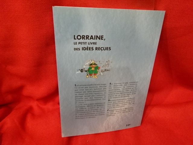
2010_202101046Heillecourt / Épinal, L'Est Républicain / Vosges Matin, 2010 ; in-8 (161 x 219 mm), 160 pp., couverture à rabats illustrée et feuilles collées. Quelques illustrations en couleur (dessins de Philippe Delestre).
2016_202404568Strasbourg, Les Éditions du Quotidien, 2016 ; in-8 (161 x 240 mm), 320 + 456 pp., broché, couverture illustrée. Les 2 volumes. Quelques illustrations en noir et blanc.
1959370788n.p.: n.p. 1959. 16 pp. 8vo. Illustrated wrappers staple bound sepia-toned photographs and line drawings throughout. 16 pp. 8vo. A small booklet celebrating the 125th anniversary of the Long Island Rail Road. <br/><br/> n.p. unknown
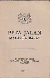
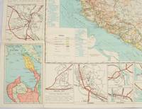
1970223469Kuala Lumpur.: Pengarah Pemetaan Negara. 1970. Large colour folding map in original paper wrappers. Text in Malay and English. 83.5 x 53.5cm folded 21 x 15cm. Closed tear along spine of trifle soiled upper wrapper otherwise a very good copy. . Pengarah Pemetaan Negara. unknown
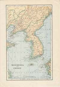
1900174813London. Circa1900. Map printed in colour showing submarine and overland telegraphs Manchuria Chosen Liao-Ting Kirin and Chili 21.5 x 13.3 cm 25.7 x 17.1 cm sheet size margins a little scuffed in very good condition. . unknown
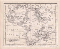
1830176607London.: Robert Jennings. 1830. Engraved map 11.5 x 14.3 cm showing route of European explorers faint added outline colour in an early hand and manuscript note to the verso in the same ink edges age-toned but in very good condition. Detailed pre-colonial map of Africa "Regions Unexplored" marked and "no fresh water to be found" on the west coast. An early manuscript inscription on the verso refers to Lander's ."wanderings of Clapperton" the Scottish naval officer and explorer. Richard Lander had returned with Hugh Clapperton's journal following his death and the account was published in the same year as Fenner's "Pocket Atlas of Modern & Ancient Geography" for which this map was prepared. . (Robert Jennings) unknown
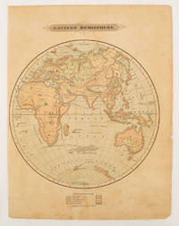
1875175128Harper & Brothers. 1875. Spherical map printed in colour 21.3 x 21.2 cm with shaded key to elevation and ocean currents unrelated text on the verso paper toned and margins soiled bottom edge ragged small sealed to to the inner margin but in sound condition. Map showing the five continents of Asia Africa Antarctica Europe and Australia. Published by Harper & Brothers for inclusion in their "School Geography". Plateau of Tibet very prominently marked. Gobi Desert and Plateau of Mongolia also marked India described as Hindostan Indo-China includes Thailand. . Harper & Brothers. unknown
1962174808Kuala Lumpur.: Survey Department Federation of Malaya. 1962. Very attractive large coloured folding map 108 x 83cm showing all the major hotels and rest houses throughout the country. Coloured references show rubber rice coconut and oil palm areas pineapple and miscellaneous cultivation areas mining land jungle built-up areas and shopping centres along with major features such as rivers principal roads minor roads and cart tracks railways lighthouses district state and international boundaries and triganometrical stations with heights. Scale 18 miles to an inch mile. Two inset maps of Northern Malaya and South Western Malaya are 9 miles to an inch. There are smaller inset maps of Ipoh; Malacca Singapore & Johor Bahru Penang Sungei Patani Kuala Lipis Kuantan Alor Star Kota Bharu Petaling Jaya Seremban Klang Batu Pahat Muar Segamat Johore Bahru and a small inset map of Malaya and adjacent territories. There is a large black & white table of approximate mileages. When folded the map is encased in the original printed manila covers measuring 21 x 14cm with a printed price of $2.50. A crisp bright map in very good condition. Survey Department Federation of Malaya No. 23. . Survey Department Federation of Malaya. unknown
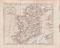
1796176602circa1796. Engraved map 18.3 x 22 cm 21.7 x 27 cm sheet original folds age toning and some offsetting inner edge darkened and discoloured but the map in good condition. Finely engraved map showing Ireland divided into counties lower coast of Scotland and Wales and the Isles of Man and Anglesea; also noting Nymph Bank 'discovered in 1735 by Capt. Doyle.' . unknown
petit in-16° carré, broche, couverture illustree. Très bel exemplaire. [FL-3]
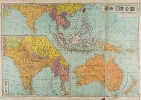
1572159290東京.Tokyo.: 金鈴社. Kinrei-sha. 昭和十八 October 101943. Two maps printed in colour on a single side of a folded sheet. The map titled "Complete Map of India and Australia" shows the region covering Australia southern India western mainland south-east Asia Indonesia the Philippines and New Guinea. The other map titled "India and Burma" shows the region covering India Afghanistan the western section of China Burma and Thailand on the lower left side. New Zealand is in an inset map in the lower right corner. As the note on the cover says "Including the detailed descriptions of the Solomons New Guinea and southern islands" this map shows the theatres of the Pacific War and the surrounding areas. The map indicates agricultural and mineral resources as well as cities roads railways sea routes national borders etc. Cover and publication details printed on two panels on the reverse. Some marking and browning. . 金鈴社. [Kinrei-sha]. unknown
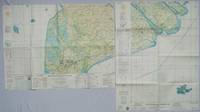
1967203840Washington D.C.: Army Map Service. 1967. Two printed colour adjoining maps 73 x 55.6 cms and 55.6 x 73 cms original folds inked operational annotations to the Quan Long sheet multiple marginal legends noting aerodromes and radio facilities roads railroads and boundaries glossary of terms much of the text is in both English and Vietnamese in very good condition. Detailed U. S. Army maps of the Mekong Delta and Southern Vietnam extending from Rach Gia in the north to the area just south of Quan Long Ca Mau in the south and east including BacLieu and CanTho. The island of Con son is at lower right of the Khanh Hu'ng sheet. Operational notes are inked around Quan Long are marked and the U Minh Forest the impenetrable "forest of darkness" is noted in ink. <br> <br>. . Army Map Service. unknown
1893174920New York.: Hunt & Eaton. Circa1893. Printed map in colour elevation shown with hachures 29 x 23.5 cm text on the verso relating to entries for Afghanistan Beluchistan and Turkey prepared for Hunt & Eaton's "New York Recorder's Atlas" small tears to the top edge but in very good condition. . Hunt & Eaton. unknown
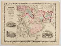
1860177019New York.: Johnson & Browning. circa1860. Engraved map 30.2 x 40.5 cm 34.5 x 45.5 cm sheet original hand-colour elaborate strapwork border three fine vignettes of Muscat Trebisond small marginal edge tears top corner chipped the map in very good condition. Most attractive decorative map of Arabia the Ottoman Empire Persia Afghanistan Beloochistan and surrounds by one of the most popular and successful 19th Century American atlas publishers. . Johnson & Browning. unknown
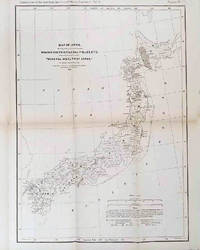
1878210211Philadelphia.: American Institute of Mining Engineers. Sherman & Co. printers. 1878. Large folding map of Japan showing "some of the more important Mining Districts Coal Fields etc." small fold split without loss tables 67pp. Covers a little scuffed and discoloured overall in very good condition. Scarce offprint separately paginated of a paper included in Volume V of the Transactions of the American Institute of Mining Engineers. The author Henry S. Munroe had been retained by the Japanese Government as Assistant Geologist and Mining Engineer with the Geological Survey of Yesso for the Hokkaidō Colonization Agency. His work laid the foundations for the future coal mining industry in Hokkaido. The report contains two lengthy tables relating to coal production and quality. . American Institute of Mining Engineers. Sherman & Co., printers. unknown
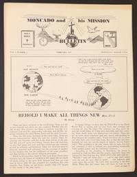
1957339444Honolulu: Supreme Council of EFB Students 1957. 4p. 8.5x11 inch newsletter very good. Hilario Camino Moncado established the Filipino Federation of America in 1925 in Los Angeles California. It was also known at various times as the Filipino World Federation and the Filipino Crusaders World Army. As one of the fraternal organizations appealing to the small but growing Filipino immigrant community the FFA distinguished itself from competitors by accentuating "clean living" and rules of moral conduct. Moncado earned a law degree and sought to portray the immigrant community as responsible and healthy in contrast to the then-prevalent depictions of uneducated gamblers. Much less publicly the FFA developed a set of religious teachings that held Moncado to be the reincarnation of Jesus Christ by way of José Rizal the Filipino patriot executed in the waning days of Spanish rule. Moncado's birthday was changed to make him appear to have been born after Rizal's death so that his identity as Rizal's reincarnation would be more plausible. After the achievement of Philippine independence and limitations on immigration the FFA turned almost entirely to spiritual rather than political objectives and even sent missionaries back to the Philippines where there is still an active sect venerating Moncado as a religious figure. This newsletter was issued after his death summarizing the tenets of his faith. in his later days Moncado emphasized golf as an ideal sport and there are small photos of him "Fighting Communism through Golfing. Supreme Council of EFB Students unknown
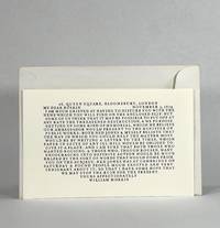
19889934Los Angeles: Scenic Road Press 1988. Unbound. Near Fine binding. Oblong bifolium 6-1/8" x 9-3/4." Limited edition one of 150 copies. Printed in black on the front cover the imprint occupies the verso of the read leaf; interior blank. A nearly fine copy in unused envelope. <br /> <br /> An anxious letter from Morris about taking measure to stop what he and others feel would be a ruinous renovation of the Venetian icon. The original is in the Sanford and Helen Berger Collection. Scenic Road Press unknown
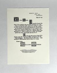
19869935Los Angeles: Scenic Road Press 1986. Broadside. Near Fine binding. Broadside 12-3/4" x 9-1/2." Limited edition one of 200 copies. The letter is set in Morris's Troy type on the recto complete with woodcut initials. Imprint at the bottom. A nearly fine copy in unused envelope. <br /> <br /> Correspondence relating to a plan of window that is being designed with reference to Edward Burne-Jones. The original is in the Sanford and Helen Berger Collection. Scenic Road Press unknown
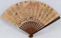
1718220781Japan.: 大海扇子商會. Taikai Sensu Shōkai. Meiji 17 1884. Black and white printed map with handcoloured pink highlights 23.5 x 39cm date stamped on reverse. A little minor wear at folds but overall very good. This fascinating fan was produced as a commemorative item marking a climb to the summit of Mount Fuji. A stamp on the reverse is dated 27 July Year 17 and appears to have been applied at the summit. This date likely refers to Meiji 17 or 1884. Commemorative fans of this type were popular at the time and the paper printing and general style appear consistent with that period. The red printed patterns and characters on the reverse also back up our belief that the fan was obtained at the summit. The pictorial map of the mountain shows four different routes to the summit marked in red with distance charts printed above. <br> <br>Mount Fuji is Japan’s highest peak. Long perceived as a sacred mountain it has a Shinto shrine at the summit and the climb has traditionally been regarded as a form of pilgrimage. . 大海扇子商會. [Taikai Sensu Shōkai]. unknown